7 Amazing Hikes Near Mount Baker, Washington
Are you looking for the best hikes near Mount Baker in Washington? In this guide, we share our favorite Mount Baker hikes, including all our tips for hiking near Mount Baker, including when to go, what to pack, where to stay near the trails, and more!

Located just shy of the Canadian border in northern Washington, Mount Baker stands 10,781 feet tall, making it the third largest peak in the state. This active volcano is actually one of the snowiest places on Earth, giving Mount Baker a picturesque, glaciated look year-round and making it an absolutely picture-perfect backdrop for a hike.
Luckily, the Mount Baker Wilderness which surrounds the mountain holds a collection of epic hiking trails and scenic vistas of Mount Baker itself, the Cascades, beautiful subalpine lakes, and wildflower-filled alpine meadows. In fact, the hiking trails in Mount Baker rival those of the nearby National Parks, like Mount Rainier and North Cascades National Park, but are often overlooked on a Washington road trip.
But we’re here to tell you that the hikes in Mount Baker should not be missed! Though it may be a bit out of the way from other places in Washington, this works to your advantage as the Mount Baker hiking trails are blissfully uncrowded compared to nearby parks, but with the same, if not better, epic mountain views.
In this guide, we share our favorite Mount Baker hikes, plus all our tips to make your time out on the Mount Baker trails smooth, including the best time to hike, what to bring, where to stay, and more. So, let’s get to it!
In this Mount Baker hiking guide:
Where Is Mount Baker?
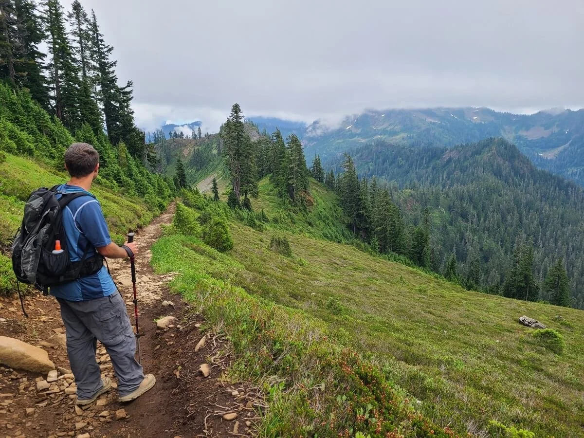
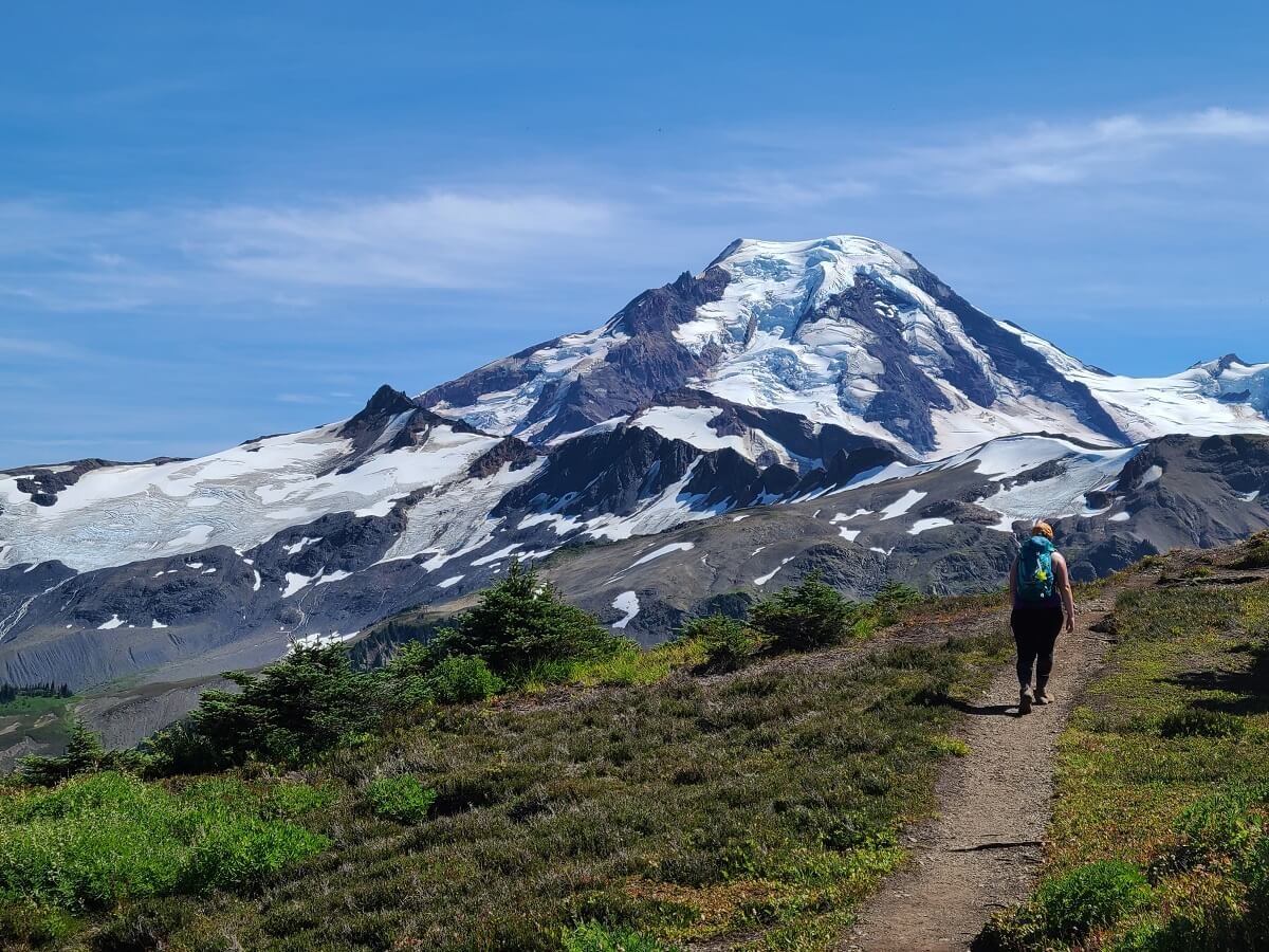
Walking along the Skyline Divide Trail- one of our favorite hikes in Mount Baker
Mount Baker is located in northern Washington state, just shy of the Canadian border. There are lots of park boundaries and divisions in this area, so it can get a bit confusing. But, here are the important ones you should know when planning to hike near Mount Baker:
The Mount Baker-Snoqualmie National Forest is a huge area that encompasses Mount Baker, but also much of the western Cascades between the Canadian Border all the way down to Mount Rainier.
Within the Mount Baker-Snoqualmie National Forest is the Mount Baker Wilderness, a small subdivision found at the northern end of the National Forest that encompasses Mount Baker and most of the wilderness around it. All but one of the Mount Baker hikes we mention in this guide lie in the Mount Baker Wilderness.
For these Mount Baker hikes, the main access road into the Mount Baker Wilderness is the Mount Baker Highway, which runs along the North Fork of the Noosack River on the north side of the mountain. It starts in Deming, and travels over 40 miles, ending at Artist Point. Along the way, you’ll find access to all of the Mount Baker hikes on this list that are in the Mount Baker Wilderness.

The Mount Baker Highway as it heads to Artist Point
The only Mount Baker trail on this list that’s not in the Mount Baker Wilderness is the Park Butte Lookout hike. This hike is instead found in the Mount Baker National Recreation Area which is found on the south side of Mount Baker and lies just adjacent to the Mount Baker Wilderness. Access to this hike is off of Highway 20 (the North Cascades Highway).
Each of these forests and recreation areas may have slightly different rules and regulations when it comes to camping or other activities, so we suggest you use the links above to learn more about them if you plan on doing other things besides hiking.
But it is important to note here that for all of the Mount Baker hikes listed in this guide, you will need a National Forest pass to park at each of the trailheads, since they all lie within the Mount Baker National Forest.
Here are your options for the hikes near Mount Baker:
One day National Forest Pass- allows you to park at any of the trailheads in the National Forest for one day. Cost: $5.
Annual National Forest Pass- allows you to park at any National Forest location for an entire year. Cost: $30. This can quickly become worth it if you’re in the area for a while!
The National Park’s America the Beautiful Pass- This is the annual park pass for the National Parks, but also works on National Forest land as well! This is what we used to park at the trailheads for all these Mount Baker hikes, and is totally worth it if you plan on visiting Washington’s three National Parks while you’re there, too! Cost: $80
Each of these passes can be bought online at the links above (or in person at one of the National Forest stations in the area).
Best Hikes Near Mount Baker
Without further ado, here are our favorite hikes near Mount Baker!
These Mount Baker hikes are listed in order of difficulty. So, if you’re looking for an easy hike in Mount Baker, then the first three on this list are good ones to check out. As the list progresses, each hike is a little more difficult than the last, though we wouldn’t say any of these Mount Baker hikes are super challenging!
Map of Mount Baker hikes

This map of Mount Baker hiking trails shows the Mount Baker Highway in red. We’ve highlighted all the hikes near Mount Baker that we mention in this guide in purple.
This map of Mount Baker trails is taken from one of the signs found along the Mount Baker Highway and indicates all the hikes on this list with the exception of the Park Butte Trail, which is found on the southern side of Mount Baker.
Picture Lake

A picture-perfect view of Picture Lake- a nice short hike in Mount Baker
Length: Up to a 0.4 mile loop if you decide to walk around the lake, but it’s just a short walk from the parking area to the famous viewpoint out to Mount Shuksan
Elevation gain: Negligible
Trailhead location: Mount Baker Highway (21 miles past the town of Glacier). There’s a small area of roadside parking along the left side of the road (this part of the Mount Baker Highway is a one-way portion of road). Look for the small footpath that leads to the lake.
Trail description: AllTrails Picture Lake information
This easy Mount Baker hike is more like a quick stroll than a hike, but for those looking for a good way to stretch your legs while taking in amazing views with little to no effort, then Picture Lake is a great place to do this.
Found along the Mount Baker Highway just a few miles before it ends at Artist Point, this small lake has an easy paved walking path around it, with plenty of picture-perfect viewpoints over the lake and out to Mount Shuksan. You can walk the whole loop around the lake, or you can simply walk to the best and most famous viewpoint of Mount Shuksan over Picture Lake…this is just a short walk from the parking area and is labelled as “Picture Lake Viewpoint” on Google Maps. On a windless day (typically in the mornings and evenings), the still water provides a perfect reflection of the mountain. While there are no views of Mount Baker from here, it’s a quick and easy stop on the way up to Artist Point.
Artist Ridge to Huntoon Point

One of the tarns near Huntoon Point- one of the more popular and easy hikes in Mount Baker
Length: 1.2 miles out and back
Elevation gain: About 200 feet
Trailhead location: At the Artist Point parking lot, located at the end of the Mount Baker Highway
Trail description: WTA trail description
The Artist Ridge trail is definitely the most popular Mount Baker hike. It’s short, easy, and leads to incredible views of both Mount Baker and Mount Shuksan. Even in winter, it’s a popular place for snowshoeing.
The Artist Ridge trail is a well- maintained gravel path that makes minor ups and downs on its way to Huntoon Point. Along the way, Mount Baker dominates the view in the distance along the right side of the trail, with Mount Shuksan ahead. At the end of this trail are several picturesque tarns which often nicely reflect Mount Shuksan and give beautiful perspective of the distant mountains.

Hiking the easy trail to Huntoon Point near Mount Baker
Mount Baker seen from the Artist Ridge trail
This is a great Mount Baker hike to do if you’re looking for something quick and easy, or even to do before or after one of the next several hikes on this list that start from the Artist Point trailhead.
Bagley Lakes Loop

Looking down at some of the Bagley Lakes and nearby trails in Mount Baker
Length: About 1.5-1.9 miles depending on the trailhead, with the option to add on more
Elevation gain: About 150-200 feet
Trailhead location: There are two possible trailheads along the Mount Baker Highway- The Bagley Lakes Trailhead or the parking lot for the Heather Meadows Visitor Center/Austin Pass Picnic Area. These two trailheads start at opposite ends of the Bagley Lakes Loop trail.
Trail description: This AllTrails description has a starting trailhead at the Heather Meadows lot and has a bit of a detour off the loop.
The Bagley Lakes Loop trail is another easy Mount Baker hike that wraps around several lakes at the base of Mount Herman. There are no views of Mount Baker from here, but the trail is still scenic none-the-less.
There are two possible starting points for the Bagley Lakes Loop trail that begin at opposite ends of the loop- from the Bagley Lakes trailhead, or from the Heather Meadows Visitor Center just a bit further up the Mount Baker Highway. Starting at the lot for the Heather Meadows Visitor Center adds just a tiny bit to your hike, as it sits a bit further back from the loop trail itself.
If you want to add a little bit more to this Mount Baker hike, you can wander off the loop a bit on a trail by the bridge on the south end of the loop (just under the Heather Meadows Visitor Center parking lot) and hike towards Herman Saddle. This trail will take you along the side of another one of the Bagley Lakes.

Views from the Bagley Lakes trail in Mount Baker
If you are really up for a challenge, you can continue on this trail up to Herman Saddle which lies ahead. This is quite a climb, however (about 1,200 feet of elevation gain and an extra 1.7 miles one-way). But from Herman’s Saddle, you’ll get amazing views of Mount Shuksan and the Bagley Lakes on one side, and Mount Baker and Iceberg Lake on the other.

The view from Herman Saddle over Mount Shuksan and one of the Bagley Lakes
It’s certainly worth the effort, but…
If you want to get this view off of Herman Saddle, it would be best to do the next hike on our Mount Baker hiking list…the Chain Lakes Loop. So let’s get to that hike now…
Chain Lakes Loop
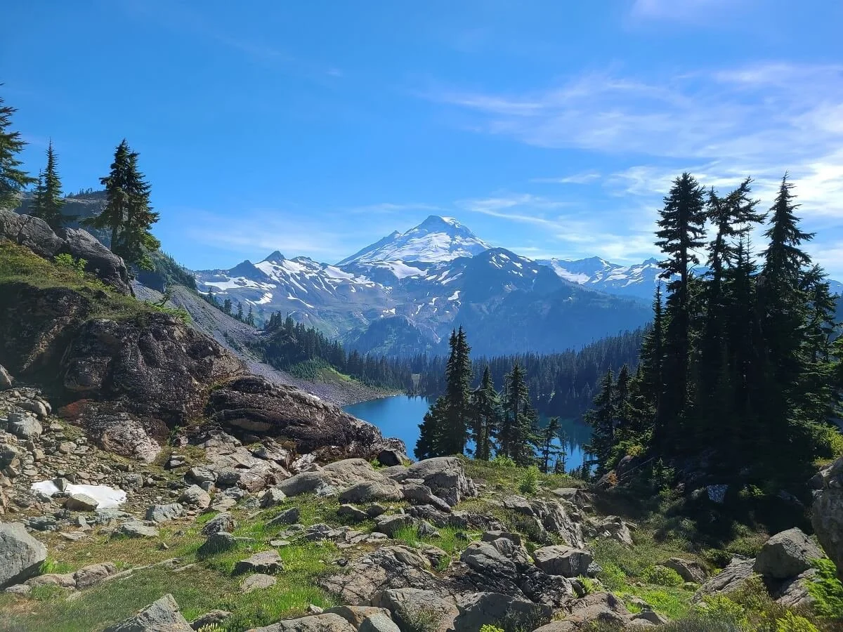
One of our favorite views from the Chain Lakes Loop trail in Mount Baker
Length: 6.5 miles
Elevation gain: 1,800 feet
Trailhead location: This Mount Baker hike can start at one of three trailheads along the loop trail, each found along the Mount Baker Highway: The Bagley Lakes trailhead, the Heather Meadows Visitor Center parking lot, or at Artist Point
Trail description: Check out our Chain Lakes Loop hiking guide
The Chain Lakes Loop is one of the most popular hikes in Mount Baker…and for good reason. It’s a moderate half day hike that leads to great views of Mount Baker and Mount Shuksan, and takes you by several scenic lakes where you can hang out and enjoy the views, take a dip (if you can handle the freezing cold water!), or even backcountry camp.
To us, the best part of this Mount Baker hike was reaching the high point at Herman Saddle, where you get awesome views on either side over to Mount Baker and Mount Shuksan. While getting to the saddle is a bit of a climb, the rest of the trail is pretty easy-going, so it has a good reward-to-effort ratio!

The view of Mount Baker near Herman Saddle on the Chain Lakes Loop
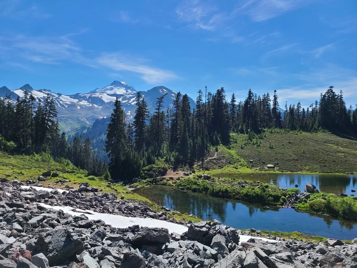
Mazama Lakes along the Chain Lakes Loop trail near Mount Baker
This Mount Baker hike can be started at one of three trailheads along the Mount Baker Highway, and the one you pick and the direction you hike the loop will depend on which point in the hike you want to get the major climbing done with (at the beginning or end). Be sure to check out our Chain Lakes Loop hiking guide to learn more about what to expect on the trail, how to pick a trailhead, and how to camp at the Chain Lakes!
Park Butte Lookout
Hiking the Park Butte Lookout trail near Mount Baker on a cloudy day
Length: 8 miles
Elevation gain: 2,200 feet
Trailhead location: At the Park Butte Trailhead lot on Forest Service road NF-13 (near Baker Lake Road). This is on the south side of Mount Baker in the Mount Baker Recreation Area.
Trail description: Check out our in-depth Park Butte Lookout trail guide
The Park Butte Lookout trail is known for its easily accessible historic fire lookout with incredible in-your-face views of the south side of Mount Baker. On the way, you’ll pass through wildflower-strewn meadows, and picturesque tarns that perfectly capture the reflection of Mount Baker on a clear calm day.
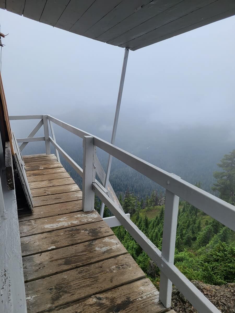
We didn’t get much of a view from the Park Butte Lookout on a cloudy day
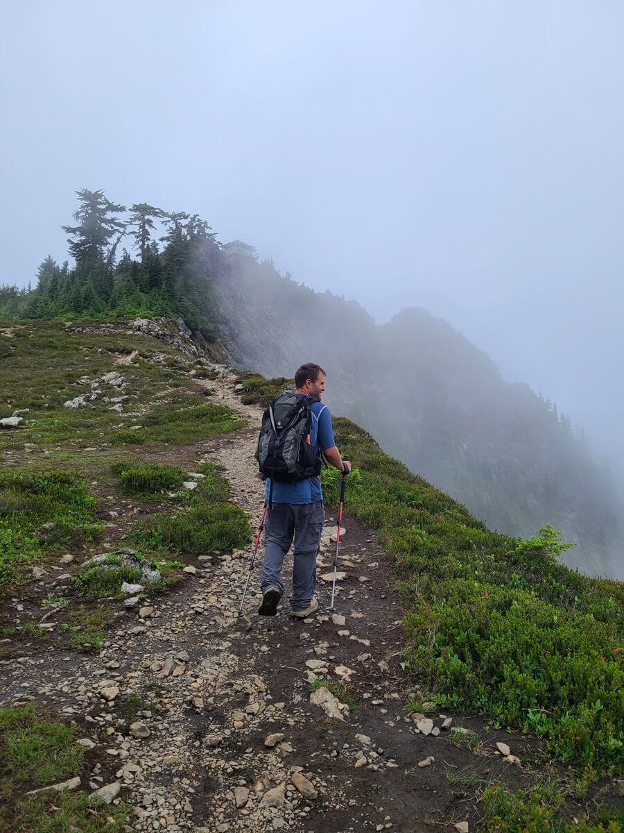
Can you see Park Butte Lookout in the fog ahead?
You can also spend the night in the Park Butte Lookout, or camp nearby, for amazing sunrise and sunset views from the trail.
This Mount Baker hike definitely has a high reward to effort ratio, as the hike is on the easier side but gives stunning views of the mountain, so it is pretty popular.
This is the only Mount Baker hike on this list that is not off the Mount Baker Highway, and is instead in the Mount Baker Recreation Area on the southern side of Mount Baker. For tons more information on how to get to the trailhead and what to expect on this Mount Baker hike, and even how to spend the night in the Park Butte Lookout, we have an entire guide on the Park Butte Lookout trail. But we will warn you before you head to our guide: When we hiked to Park Butte Lookout, Mount Baker and the lookout itself were in a blanket of cloud and fog, and we didn’t get the epic views we were hoping for. We still go over all the essentials for hiking this trail, but we won’t give you the pretty pictures you might be looking for. But hey, that just means it will be that much better for you when you see it in person for yourself!
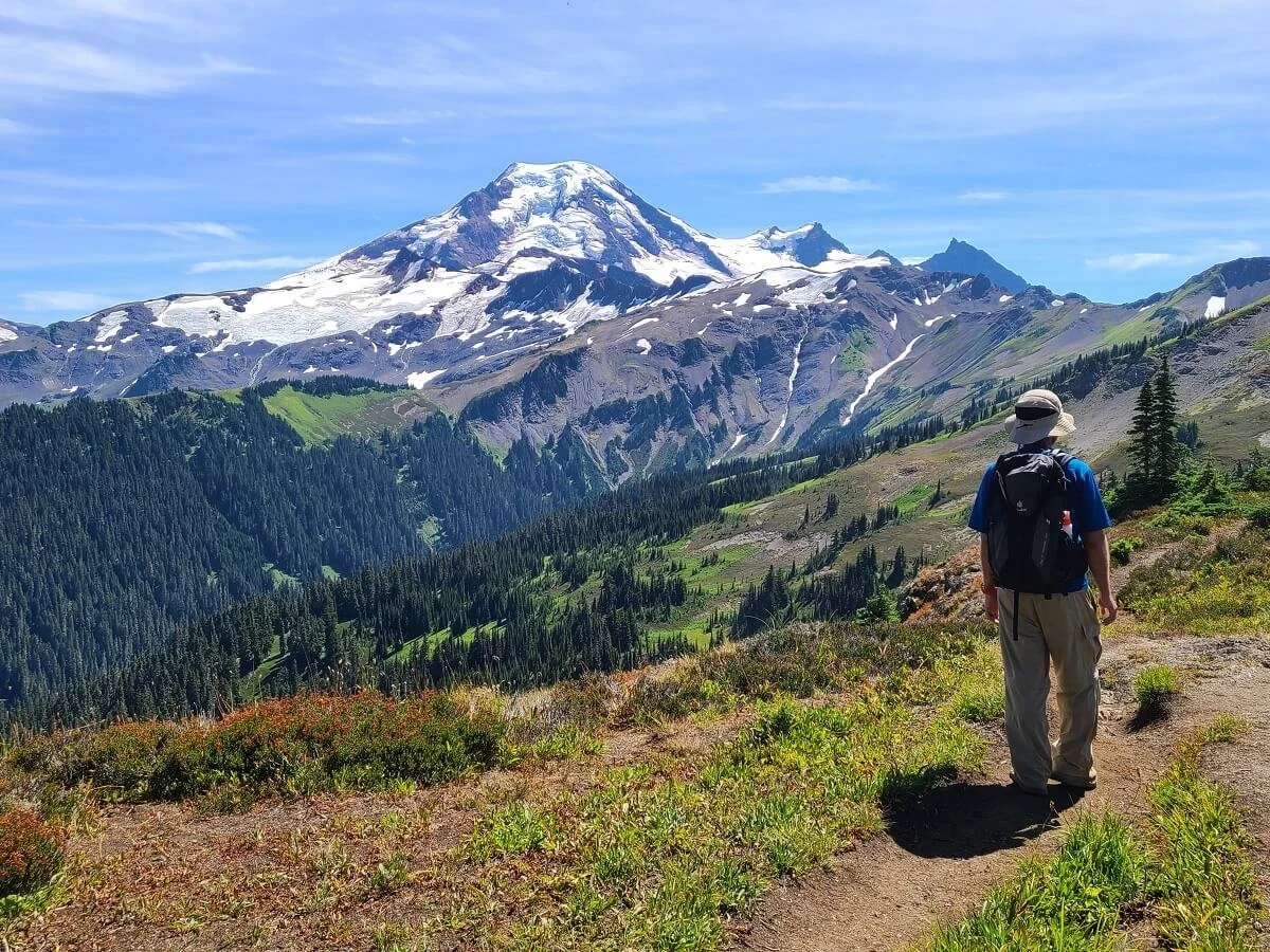
Skyline Divide
The Skyline Divide Trail in Mount Baker has some of the best views of the mountain!
Length: 7.4 miles
Elevation gain: 2,400 feet
Trail location: At the end of Forest Service road NF-37. This is a rough and slow-going 13 mile dirt road that branches off the Mount Baker Highway just past the town of Glacier.
Trail description: Check out our in-depth trail guide to the Skyline Divide Trail
The Skyline Divide Trail was absolutely one of our favorite hikes near Mount Baker.
The trail is a moderate half day hike, starting off with a steep and steady climb through the forest at the beginning, but once you make it above tree line, the views of Mount Baker are stunning and stay with you for the entire rest of the trail. You’ll continue to traverse several short but steep hills along the Skyline Divide itself, but the views of Mount Shuksan and Mount Baker are more than worth it and will motivate you to keep going further.
Hiking along the Skyline Divide Trail near Mount Baker
The last bit of the Skyline Divide Trail ends as more of a mountaineer’s route to the top of Hadley Peak, but most hikers choose to stop at a common turnaround point before the trail gets too difficult. Check out our complete Skyline Divide hiking guide for much more information on how to get to the trailhead (this one is a bit difficult to get to!), what to expect along the trail, and where we turned around.
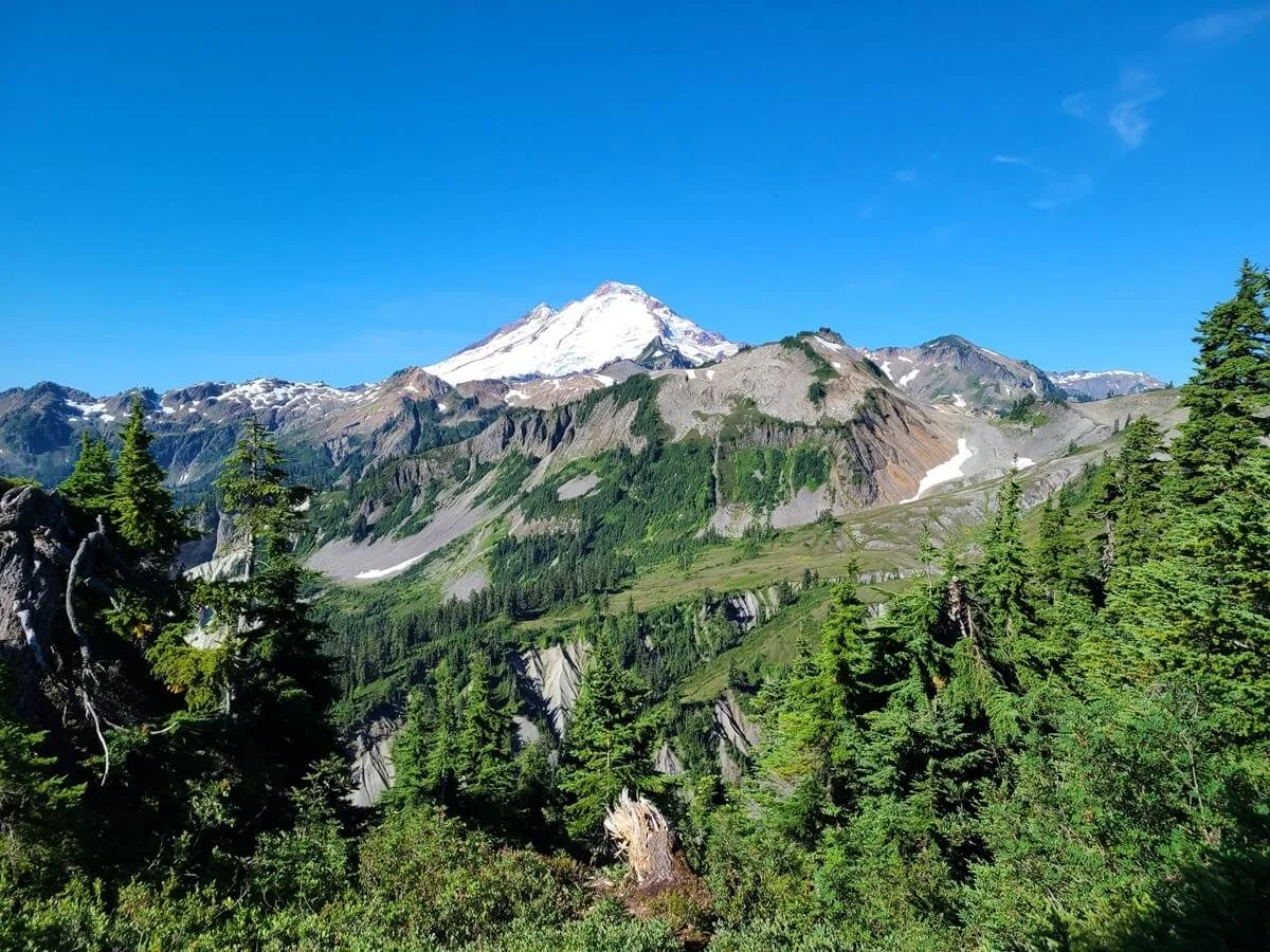
Ptarmigan Ridge

Hiking along the Ptarmigan Ridge Trail-our favorite hike near Mount Baker!
Length: 8.2 miles
Elevation gain: 1,800 feet
Trailhead location: At the Artist Point parking lot at the end of the Mount Baker Highway
Trail description: Check out our complete Ptarmigan Ridge trail hiking guide
We’ve saved the best for last, because if we had to pick just one trail on this list to name as our favorite Mount Baker hike, then the Ptarmigan Ridge trail is it. Because it’s the last one on our list, though, it is the most difficult, but this hike is more than worth it if you want some of the best views of Mount Baker you can get from a hiking trail!
The Ptarmigan Ridge trail starts from the Artist Point parking lot and traverses meadows, mountain slopes, and even volcanic rock, all the while with Mount Baker and Mount Shuksan pretty much in view the entire time. By the time you reach the common turnaround point for most hikers, you’ll have the most breathtaking in-your-face view of Mount Baker you can pretty much get short of climbing the mountain itself.

Close-up views of Mount Baker from the Ptarmigan Ridge Trail!

Views of Mount Shuksan from the Ptarmigan Ridge Trail near Mount Baker
But what makes this Mount Baker hike the most challenging on this list isn’t so much its distance or elevation gain, which themselves aren’t too bad, but the often tricky terrain of the trail. Because the Ptarmigan Ridge Trail lies super close to Mount Baker, snow lingers on the trail well into summer…even in early August we found ourselves having to cross several snow patches, a few more tenuous than others. You’ll also be traversing across steep slopes with loose rock, so this Mount Baker hike is a little more rugged than the others on this list.

One of the many snow patches along the Ptarmigan Ridge Trail near Mount Baker
To get tons more information on the best time to hike this Mount Baker trail, what to bring, and what to expect along the hike, check out our complete Ptarmigan Ridge hiking guide.
Other hikes near Mount Baker
This list of Mount Baker hikes is by no means comprehensive…there are tons of trails out here that it could take months to cover them all! But there are a few more hikes near Mount Baker that we wanted to mention that really stood out to us and are definitely on our to-do list for our next visit!
Heliotrope Ridge
The Heliotrope Ridge hike was on our list of must-do hikes near Mount Baker when we visited last. This hike leads to a breathtaking and up-close view over the Coleman Glacier on Mount Baker.
The catch is that there are several stream crossings along this trail. They can all be tricky, but the last crossing is at Heliotrope Creek found near the end of the trail and it’s the most substantial and challenging. The current can be strong and high here. At the very least, you’ll likely be crossing through ankle-deep water. But after rain or in the early season, such as spring and early summer when the snow is melting, the water levels can be much higher. Even on hot summer days when glacial melt is high, water levels are much higher in the afternoon than they are in the morning, and the current can often become strong, making crossing on the way back down the hike much harder that it was on the way up. A powerful current and slippery footing underneath is a bad combo and it can sometimes turn dangerous.
When we were in the area and considering this Mount Baker hike, it had been a particularly hot summer, with lots of afternoon glacial runoff, so we were a bit hesitant to attempt this trail. We had been reading recent reviews on AllTrails, with varying accounts of people having to turn around before the crossing because of the strong current, and others saying that the water was up to knee and even thigh level at times. Others reported getting stranded on the way back down because they couldn’t cross the creek safely on their own and they called for search and rescue. So we decided it wasn’t worth it at the time. The good news is that if you don’t want to or can’t cross the last creek, there is a junction shortly before it to head up a climber’s route to Hogsback Ridge. It’s a steep short climb but it will get you equally awesome views over the glacier and Mount Baker. I kind of wish we did this instead, but there’s always next time!
The key to this Mount Baker hike is to start early enough to avoid the strong afternoon creek currents on the way down, and to make sure to check recent reviews of the trail and even check conditions with a ranger before deciding to hike (we called the Glacier Public Service Center to speak with a ranger before deciding, and they basically confirmed to us that it would be very difficult to make the crossing at that time of year).
Trailhead location: This Mount Baker hike is located at the end of NF-39, a rough forest service road that turns off from the Mount Baker Highway just past the town of Glacier.
Yellow Aster Butte trail
This Mount Baker hike is a bit further from Mount Baker (on the opposite side of the Mount Baker Highway as all the other hikes on this list), so the views of Mount Baker are not quite as in your face, but the trail traverses a beautiful landscape speckled with tarns, wildflowers, and mountain views. It looks like it would be a particularly amazing trail in the fall as it becomes blanketed in reds, oranges, and yellows.
Trailhead location: This Mount Baker hike is found on Forest Service Road 3065, which can be reached off the north side of the Mount Baker Highway, about 12 miles past the town of Glacier.
Hikes in North Cascades National Park

The North Cascades- these views are right near Mount Baker!
The Mount Baker Wilderness is bordered on the east by North Cascades National Park, which contains its own collection of epic hiking trails with small crowds.
Marblemount is the small town that serves as sort of the gateway into North Cascades National Park, and from Glacier along the Mount Baker Highway, you’re only about an hour and 40 minutes away. However, you’ll be much closer if staying on the southern side of Mount Baker (in Sedro-Woolley, Rockport, or Darrington).
We would absolutely recommend visiting both Mount Baker and the North Cascades in one go if you can! Some hikes in the North Cascades we would specifically recommend include:
The Hidden Lake Lookout Trail- check out our complete guide on how to hike to this epic fire lookout overlooking the Cascades and a scenic lake!
The Maple Pass Loop – guide coming soon!
Cascade Pass and Sahale Glacier- guide coming soon!
Best Time to Hike in Mount Baker

Summer wildflowers along the trails in Mount Baker
Remember when we said above that Mount Baker is actually one of the snowiest places on Earth? Yea…it gets a lot of snow, which means that there’s a pretty small window for hiking on snow-free trails around Mount Baker- typically mid-July to end of September or early October. This is also when most visitor centers are open as well.
We would say that the best time to hike in Mount Baker is late summer to early fall, so around early August to mid-September. Many trails near Mount Baker have lingering snow well into July, although at this point the trails are likely still passable, but you might want to bring microspikes and trekking poles at the very least to help you traverse any potential snow patches.
A pro to hiking around Mount Baker in the summer months of July and August means you’ll likely encounter lots of beautiful wildflowers which are in the meadows on most of the hikes on this list. But it also means you’ll experience the worst of the bugs, which can get really bad around here. Make sure to bring lots of bug spray!
The other thing to consider on when to visit Mount Baker is road closures. The road to Artist Point, where several of the Mount Baker hikes on this list begin, closes at the Bagley Lakes Trailhead each winter, meaning the last 2.7 miles of the road are inaccessible by car. There are no set dates each year for when it closes or opens, it all just depends on the snowfall in any given year. Generally, you can plan on the road to Artist Point being open somewhere in the beginning of July to as early as the end of September (but more typically, sometime in October- it just depends on when the first substantial snow falls).
Tips for Hiking in Mount Baker
Here are some other tips before you set off on the Mount Baker trails!
Check road and trail conditions

Many Mount Baker hikes require stream or snow crossings, so checking up on conditions before heading out is helpful!
Before hitting the trails near Mount Baker, make sure to check trail and road conditions. This is important if you are coming early or later in the hiking season when conditions can be variable. It’s also particularly important for trails like the Ptarmigan Ridge Trail that we mention above, where lots of lingering snow can make the trail dangerous or require that you have proper winter hiking gear, and the Heliotrope Ridge Trail, where stream crossings can be dangerous at certain times of the year or even certain times of the day.
It’s also important to check for current road conditions and closures, which can happen often on the rough Forest Service roads leading to many Mount Baker trailheads.
Here are some helpful resources to check on trail and road conditions in the Mount Baker area:
The Mount Baker Ranger District Office in Sedro-Woolley
The Glacier Public Service Center (this is a great place to stock up on water, and ask a ranger about conditions, get trail information, and even buy any necessary parking passes, before heading further down the Mount Baker Highway).
Heather Meadows Visitor Center (they sell parking passes here, too)
List of current closures and alerts on the Forest Service site
A handy map of all trail and road closures and statuses
AllTrails and the Washington Trails Association (WTA) website are great resources for recent trail reports where you can learn about the current trail conditions from fellow hikers
Parking passes for Mount Baker hikes
While none of the Mount Baker hikes on this list require any special permits themselves, you will need a pass to park at the trailheads, as they lie in a Washington National Forest. You can use one of the following passes:
A National Forest day pass ($5 and good for parking at any trailhead for one day)
An Annual National Forest pass ($30 and good for an entire year)
A National Parks America the Beautiful Pass ($80 and good for an entire year at all National Parks and Federal Recreation Areas-including National Forests!)
You can buy any of these passes online in advance, or you can buy them in person at a Mount Baker ranger station. This great site has links to buy each pass online with more information about each one, and there’s also a vendor map for where exactly you can purchase the passes in person.
What to bring on a hike near Mount Baker

Expect snow on the Mount Baker trails- even in summer!
Aside from the usual day hiking essentials, here are some things we would specifically recommend for hiking near Mount Baker.
Trekking poles: These will come in handy on many of the Mount Baker hikes listed here (for snow and creek crossings and trails with loose rock or steep descents).
Microspikes: If you plan to hike in Mount Baker in the spring, early summer, or mid to late Fall, these are good to have just in case you run into snow or ice on the trail.
Bear spray: Mount Baker is home to black bears, and we would always suggest hiking with bear spray as a precaution in case of an emergency.
Bug spray: The bugs can get brutal in the summer months on Mount Baker trails, so be sure to be prepared! We would even recommend a bug net in case they get super bad.
Get an early start
A nearly full lot at a Mount Baker hike trailhead
Though the hikes near Mount Baker aren’t quite as popular (yet) as other places in Washington, it’s still helpful to get an early start as some lots may be small and/or more popular than others. When we visited in early August (which is during prime time!) we actually really didn’t have an issue and we got pretty late starts (mid-morning). We were always able to find parking, but sometimes it was in one of the last few spots.
We would also recommend starting earlier, especially in the summer, to avoid the midday heat (which can be pretty bad!) and to try and avoid the heavy glacial runoff that leads to challenging creek crosses on some Mount Baker trails (like Heliotrope Ridge or Park Butte Lookout).
Backpacking in Mount Baker

If you look closely, you can actually see a backpacker’s tent in the bottom left corner of this picture. Talk about a room with a view!
If you’re looking for relatively easy backpacking trips with epic views, then many of the Mount Baker hikes on this list are great for that! Specifically, you can camp overnight on the following trails (click the links to learn more about it!):
Some things to remember when backpacking in Mount Baker:
No advanced wilderness permits or reservations are needed to camp along any of these Mount Baker trails, and all sites are first come first served (there may be self-service permitting stations at the trailhead that you can fill out right before your hike), but there are wilderness regulations that you should read up on before heading out.
Camp in designated sites/areas only and don’t set up camp on fragile vegetation- try to find bare ground or rock instead. Where you are allowed to camp along each trail can be a bit confusing or unclear, so we highly recommend stopping in or calling a ranger station to get clear instructions on where it is okay to set up camp along the trail.
Bring proper food storage (i.e. a bear can) as Mount Baker is home to bears and other curious critters and practice strict Leave No Trace principles to avoid any unwelcome encounters.
Where to Stay Near Mount Baker hikes
For the Mount Baker hikes found along the Mount Baker Highway, Glacier is the best place to find lodging, as it sits right along the Highway and is located near most of the hikes in the area.
You can also stay in Bellingham or Sedro-Woolley, each about an hour and a half from Artist Point. A day trip from Seattle is also doable if you plan on just doing one day hike in Mount Baker, but it will be about 3 hours each way, so it would be a long day.
If you want to camp, there are two main options along the Mount Baker Highway, the Silver Fur Campground and the Douglas Fir Campground. Each are reservable on a 6 month rolling basis (i.e. reservations for July dates open in January).
What’s great about the Mount Baker-Snoqualmie National Forest is that if you don’t want to stay at an established campground, free dispersed camping is allowed along forest roads (dirt roads off the main highway) as long as you can safely park your vehicle completely off the road. We recommend calling the Mount Baker Ranger Station to verify where exactly it would be okay to do this and where they would recommend. If you choose to do this, remember that there are no facilities or services at these spots and it’s super important to practice leave no trace principles to help preserve these camping areas and keep them open for use!

Our RV camped in a dispersed camping site near Mount Baker
For the Park Butte Lookout hike, Concrete, Marblemount and Sedro-Wooley are your best options for finding camping and lodging nearby.
Is Mount Baker Worth Visiting?

We think views like this make a visit to Mount Baker absolutely worth it!
Though it’s a bit out of the way from more popular places like Mount Rainier and Olympic National Parks, we absolutely think hiking in Mount Baker is worth the trip. Being a bit further away means fewer crowds, and the trails provide stunning scenery and mountain views. We would highly recommend combining a visit to the Mount Baker area with the neighboring North Cascades National Park which has its own collection of amazing hiking trails.
Best Hikes in Mount Baker: Trail Guides
For more information on some of the Mount Baker hikes we described in this guide, check out our more comprehensive hiking guides!
More Amazing Hikes in Washington
Planning a road trip through Washington or just looking for more amazing hikes nearby? Check out our Washington travel and hiking guides to help you plan your trip!
MOUNT RAINIER NATIONAL PARK: Check out our favorite trail in Mount Rainier, the Burroughs Loop Trail.
NORTH CASCADES NATIONAL PARK: The Hidden Lake Trail is one of the best hikes in the park!
Are you planning on hiking near Mount Baker? Which of these Mount Baker trails are you looking forward to the most? Let us know if you have any questions on any of these hikes near Mount Baker, we love to help!