Hiking the Ptarmigan Ridge Trail in Mount Baker-Snoqualmie National Forest: The Complete Guide
Are you looking for a rugged hike that will get you up close and personal to a glaciated volcano? Then look no further than the Ptarmigan Ridge Trail in Mount Baker-Snoqualmie National Forest. This incredibly scenic hike will take you through meadows, volcanic landscape, and snowfields to get to amazingly close views of Mount Baker, the third highest peak in Washington State. In this guide, we go over everything you need to know to hike Ptarmigan Ridge, including how to get there, when to go, what you need to bring, and what to expect along the trail.
Mount Baker is a picturesque glaciated volcano that sits in the far north of Washington State, just shy of the Canadian border. As the third highest peak in the state, views of this mountain rival those of the nearby but far more popular Mount Rainier National Park.
The Mount Baker Wilderness has tons of incredible hiking trails surrounding the mountain where you can get every view imaginable of this volcanic giant. But one hike in particular will get you incredibly close. On the Ptarmigan Ridge Trail, you’ll walk along the flanks of Mount Baker itself, across meadows, ridges, volcanic rock and sand, and snow patches to some of the most up-close views of Mount Baker you can get without actually climbing it. It’s a scenic trail from start to finish, and because Mount Baker is a bit of an underrated gem of Washington, you’ll get National Park-level views but without the crowds.
Before you hit the trails in Mount Baker, though, there’s some critical information you’ll need to know, such as when to go, what you should bring, and how you should be prepared for hiking in this alpine environment. The Ptarmigan Ridge Trail is probably one of the most rugged trails in this area of Mount Baker, and it can be dangerous if not done under the right conditions. In this guide, we go over everything you need to know to hike Ptarmigan Ridge in the Mount Baker Wilderness to help you fully prepare for your next adventure!
In this Ptarmigan Ridge Trail hiking guide:
Where is the Ptarmigan Ridge Trail in Washington?

The Ptarmigan Ridge Trail is found in the Mount Baker Wilderness, part of the Mount Baker-Snoqualmie National Forest. The Mount Baker Wilderness is about 3 hours north of Seattle, and just shy of the Canadian border. This wilderness makes up part of the western edge of the Cascade Mountain range, and is just adjacent to North Cascades National Park (making it a great add-on if you are up here visiting this epic National Park!).
Mount Baker itself is a 10,781 foot volcano, making it the highest mountain in the North Cascades and the third highest in the state. It’s very heavily glaciated and actually gets some of the highest amount of snowfall in the world! This makes it a popular winter destination for skiing and snowshoeing, but the short snow-free summers offer amazing hiking opportunities through wildflower-filled meadows to gorgeous views of alpine lakes, Mount Baker, and the distant Cascades.
How to get to the Ptarmigan Ridge trailhead
The main region that has many of the best hikes in Mount Baker is the Mount Baker Highway, or Hwy 542, which follows the North Fork of the Noosack River along the North side of the mountain. Several campgrounds, trailheads, and points of interest can be found along this scenic drive.
The Mount Baker Highway starts in Deming, WA and stretches over 40 miles, ending at the popular Artist Point. Artist Point is a popular and incredibly scenic area for hiking in Mount Baker, and has some of the park’s most well-travelled trails, including the Ptarmigan Ridge Trail. The views from the lot alone are incredible, with Mount Baker and Mount Shuksan in full view. The trailhead for Ptarmigan Ridge is actually the same one for the Chain Lakes Loop found at the far end of the lot. You’ll share the trail with the Chain Lakes Loop for about the first mile before splitting off and hiking the Ptarmigan Ridge Trail.
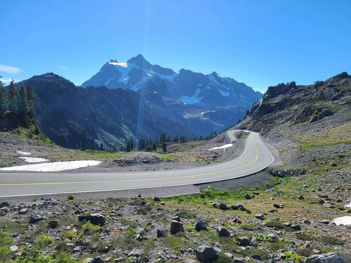
The road up to Artist Point and the Ptarmigan Ridge trailhead
Because this is a popular area in Mount Baker, parking may be an issue if you come too late. There are two other lots lower down on the road that you can park at. The closer one is the Heather Meadows Trailhead, and the one below is the Bagley Lakes Trailhead. All three trailheads are connected by the Wild Goose Trail, which essentially follows the road as it climbs up to Artist Point, so it’s possible to reach the Ptarmigan Ridge Trail by parking at one of these lower lots, but it will cost you in extra mileage and elevation. From Bagley Lakes to Heather Meadows, the Wild Goose Trail is relatively flat and only a half a mile, but from Heather Meadows up to Artist Point, it will be about a mile with roughly 600 feet of steep elevation gain. When we visited Mount Baker, the Artist Point lot was closed for construction and we had to hike this last mile of the Wild Goose Trail to get up to the trailhead…the views were pretty good, but it was definitely a challenging way to start off the day before even getting on the trail!

This Mount Baker map is found at the trailheads in the Artist Point area. The three potential lots for accessing Ptarmigan Ridge are highlighted.

A steep section on the Wild Goose Trail heading up to Artist Point
How Long is the Ptarmigan Ridge Trail in Mount Baker?
When we read accounts of the Ptarmigan Ridge Trail in Mount Baker, we saw varying stats of elevation and mileage for the trail. This is probably because Ptarmigan Ridge is an out- and- back hike, so people can turnaround wherever they like for a shorter or longer hike. Most people don’t actually go all the way to the end of the trail, because the Ptarmigan Ridge actually serves as a gateway to a mountaineer’s route to summit the mountain, so the end of the trail gets a bit dicey. The trail technically ends in a climber’s camp on a volcanic plateau near the mountain, and beyond that are herd paths which can be dangerous to follow without climbing experience and proper gear. Most people who have hiked to the end of this official trail quote around a 9 mile round trip hike and somewhere between 1400 and 1800 feet of elevation gain.
A very common turnaround point, and the spot where we turned around, is the small plateau over Goat Lake, which is probably a half mile or so shy of the actual end of the trail. This is what our out-and-back trail stats for the Ptarmigan Ridge Trail reflect, and will likely be relevant to most people hiking this trail.
Hiking stats for the Ptarmigan Ridge Trail in Mount Baker
Distance: 8.2 miles
Elevation Gain: Approximately 1800 feet
Time: 5.5 hours (this is with about 1 hour of resting time enjoying the views from the end of the hike!)
Trail profile:
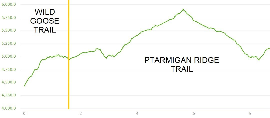
Our elevation profile from our hike on the Ptarmigan Ridge Trail. The yellow line marks the start of the actual Ptarmigan Ridge hike, as we had to hike up to the trailhead via the Wild Goose Trail to start. Also note that we combined this hike with the Chain Lakes Loop, so these two hikes were tracked together. This trail profile ends at the intersection with the Chain Lakes Loop on the return hike. The last one mile portion of the Ptarmigan Ridge hike back to the lot is missing here (but would look identical the first mile of the hike!)
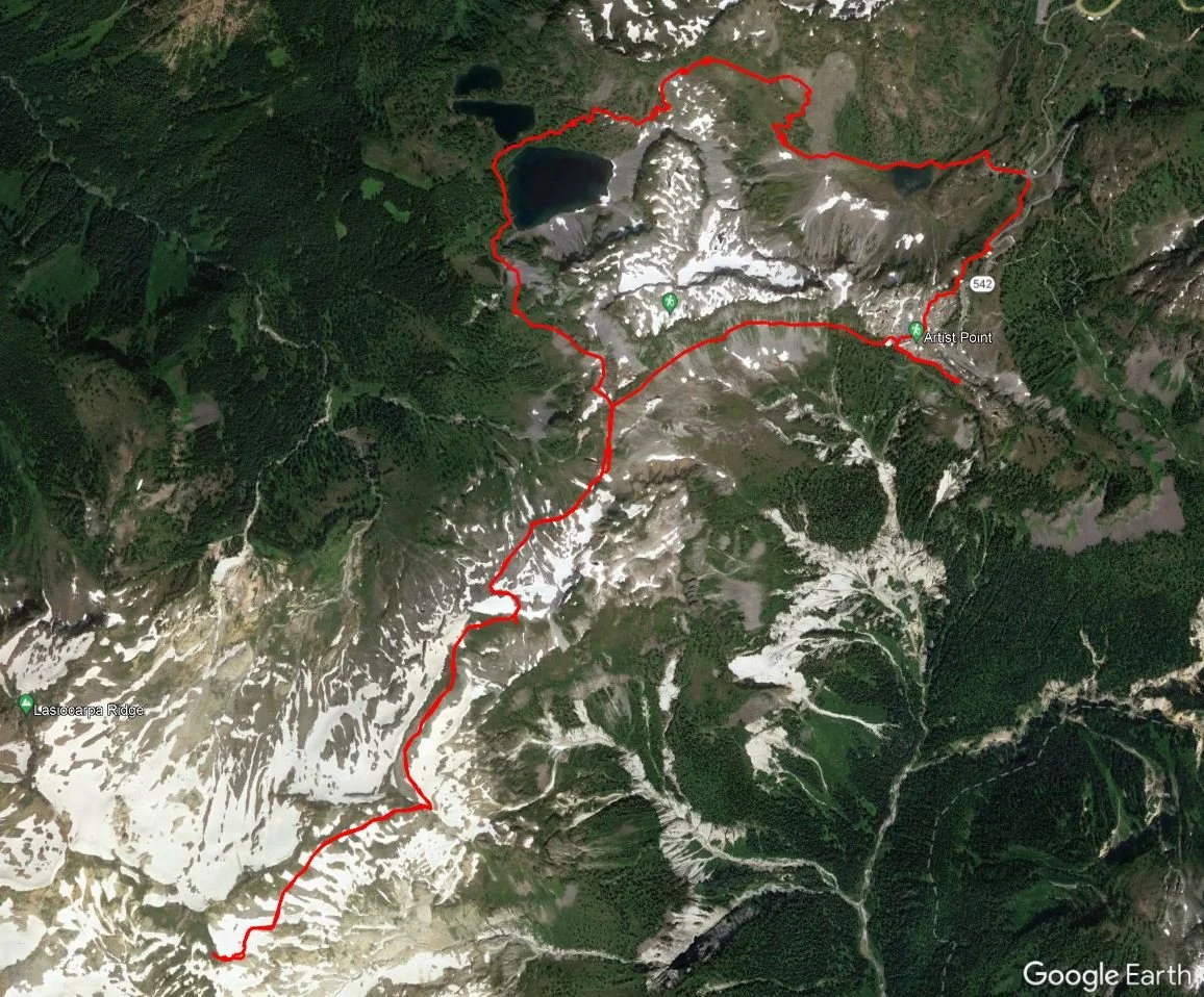
The satellite view of our Ptarmigan Ridge -Chain Lakes Loop hike in Mount Baker
Ptarmigan Ridge trail map
Here is a trail map of Ptarmigan Ridge, showing the different parking lots up to Artist Point, as well as the official Ptarmigan Ridge Trail.
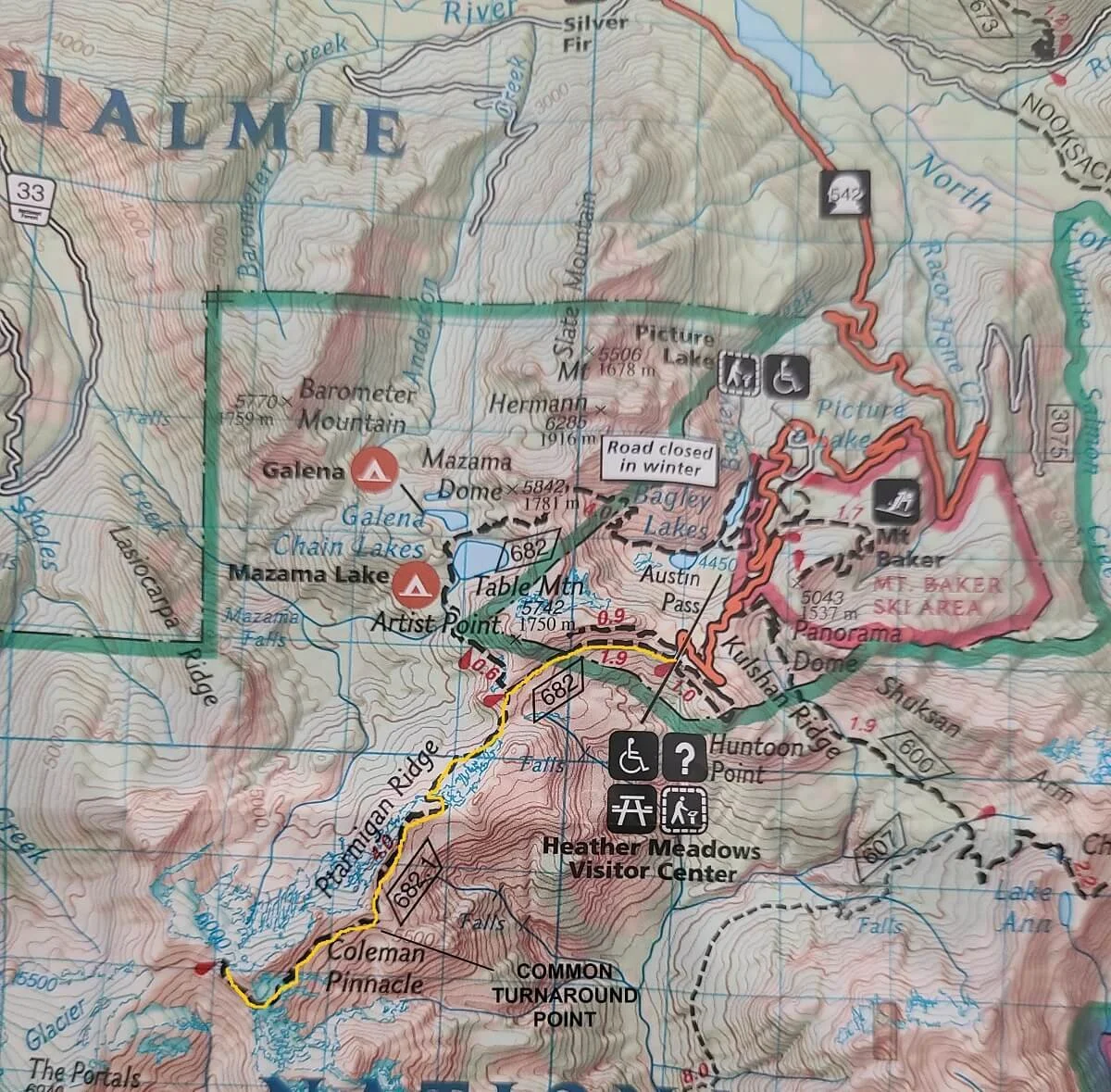
This Ptarmigan Ridge trail map is marked with the common turnaround point on the hike
How Hard is the Ptarmigan Ridge Trail in Mount Baker?
For being able to get so close to Mount Baker, the distance and elevation gain of the Ptarmigan Ridge hike is surprisingly pretty low. We would describe the trail as moderate. I think the only thing that made us feel like it was a little harder than it should have felt was that we had done several big hikes in the few days before and we were starting to feel it…plus the steep climb right off the bat up the Wild Goose Trail left us tired from the start! On the way back, though, we realized how really mellow this trail was in terms of elevation and distance.
However, what makes the Ptarmigan Ridge Trail a little challenging is its terrain. Because the trail runs so close to the mountain, snow lingers on this trail for quite a while…well into summer. The trail may not even be passable without the proper snow gear (crampons and ice axe) until late July or so. Even then, significant snow patches linger and some are even permanent features of the trail. We hiked Ptarmigan Ridge in early August and crossed about 6 snow patches, one of which was on a steep slope and particularly scary (if you slipped you might end up going for a bit of a ride down the slope!). We would recommend checking in on trail conditions before hiking Ptarmigan Ridge. AllTrails is a good reference, with recent reviews of conditions from fellow hikers. We also called the Mount Baker Ranger Station to speak with a ranger and get their opinion on how dangerous the hike would be a what equipment would be needed. Even if going later in the summer, we would definitely recommend, at the very least, having trekking poles to stabilize yourself on the snow patches, and even better, microspikes. Especially in the morning, the snow patches were quite slippery and slushy. We found that on the return hike later in the day, the snow patches were more well-trodden and packed down and therefore easier to cross.
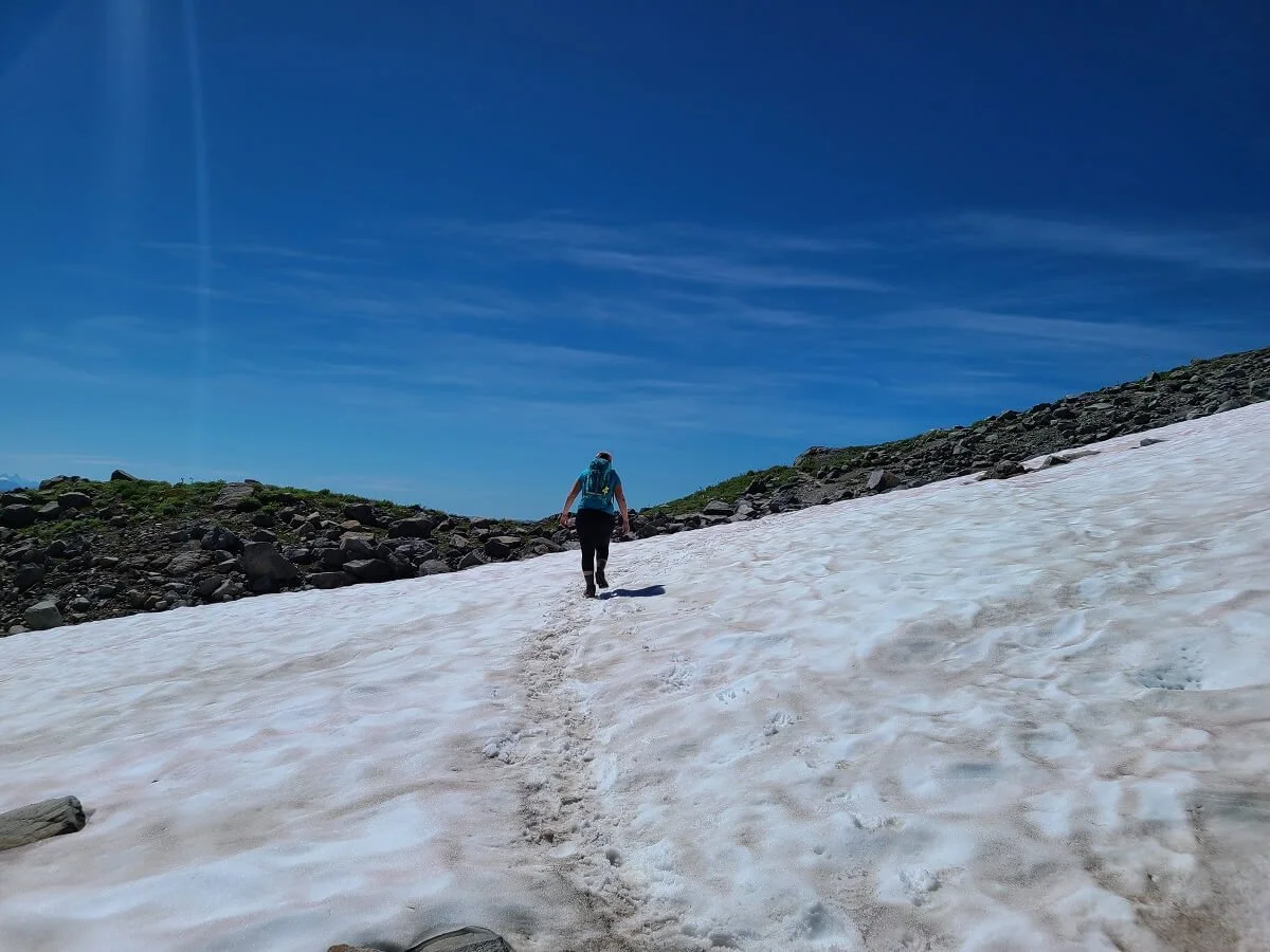
Frequent snow patches are found on the Ptarmigan Ridge Trail
Other than the potential of snow, the Ptarmigan Ridge Trail has several sections where you’ll be walking along steep slopes and the trail will consist of loose gravel and rock, so just watch your footing.
Best Time to Hike Ptarmigan Ridge in Mount Baker
The last bit of road up to Artist Point and the Ptarmigan Ridge Trailhead is usually cleared of snow and opened by late June or early July, and then closes again by November, giving you about a four month window where you can directly access the Ptarmigan Ridge trailhead. However, we would say the best time to hike Ptarmigan Ridge in Mount Baker is late summer to early fall (mid-August to early October). This is a snowy trail, but by mid-August, most of the snow should be cleared, making it safer and more accessible. In the summer, you’ll get to see some beautiful wildflowers adoring the meadows around Mount Baker as well, but a downside is you’ll have to contend with the bugs.

Purple wildflowers line the Ptarmigan Ridge Trail in the summer months
By late September, fall colors will start to emerge, the bugs will be gone, and hopefully, the trail will be as snow-free as it can get. Pushing it too late into fall, though, may mean the new winter’s snow can begin, so keep an eye on forecasts and trail conditions before heading out.
The Ptarmigan Ridge Hike in Mount Baker-Snoqualmie National Forest: Our Experience
Here we share our experience hiking the Ptarmigan Ridge Trail in Mount Baker so you know what you can expect along the trail!
We arrived at the parking lot at around 8:30 am thinking the lot would be getting full at this point, but there was still plenty of parking left! (We would say get there by mid-morning to be on the safe side.) Because the parking lot at Artist Point was closed for construction, we had to park at the Heather Meadows lot about 600 feet below and hike up to Artist Point via the Wild Goose Trail. This was a steep trail that paralleled the road and threw us into a climb without any warm-up for the legs!

Heading up the Wild Goose Trail up to Artist Point
Once we made it to Artist Point, we found the Chain Lakes trailhead at the far end of the lot and started the actual hike.
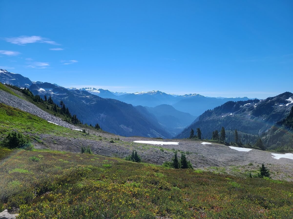
The hike to Ptarmigan Ridge actually begins on the Chain Lakes Trail, which it shares for the first mile as it skirts the slope underneath Table Mountain to the right. This ridge is fairly flat and already incredibly scenic, with views of Mount Baker peaking out ahead, and Mount Shuksan behind. The further you walk, the more each mountain comes into view and it’s really stunning.

Starting off on the Ptarmigan Ridge Trail, with Mount Baker in view ahead

Looking back from the Ptarmigan Ridge Trail out to Mount Shuksan

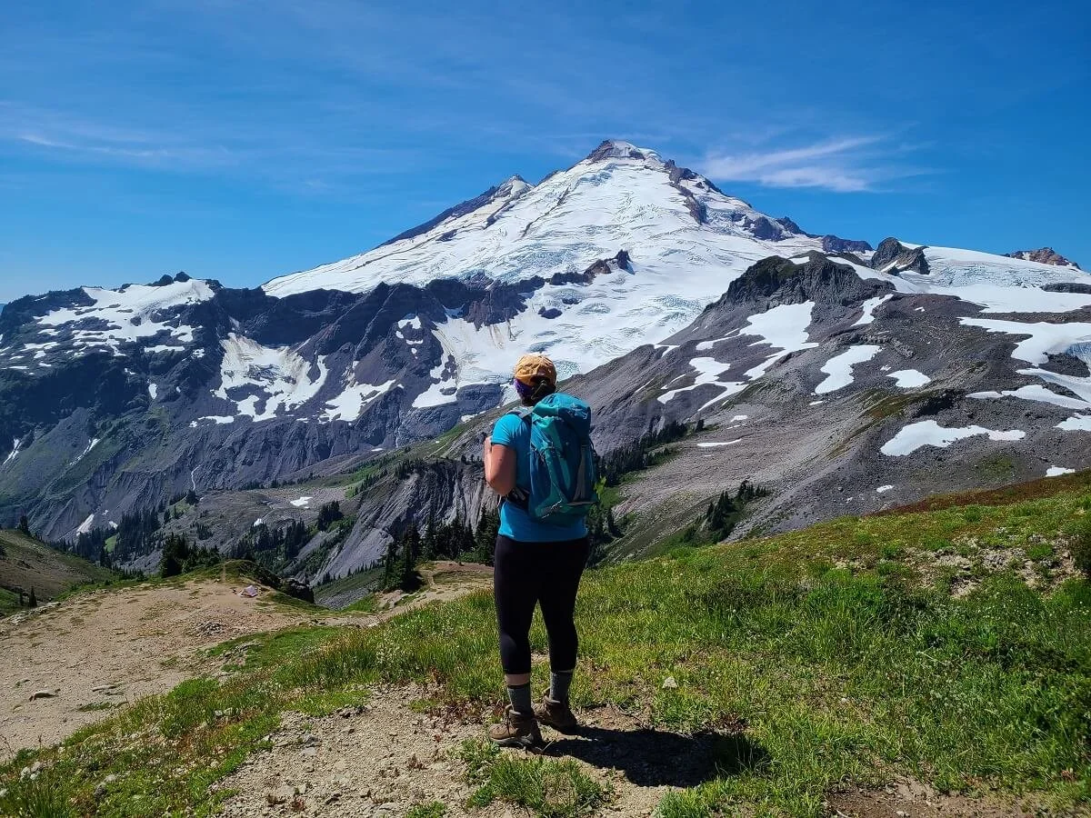
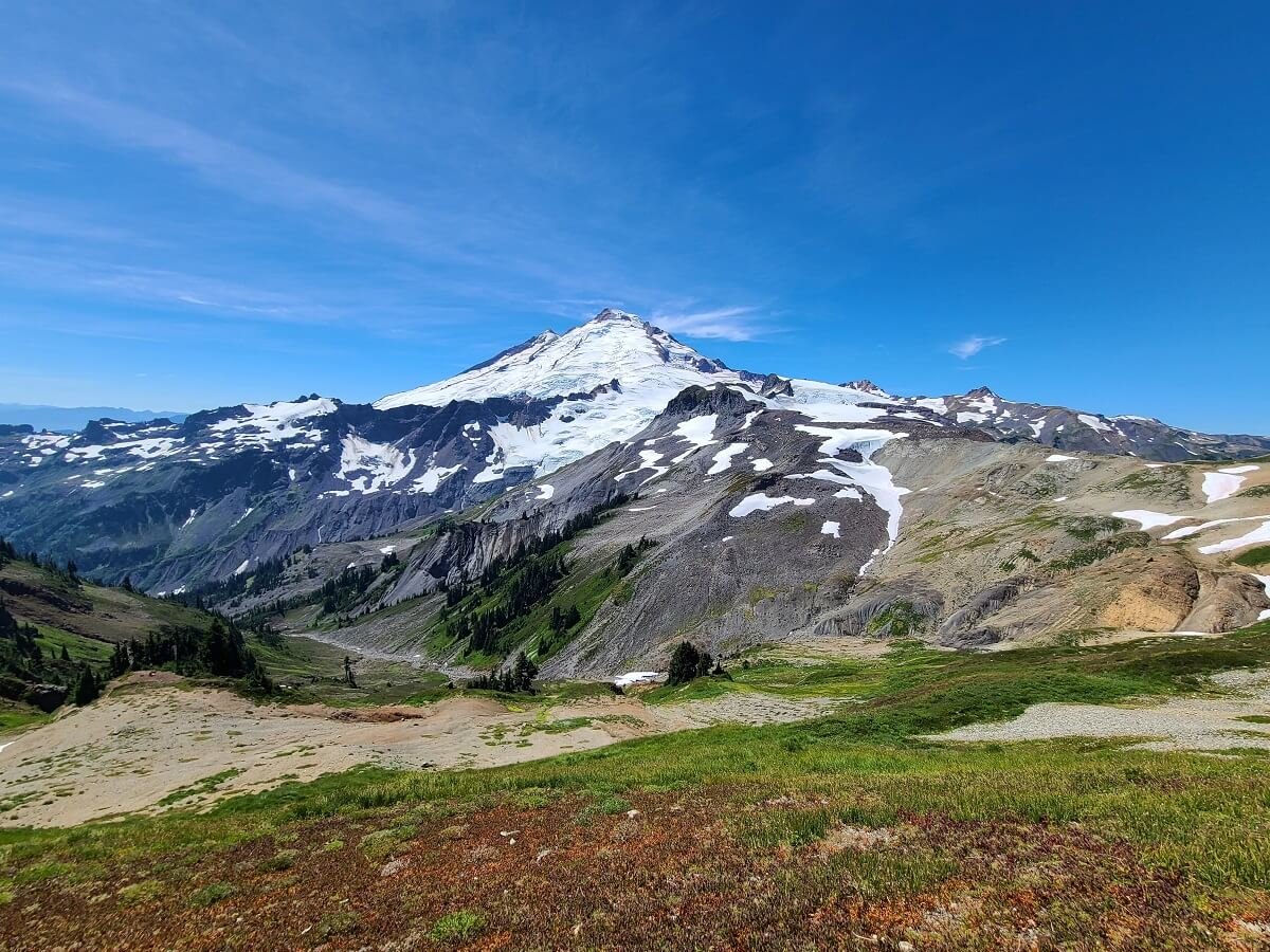
Beautiful views of Mount Baker from the Ptarmigan Ridge Trail!
After 1.1 miles in, you’ll come off the slope and hit the trail junction with the Ptarmigan Ridge Trail. Bear left at this junction to continue onto the Ptarmigan Ridge rather than the Chain Lakes Trail. From here, it’s just a short walk to a little crest just before the trail drops.

The junction with the Chain Lakes Loop Trail
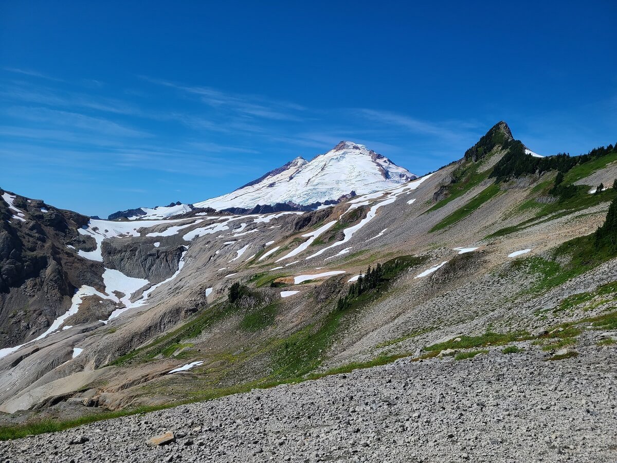
From here, enjoy head-on views of Mount Shuksan in the distance. Ahead, you can see the narrow trail sprawl out in the distance over the blackened landscape. Mount Baker’s summit peaks out, and the pointed rock feature just in front of it to the left is a feature called Coleman’s Pinnacle. The Ptarmigan Ridge Trail is going to take you around to the left side of that feature and across its front!

Beautiful view of Mount Shuksan!

Ahead, the trail drops down and then sprawls out across the volcanic landscape in front of Mount Baker. The pointed rock feature just to the left of Mount Baker is Coleman Pinnacle- you’ll be hiking around that soon!
From this crest, the Ptarmigan Ridge Trail annoyingly drops almost 200 feet into a rugged volcanic landscape. To get down this drop, there are a few switchbacks that will weave you down the slope. Somehow, we missed the turn onto the first switchback (it’s pretty rocky here so the path might be hard to see), and we ended up taking a herd path straight down loose rock…this wasn’t fun, so we just wanted to give you the heads up to look for the actual switchbacks!
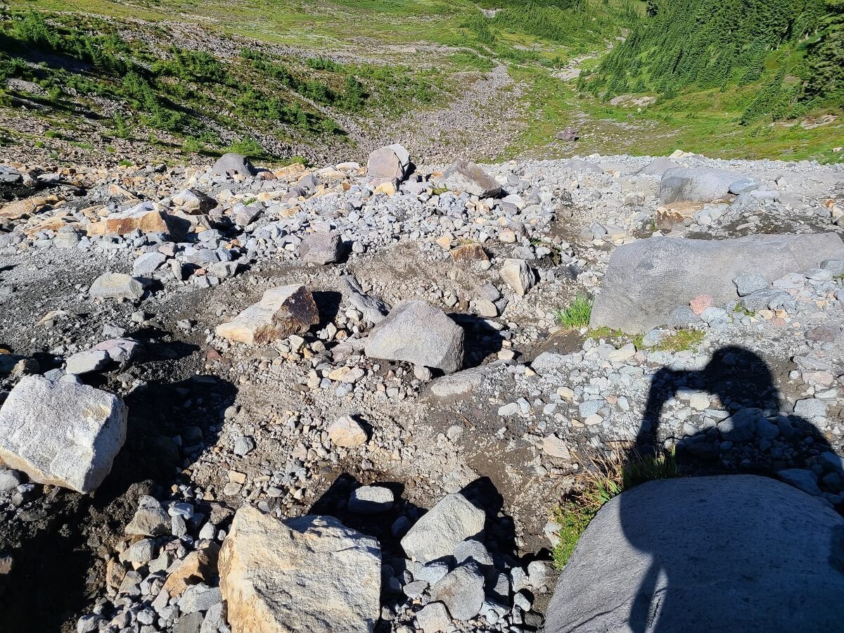
This is the route we took down into the valley…
Looking back from a bit further down the trail, you can see the big switchback we had missed and the herd path straight down the rock that we took.
Once at the bottom, the trail flattens out as it spans out across a volcanic landscape of rock and black soil that was actually a little reminiscent of the volcanic landscape in Iceland! At first, there’s some greenery and wildflowers, and small streams run down from the slopes to your left that you have to hop over every now and then. The water is coming from small snow patches just above, and when we walked by them, they actually felt like mini-air conditioners in the hot summer heat! Bright green lichen grows on the blackened soil, which is what really gave the Ptarmigan Ridge Trail that Icelandic feel to us!

Icelandic feels along the Ptarmigan Ridge Trail!

Beautiful wildflowers in front of a barren volcanic landscape on the Ptarmigan Ridge Trail
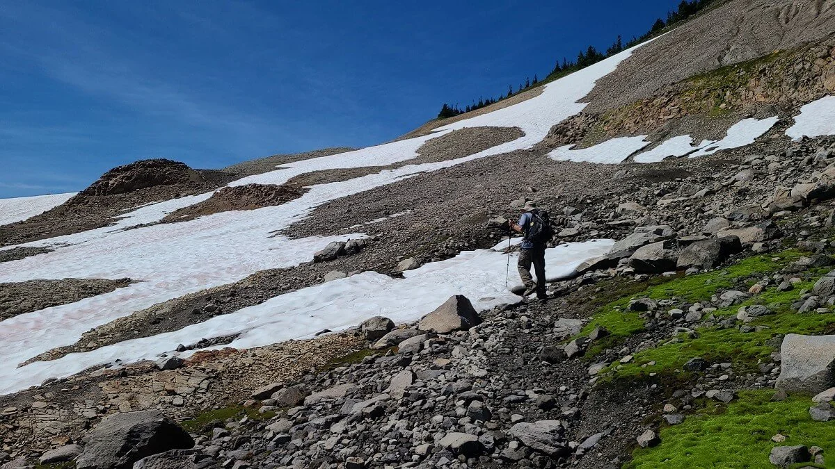
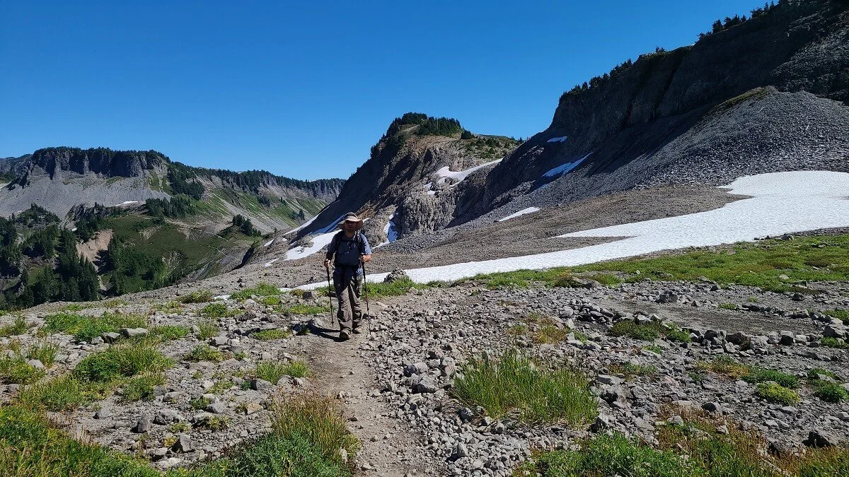
But about halfway across this low valley, you’ll leave the greenery behind, and ahead is just a black, rocky, moon-like landscape. Because the landscape is made of a lot of loose rock and soil here, the path might be hard to see, but it will begin to slowly switchback its way up to the ridge above. On this climb was the first snow patch of the hike that we encountered. It was a little slippery, but it didn’t feel dangerous because the slope it was on wasn’t too steep. Trekking poles definitely helped here, especially this early in the morning when the snow was still slick and hadn’t yet been broken in by too many hikers ahead of us.

A small snow patch on the Ptarmigan Ridge Trail

Hiking through snow on Ptarmigan Ridge
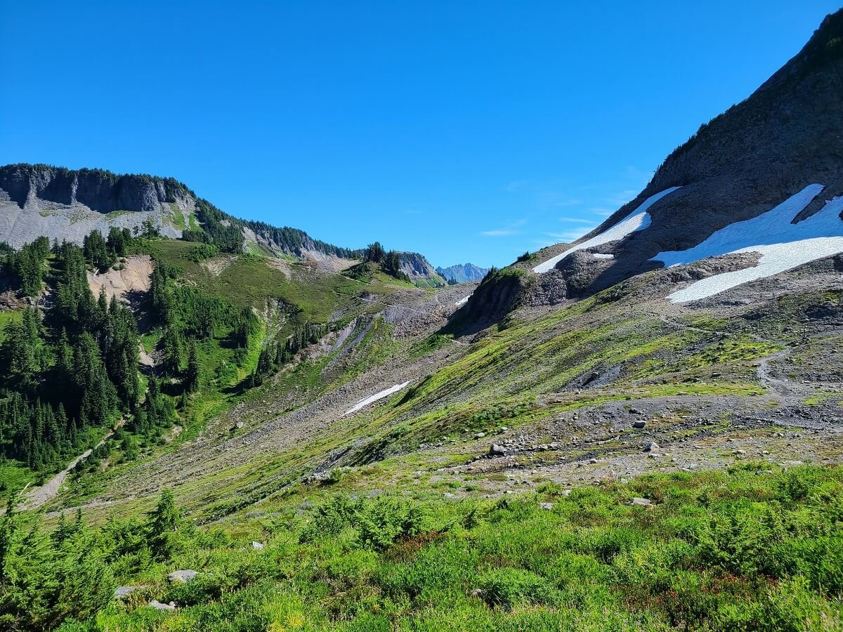
We crested the hill to beautiful views over meadows, wildflowers, the Cascades, and out to Mount Shuksan. Mount Baker was hiding from here, though. Instead, what we could see ahead was another narrow path skirting the slopes up to yet another ridge.

View from the Ptarmigan Ridge Trail
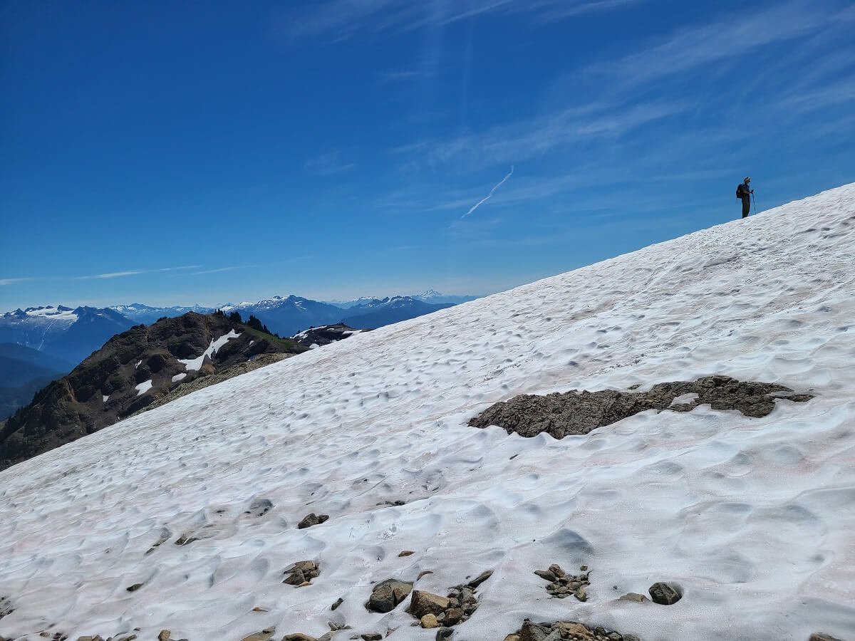
The trail climbs a bit at first to get up to the slope and then remains pretty flat as it skirts just below the ridge. The trail becomes rocky here, and you’ll likely have to cross another snow patch here. This snow patch was the scariest one along the trail. It was on a pretty steep part of the slope, and the snow was still very slippery. Having poles here was key, and microspikes would have been super helpful (I’m not sure why we didn’t pack ours!). I took each step very carefully, and it felt like if I slipped, I would definitely go for a little ride down the slope. Fortunately, we both made it without incident!

The narrow trail as it skirts the ridge and heads toward the snow patches ahead

Crossing the steep snow patch on the Ptarmigan Ridge Trail

We made it passed the snow! Now cresting the ridge above it…

On top of the ridge…look at those views!
We crested the top of that next hill, only to find the trail continued on another ridge to crest another hill. This hike seemed to be the hike of never- ending ridges! When we first started out on the Ptarmigan Ridge Trail, we actually didn’t really have a concept of how far we would go or where the good turnaround point was. We just kept hiking further and further, and each time we saw the trail span out over a new ridge with Mount Baker poking out behind it, we’d say “The views look like they’ll get even better out there, let’s keep going!”. And indeed, with this next ridge, it seemed like it would spill us out right into full view of Mount Baker, so on we went.
The Ptarmigan Ridge Trail continues along the slopes to the right and out to the ridge in the distance
The trail across this slope remained pretty flat for a while as it skirted the slopes that sit underneath Coleman Pinnacle (that pointy feature you saw way back at the beginning of the hike…yea- you’re way out there already!), but then towards the end, below the crest, it started climbing through terrain of loose rock, and we ended up having to cross about four more snow patches (none nearly as scary as that last one, though!).

Navigating the rocky path on the slopes under Coleman Pinnacle

More snow on the Ptarmigan Ridge Trail!
There’s usually quite a bit of lingering snow just before the ridge above Goat Lake

The view of Mount Shuksan are even more epic from up here!

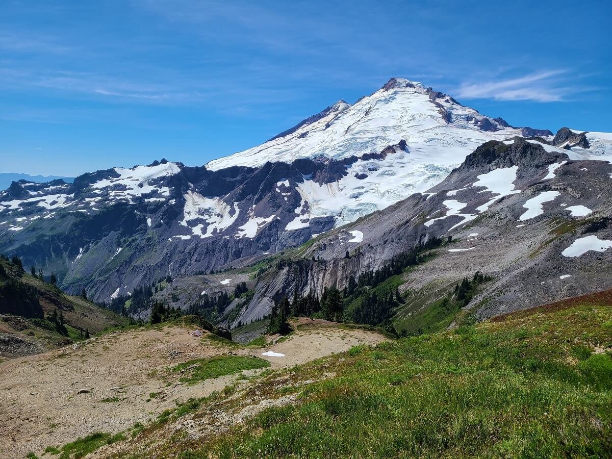
We finally crested that final ridge, and boy, the views were worth it! Mount Baker came into full view ahead of us, the still half-frozen Goat Lake sat below us on the left, and Mount Shuksan was dominating the view behind us. This is the common turnaround point on the Ptarmigan Ridge Trail for most people, and it’s also just an incredible little flat plateau to rest and enjoy the views. The views of Mount Baker here are probably about as good as you can possibly get! The only downside of being up here were the annoying flies…they weren’t as bad as other hikes we did in Mount Baker and Washington (I’m looking at you Skyline Divide Trail!), but they were bad enough to be annoying.

Topping out on the ridge over Goat Lake!

A half-frozen Goat Lake in the distance
Perfect views of Mount Baker from the Ptarmigan Ridge Trail!
We chatted with a local couple who actually told us that it’s pretty unusual to make it this far up the Ptarmigan Ridge Trail because of all the snow that usually lingers, but that it had been unusually hot this particular summer, so we considered ourselves lucky!
From here, there is herd path down to get to the edge of Goat Lake. In fact, it’s a pretty popular area to backcountry camp! Just be aware that the initial part of the hike down is on some incredibly loose rock and gravel and can be hard to navigate. But once on the plateau where Goat Lake sits, the trail gets better, and I’m sure the views of Mount Baker from the edge of the lake are fantastic. You can also camp near this turnaround point above the lake, which is what one lucky backpacker decided to do while we were there. Just look at this front-door views! It definitely had me kicking myself a little bit that we didn’t think to pack our tent and gear!
From this point, we also saw the main Ptarmigan Ridge Trail continue on. It took a sharp right turn to continue crossing the slopes under the Coleman Pinnacle, this time around its front. We decided to keep going just a little bit further to see where it took us and if the views got any better. The trail climbed a bit more along a grassy ridge, and from here, we could see out in the distance where the trail continued across another ridge as it creeped even closer toward the mountain. We knew the trail ended somewhere out there just before it climbed up to the Portals, the two prominent rock features on the right side of Mount Baker, and which serve as a gateway for a mountaineering route to the summit. To get beyond the end of the official trail requires route-finding along primitive herd paths. We didn’t feel the need to continue on much more, satisfied with the views we were getting from this popular turnaround point, so we decided to head back from here.

The Ptarmigan Ridge Trail continued on a steep dirt path under Coleman Pinnacle. Can you see Kevin at the top of the trail?

The trail continued further along this ridge before it drops down and follows the side of the slopes in the distance

Epic views of Mount Baker from the Ptarmigan Ridge Trail!

Enjoying the epic view of Mount Shuksan from the turnaround point on the Ptarmigan Ridge Trail!
The hike back was pretty fast and easy. The hike in felt longer and harder than it should have for us for a few reasons. First, we had to start off on an unexpectedly steep climb just to get to Artist Point, which got our legs a little tired. Plus, we had two big days of hiking just before this, hiking both the Skyline Divide Trail and the Park Butte Trail in Mount Baker, so our legs were starting to feel it. And of course, we were just at the start of a Washington heat wave, so the temps were pretty hot as we were hiking, which slowed me down a bit. Finally, we didn’t really know where our turnaround point would be, and we just kept seeing one long stretch of ridge after one long stretch of ridge, and it became kind of a psychological thing of making the trail seem longer and hard than it really was. But really, the Ptarmigan Ridge Trail is not bad. From the beginning, you can pretty much see where the trail goes, and it’s a pretty gradual, albeit constant, climb. Like we said, the hike out went much faster, and we enjoyed views of Mount Shuksan in front of us most of the way. By this time in the day, the snow was packed down a bit more by hikers and was less slippery, so they were easier and less scary the second time around.

Heading back down to the plateau above Goat Lake, which can be seen in the distance

Mount Shuksan dominated the views on the way back down the Ptarmigan Ridge Trail

The big snow patch was a little more packed down and easier to cross on the way back
Once we got back to the junction for the Chain Lakes Loop, we decided to take the long way back to the parking lot via the Chain Lakes Trail! It’s an easy hike to combine with the Ptarmigan Ridge Trail if you’re up for more distance, so be sure to check out our Chain Lakes guide if you want to do the same.
Where to Stay Near Ptarmigan Ridge in Mount Baker-Snoqualmie National Forest
If you’re looking to camp near the Ptarmigan Ridge Trail in Mount Baker, you’ll have a few different options. The two main campgrounds along the Mount Baker Highway are the Douglas Fir Campground and the Silver Fir Campground. Both can be reserved online. The Silver Fir Campground is the closest to Artist Point- about a half hour (10 miles) away.
What’s great about the Mount Baker-Snoqualmie National Forest is that free dispersed camping is allowed along forest roads (dirt roads off the main highway) as long as you can safely park your vehicle completely off the road. We called the Mount Baker Ranger Station just to verify with them what was allowed and where they would recommend, and we suggest you do the same. We ended up camping at the Salmon Ridge Sno-Park, which is an empty parking lot (used only in winter) just across from the Silver Fir Campground and near the Shuksan Picnic Area. We also saw a bunch of people camping along the Noosack River off the road up to the Skyline Divide trailhead (Forest Road 37) at some established primitive sites.
Please remember when you are dispersed camping that there are no facilities or services offered, so be very careful to clean up after yourself and leave no trace to help preserve these places for everyone to use!
If you’re not looking to camp near Mount Baker, you can find limited lodging and cabin options in the town of Glacier, about 45 minutes away from the Ptarmigan Ridge trailhead. Bellingham is a bit further out (about an hour and 45 minutes away). You can also do a day trip to Mount Baker from Seattle, but it will will be about 3 hours of driving each way to get to Artist Point.
Can you camp on Ptarmigan Ridge in Mount Baker?
Yes! You can camp along Ptarmigan Ridge in Mount Baker- just make sure to be a mile past the junction with the Chain Lakes Trail. The most common place to camp along the Ptarmigan Ridge Trail is at Goat Lake or at the plateau just above. We were definitely envious of the people with the tents set up with Mount Baker in full view! Just be aware that the area around Goat Lake often has late lingering snow and the lake stays frozen late as well…it was still half frozen when we were there in August!
Can you see the tiny tent down on the ridge? What an epic camping spot on the Ptarmigan Ridge Trail!
We also heard that camping at the very end of the official trail on the plateau just before the Portals is another good option, through we don’t really know much about this location or if there is a good water source nearby.
Tips for Hiking Ptarmigan Ridge in Mount Baker
Check conditions. Before heading out on the Ptarmigan Ridge Trail, check conditions of both the trail and for any road closures. You can check the US Forest Service site, call either the Mount Baker District Ranger Station or the Glacier Public Service Center, and use AllTrails to get recent reports from fellow hikers. This will help you be prepared with proper gear and equipment. The small town of Glacier is a good place to stop in general en route to Artist Point so that you can visit the service center and speak with a ranger and use restrooms.
Passes. Parking at the Artist Point lot and most trailheads around Mount Baker require the Northwest Forest Pass which costs $30 annually. What’s great is that in lieu of this pass, you can use an Annual National Parks Pass! So, if you have already purchased one of these to visit the three Washington National Parks, then you’re all set!
Come prepared. For the Ptarmigan Ridge hike, we recommend wearing good hiking shoes/boots for the rocky terrain, having trekking poles to help with the rocky terrain and snow crossings (miscrospikes would be even better for the snow), having plenty of sun protection (sunscreen, hat, and sunglasses-this is an entirely exposed hike and also the glare off of big snow patches can be blinding!), bringing layers (for warmth and rain), and bringing bug spray for the pesky flies and mosquitoes.
Check the smoke forecast. Unfortunately, smoky skies are the norm for hiking in the west, and Mount Baker is no exception. Thick wildfire smoke can not only affect views, but also just be very unhealthy to hike in. We like this website to check for the smoke forecast in Washington. You can also google “AQI in Washington” to get forecasts of how healthy the air is. This site is a good one to check out.
Bears. The Mount Baker Wilderness is bear territory, so make sure you are bear aware and store all food properly (and don’t leave anything out unattended).
Extend your hike! The Ptarmigan Ridge Trail is easy to combine with other hikes in the area, especially the Chain Lakes Loop. For us, it was a no-brainer since we had to park in the lower Heather Meadows lot and had to hike the first part of the Chain Lakes Loop anyway to get up to Artist Point.
More Hikes Near Ptarmigan Ridge in Mount Baker-Snoqualmie National Forest
Looking for more hikes in Mount Baker near the Ptarmigan Ridge Trail? We’ll have guides coming out soon for these hikes!
Chain Lakes Loop
Park Butte Trail
Skyline Divide Trail
Are you up for hiking the Ptarmigan Ridge Trail in Mount Baker? We think the Ptarmigan Ridge Trail is the best hike in Mount Baker for epic and up-close views of the mountain. Let us know if you have any questions, and happy hiking!