How to Hike to the Bench Lakes in Idaho’s Sawtooth Mountains
Are you looking for an off-the-beaten hike in the Sawtooth Mountains? The Bench Lake Trail in Idaho will take you to five beautiful alpine lakes in a choose-your-own-adventure type of hike. The path to the first two Bench Lakes is easy and straightforward, but to venture past to the third, fourth, and fifth Bench Lakes requires some route- finding and off- trail adventuring. Read this guide to learn all about how to hike to the Bench Lakes in the Sawtooth Mountains, including how to get there and what to expect along the trail.

Located in central Idaho, the Sawtooth Mountain Wilderness is a hidden gem. This area is packed with beautiful jagged mountains, pristine and hidden alpine lakes, and epic hiking trails, and surprisingly, it’s still relatively uncrowded compared to many other U.S. destinations.
We first visited the Sawtooth Mountains on our 6 month road trip across the U.S., and we quickly fell in love with the area. We spent six days here hiking the trails, and already can’t wait to come back for more!
One particularly unique trail that we loved was the hike to the Bench Lakes. This Sawtooth hike goes to five beautiful alpine lakes, with each one better than the last. The catch? Well, if you want to hike all the way to the end, it’s going to require some off- trail hiking and route-finding skills. Because, while a well-maintained and relatively easy path will take you to the first two Bench Lakes, this is where the trail ends, and you won’t find a map with a trail that goes beyond to the third, fourth, and fifth Bench Lakes. Instead, you’ll have to follow barely visible herd paths through blowdown and overgrowth and up steep rocky climbs, but the reward for your efforts are pristine alpine lakes that you’ll likely have all to yourself. While this is an adventure we would definitely recommend to only those with experience in this kind of off- trail hiking, the hike to the first two Bench Lakes is still worthy in and of itself and we recommend you check it out if you are looking for an easier hike in the Sawtooth Mountains. The Bench Lakes hike is truly a choose your own adventure type of trail!
In this guide, we’ll go over everything we learned from our experience hiking to the Bench Lakes in Idaho. We’ll cover how to get there, when to go, and what to expect on the trail to each of the Bench Lakes to help you decide if hiking to the Bench Lakes in the Sawtooth Mountains is for you!
In this Bench Lakes, Idaho hiking guide:
About the Hike to the Bench Lakes in the Sawtooth Mountains

The official Bench Lakes Trail in Idaho goes to two beautiful alpine lakes at the base of Mount Heyburn in the Sawtooth Mountains. Most people stick to this official trail and turn around at the Second Bench Lake. These first two lakes are straightforward to get to on a relatively long but easy and enjoyable hike. However, as you continue up towards the basin beneath Mount Heyburn, there are three more lakes. They are accessible, but only through off-trail hiking and route-finding, as there are no official or maintained trails to get to them.
When we were first looking up hikes in the Sawtooth Mountains, the Bench Lakes hike didn’t seem to get the most glowing reviews, but that’s because most people don’t venture past the Second Bench Lake. However, we still feel this shorter hike to the first two Bench Lakes is a bit underrated. Sure, it doesn’t have the most epic views you can get from a trail in the Sawtooth Mountains, but we actually really enjoyed it. We were looking for an easy hike for our rest day between harder hikes and backpacking trips, and the hike to Bench Lakes fit the bill perfectly. It was a very quiet trail with decent views of Redfish Lake and the distant mountains, and while it is on the bit longer side, we think it’s pretty family friendly, and something that many people can do. If you’re looking for a nice hike that’s not overly strenuous, then the hike to the Bench Lakes (the first and second ones) is a great option in the Sawtooth Mountains.
On the other hand, if you want to hike past the Second Bench Lake, that’s a whole different ball game…
The Third, Fourth, and Fifth Bench Lakes are a bit more challenging to get to. There is no established trail to these lakes that would be found on any trail map, and you won’t find many reviews of hikers going past the Second Bench Lake. To get to them, you will follow unmaintained and unmarked herd paths that are often hard to follow and easy to lose. We wish we could give you an exact roadmap to help you get to each of the lakes, but that really doesn’t exist, because it’s quite impossible to do. It really just comes down to descriptions by word of mouth, reading other accounts like this, and finding reviews from other hikers. In this guide, we’ll do our best to describe the trail and how to get to the Bench Lakes (up to the Fourth Bench Lake anyway…the path got too difficult for us to follow up to the Fifth Bench Lake!), but really it will come down to your experience with route- finding to guide you up there.
The great part is that because it’s such a truly off the beaten path hike in the Sawtooth Mountains, you’ll be rewarded with solitude at one of the most beautiful alpine lakes we’ve seen.
Where are the Bench Lakes in Idaho?
The Bench Lakes are a series of five alpine lakes in the Sawtooth Mountains of Idaho. This mountain range is found in central Idaho. Stanley, the small mountain town often used as a base to explore the area, is located almost 6 hours from both the Salt Lake City and Bozeman International Airports, about 3 hours from Boise, Idaho and about 3.5 hours from Idaho Falls. Because it feels kind of in the middle of nowhere, it’s a good idea to visit the Sawtooth Mountains as part of a larger road trip through Idaho and beyond. We’ll be sharing our Southern Idaho road trip itinerary soon!
How to get to the Bench Lakes trailhead
Stanley is a small mountain town with a population of about 100, but this town and the nearby area are used as a base to explore the Sawtooth Mountains. Just minutes from Stanley is access to some of the best trails in the area, including the Bench Lakes.
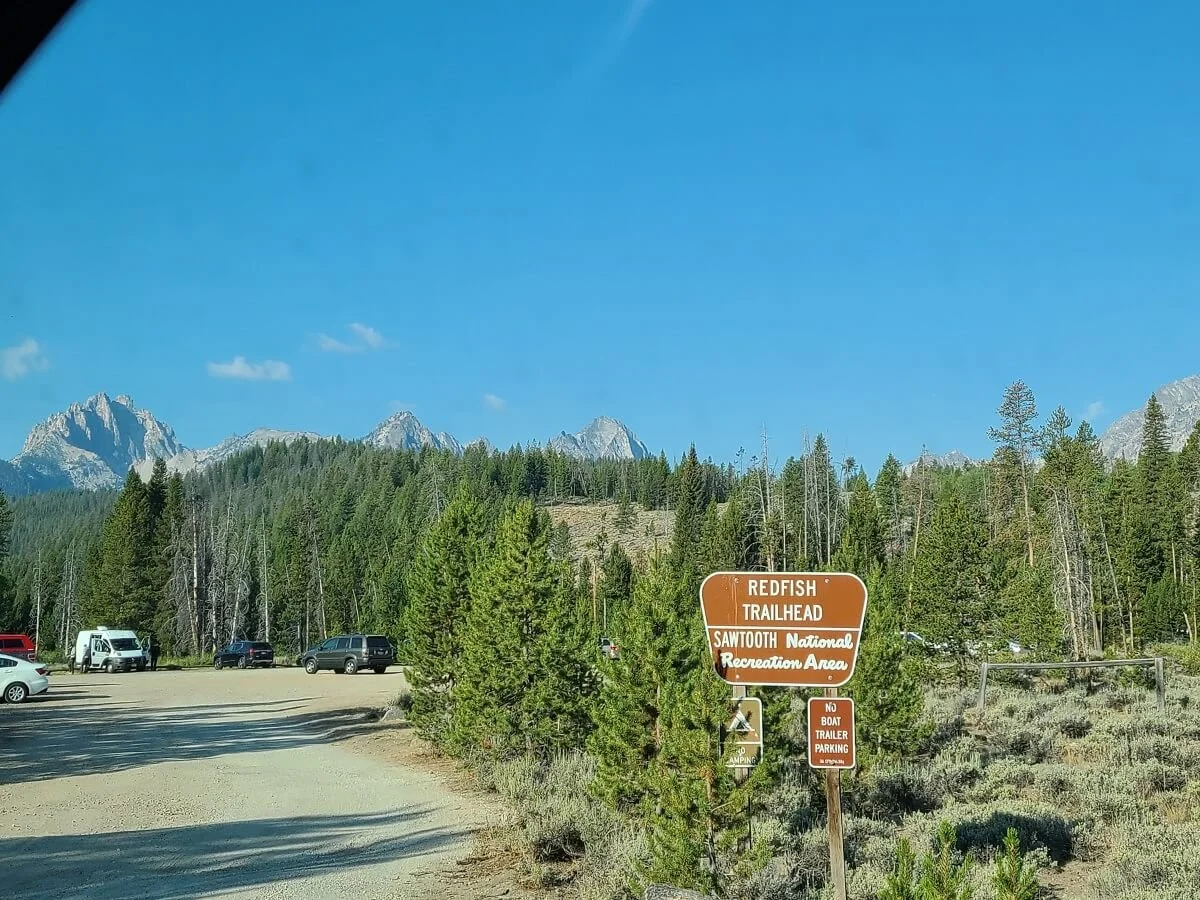
The trailhead for the Bench Lakes is found at the Redfish Trailhead, near the Redfish Lodge and Redfish Lake, a popular destination in the Sawtooth Mountains. This trailhead is about 12 minutes from Stanley. Head south on Highway 75 out of Stanley for about five miles until the right turn that goes to Redfish Lake. Go straight through the roundabout, and soon enough, the Redfish Trailhead will be on the right. The trailhead is at the far end of the parking lot. The Bench Lakes hike can be done as an out and back from here.
The start of the Bench Lakes Trail
We got to the Bench Lakes trailhead just after 9 am with plenty of parking available (it’s a pretty large lot). We were in the lot for about 40 minutes before starting our hike to the Bench Lakes and barely any other cars drove in. This is what we loved about the Sawtooth area…it’s still pretty crowd-free and you don’t have to wake up at the crack of dawn to get to trailheads!
Alternatively, you can make the Bench Lakes Trail a point-to-point hike by using the Redfish Lodge shuttle. This shuttle crosses the length of Redfish Lake and drops hikers off at the other side, allowing them to cut off a good chunk of hiking and access more distant alpine destinations on just a day hike. For the purposes of the Bench Lake Trail, you could take this shuttle across the lake, and then hike back to the Redfish Trailhead and Redfish Lodge Marina on the west side of Redfish Lake, hiking up to the Bench Lakes as a detour on the way.
The shuttle leaves on demand, so just show up without reservations! You can pay for a one-way ride with cash or credit card on the spot.
You could also do the opposite way and choose to hike first from the Redfish Marina, hike up to the Bench Lakes, and continuing hiking along the west shore of Redfish Lake to the shuttle pick up point, and then take the shuttle back to the marina. We wouldn’t recommend this, as there are scheduled pick up times from this side of the lake, so this really sets you on a schedule for your hike. Check out the Redfish Lodge Marina website for more information on pick-up times and updated prices (the last we checked, it was $16 for a one-way ride).
Bench Lakes trail map
This is a map of the Sawtooth hikes found around Redfish Lake. This sign is found at the Redfish Trailhead.
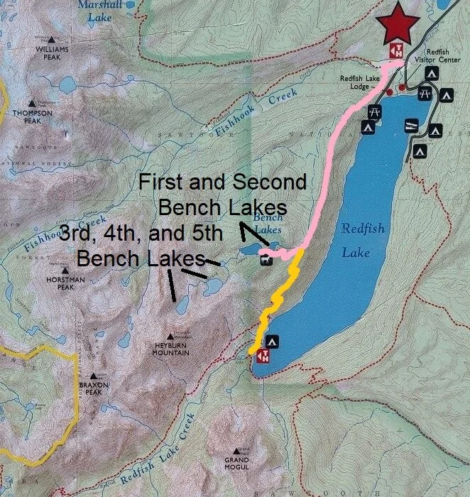
This trail map of the Bench Lakes shows the two approaches to the lakes. The Red Trail begins at the Redfish Trailhead and goes as an out and back up to the Bench Lakes. The Yellow Trail begins at the shuttle boat drop-off location at the other side of Redfish Lake. This map shows only the maintained trail up to the Second Bench Lake. Beyond that are the chain of three lakes with no marked trail.
We did the Bench Lakes Trail as an out and back hike from the Redfish Trailhead, so that’s how we will describe the hike here.
How Long is the hike to the Bench Lakes in Idaho?
Here is our hiking stats of the Bench Lakes hike in Idaho. We did this as an out and back hike out of the Redfish Trailhead, making it just beyond the Fourth Bench Lake.
Distance: 10.8 miles
Elevation gain: 1,706 feet
Time: 7.5 hours (total hiking time was more like 5.5 hours)
Trail profile:

The elevation profile of our hike up to the Fourth Bench Lake and back
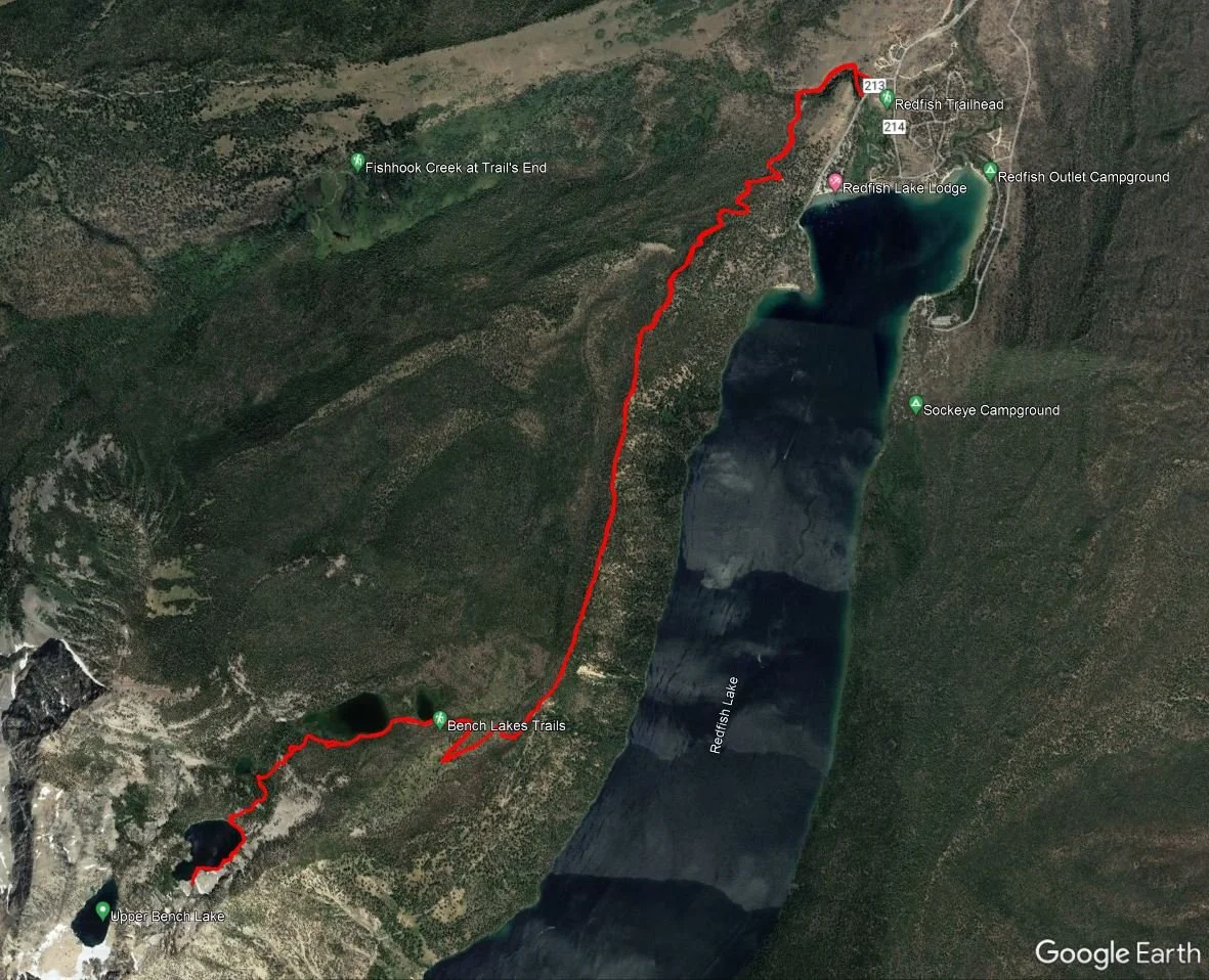
A satellite view of our hike to the Bench Lakes in Idaho
Here are the one-way trail stats for each of the first four Bench Lakes that you can use as benchmarks for your own route-finding:
Redfish Trailhead to First Bench Lake
Distance: 3.85 miles
Elevation gain: Approximately 1,100 feet
Time: One hour and 45 minutes
First Bench Lake to Second Bench Lake
Distance: 0.2 miles
Elevation gain: Negligible
Time: Approximately 5 minutes
Second Bench Lake to Third Bench Lake
Distance: 0.7 miles
Elevation gain: 130 feet
Time: 30 minutes
Third Bench Lake to Fourth Bench Lake
Distance: 0.3 miles
Elevation gain: 250 feet
Time: 40 minutes
How Hard is the Hike to the Bench Lakes in Idaho?
The hike to the First and Second Bench Lakes is relatively easy, though it is a bit long. However, the elevation gain is very gradual, the terrain is easy, and the whole trail is very straightforward. We thought it was an enjoyable hike for our “rest day” from more challenging Sawtooth hikes, and think it is pretty family-friendly for those used to some distance.
The hike beyond the Second Bench Lake becomes more challenging. As we’ve said, there is no longer a maintained trail, and you’ll have to rely on route-finding skills to navigate your way on herd paths and through blowdown and overgrowth. It can be pretty easy to lose your path. As we were coming back down from the Fourth Lake, we ran into one very frustrated couple who had gotten lost several times before the Third Lake and had to bushwhack a lot, which can get very tiring. Because you might end up going off track and have to retrace your steps and start over, we highly recommend having a good way to navigate, such as the old-fashioned map and compass, or some sort of GPS tracker. Kevin had his Garmin watch with the breadcrumb feature activated so that we could retrace our steps if we ever felt lost and like we needed to turn around.
Other than being navigationally difficult, the terrain on the hike to the upper Bench Lakes can be pretty unforgiving and exhausting. You will be hopping over quite a bit of blowdown and overgrowth, and you’ll have to hike up a few steep boulder piles. The longer you have to navigating through this terrain by getting off-track, the more tiring it becomes, and that ultimately is what led us to turn around before we made it to the Fifth Bench Lake. We knew we had gotten off track and were just too exhausted to really keep trying, and eventually decided to turn around, happy with the views from the Fourth Bench Lake.
Ultimately, don’t try to push yourself too much. Give it a bit of effort, and if you feel like you just can’t seem to go in the right direction, it’s okay to turn around. You’ll be on challenging terrain on an unmarked route, so you don’t want to risk getting lost or injured out here.
Hiking to the Bench Lakes in Idaho: Our Experience
Here is our experience and everything we learned from our hike to the Bench Lakes in Idaho. As much as we’d like to, it’s very hard to give or describe an exact route to get to the Third, Fourth, and Fifth Bench Lakes, as there are not markers or points of reference. We struggled to find any exact descriptions of the “trail” ourselves, but we’ll do our best to describe how we found our way up to the Fourth Lake, and our attempt to find the Fifth Lake, to give you an idea of what the Bench Lakes hike entrails.
Hiking to the First Bench Lake
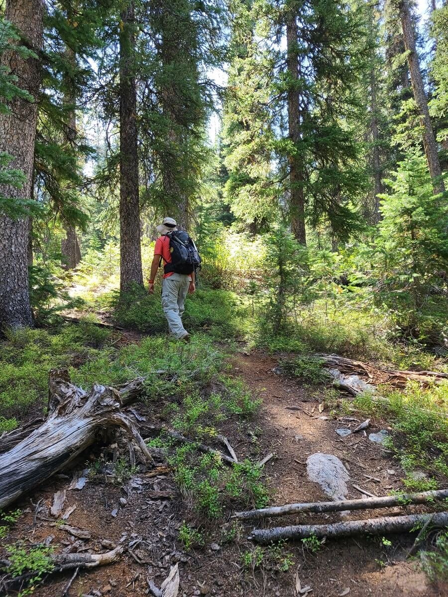
From the Redfish Trailhead, the Bench Lakes Trail starts off as a flat path through the forest that quickly opens up into an open field. After just about a quarter mile of hiking or so, you’ll come to your first junction. Take a left here, following the signs for the Redfish Lake Trail and Bench Lakes.

The beginning part of the trail to the Bench Lakes
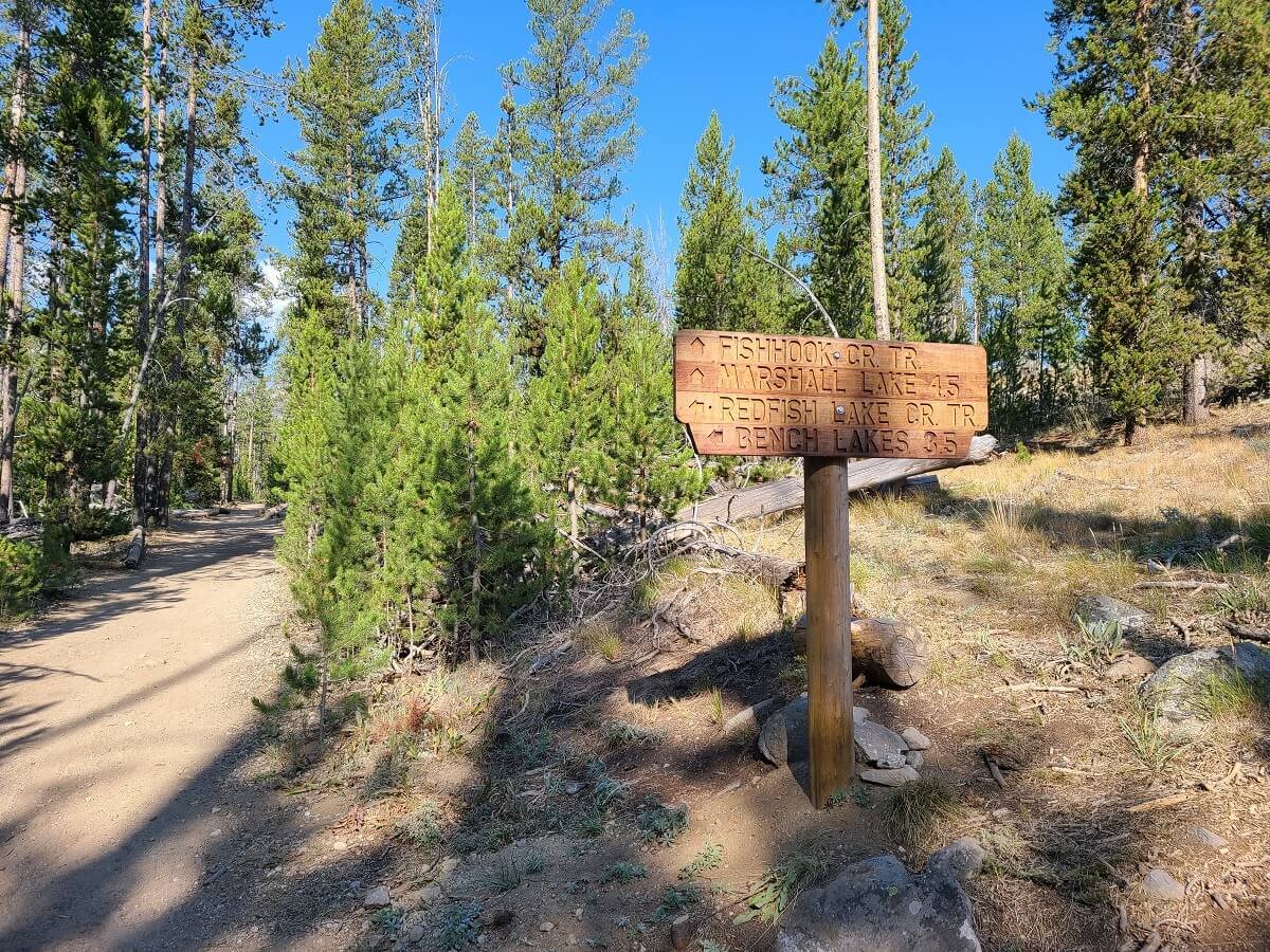
The first trail junction to the Bench Lakes
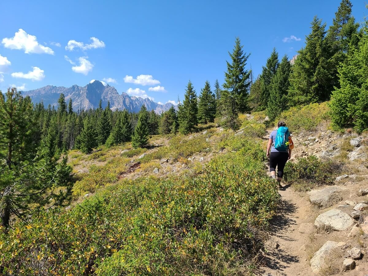
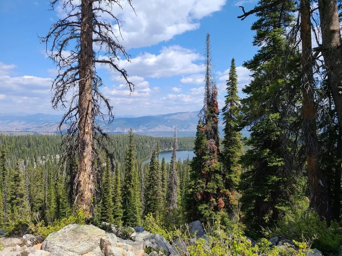
From here, the trail gradually climbs up to a ridge that follows the west side of Redfish Lake. Most of the climbing is done early on, and then once on the ridge, it’s pretty easy-going. On the ridge, it’s still pretty forested but you’ll get occasional views over Redfish Lake on your left, and of the Sawtooth Mountains to your right. In particular, you’ll see the jagged Mount Heyburn, underneath which the chain of five Bench Lakes sit. We thought this whole section was a very nice walk on a quiet trail.

The hike up to the ridge on the Bench Lakes Trail

A view over Redfish Lake from the Bench Lakes Trail
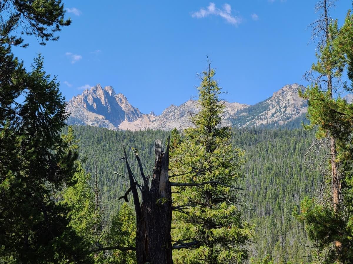
A view of Mount Heyburn (on the left) from the Bench Lakes Trail
About three miles into the Bench Lakes hike, you’ll hit your next trail junction. Take a right here, following the sign for the Bench Lakes.

The final junction before the Bench Lakes
Shortly after this junction, you’ll enter the Sawtooth Wilderness. There will be an informational sign and instructions for filling out a self-issued hiking permit. We suggest you do this, but especially if you plan on trying to hike past the Second Bench Lake in case something were to happen.

Stop here to grab your Wilderness Permit as you enter the Sawtooth Wilderness
From here, you’ll climb out of the forest on about 3 to 4 very long and mild switchbacks which will spill you out to the First Bench Lake.
Heading up the switchbacks to the First Bench Lake
The First Bench Lake is a peaceful lake with a nice reflection on a clear, windless day. It’s surrounded by trees with the jagged peaks of the Sawtooth Range making an appearance in the distance.

Beautiful views over the First Bench Lake
Hiking to the Second Bench Lake
We didn’t stay at the first lake for too long, and continued onto the Second Bench Lake. This lake is only 5 minutes away on a flat trail, and the views from this lake are slightly better than the first.
I though the Second Bench Lake had a nice color to it, and it was super clear with a nice reflection. Plus, from this lake, we got a better view of Mount Heyburn in the distance. Just the views from this lake alone made me glad we chose this hike despite the mediocre reviews we had read.
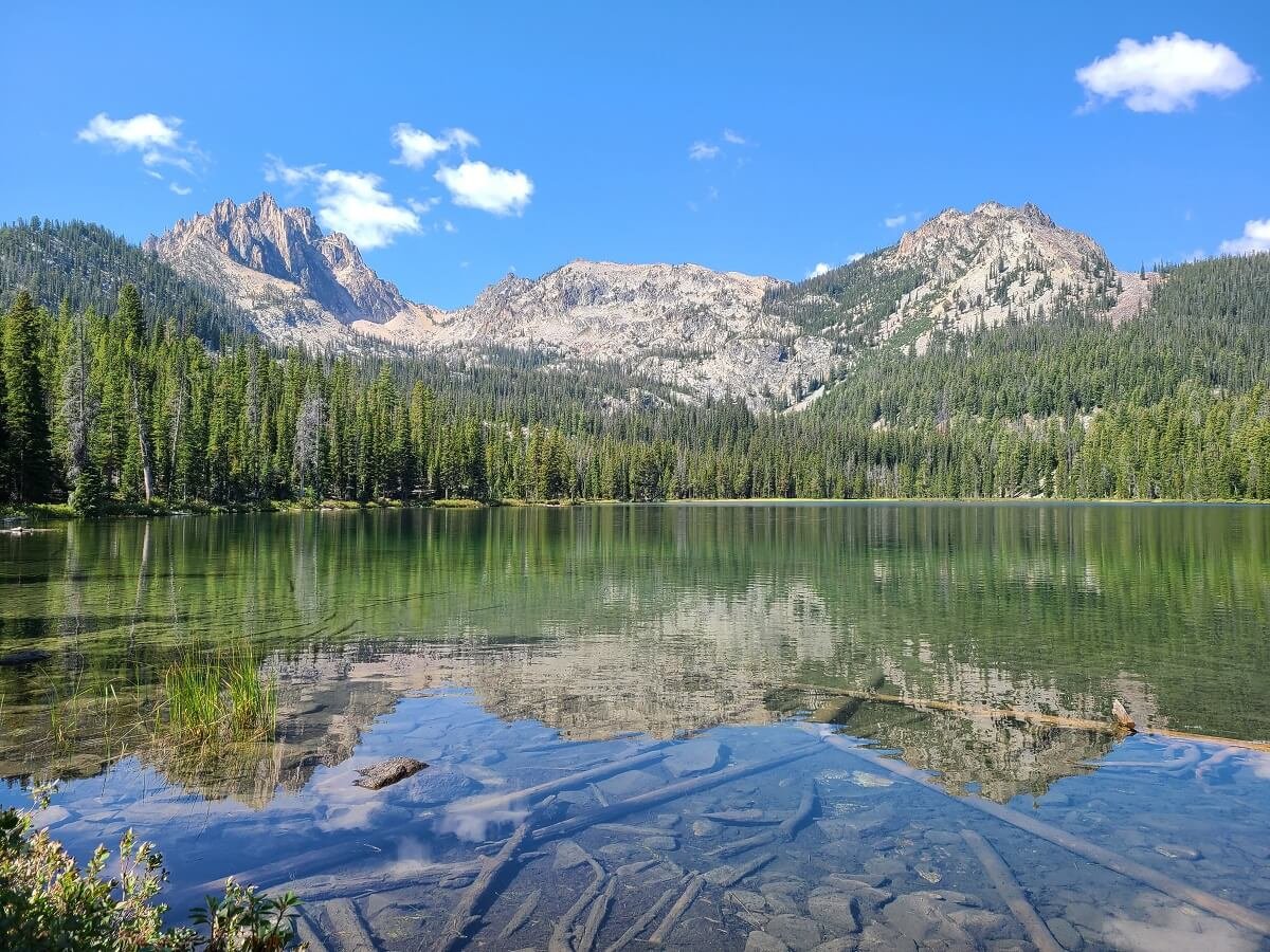
Nice reflections and color of the Second Bench Lake!
There are little heard paths that go around the lake in each direction, so if you follow these you can find your own little private lakeside spot (although there were never very many people up here to begin with). We sat and enjoyed the views for a bit while eating a snack. In the shrubs surrounding the lake, we heard the constant low of hum of what sounded like swarms of bees, but they never seemed to come out or really bother us.

Enjoying a quiet spot alongside the Second Bench Lake
Hiking to the Third Bench Lake
After a little while, we decided to continue on just out of curiosity to see how far we could get past the Second Bench Lake. We knew that the route continued around the left side of the lake, so that’s the direction we started heading in. There was a sign of a herd path this way, so we started to follow it, having to navigate through some blow down and overgrowth. About halfway around this side of the lake, the route does start to get a little confusing. We kept coming into open areas that looked as if there were a few different ways to go from there, but all we could say is that we kept following what looked to be the most “path-y” (can we make this a word?!). I am guessing that most of these herd paths were just made by fellow hikers before us trying to find their way, and they all end up going in the same general direction, but eventually, as we neared the other side of the Second Bench Lake, the route turned away from the lake, so we figured we were on the right track.


Between this point and the Third Bench Lake was the hardest and most confusing part of the route for us and requires some good route-finding. For me personally, I kept questioning where we were going and was afraid of going off route too much, but it was Kevin pretty much leading the way (his route-finding skills are much better than mine!). Thankfully, our tracking watch has a breadcrumb feature that tracks your path and allows for backtracking if needed, which made me feel infinitely better about continuing along. We kept going to where it seemed like it could be a path because of slightly less overgrowth, or by looking for old footprints, or slightly more stomped down soil or brush. Just as I would get a bit nervous, we’d stumble upon a more defined herd path for a bit that made us confident that we must be on the right route. Of note, we never had to do any serious bushwhacking, so if you feel like that’s what you’re doing, you’ve probably gotten off course. There were just a few times where we had to turn around because the vegetation got pretty thick and we felt like that probably wasn’t the right way.
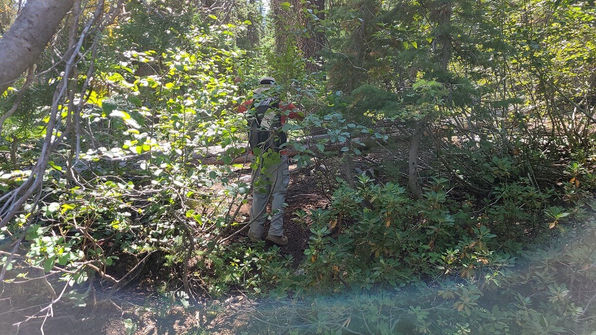
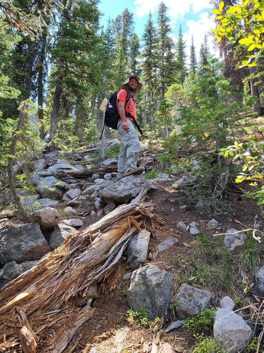
Navigating through blowdown on a faint herd path up to the Third Bench Lake

Hiking up the steep rock fields to the Third Bench Lake
As we hiked up the more steep rocky parts of the path, we would sometimes spot little rock cairns, which made us feel even better about our route-finding (thank you fellow previous hikers!).
Eventually, we stumbled on the Third Bench Lake. It was a bit in the distance and hard to access from where we were. It was very marshy around it, and from this vantage point it was a bit boring to look at (kind of just like a marshy pond). We didn’t feel the need to see if there was a way around it to get better views, and we kept continuing on.

A distant view of the Third Bench Lake
Hiking to the Fourth Bench Lake
From the Third Bench Lake, the route up to the Fourth Bench Lake seemed to be a bit more defined and easier to spot, although it became steep and rocky from here. However, in between the rocks we could see more well-worn paths through the dirt that guided us, and every now and then, we would see a cairn that led the way through the rocky areas. It’s steep through here, with some loose dirt and rocks and some larger boulders to navigate around.


Eventually, you’ll turn around and see the Second Bench Lake come back into view below, and you’ll know your close to the Fourth Lake! You can catch a glimpse of the bright turquoise water through the trees ahead, and it will be a little bit of a rocky descent to get to its shore.
View over the Second Bench Lake from above
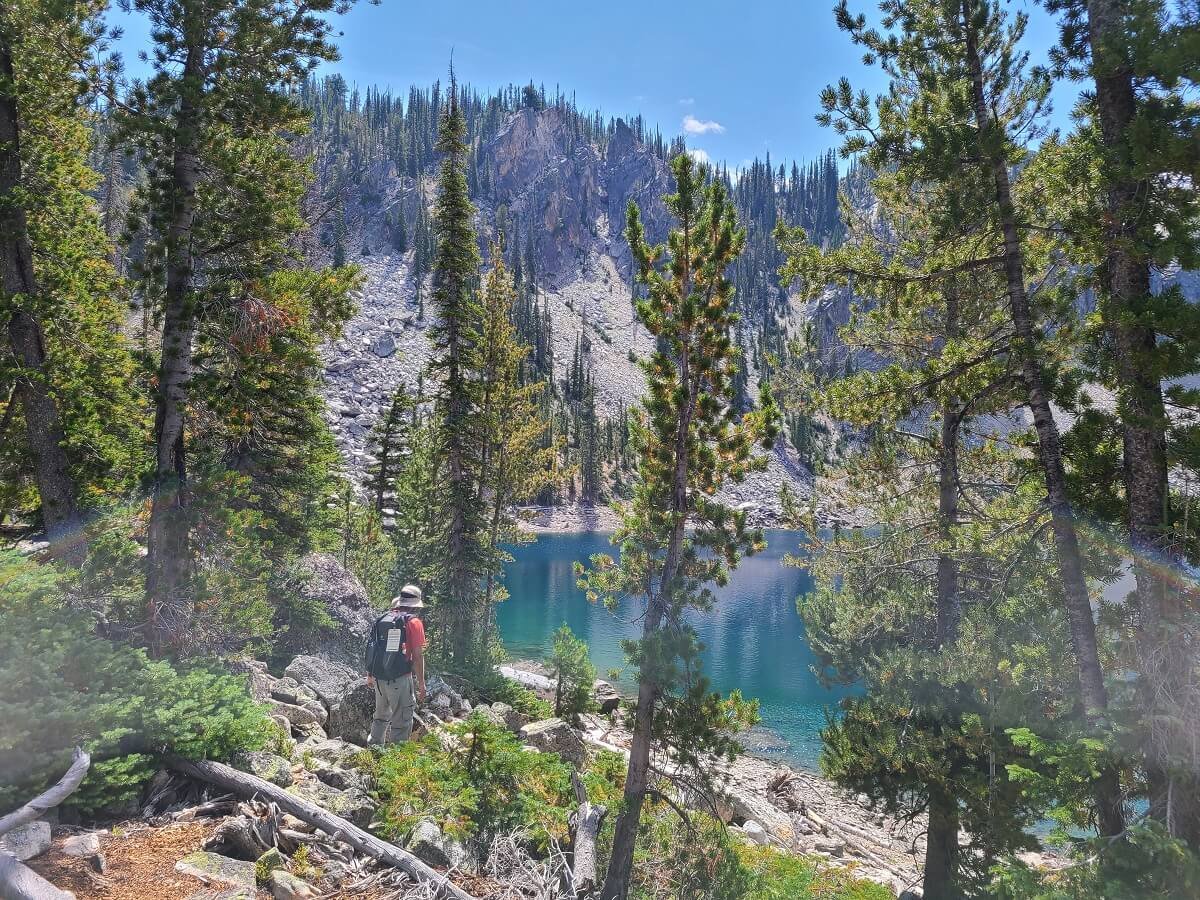
Finally made it to the Fourth Bench Lake!
After the climb it to get here, the Fourth Bench Lake blew us away. The Gatorade-like blue color combined with the epic mountain backdrop is absolutely stunning, and we had it all to ourselves.
Stunning views from the Fourth Bench Lake

When the wind stopped, the color and reflections from the Fourth Bench Lake were mesmerizing. The Fifth Bench Lake sits just up in the bowl above the lake and below Mount Heyburn.
We sat here for a while, just enjoying the view and our accomplishment of getting here. As a side note, the flies and bees here were super annoying, and were the one downside of being up here!
Hiking to the Fifth Bench Lake
Full disclaimer: we never made it to the Fifth Bench Lake, but maybe you could learn from our mistake!
As we sat at the Fourth Bench Lake, we knew exactly where the Fifth Bench Lake lied…just up in the bowl below Mount Heyburn. It didn’t look too much further or too much more of a climb from this vantage point. It was so close, but so far…
We scanned the landscape, trying to find a possible route up from the Fourth Lake. Either way we sliced it, approaching from the left or right, it looked like it would be a sketchy hike over steep, exposed, and maybe loose, rock.
We saw what looked to be a herd path heading around the left side of the Fourth Lake, so we decided to see where that led. We saw on the far side of the lake one spot in particular that looked sketchy, but we wanted to see for ourselves. The path around the lake required a lot of rock and boulder hopping, which was exhausting in itself.

Navigating the boulder field around the Fourth Bench Lake
It took us a bit of time, and we eventually ended up at the sketchy spot we saw from the other side of the lake. We basically hit a dead-end section where the rock got very steep over the lake and would require some scrambling to get around. Plus, we just didn’t see a clear path ahead, no signs of any cairns, and no idea if this was the right way. It’s something we probably could have done, but we decided to play it smart…we were alone on an unmarked trail and didn’t want to risk injury or expend a ton of energy trying to navigate this difficult and probably sketchy terrain. It was a little sad, but we decided to turn around.

Kevin trying to figure out a path ahead
As we were heading back around the lake, I kept glancing up at the basin where the Fifth Bench Lake lived, and it seemed more reasonable that the correct route was up the right side of the basin (it looked like it would be way less steep and exposed). I guess we just got too distracted with the herd path we saw going around the lake, and then simply tired ourselves out with all the rock hopping on that route. When we got back to the other side of the lake, we climbed back up to the path we had come up on and briefly tried to find anything that resembled a herd path from here that continued up to the Fifth Lake. It was really hard to tell…there were no cairns and there was so much tree blowdown that it was hard to tell which direction to take. I followed what looked to be something promising for a bit and then got to a point where I would end up having to really bushwhack. At this point, we didn’t want to keep trying and exhaust ourselves even more (after all, this was supposed to be our “rest day” hike!), and it was getting late in the day. We were happy enough to get to the stunning Fourth Bench Lake, and headed back down the way we came. I have a strong feeling, though, that if you’re trying to get up to the Fifth Bench Lake, this is the side of the lake to route- find on.
We got back down to the Second Lake pretty easily, as we were able to recognize different parts of the trail from when we came up.


We rested briefly at the Second Bench Lake and then made the long hike out.
We finished the Bench Lakes Trail slightly bummed that we didn’t make it all the way, but that just gives us another reason to head back one day and give it another try! Plus, I can’t complain with the beauty of the other lakes we did get to see (well, maybe just the third one…). Overall, we really enjoyed the Bench Lakes Trail, and would recommend the hike out to at least the second lake!
Best Time to Hike to the Bench Lakes in Idaho

The Fourth Bench Lake!
The best time to hike in the Sawtooth Mountains is from mid-July to September. This is when the trails are likely to be clear of snow, but always check recent trail reports, conditions and weather before you head out on a hike. If you plan on hiking past the Second Bench Lake in particular, you don’t want to go with any snow or wetness on the trail- it would just make the trail more dangerous and potentially harder to navigate.
Where to Stay Near the Bench Lakes in the Sawtooth Mountains
The small mountain town of Stanley is often used as a base for exploring the Sawtooth Mountains. Here, there are several lodging options, restaurants, and adventure tour companies for things like white water rafting and horseback riding. Plus, it’s just minutes away from all the best hikes in the Sawtooth Mountains.
The town of Ketchum is a little bit more substantial, but is an hour away from Stanley and the Sawtooth hikes, however, it has its own set of mountain views, hikes, and outdoor activities.
The Sawtooth and Redfish Lakes Lodges are good options for a mountain getaway in the Sawtooth range.
Camping in the Sawtooth Mountains
The Sawtooth Mountain area has an incredible network of campgrounds, both serviced and dispersed. Check out the USDA website (look at the options under “Sawtooth National Recreation Area” for all the options for camping in the area. Some are first come first served sites while others require reservations in advance. Here, you can also find prices and amenities for each site.
There is also a ton of great dispersed free camping around the Sawtooth Mountains as well. In fact, the sites are some of the best dispersed camping spots we’ve been to. They are run by the US Forest Service and are pretty much like regular campgrounds with designated but well-spaced out sites. Some even have vault toilets in the camping area. However, they are still primitive so don’t expect water or any other amenities. Check out this site with some areas with dispersed camping (again, look under the Sawtooth National Recreation Area section). We camped in one of the areas near the Salmon River and loved it. It was peaceful and quiet and pretty well-maintained for a dispersed camping site.
Tips for Hiking to the Bench Lakes in Idaho
Here are some of our tips for hiking to the Bench Lakes in Idaho, some of which we already mentioned, but are worth mentioning again!
Track your hike. When hiking to the Bench Lakes, make sure to have some sort of GPS tracking device that will allow you to track your hike and retrace your steps if needed. Having an emergency device like a Garmin InReach is smart to have as well since you’ll be doing off-trail hiking on rugged terrain.
Take lots of pictures. Not just for memories, but for remembering your route for finding your way back down to the Second Bench Lake.
Bring bug spray. The bugs can be brutal here in the early summer months.
Permits and fees. There are no fees or advanced permits necessary for hiking any of the Sawtooth Mountain trails! Usually once you enter the Sawtooth Wilderness along a trail, you will pass a sign with instructions to self-register for a free wilderness permit that you should keep with you during the hike.
Weather in the Sawtooth Mountains. Did you know that Stanley, Idaho is one of the coldest places in the lower 48? Because it’s located in a low basin surround by several mountain ranges, the cool air tends to sink and sit there, keeping temperatures cooler. In the summer, the daytime can reach up to 80 degrees Fahrenheit or so, but the nights are still frigid and in the 30s. Make sure to bring warm layers both for at night and while on your hike!
Be bear aware. The Sawtooth Mountains do have black bears, so read up on safety precautions before hiking to the Bench Lakes.
Other Things to Do Near the Bench Lakes Trail in the Sawtooth Mountains
There are so many amazing hikes in the Sawtooth Mountains. Some of our other favorites include the hike to Sawtooth Lake, and the Alice-Toxaway backpacking loop. We will be writing guides for these, as well as a Southern Idaho road trip itinerary, soon!
Are you up for hiking to the Bench Lakes in Idaho? Let us know if you have any questions! And let us know if you made it to the Fifth Bench Lake, and any tips or pointers on getting there!