How to Hike the Burroughs Mountain Trail in Mount Rainier National Park
The Burroughs Mountain Trail is an incredible hike in Mount Rainier National Park, with the best up- close views of Mount Rainier in the entire park! In this guide, we’ll go over everything you need to know to hike the Burroughs Mountain Trail in Mount Rainier, including how to get there, when to go, what to expect on the trail, and more.

Mount Rainier National Park in Washington is a treasure trove of absolutely stunning hiking trails. From groves of giant ancient trees to scenic waterfalls, epic vistas, and wildflower-filled meadows, this park has it all, but our favorite Mount Rainier hikes are the ones that give those incredible in-your-face views of Mount Rainier itself. There’s no shortage of these hikes in the park, but our particular favorite is the Burroughs Mountain Trail.
Located in the picturesque Sunrise area of the park, The Burroughs Mountain Trail in Mount Rainier National Park is a nearly ten- mile hike through the alpine tundra landscape that offers non-stop incredible views (seriously!) of Mount Rainier, its glaciers, and the surrounding valleys that rival those of the more popular trails in the park, like the Skyline Trail and Mount Fremont Trail. By the end, the trail brings you so close to Mount Rainier that you feel like you can almost reach out and touch it. On a clear day, you can even see out to other notable Washington State landmarks like Mount Baker, the Cascades, and the Olympic range. Plus, you may even get to see cool wildlife, like marmots and mountain goats!
While there are views the entire way, the Burroughs Mountain Trail consists of three particular viewpoints, or summits- the First Burrough, Second Burrough, and Third Burrough- and there are a few different route options you can take to get to them. You can choose to just do one, two, or do all three, and you can do them as an out- and- back hike or make it into an epic loop that promises new scenery the entire time.
In this guide, we’re covering everything you need to know to hike the Burroughs Mountain Trail in Mount Rainier National Park. We’ll go over how to get there, the different route options, what to expect along the trail, when you should go, what to bring, and more. So, let’s get to it!
In this Burroughs Mountain Trail guide:
Route options for the Burrough Mountain Trail in Mount Rainier National Park
How long is the Burroughs Mountain Trail in Mount Rainier National Park?
Best time to hike the Burroughs Mountain Trail in Mount Rainier National Park
Hiking the Burroughs Mountain Trail in Mount Rainier National Park: Our experience
Check out our other Mount Rainier Trail Guides!
The Mount Fremont Lookout Trail
Dege Peak
The Skyline Loop Trail
The Tolmie Peak Lookout Trail
Where is the Burroughs Mountain Trail?
The Burroughs Mountain Trail is found in Mount Rainier National Park, just over two hours south of Seattle.
Mount Rainier is a pretty big National Park, with five main regions and four entrance stations, so you’ll want to make sure you head to the right one! The Burroughs Mountain Trail is found at the Sunrise region of the park, on the park’s eastern side. To get here, you’ll go through the White River Entrance.

The Sunrise region of Mount Rainier National Park
How to get to the Burroughs Mountain trailhead in Mount Rainier
The road to the White River Entrance and into Sunrise is off of State Route 410 outside of Enumclaw, WA. The White River Entrance is about an hour and 44 minutes from Seattle. Be prepared to show your park pass or buy one here (it’s $30 per vehicle for a 7 day pass).
From the entrance, it’s about another 30-40 minutes and 14 miles to get to Sunrise. The road is paved, but it is windy and sometimes goes by some bits of steep exposure on one side (but it’s usually guarded by trees or stonewalls so it’s really not scary). From the entrance station, you’ll climb from an elevation of 3, 500 feet up to the Sunrise Visitor Center at 6,400 feet, making this the highest point in the park that you can drive to. Most of the drive is wooded, but the benefit to this is that once you get close to the parking lot when the views really open up, your first view of the mountain will be literally breathtaking. Be sure to stop at the Sunrise Point lookout for amazing views of Mount Rainier, Sunrise Lake, and the surrounding area.

A view of the road into Sunrise…talk about a scenic drive!
The Sunrise parking lot is quite big, but can fill up by mid-morning, so be sure to get there early! The parking lot has a visitor center, picnic area, a day lodge serving food, bathroom, and water fill stations.
There are two different trailheads for the Burroughs Mountain Trail from the Sunrise parking lot- one leaves from the North end of the lot, and one leaves from the South end. Which one you take depends on your preferred route. So, let’s go over the Burroughs Mountain Trail route options now!
Route Options for the Burroughs Mountain Trail in Mount Rainier National Park
There are a few different ways to hike the Burroughs Mountain Trail- as an out and back, or as a loop.
Burroughs Mountain Trail via Sourdough Ridge: This is an out and back hike. You’ll take the trailhead at the North end of the lot near the visitor center and head up to the Sourdough Ridge. Take this trail to Frozen Lake, and from there, head up to the First Burrough. If you’d like, continue from there to the Second and Third Burroughs before turning around and heading back the way you came. This is the shortest and easiest route for hiking the Burroughs Mountain Trail.

This is the trailhead to go to the Sourdough Ridge Trail which leads to the Burroughs Mountain Trail
Burroughs Mountain Trail via Sunrise Rim: This is an out and back hike, starting at the trailhead at the South end of the lot opposite the visitor center that goes towards Emmons Vista. On this trail, you’ll hike up to the First Burrough around its other side, with views into the White River Valley and head-on views of Emmons Glacier. From the First Burrough, continue on the Burroughs Mountain Trail to the Second and Third Burroughs before turning around and heading back the way you came. This is the longest way to do the Burroughs Mountain Trail, but the good thing about this way is that it avoids the crowds found on the other side of the Burroughs around Frozen Lake and along Sourdough Ridge.

Views from the Sunrise Rim Trail on the way to the Burroughs
Burroughs Mountain Loop: Combine the two trails above- the Sourdough Ridge and Sunrise Rim- for an epic loop hike to the Burroughs Mountains! The benefit of this route is that you get the best of both worlds (amazing views from the Sourdough Ridge, and less crowds on the Sunrise Rim trail with equally amazing views) and have different scenery on the way up and down. This is the way we hiked the Burroughs Mountain Trail, and we highly recommend it!
Other route options for the Burroughs Mountain Trail
The trails out of Sunrise are the main ways to hike the Burroughs, but they aren’t the only options. Here are two more ways you can hike the Burroughs Mountain Trail that avoid the crowds in the Sunrise area. They do require a bit more effort, though, as you’ll have to climb up to the Sunrise area instead of simply driving there, but we thought they were worth mentioning just in case these interest you!
White River Campground: Start from the White River Campground, located off a side road about half way up the road to Sunrise. From here, it’s a 2.6 mile uphill climb up the Wonderland Trail to Shadow Lake along the Sunrise Rim Trail. From here, you’ll resume the hike on the Sunrise Rim up to the First Burrough.
Glacier Basin Trail: From the White River Campground, you can hike about 2 miles in to a junction just before the Glacier Basin backcountry campground. Head up the steep trail, where it will spill you out to the valley that sits between the Second and Third Burrough. From here, you can hike all the Burroughs.
Make it a loop: You can combine the two trails above to make one giant loop starting and ending at the White River Campground.
Burroughs Mountain Trail map
We know our route descriptions above probably don’t make much sense without a map, so here it is! Below we highlight all the route options for the Burroughs Mountain Trail that we mentioned above to help you better visualize what your options are.

A map of the Burroughs Mountain trail system. Blue is the approach to the Burroughs via the Sourdough Ridge. Purple is the approach via Sunrise Rim. The red trail is the Burroughs Mountain Trail that goes to all three Burroughs. The gray trails are those that start from the White River Campground in the valley below. Our route was the Burroughs Mountain Loop in a clockwise direction: the purple trail, then the red trail out and back, and lastly, the blue trail back to the lot.
How Long is the Burroughs Mountain Trail in Mount Rainier National Park?
No matter which way you slice it, the Burroughs Mountain Trail will take at least a half a day if you want to do the full hike to all three Burroughs. Of course, you can always just hike to the First or Second Burroughs and shorten the hike up a little if you’re short on time or energy.
Here are our stats hiking the Burroughs Mountain Loop Trail, starting on the Sunrise Rim and hiking back on Sourdough Ridge.
Distance: 8.9 miles
Elevation gain: 2,500 feet
Time: 7 hours (This is with about 2.5 hours total of enjoying each of the summits! We had an actually hiking time more like 4.5 hours…but definitely plan in some extra time for hanging out at the top!)
Trail profile:

Our elevation profile of the Burroughs Mountain Trail. It’s worth noting that we tagged on Dege Peak at the end of our hike, so we cut off the elevation profile where we began that portion of the hike. So, this trail profile of the Burroughs Mountain Loop ends at the junction on the Sourdough Ridge that heads back down to the Sunrise lot (so it only cuts off the last .3 miles back to the car).
Here are the one-way distances for alternative Burroughs Mountain Trail options:
Sourdough Ridge to First Burrough: 2.1 miles
Sourdough Ridge to Second Burrough: 2.7 miles
Sourdough Ridge to Third Burrough: 4.2 miles
Total out and back distance for all three Burroughs via the Sourdough Ridge: 8.4 miles
Sunrise Rim to First Burrough: 2.6 miles
Sunrise Rim to Second Burroughs: 3.2 miles
Sunrise Rim to Third Burroughs: 4.7 miles
Total out and back distance for all three Burroughs via Sunrise Rim: 9.4 miles
White River Campground to First Burrough: 4.7 miles (and an additional elevation gain from 4,300 feet to 6,200 where it meets up near Shadow Lake)
White River Campground to junction between Second and Third Burroughs: 2.6 miles to the junction just before Glacier Basin Campground (climbing from 4,300 feet to 5,500 feet) and 1.5 miles up to the valley between the Burroughs, while climbing an additional 1,600 feet!
How hard is the Burroughs Mountain Trail?
We would say the Burroughs Mountain Trail in Mount Rainier National Park is on the moderate side. There’s nothing overly difficult or technical about it, but it is a steady and consistent climb to each Burrough, regardless of the route you take.
We would say the Sourdough Ridge route to the First Burrough felt a bit easier (a little less steep) than the Sunrise Rim approach, which has a longer continuous climb, but either way, expect sections of steady and consistent climbing.
Each of the three Burroughs has a small valley in between, so there is a bit of up and down with this trail on the way out, and then again on the way back. The trail between the Second and Third Burroughs is the toughest part of the whole trail. From the Second Burrough, you drop about 400 feet, and then climb back up about 800 feet to the top of the Third Burrough, and it’s a very steep climb up loose gravel and possibly some slippery snow patches. Many hikers on the Burroughs Mountain Trail don’t make it out this far (in fact, with each Burrough, the crowds get thinner and thinner), and that’s totally fine, because there are great views from all three summits! But if you do make the effort to hike out this far, you’ll be rewarded with stunningly close views of the Winthrop Glacier that make you feel like you can just reach out and touch it. You’ll see what we mean when we describe our experience on the Burroughs Mountain Trail below!
Typical trail conditions on the Burroughs Mountain Trail

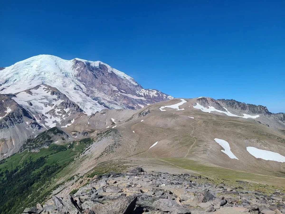
This is the view of the Burroughs Mountain Trail as seen from the start of the Mount Fremont Trail. You can see the entire trail climb up to the First Burrough. The bump below the summit of Mount Rainier is the Second Burrough. The furthest bump is the Third Burroughs!
Also be aware that snow can linger on parts of the trail well into July or later. When we were there in mid-July, we had to cross a few snow patches. The most difficult ones were on the way up to the Third Burrough, as they were on the really steep parts of the trail and quite slippery. Having trekking poles really helped here, and while we didn’t pack our microspikes for this hike, we would recommend that you do because it would have made walking up and down these patches much easier and safer.
Best Time to Hike the Burroughs Mountain Trail in Mount Rainier National Park

Epic views from the end of the Burroughs Mountain Trail!
The best time to hike the Burroughs Mountain Trail is from July to September. The road into Sunrise is generally only open during this time (you can check the road status here). This is also the best window for good weather and snow-free trails (although snow can linger well into July as it did for us!). In July and August, the meadows around Sunrise fill with beautiful pink and purple wildflowers as an added bonus!
Hiking the Burroughs Mountain Trail in Mount Rainier National Park: Our Experience
We want to share our experience hiking the Burroughs Mountain Trail to help you decide which route you’d want to take and how far you’d want to go on the trail before turning around (and if you want to tackle that tough Third Burrough!).
We did the Burroughs Mountain Loop, starting on the Sunrise Rim, hiking out to all three Burroughs, and then hiking back along Sourdough Ridge (so, a clockwise direction). Does it matter which way you hike the Burroughs Mountain Loop? We don’t really think so. In either direction as you are hiking to the First Burrough, the views of Rainier are gorgeous, so on the way back on either trail, you’ll always have to be turning around for the views as you head out. We would say the approach to the First Burrough on the Sourdough Ridge might be a bit easier than the Sunrise Rim approach just because the climb will be broken up a bit more into shorter bits of steep climbs rather than one long continuous climb up the Sunrise Rim Trail. So, head counterclockwise on the loop if this sounds more appealing to you.
Here is our experience hiking the Burroughs Mountain Loop clockwise!
Sunrise Rim Trail to the First Burrough
Time: Approximately 1.5 hours
We got to the Sunrise parking lot nice and early…just after 7 am. We were worried about parking and crowds, but when we got there, the lot was practically empty!
Even the views from just the parking lot are breathtaking, so you can only imagine what your day on the Burroughs Mountain Trail has in store for you!

Views from the parking lot at the Burroughs Mountain Trailhead
We started on the trailhead opposite the Visitor Center around 7:30 am. A short flat trail leads right to your first viewpoint of the day, the Emmons Glacier Overlook. Here, you get an incredibly picturesque view of the Emmons Glacier, which is the glacier with the largest surface area of any glacier in the lower 48! You’ll also see the glacial moraine and the valley stretching out in front of it. An amazing view for sure, but they’ll just keep getting better from here!

The Sunrise Rim Trail starts off flat and easy

A postcard-worthy view from Emmons Glacier Overlook
From the overlook, it’s an ever so slight downhill hike into a beautiful wildflower-filled meadow section. Shortly after, at about a half mile into the trail, you’ll come to an intersection with the Wonderland Trail. Stay straight here to avoid hiking down into the White River Valley!

Trails in Mount Rainier National Park are super well-marked at the junctions

Hiking beside the wildflowers on the Sunrise Rim Trail
The trail will be flat for a bit (enjoy it!) and eventually at about 1.2 miles in, you’ll see Shadow Lake and then just past that will be Sunrise Camp, a backcountry campground that has a vault toilet (when we were there, there was no toilet paper so make sure you bring some with you!). At the junction, continue straight to stay on the Sunrise Rim Trail (and not the Wonderland Trail).

Shadow Lake along the Sunrise Rim Trail
Just after this junction, the ascent up to the First Burrough begins. It’s a long consistent climb that doesn’t really end until you’re at the Burrough 1.3 miles later.

The steady climb up to the First Burroughs
The trail climbs steadily up to your second overlook of the day, the Glacier Overlook, which gives another stunning view of Rainier and the valley below, but this time a little closer up. As an added bonus, we had this cute little marmot lounging out and checking out the views with us!


Overlooking Mount Rainier and the White River Valley
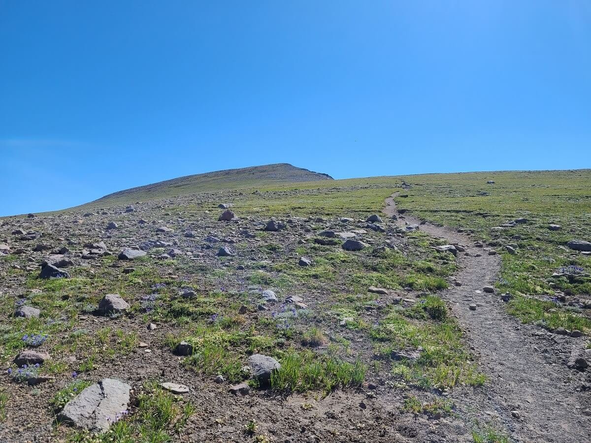
From here, the trail turns and you are now entering alpine tundra. The terrain becomes a bit rockier and more exposed as the trail steadily climbs and skirts along the side of a rocky slope heading up to the Burroughs. Along this trail, you’ll inch closer and closer to Mount Rainier, the entirety of which is now splayed out directly in front of you as you climb.

It’s a steady climb from here but the views are amazing!

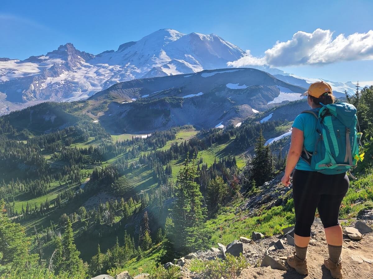
Mount Rainier in full display from the Sunrise Rim Trail!
These views were incredible! It was as if we were staring into a giant real-life Bob Ross painting! At this point, we felt like we were already super close to the mountain, but we were just getting started, and we would end up getting way closer. We were also really glad we decided to do the Burroughs Mountain Trail as a loop because from here, you see a different angle of Rainier than you do from the Sourdough Ridge. Don’t forget to also look behind you every now and then as well to get views of the White River Valley stretching out into the distance.

Getting closer to the First Burrough

Don’t forget to look behind you for views of the White River Valley
As we got closer to the First Burrough, there was one small snow patch that still lingered on the trail that we had to cross. Luckily it was short enough and packed down enough where it wasn’t an issue.

Crossing a small snow patch on the Burroughs Mountain Loop
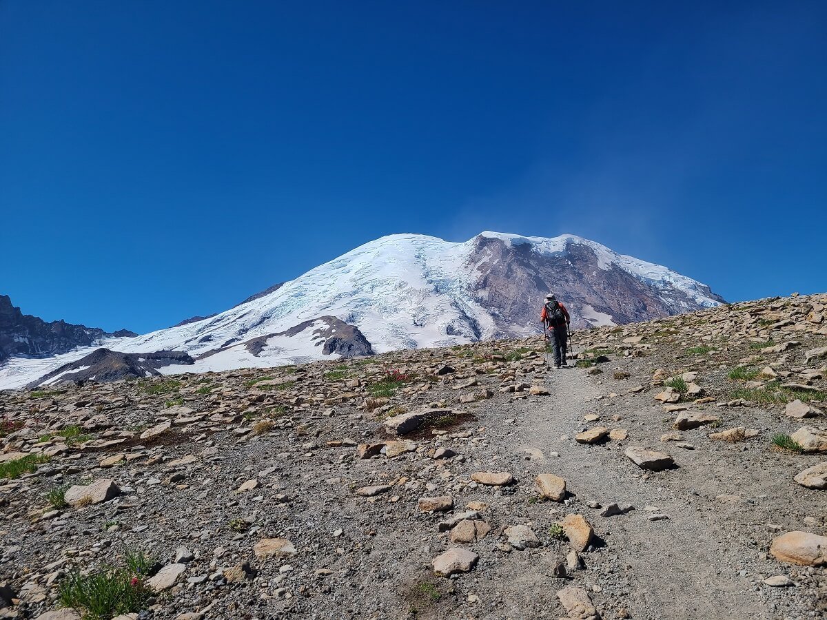
Eventually the trail makes a turn around a corner and you can see the Burroughs Mountain Trail in the distance as it climbs up to the Second Burrough. It’s exciting to see just how much closer you’ll be getting to the mountain on this trail!

The trail in the distance is the one you’ll be climbing to get to the Second Burrough

Some of the final bits of climbing to the First Burrough
At about the 2.6 mile mark, you’ll be standing on top of the First Burrough! It’s a small flat area with gorgeous 360 degree views. To the North, you can see a huge portion of the entire Sunrise area trail system spread out in front of you, including the Mount Fremont Trail and the Fremont Fire Tower out in the distance, and on a clear day Mount Baker looms behind it.

On top of the First Burrough!
Views over the Sunrise area from the First Burrough

The view west as the Burroughs Mountain Trail continues on to the Second Burrough
The top of the First Burrough is where both trails (the Sunrise Rim, and the approach from Sourdough Ridge) meet up. From here, a single trail continues onto the Second Burrough. You can see the entire trail ahead…it makes a short and easy descent into a small valley and then climbs back up to the Second Burrough. We enjoyed the view up here for about 20 minutes and on we went…
Hiking to the Second Burrough
Time: Approximately 20 minutes
The hike between the First and Second Burrough is pretty easy, so we would highly recommend you at least make it out to the Second Burrough before deciding to turn around.
It’s about 0.6 miles between the two Burroughs and involves a steady climb but it’s short and over with pretty quickly.

Starting up the short climb to the Second Burrough

Almost there!
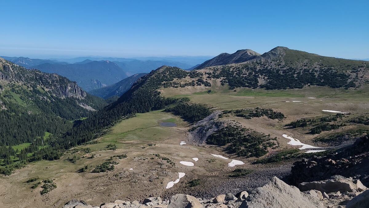
From the top of the Second Burrough, you are much closer to the mountain now and you are rewarded with even more epic views of Mount Rainier. From this viewpoint, you get the contrast of the whites and grays of the mountain with the bright lush greens of the White River Valley below it (which were blocked from view on the First Burrough), and this colorful contrast really makes this viewpoint amazing. We stayed up here for an entire hour eating lunch and soaking in the views. If you do plan to enjoy a snack up here, watch out for the rascal chipmunks up here who will try to steal your food!

Stellar views of Mount Rainier from the Second Burrough!

Watch out for these food thieves!

A close up shot of the Fremont Fire Tower in the distance
Hiking to the Third Burrough
Time: Approximately 70 minutes
From the Second Burrough, you can see the Burroughs Mountain Trail continue onto the Third Burrough, and we won’t lie, it looks very intimidating. It dips down into a valley quite a bit (meaning we would have to climb back up for the hike back!) and then climbs quite a bit back up the other side, and it looked steep. We questioned (only for a second) if we wanted to continue on, but judging by how close it went to the mountain, the answer was an instant yes!
The intimidating trail up to the Third Burrough
So, on we went. The first part of the trail makes a couple of long switchbacks down into the valley. This part of the trail goes pretty fast, as it’s pretty smooth and not rocky like it has been to this point. We cruised down to the bottom in about ten minutes. About half way down is the junction to head down into the White River Valley, but your mission now is to head directly up the mountain in front of you!

Heading down into the valley between the Second and Third Burroughs
The climb up to the Third Burrough is quite steep, steady, and long. You’ll be hiking up mostly sandy gravel with some loose rock scattered in it, and it’s really just a grind. But trust us when we say it’s worth it. As you get higher, Mount Rainier will poke its head back out into view above the Burrough, and this is the motivation that will keep you going. It will look so close and massive.

The steep climb up to the Third Burroughs as Mount Rainier begins peeking back out

The slog up to the Third Burrough
Towards the top of the climb, there was one snow patch we had to cross. It was on a steep slope and quite slippery, so having trekking poles for this was definitely helpful for balance both on the way up and down.

Crossing the snow patch on the way up to the Third Burrough

Epic views on the Burroughs Mountain Trail!
The last bit before the summit felt the steepest, but when you crest the ridge and come face to face with Mount Rainier herself, your jaw will quite literally drop. You’ll be so close to the mountain you’ll feel like you can reach out and touch it…we didn’t realize how close you can actually get to Mount Rainier without climbing it! You’re so close here you can even hear the occasional cracking of the glacier.

The final push to the summit of the Third Burrough!

Incredible views at the end of the Burroughs Mountain Trail…see, we told you they were worth it!

The reward at the end of the Burroughs Mountain Trail
To get to the end of the trail, you’ll hike a short boulder-filled ridge to get to the true summit, but really, anywhere along this ridge has incredible views, and there won’t be too many people up here to share it with, so pick a spot and enjoy! You earned it.

The ridge on top of the Third Burrough
The Burroughs Mountain Trail via the Sourdough Ridge
Time: Approximately 2 hours
Eventually it was time to go. I was kind of dreading the climb down and back up to the Second Burrough, but honestly it wasn’t bad at all. I think after the climb to the Third Burrough, the climb back up to the Second seemed shorter and easier, and we were able to power up it. As a bonus, we even saw a majestic mountain goat off in the distance!
Heading back down the Third Burrough
Looking up the trail back up the Second Burrough…it’s not as bad as it looks!

The climb back up to the Second Burrough

A mountain goat!
The hike back to the First Burrough was super easy, with minimal climbing to get back up to it.
At the First Burrough is where the two paths diverge- you can either head back down the Sunrise Rim or head down the other side towards Frozen Lake and the Sourdough Ridge, which is what we did.

Looking towards the First Burrough on the way down from the Second Burrough. Frozen Lake is in the distance.
The trail to Frozen Lake was an easy but steady descent with beautiful views over the area. This is where we saw by far the most people of the day, as many hikers will head up to the First Burrough and back from the Frozen Lake area.

Heading down from the First Burrough to the Frozen Lake junction

The view back toward Mount Rainier and the First Burrough as you begin the descent down to Frozen Lake
There was a mob of people at Frozen Lake, which was expected midday, as this is a central hub for many hikes in the area and it’s pretty easy to get to, but from here, everyone spreads out along the trails so most of the trails themselves don’t seem overly crowded.
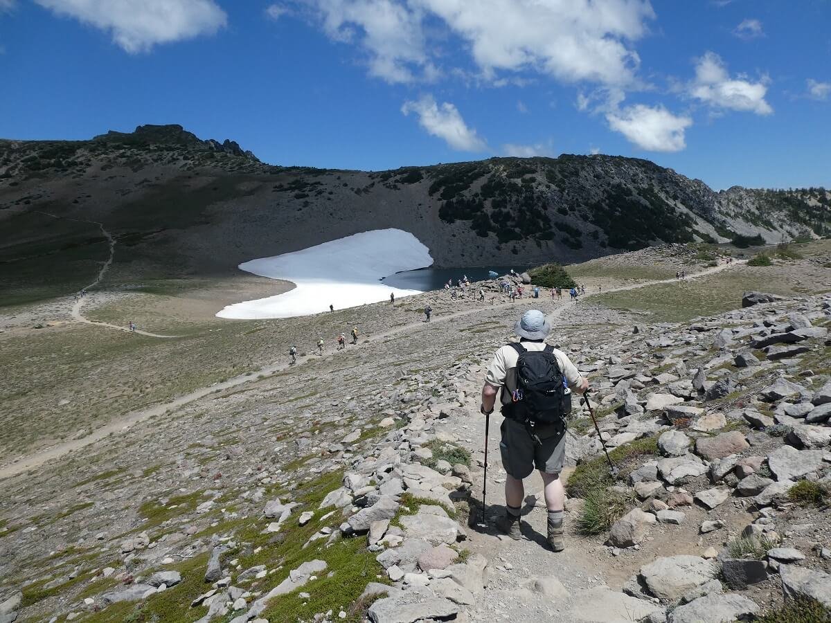
The crowd of people at Frozen Lake. You can also see the five-way junction.

A view back towards the Burroughs Mountain Trail as it heads up to the First Burrough from Frozen Lake
At Frozen Lake, you’ll find a five-way trail junction, so check the signs carefully and make sure to follow the one to the Sourdough Ridge (it will be the trail that basically has you going straight through the junction from the Burroughs Mountain Trail).
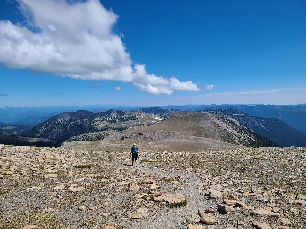
The Sourdough Ridge will start off mostly flat. Look behind you often for views of Rainier! Even after being so close to the mountain, these views really do never get old.
A view of the Sourdough Ridge Trail as it heads back towards the Sunrise parking lot

Views from the Sourdough Ridge Trail
Mount Rainier is a beauty from every perspective
The trail will climb a bit uphill to a high point along the ridge, and then back to down to the intersection where you will take a right to head down a wide gravel trail back to the Sunrise parking lot. The view of Mount Rainier here with the wildflower-filled meadows in the foreground is a really beautiful way to end this epic Mount Rainier hike.

Beautiful summer wildflowers on the hike down from the Sourdough Ridge

The final part of the trail back to the Sunrise parking lot
You’ll come out to the Sunrise parking lot on the North end, opposite of where you started this morning.
Where to Stay Near the Burroughs Mountain Trail

Taking in the views from the Third Burrough!
If you want to stay super close to the Burroughs Mountain Trail and the Sunrise area, your best bet is to camp at the White River Campground. This is a first come first served campground located along the Sunrise road and costs $20. It’s generally open from Late June to late September, but make sure to check the status to be sure it’s open when you want to go.
There are also Forest Service camping options that are outside of the park but nearby.
If you are looking for lodging near the Burroughs Mountain Trail, the Crystal Mountain Lodge is about 45 minutes from the Sunrise parking area. Otherwise, the towns of Enumclaw and Packwood are about an hour and 20 minutes away in opposite directions. Enumclaw would be best if you plan on also visiting the Carbon area of the park, while Packwood is ideal if you also plan on visiting Paradise.
What to Pack for the Burroughs Mountain Trail

Amazing views from the Burroughs Mountain Loop
Here are some things we would recommend specifically for the Burroughs Mountain Trail.
Sun protection- Pretty much the entire Burroughs Mountain Trail is exposed, so wear a hat, sunglasses, and sunscreen.
Bug spray- There are lots of flies on this trail in the early summer!
Hiking shoes- The terrain on the Burroughs Mountain Trail is rocky, slick, and steep at times, especially on the climb to the Third Burroughs.
Trekking poles- These can come in handy on any snow patches, and on the steep descents.
Microspikes- These will also come in handy for snow patches on any steep sections of trail.
Layers- It can get cool and windy up on the Burroughs, so if you plan on hanging out for a while and eating lunch on top, you’ll want some extra layers.
Food/water- Bring lots of snacks and water (especially because it’s at higher altitude)- there are really no water sources along the Burroughs Mountain Trail.
Tips for Hiking the Burroughs Mountain Trail

Heading up to the Third Burrough
Start early. This will help you avoid some of the biggest crowds on the Burroughs Mountain Trail. For parking, we would recommend showing up sometime before 9 or 10 am, as the lot can fill up by mid-morning. If it fills, cars will be held down at the entrance station and slowly metered in.
Make sure to grab a map. Have a trail map with you, or you can grab a rudimentary one at the Visitor Center for trails in the Sunrise area. There are lots of intersection trails and junctions in this area of the park, and while well-signed, it’s helpful to plan out your route in advance and map out your distances.
Be aware of wildlife. Mount Rainier is home to lots of wildlife, like cute marmots, chipmunks, and mountain goats! Keep your distance and don’t try to touch or feed them, please! While rare to see, bears and cougars do live in Mount Rainier National Park, so read up on safety tips before you hit the trail. If it makes you feel more comfortable, plan on hiking with some bear spray just for emergency use.
Check conditions. The National Park Service has detailed trail conditions for most trails in the park, including snow cover percentages. Be sure to check this for the Burroughs Mountain Trail before heading out, especially if coming towards the beginning or end of the hiking season. Check weather forecasts before heading out. Even if the weather is good, Mount Rainier can be fickle on when it decides to show itself. Low lying clouds frequently cover the mountain. Luckily, the Sunrise side of the mountain tends to be a little bit more forgiving and doesn’t get the brunt of the mountain’s weather. If you want to see what the mountain looks like before heading out, check on the webcams.
Things to Do Near the Burroughs Mountain Trail
The Sunrise area of Mount Rainier National Park has a ton of amazing hiking opportunities. If you are short on time, it’s easy to add them onto the Burroughs Mountain Trail for an even longer day hike (we did that with the Dege Mountain Trail!), or come back another day and tackle some more.
We highly recommend the Mount Fremont Trail and the Dege Mountain Trail in the Sunrise area.
Other hikes in Mount Rainier that we love that are found in other parts of the park include:
The Skyline Trail (in Paradise)
Silver Falls (in Ohanapecosh)
Grove of the Patriarchs (in Ohanapecosh)
The Tolmie Peak Lookout Trail (in Mowich Lake)
Mount Rainier itineraries
Feeling overwhelmed by how to plan a larger Mount Rainier itinerary that includes the Burroughs Mountain Trail plus some other amazing hikes in the area? Check out our Mount Rainier itineraries for one to four days in the park to help you plan your time!
More Washington Travel Guides
Looking for more things to do on your Washington road trip! Let us help you plan your trip! Check out our guides to more amazing places to hike and sightsee throughout the state.
MOUNT BAKER: Check out a list of our favorite hikes near Mount Baker!
NORTH CASCADES NATIONAL PARK: Learn more about the amazing Hidden Lake Lookout Trail.
The Burroughs Mountain Trail was definitely our favorite trail in the entire park! Are you planning on hiking the Burroughs Mountain Trail in Mount Rainier National Park? We hope this guide answered all your questions, but if you have any more, let us know! Happy hiking!