5 Incredible Hikes in Iceland to Put on Your Bucketlist

Iceland is a hiker’s dream, with out-of-this-world landscapes filled with volcanoes, glaciers, lava fields, waterfalls, colorful rhyolite mountains…need we say more?
Choosing to hike in Iceland is a great way to get away from some of the crowds, see stunning Icelandic scenery, and really experience true Icelandic wilderness, moreso than you could do from the comfort of your car or from a crowded parking lot.
Don’t get us wrong, the popular and famous sights around Iceland are certainly worthy of your time and you should visit them all! But you all know we are hiker’s at heart, and we highly suggest making time for a few hikes in Iceland to really experience the epic and remote landscape of this country first-hand.
Ok, great, you wanna hike! But where to start? There are so many incredible hikes in Iceland that you can spend months there and not hit them all.
Don’t worry, we had that same predicament, so we’re here to help! During our time in Iceland, we managed to do a several awesome hikes, some short and sweet, others long and challenging, and we want to share them with you.
Minor disclaimer: We definitely don’t claim that this is by any stretch a comprehensive list of the best hikes in Iceland! We only did a small handful and can speak from our experiences on these trails. There are so many incredible hikes we have yet to go back and do. But we will say that these hikes were pretty great, and our sole purpose here is to show you some options to help you narrow down or build your own list of hikes to check off in the land of fire and ice!
Ok, without further ado…here’s our list of some of the best hikes in Iceland.
Article Contents
Five Epic Hikes in Iceland
1. Bruarfoss
Best for: An easy hike to get you to a beautiful off-the-beaten-path waterfall
Distance: 4.4 miles out and back
Recommended time: 2-3 hours
Location: The Golden Circle

Bruarfoss is a stunning waterfall that makes an “unofficial” stop along Iceland’s famous Golden Circle route, and known for its incredibly blue color. In fact, it’s often called Iceland’s bluest waterfall. And guys, this water really is blue…we’ve never seen anything quite like it!
And despite its location along the popular Golden Circle, Bruarfoss still doesn’t see as many people as the other points along the route, not by a long shot. So, by making the effort to venture off the beaten path just a little bit, you’ll be rewarded with a quiet trail and beautiful views.
The hike to Bruarfoss is an easy, mostly flat, 4.4 mile out and back hike in Iceland that follows the Bruara river. Along the way, you’ll pass by two additional waterfalls that are arguably even bluer than Bruarfoss itself!
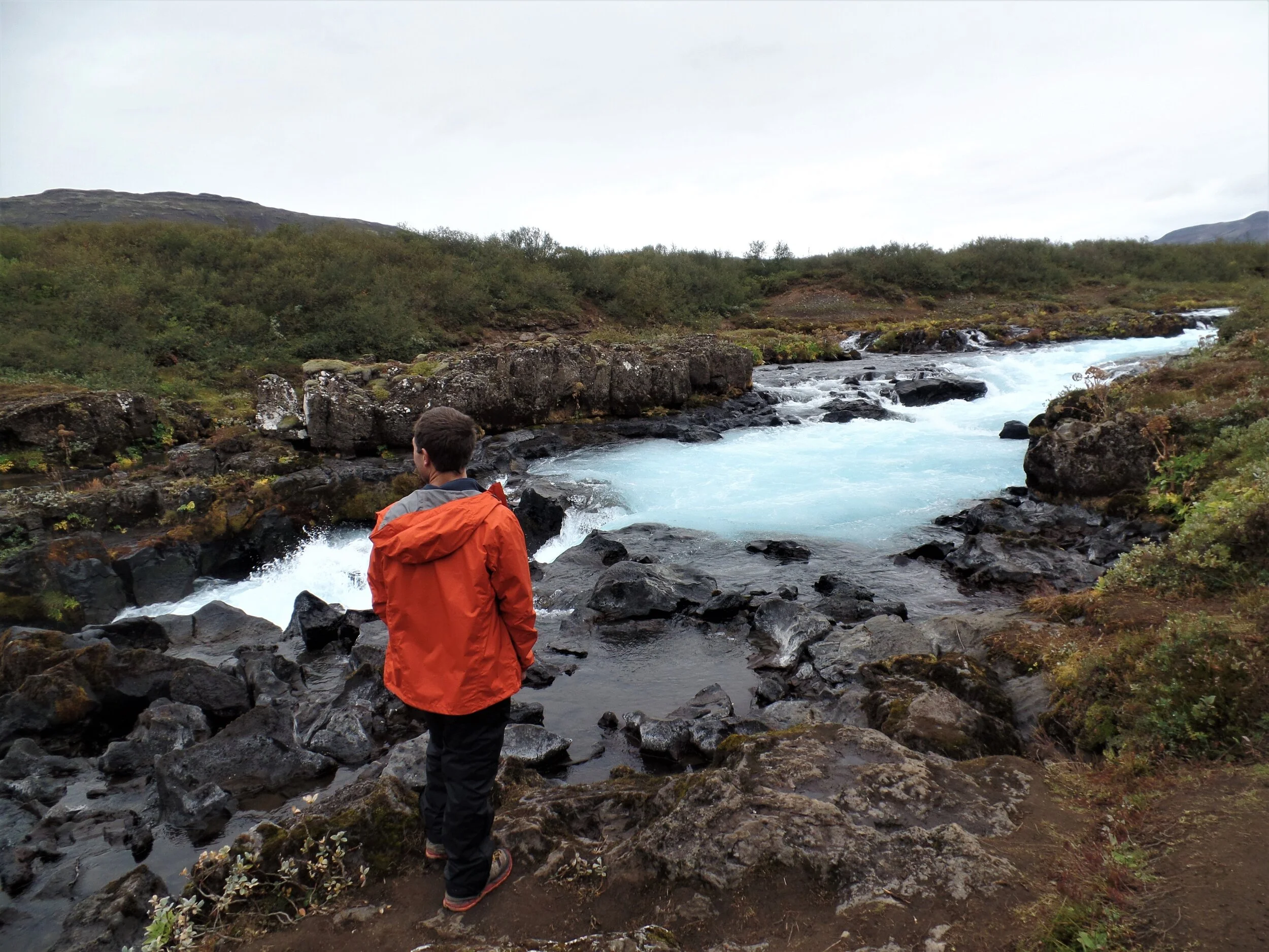
The first is Hlauptungufoss (er, how do you say that?) about half way into the hike. It’s a small but powerful falls. It’s the first time you’ll see that striking blue water standing out against the dark rock that it flows between, and as soon as you see it, you’ll be glad you’re on this hike.

Shortly after, about a half a kilometer away, is Midfoss, the second waterfall. Midfoss is more like a series of small cascades flowing across the river, but guys, the water here is so blue. I could have stayed here for hours mesmerized by the color!
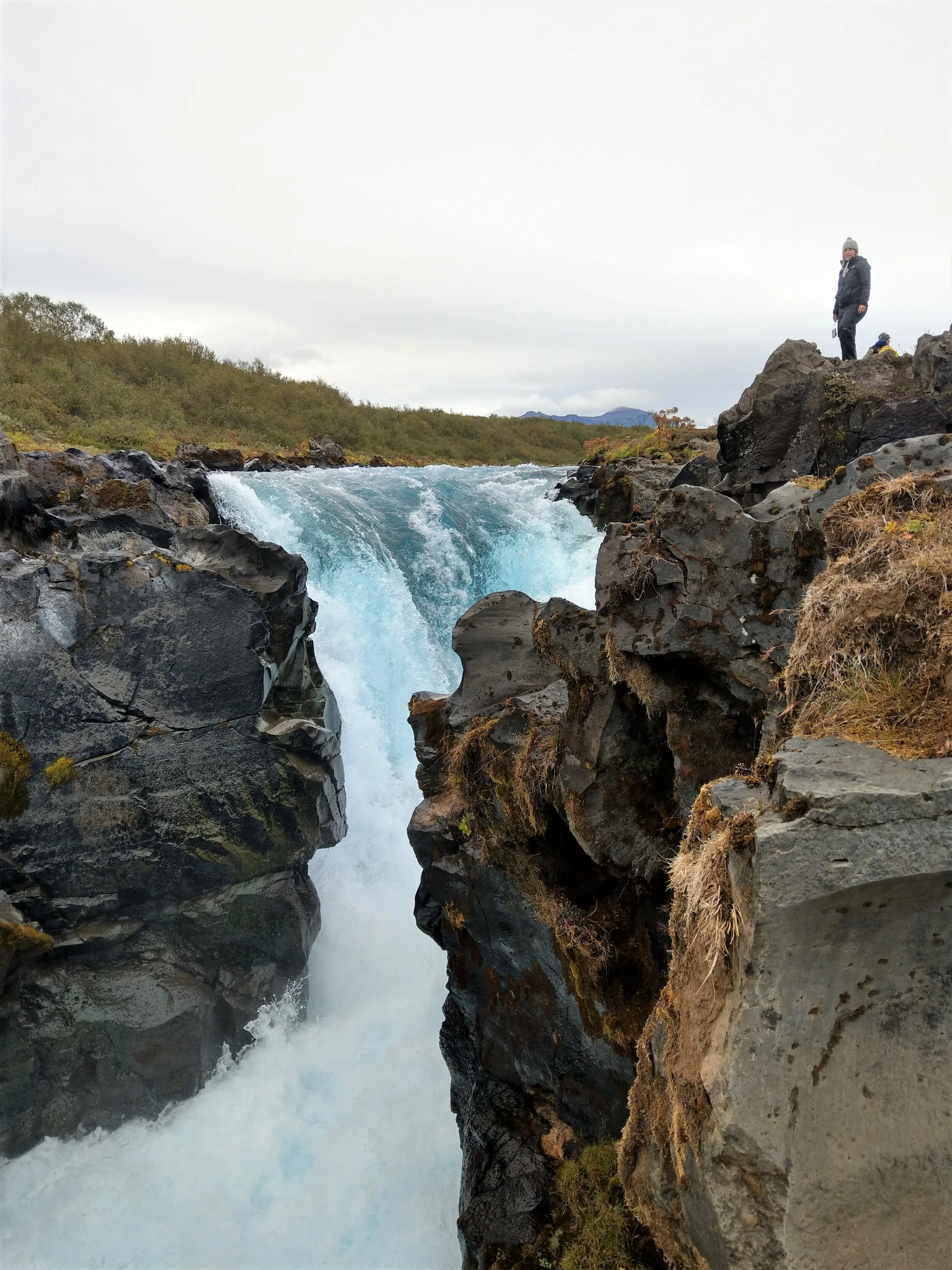
But believe it or not, you haven’t reached the grand finale of this hike yet! Keep going another 1.5 km to finally reach the main attraction here…Bruarfoss.
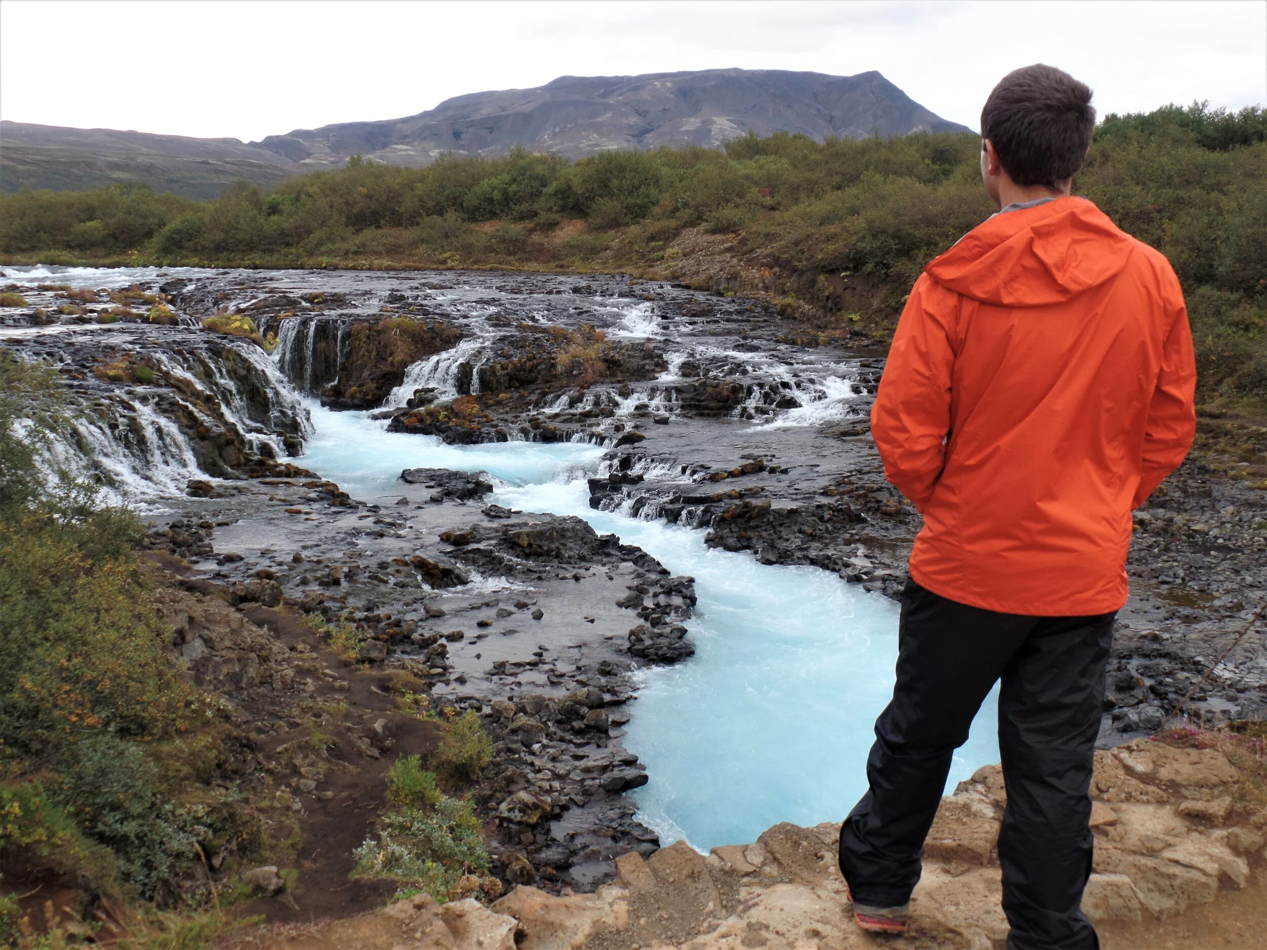
Bruarfoss is an incredibly unique falls, made up of a series of smaller falls that come together to make a bigger U-shaped waterfall. A bridge spans across the river here so you can get a great view straight down the waterfall.
Once you’ve had your fill, it’s time to head back. Simply retrace your steps back to the parking lot.
Overall, we really enjoyed this hike. The color of the water here makes the time spent here more than worth it, and it feels great to be able to find a lesser visited spot like this along a crowded tourist route.
How to get to the trailhead: The parking lot for Bruarfoss is along route 37 on the Golden Circle. There is no sign, just a small dirt parking lot on the side of the road, so be sure to use a navigation system. If using Google Maps, make sure to type in “Bruarfoss Waterfall Official Parking”. This will take you to the correct trailhead. Simply typing in Bruarfoss Waterfall will lead you past the real trailhead through a private town to an older trailhead on private property.
2. Svartifoss-Sjornarnipa Loop
Best for: A moderate hike with stunning glacier views
Distance: 4.6 mile loop
Recommended time: 3 hours (with a relaxed pace and lots of time at the viewpoints!)
Location: Vatnajokull National Park

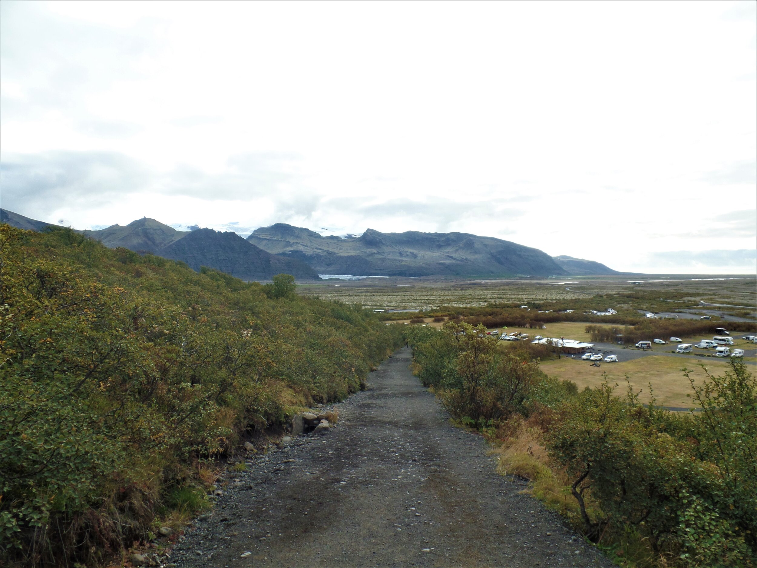
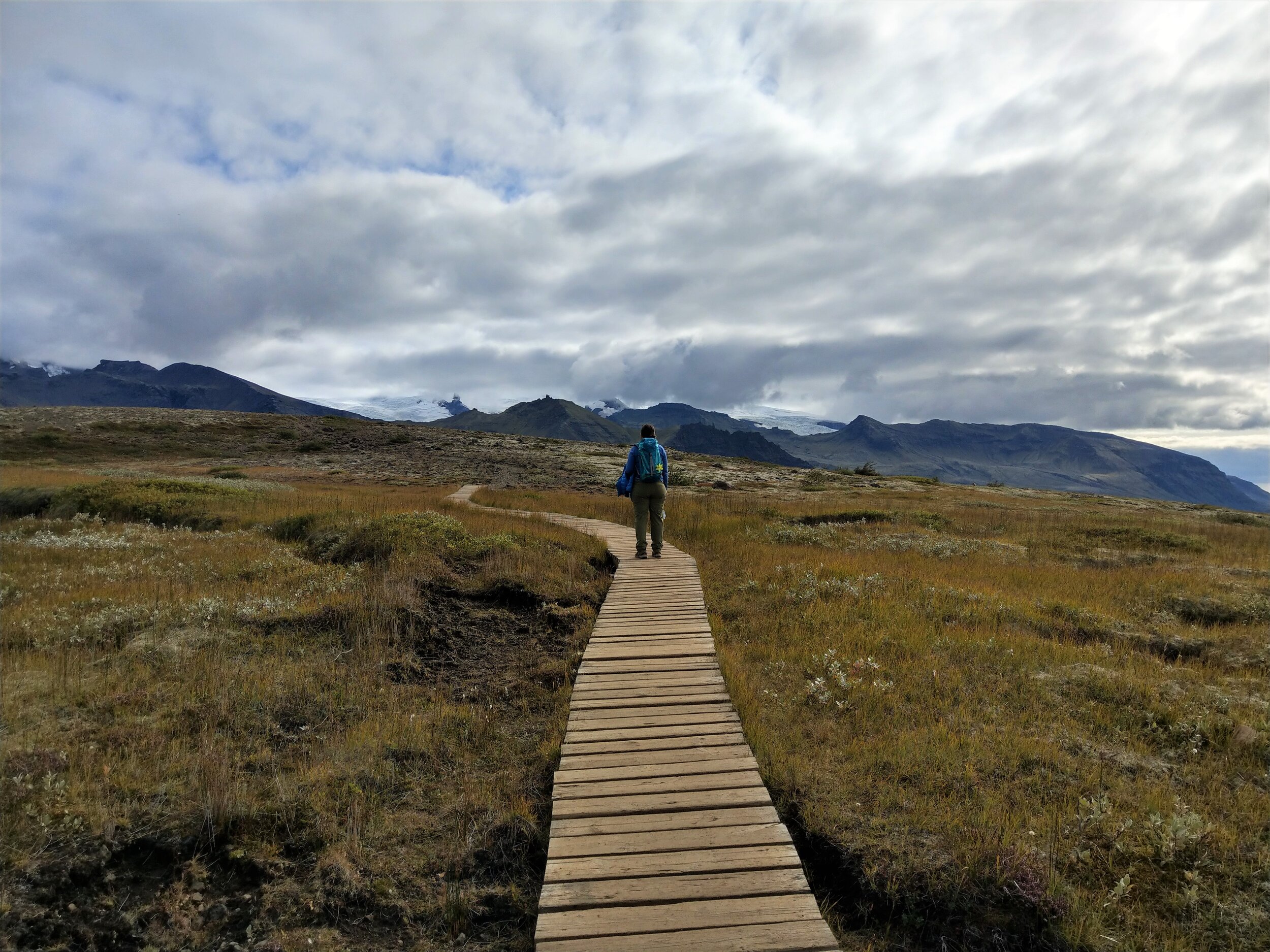
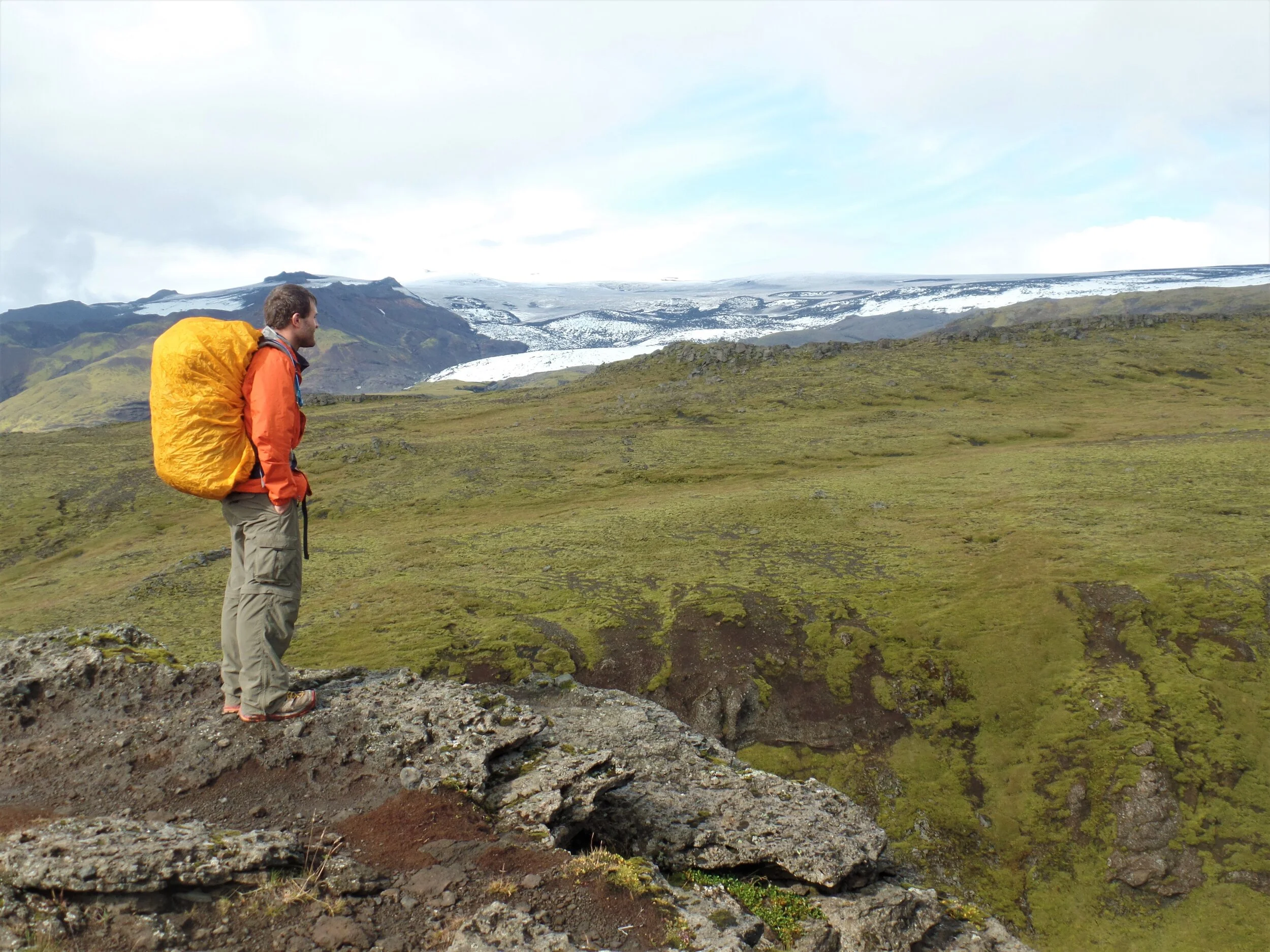
The Svartifoss-Sjonarnipa Loop is an awesome hike in Iceland that’s found in the Skaftafell area of Vatnajokull National Park.
Visiting a National Park in Iceland is one of our top experiences in the country. Check out more of the best things to do in Iceland here!
The area is filled with picturesque glaciers cascading down from the massive icecap, one of the most prominent and well known being that of Skaftafell. A visitor center and campground are found in the Skaftafell area, as well several amazing hikes that bring you to viewpoints overlooking these stunning glaciers or to their base so you can get an up-close look.
If you’re in the area, we would highly recommend the Svartifoss Sjonarnipa Loop. This is a moderate hike with a 1200 foot elevation gain that brings you first to a unique waterfall that cascades down a series of black basalt columns, and then to an epic viewpoint overlooking the entire length of the Skaftafell glacier.
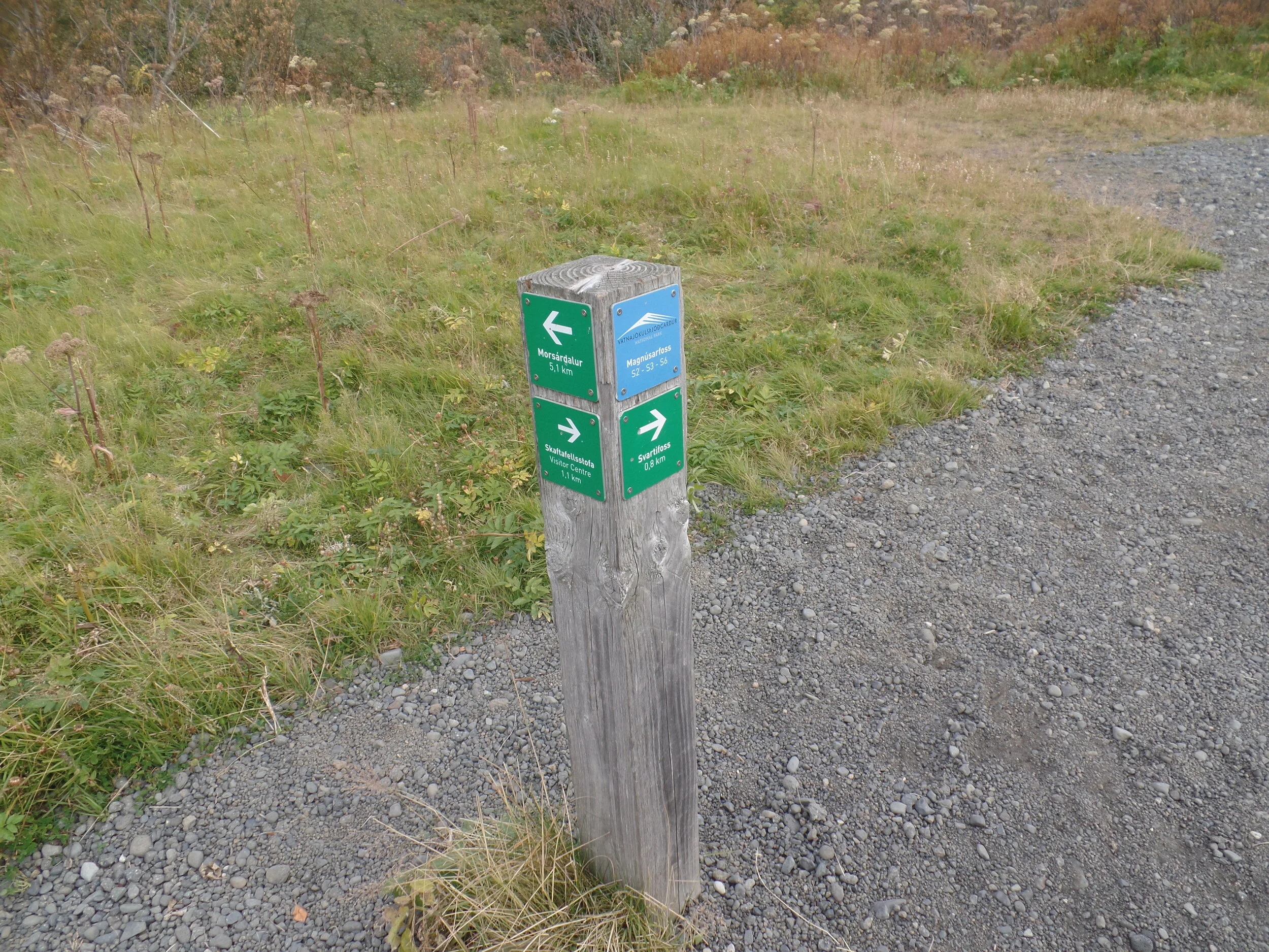
The hike starts right behind the visitor center in Skaftafell. The first part of the hike is a bit of climb as you work your way up the hillside, but it’s pretty quick, and once this part is done, it’s relatively smooth sailing from here. Part way up this climb, you’ll come to in intersection that indicates that Sjonarnipa is to the right. We recommend continuing straight here to Svartifoss first, so you can save the best part for last!
On your way to Svartifoss, you’ll pass by another waterfall, but don’t be fooled….this isn’t the main attraction!

Eventually, you’ll see Svartifoss in the distance, and you’ll know it when you see it… recognizable by its characteristic black basalt columns. Continue on until you come to the viewpoint that overlooks it. Here, there’s a trail intersection that you’ll continue on to visit the Sjonarnipa viewpoint, but first, you’ll want to take the path that brings you down to the base of Svartifoss.
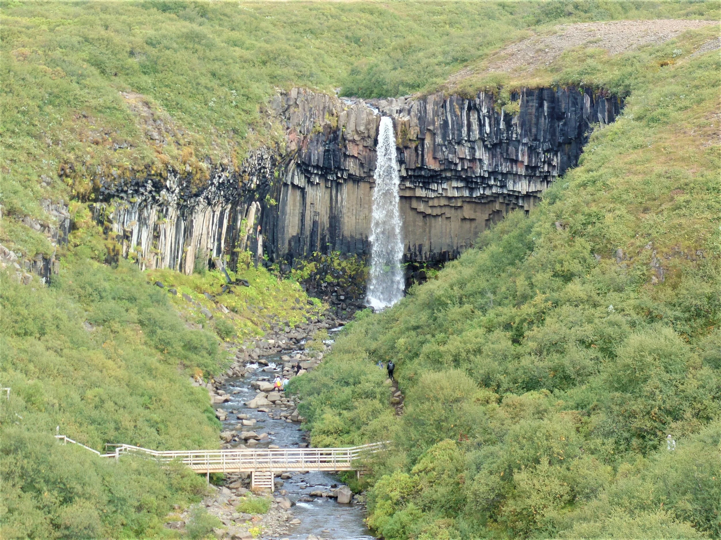
The path down to the base of the falls is a dirt path that can be a little bit steep and rocky at places, so use caution. At the bottom, you’ll come to small stream with a viewing platform to admire Svartifoss up close. A small footbridge crosses the river and continues up the bank to the other side, but for today’s loop, you’ll retrace your steps back up the side that you came down.

When you’re back up at the top, take the path that points you towards Sjonarnipa. In our opinion, this is where the hike gets really good!
Along this part of the trail, you’ll pass through beautiful Iceland tundra, with gorgeous mountain backdrops. Reindeer and artic foxes are spotted here often, though we weren’t so lucky! But even if you don’t get lucky either, the hike is beautiful, and it’s relatively flat along this portion, too.
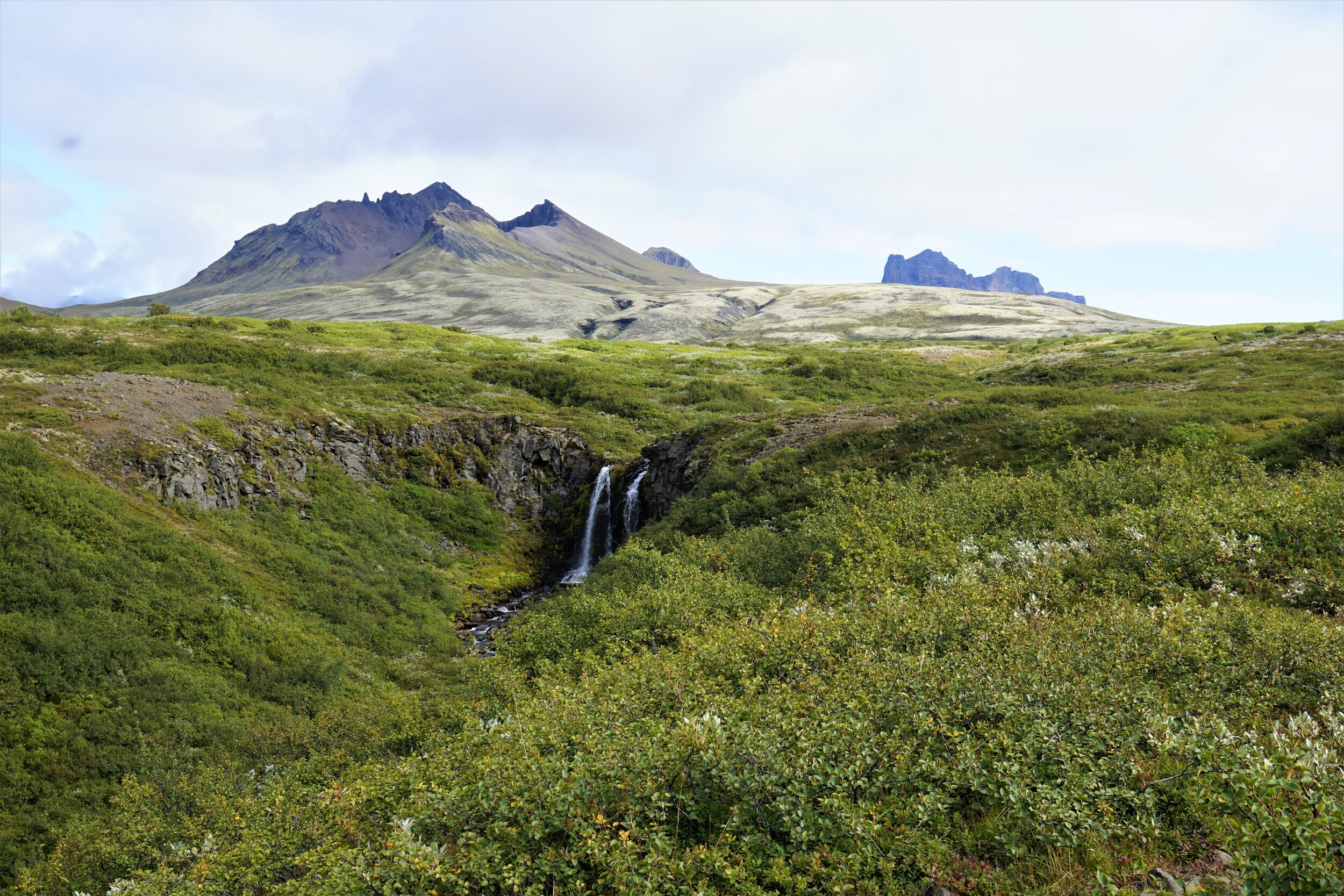
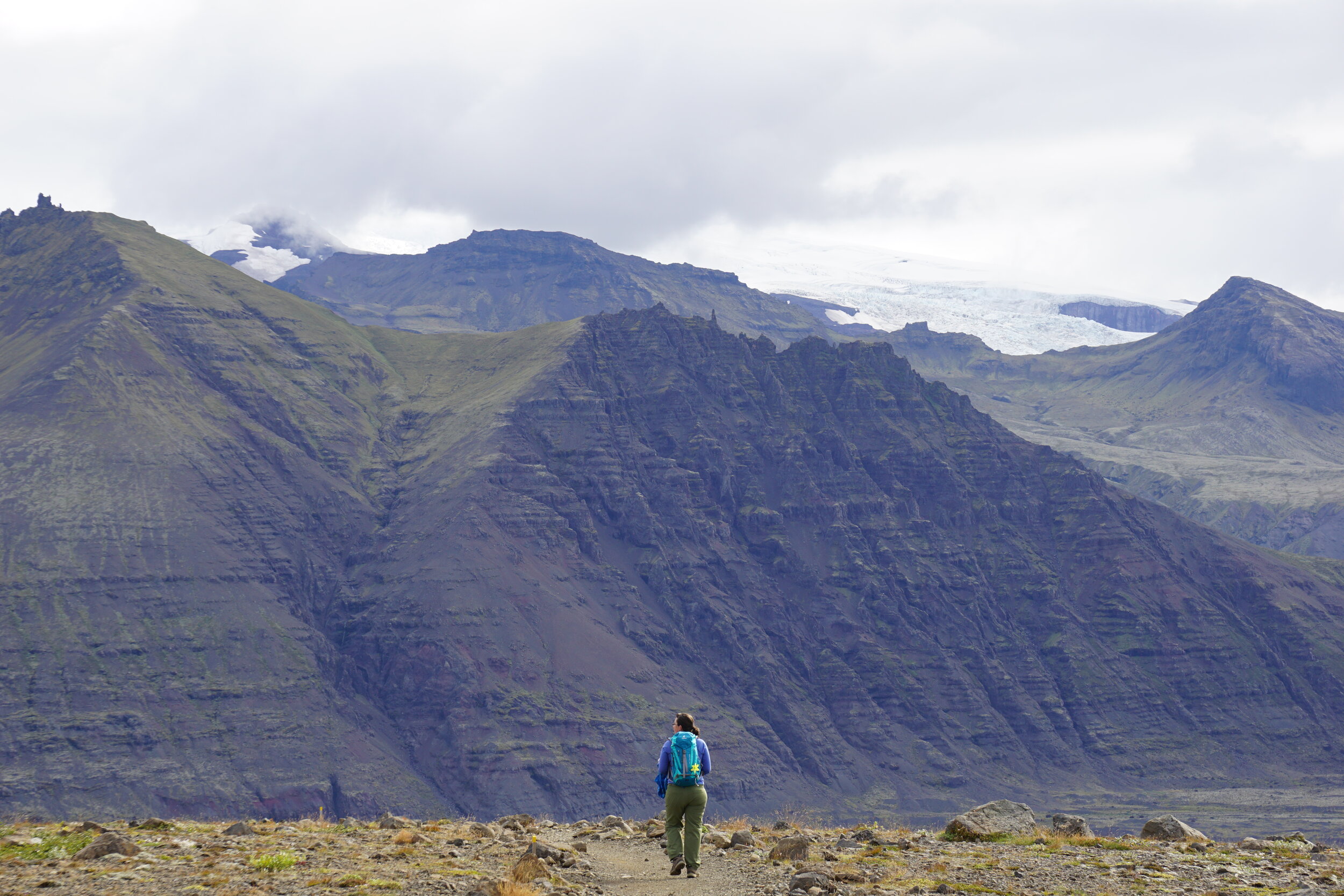
Eventually, you’ll come to the best part of the hike…the overlook of the Skaftafell glacier. Guys, this view is crazy! You get an incredible birds-eye view of the entire expanse of the glacier tongue, its lagoon, and the gorgeous mountain backdrop. We probably stayed up here for a good hour just in awe of the sight.

Unfortunately, there will be a point where you have to come down. Huge bummer but ya gotta do what ya gotta do. Instead of retracing your steps back, you’ll continue along this trail, which will loop you right back down to the visitor center.
Overall, this trail took us exactly three hours, but this was at a very relaxed pace with lots of time spent at the waterfall and the viewpoint. It’s great trail to add to your Iceland hiking list if you’re looking for incredible views without too much work!
How to get to the trailhead: The area of Skaftafell is found right along the southern ring road, about four hours from Reykjavik. You’ll need to make a turn onto road 998 off the ring road, which will bring your right to the visitor center parking lot. Here you’ll also find a cafeteria, bathrooms and a campground.
3. Blahnukur-Brennisteinsalda Loop
Best for: An epic day hike with stunning volcanic scenery in the Icelandic highlands
Distance: 5.9 mile loop
Recommended time: 4-5 hours
Location: Landmannalaugar

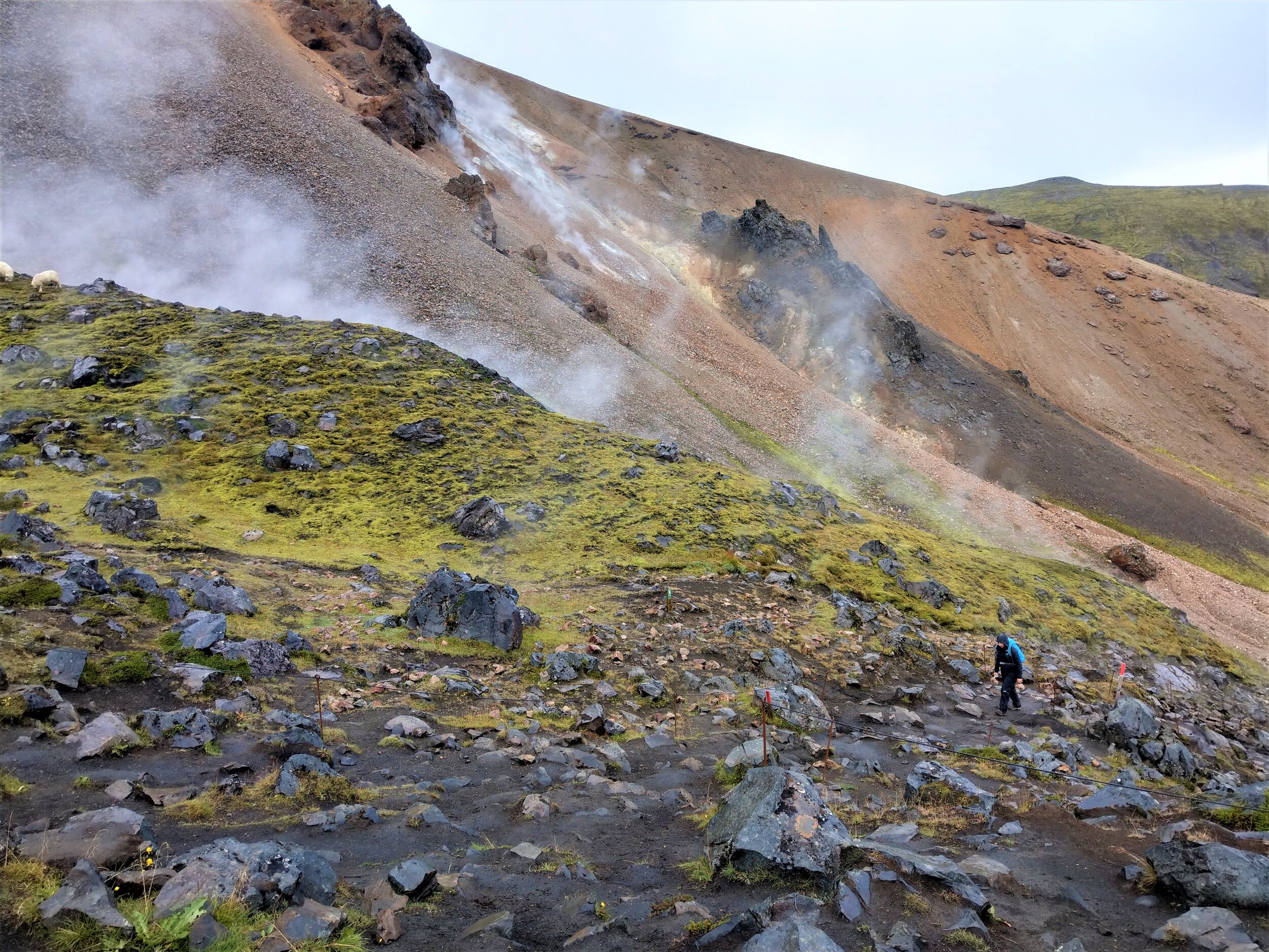
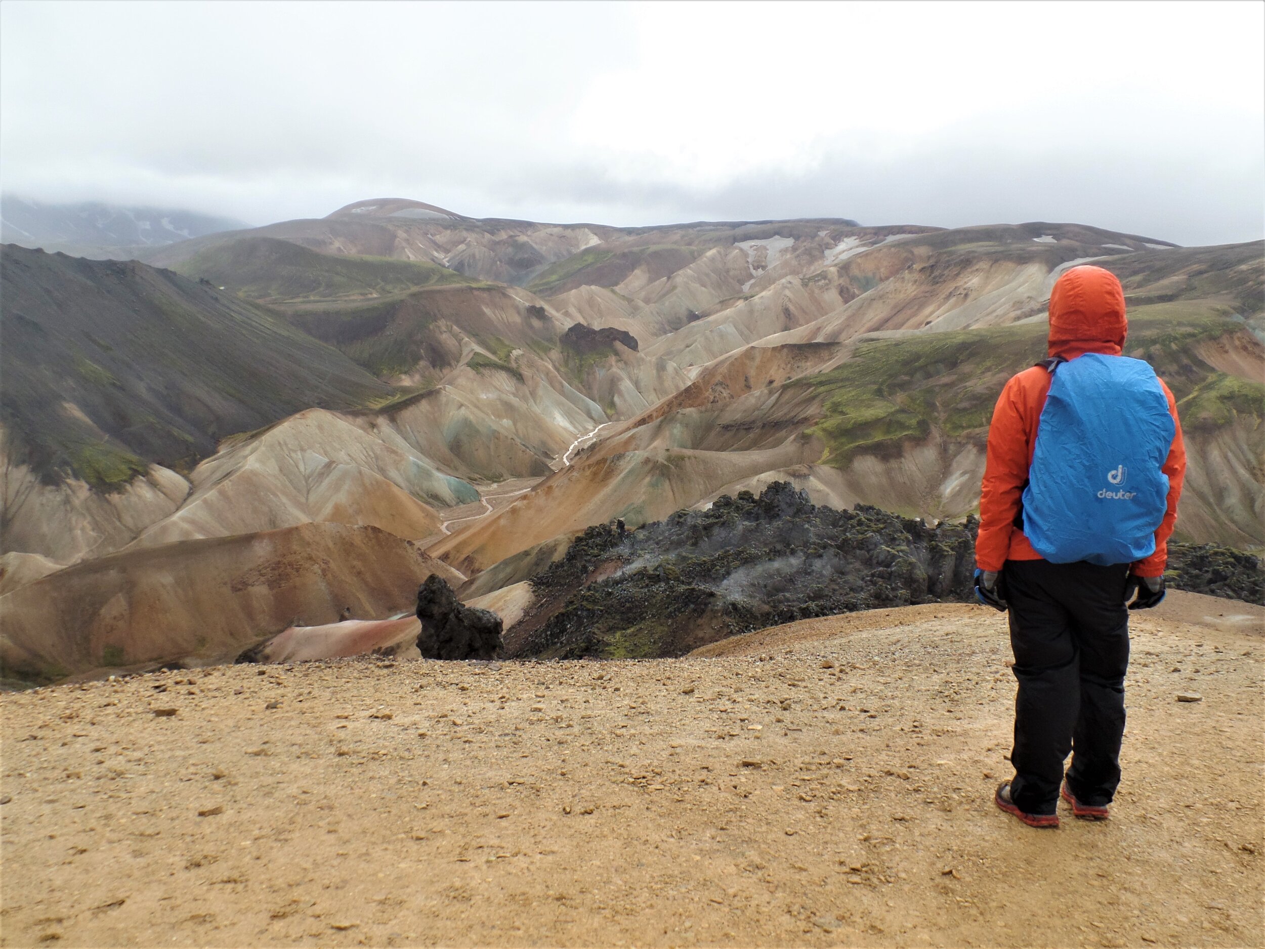
If you’re wondering what our absolute favorite hike in Iceland was, the Blahnukur-Brennisteinsalda Loop in Landmannalaugar is it. Located deep within the Icelandic highlands in the interior of the country, this hike will bring you through lava fields, by colorful rhyolite mountains, over two volcanoes, and across some of the most otherworldy scenery we have ever seen in our lives. We’re not exaggerating!
In short, this is what the hike looks like:
The hike starts with a short climb up to the Laugahraun lava field just behind the Landmannalaugar huts. When you reach the top, you’ll be rewarded with an amazing view of the colorful mountains that surround the valley but aren’t visible from the camp below. It’s quite a sight!
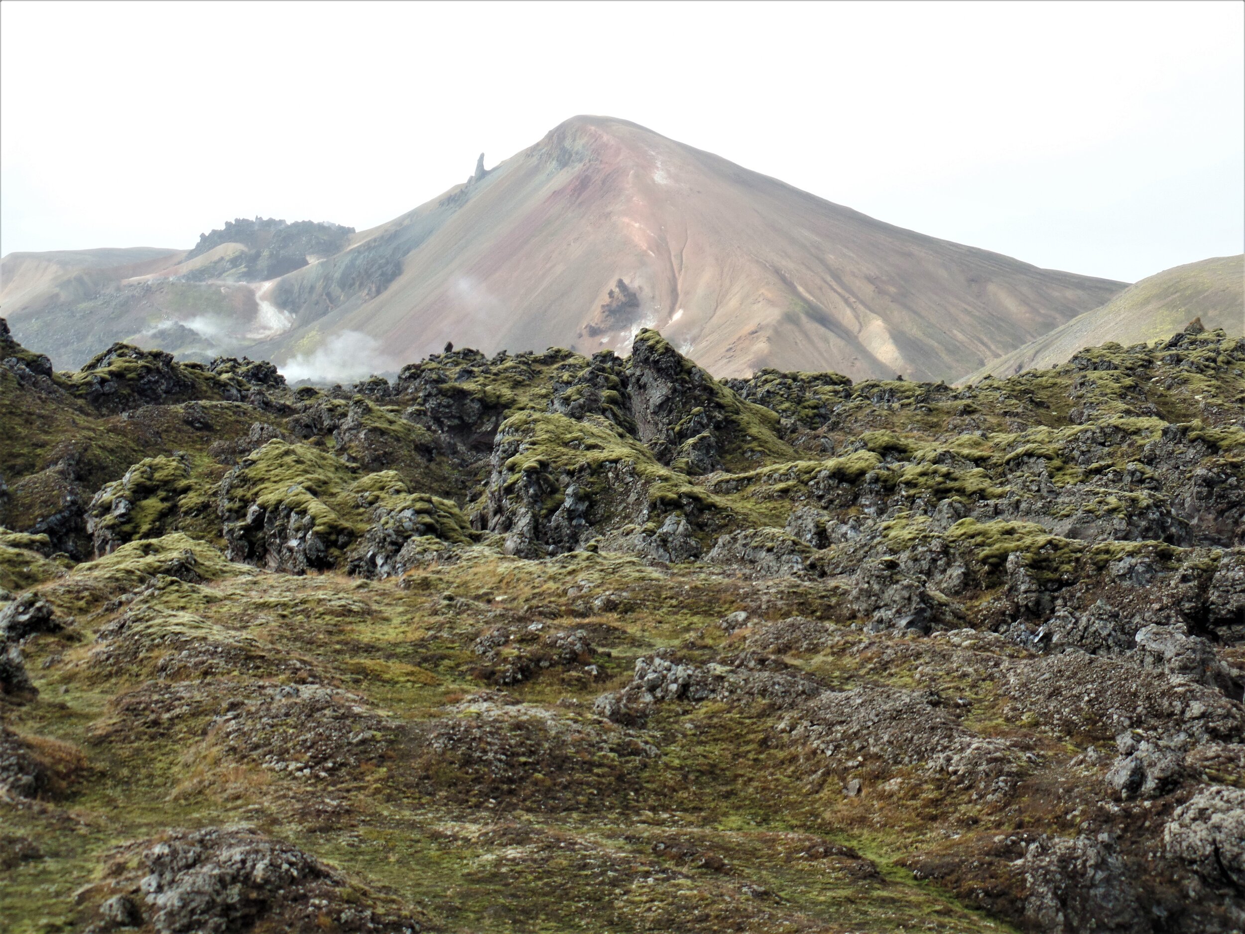
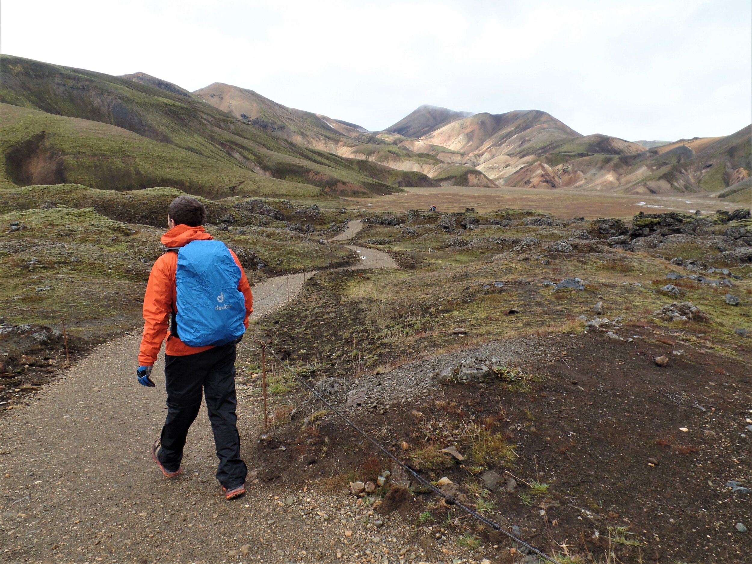
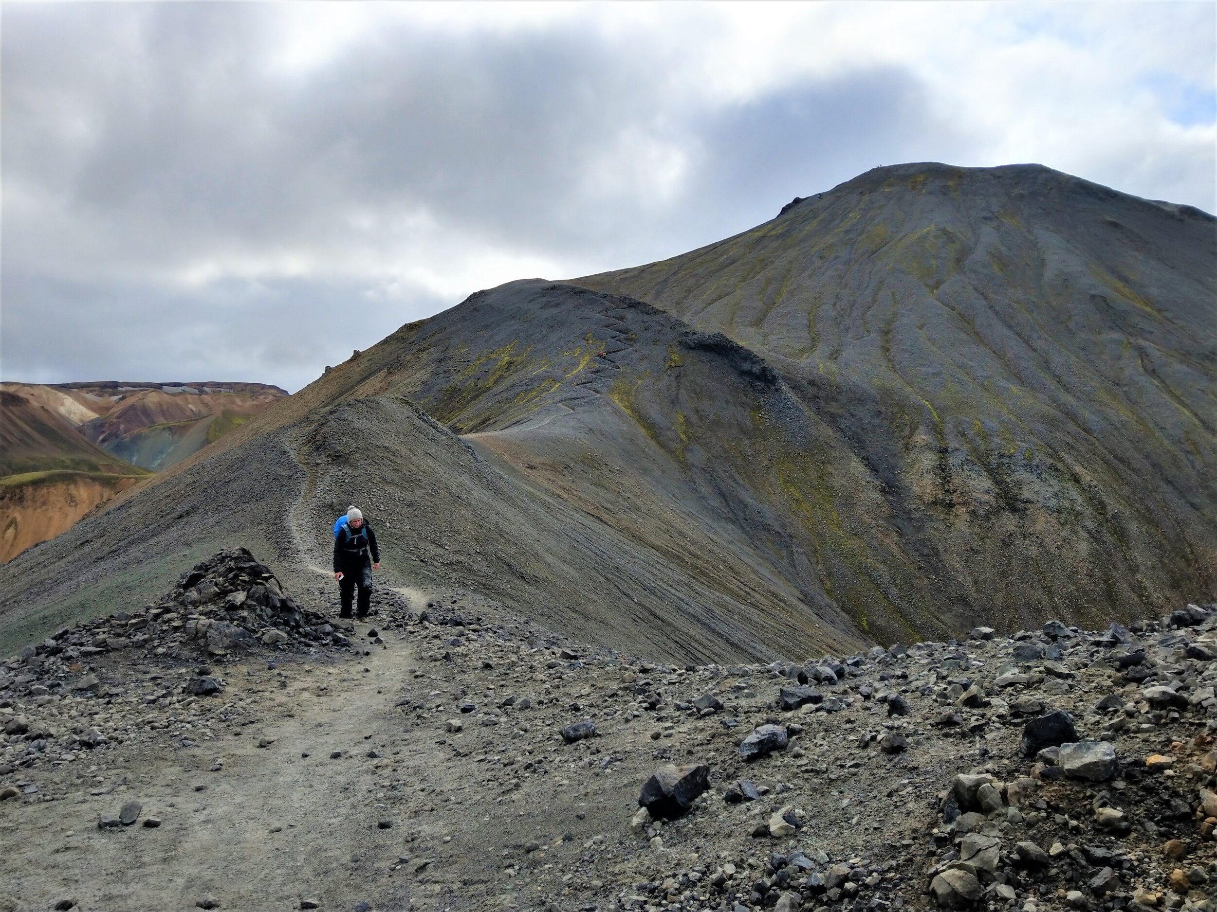
After you exit the other side of the lava field, you’ll start your ascent up Brennisteinalda, one of those colorful peaks, passing through steaming geothermal vents on your way. The views from the top are gorgeous, and you can get a clear shot of your next destination Blahnukur.
It looks more intimidating than it actually is! And it’s easy to see where its name, meaning, “The Blue Peak” comes from, as it stands out like a sore thumb amidst the sea of rhyolite.
You’ll descend back down Brennisteinsalda and make your way back through the other side of the lava field and towards the base of Blahnukur.
Next up: The Blahnukur summit! In our opinion, this the best part of the whole hike. Summiting Blahnukur involves a steady climb up a ridge to the top and the views are stunning the whole way… arguably, better than those on Brennisteinsalda! Just have a look for yourself…
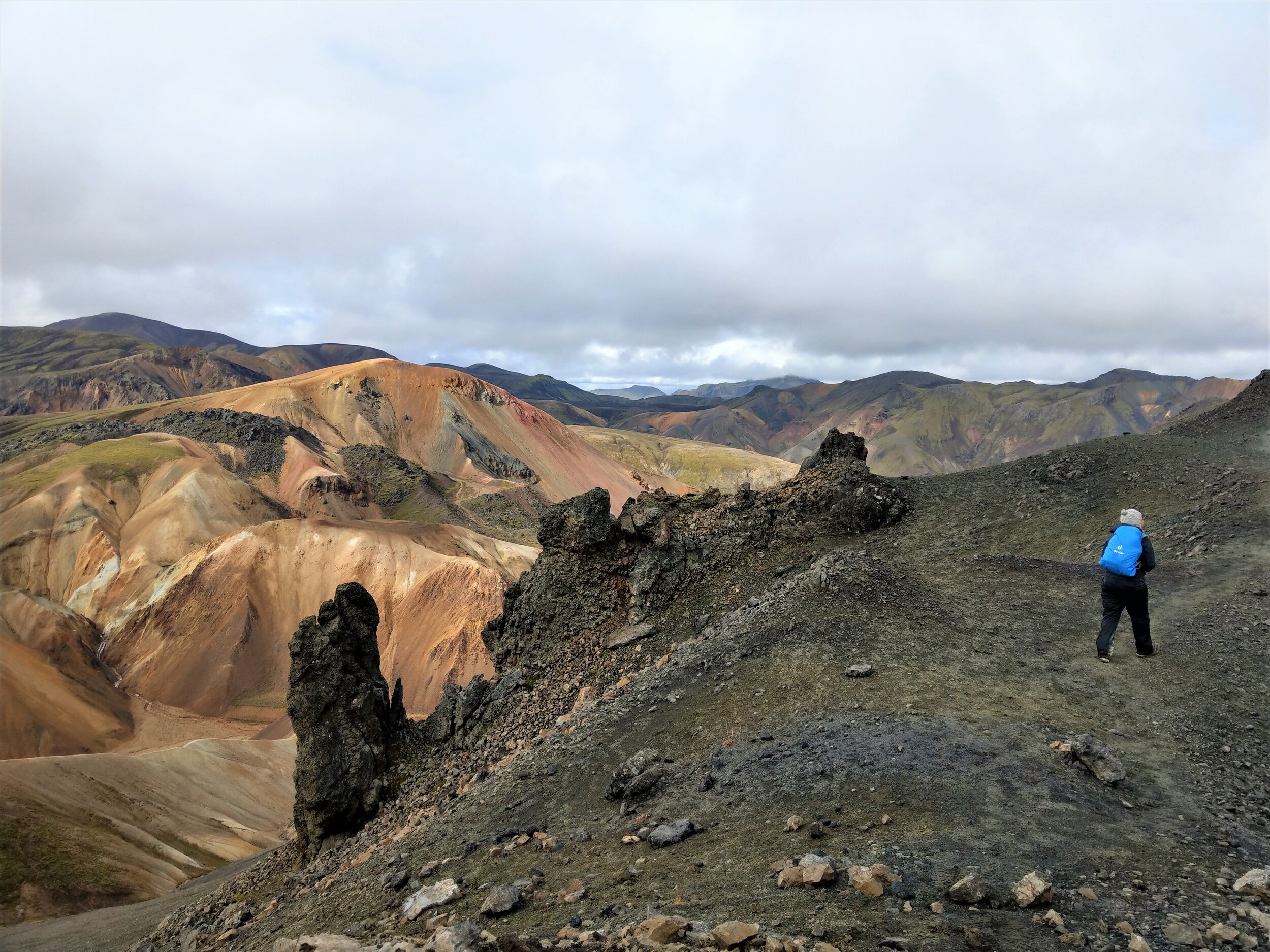
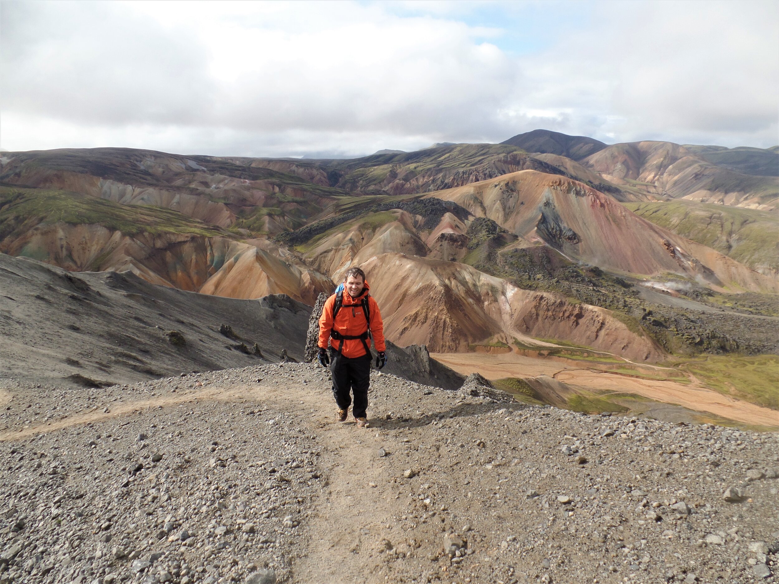
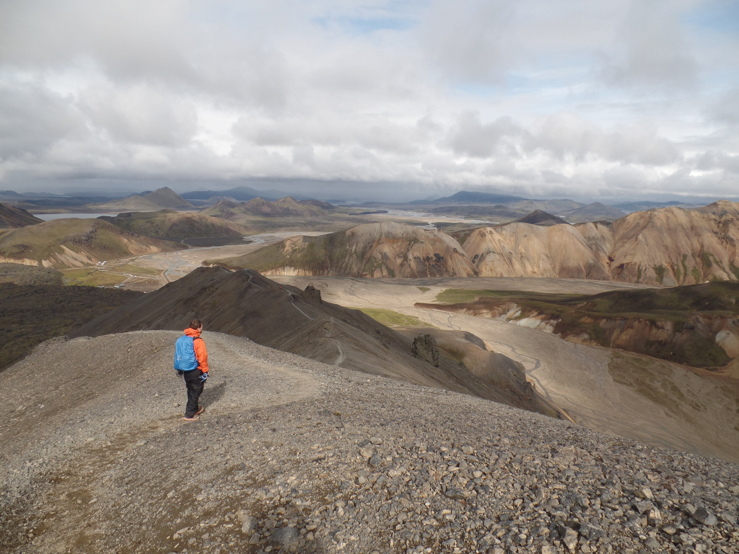
Pretty crazy, right? If it looks almost fake to you, you’re not alone! Even seeing this landscape in person made us still feel like we were trapped in a painting or something.
Overall, we would say this is a must-do on any list of Iceland hikes. The hike itself was moderate, with some steady climbs but nothing tricky or difficult. It took us about five hours, but that was with a relaxed pace and spending lots of time enjoying each of the summits. You won’t want to rush this hike, trust us!
The only mildly challenging part is getting there…
How to get to the trailhead: The Blahnukur-Brennisteinsalda Loop is located in Landmannalaugar, which is in the Icelandic highlands and only accessible via 4x4 down rough gravel F roads. Because of this, you can only travel to Landmannalaugar on your own between mid-June to mid-September when the F roads are open and clear of snow.
4. The Fimmvorduhals Trail
Best for: Those looking for a long and challenging day hike (with the option to backpack) across three diverse landscapes in the Icelandic highlands
Length: 15.4 miles
Recommended time: 10 hours
Location: Skogar to Thorsmork

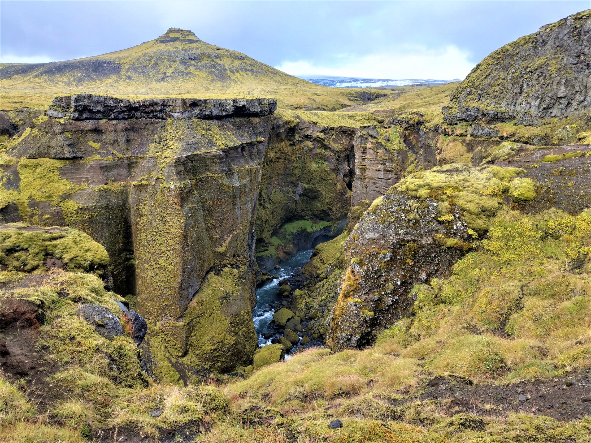
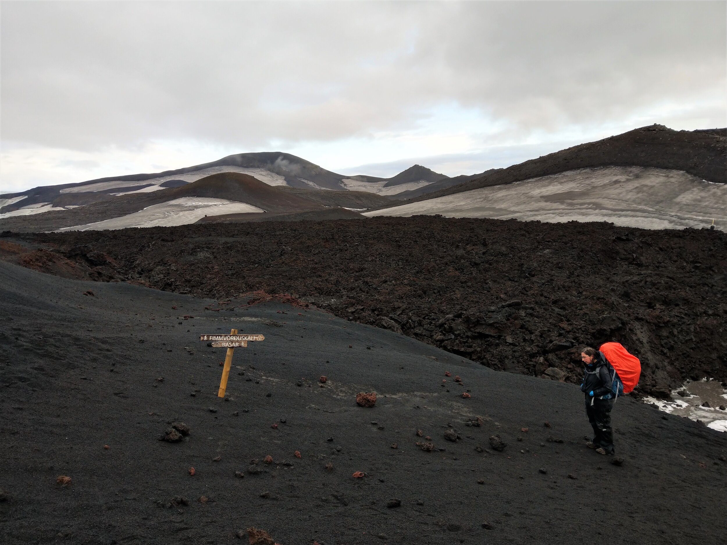
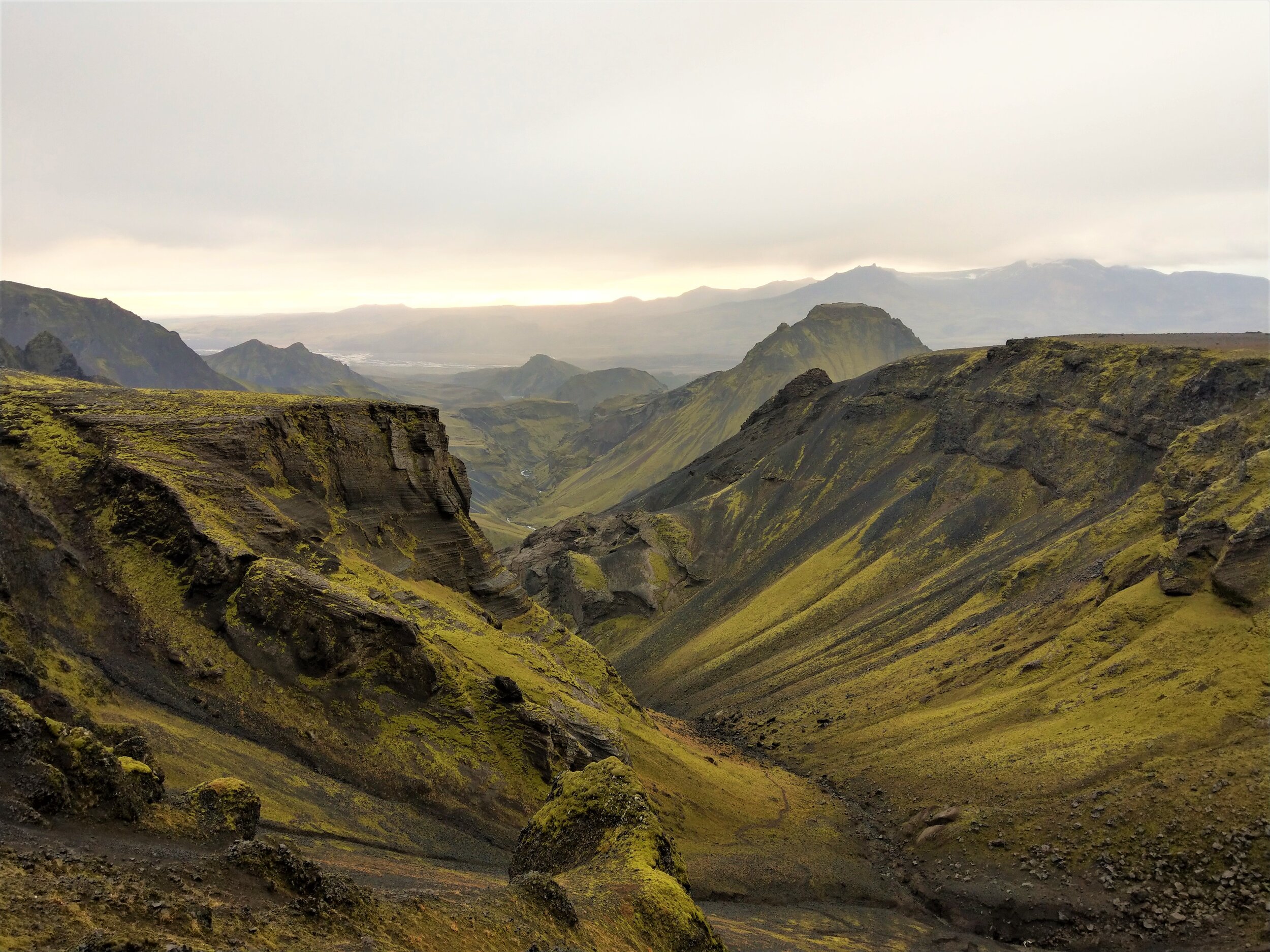
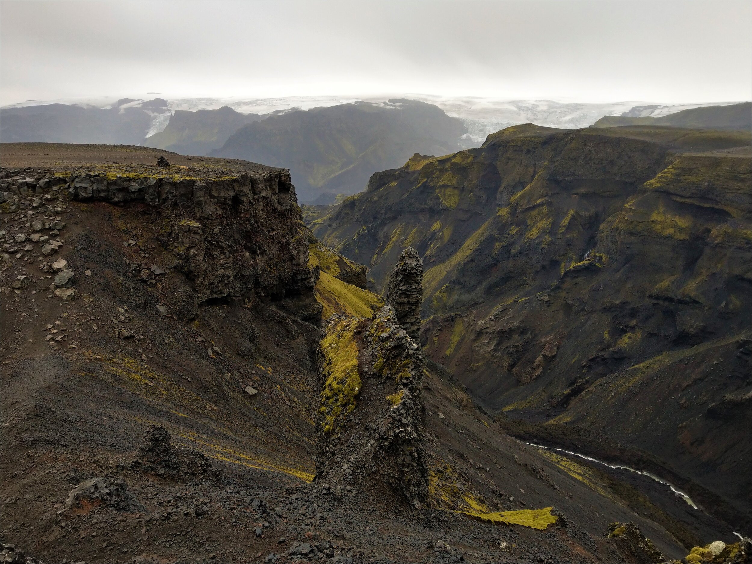
The Fimmvorduhals Trail is hands down the most challenging and demanding hike on this list, but it’s also the most rewarding. Often considered Iceland’s best day hike, this is a 15 mile point to point trail connecting Skogar, along the southern coast ring road, to the village of Thorsmork in the Icelandic highlands. On the way, you’ll pass through three incredibly different landscapes ranging from lush green canyons to barren volcanic terrain.
Your day will look something like this:
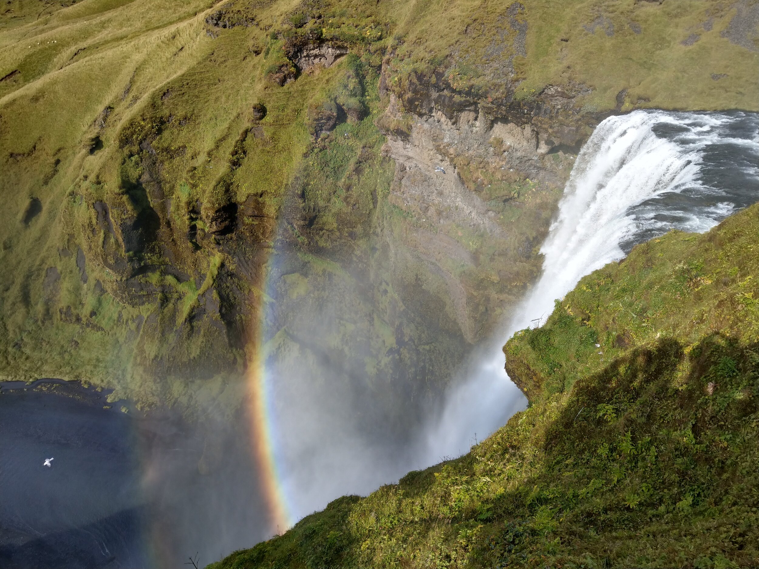
You’ll start the hike at the epic Skogafoss waterfall by hiking up the set of approximately 400 stairs (or somewhere around there, we both kind of lost count!) to the top of the falls. Here is where the Fimmvoruhals starts. You’ll follow the Skoga river upstream for about 5 miles, passing by lush green canyons and 25 more waterfalls (yes, 25!).
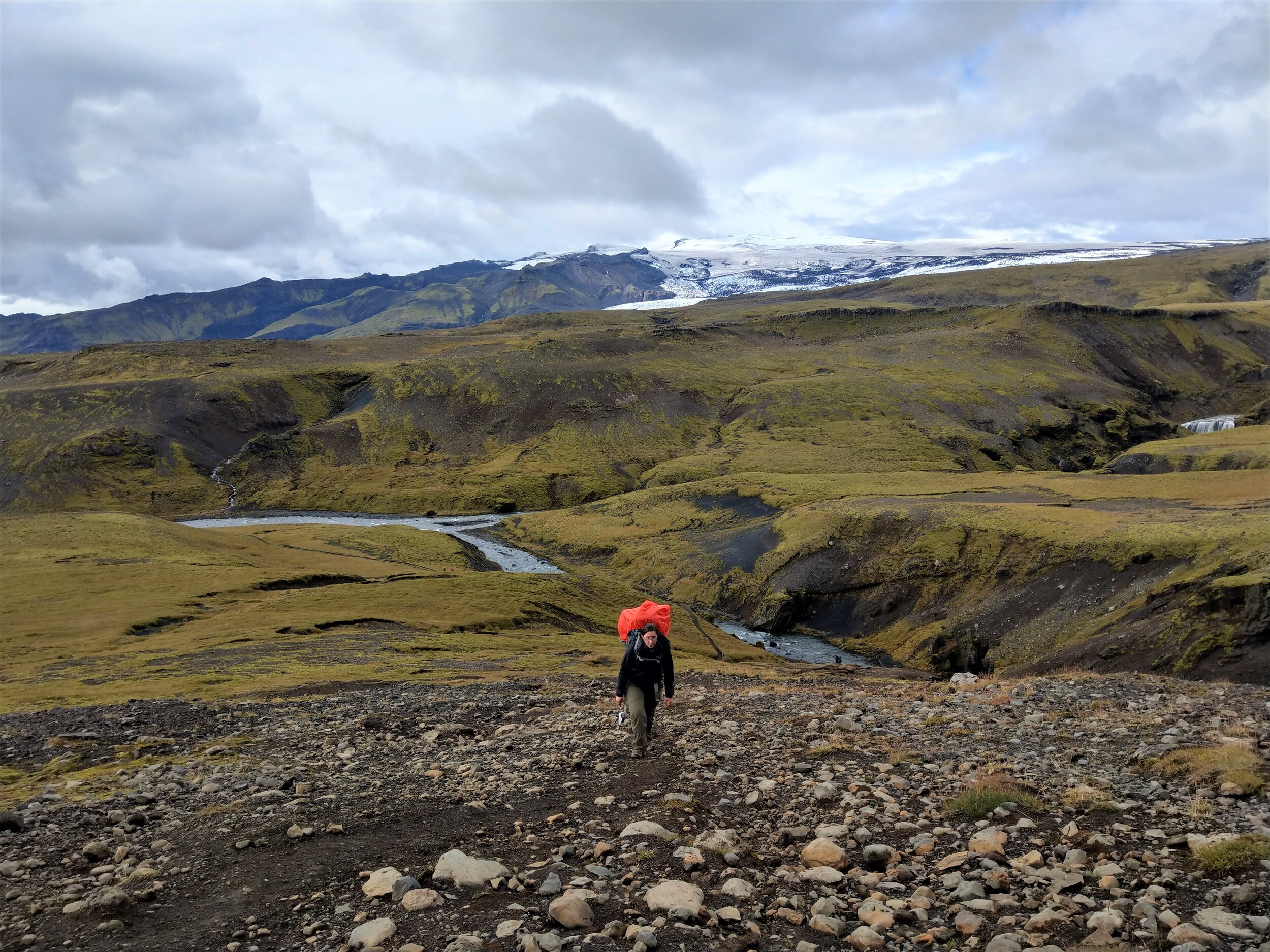
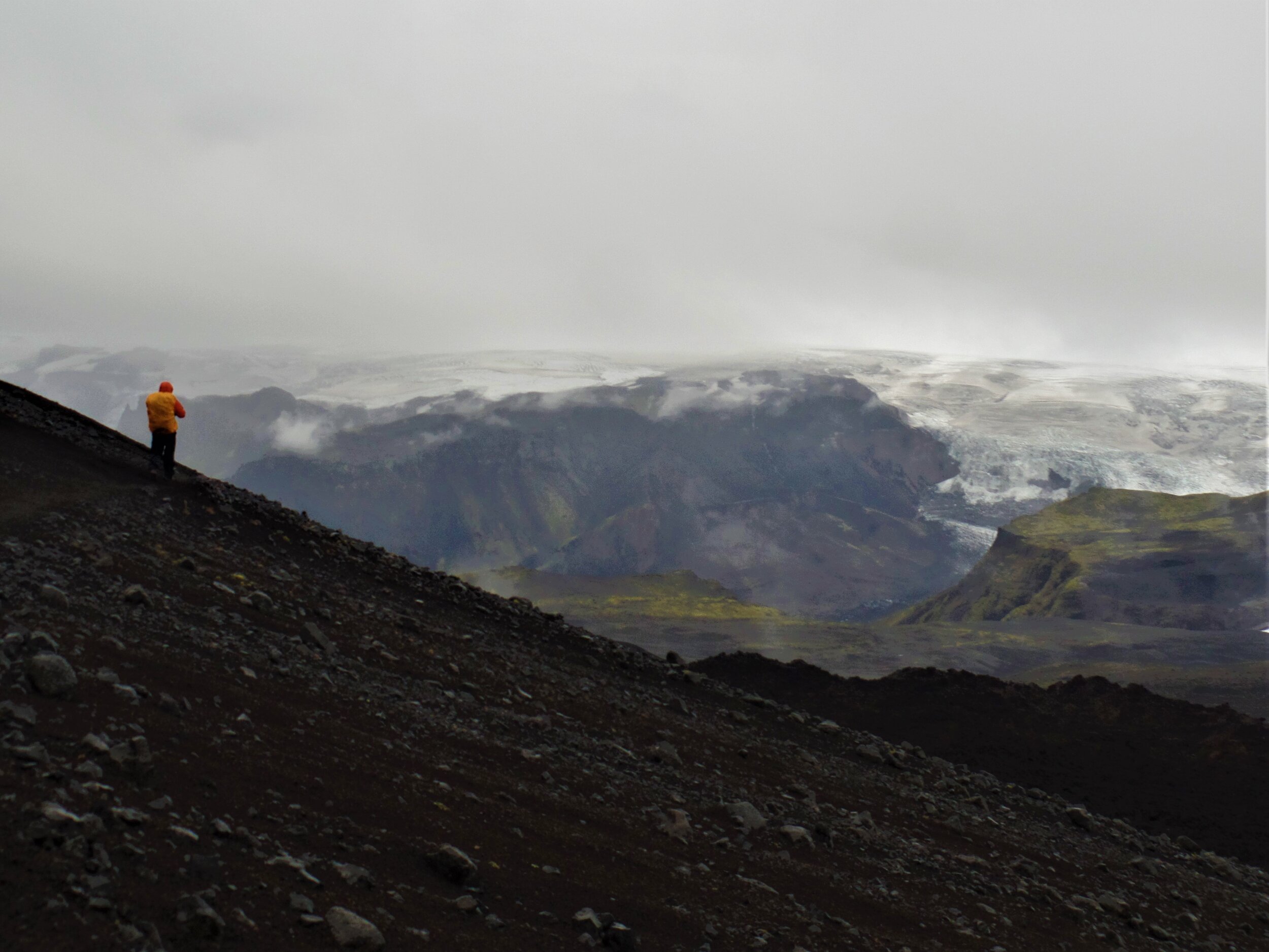
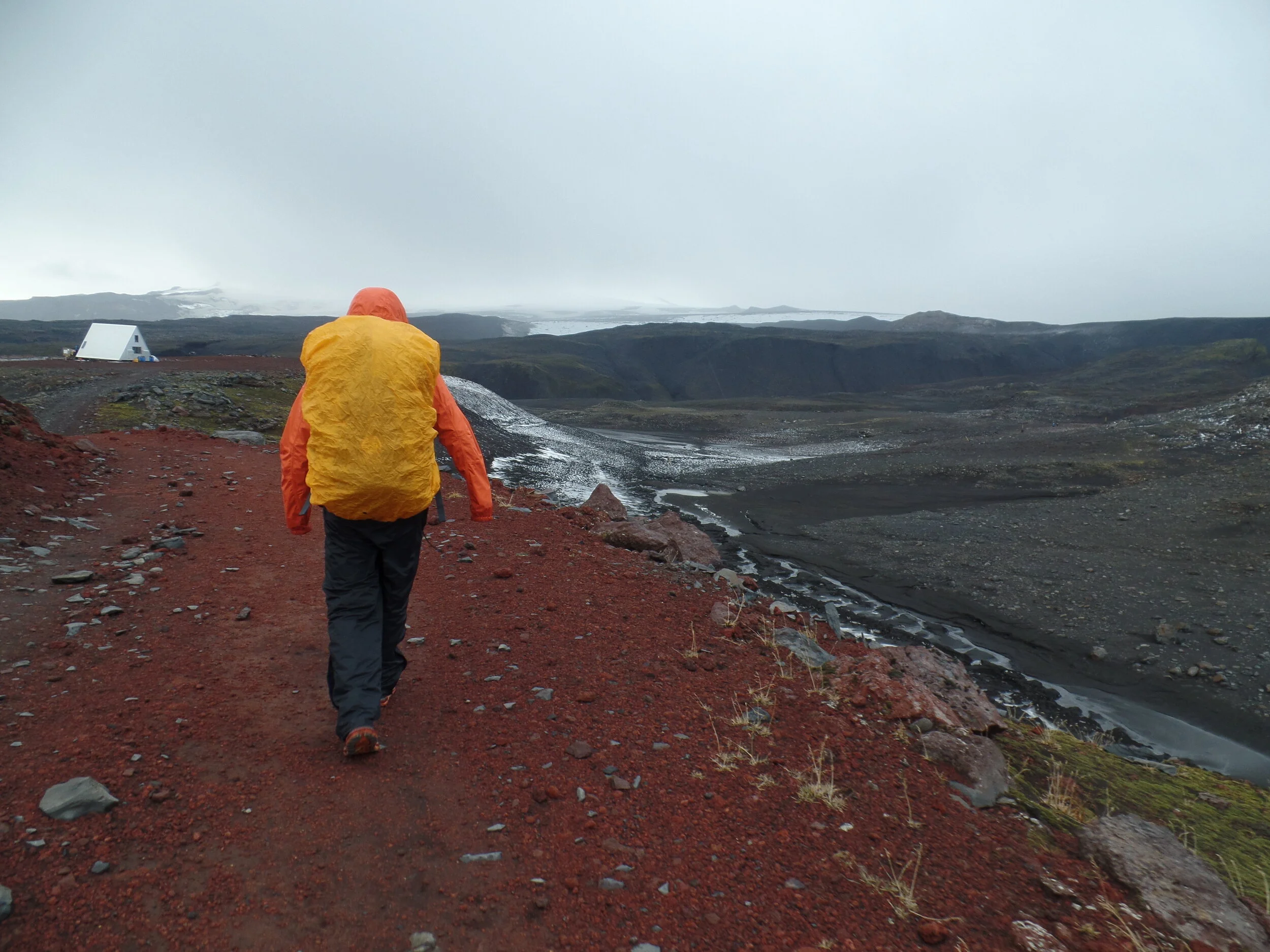
Next, you’ll cross the river via a small footbridge, and before you know it, the landscape in front of you is drastically different. You’re suddenly in a barren, black, volcanic landscape as you make your way up to the Fimmvorduhals pass, the high point of the trail. Along the way, you’ll be walking between two glaciated volcanos, Eyjafjallajokull and Myrdalsjokull, making for some truly epic scenery. You’ll hop through lava fields and trek across black sand desert as you make your way towards Thormsork.
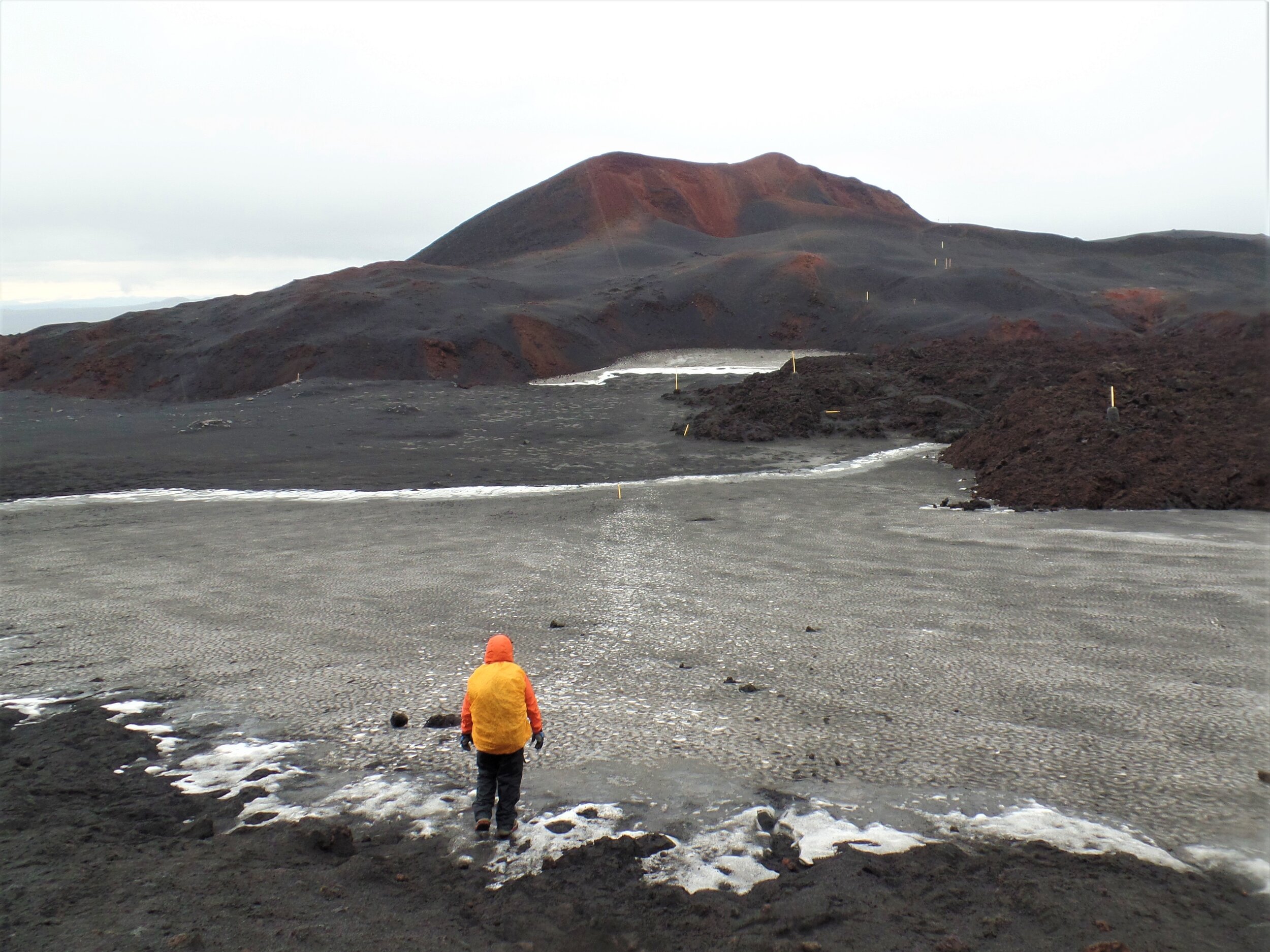
Finally, you’ll begin your descent into Thorsmork. The landscape transforms yet again into something truly out-of-this-world. The bright lime green moss that covers the dark canyon walls of Thorsmork is one of the most unique landscapes we have ever seen! Even though it was rainy and overcast for us along this part of the trail, we just couldn’t get over where we were.
This hike is quite challenging for a day hike. Not only does it stretch over 15 miles and gain over 4,200 feet of elevation, you have to be prepared for the unexpected weather of the Icelandic highlands. Rain, snow, wind… it can all happen on the Fimmvorduhals, even in the course of a single day.
Not only is the hike physically demanding, but it’s also logistically challenging as well. Since it’s a point to point, you’ll have to figure out a way to arrange transportation from one trail head to another, which is harder than is sounds in Iceland! The road into Thorsmork is rough and requires river crossings, so unless you have a car that can handle that (and we don’t recommend taking your rental through these rivers), then you’ll have to rely on public buses.
If you’re looking for a truly epic hike in Iceland and are up for a challenge, the Fimmvorduhals route is your hike and is definitely one for the bucketlist.

How to get to the trailhead: The Fimmvorduhals hike is a point to point hike that can start in either Skogar or Thorsmork.
Getting to Skogar is easy enough, as it’s right along the ring road.
Getting to Thorsmork is a bit tricker, as the F roads into the valley require substantial river crossings that most cars, even standard 4x4s, can’t handle. You’ll likely need to arrange a spot on a public bus that goes into and out of Thorsmork to get to and from that end of the hike. Plus, you’ll still need a way to get between the two trailheads, as there is no bus that goes directly between Skogar and Thorsmork. Be sure to read our Fimmvorduhals guide where we go over all of your options and exactly how to arrange your transportation between the two trailheads.
5. Waterfall Way
Best for: An easy hike that packs a big punch for scenery and waterfalls
Length: 10 miles out and back
Recommended time: 4 hours
Location: Skogafoss

Ok, so this hike kind of overlaps with the Fimmvorduhals hike, but we wanted to include it on this list for those who aren’t quite up to hiking the entire length of the Fimmvorduhals route.
If that describes you, then you’re in luck, because you can still experience a small part of this epic Iceland hike by walking down Waterfall Way.
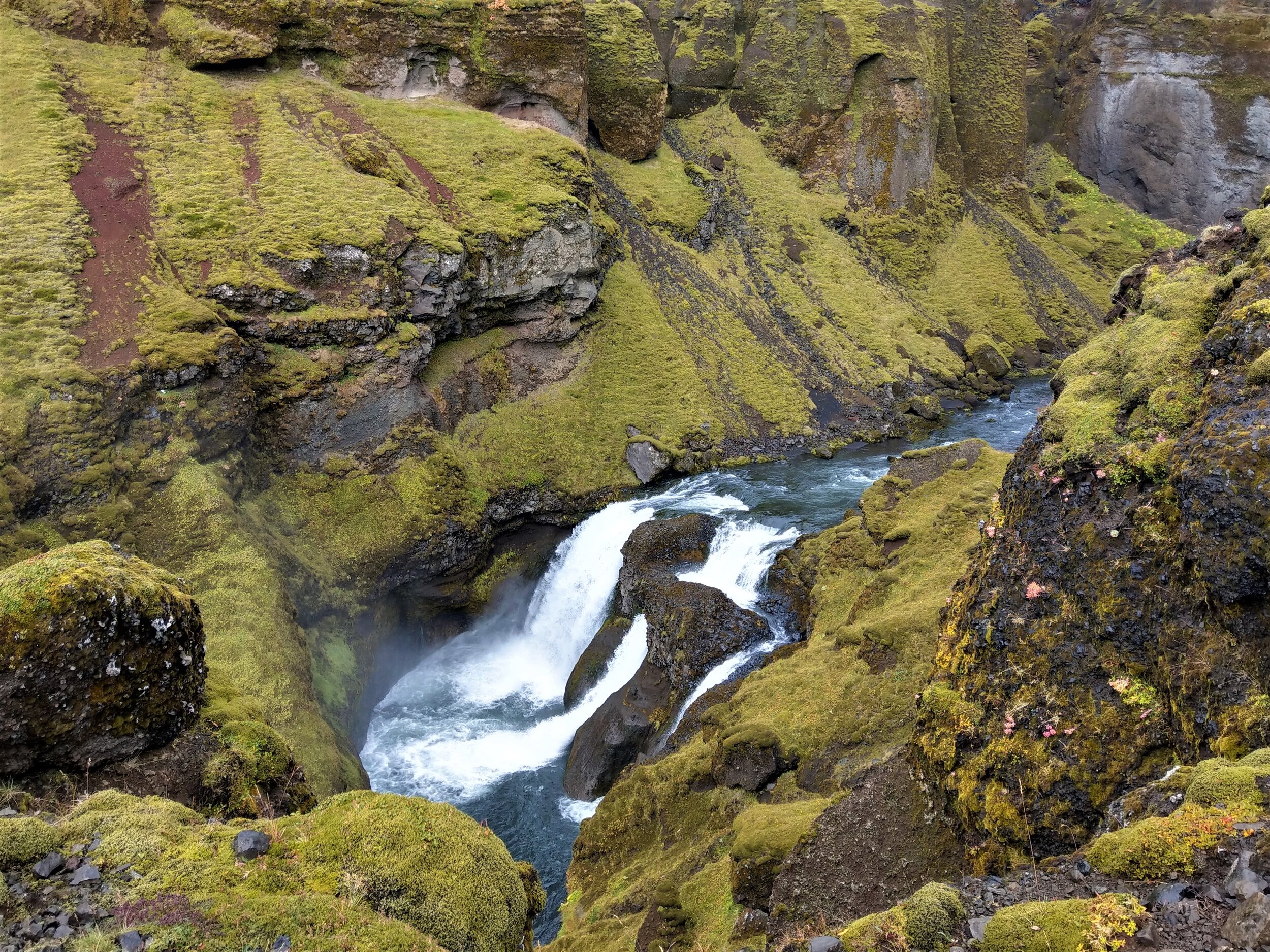
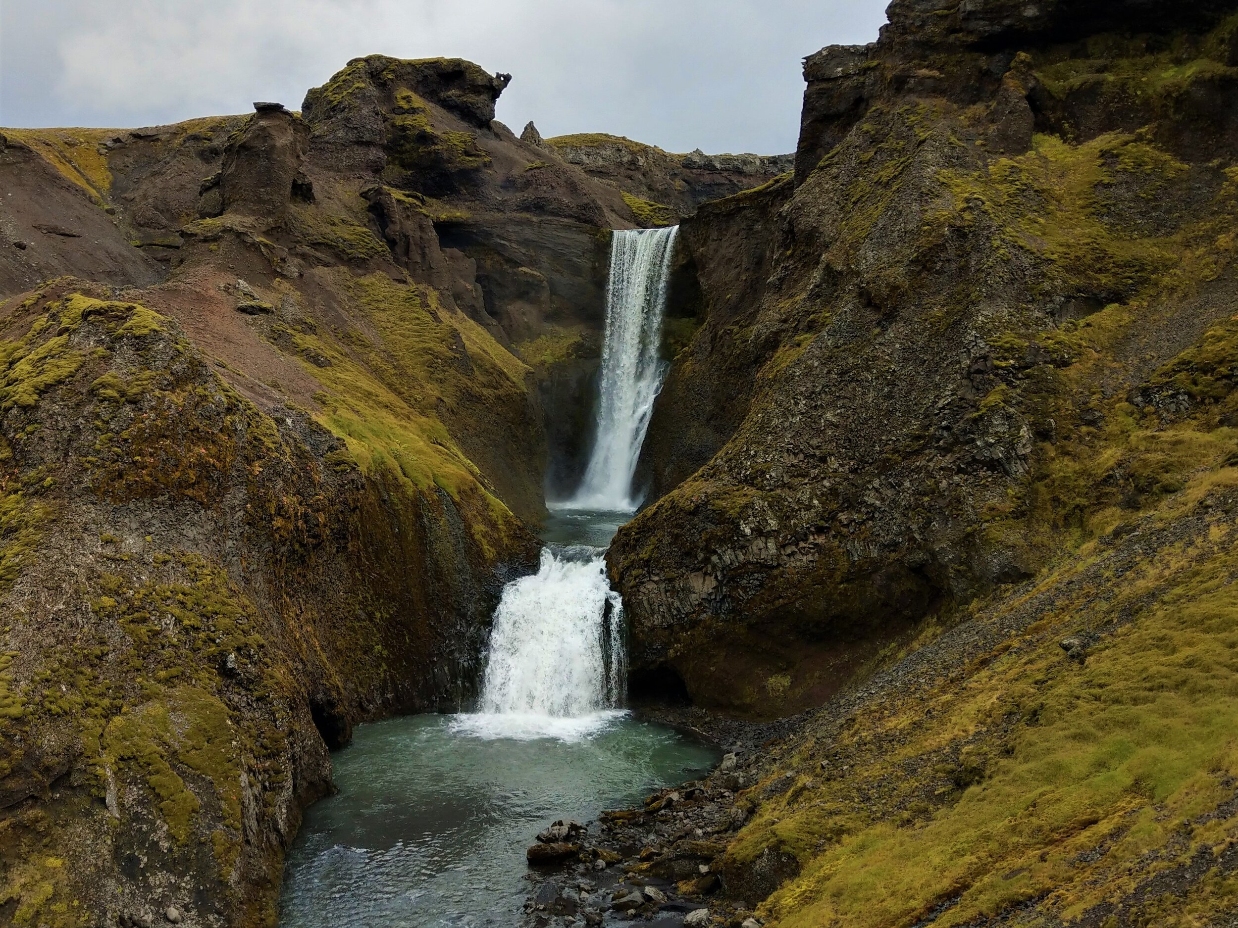
Waterfall Way is the first five miles of the Fimmvorduhals trek. It follows the Skoga river all the way up to the footbridge crossing. It’s an incredibly scenic 10 mile roundtrip hike that passes by all 26 waterfalls of the river as they cascade through the picturesque canyon. Plus, it’s relatively easy, and with the exception of the initial climb up the top of Skogafoss, has only minor ups and downs as you follow the river inland.
Its relative easiness combined with beautiful scenery make this one of the best bang-for-your-buck hikes in Iceland. Go as far along the trail as you’d like before turning around, but remember, the further you go, the more you’ll escape the crowds, which is always a good thing in our book!
Other Hikes to Consider in Iceland
Like we said from the get-go, this list is not comprehensive of all the incredible hikes that can be found in Iceland, and there are still plenty more on our list that we want to go back to do!
We thought we include some other ones on our list that we can’t speak from experience on, but might give you some more ideas when deciding which Iceland hikes you want to do.
Glymur waterfall: A moderate half day hike that leads to an overlook of the second tallest waterfall in Iceland. It can be easily done as a day trip from Reykjavik or as a minor detour off a ring road itinerary.
Mount Esja: Mount Esja is a popular route due to its proximity to Reykjavik. It’s a short but steady and often steep climb up to a point overlook at Reykjavik and the surrounding ocean. Take a look at this hike if you don’t plan on venturing too far from the city but still want to get a hike in.
Laugavegur Trek: No list of hikes in Iceland would be complete without the Laugavegur hike. This is 3-4 day world-famous backpacking route from Landmannalauguer to Thorsmork and is often combined with the Fimmvorduhals trail to make an incredibly epic trip from start to finish. This one is high on our list for when we return to Iceland, but requires a lot of planning and preparation, and a bit of luck weather-wise!
Tips for Hiking in Iceland
Ok, now that we’ve covered some of our favorite hikes in Iceland, it’s time to go over some more helpful hints to make your hiking trip in Iceland as smooth as possible.
Hiking in Iceland definitely requires a certain degree of preparedness, especially because of its notoriously unpredictable weather.
When to hike in Iceland
The best time to hike in Iceland is from mid-to-late June to mid-September. This is when the trails are safe and clear of snow. It’s also when the F-roads are open, so access to some of the trailheads on this list, like Landmannalauger and Thormsork, is available only within this time frame.
What to bring on an Iceland hike
The most important thing you can do in Iceland is be prepared for the weather. In a single day, you can experience sun, snow, rain, and wind. We would recommend having the following with you on any day hike in Iceland:
A rain coat
Rain pants! Having these were so helpful in Iceland, especially on the longer hikes like Fimmvorduhals where you don’t have to hike in drenched clothing all day.
A good pair of hiking boots. You’ll want hiking shoes with a good grip and waterproofing.
Warm layers for the changing weather.
Pack cover. This is to keep your hiking pack dry. Or at the very list, bring a dry bag that you can keep some of your gear in within your hiking pack.
Essentials like snacks, plenty of water, a first aid kit, and a map or GPS tracker, especially for the longer hikes.
There you have it…some of our favorite hikes in Iceland! We hope this has given you some ideas as you’re planning your own list of must-do hikes. Let us know in the comments which are your favorites if you’ve been to Iceland before!