How to Visit Landmannalaugar, Iceland: The Ultimate Guide
Landmannalaugar is located deep within the highlands of Iceland and is every outdoor enthusiast and hiker’s dream, consisting of colorful rhyolite mountains, steaming geothermal vents, an expansive lava field, and the chance to climb volcanos. When you’re there, you feel like you’ve been transported to another planet, or that maybe you somehow got trapped in an oil painting…
But you don’t need to be an avid hiker to plan a visit to Landmannalaugar or to appreciate its beauty, just someone with a love for the outdoors and seeing unique places. Simply wandering around, experiencing the scenery, and taking a dip in the People’s Pool, a natural hot spring at the edge of a lava field, is well worth a day trip from the Ring Road.
Not only is Landmannalaugar itself a worthy destination, but the journey to get there is an adventure, too. To get to Landmannalaugar, you’ll need to drive along roads known as F-roads, rough gravel roads that require a 4x4 vehicle and go deep into Iceland’s interior.
This might sound intimidating, but have no fear! That’s where we come in!
In this post, we’ll go over everything you need to know to plan a visit to Landmannalaugar, how to get there, and what to do once you’re there!
This post is jam-packed, so if you are looking for something in particular about your visit to Landmannalaugar, feel free to jump right to it!
Article Contents
Things to Know For a Visit to Landmannalaugar

Where is Landmannalaugar?
It’s not on the moon, so where is it?! Landmannalaugar is located in the southern highlands, in the interior of Iceland. It’s part of the Fjallabak Nature Reserve, known for its black sand deserts, moss-covered volcanoes, colorful rhyolite mountains and high degree of geothermal activity. In fact, this area has the largest collection of rhyolite formations and has the second largest amount of geothermal activity in Iceland!
Landmannalaugar itself is used by hikers and visitors as a basecamp to further explore the area. It sits at the edge of a large lava field against a backdrop of wide valleys and colorful mountains.
Landmannalaugar historically is best known for its geothermal pools, and while the natural hotsprings are still popular, today this area is best known for its epic hiking opportunities through these incredibly scenic landscapes. Hiking beyond the basecamp brings you into a world of blue, green, and red-striped mountains, steaming hillsides, and expansive lava fields. These hikes range from short, sweet and easy, to challenging multiday treks, with enough options to make everyone, from the casual hiker to the avid outdoor adventurer, happy.
In short, a visit to Landmannalaugar should definitely be on your Iceland bucketlist.
Best time to visit Landmannalaugar
The best time to visit Landamannalaugar to hike and to see the brilliant colors in all their glory is in the summer, when the trails are clear of snow and the daylight hours are at their longest. The roads into Landmannalaugar are actually only open from the end of June into mid-September, the only time when they are clear of snow and safe to travel on. More specifically, July to early September is the optimal window, because, even if the roads are open and clear, there may still be some snow on the trails as late as June and early July.
You can still visit Landmannalaugar in the winter on a guided Super Jeep Tour, but it will be a completely different experience. The landscape will be covered in a blanket of white, so hiking is not an option. However, the crowds here will be much thinner, and you can enjoy the natural geothermal bath and potentially have an epic place to catch the Northern Lights in true Icelandic wilderness.
So, even if you’re visiting Iceland in the winter to save some money on your Icelandic vacation, or to check out the cool winter things like the Northern Lights, don’t completely discount a visit to Landmannalaugar!
Weather in Landmannalaugar
Like everywhere in Iceland, the weather in the highlands can be unpredictable and fickle no matter what time of year it is, however, it’s even more so here. Come prepared for anything…rain, heavy winds, snow, sun….you name it.
We recommend keeping an eye on the forecast for a few days before visiting Landmannalaugar and just monitoring it. The forecast is usually accurate within a day or two. So if you want to make sure you have clear weather (is that a thing in Iceland??? Really, we’re asking…), it’s important to be flexible in your schedule and spontaneous enough to go when the weather gods act in your favor.
Keep in mind that I said the forecast is usually accurate. Even if it looks okay, still come prepared for rain. And if the forecast says cloudy, it will rain. For us, it was a purely cloudy forecast, but it ended up raining on us all night and most of the next morning.
In terms of temperatures, it’s always a little bit cooler in the highlands than along the ring road. In the summer, expect it to be somewhere in the 50s (F).
How to Get to Landmannalaugar
So we said it’s in the interior of the country, and mentioned something about F roads. How exactly do you get there?
You have three options when it comes to getting to Landmannalaugar. You can drive there yourself, take a bus, or join a guided tour.
How to Drive to Landmannalaugar
So you want to drive yourself to Landmannalaugar? Good choice! We think driving through Iceland is the best way to experience the country, giving you so much more flexibility, and driving yourself into the highlands will definitely be an adventure!
But, the first thing you should know is this: the only way to get to Landmannalaugar is by driving on rough gravel F roads. F roads in Iceland are characteristically rough gravel roads that, by law, absolutely require that you have a 4x4 vehicle. So, it’s impossible to get there with a regular 2- wheel drive car.
The condition of F roads throughout Iceland can vary. Some can be relatively smooth. Others can be riddled with potholes and so washboarded that you’ll feel your body residually shaking even after you get out of the car. These types of F roads require a pretty confident driver who is able to focus on the road for long periods of time. Take it from us, driving on these roads can get exhausting!
When renting a vehicle to drive on F roads, make sure the car you rent is approved for driving on these roads, and definitely make sure to purchase the extra gravel insurance! You’ll be happy with the extra peace of mind as you hear all the pings from stones hitting your car as you bounce down the F roads.
There are three main driving routes that will get you to Landmannalaugar. The three different roads are shown in the map below. The one we’ve marked with red dashes is the best way to get to Landmannalaugar on your own.
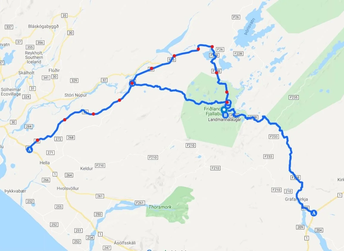
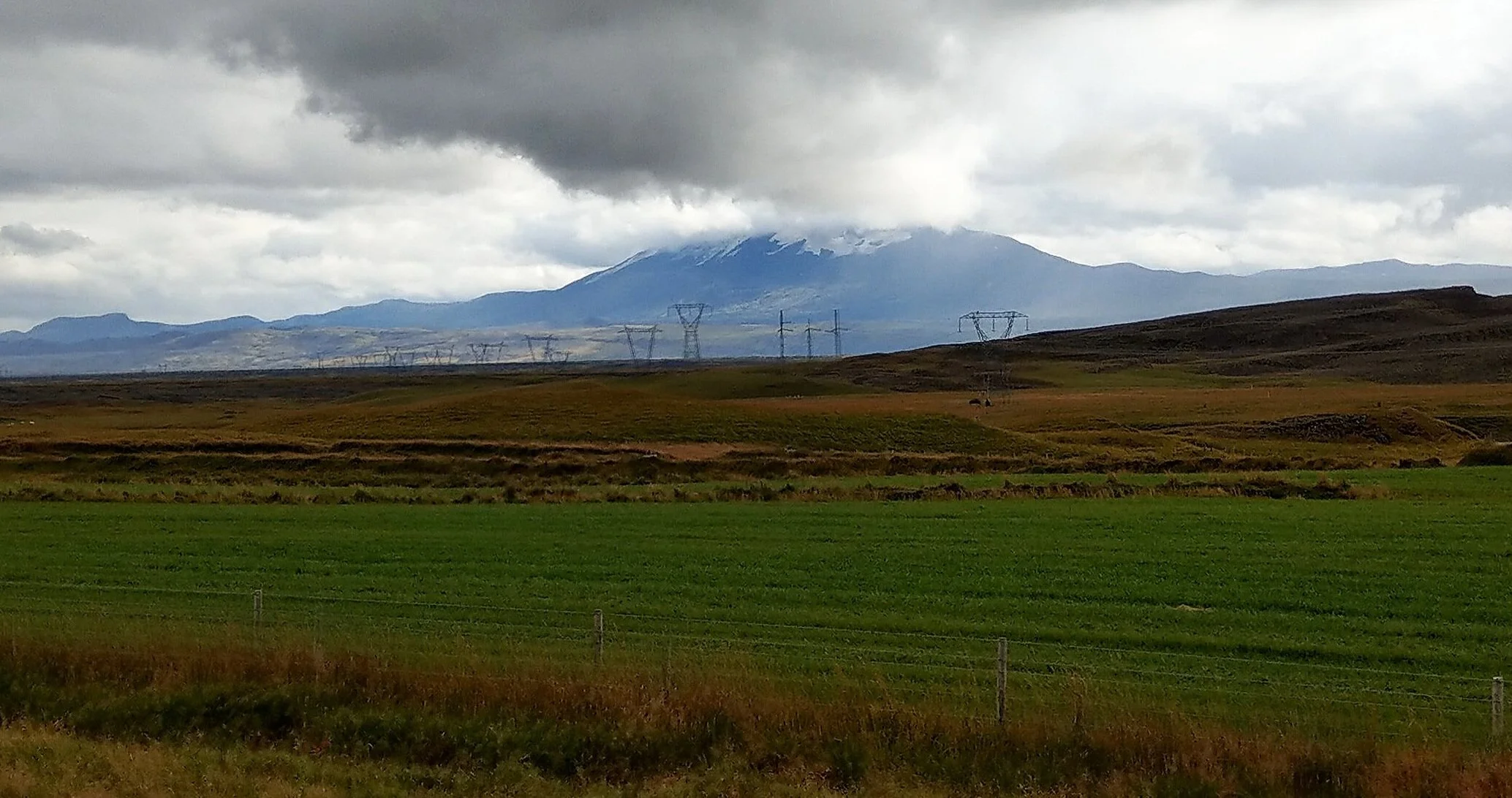
This red- dashed route is the first, and easiest, option to get to Landmannalaugar. You will take route 26 off the ring road (located between Selfoss and Hella). This is a well paved road that becomes an F road after about 50 minutes of driving (about 60 km), however, the initial portion of this F road is still paved. It’s a fairly scenic drive, because off to the east, if you’re lucky and have a clear day (rare in Iceland!), you’ll get a gorgeous view of Hekla, a MASSIVE volcano, and one of Iceland’s most active!
You’ll follow F26 for another 15 minutes (20 km), and watch as the landscape gradually changes from grassy hillsides to dark barren volcanic landscape. It’s a pretty cool transition to experience!
After a bit on F26, the road will split and you’ll turn right onto F208…but it’s still paved! After about 5 more minutes, you’ll drive by a geothermal power plant alongside a large lake, and this is where the road becomes gravel… and it can get a little rough.
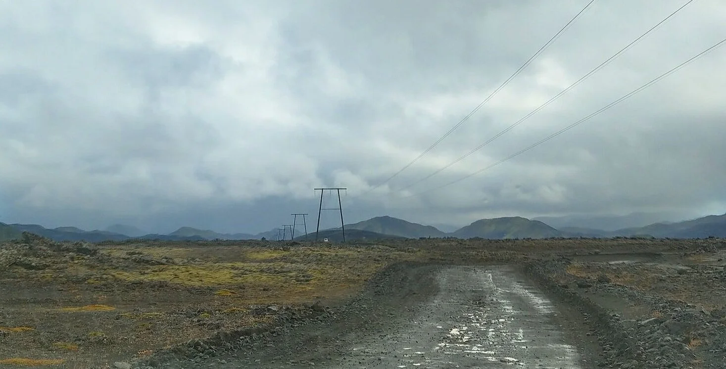
The initial portion right after the gravel starts is up a small hill, and when we drove it, was really rough – probably THE worst section of road we drove in all of Iceland! There were huge potholes and rocks that we had to dodge, and it was just all around an extremely bumpy and uncomfortable ride. But, we actually passed a grader that was attempting to level and clear off the road a bit, and when we drove back through the next day, the road was slightly better.
Fortunately, this doesn’t last for too long, and the road starts to smooth out pretty nicely. It became almost like packed dirt, although you still have to keep your eyes peeled for the occasional potholes and loose rocks that are just waiting for you to become their next victim (so dramatic…).
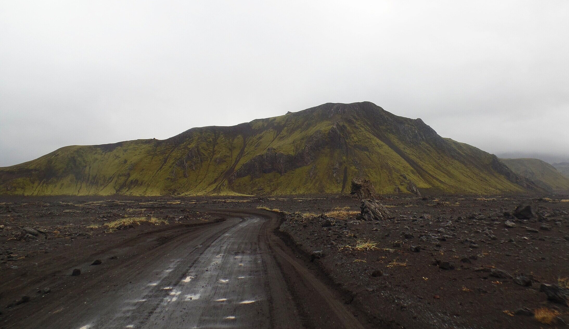
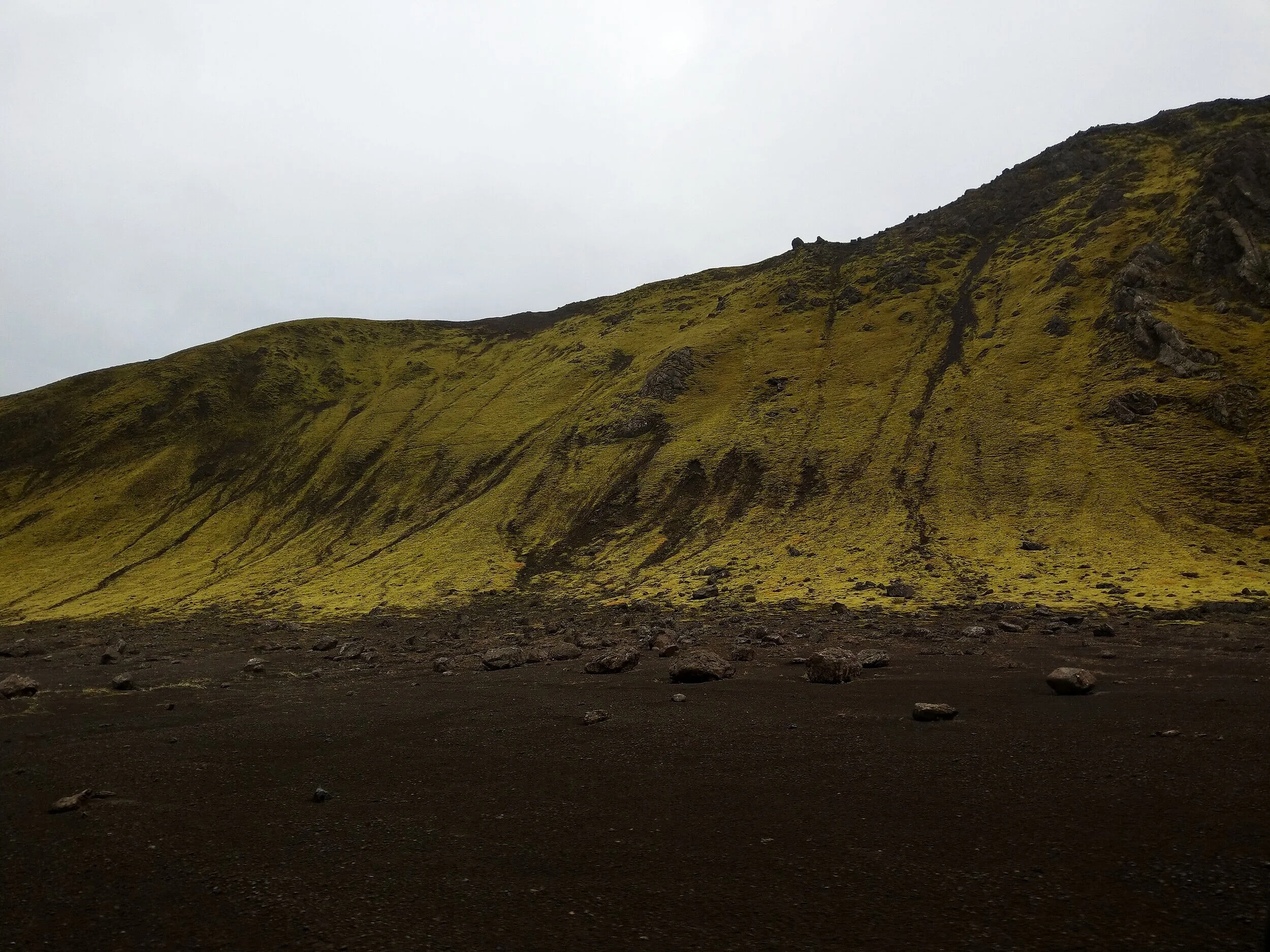
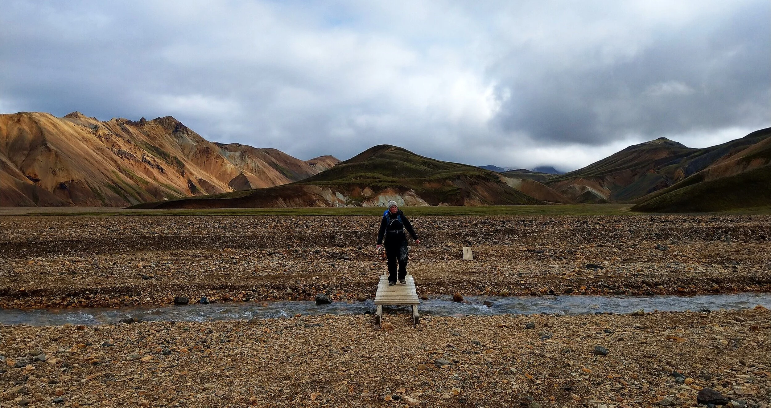
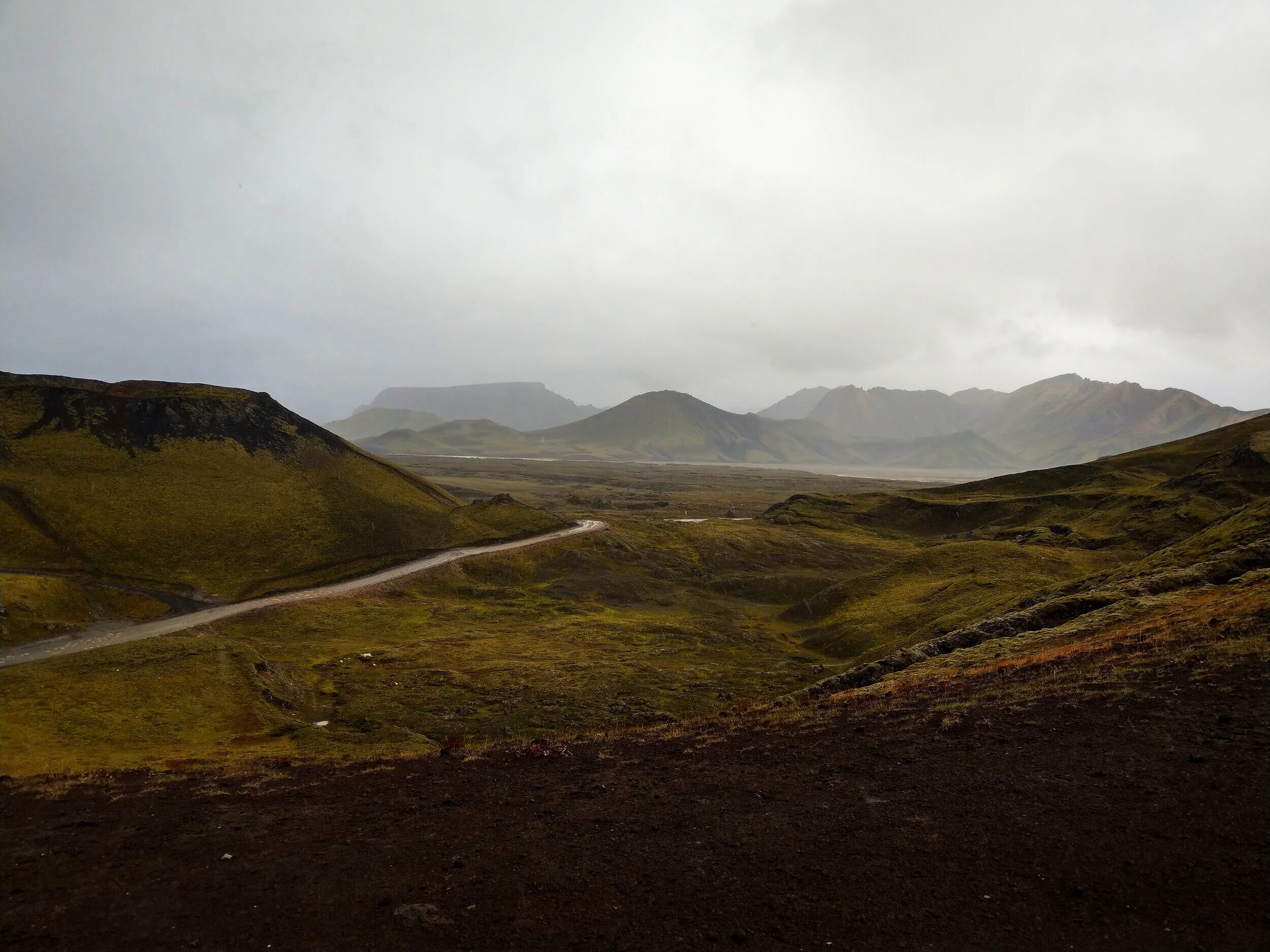
You’ll be on gravel road for about an hour before you reach Landmannalaugar. As you enter the Fjallabak Nature Reserve, you’ll start to see why this area is so special and unique. You’ll drive through desolate black sand deserts punctuated by the striking contrast of lime-green moss- covered hills and mountains. It’s the coolest thing!
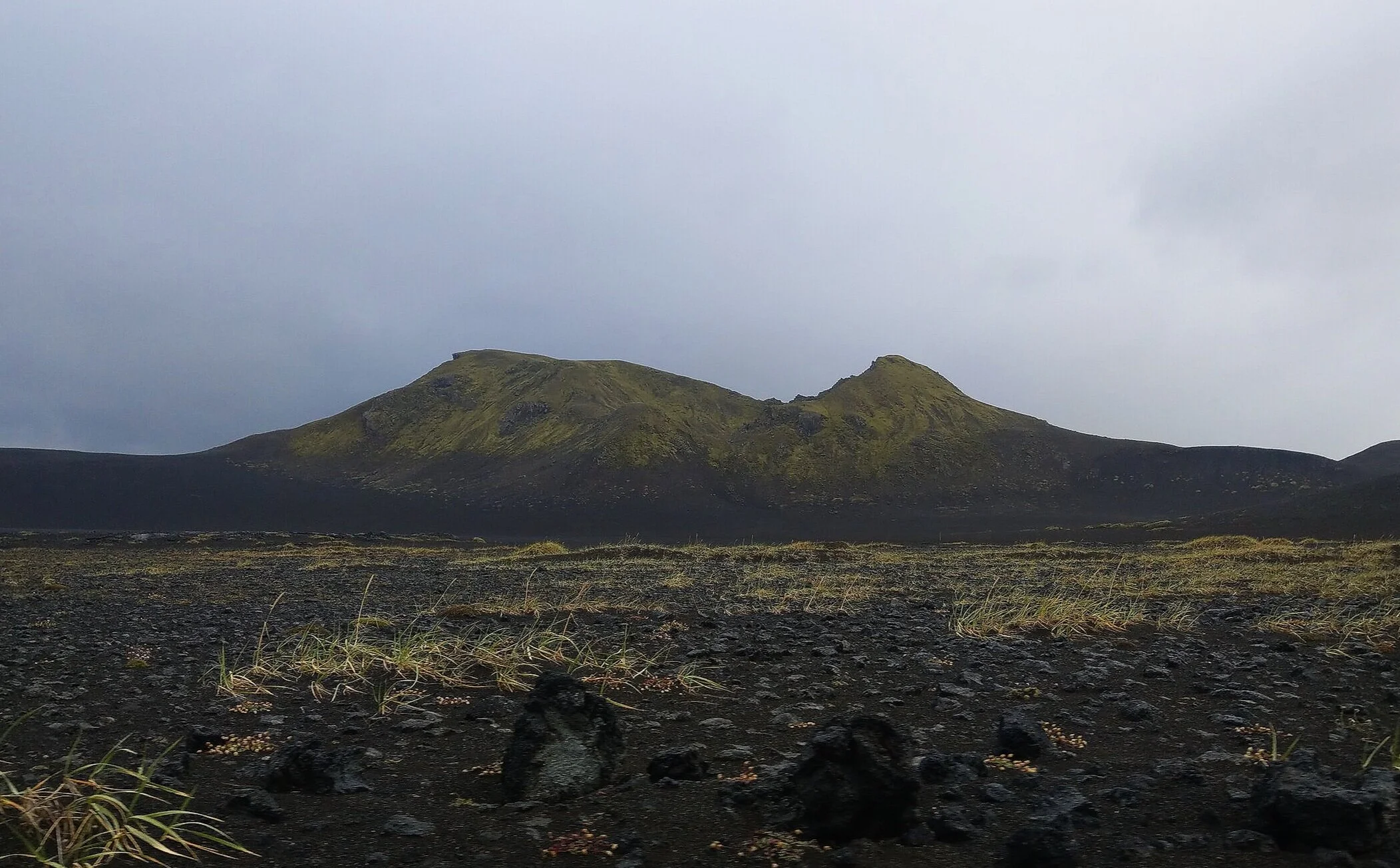
Check out this birds-eye view of the road to Landmannalaugar through the otherwordly landscape of volcanic craters and black sand desert. It’s something, right? Can you see the tiny white cars making their way down the road? We did say part of the adventure of visiting Landmannalaugar is just the journey there…
Just a few kilometers before you reach Landmannalaugar, you’ll make a right- hand turn onto F224 for the final stretch. Clear signs at the intersection will keep you on the right path to Landmannalaugar.
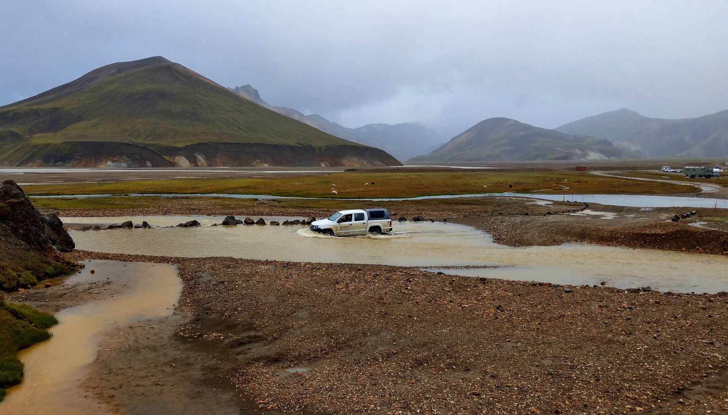
The other two routes to get to Landmannalaugar are a bit more rugged, adventurous, and off the beaten path, as they require river crossings. We do NOT recommend you try these with a normal 4x4. The moment you touch water, all bets are off and insurance stops covering you. Any damage incurred is on you… and water damage, especially to the engine, will cost you tons. Not to mention it’s just not safe. So unless you have a jeep outfitted specially for crossing rivers or are on a tour, we wouldn’t recommend these routes.
Important! Make sure you check the road conditions and any advisories before driving to Landmannalaugar.
Also, make sure you have a full tank before you leave the ring road! There was one gas station on route 26 shortly after leaving the ring road, but when we stopped there, their gas pump wasn’t working and it would be another several hours until they had a new part in to fix it. Luckily we were just doing a top off instead of actually needing gas. Because this is the LAST gas station en route to Landmannalaugar, so you need enough gas to get all the way into Landmannalaugar and back without refilling.
Driving distances and times to Landmannalaugar via F26:
From Reykjavik – About 3 hours / 200 km
From Fludir along the Golden Circle – Just over 2 hours / 120 km
From Vik (along the southern Ring Road) – 2 hours and 45 minutes / 120 km
Good to know: These estimates are based on driving straight through. But in Iceland, you should always plan for things to take just a bit longer! There are always cool sights to see and places to stop along the way to any destination, and Landmannalaugar is no exception. If you can budget more than one day to this area, we suggest planning a good portion of your day just driving into Landmannalaugar, as there a few neat stops to make along the way.
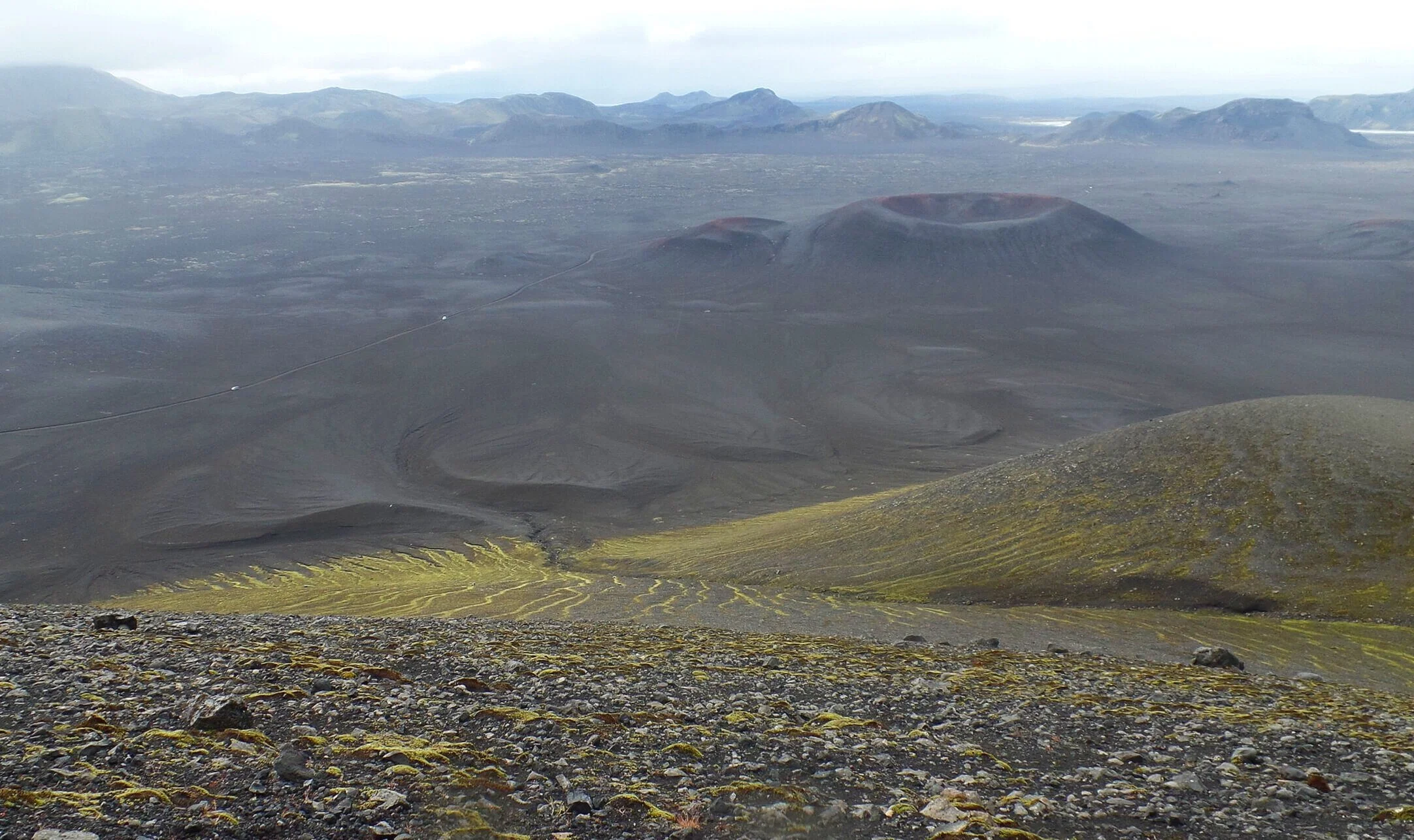
Check out this volcanic crater we stopped at on our way into Landmannalaugar! This random detour was actually one of THE coolest things we saw in all of Iceland!
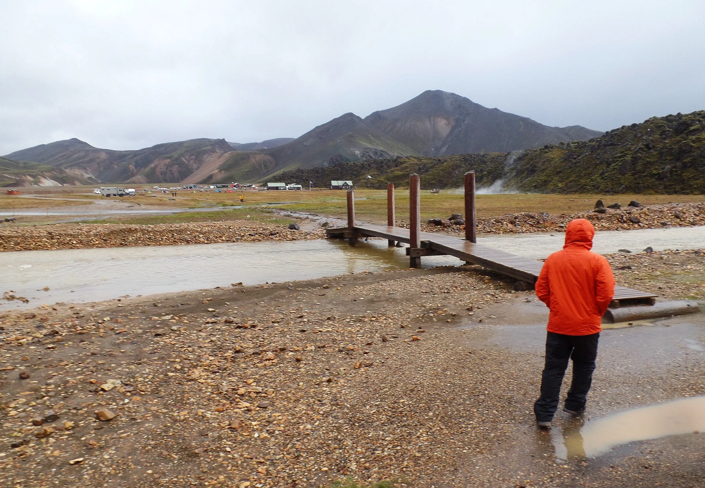
A note about parking in Landmannalaugar: F224 ends in the first of two parking lots for Landmannalaugar. Going any further requires a river crossing. The walk from here to the hut and campground is just over 0.3 miles. Be prepared to have to carry everything in! If you have the proper vehicle and can manage to cross the river, the second parking lot is adjacent to the campsite.
How to take a bus to Landmannalaugar
If driving doesn’t sound appealing to you (and hey, I don’t blame you!), you can also take a bus into Landmannalaugar.
There are several bus companies in Iceland that make daily trips between Reykjavik and Landmannalaugar, making stops in various towns along the way (you can catch the bus from any of these bus stops).

For example, Reykjavik Excursions has an Iceland On Your Own bus pass for buses that leave from the Reykjavik bus terminal (or the Reykjavik campsite) and go to Landmannalaugar, taking about four hours. The earliest the bus will get you there is 12:15 pm, with buses leaving to head back to Reykjavik at 4 and 7 pm. You can choose to just spend the day there or catch the bus back another day.
Trex , Sterna, and Thule all have similar options, and we recommend you browse their sites to compare your different options.
When choosing a bus to Landmannalaugar, make sure you check out the following:
The dates of operation. Most buses operate somewhere between mid-June and mid-September, but each company has different start and end dates.
Bus schedules. Most companies have two daily buses leaving Reykjavik, one in the morning around 7-8 am and one in the afternoon around 12 or 12:30 pm. Those leaving Landmannalaugar are a bit more varied.
Which stops they make along the way. This is important if you don’t plan on being picked up in Reykjavik, but in a town further down the route (which will make the bus trip shorter and cheaper).
Prices. A roundtrip ticket will run you at least 15,000 ISK, or about $120 USD.
Make sure you book in advance, however, it might be helpful to wait just a few days before your planned visit to Landmannalaugar to monitor the weather and conditions.
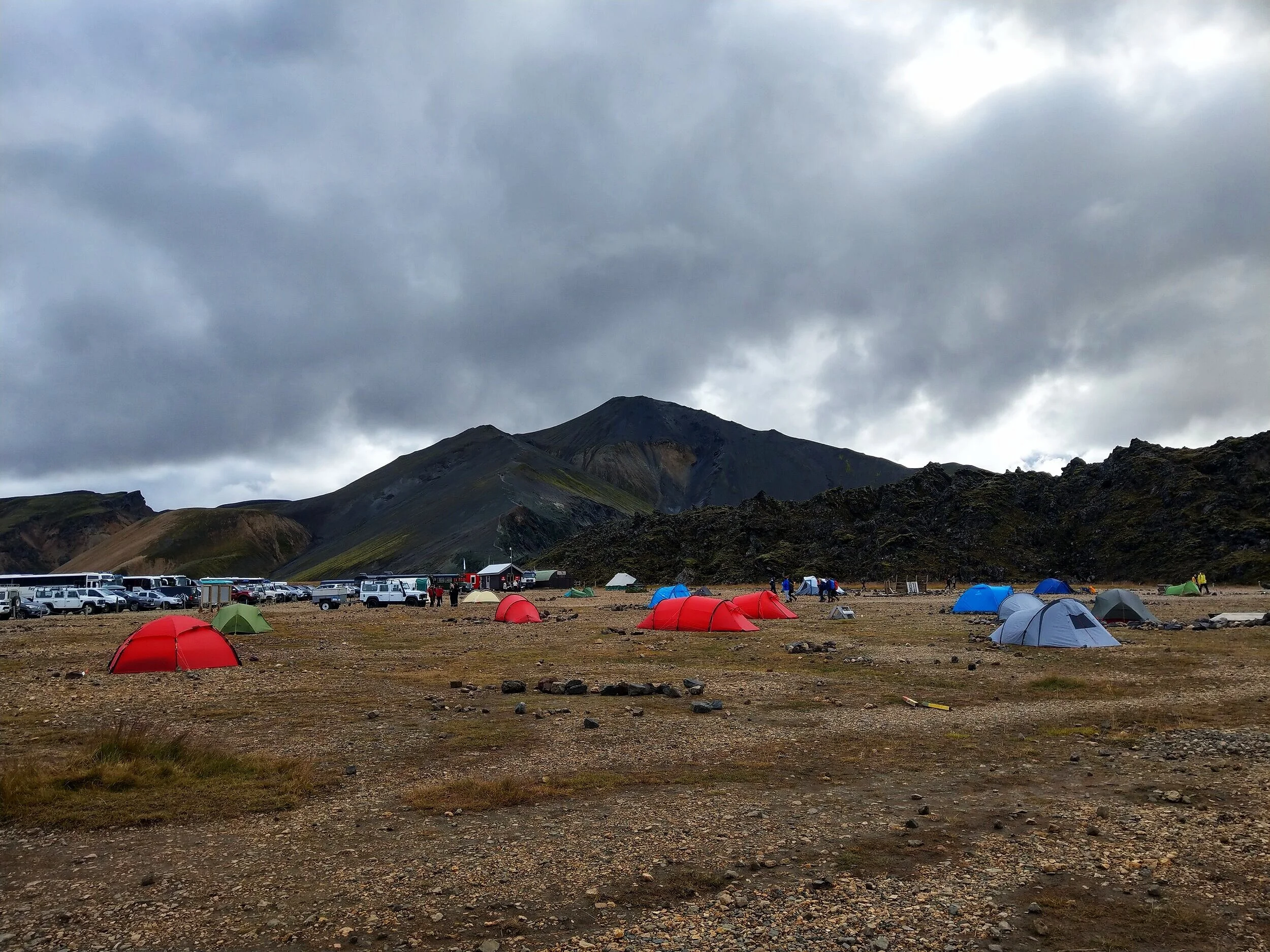
Sleeping Accommodations and Camping in Landmannalaugar
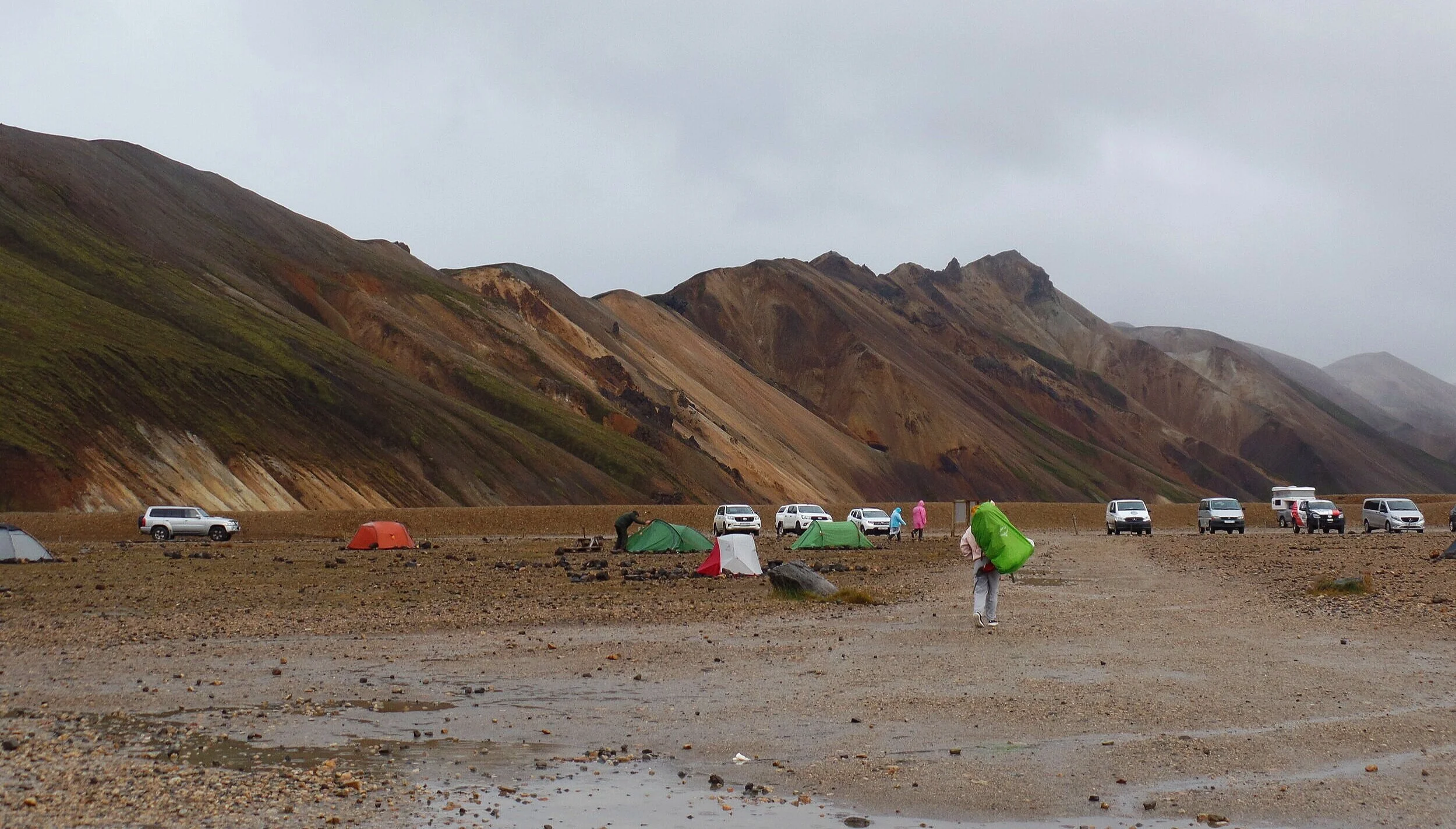
Your two options for spending the night in Landmannalaugar are staying in the hut or camping. These options are open from mid-June to mid-September each year.
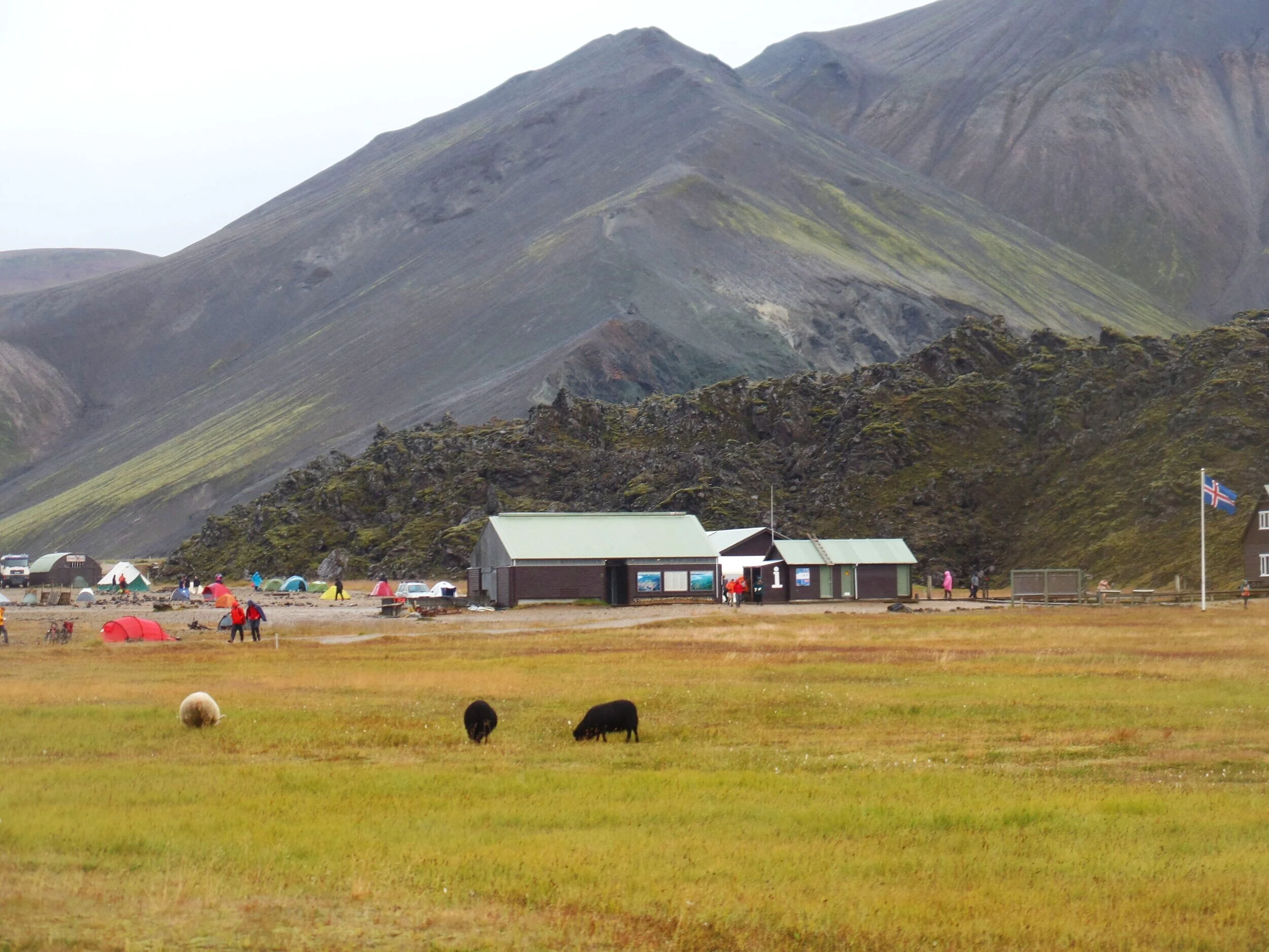
The hut is operated by The Icelandic Touring Association FÍ (Ferðafélag Íslands) and has dorms with enough bunks to house 78 people (but you have to bring your own bedding) and a fully equipped kitchen. The bathroom is separate, and the same one shared by the campground and all visitors to Landmannalaugar. The hut costs 9000 ISK per person per night and you need to make reservations well in advance.
The campground is directly adjacent to the hut. It’s pretty much just an open space and a free for all for pitching tents. (And if you have a campervan or car tent, you can just stay parked in the parking lot that runs adjacent to the campground). Either way, expect to have close neighbors and be in tight quarters, especially during the height of the summer. A lot of people also say they have trouble staking their tents into the ground because it’s super rocky and hard, but we had no issues. You don’t get access to the facilities in the hut (i.e. the kitchen), however there is a tented shelter with picnic tables where you can cook and eat, and dish washing facilities outside. The campground costs 2000 ISK per person and is first come first served… no advanced reservations needed.
The bathroom, shared by all visitors to Landmannalaugar, is a single unisex building with heat, showers, warm water and place to hang your clothes to dry.
Other Services in Landmannalaugar

Visitor Center: There is a small visitor center in Landmannalaugar where you can purchase snacks, hiking maps, purchase campground passes and day passes and get more information about the area.
Food: There’s also a unique thing called the Mountain Mall…two old buses were converted and outfitted to sell basic camping and hiking supplies, snacks, and drinks (can anyone say hot coffee? Or even better…hot cocoa?). We actually didn’t even know about this when we were there! They are located at the back of the campground and we thought they were just some of the parked tour buses.
Visitor Pass: If you’re just visiting Landmannalaugar for the day and do not intend on spending the night, you still have to purchase a visitor pass at the visitor center (an orange wristband). This gives you permission to use the facilities, including the bathroom and outdoor cooking areas. These are 500 ISK per person if purchased in Landmannalaugar, but only 400 ISK if purchased in advance online.
Services that are NOT available in Landmannalaugar: Wifi, gas stations, restaurants, or hotels. (I know this might seem obvious, but we just want to make sure it’s clear 😉). Don’t expect to get cell phone service in Landmannalaugar either. We didn’t have any using Nova, but we heard that Siminn has service even in the highlands.
Best Things To Do in Landmannalaugar
Okay, now it’s time for the good stuff! You came all this way to visit Landmannalaugar, now what’s a person to do?!
Get out there and enjoy the landscape around you!
Hiking in Landmannalauger
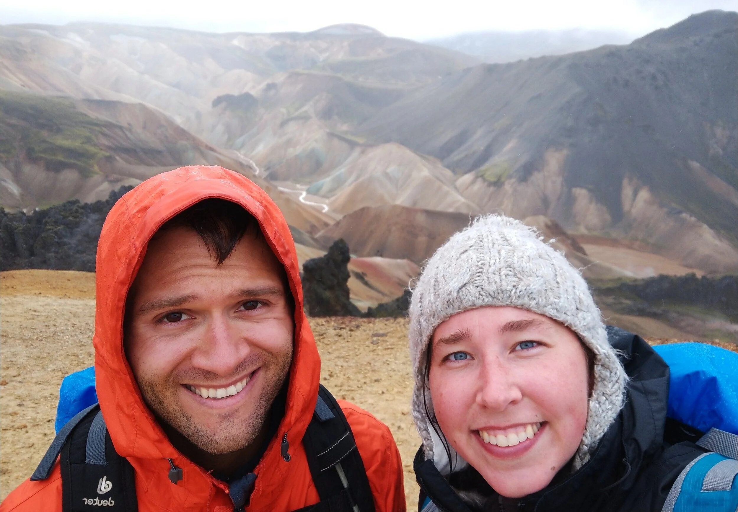
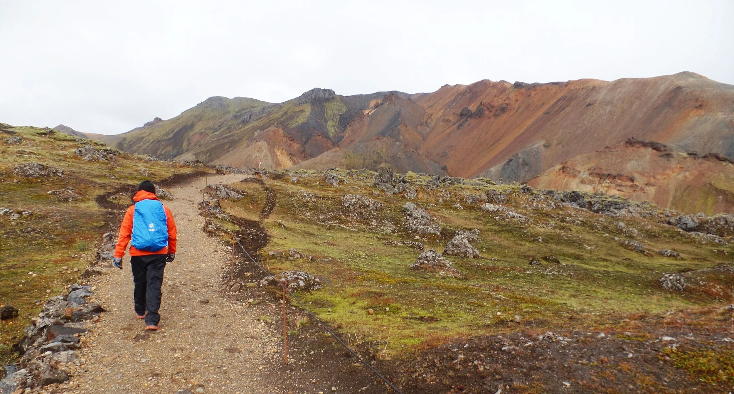
Hiking is absolutely one of the best things you can do during your visit and what Landmannalaugar is most well-known for. Venturing beyond basecamp brings you into otherworldly landscapes, and, when looking back on it, even Kevin still goes “What the hell planet were we on?!”.
We think Landmannalaugar is the best place in Iceland for hiking, and we can’t wait to get back and check out more trails! There are hikes for anyone… from short flat strolls through lava fields, to steep climbs up dormant volcanoes.
You can purchase this hiking map at the information center right in Landmannalaugar. The colors of the trail on the map correspond with the colors of the hiking posts along the trails, which are, for the most part, pretty well-marked.
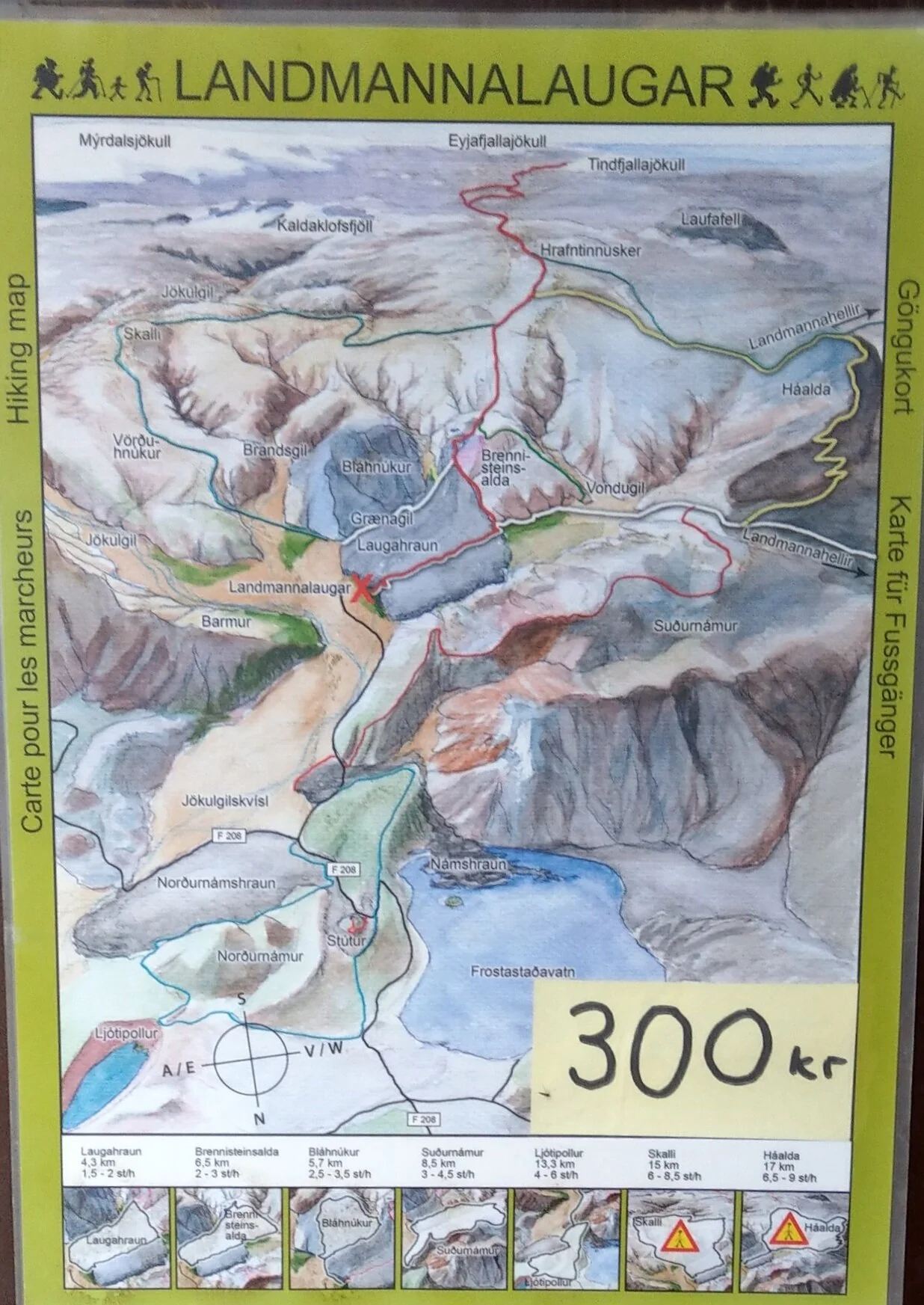
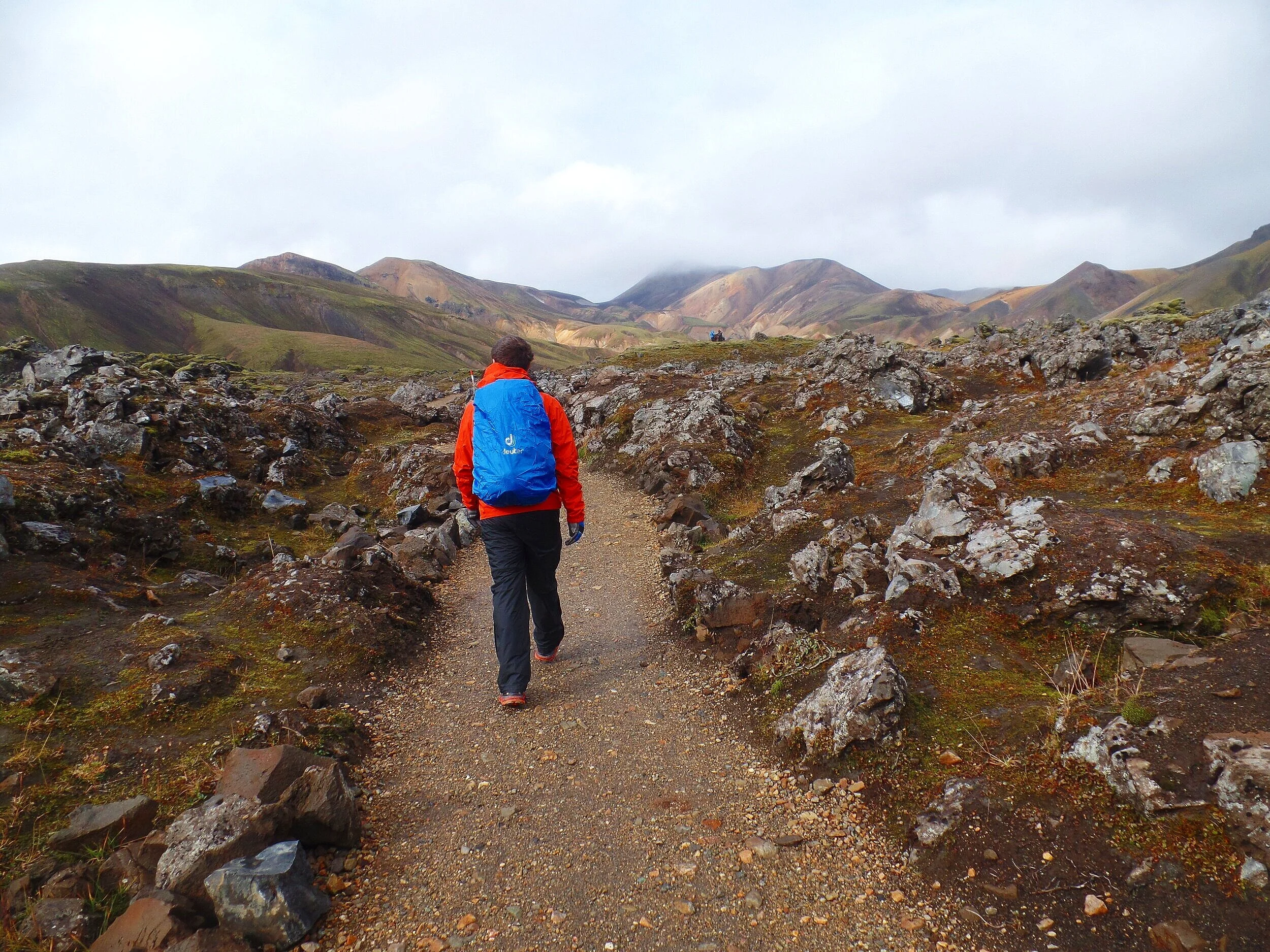
The best hikes on the easier side are the Laugahraun and Graenagil trails, which can be combined into a short loop.
Laugahraun- Graenagil Canyon Loop - 4.3 km (2.7 mi)
This is a mostly flat loop through the Laugahraun lava field, which was formed from an eruption back in 1477. It starts with a short but steep climb from basecamp up into the lava field following the red and white-marked trail. The start of this trail is well-marked by signs that will lead you to an area just behind the Landmannalaugar hut where the hike begins.
You’ll traverse a flat trail through to the other edge of the lava field, with colorful mountain views on either side of you.
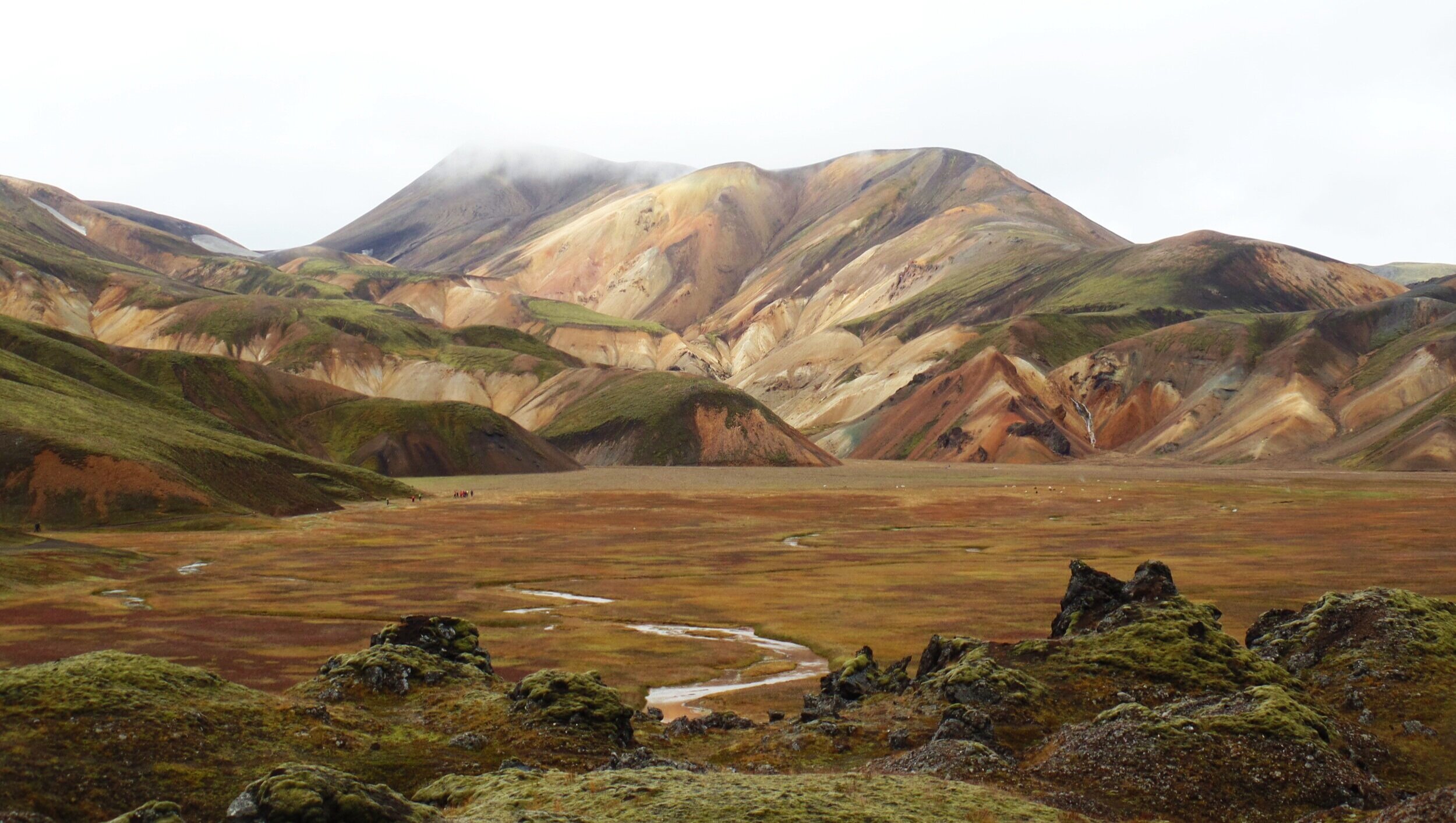
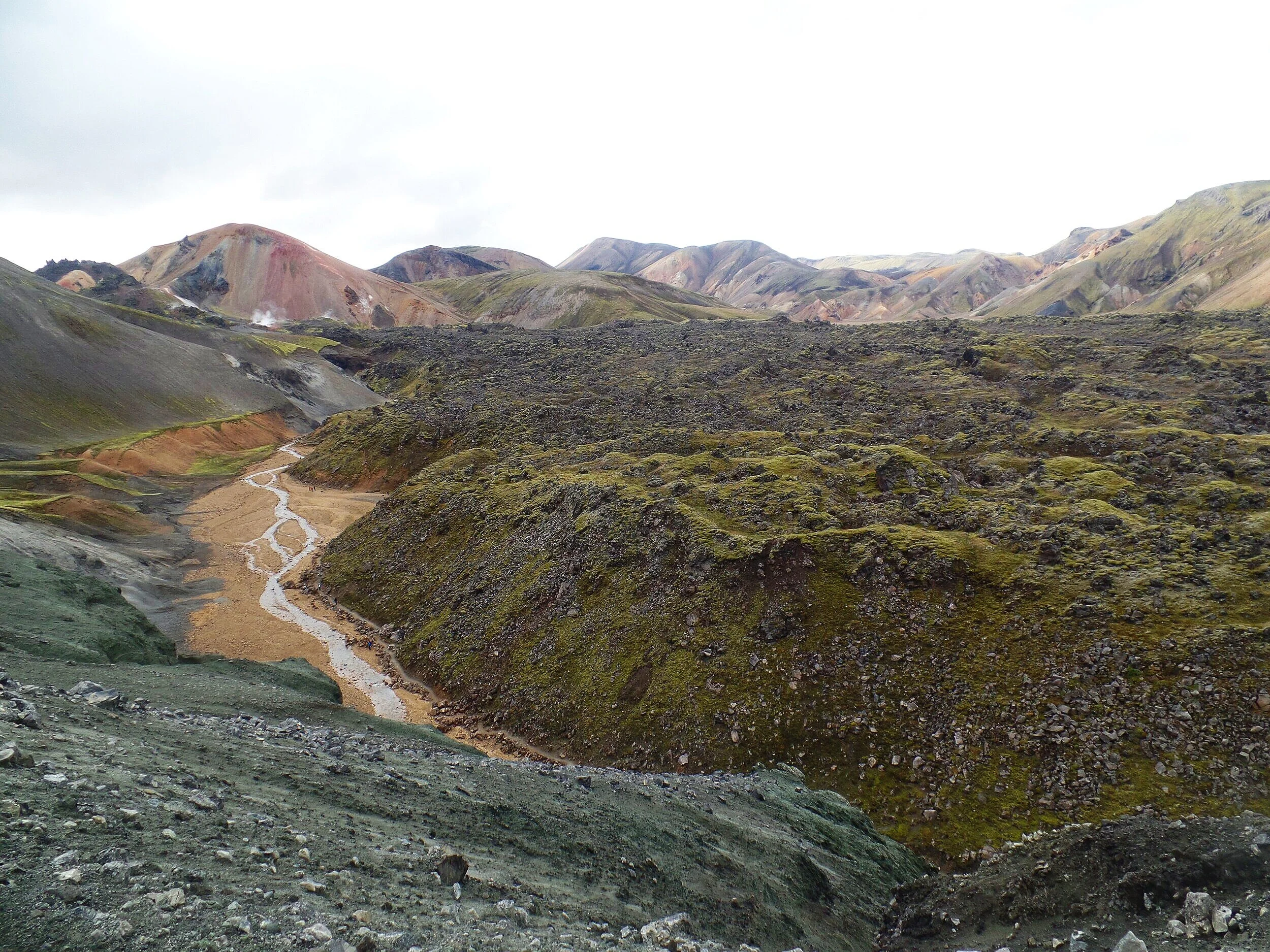
Once you reach the end of the lava field, you’ll come to Vondugil Canyon, a wide plateau between the colorful rhyolite mountains. You’ll hang a left, following the red path towards Hrafntinnusker (you’ll see the signs leading the way) and skirt between the edge of Laugahraun to your left and Brennisteinsalda, the almost rainbow-colored mountain to your right. After passing through some steaming vents and fumaroles, you’ll reach another intersection. Here, you’ll take a left, following the white path back through the other side of the lava field and back to basecamp.
You’ll have a flat walk out through Graenagil Canyon, with lava walls to your left and the mighty blue Blahnukur to your right. You’ll come out of the canyon with just a short walk through the valley back to basecamp.
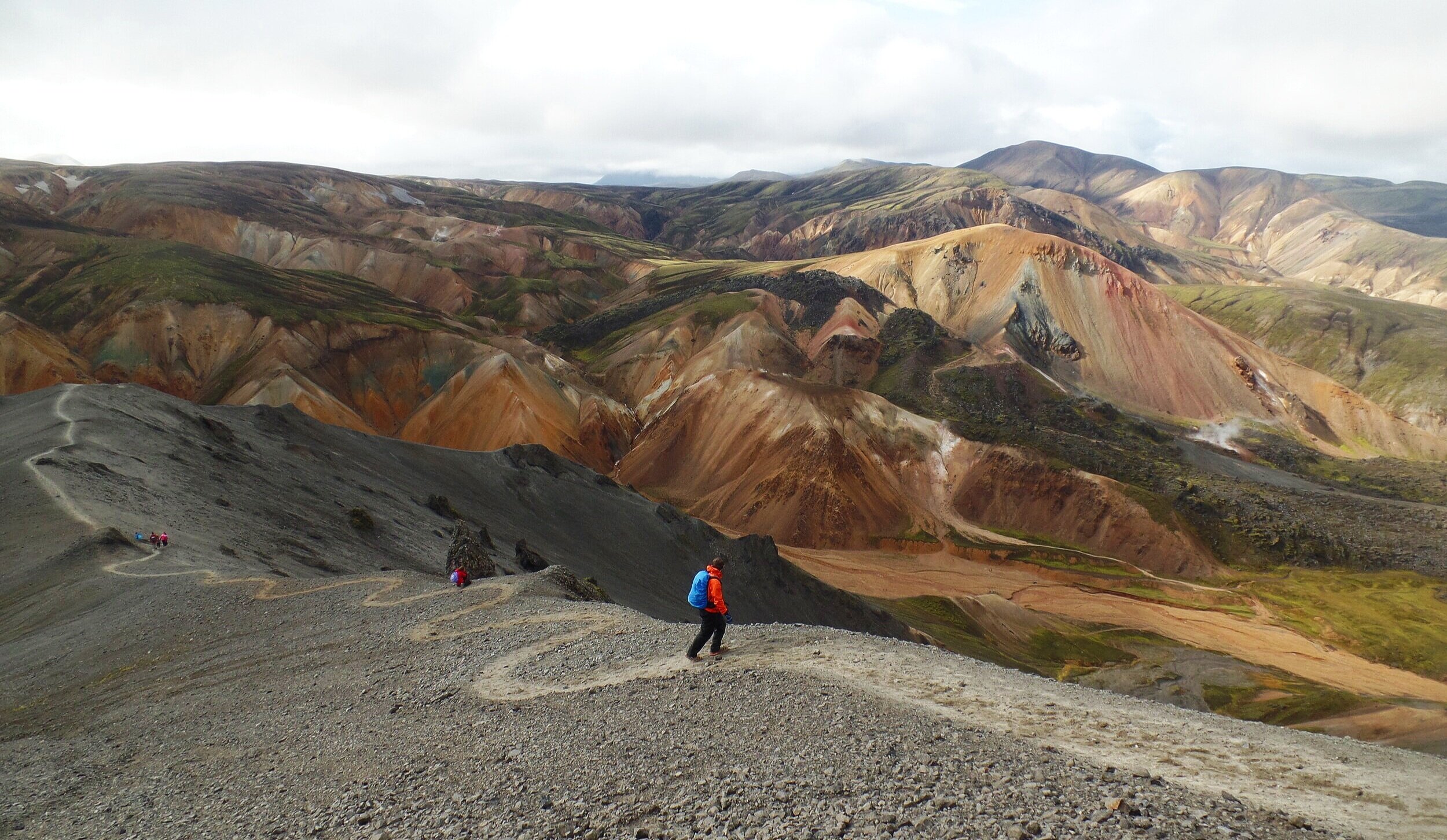
The picture below is a bird’s eye view of the canyon looking down from the trail on Blahnukur.
Landmannalaugar also has some longer or more difficult hikes for those looking for more of a challenge or for better birds-eye views over the area.
Sudurnamur – 8.5 km (5.3 mi) – 300 m (1000 ft) gain
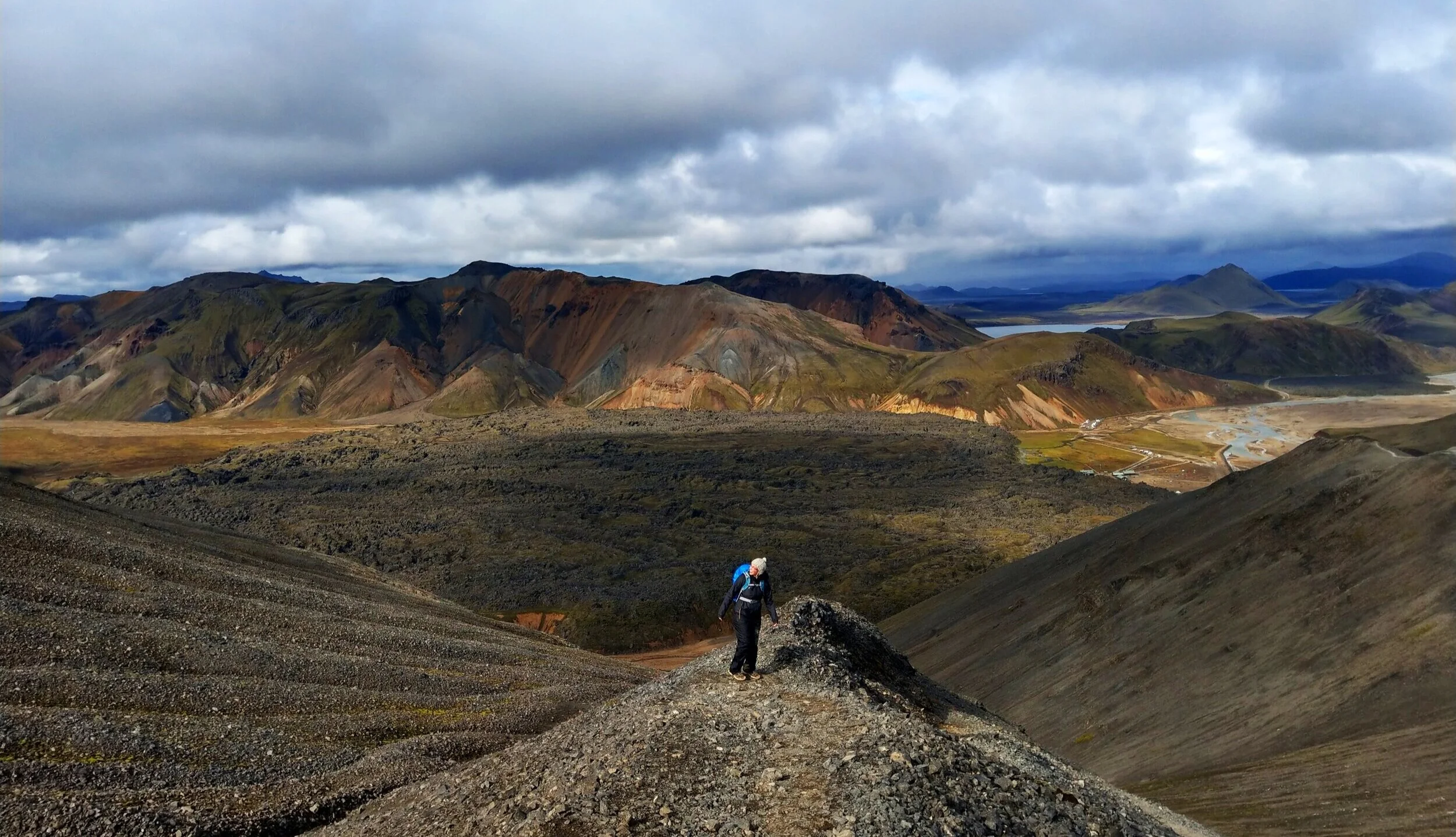
This is about a 5.5 mile hike that takes you up and across a mountain ridge located just north of the Laugahraun lava field. Completing the loop will take you back to basecamp via the Laugahraun trail, giving you the best of both worlds in Landmannalaugar… mountain views and lava field strolls.
We didn’t do this hike, but in the picture above, the ridge that you’ll traverse across on the Sudurnamur hike is in the background, on the other side of the lava field.
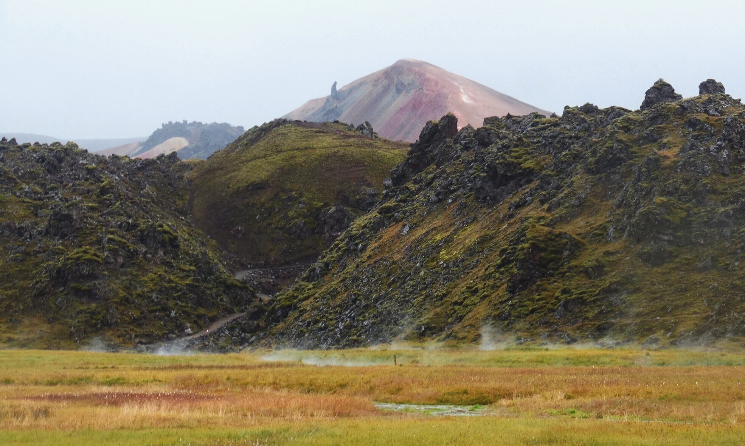
Brennisteinsalda - 6.5 km (4 mi) – 200 m (660 ft) gain
Breinnisteinsalda, or “The Sulphur Wave”, is a shining example of the striking colors formed by the rhyolite mountains, and can be hiked to the top for stunning views over Landmannalaugar. It is the colorful mountain in the background of the picture above.
You’ll start by hiking through the Laugahraun lava field, but instead of looping back around on the Graenagil Canyon trail, you’ll continue along the trail as you traverse the side of the mountain past colorful hillsides and steaming geothermal vents.

You’ll reach an intersection to either continue straight along the Laugevegur trail, or hook a right and continue your climb up Breinnisteinsalda. From here, it’s a short but steep climb to the top.
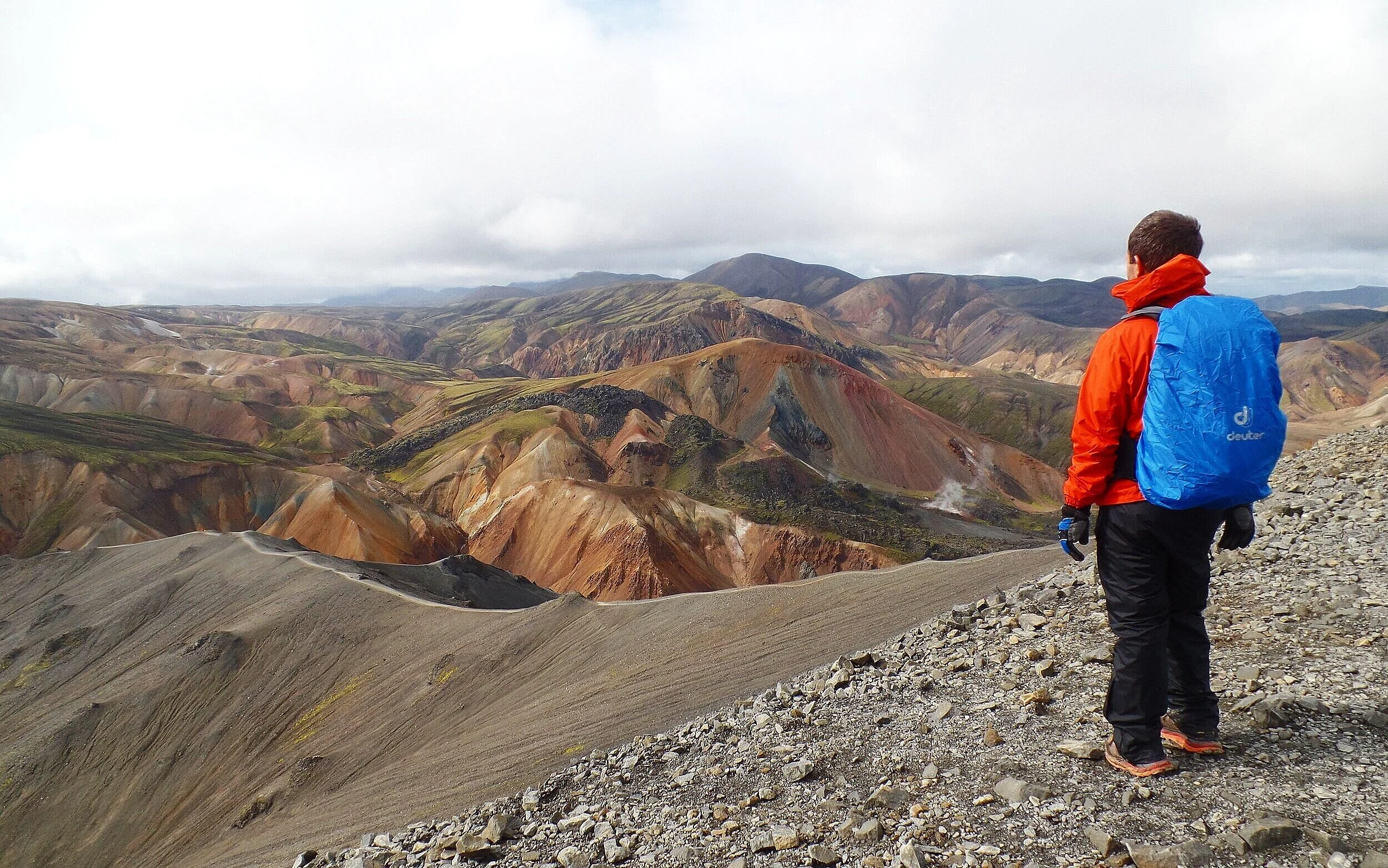
From the top, you get sweeping views over Landmannalaugar and a direct view over to Blahnukur, the next hike on our list.


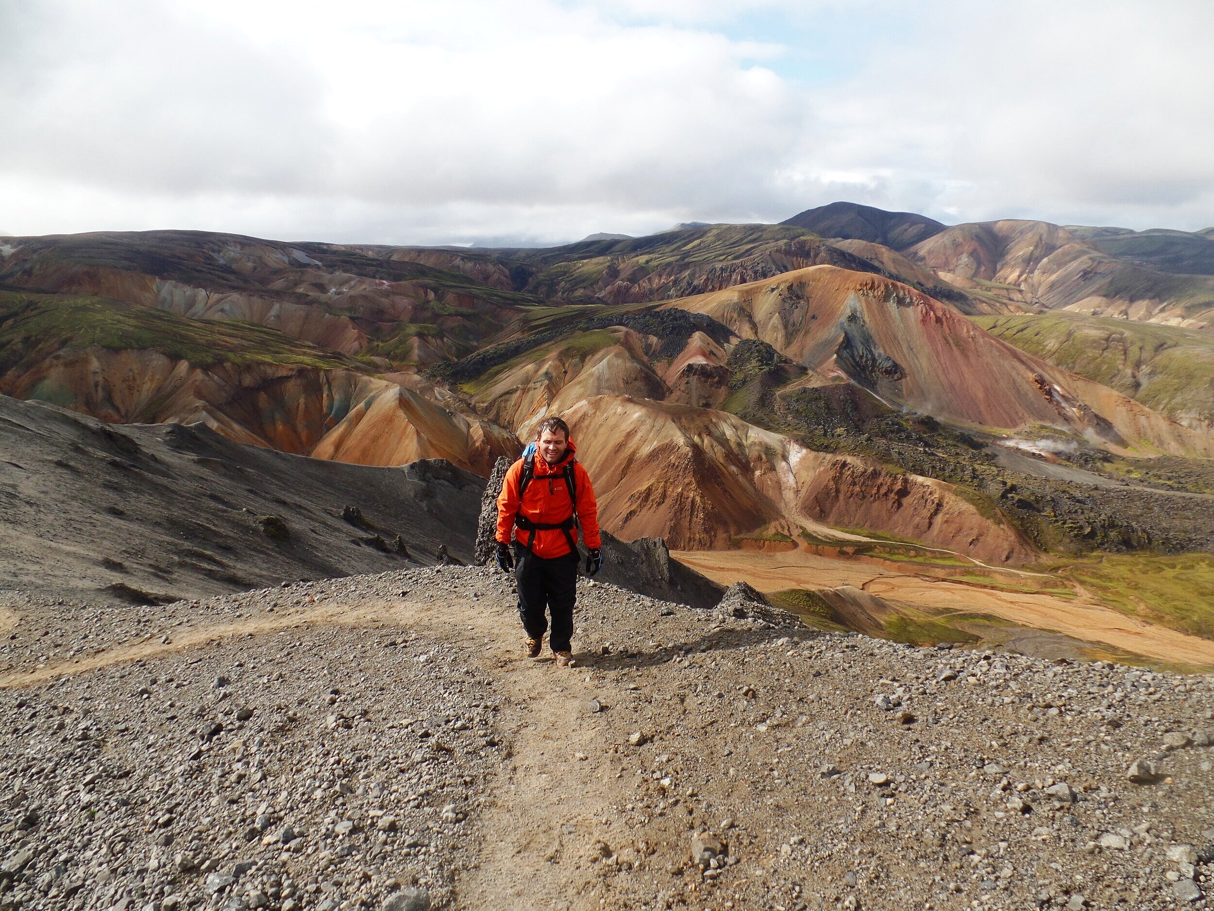
Blahnukur - 5.7 km (3.5 mi) - 320 m (1,050 ft) gain

Blahnukur, or “The Blue Peak” is one of Landmannalaugar’s most popular day hikes. Named after it’s blue-greenish tint, which makes a striking contrast to the colorful rhyolite mountains that surround it, it involves a steady climb up long ridge lines on either side. Your efforts will be rewarded with a breathtaking summit view over Landmannalaugar.

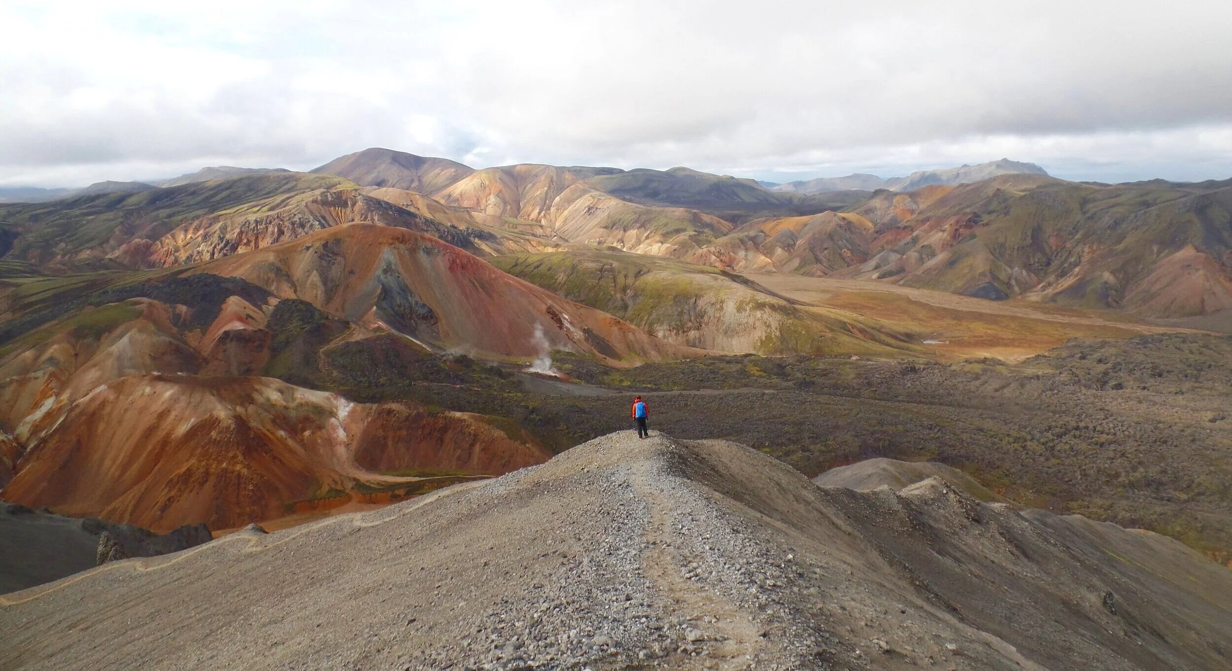
If you had to choose just one, though, our recommendation is Blahnukur, without a doubt. The views from this summit are just…well…we’ll let the pictures above do the talking here.
Some worthy hikes worth nothing are those that are a bit of a trek to get to from basecamp. However, they are just off the road on the way into Landmannalaugar, right before the intersection onto F224, and if you have your own car, you can simply pull off to the side of the road and begin your hike from here rather than from basecamp.
Stutur is a small volcanic crater that you literally drive right beside on the way to Landmannalaugar. It’s a short climb to the top and a quick traverse around its rim. Stutur is the crater to the left in the picture below.
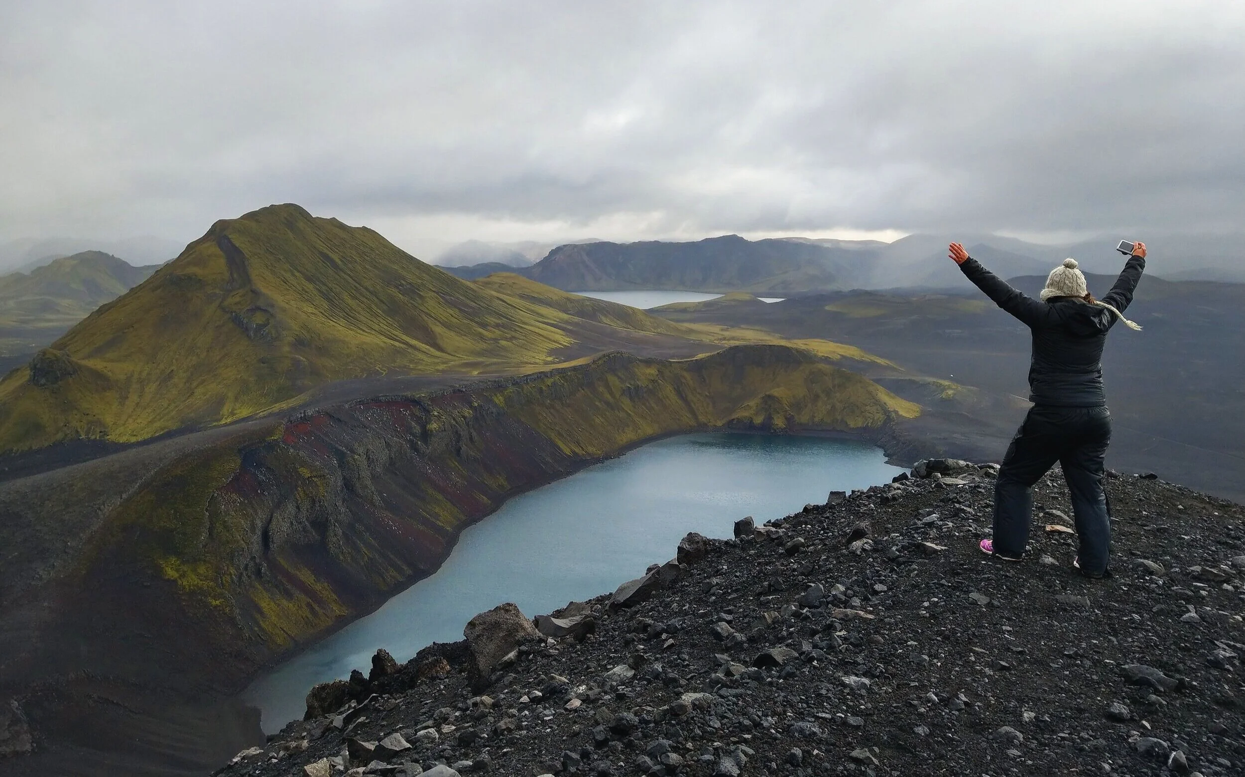
Ljotipollur is another volcanic crater but famous for its blue lake, moss-covered sides, and red lava rock along its walls. Its name means “The Ugly Puddle”, but it’s anything but that. Hiking to here from basecamp would set you back about 4 hours or so for a roundtrip hike.
The Laugevegur Trail

Finally, we come to the most well-known of the hikes. Landmannalaugar is famously known as the starting point for the Laugevegur Trek. This is 34 mile- long trail through the Fjallabak Nature Reserve, and has often been cited as one of the best treks in the world! It will take you through the colorful rhyolite mountains in Landmannalaugar, to barren volcanic landscape and black sand deserts, to the lush valley of Thorsmork, with an opportunity to stay at huts or camp along the way. It’s often done over the course of 3 to 4 days.

Setting out on this trek definitely requires a lot of preparation and planning – for the physical demand of hiking over various terrain, for the bad and unpredictable weather of the highlands, and for the logistics of arranging accommodation and transport to and from the trailheads. We planned out the logistics for this hike before coming to Iceland, but ultimately decided to forego it and spend those four days seeing more around Iceland. Plus, we didn’t want to chance having bad weather that Iceland is so notorious for. And, it’s a good thing! The week we were planning on hiking the Laugevegur was a week when a massive storm system barreled over Iceland, causing terrible weather and cautionary advisories for hikers in the highlands. The take home here? Be prepared! And be flexible. Keep an eye on weather and conditions before you make the decision to start out on this trek.
The People’s Pool
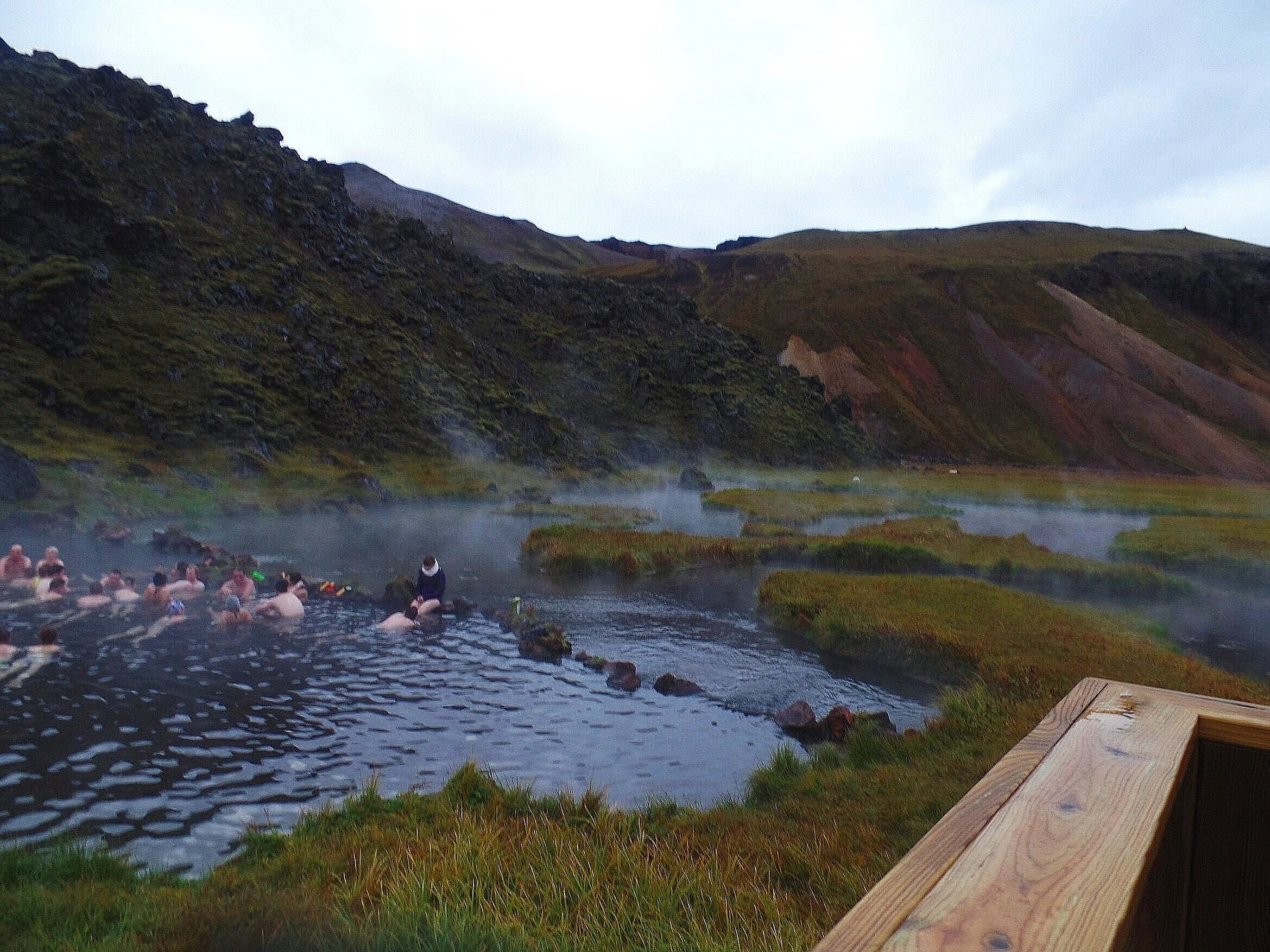
Landmannalaugar is historically known for its abundance of geothermal activity and, as a consequence, its natural geothermal pools. Landmannalaugar quite literally translates to “The People’s Pool”, which just also happens to be the name of the popular natural hotsprings in Landmannalaugar used by most people who come through the area.
This hotsprings is found at the edge of the Laugahraun lava field and hovers around a balmy 100 degrees Fahrenheit all year. It can get pretty crowded in the summer, so don’t expect to have too much peace and tranquility here. But it’s a great way to relax the muscles after a long day of hiking through the epic landscapes.
Just a head’s up: There is a sign at the People’s Pool that just lightly cautions people of Swimmer’s Itch (ummm…?). Honestly, I’m not entirely sure of what that entails, or how often people get it here (it doesn’t seem too much of an issue), but just so you know, there’s that.

What to Pack for Landmannalaugar

Warm layers for cold nights and mornings
Rain gear – including rain pants, which were the single best investment I made before going to Iceland! They are truly lifesavers in a country with weather like Iceland.
Bathing suit and towel to take a dip in the hotspring
A good pair of hiking boots with good traction if you plan on hiking up any of the mountains
Food – There are places to buy snacks, but for meals, you want to pack it all in with you.
Bedding i.e. sleeping bags and pillows – this is not provided by the hut.
All your kitchen and cooking supplies, such as a jetboil, if camping – the hut does not give you access to the kitchen facilities inside.
A camera (of course)! And lots of memory cards…
How Much Time Do You Need in Landmannalaugar
Landmannalaugar can certainly be visited in a day trip, and a lot of people do just that. One day in Landmannalaugar is a perfect amount of time to pick one or two hikes and to relax in the hotspring. Of course, more time means more opportunities to explore the area, but just a day is sufficient to experience this unique place. Just know that it will be a lot of driving for one day, especially if you are coming from the Reykjavik area, which would be a 6 hour round trip drive.
We chose to break up the driving by driving into Landmannalaugar in the afternoon, taking our time and making stops along the way. We spent the night, did our hiking the next day, and drove back to the ring road in the late afternoon.
Other Tips for Visiting Landmannalaugar

Start hiking early. This one will only be possible if you drive here yourself and come early in the day, or spend the night and wake up early the next morning. This is to avoid the summertime crowds on the trails, especially through the easier sections like Laugahraun. The crowds start getting thick between 11am and noon – this is when the tour buses start arriving from Reykjavik. Same goes for the People’s Pool…if you can, wait either before the tour buses come or after they leave for the day.
We started our hike up Brennisteinsalda mid- morning after waiting for some rain to dissipate, and the trails were fairly clear. On the way back down…quite a different story through the lava fields. However, the summits of both Breinnisteinsalda and Blahnukur were still pretty empty, even midday.
Money: The services in Landmannalaugar take both cash and card, so bring either.
Share your wealth. The campground, like most in Iceland, has a place where people can leave camping stove fuel and food no longer needed. Dig through this to see if you can snag anything, but definitely don’t rely on this as your sole source of food or fuel. Be sure to leave anything behind that you won’t need before you leave so others can benefit!
Be flexible. Check the weather often and be as flexible as you can about when you drive into Landmannalaugar (much easier to do if you are camping and driving yourself there). And, if you’re stuck with not-so-great weather, which is a likely possibility, don’t let it get you down too much. You’re still in an amazing place…take a walk through the flat lava field trails. And if you wait it out a bit, chances are you’ll get a window of opportunity to go on a bigger hike and get some views. It’s Iceland – as they say, if you don’t like the weather, just wait 20 minutes!
Need more information?
Got any questions about visiting Landmannalaugar? Or maybe you have some additional insights into visiting this surreal place? Let us know below!
