The Fimmvörðuháls Hike: The Ultimate Guide to the Best Day Hike in Iceland

The Fimmvörðuháls hike is said to be Iceland’s best day hike, and after doing it ourselves, it’s hard to argue with that statement. On this point-to-point trail connecting Skógar along the ring road to Thórsmörk in the Icelandic highlands, you’ll trek past 26 waterfalls, through recently laid lava fields, up and over Fimmvörðuháls, which is a mountain pass between two massive glaciated volcanoes, and over barren volcanic landscape, making the Fimmvörðuháls hike an epic and incredibly scenic trek from start to finish.
The catch? This is not a simple day hike. It’s challenging, entailing 15 miles through ever-changing landscapes, over 4000 feet of elevation gain, and the prospect of wet, cold, and unpredictable weather.
But this hike isn’t just physically challenging, it’s logistically challenging, too. The Fimmvörðuháls trail is a point-to-point hike, and arranging transportation between the start and end of the hike can get surprisingly complicated.
We actually didn’t know much about the Fimmvörðuháls hike before coming to Iceland. We knew it was an epic hike through the Icelandic highlands, had a rough description of the trail and the time it might take us, and that was about it. We couldn’t find any clear transportation solutions, either, but we knew it sounded awesome and we just had to do it. So we came to Iceland without a clear plan about how we were going to actually make it happen. This was on the top of our Icelandic bucket list for sure, but there were so many things about the trail that we just weren’t quite expecting (like the narrow ridge walks and treks across snow fields!) and there are a number of things we would do differently if we were to do this hike again.
And we want to share it all with you!
In this post, we’ll walk you through everything you need to know on how to hike the Fimmvörðuháls trail in Iceland. And we mean everything. We’ll share our own experience, show you what you can expect along the trail, go over arranging logistics and transportation, and hopefully arm you with all the information you’ll need to plan for this epic Iceland hike!
This is a giant post with everything you need, so if you’re looking for something in particular, feel free to jump around:
Article Contents
An Overview of the Fimmvörðuháls Hike

Hiking the Fimmvörðuháls trail in Iceland is an incredible journey from start to finish, with epic scenery literally everywhere. This is not an exaggeration.
Here is a brief overview of everything you’ll see while hiking the Fimmvörðuháls trail:
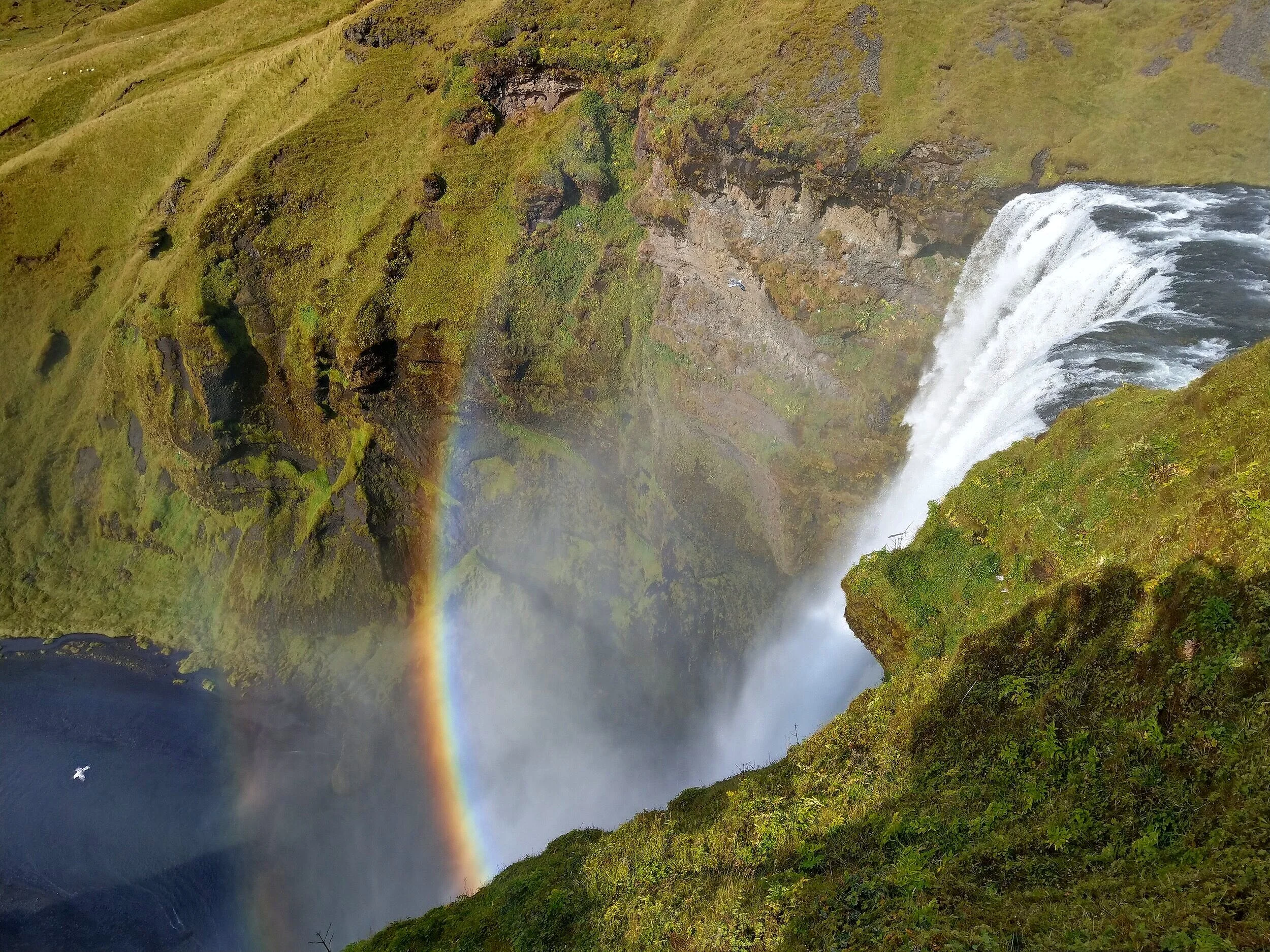
The hike starts at the iconic and breathtaking Skógafoss, a seriously picturesque beginning to an epic trail. But, believe it or not, Skógafoss is probably the least scenic part of the hike!
You’ll climb to the top of the falls and begin your hike along the beautiful Skógá River, also called Waterfall Way, because there are not one, not two, not three…but 26 (yes, 26) waterfalls.
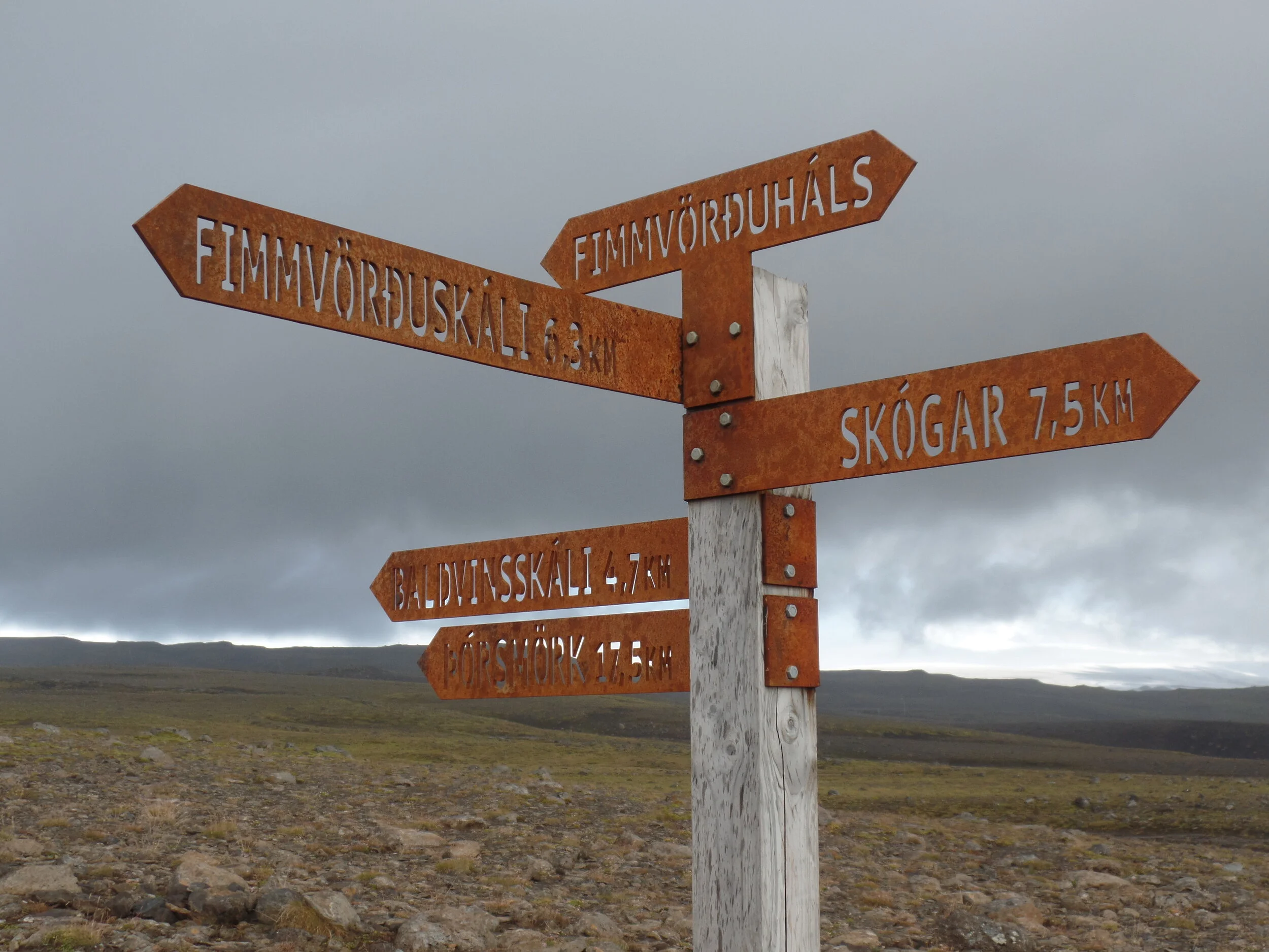
You’ll cross over the river, via a small footbridge, into the next section of the hike, and the landscape takes a 180-degree turn. You’ll follow an old road through a barren and black volcanic landscape up to the Baldvinsskáli hut, which marks roughly the half way point of the hike, but you’ll still have some climbing to go to get to the top of the pass.
Past the hut, you’ll cross over several snowfields as you make your way up to Fimmvörðuháls Pass, the high point of the trail. In this incredible section of the trail, you’ll walk between the Eyjafjallajökull and Mýrdalsjökull glaciers (that’s a mouthful!), and the views just keep getting better and better. You’ll also hike through a young lava field, quite recently formed from the 2010 eruption by the Eyjafjallajökull volcano. As you journey through here, you’ll be walking on some of the newest geological features on earth! Pretty crazy, right?
You’ll eventually see the valley of Thórsmörk open up in front of you as you enter into Goðaland. This is the grand finale of the hike. The bright green moss laid across the black volcanic sand in contrast with the gleaming white glaciers in the background…it’s something that words and pictures just can’t do it justice. In the final stretch of the hike, you’ll begin your descent into Thormork along the Cat’s Spine Ridge, and end your epic hike at the Básar in Thórsmörk.
In just a little bit, we’ll describe each of these sections in more detail and show you what to expect along the way.
Where does the Fimmvörðuháls trail start and end?

The Fimmvörðuháls trail is a point-to-point hike connecting Skógar to Thórsmörk. You can choose to start at either end.
Starting the Fimmvorduhals hike in Skógar: The more popular way to do the Fimmvörðuháls trail as a day hike, and the way we did it, too, is to start in Skógar. Going this way involves a more gradual ascent, and the views this way are, arguably, better. Sure, no matter which direction you hike will take you through the same scenery, but as you follow the Skógá river from Skógar, you’ll be greeted with the 26 waterfalls face on, instead of having to constantly look back to enjoy these views. And the descent into Thórsmörk is out of this world from this direction (trust us!). As you hike into the valley, again, all the views are in front of you rather than behind. It will be a steep descent, though, which can be rough on the knees, and overall just more exhausting. Some of the descent is on slippery dirt slides or involves hanging onto chains, and some people find this easier going up than down.
Starting in Fimmvorduhals hike in Thórsmörk: If you begin the hike here, you will have a steep ascent to start off, but then a very gradual descent back into Skógar. While still trekking through the same territory, the views are mostly behind you, but some people say it’s super cool to hike starting at the source of the Skógá river, and then follow it to its final destination at Skógafoss and out to the ocean.
So, it’s really just a matter of preference.
How long is the Fimmvörðuháls trail?
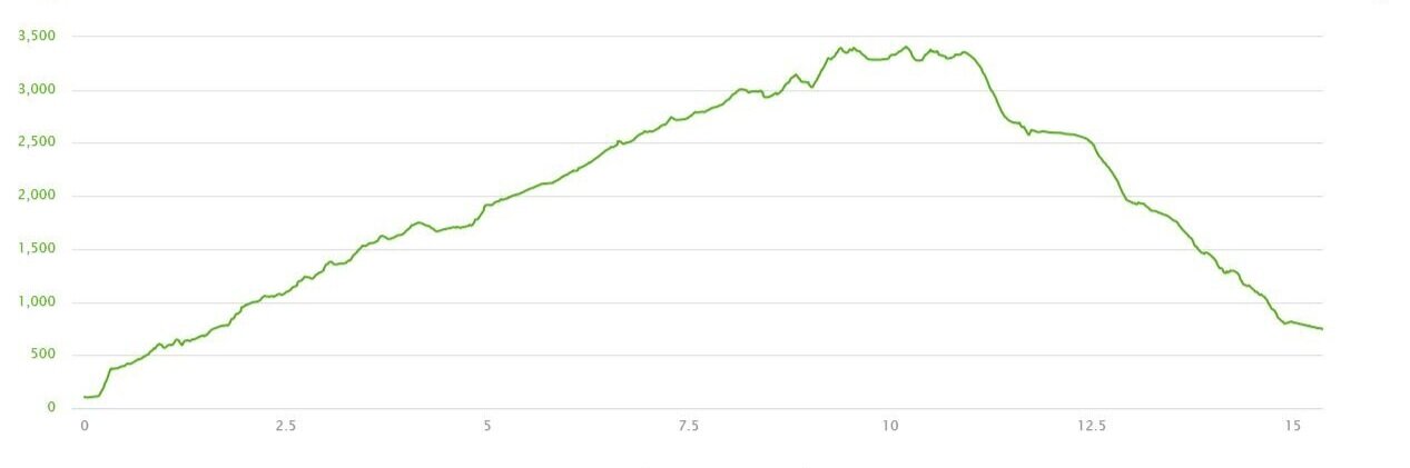
Here are some of the statistics of the hike that we logged with our Garmin watch while hiking the Fimmvörðuháls trail.
Before taking on the Fimmvörðuháls hike, we read several different accounts of the hike with varying distances and elevation gain. I think the variation has to do with where they started and ended their tracking. For example, some people don’t start tracking until the top of the stairs at Skógafoss, or until they see the first official sign marking the Fimmvörðuháls trail that’s a bit past the top of the falls. There are also a few different trails along the way, so variations can come from people taking different routes. The statistics from doing the trail in reverse will also be different, as there is less elevation gain when starting in Thórsmörk.
Our statistics come from taking the main Fimmvörðuháls trail for the entire way, starting from the information center at Skógafoss, and ending at the official trail end.
Distance: 15.37 mi
Elevation Gain: 4265 ft
Duration: 10 hours 20 minutes
Trail Profile:
How long does it take to hike the Fimmvörðuháls trail?
You have two options when hiking the Fimmvörðuháls trail: conquer it in a single day, or take a more leisurely pace and do an overnight trek.
The Fimmvörðuháls trail day hike: We have read that it takes anywhere from 8-14 hours to hike the Fimmvörðuháls trail…quite a spread! The average seems to be somewhere between 10-12 hours. It took us just over 10 hours going at a semi-slow pace due to carrying heavy overnight packs.
The Fimmvörðuháls trail as a multi-day hike: A lot of people choose to break this hike up into two days. There are two different huts located about half way along the trail, the Baldvinsskáli hut and the Fimmvörðuháls hut, which we’ll talk more about below.
What did we do? We did a one day trek on the Fimmvörðuháls trail, however, we planned to camp in Thórsmörk so that we didn’t have to rush through the hike in order to catch the last bus out of Thórsmörk that night. Because of our transportation (and we’ll talk more about this later in the post), we couldn’t get to the Skógar trailhead until 11 am, and the last buses left Thórsmörk at 6:30 pm. Knowing my usual pace, and my tendency to stop and take an overabundance of pictures, I didn’t trust myself to get done with the hike that fast, so we essentially backpacked the full length of the trail in one day and then spent the night in Thórsmörk. We also envisioned ourselves spending some time in Thórsmörk on the second day to do some smaller hikes (spoiler alert…we were way too exhausted!).
Knowing now the difficulty of the trail, we wouldn’t do this again. Lugging our heavy packs made the trail so much harder than it really was and made us significantly slower, and we would figure out a way to arrange transportation differently so that we could make the last bus out of Thórsmörk.
Where to stay when hiking the Fimmvörðuháls trail
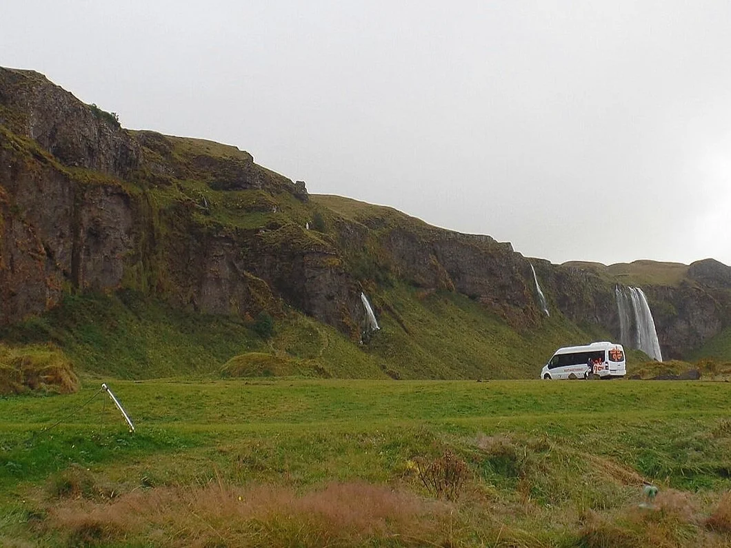
The night before hiking the Fimmvörðuháls trail, we recommend staying somewhere near Skógar, Seljalandsfoss or a town along the bus route between Thórsmörk and Reykjavik (such as Selfoss, Hella, or Hvolsvöllur). The reason for this will make more sense when we talk about transportation logistics later in this article.
We stayed at the Seljandsfoss campground, which not only made for a convenient location for bus pick up and drop off, but had amazing views of the waterfalls.
If you are doing a multi-day hike of the Fimmvörðuháls trail, you have the option of staying at one of two huts along the trail.
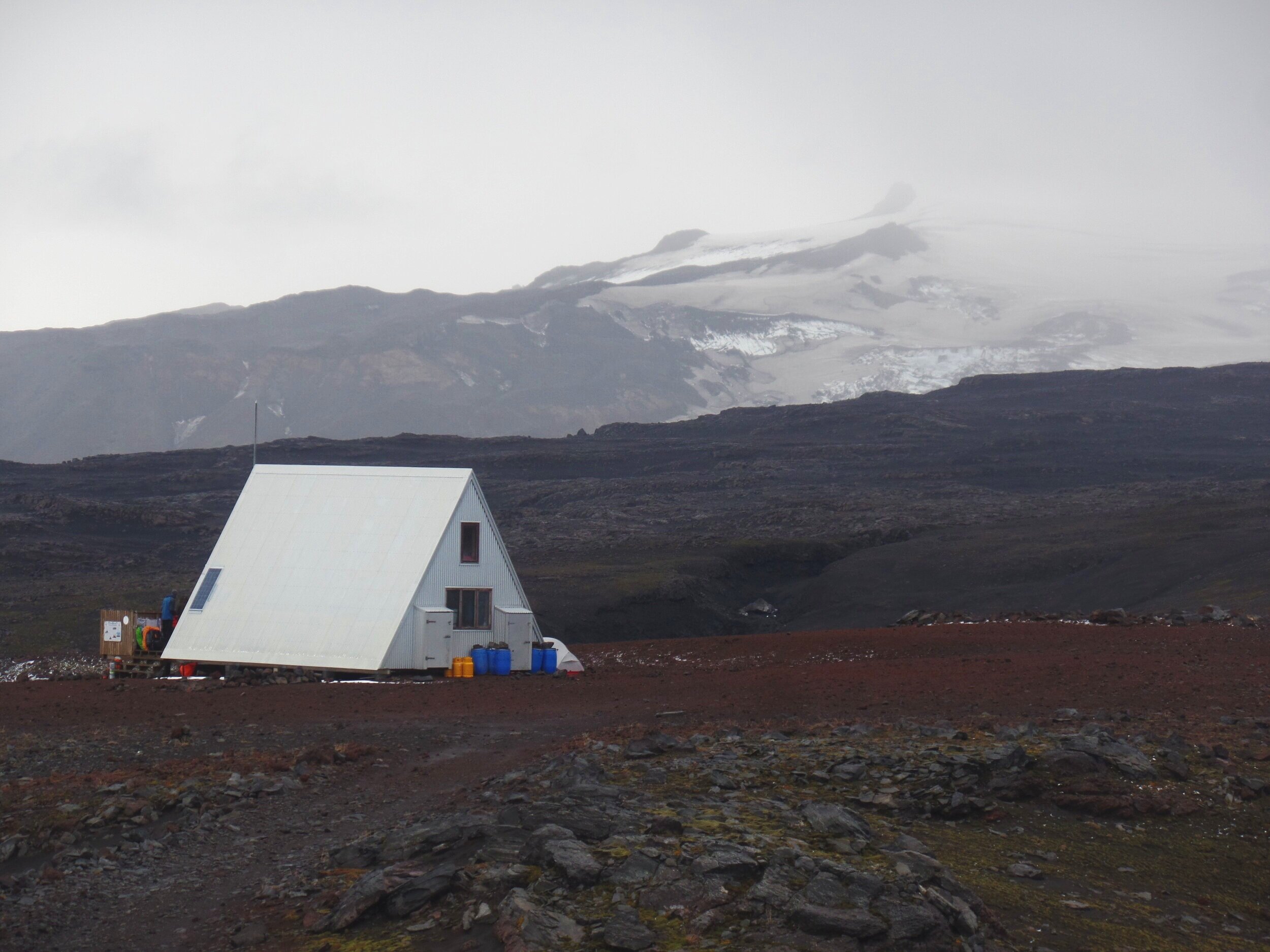
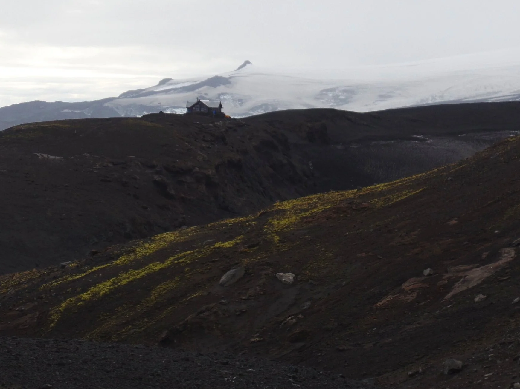
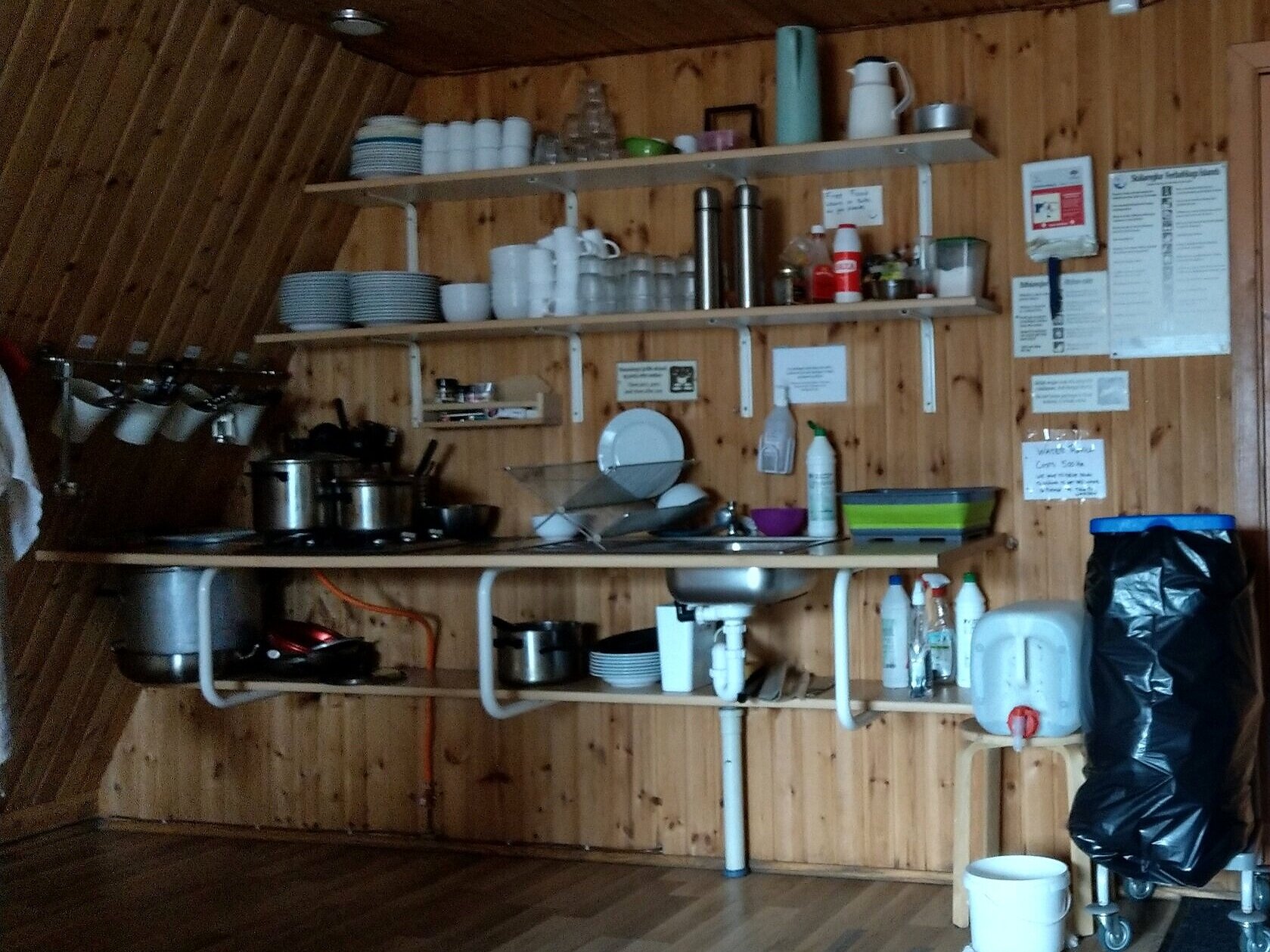
Baldvinnsskali Hut
The first is the Baldvinsskáli hut (operated by Ferðafélag Íslands), located right along the main hiking trail and just below the Fimmvörðuháls pass as you are hiking from Skógar. This hut has space for 20 people. There are mattresses on the floor and you have to provide your own bedding (i.e. sleeping bags and pillows). There’s also a kitchen inside with a small space heater, but there’s no running water. The hut warden makes trips into town once a day to fill jugs of water and gives it to guests of the hut or those passing through for a small fee (500 ISK). The hut costs 7000 ISK per person per night and should be booked in advance. You can also camp here for a smaller fee, if you like, but keep in mind the weather here can get intense, cold, and windy.
Fimmvörðuháls Hut
The second hut is the Fimmvörðuháls hut (operated by Útivist), located at the highest point of the Fimmvörðuháls pass. This hut is off the main trail, about a 30 minute or so hike from the Baldvinsskáli hut and along the red-marked trail. This hut fits 23 people in bunks with mattresses, but again, you’ll have to provide your own bedding and there is no running water. This one is a bit more expensive, at 7200 ISK per person, and can be booked here.
Accommodations in Thórsmörk
If staying in Thórsmörk the night before or after hiking the Fimmvörðuháls trail, you’ll need to know that there are three huts in Thórsmörk, and they are spread out quite a ways from each other (Thórsmörk is a lot bigger than we thought!).
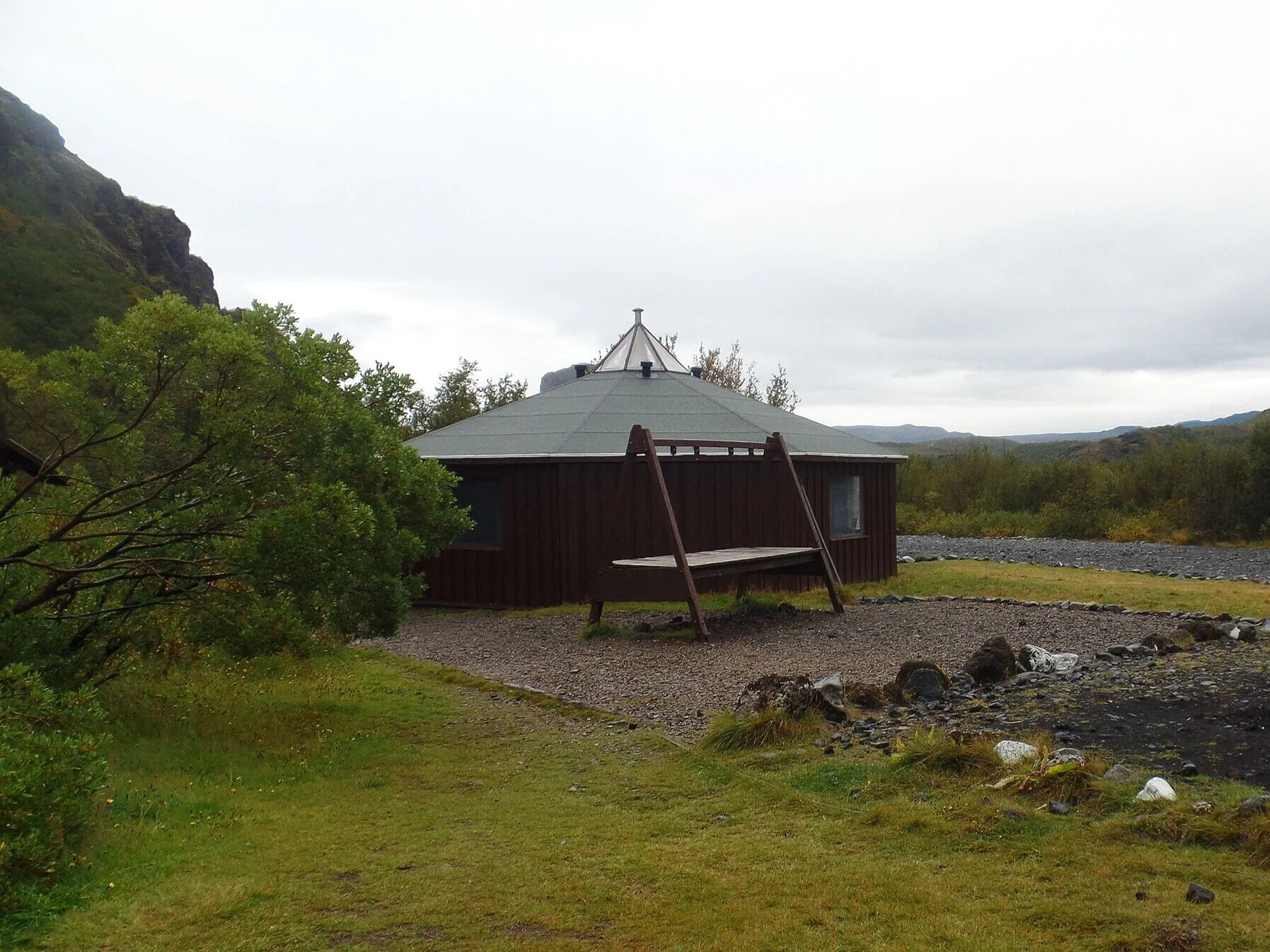
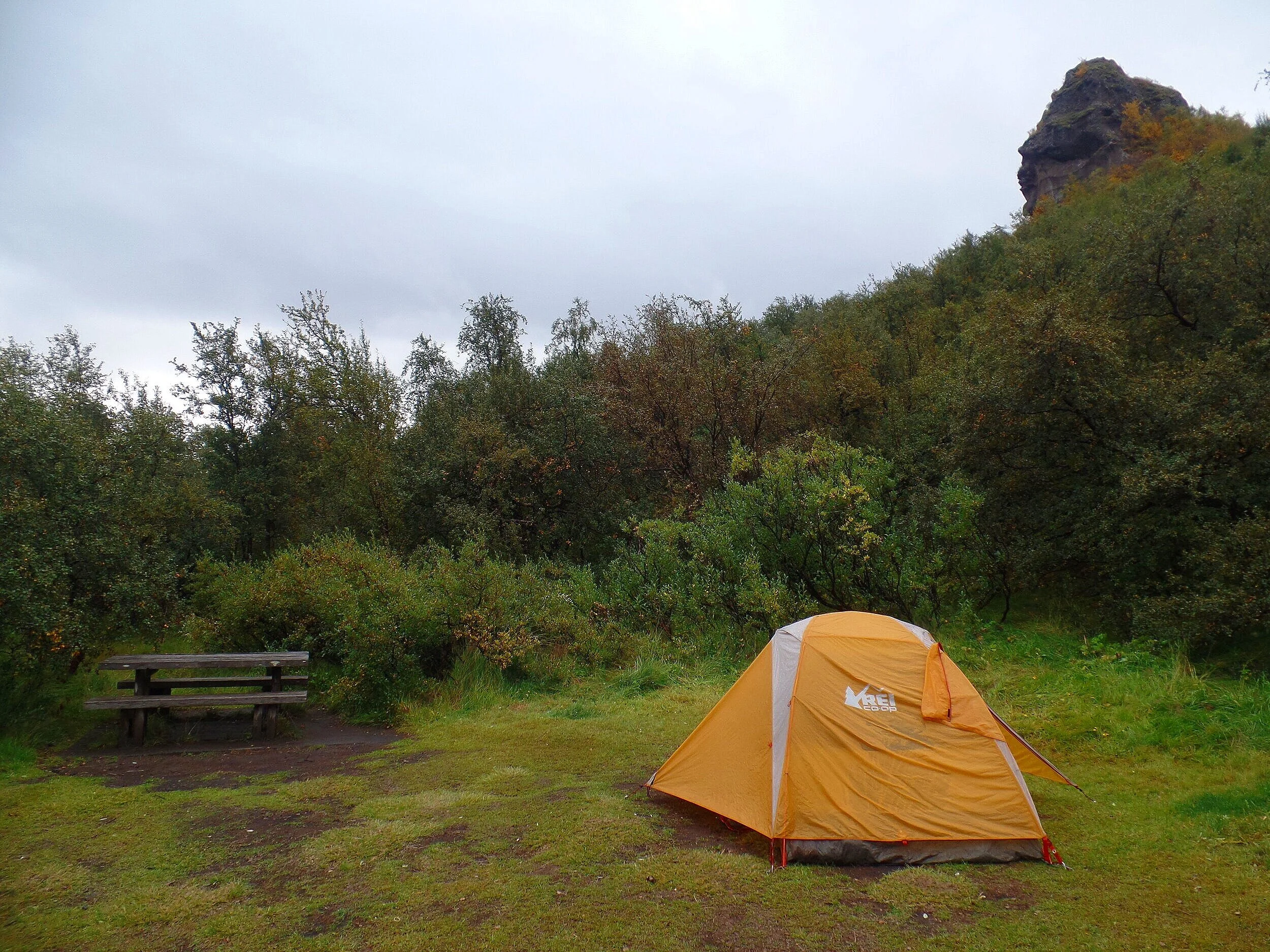
The one you’ll want to book your stay at is the Útivist-operated hut, Básar. Trust us, at the end of a long hike, you won’t want to go anywhere else but here unless you want to add several more miles to your hike to get to a different hut. For space in the hut, the price is 7200 ISK per person, and you can make reservations in advance.
Camping here is first come first served, which is what we did. We thought it was a pretty nice campground, and we were able to find a nice private site. There are bathrooms, a kitchen yurt you can use to cook and take shelter in from the elements, and showers are available for 500 ISK. When we stayed there in 2019, we paid 1500 ISK for a tent site, but it appears to have gone up to 1700 ISK per person plus an additional 300 ISK tent tax per site.
If you’re planning on spending more time in Thórsmörk before or after your hike, you can either hike or take buses to the other two huts. It’s best to book any of the huts in advance, as Thórsmörk can be a popular place in the busy summer hiking season.
The first is the Volcano Huts in Húsadalur Valley. It’s a pretty big establishment, with options to stay in dorms, private rooms, cottages or at the campground. There’s a restaurant here as well with bathrooms (for a fee). Many good day hikes are based out of this area of Thórsmörk.

The other hut is Skagfjörðsskáli, located in Langidalur Valley and operated by Ferðafélag Íslands. We didn’t visit this hut while in Thórsmörk, but you can learn all about the hut in Langidalur and book it here.
The famous Laugevegur trail comes out at either of these huts, so a lot of people will stay in either of these huts before leaving Thórsmörk and continuing onto the Fimmvörðuháls trail.
When should you hike the Fimmvörðuháls trail?
The optimal hiking season in the Icelandic highlands is July to early September. In fact, the road into Thórsmörk is only open mid-June to mid-September when it’s clear from snow, but even as late as June you can still find snow on the trails, making route finding harder and conditions more rugged and dangerous.
Mid-summer is the best time to hike the Fimmvörðuháls trail not only for the weather and trail conditions, but because of the longer days, giving you more daylight to complete the hike if you get on the trail a little bit later.
Weather on the Fimmvörðuháls trail
Unpredictable weather is one of the things that makes the hiking the Fimmvörðuháls trail so challenging. Rain, wind, snow, fog, hail…anything can happen in the Icelandic highlands. No matter what the weather is doing back on the ring road near Skógar, the highlands have a mind of their own and weather can change fast along the trail.
We started off the day in Skógar, and the weather couldn’t have been more beautiful. I was happy as a clam. Once we got past Waterfall Way, things changed fast, and we got rained on for about an hour, thoroughly soaking us. And up at the Baldvinsskáli hut, it wasn’t rain…it was snow, in late August!
Before the hike, make sure you keep an eye on the weather forecast, and keep your eye out for general warnings and advisories. In the two weeks we were in Iceland, there were several advisories to stay off the trails due to hazardous weather conditions. At the information booth at Skógafoss, they post regularly updated information on weather and trail conditions as well.
What to pack for the Fimmvörðuháls trail
The most important thing you can do on the Fimmvörðuháls trail is to be prepared for the weather!
You’ll need to be prepared for cold weather, wind and rain. Even in the summer, the pass can be in the high 30s or low 40s and covered in snow. So, make sure you bring:
Warm layers. And make sure your base layer is NOT cotton. Wear a synthetic material that can absorb your sweat well so that it doesn’t stay wet and make you cold in the already cold conditions. Make sure you have a hat and gloves, too.
Rain gear! Bring a rain jacket, and, the saving grace for our trip, rain pants. Rain pants were the single best investment I made before going to Iceland.
A rain cover for your pack. Or a dry bag to carry inside your pack at the very least. It’s no good if you’re keep warm layers in your pack, only to have them get wet from the torrential rain seeping through!
Snacks and plenty of water. Along Waterfall Way, there are a few opportunities to fill up with water from the river. But once you cross that bridge, there’s no opportunity for water for the rest of the trail, unless the Baldvinsskáli hut happened to have some trucked in when you’re there. You’ll have to pay for it, though.
Wear a sturdy pair of hiking boots.
Microspikes could be helpful for walking across some of the snow fields. These could get icy, especially near the shoulder seasons.
A good pack. Make sure you wear a comfortable and properly fitting pack… it’s a long hike with lots of ups and downs.
Hiking poles may also be useful on the steeper descents into Thórsmörk.
Bring a map and GPS to keep you on track. For the most part, the trail is well-marked, but in bad weather, such as rain or fog, it can be tricky to navigate.
Bring along a first-aid kit. When we did the hike, we didn’t pass a lot of people once we got past the hut. You want to be as self-sufficient as possible.
Some small cash. For unexpected things like bathroom use in the huts along the trail.
Hiking the Fimmvörðuháls Trail
Ok, so even though I told you all these warnings and challenges of the hike up to this point, the Fimmvörðuháls hike was hands-down one of the most incredible hikes we have done to date. If you are properly prepared, it’s totally worth it. The best views come after the hardest climb, right?
Here is what you can expect while hiking the Fimmvörðuháls trail, broken down by each section of the hike. Remember, this route can be reversed depending on where you want to start the hike.
Skógafoss and Waterfall Way
You’ll start the Fimmvörðuháls hike at the iconic Skógafoss. This is one of Iceland’s best waterfalls…it’s quite a thrill to get up close and feel its power, and on a sunny day, there’s often a waterfall in its midst. But, we would recommend you don’t get too close to it right now, or else you’ll get soaked…and you want to avoid that for as long as possible along this trail!
Instead, you’ll climb up the stairs to the top of the falls….roughly 400 of these bad boys (what a way to get your muscles woken up and ready!). You’ll get your legs nice and warmed up for the day and at the top, you can admire the view of the falls from this high vantage point and look out towards the north Atlantic.
From here, you’ll continue down the trail along the beautiful Skógá river. This is a very scenic section of trail called Waterfall Way, and apparently, you’ll pass 26 waterfalls as they cascade down to the ocean from the melting Eyjafjallajökull and Mýrdalsjökull glaciers (we didn’t actually count these, but we’ll trust the sources! It was definitely a lot of waterfalls).


The bright mossy greens and deep canyons contrasted with the blue river are quite a sight, and on a clear day, you can even start to see the Eyjafjallajökull glacier out to the west. Our day started off beautifully and it was our first time seeing blue clear skies after a week of constant rain. Our spirits were up and we were super excited for the hike ahead. We just couldn’t get over these views!


You’ll be on this section of trail, following the Skógá river, for about 8 km (or 5 miles), and the further you are along the trail, the fewer the people - not many visitors of Skógafoss venture beyond the top of the stairs.
The trail is very clear to follow and has a bit of ups and downs, but overall, it’s a gradual steady climb. There are some areas where you’ll be along an edge of the river canyon, and two times where you’ll have to rock hop across a narrow stream, but other than that, it’s pretty much smooth sailing through here!
Trekking to the Baldvinsskáli Hut
At roughly 8 km, you’ll come to a small footbridge on which you’ll cross the Skógá river, and just like that, you’re in a completely different world! The trail transforms from mossy greens and flowing rivers to wide open black volcanic landscape.
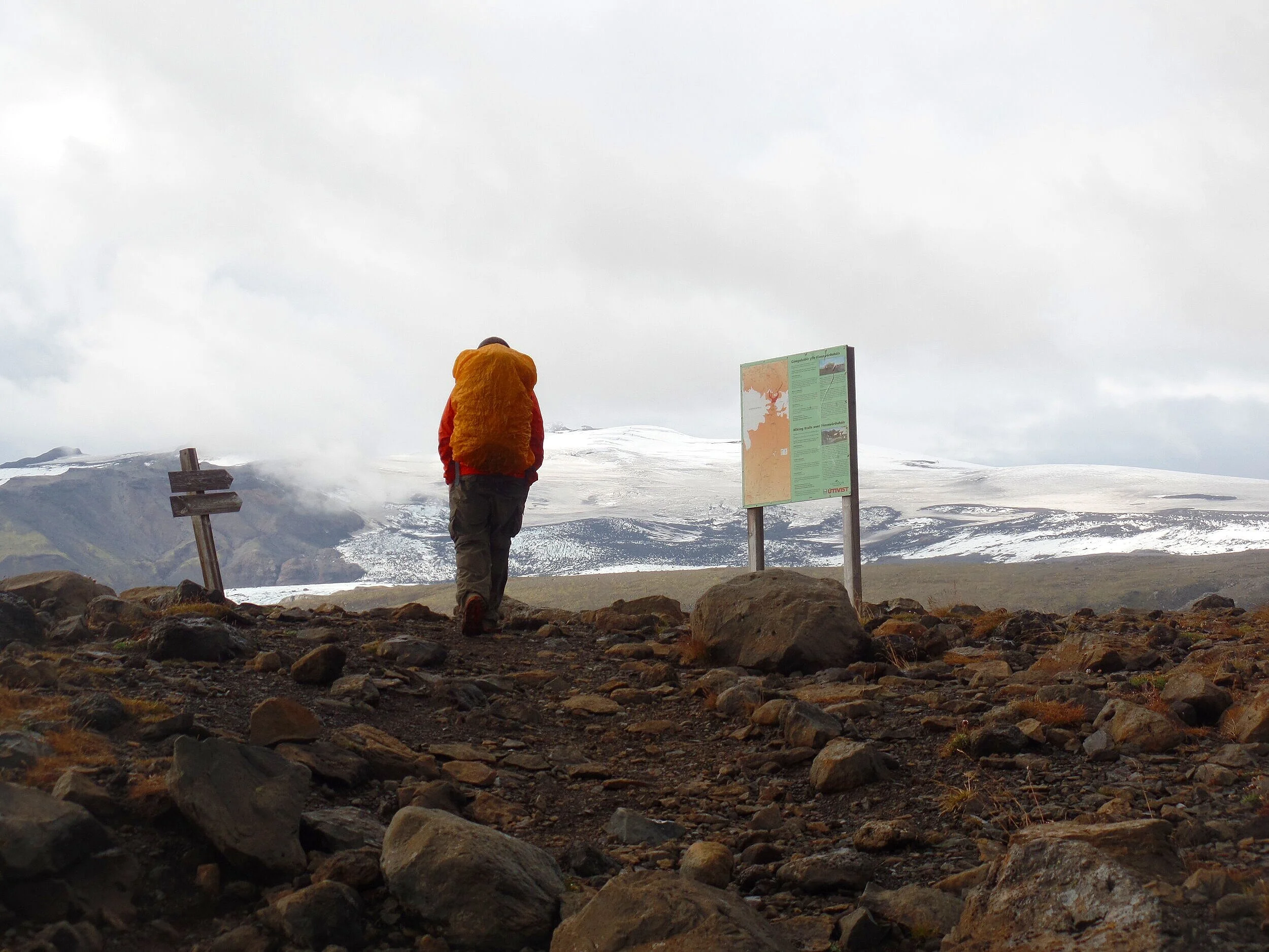
Once over the footbridge, you’ll come to a sign and map describing the rest of the trail, which was super helpful to us. We didn’t know beforehand that there were a few different trails along the way.
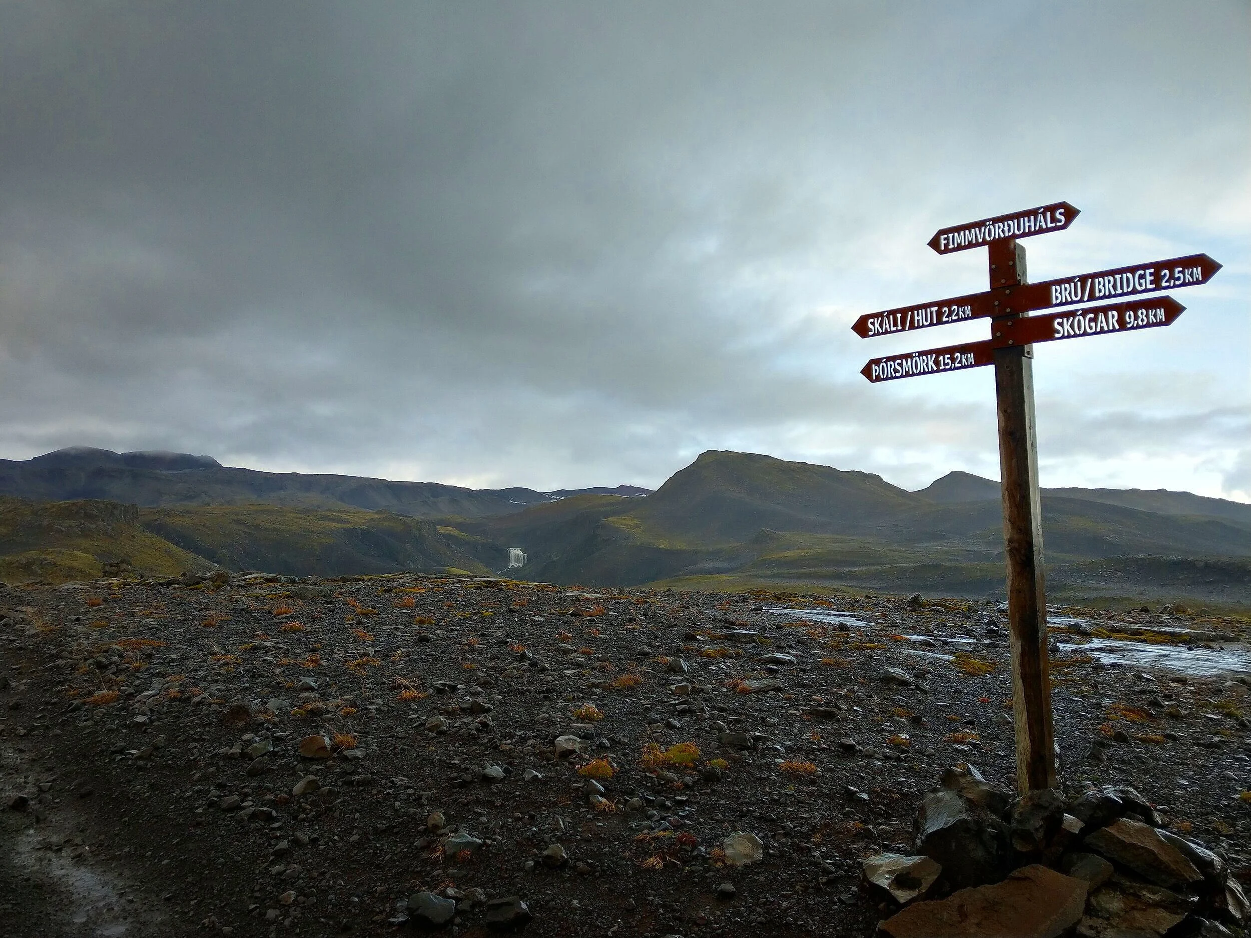
The blue trail here is the main Fimmvörðuháls hike, and the most direct route between Skógar and Thórsmörk. It passes through the Baldvinsskáli hut and through the Fimmvörðuháls pass, but it doesn’t pass through the more famous of the huts, the Fimmvörðuháls hut, located at the top of the Fimmvörðuháls pass.
The red trail is an off shoot that detours up to the Fimmvörðuháls hut, and usually people won’t use this route unless planning an overnight stay there.
The trails are pretty easy to tell apart, based on posts in the ground along the route that are spray painted at the tips with either a red or a blue marking.

As you continue on along the blue trail, you’ll walk along an old gravel road for pretty much the entire way to the Baldvinsskáli hut. This section of the hike between the bridge and the hut is just under 5 km. It’s a gradual climb up, and pretty easy here.
However, this was the most miserable portion of the hike for us. The sky opened up on us and it rained hard for pretty much this entire section of trail, getting us thoroughly soaked and hiding all the views from us. This is probably the least scenic section of the trail, though, so we lucked out in a sense that this was the only time it rained on us! (Just staying positive here…) However, we could still see the massive icecaps in the distance starting to appear.
This part of the Fimmvörðuháls trail was also very desolate, and we only passed one other party on the way to the hut. It’s truly Icelandic wilderness!
Eventually, the hut will come into view, and you’ll weave your way through the barren landscape to get there. Seeing that hut was so relieving, because I desperately needed a break, some snacks, and a chance to get just a little bit drier.
After approximately 5 hours and 13 km of hiking the Fimmvörðuháls trail, we made it to the hut. But it wasn’t quite the respite I was hoping for! It was freezing up at the pass! And all that rain that fell on us earlier was actually snow up here, and there was a thin sheet of freshly laid snow all around us.
The hut itself was pretty nice and very clean and well-kept. If you’re passing through, there’s a 500 ISK facility fee to use the kitchen as well as the bathroom, which is a separate from the main hut.
Inside the hut is a little reception area where you have to take off your shoes before going upstairs to the beds or into the kitchen area. In the kitchen is a place to cook and prepare food, and a small space heater that sadly didn’t seem to be working. There was also no water available for us at the time. There is actually no running water at the hut at all. Instead, the warden has to drive back to Skógar to refill jugs to supply the hut, and when we arrived, the warden had left a sign saying he would be gone for the next several hours getting water and supplies. So be prepared for this when through- hiking this trail and make sure you have enough supplies and water to last you the entire length of the trail!
We hung out here for about a half hour to rest and eat, but never really got the chance to warm up or dry off.
At the time, I also mistakenly thought that this hut was the high point along the trail. But, you still have a bit of climbing to do to get to Fimmvörðuháls Pass from here. So, tired, wet, and cold, we trudged along.
Ok, even though I make it sound a little miserable just then, and maybe my spirits were admittedly a little bit down, don’t let this give you the wrong impression! The views from the hut were phenomenal, and worth any challenges along the way. From the hut, you can see the glaciers starting to peak out, and on a clear day, you can even see out towards the Atlantic Ocean, back where you started…and, it only gets better from here!
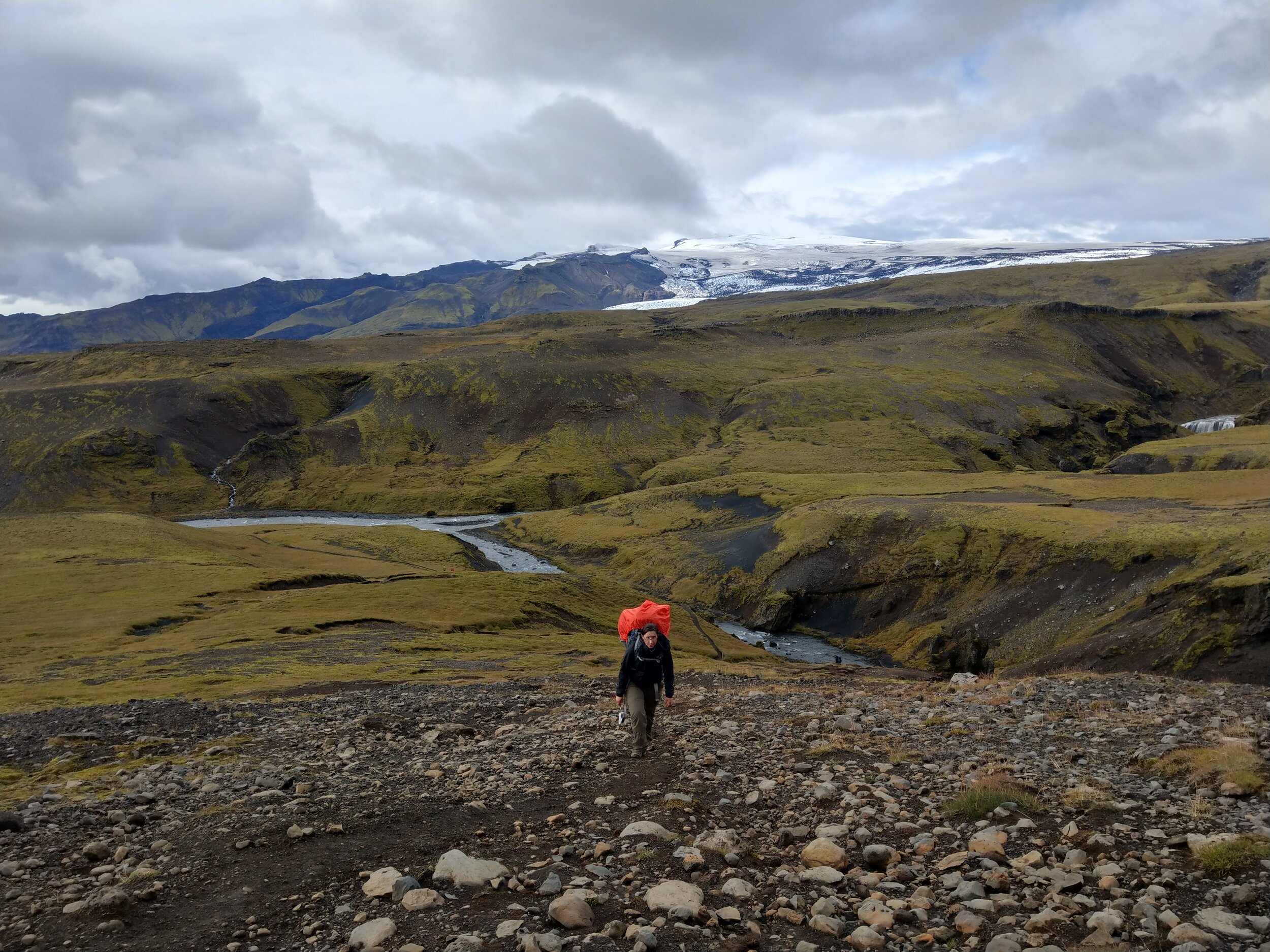
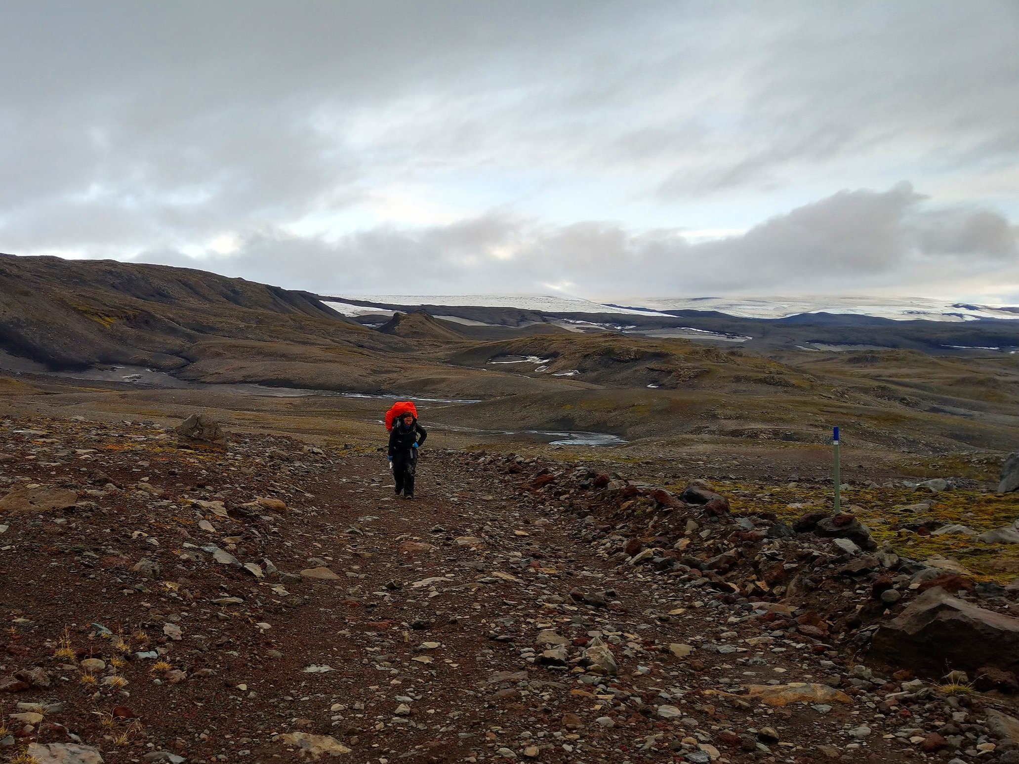
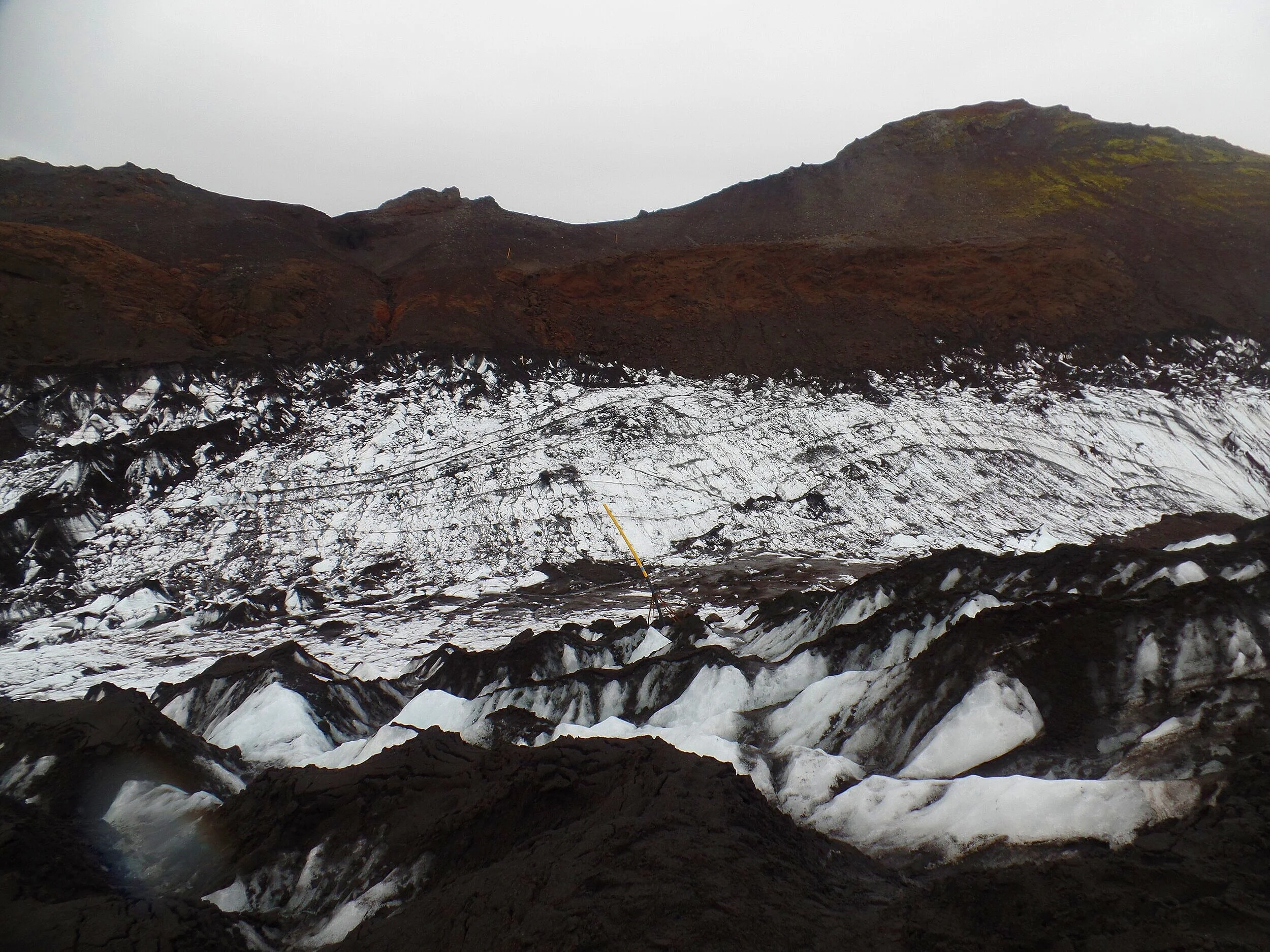
The Volcanic Landscape between Eyjafjallajökull and Mýrdalsjökull
For the rest of the hike along the Fimmvörðuháls trail, you’ll be trekking between the two famous glaciers, Eyjafjallajökull and Mýrdalsjökull.
Underneath the Eyjafjallajökull glacier to the west sits the Eyjafjallajökull volcano, famous for its recent 2010 eruption, the remnants of which you’ll be trekking though later on this hike. And underneath the Mýrdalsjökull glacier to the east sits another famous volcano, Katla. This is Iceland’s most active volcano, erupting approximately every 50-100 years. The views of these glaciers along the rest of the trail are stunning as you make your way through the mountain pass that separates them.
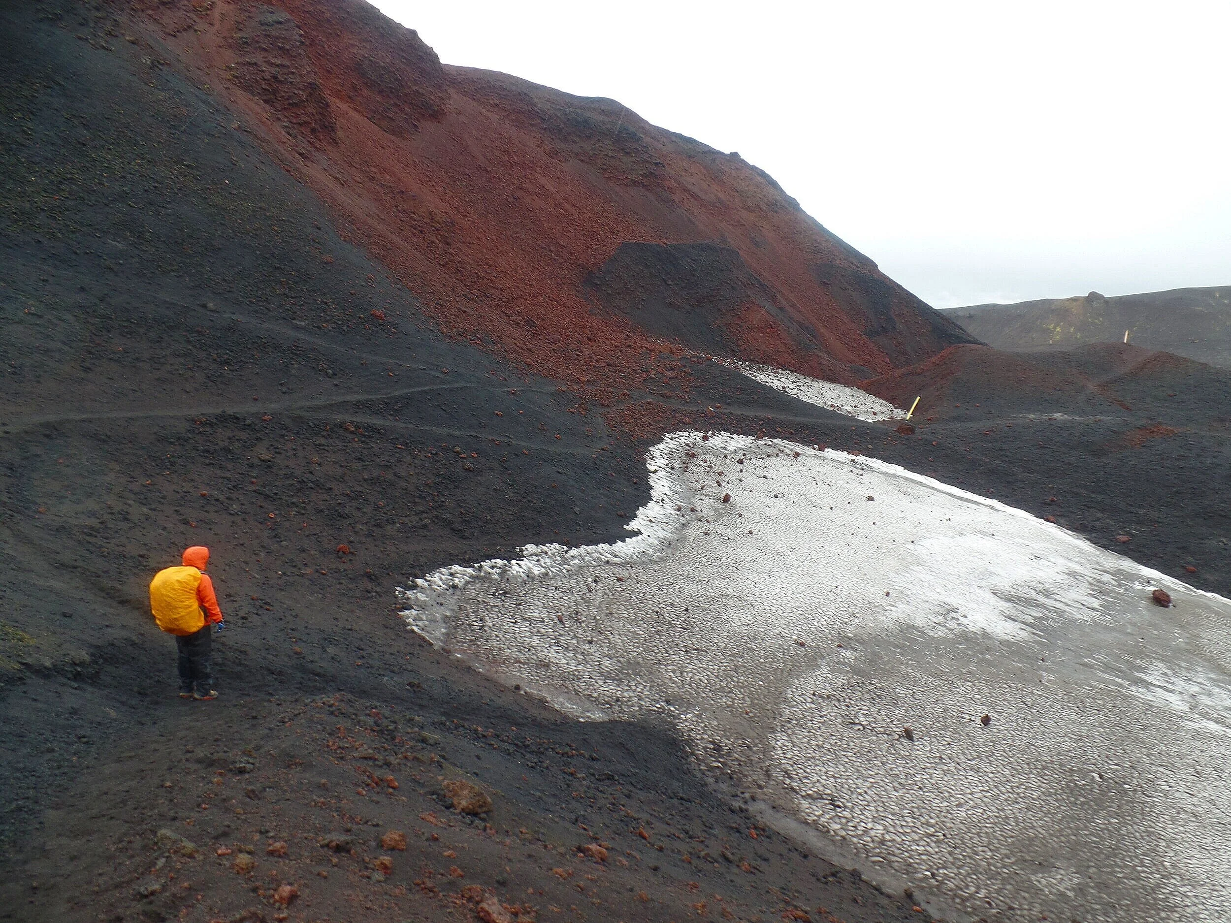
Shortly after leaving the hut, you’ll start crossing the first of several snow fields.

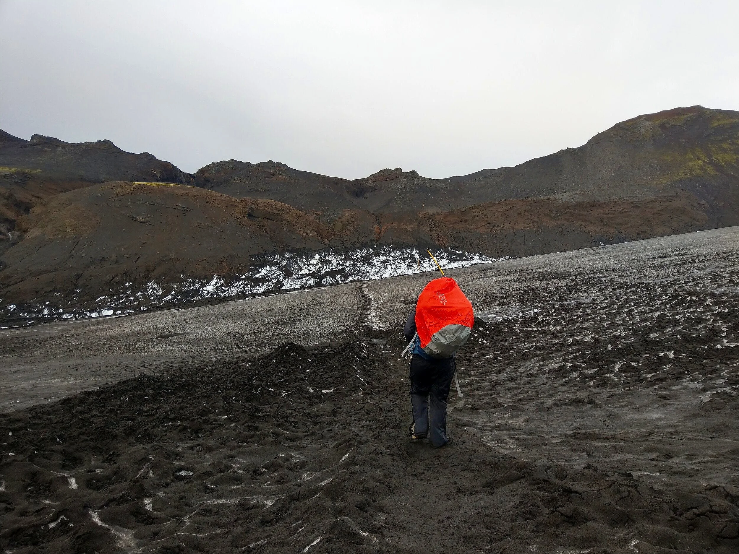
One in particular threw us for a loop. We reached a point where we would have to walk across what looked like a full-on glacier! We got a little confused… we saw trail pole markers in the distance off to the west going up what we assumed was the red trail to the Fimmvörðuháls hut, and the blue poles were most definitely taking us across this snow field. We hesitated a bit, and there was no one else around, but we saw tons of footprints going through the snow and knew that the blue trail was indeed the main trail, so we continued onward.

I can certainly see here how bad weather and foggy conditions can make trail finding quite a bit hard, and a map and some sort of navigation system are definitely helpful, and necessary, in inclement conditions. This is also where some sort of microspikes or crampons would come in handy as well, as the path across the snow was pretty slippery and sketchy in some spots.
You’ll cross a few more less daunting snow patches as you make your way up some steep climbs to the pass.

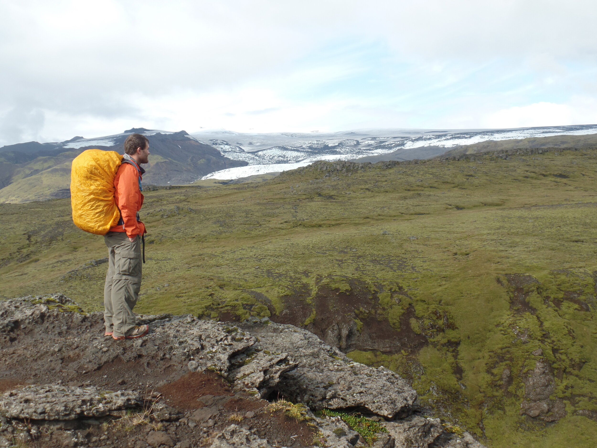
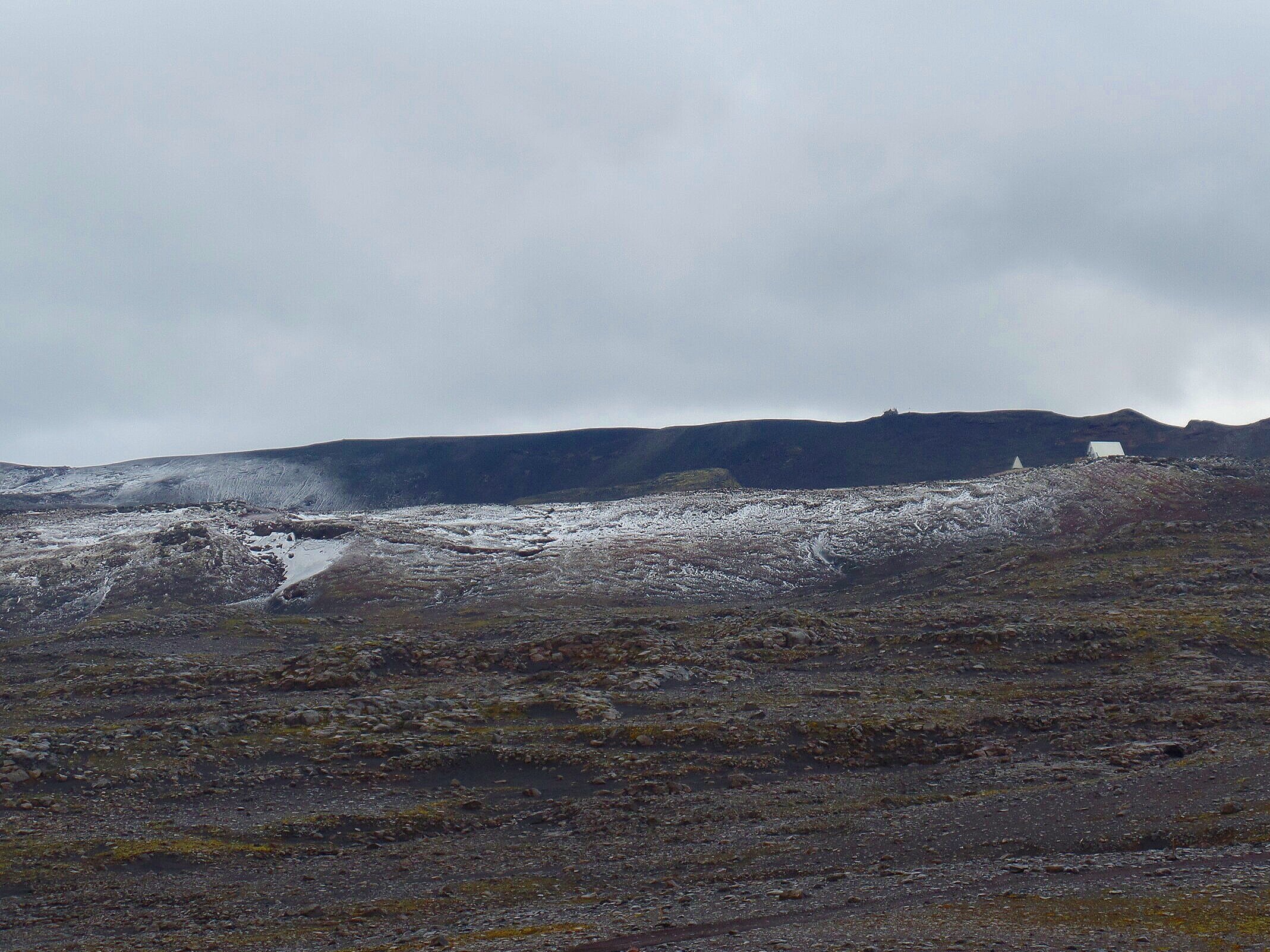
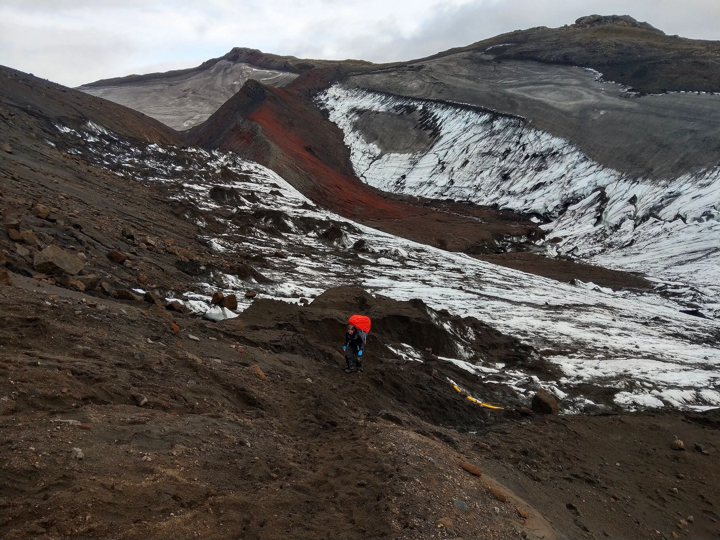
Once you hit the Fimmvörðuháls pass, congratulations! You’ve officially made it to the highest point of the trail, and you’re over half way done! Woohoo! From here, you can see the Fimmvörðuháls hut out to the west set against a scenic backdrop of the Eyjafjallajökull glacier.
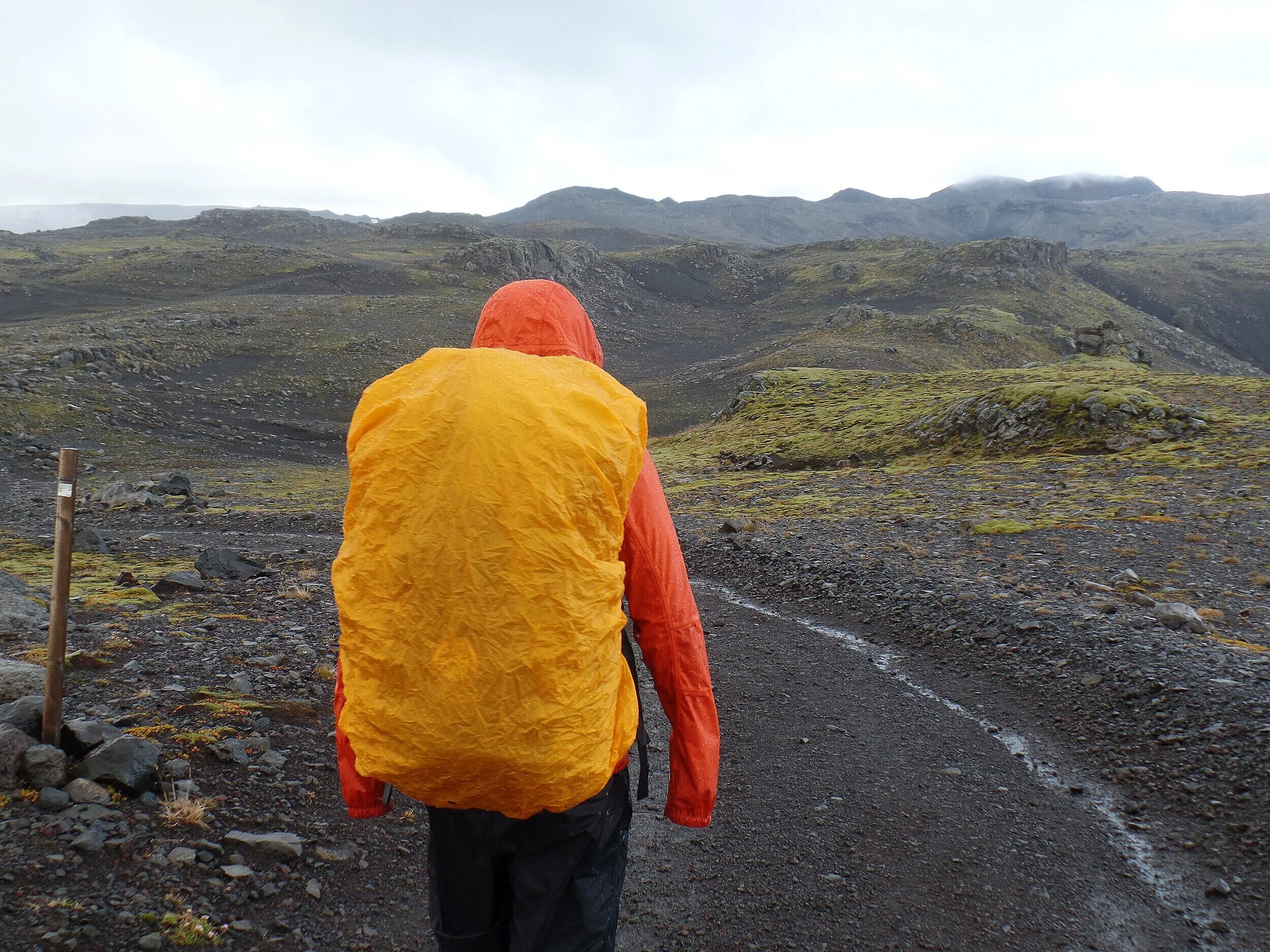
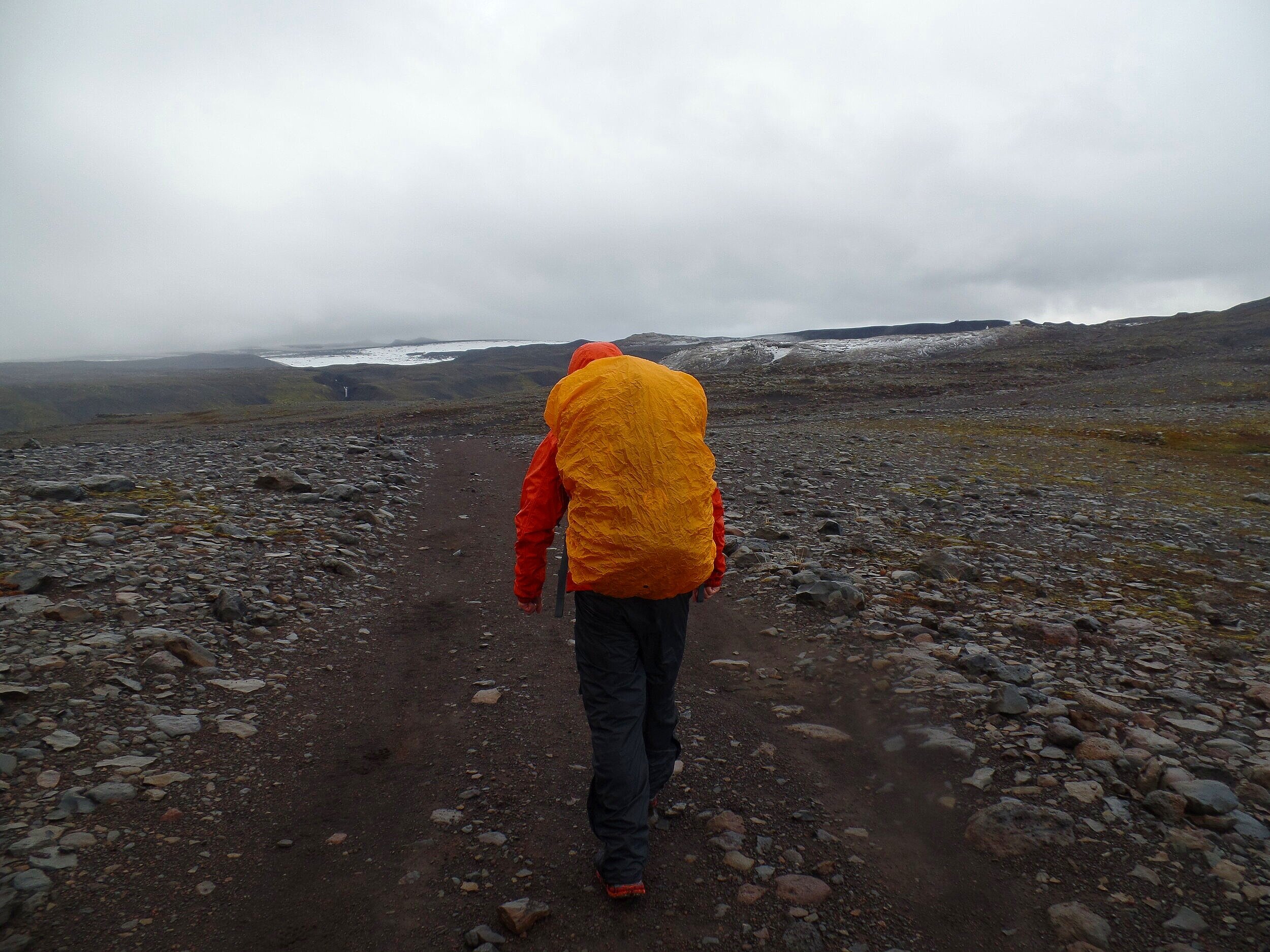
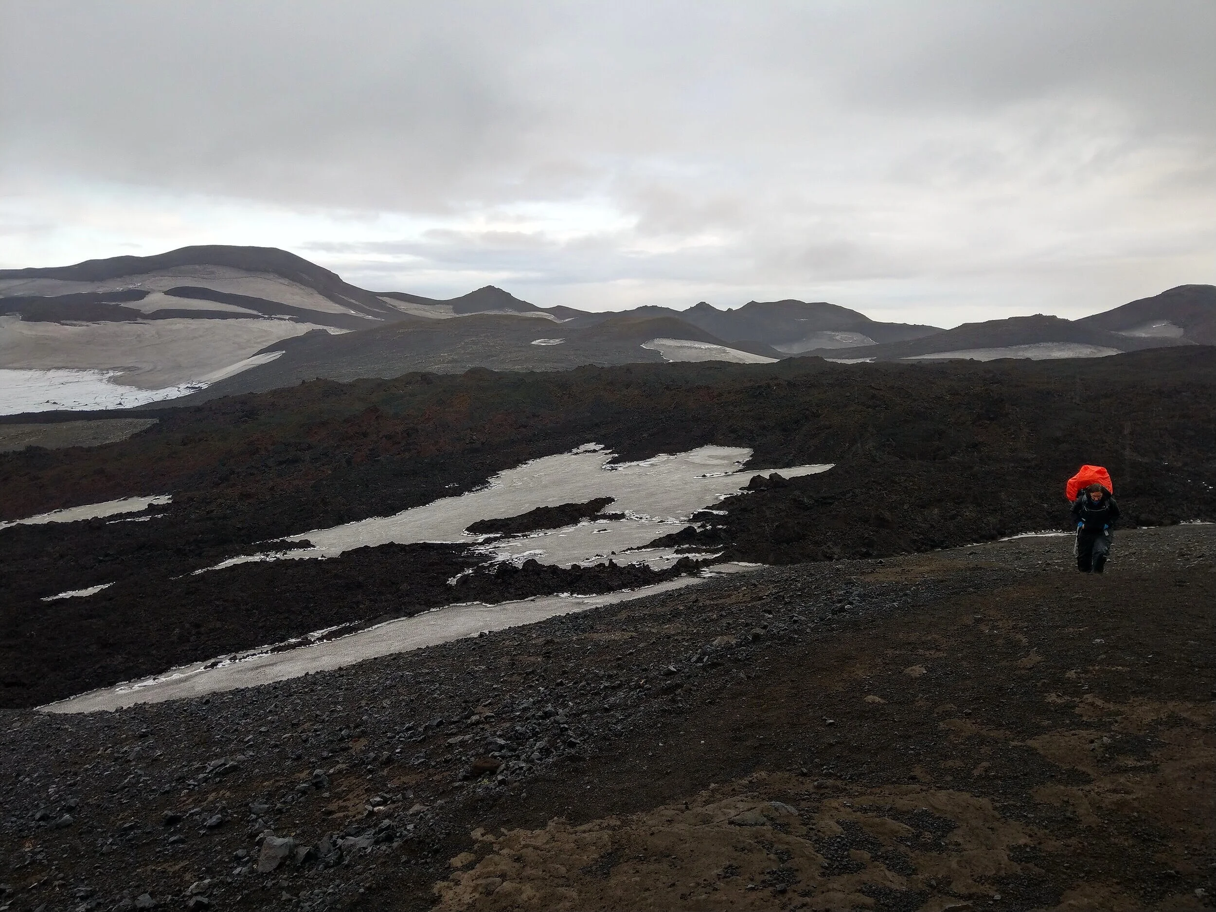
Beyond the pass, you’ll see your path forward, with yellow poles snaking their way up and down the vast and barren volcanic plateau sandwiched between the two massive glaciers. It’s certainly other-worldly up here, and dramatically different than the start of your day along Waterfall Way! Part of what makes this hike so unique and special is watching these drastic changes in just a matter of hours of hiking.


As you continue hiking along the Fimmvörðuháls trail, you’ll have some more small up and downs along the trail, cross a few more snow patches, and eventually come to a flat black sand plateau.
When you crest the hill at the end of this plateau, you’ll get your first peek into the valley of Thórsmörk off in the distance. To say we were excited is an understatement! We couldn’t wait to get closer and see the valley.


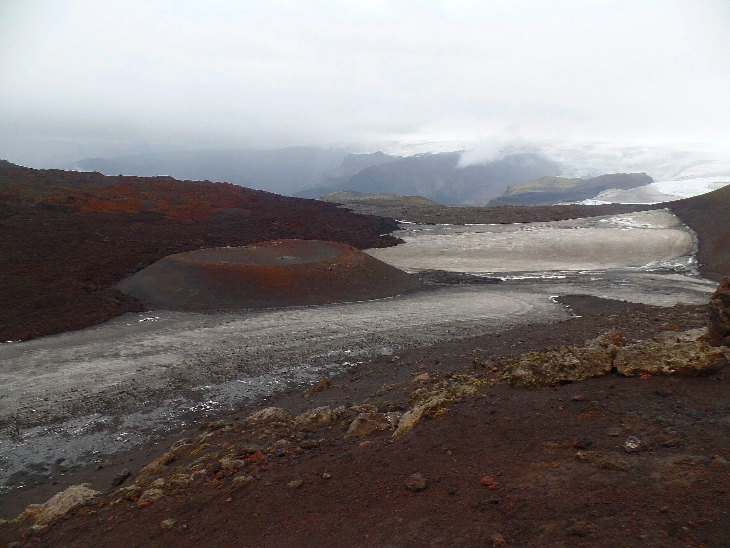
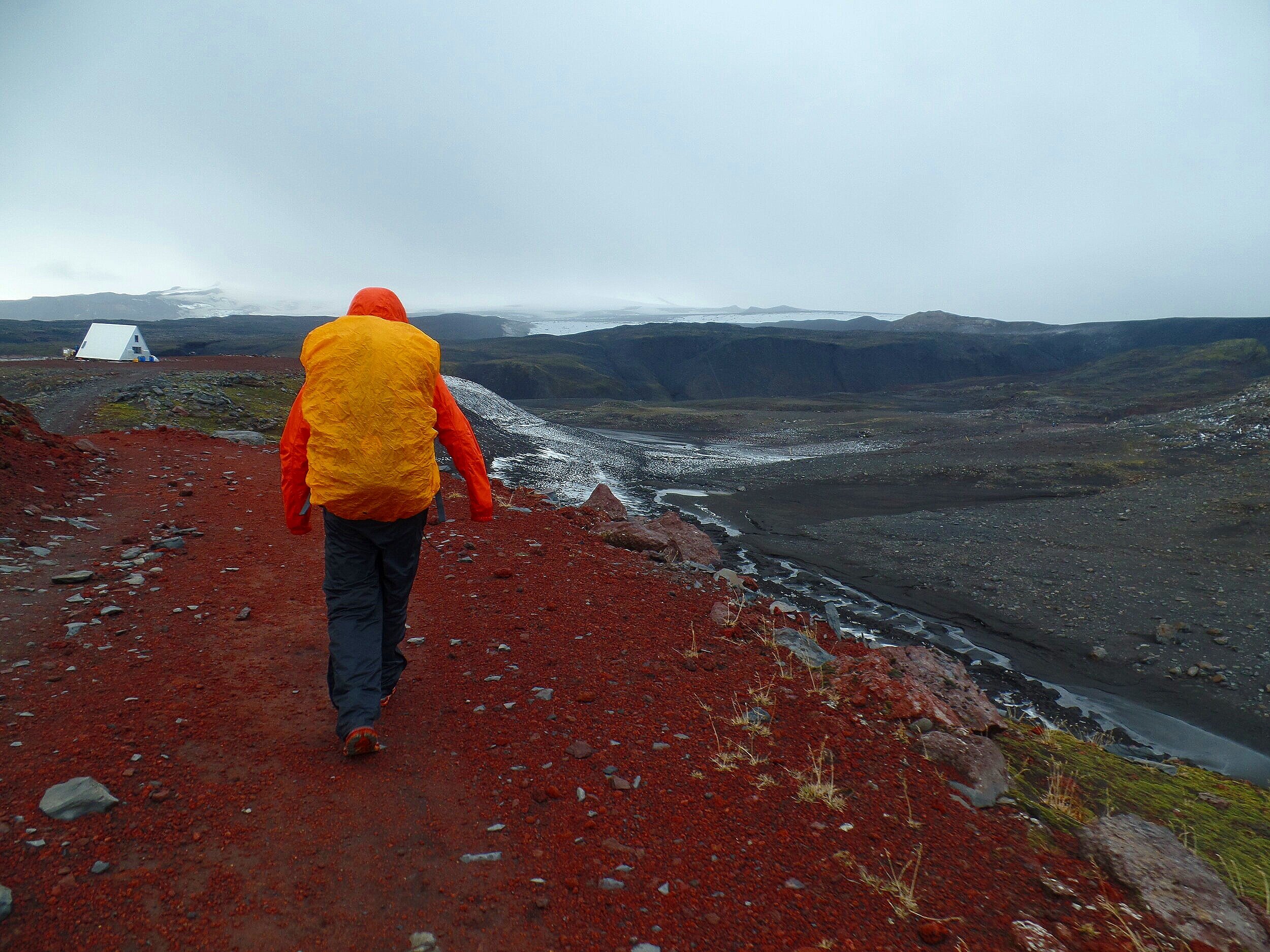
But first, you’ll have one more epic landscape to traverse through. Here, you’ll pass through the craters and lava fields laid down by the Eyjafjallajökull volcano.
At the base of Móði, there’ll be a sign describing the landscape around you and an opportunity to walk up to the summit. Honestly, I didn’t even notice the trail climbing up the hillside…we were just exhausted and trying to get to the end of the hike! But, looking back on this, the trail looks short and sweet and doing this small detour wouldn’t add to much time or distance to your trek, and I bet the views from the top are spectacular.

From here, you’ll weave your way through the extensive lava field left over from the eruption.


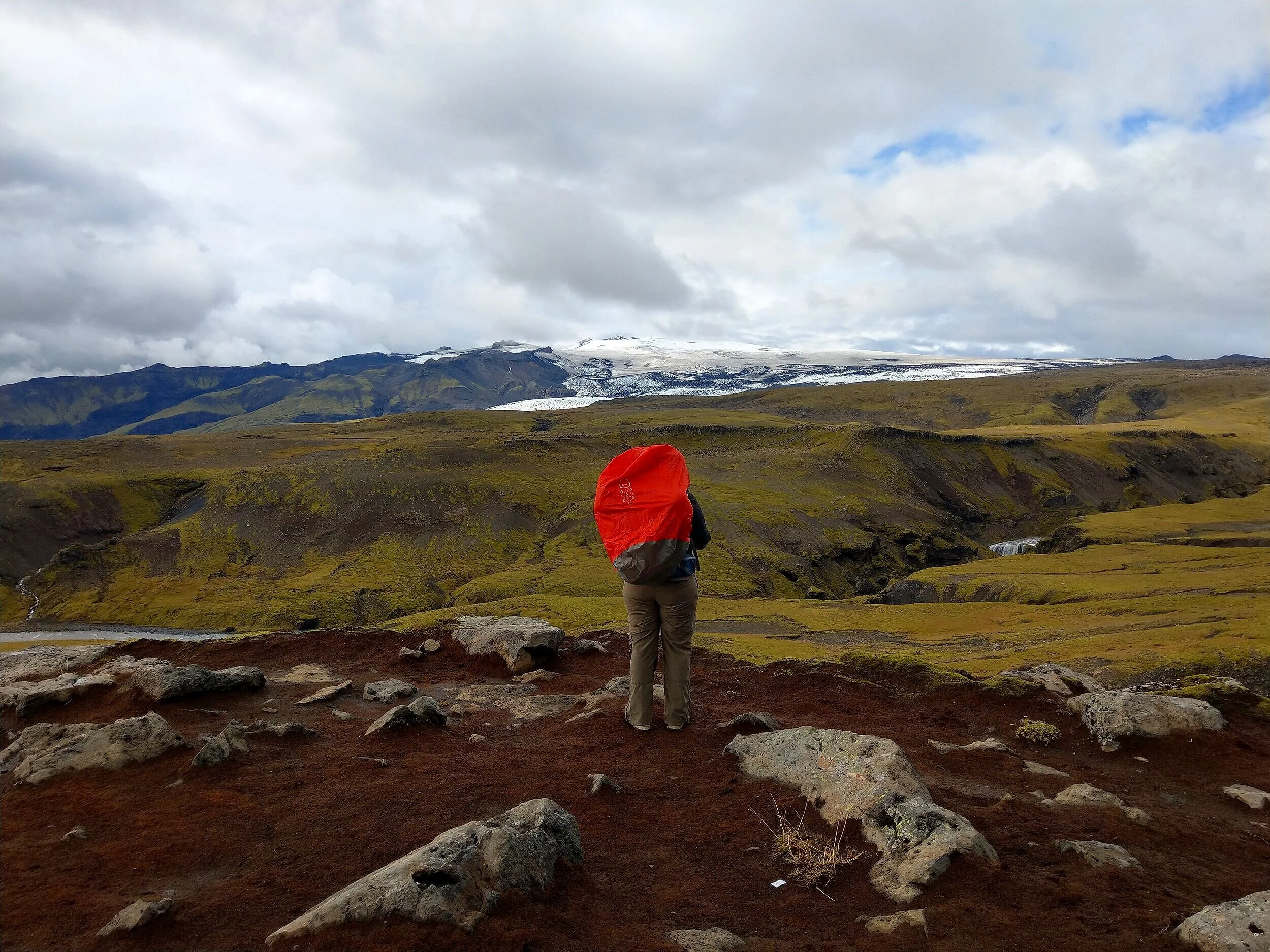
As you crest over the next hill, you’ll be hit with some breathtaking views as the valley of Thórsmörk, your final destination, opens up in front of you. It’s here that you begin your descent into Goðaland, named after the glacial toe cascading down from the Mýrdalsjökull glacier that can be seen from the Fimmvörðuháls trail.
The Descent into Thórsmörk
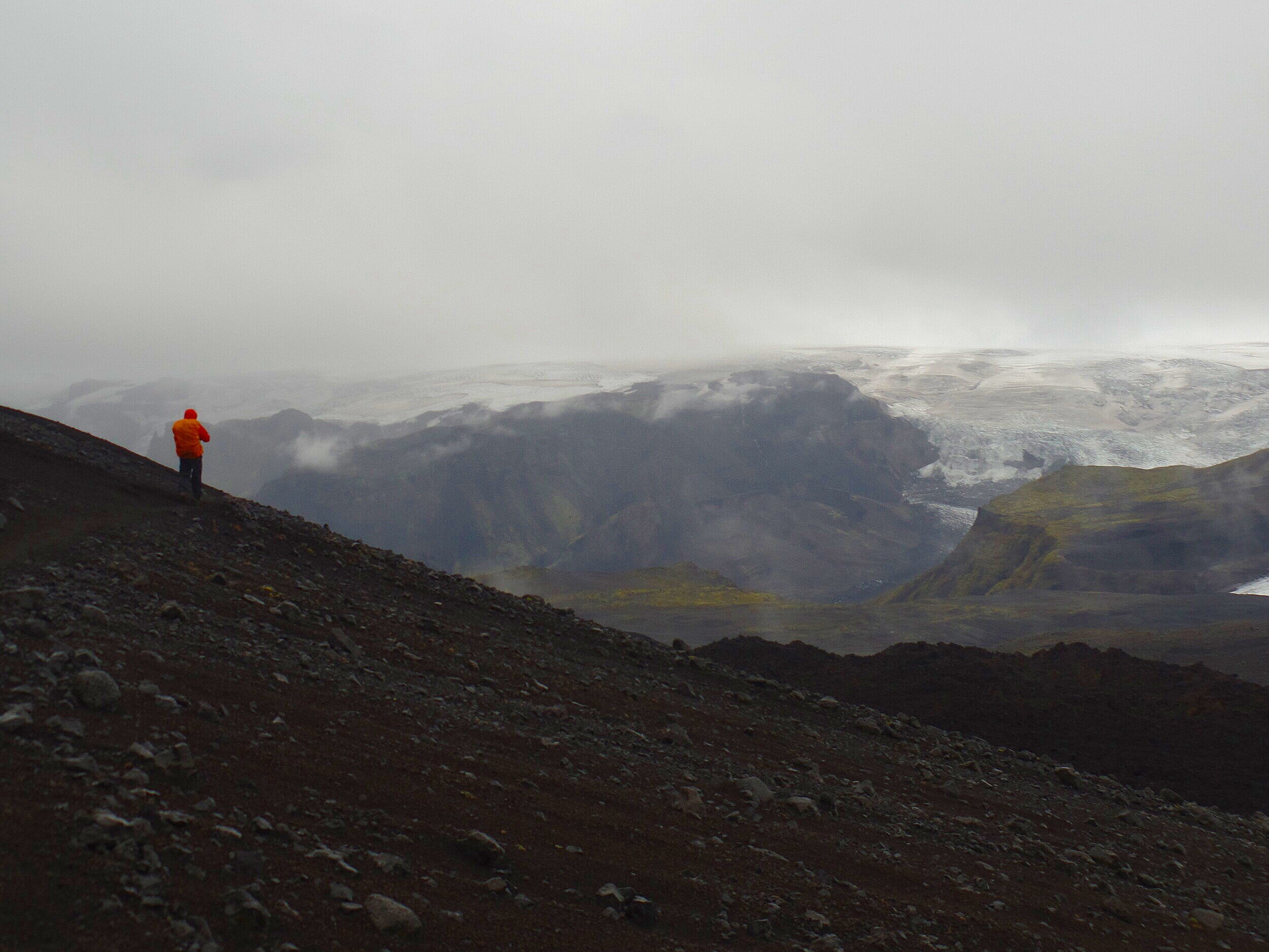
As you descend down from the pass and into Thórsmörk, you’ll have some steep descents through this section, some of which are scree and dirt, and some areas which are pretty slick, especially after any rain. But the further you go, the better and better the views get…flat plateaus separated by deep canyons, lime green moss overlying dark black sands, and massive white ice caps in the distance. It’s so unique and you’ll feel transported to a different planet! Even in gloomy weather, the views had us in awe (and I definitely had a soundtrack of epic music playing on repeat in my head the whole time). Pictures definitely cannot do this place any justice, although I’m trying here…


Note for people afraid of heights! One of the steep descents runs along a cliffside, and there are chains to hang on to as you make your way down. These threw me for a loop! This was something I admit that I had no idea this was part of the trail. The chains were a bit sketchy, as some of the poles they were attached to were popped out of the ground. At the bottom of the slope, the trail and the chains then run along a narrow ridge along the cliff side.


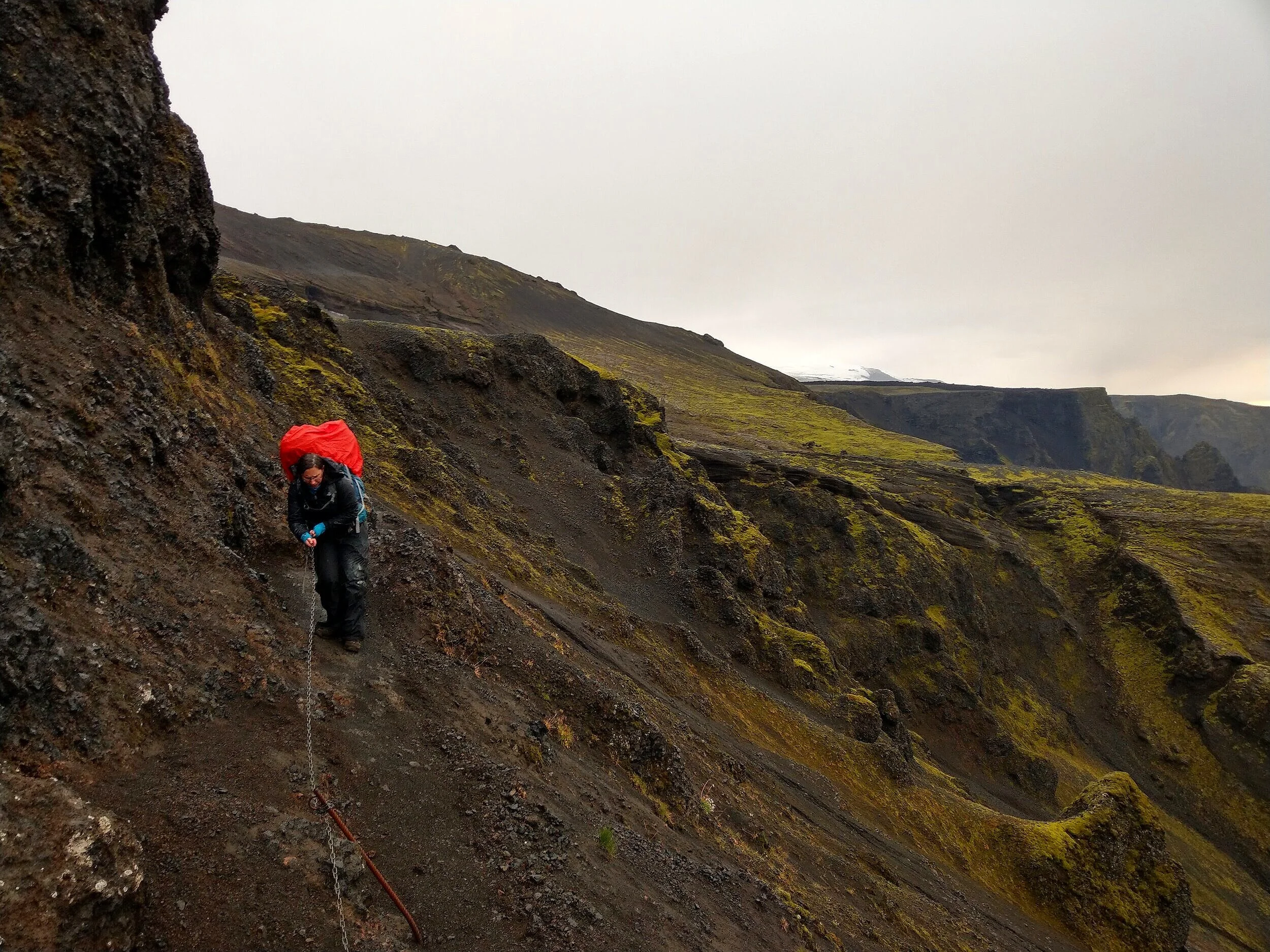
The canyon that you’re skirting the edge of is called Hvannárgil Canyon. Apparently, there is an alternate route, called Votupollar, that descends into this canyon and also gets you into Thórsmörk, however we read that it is more technical with steep drop-offs, and we have no experience with this trail.

This part of the trail is a bit harrowing, especially if you have a fear of heights and narrow ridges with steep drop offs (*raises hand*), but look at these views into Thórsmörk!
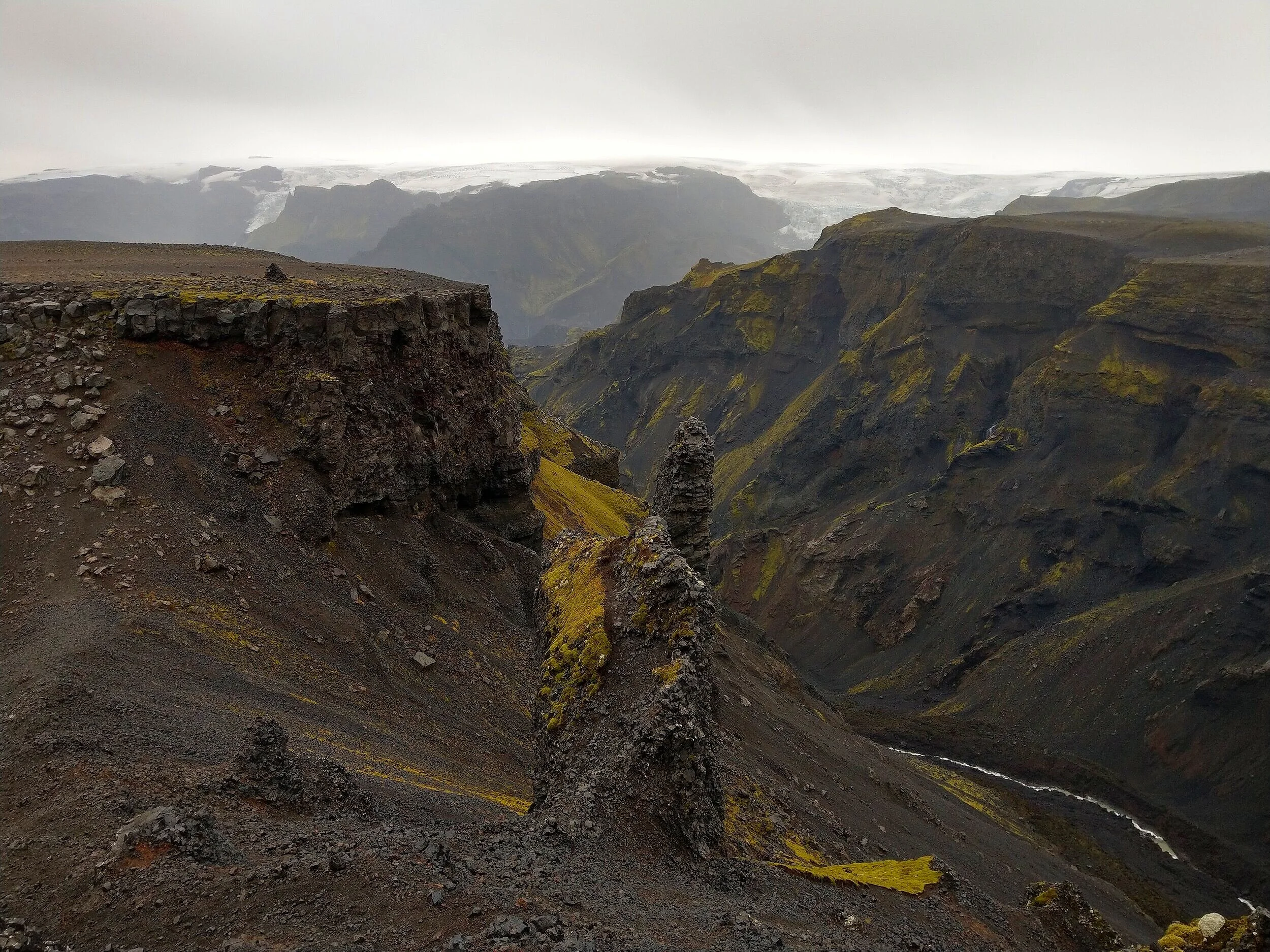
Once done with the chains, the trail will lead you up to the top of a long, flat plateau. You’ll follow this flat plateau for a while, with epic views of glaciers to your right and the valley to your left.
You then begin your final descent into Thórsmörk via a ridge line known as the Cat Spine Ridge, or Kattahryggur.

The descent starts off pretty gradually. You see the valley floor in the distance and think you’ll get there fast, but it takes a while to zig zag your way along the ridge. It felt long to us, anyway, because at this point, we were pretty tired and cold.
The hike down involved some short knives-edge-like ridges and some dirt scree sections, but honestly, I barely noticed! We were in the home stretch, the sun was starting to set, and we were motivated to get down to that valley. We knew we were getting close when we came upon some stairs built into the trail, and even benches!
And finally, we saw the beacon of light in the valley…quite literally… The Básar has a bright light that you can see from way up on the ridge, indicating your final destination, and it was certainly a happy sight to see for us!


The sun was starting to set fast, so we were on a mission to get off the trail, although seeing the sunset from the trail was certainly something.
You’ll finally start making some steep descents down into the valley, the final one through a small forest of trees. When you hit the bottom, a sign and map will mark the end of the Fimmvörðuháls trail. And trust us, after ten hours of hiking the Fimmvörðuháls trail with heavy packs and chilled bones, this sign will be the best thing you’ve ever seen in your life!
From here, it’s 0.6 km to Básar along a flat walk through the edge of the valley.
When we arrived at Básar a little after 9:30 pm, the reception was still open and we were able to pay for a campsite and get some information about the layout of the area. We picked a nice private campsite and set up camp, made some dinner in the kitchenette, and went to bed.
The next morning, we had a 1:00 pm bus booked to get us back to our car parked at Seljalandsfoss. But when we woke up, we learned that the bus wasn’t picking people up at the Básar, but instead at the Volcano Huts, and walking to this hut would be a few hours and several miles worth of hiking through the valley of Thórsmörk! We’ll walk you through booking the buses (and making sure this doesn’t happen to you) shortly!
By some massive stroke of luck that we will be forever grateful for, a bus did come to the Básar around 11:15 that morning and we were able to hop on and get a ride over to the Volcano Huts. The bus ride took about 45 minutes and involved a couple of river crossings, one being across the massive Krossá River. Driving through Thórsmörk is an adventure in itself!
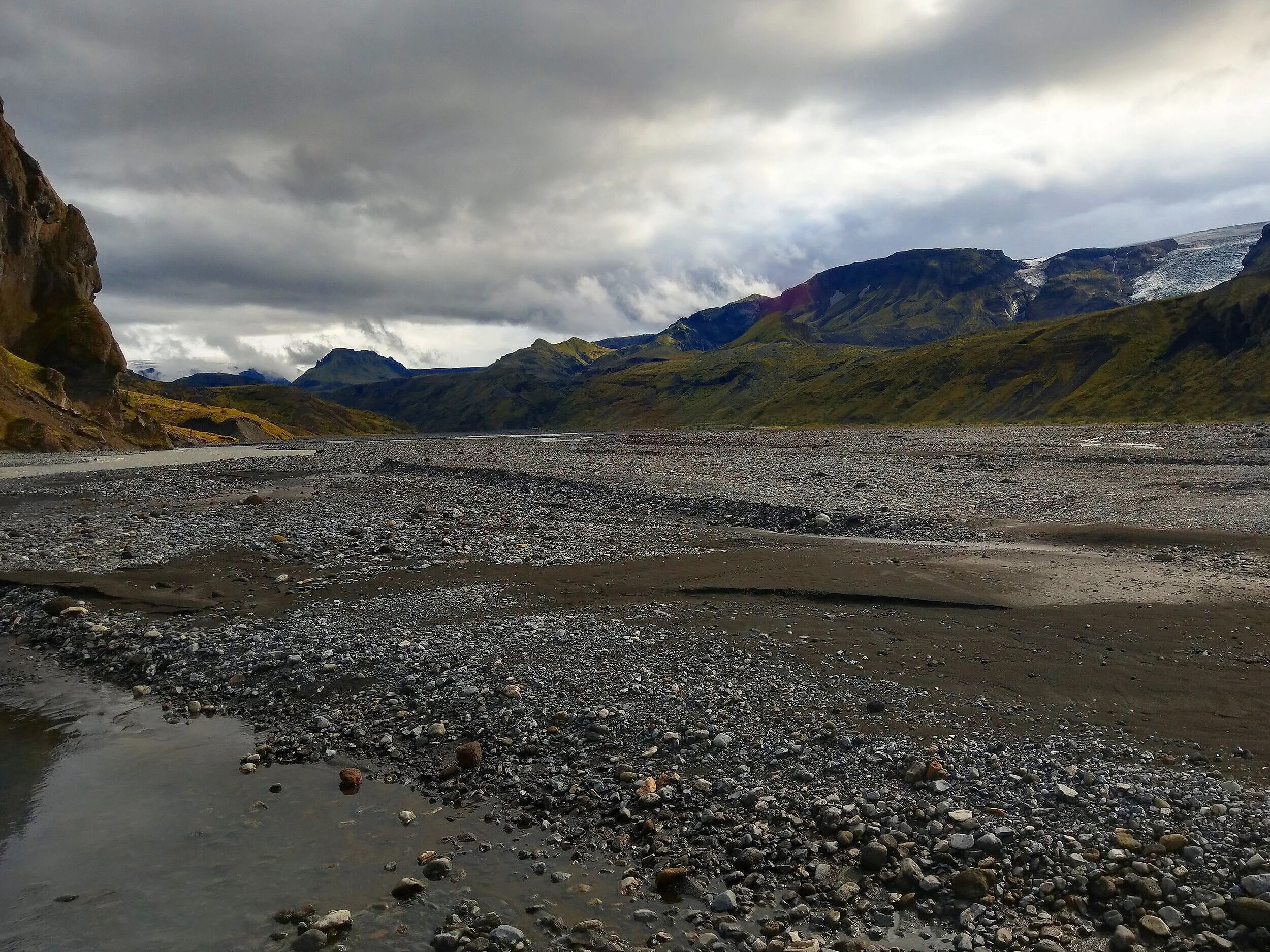
We got dropped off at the Volcano Huts and had about an hour of down time here before our next bus out from Thórsmörk back to Seljalandsfoss. This hut is really nice and a little more developed than Básar. There is an indoor restaurant that serves three meals a day in a buffet style, and a very helpful reception area that gives information and maps to visitors looking for things to do in the area.


The bus back to Seljalandsfoss, the first stop on the bus route back to Reykjavik, was about an hour.
All in all, despite the fact that by the end of the hike we were dirty, wet, cold, and absolutely exhausted, the Fimmvörðuháls trail was one of the best day hike’s we’ve ever done. The epic scenery and constantly changing landscape made all the challenges of this hike absolutely worth it, and we would recommend this one to any avid hiker who is ready to put in the time and effort to get the logistics down.
Speaking of which…
Arranging Transportation for the Fimmvörðuháls trail
So, we’ve gone over what the trail is like, and obviously, you want to do it, right?! But how? Logistics are a little bit tricky for this one, especially if you’re on a budget and trying to save some money while in Iceland.
The challenge is that the Fimmvörðuháls trail is a point-to-point hike. You start in Skógar and end in Thórsmörk (or vice versa). So, you’ll need a way to get back to your car. Unfortunately, this isn’t as simple as it sounds, as there are no buses that go directly between Skógar and Thórsmörk! We were surprised to learn this since the Fimmvörðuháls trail is such a popular hike.
I spent so long trying to figure this one out. For some reason, we couldn’t find any definitive way online to do this. Most people either didn’t say what they did to arrange transportation, or were very vague, or spotted cars at each end of the hike (and most people likely won’t be renting two cars and can’t do that). So, we went to Iceland with no concrete plan. We were hoping to figure something out once we were there, and if not, maybe try to hitchhike (and both of us weren’t too thrilled about that idea). Luckily, throughout Iceland, there are bus timetables everywhere… at campgrounds, bus stations, and some tourist attractions. So after glancing at the different bus schedules and doing some more research in Iceland, I found a series of buses that would take us back to our car at the end of the hike.
So, what are your options?
Well, the first thing you need to know is that Thórsmörk is not simple to get to. You’re likely not going to be able to drive there yourself. The entrance to Thórsmörk requires a substantial river crossing across the Krossá river and requires the proper 4x4 vehicle outfitted for this kind of thing. You don’t want to be crossing any rivers in standard 4x4 rentals that aren’t built for river crossings. As soon as you enter any water, all bets are off… insurance no longer covers you and any damage incurred is on you. Water damage to the engine can cost thousands. Plus, it’s just dangerous if you don’t know what you’re doing. A lot of cars get stranded here.
So, to get in and out of Thórsmörk requires that you hop on a bus that goes there. For this, you have several options… four to be exact.
The four major bus companies operating in and out of Thórsmörk are Reykjavik Excursions, Sterna, Trex, and Thule. They each operate between mid-June to mid-September…each company varies slightly in their start and end dates, so make sure you look carefully at the schedules. We chose Sterna, which has a Hop On Hop Off bus in and out of Thorsmork and seemed to be the cheapest.

Each of these companies have bus routes that run between Reykjavik and Thórsmörk on a daily basis, making several intermediate stops on the way, including Hveragerði, Selfoss, Hella, Hvolsvöllur, and Seljalandsfoss (may differ by company). You can book a one-way ticket between Thórsmörk and any of these stops for fairly cheap, depending on how far you travel on the bus. But did you notice?... Skógar, the other end of the Fimmvörðuháls hike, isn’t on the list of stops. You’ll need to arrange a different bus for that.
But before we solve that problem, here are two very important things to note:
When you are comparing the different bus options, look carefully at the schedules of the buses leaving Thórsmörk. In general, the buses leave either at 1 or 2 pm, or somewhere around there, and/or around 6 or 6:30 pm. So keep in mind, if you’re doing a day hike and not planning on spending the night in Thórsmörk, you need to be at the bus stop in Thórsmörk no later than 6:30 pm.
When you’re looking at schedules, also look very carefully at the specific stop in Thórsmörk that the bus is going to. Remember, there are three huts in Thórsmörk that are far apart from each other. Each bus company only goes to 1 or 2 of these huts, and some buses within the same company will go to different huts at different times. Make sure you are booking the right bus that goes to the hut you know you’ll be at!
On the time tables, you’ll see options for the Utivist hut called Básar, the Volcano Huts in Húsadalur, and the Langidalur Hut (FI). If you are just finishing the Fimmvörðuháls hike, you’ll be at the Básar hut. However, if you’re spending more time in Thórsmörk after the hike and you’ve wandered to another hut, you need to book the bus accordingly.
So let’s go over the steps and the options for doing the Fimmvörðuháls hike in each direction.
Transportation logisitics if hiking the Fimmvörðuháls trail from Skogar to Thorsmork
The first option is to park your car somewhere along the Thórsmörk - Reykjavik bus route, so that when you get the bus out of Thórsmörk, you can take it directly back to your car. However, you’ll still need to get to the trailhead in Skógar to start the hike. You have three options.
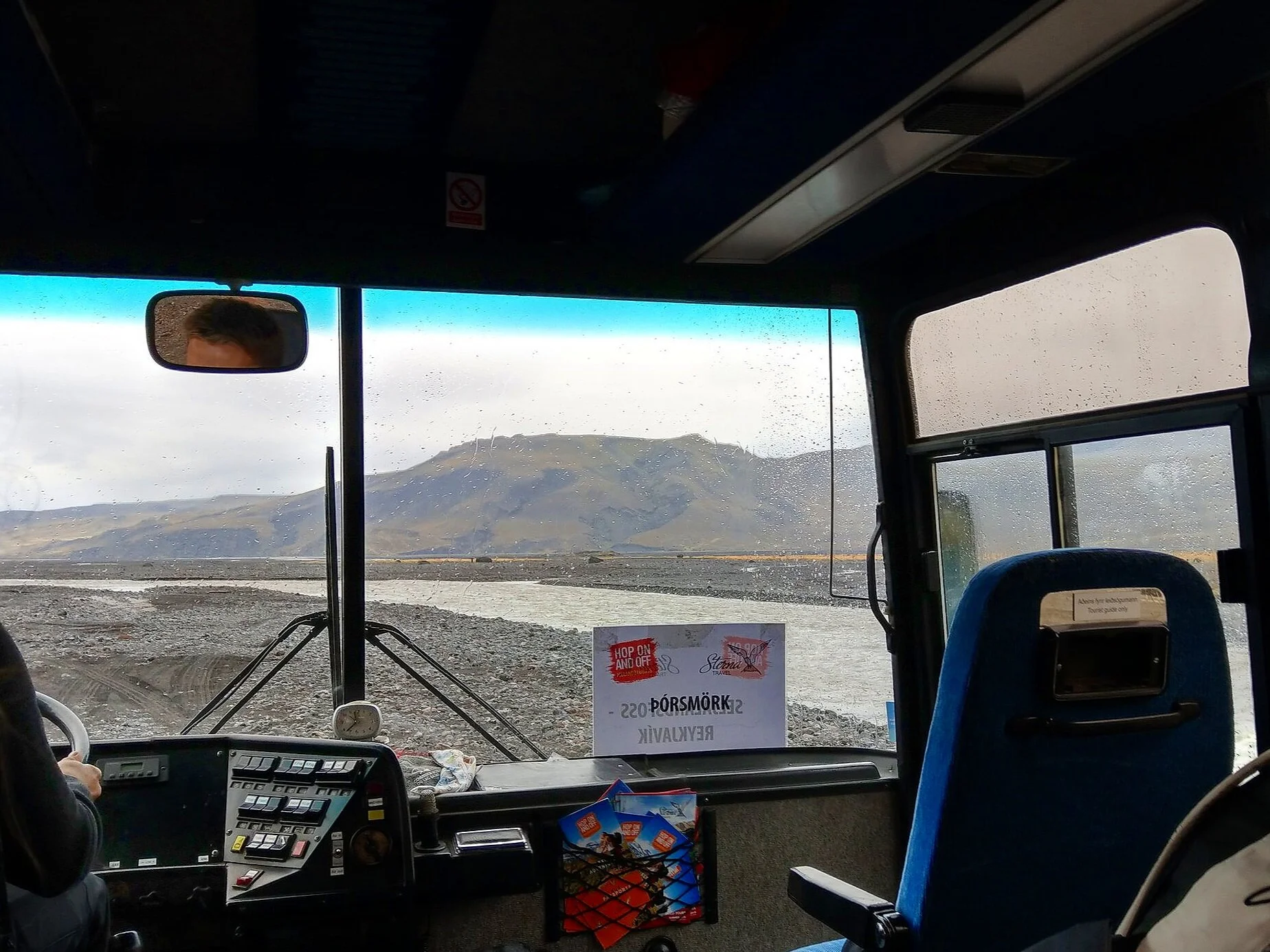
The first is to take a bus in the morning from your car to Skógafoss. This is what we did. We used Sterna. Sterna runs a service called Hop On Hop Off that operates on a daily basis, making stops at multiple places along Iceland’s southern coast between Reykjavik and Jokulsarlon, including Skógar. You can purchase a one-way ticket between any two stops on the route. So, wherever you choose to park your car, just make sure it’s a stop on both the Thórsmörk bus AND this Hop On Hop Off South Coast bus, and buy a one-way ticket from there to Skógar. The easiest place is at Seljalandsfoss, since it’s the closest stop to both Thórsmörk and Skógar, but it costs money to park here (and not every bus company may stop here on its way out of Thórsmörk…make sure you check each company carefully).
The catch with this is that the earliest the bus would bring you to Skógar is 10:30 am (the South Coast bus to the Glacier Lagoon). The only other bus that goes to Skógar for the day (the South Coast bus to Skógar) arrives in Skógar at 11:00 am. That’s quite a late start for this hike, especially if you’re trying to make the last bus out of Thórsmörk. If you know you’re a slow hiker, this option isn’t a good one if you’re trying to hike the Fimmvörðuháls trail in one day. However, if you’re hiking it over two days or plan to spend the night in Thórsmörk (which is what we did), this option works well. The following day, you can take the bus out of Thórsmörk right back to your car.
The second option to get to Skógar in the morning is to hitchhike. This is risky. There are a lot of people traveling along the ring road on their way to Skógar, but if you can’t find someone to pick you up, you’re out of luck, or risk getting to the trailhead too late in the day. When we got back from Iceland, we also saw this site that acts as a forum for people looking for rides. We have no experience with this, so I can’t say much about it, but it might be worth checking it out.
Your third option is a taxi. But this is an expensive option and, depending on where you park along the Thórsmörk bus route, can cost you hundreds of dollars. Taxis in Iceland are not cheap! But hey, for this, it might be worth it!
The second option for starting the Fimmvörðuháls hike in Skógar is to park your car right in Skógar. This will allow you to start the trail as early as you’d like, giving you the best chance of making the last bus out of Thórsmörk.
However, you’ll still have to get back to your car in Skógar after your hike. You would take the bus out of Thórsmörk, hop off at Seljalandsfoss, and then either hitchhike or get a taxi back to Skógar. Hitchhiking at this time is risky, as less people are traveling, and you’ll probably be kinda gross and dirty from the hike, making you an unappealing prospect for picking up! So you’ll risk getting stranded.
Unfortunately, the Hop on Hop Off bus doesn’t run in this direction this late at night. You could spend the night at Seljalandsfoss (or any other stop along the bus route) and take the Skógar bus the next morning, but that would require you to bring overnight or camping gear with you along the Fimmvörðuháls trail, adding substantial weight to your pack (which makes the trail a little more grueling…trust me, I speak from experience!).
Transportation logistics if hiking the Fimmvörðuháls trail from Thorsmork to Skogar
If starting the Fimmvörðuháls trail in Thórsmörk, it’s even more logistically complicated, bus-wise. You would have to leave your car somewhere along the Thórsmörk bus route between Reykjavik and Thórsmörk and take the bus into Thórsmörk. These buses tend to leave Reykjavik around 7 am or so and get to Thórsmörk around 11 am or so (at least for the Hop on Hop off bus, it leaves Reykjavik at 7:15 am and gets to Básar in Thórsmörk at 11:15 am).
You could potentially start the hike then, but you won’t make it to Skógar in time for a bus back to your car. The last Hop On Hop Off bus leaves Skógar at 2 pm. So, your options are, again, to hitchhike or taxi back to your car. Or, you can spend the night after the hike in Skógar and take the bus back the next day, or spend the first night in Thórsmörk and set out early on the hike the next morning to try and get the 2 pm bus back to your car, but both of these options would require you pack a heavy overnight backpack and carry it with you the entire length of the trail.
The Hiker's Bus Passport
There is actually one convenient and easy option for getting to either Fimmvörðuháls trailhead. However, it’s a bit expensive, and doesn’t make sense if you already have your own rental car. The solution is getting a Hiker’s Bus Passport.
The two I looked into were through Sterna and Reykjavik Excursions. You basically book one discounted round trip ticket that is good for transportation between Reykjavik and one of the trailheads and then from the other end of the trail back to Reykjavik. It’s a great option if you’re basing yourself out of Reykjavik, but it will run you about 13,900 ISK per person or more, depending on the company. So this is not the most budget friendly option for hiking the Fimmvörðuháls trail.
You’ll also have to be prepared for an overnight stay somewhere. These buses run a slightly more flexible schedule than the Hop On Hop Off daily buses, leaving the trailheads later at night, but still, unless you’re a fast hiker, you’ll probably need an overnight stay somewhere. You won’t get to the trailhead to start the hike until midday, so catching a bus back to Reykjavik at the other end of the hike on the same day would be difficult. Some companies may even require that you have an overnight stay, and cannot get a bus back on the same day.
Here's what we did
The night before our hike, we camped at the campground at Seljalandsfoss. We asked them if we could leave our car overnight, and they told us we could and where to leave it, so we avoided having to pay for multiple days of parking at Seljalandsfoss. We walked to the bus stop and hopped on the 10:30 am Hop On Hop Off bus that brought us to Skógafoss at 11 am. The trip between Seljalandsfoss and Skógafoss costs only 500 ISK per person.
By the time we got situated and got our packs together, we started the hike by about 11:20 am. This is super late to start this hike as a day hike, but if you’re fast enough, it is possible to get to Thórsmörk in time to catch a bus out. If not, you’ll have to backpack the trail and spend a night in Thórsmörk, taking the bus out the next day. And that’s what we did. And although we had to carry heavy packs with us, I’m glad we didn’t try to make it to the last bus that day. The last thing I wanted to do on such a beautiful trail was rush through it and feel stressed about making it to our destination by a certain time.
We camped at Básar, and the next day we got a bus out of Thórsmörk, which brought us right back to our car at Seljalandsfoss. We booked through Sterna’s Hop On Hop Off Thórsmörk bus - it was the cheapest option by far. It costs 4,500 ISK per person between Thórsmörk and Seljalandsfoss (although when we booked, there was a sale and we got tickets for 4,050 ISK per person) and the ride took about an hour from the Volcano Huts.
Here are some important tips to remember when booking the bus out of Thórsmörk after you finish the Fimmvörðuháls hike:
Make sure you know which hut the bus will pick you up at!! I said this above but it’s worth reiterating. Not every company goes to every hut in Thórsmörk, nor does every company have the same drop off spots along the route back to Reykjavik (for example, when we checked for our own trip, Reykjavik Excursions did not stop at Seljalandsfoss).
Knowing which hut to be at is super important, though, but not too intuitive. When we booked our Hop On Hop Off bus, we selected that we wanted to be picked up in Thórsmörk, but in the booking process, it only asked which bus time we wanted, not from which hut. We chose our time not even thinking about the hut situation, and our ticket just said Thórsmörk (see the image below). Well, that was a mistake! And it was a very depressing realization when we woke up the next morning in Thórsmörk to the news that we would have to walk several miles, from Básar to the Volcano Huts, to catch our 1:00 bus out.
To avoid this mistake, MAKE SURE you crosscheck the bus timetables (which will have the time the bus stops at EACH Thórsmörk hut) with the time you are booking to make sure the time you are selecting is for the hut you want.

Know your hiking pace and know if you’ll be able to make the last bus out of Thórsmörk and figure out a way to make sure you won’t get stranded anywhere!
Be flexible. It might be best to wait about a week before you plan to hike the Fimmvörðuháls trail to book your bus tickets. The weather in Iceland, and especially in the highlands, is so unpredictable, and you don’t want to be on this trail in really bad weather. When we were in Iceland, there were multiple times throughout our two week stay where there were advisories to stay off the trail because of hazardous conditions. Just a few days before we did the hike, the buses into Thórsmörk weren’t even operating… the massive amount of rain fall during the entire week meant high water levels, making the river crossing too dangerous.
Like I said above, we didn’t make all these concrete transportation plans until we were in Iceland….in fact, we didn’t book bus tickets until two days before we did the hike! And we had no issues with this. Both buses we took were not even close to being filled, and people were hopping on without advanced reservations and paying on the bus (even the buses in Iceland have card readers!). We did do this hike, though, at the end of the season, and so the situation might be different in the busier months.
Alternatives to the Fimmvörðuháls trail

If you’re not up to hiking the entire Fimmvörðuháls trail, you can hike Waterfall Way. A round trip hike to the foot bridge and back is 10 miles (16 km), which is still about two thirds of the entire one-way length of the Fimmvörðuháls trail, but it’s the easiest terrain of the trail, with gradual inclines, and could probably be done pretty quickly with just a day pack. And you’ll hike through beautiful scenery past all 26 waterfalls. It’s a great option if you’re looking for a longer day hike without having to deal with all the logistics of the entire Fimmvörðuháls trail.
On the contrary, if you’re looking for even more hiking, you can check out the Laugevegur Trail. This is a 3 to 4 day backpacking trip from Landmannalauger to Thórsmörk, and is often done in connection with the Fimmvörðuháls trail. The Laugevegur trail is one of the most scenic trails in the world, taking you through the Fjallback Nature Reserve of colorful rhyolite mountains, lava fields, and epic volcanic landscape. Once in Thórsmörk, many people spend a night there and then continue along the Fimmvörðuháls trail over 1 or 2 days to Skógar.
Finally, if you’re looking for other short hikes to do during your stay in Thórsmörk, check out these options for day hikes in the area. These can be done before or after your time on the Fimmvörðuháls trail, but again, just make sure you time them right so that you can make your bus out of Thórsmörk in time!
Summary for Hiking the Fimmvörðuháls Trail
This was a long post, so were going to give you some final thoughts about the Fimmvörðuháls hike here.
This is not a simple day hike. It’s definitely physically challenging with a lot of elevation gain and some steep descents. Expect snow crossings, lava fields, dirt slides, chains, and narrow ridges.
You will get wet. Or, you should at least plan for it. The weather along the trail can change drastically. Bring a rain coat, rain pants, and a pack cover at the very least.
We would recommend you don’t try to backpack the entire trail in a single day. It’s exhausting. Either split it up into two days, or try to arrange for transportation that will allow you to day hike it at a comfortable pace but still be able to get a bus back to your car that night.
Things to look for when comparing bus companies into and out of Thórsmörk:
1) the dates of operation (usually mid-June to mid-September but note the specific dates for each company)
2) which stops they make on the route between Reykjavik and Thórsmörk and make sure you park your car along a designated stop (these can vary by company as well)
3) the times each bus leaves Thórsmörk, to make sure you finish the Fimmvörðuháls hike on time
4) Which hut each bus leaves from, so you know you’ll be in the right spot, and lastly
5) Prices. These vary between companies, and we found the cheapest option to be Sterna’s Hop On Hop Off bus by far.
Most importantly, have fun!! I know this all seems like a big hassle to plan, but, it’s worth it! This hike will take you through some of Iceland’s most spectacular scenery and is one for the books. It requires a lot of advanced planning, but if you prepare properly, the Fimmvörðuháls trail might just become your new favorite hike!
We want to hear from you!
We hope this guide helps you sort through the logistics of planning your hike along the Fimmvörðuháls trail in Iceland. Let us know if you have any questions, or any other thoughts on the hike if you’ve already done it! We’d love to hear from you in the comments below.
