Hiking the Blahnúkúr Brennisteinsalda Loop in Iceland: Landmannalaugar’s Best Day Hike

Landmannalaugar, located in the southern highlands of Iceland, is a hiker’s paradise. The landscape here transports you to a world of colorful rhyolite mountains and expansive lava fields with steaming geothermal vents everywhere you look.
Now you might start to think as you scroll through this post, is this place even real? And we don’t blame you. It does look kind of fake in pictures, but guys, it actually looks this fake in real life, too. We didn’t secretly travel to Mars and take these pictures. Really, we’re not making this place up.
And the best part? There are several trails to choose from that take you through this epic landscape, ranging from easy strolls through the lava fields to hard climbs up and over volcanoes to multiday treks ending in completely different parts of Iceland.
So which hike should you do if you have only one day in Landmannalaugar?
Well, two really really awesome hikes in Landmannalaugar that we think are the best and that we absolutely recommend are the hike up Brennisteinsalda (say that five times fast) and the hike up Blahnúkúr. Each involves a steady climb up to the summit of a volcano and each has pretty stunning views over the entire area of Landmannalaugar. We’re talking jaw-drop worthy views.
And if these both look appealing to you but you’re of the super indecisive type (*raises hand* Let’s be real…just deciding what to eat for dinner is a chore), then you’re also in luck… because there’s a way to combine BOTH of these mountains into one super awesome loop. So there, you don’t have to decide! And of course, if you have the time and energy, we highly recommend doing this.
Actually, this Brennisteinsalda Blahnúkúr loop was our favorite hike in Iceland! I personally enjoyed this even more than the epic Fimmvorduhals trail that we did just days later, so that’s saying something!
In this post, we’ll walk you through everything you need to know about hiking both Blahnúkúr and Brennisteinsalda, as well as combining them and hiking the Blahnúkúr Brennisteinsalda loop, the best trail in Landmannalaugar (in our humble opinion anyway!). We’ll show you what trails to take, what to expect, and give you some helpful tips along the way about visiting and hiking in Landmannalaugar.
If you only have time for one of these hikes during your time in Landmannalaugar, we’ll also compare each and give you our recommendations for which hike you should choose.
Let’s do this!
Oh, and if you’re eager to just cut to the chase and read something specific, here are some links to jump around the page!
Article Contents
How to Get to Brennisteinsalda and Blahnúkúr
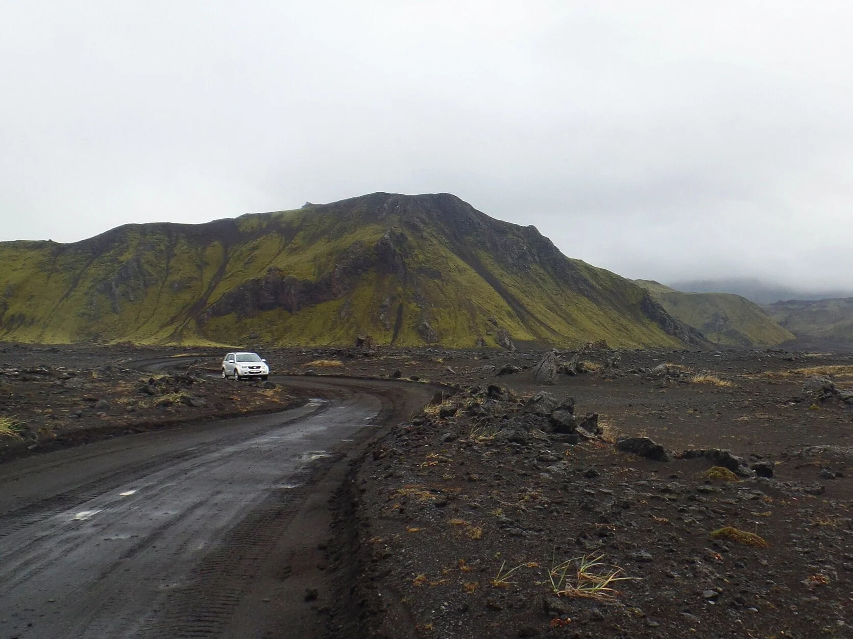
Getting to Brennisteinsalda and Blahnúkúr is an adventure itself. Both of these hikes are in Landmannalugar, the heart of the Icelandic highlands. To get here, you’ll have to drive on rough gravel roads, otherwise known as F roads. Driving on these roads requires a 4x4 vehicle and a confident driver.
The best route to get to Landmannalaugar is via F26 and connecting to F208. There are other routes, but they are more rugged and require river crossings, so we do not recommend these routes, especially if you are in a rental car. From Reykjavik, the drive to Landmannalaugar will take you about three hours, the last hour of which will be on the rough gravel portion.
If you’re not up for driving, there are plenty of options for hopping on a bus and exploring Landmannalaugar on your own, or using a tour company.
Facts About the Brennisteinsalda and Blahnúkúr Hike
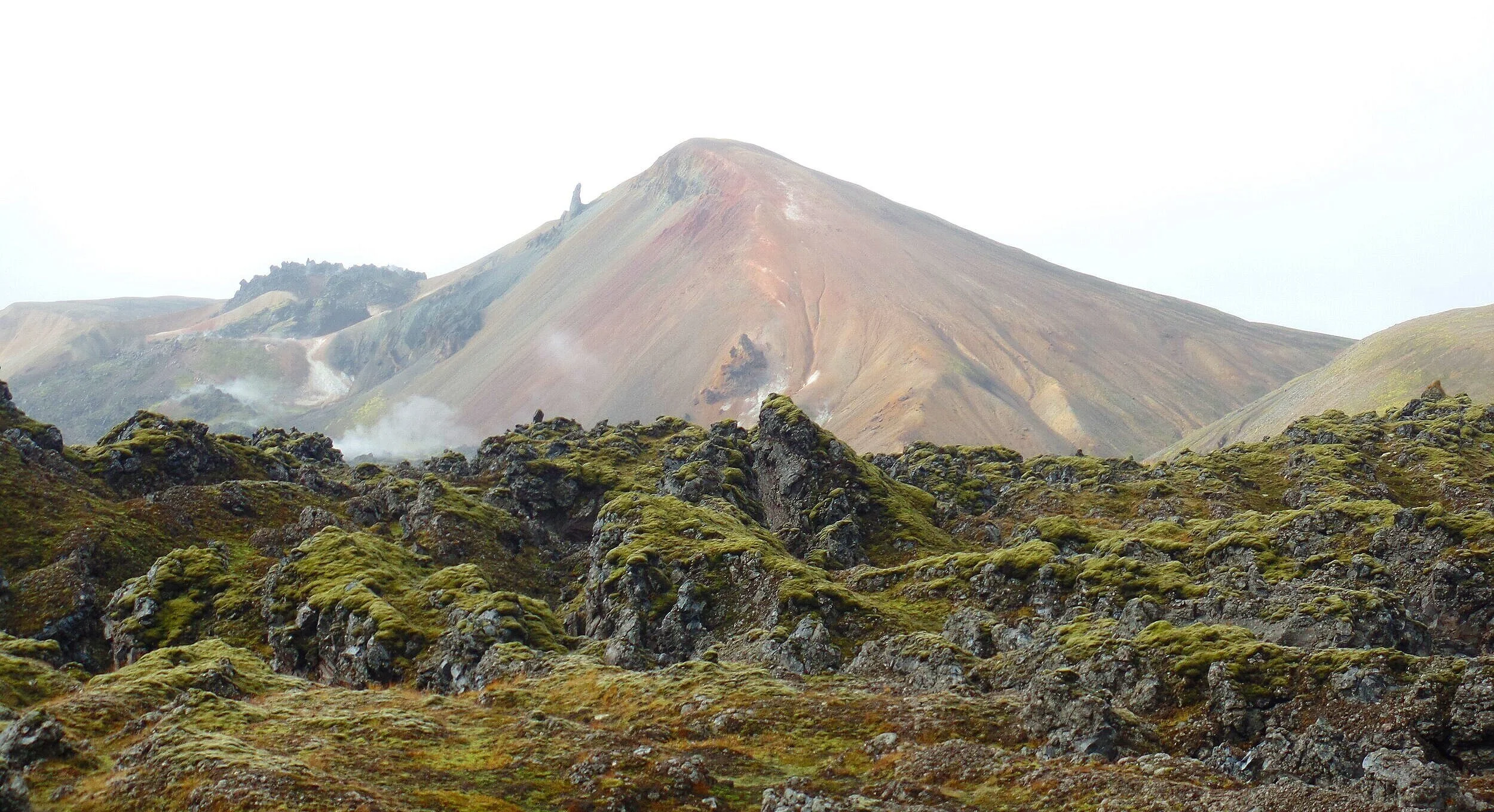
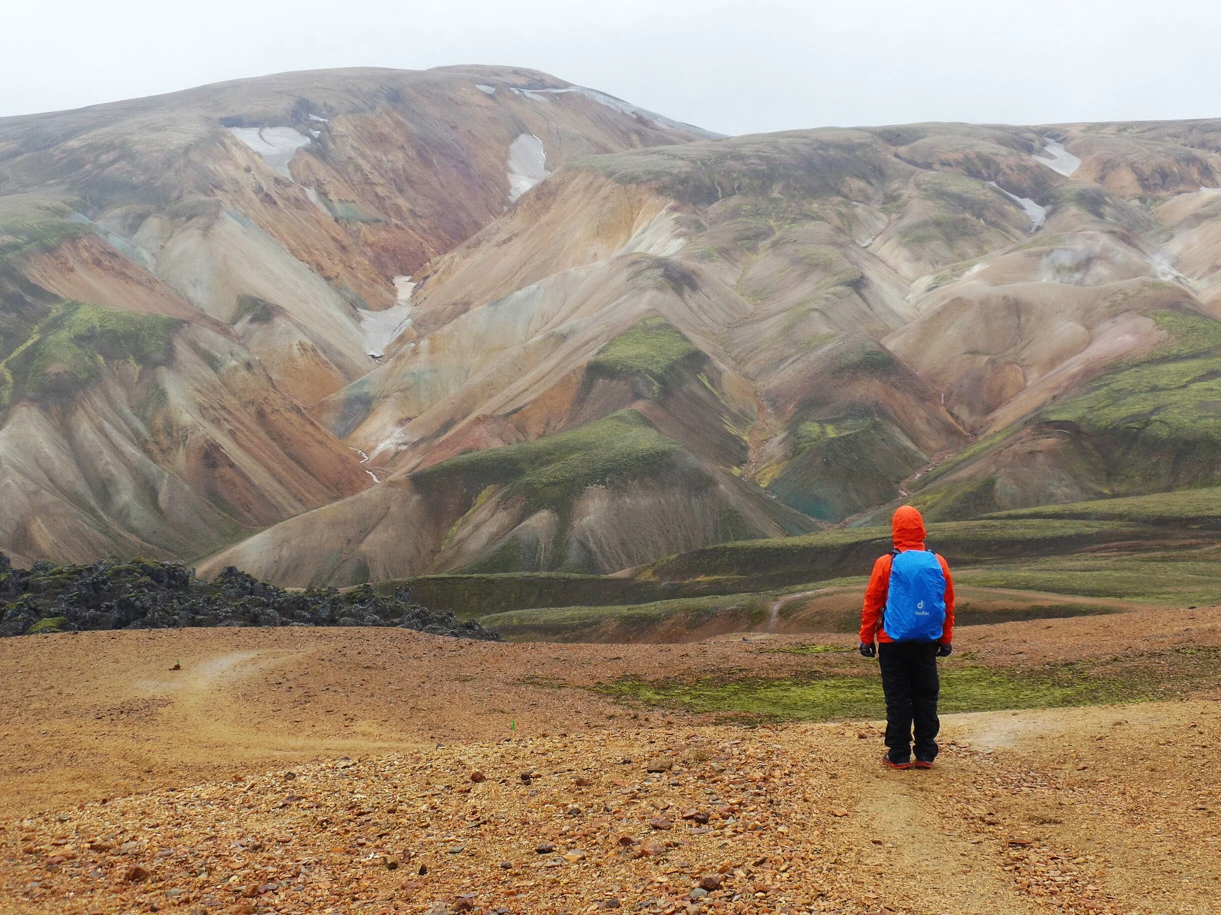
More about Brennisteinsalda: Brennisteinsalda is an excellent example of the colorful rhyolite mountains that are so characteristic of Landmannalaugar and make this area famous. Brennisteinsalda literally translates to “The Sulphur Wave”, referring to the hues of reds, blues, and greens painted on its sides, a consequence of the sulphur-rich volcanic rock that forms it. Brennisteinsalda’s last eruption was actually not too long ago, in 1961! And it is still visibly active - as you traverse around its sides you can see steaming vents and fumaroles. You can see just the tip of this mountain from the base camp in Landmannalaugar, and to get good views of the full mountain, you’ll need to trek up into the nearby Laugahraun lava field.
More about Blahnúkúr: Blahnúkúr is probably the most recognizable formation in Landmannalaugar, as it makes a striking contrast to the multi-colored rhyolite mountains that surround it. Known as “The Blue Peak”, this volcano stands out with its greenish blue hue due to volcanic ash and lava flows. This giant can be seen and accessed directly from the Landmannalaugar basecamp as it towers over the valley.
Hiking stats for the Brennisteinsalda and Blahnúkúr hikes
Here is a map of the Brennisteinsalda and Blahnúkúr hikes. This map can be purchased at the service center in Landmannalaugar for 300 ISK, and we suggest you do. It comes in handy on the trails.
Brennisteinsalda Hiking Loop
Distance: 6.5 km / 4 mi
Elevation gain: 200 m / 660 feet
Estimated time: 2-3 hours
On the map: Laugahraun trail (red/white) to the white trail to the green trail (up Brennisteinsalda) to the red trail to the white trail through Graenagil Canyon
Blahnúkúr Hiking Loop
Distance: 5.7 km / 3.5 mi
Elevation gain: 320 m / 1,050 ft
Estimated time: 2.5 – 3.5 hours
On the map: The brown trail over Blahnúkúr to the yellow trail to the white trail through Graenagil Canyon
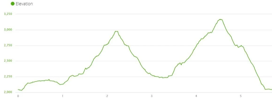
We personally hiked the full Brennisteinsalda Blahnúkúr Loop and tracked the stats with our Garmin watch.
Distance: 5.87 mi
Elevation gain: 2,034 ft
Hiking time: 4 hours 50 minutes (this was at a pretty leisurely pace with lots of time enjoyed on the summits 😊)
Often, this hike is quoted as being a bit longer than what we have here, more like 6.2 miles. This is because we didn’t do the usual loop. We hiked up and down the same side of Brennisteinsalda, rather than going up one side and hiking down the other. (Instead of going through Vondugil canyon on the white trail, up Brennisteinsalda and down the other side, we skipped the canyon and just went up and down the other side only.)
Here’s our route tracked from our Garmin watch.

Regardless of which way you choose, the elevation gain will be similar and you’ll still have the same gorgeous views at the top!
Best time to hike the Brennisteinsalda and Blahnúkúr Loop
The hiking season in Landmannalaugar is from the end of June to mid-September. In fact, the F roads leading to Landmannalaugar are only open during this time frame.
However, you can still expect some snow and ice on the trails in June and early July. We would say the best time to hike Brennisteinsalda and Blahnúkúr are the mid to late summer months when the trails are free of snow and the days are long.
Any visit outside of these summer months requires a Super Jeep Tour into Landmannalaugar, but all bets are off for hiking then.
Hiking the Brennisteinsalda and Blahnúkúr Loop

Here’s a more detailed look at the full Brennisteinsalda Blahnúkúr loop hike. And don’t worry, if you’re only planning on doing one of these mountains, we got you covered here, too. There’s only a few slight changes that we’ll walk you through once we get to them.
There are four parts to this hike that we will cover below:
The Laugahraun Canyon
Hiking up Brennisteinsalda
Graenagil Canyon
Hiking up Blahnúkúr
Which direction should you go around the full loop?
You can do this hike in either direction, and it really doesn’t matter which direction you choose. We did a counterclockwise loop out of basecamp, climbing Brennisteinsalda first and then Blahnúkúr, so that’s the hiking direction we’ll describe here.
Part 1: The Laugahraun Lava Field
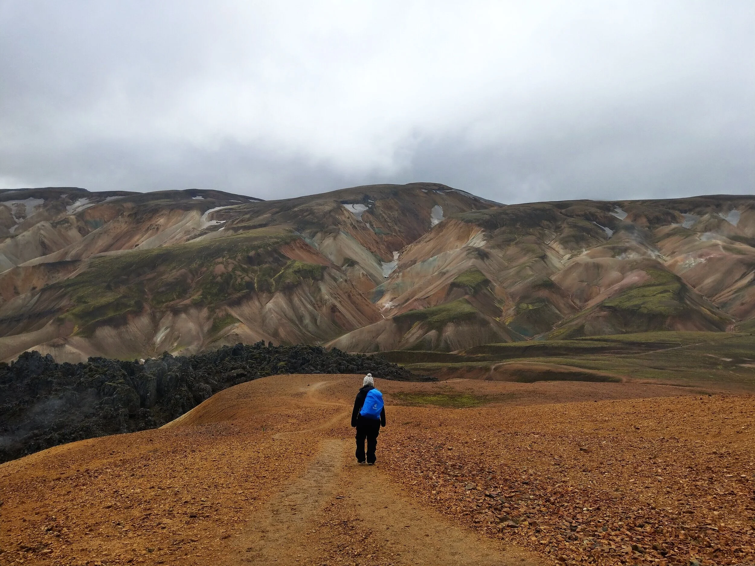
The Brennisteinsalda - Blahnúkúr hike starts right behind the Landmannalaugar hut. Signs next to the service center will point you towards the trailhead (follow signs for Laugevegur and Brennisteinsalda).
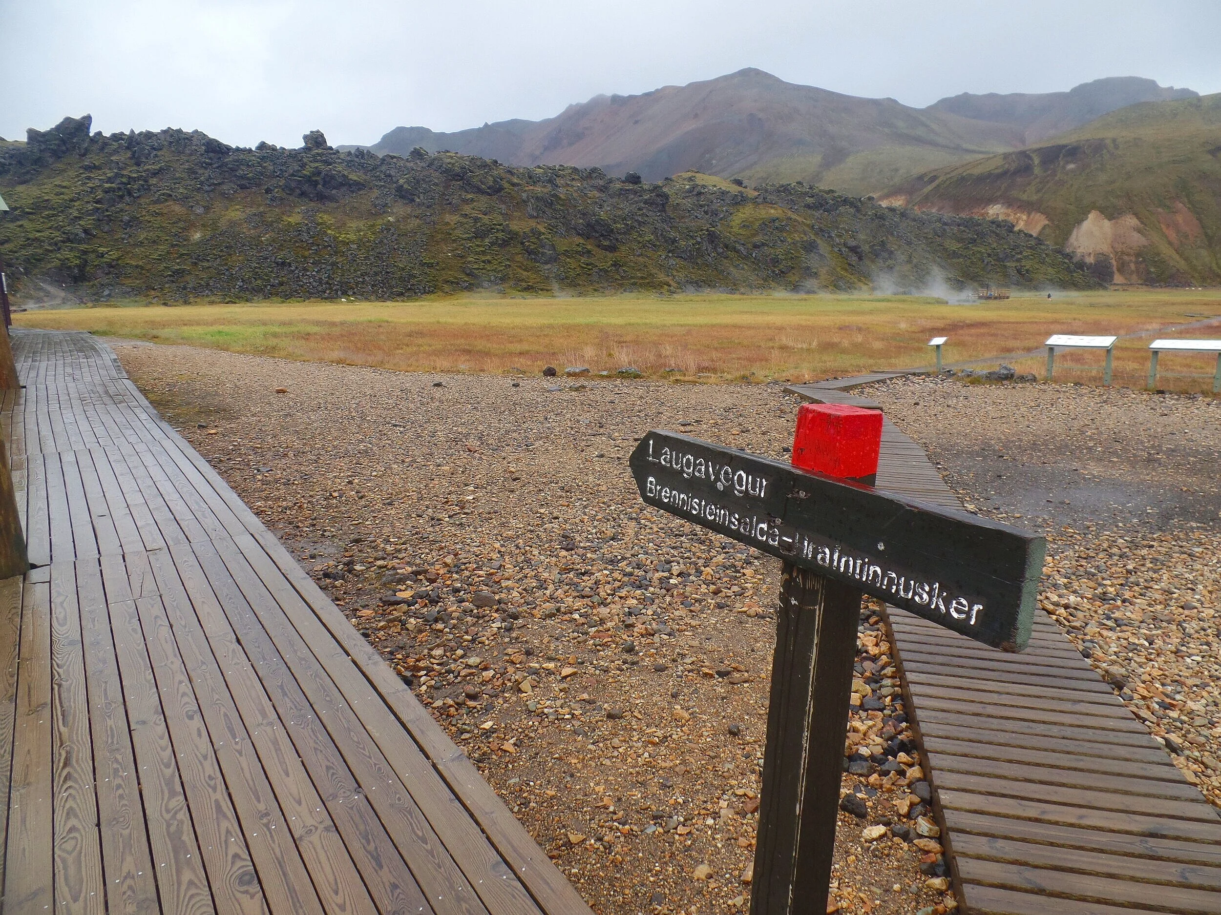
The first part of the trail is through the Laugahraun lava field (a white-marked trail) but is also the start of the famous Laugevegur trek to Thorsmork (a red-marked trail), so for this first section of trail, you’ll be following the trail with posts marked with red and white paint.
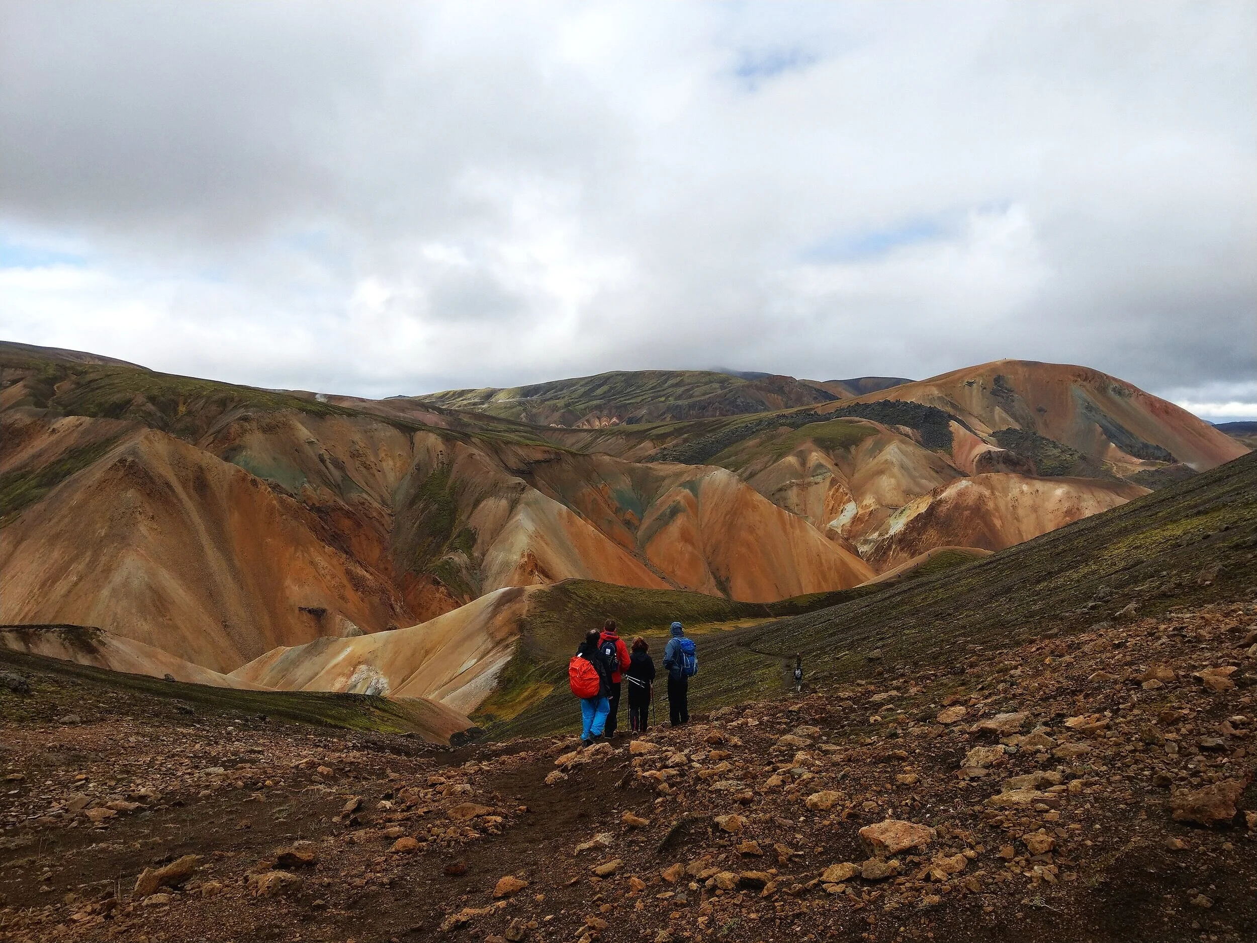
The hike begins with a very short climb to get up into the Laugahraun lava field. When you reach the top, you already get rewarded with nice views back down to basecamp, and the views of the rhyolite mountains now begin to open up all around you.
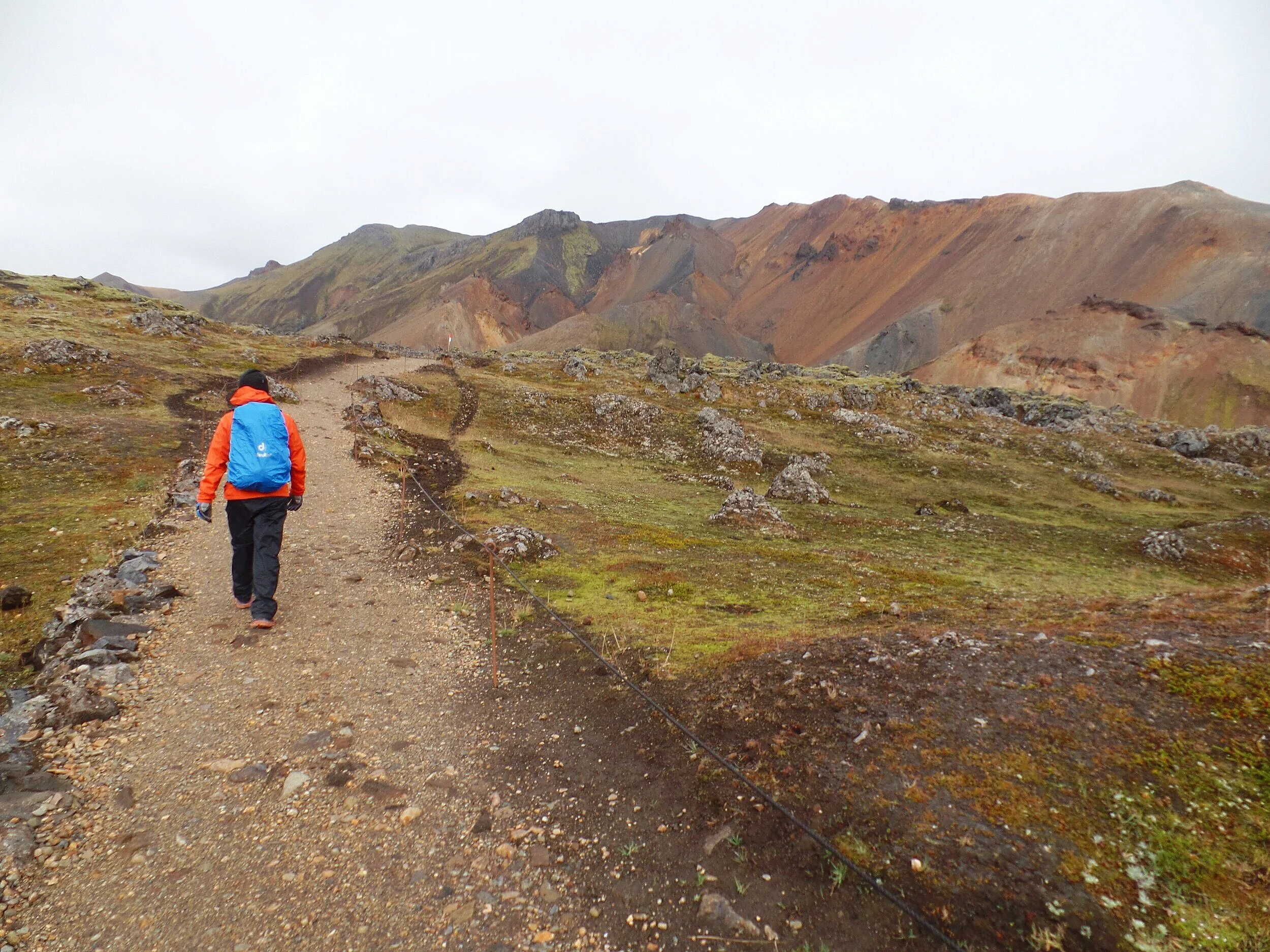

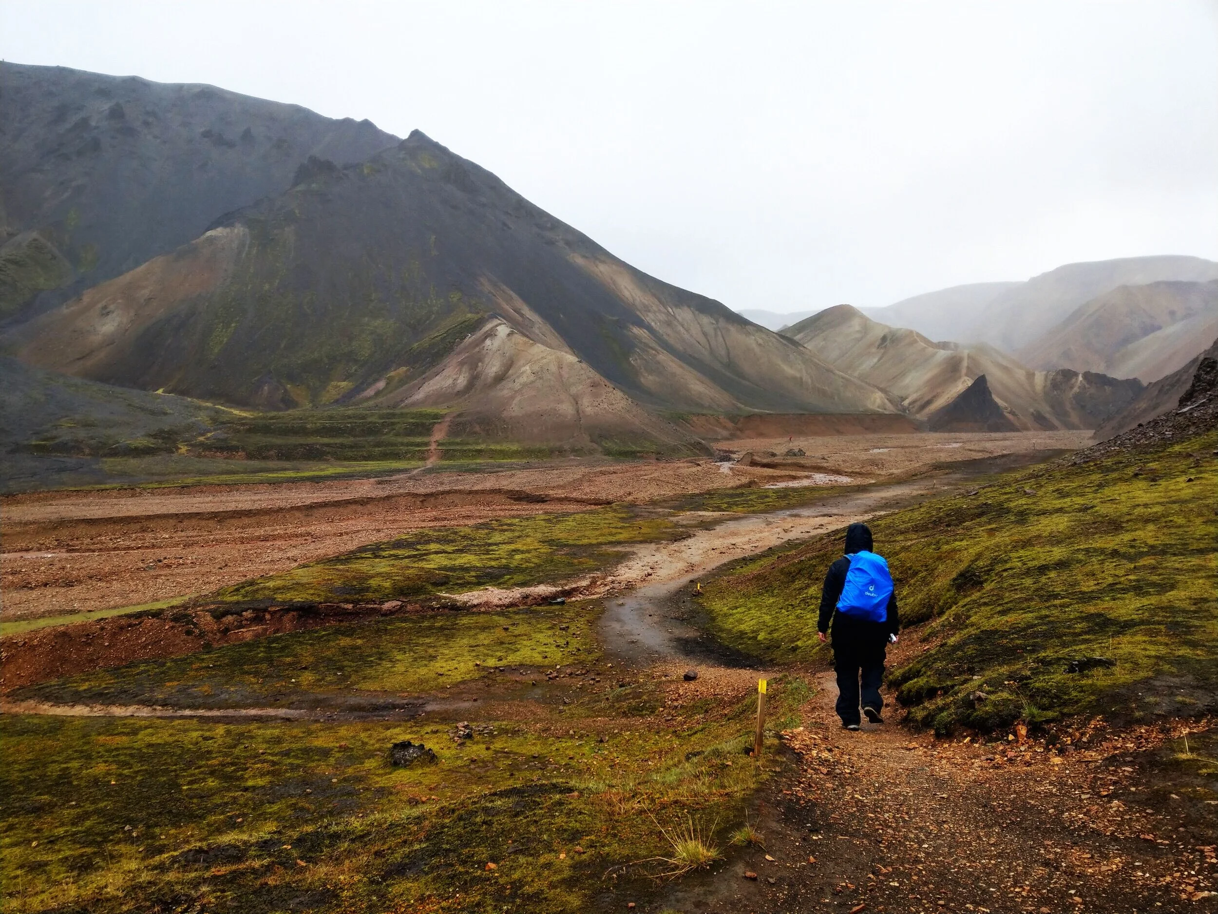
You’ll follow a clear, well-marked, flat path through the lava field. Your two destinations, Brennisteinsalda and Blahnúkúr, will be in sight. And don’t worry, they look more intimidating to climb than they actually are!
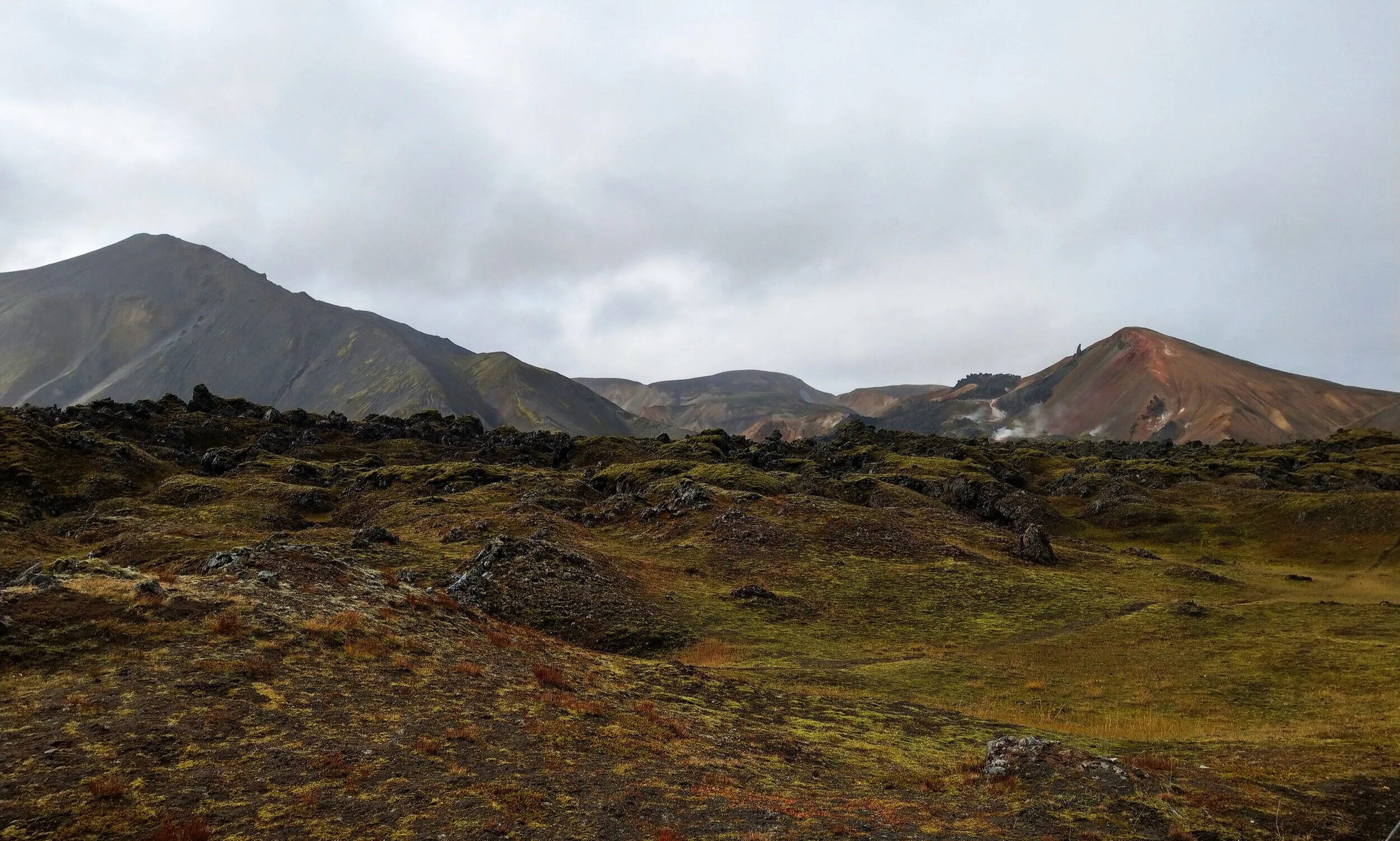
When you reach the opposite edge of the lava field, the views will open up to Vondugil Canyon, a flat valley between the hillsides.
Follow the trail that skirts the edge of the lava field until you come to the next sign marking an intersection.
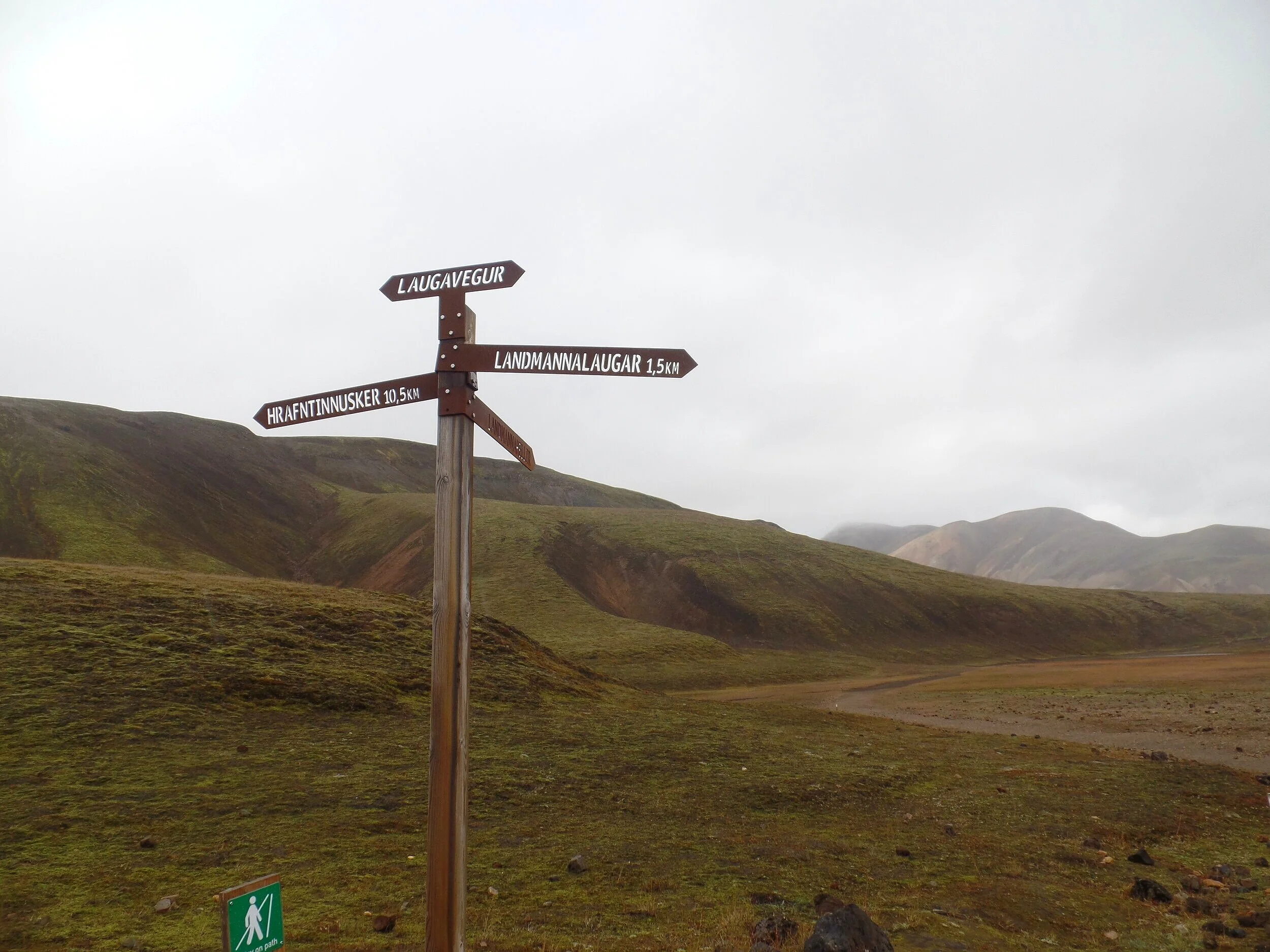
This is where we strayed from the true loop route. We continued to follow the signs for the Laugavegur trail towards Hrafntinnusker. However, if you would like to do the true loop, instead follow the sign towards Landmannahellir. This route will take you through the Vodugil valley and up the backside of Brennisteinsalda. Simply follow this route alongside the base of the mountain until you hit the next intersection. Here, you’ll take the green-marked trail to the top of Brennisteinsalda.
If you’re taking our route, continue straight along the Laugevegur trail, now marked with just red posts. This trail will take you along the opposite side of Brennisteinsalda. Through this section of the hike, you’ll have the lava field to your left and Brennisteinsalda to your right.
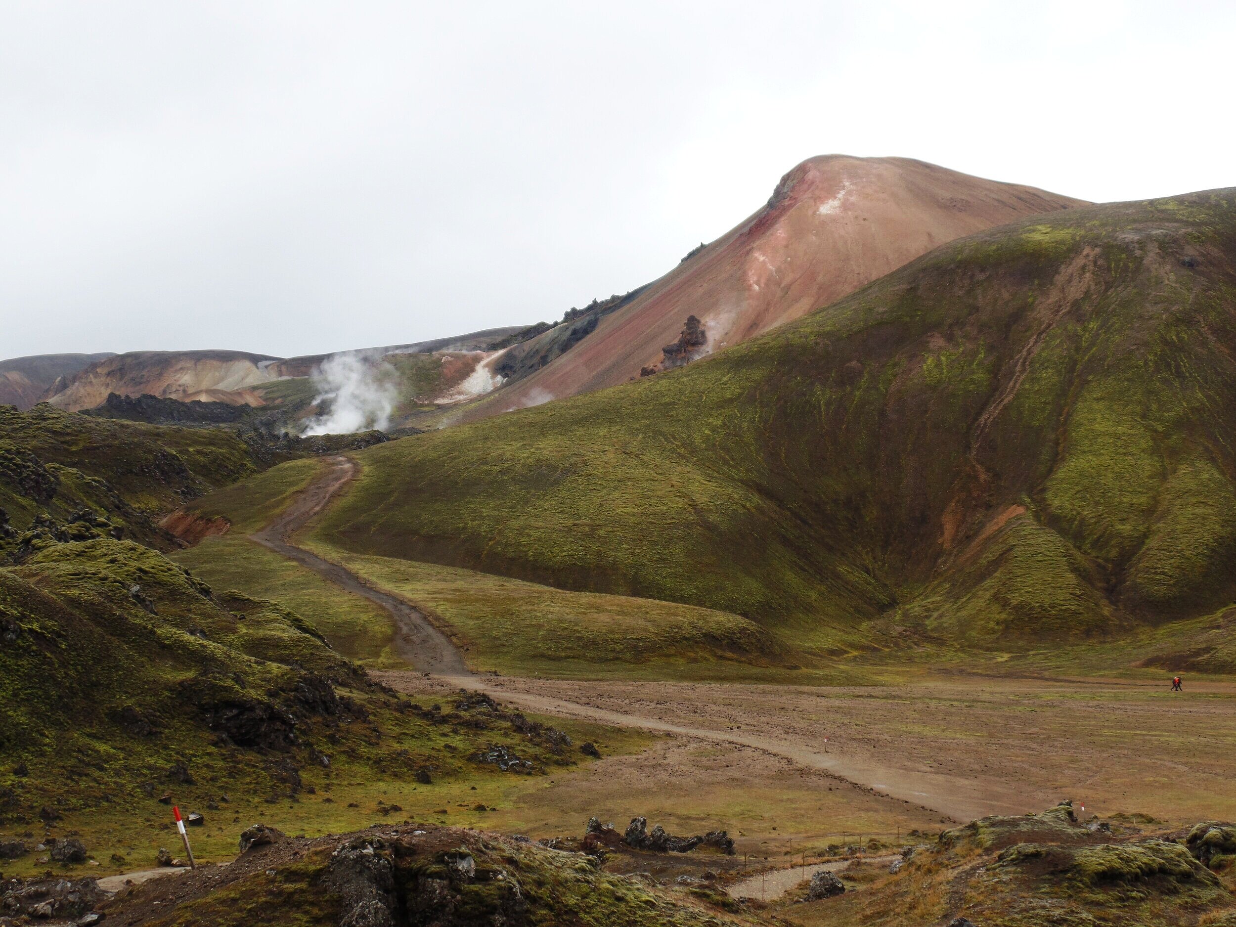
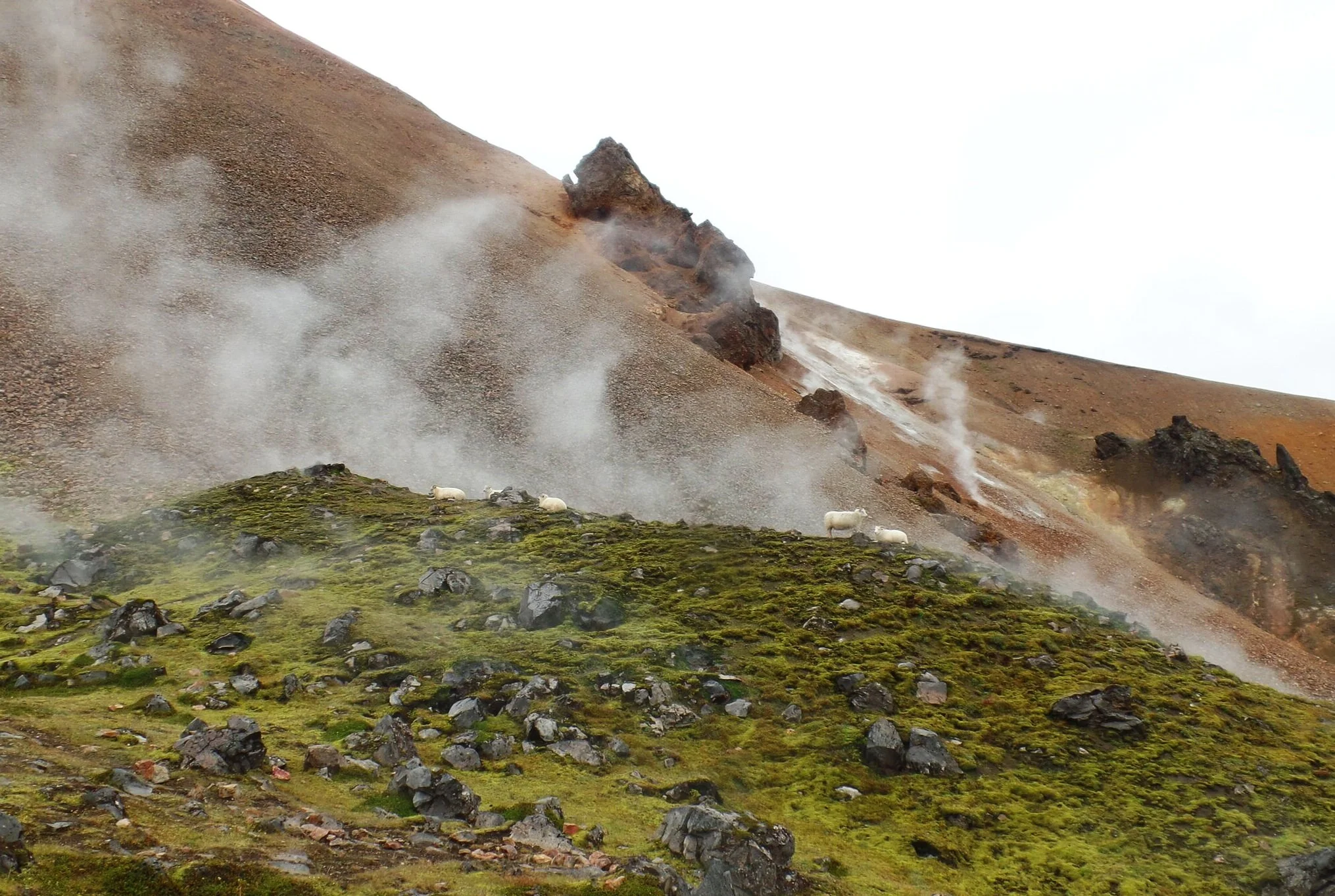
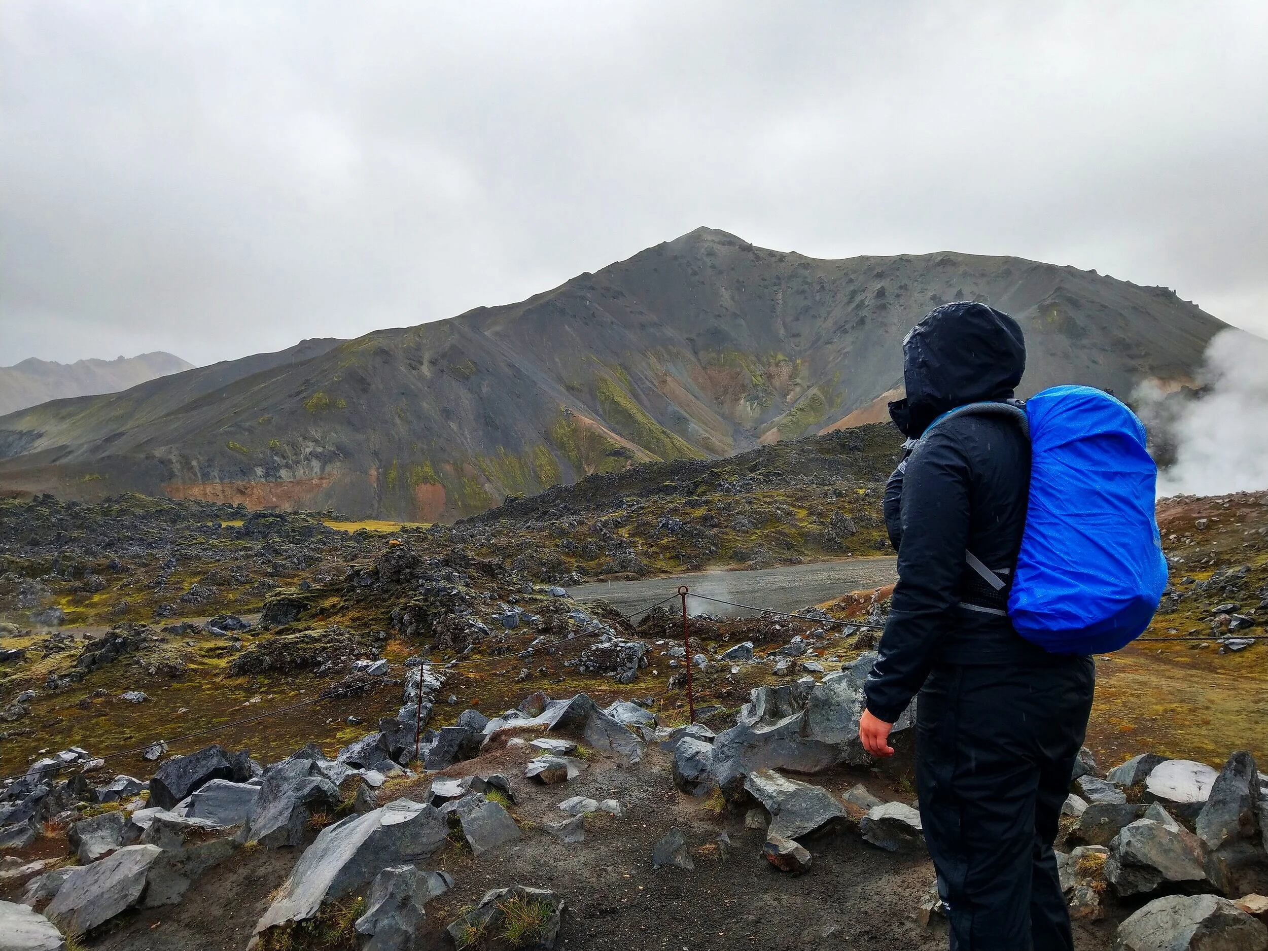
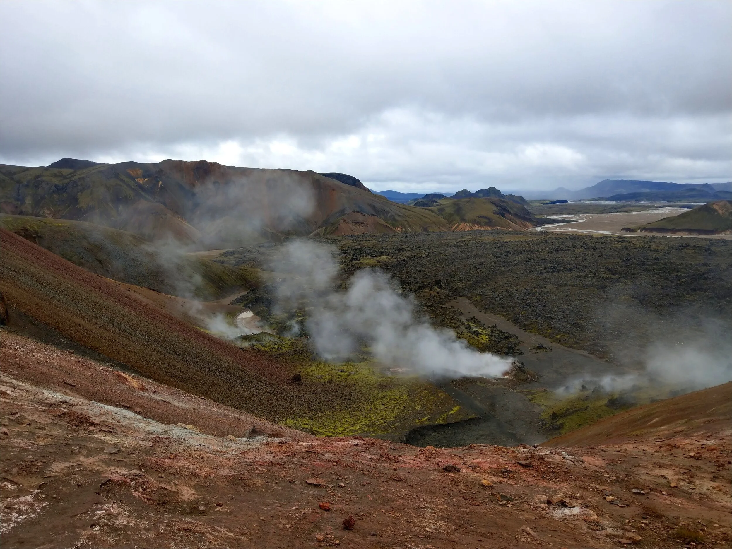
As you skirt along the mountain’s edge, you’ll pass by lots of geothermal activity and steaming vents.
And it’s likely you’ll also meet some sheep friends along the way (I’m obsessed with these little guys).

These guys know where it’s at…soaking up the warmth. These just may be my spirit animals.
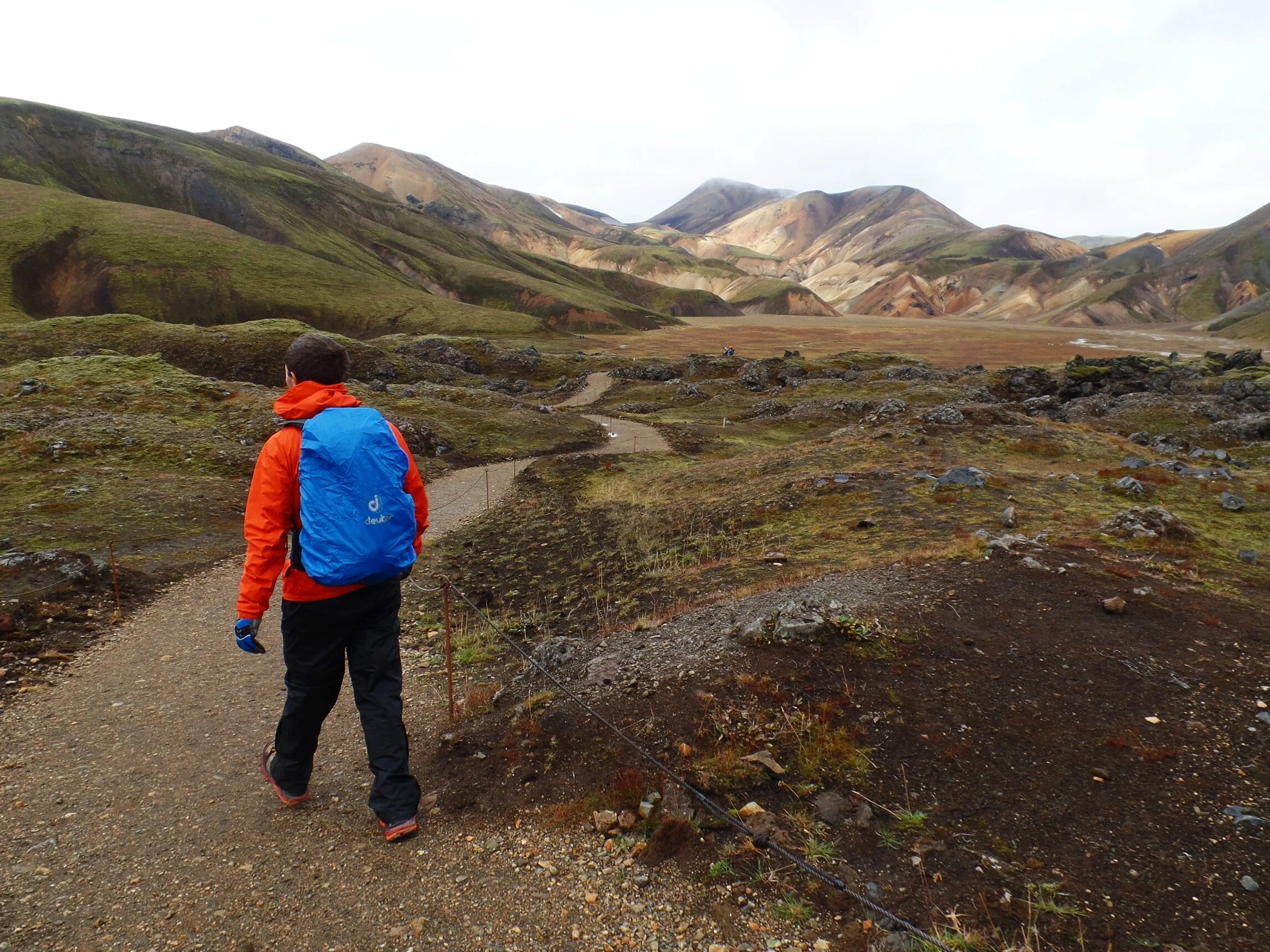
You’ll also get a close- up view of today’s second destination, Blahnúkúr, but you’ll tackle this beast in just a little bit.
Part 2: The hike up Brennisteinsalda
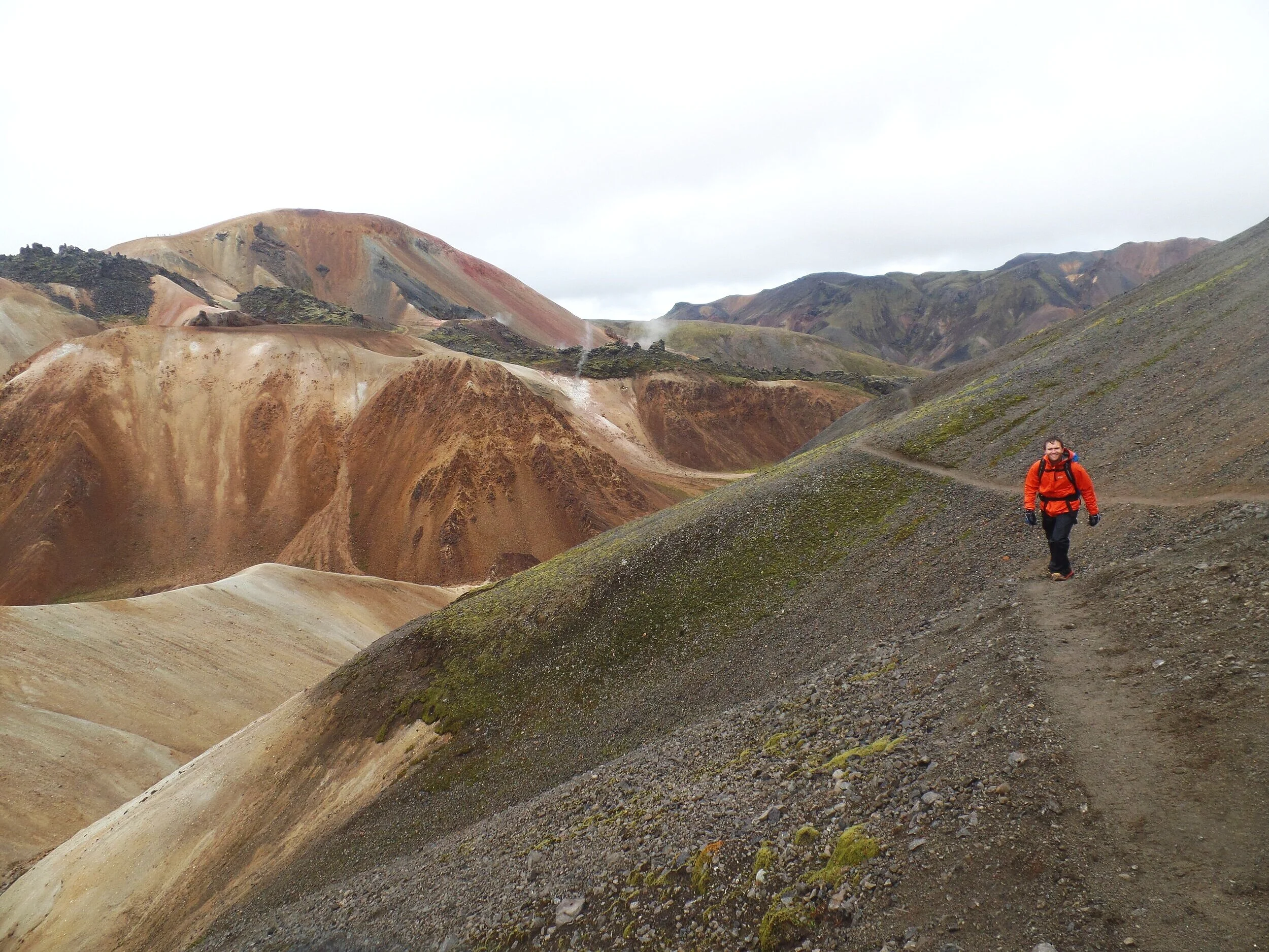
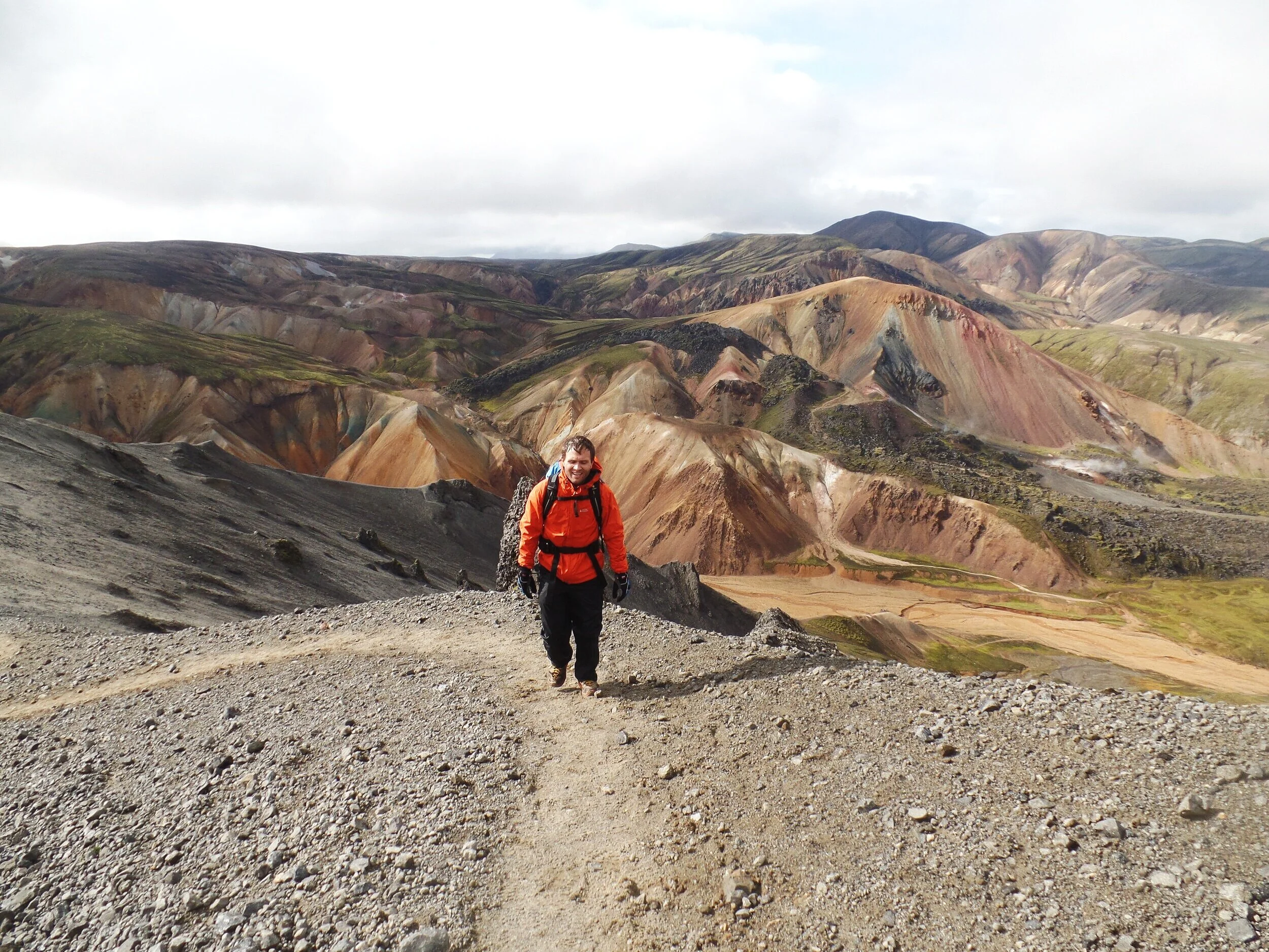
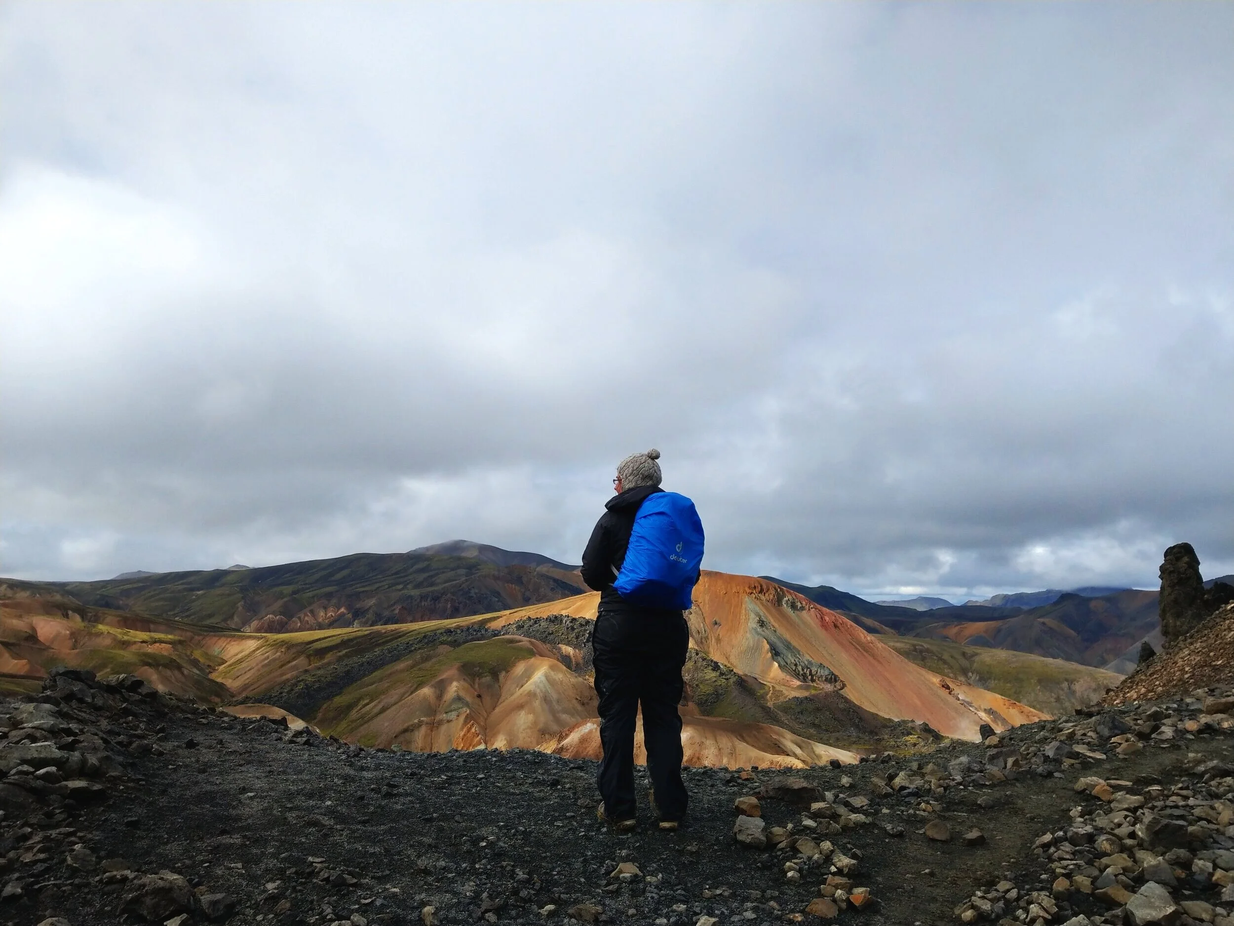
After a bit of a flat walk, you’ll start the initial climb up the mountain, climbing up a rocky path that weaves its way through the lava rocks. As you climb higher and circle around the mountain, Brennisteinsalda’s colors come into full view.
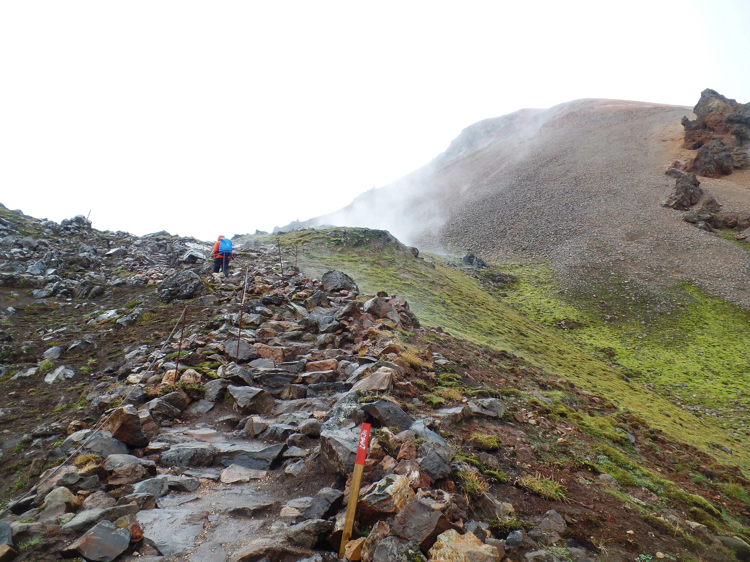
Another gradual climb will lead you to the final intersection before Brennisteinsalda’s summit. Here, instead of going straight and continuing down the Laugavegur trail, you’ll bear right and follow the green-marked path.

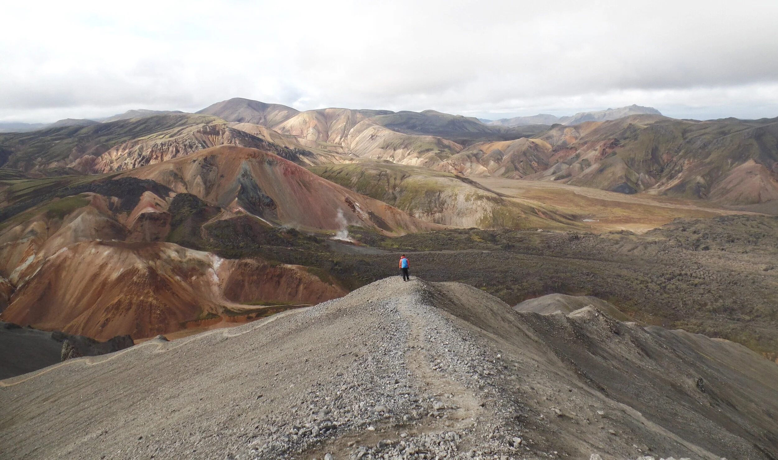
This is the final steady push to the summit. It’s a little steep here, but short, and you’ll be at the summit in no time.
Don’t forget to look back every so often and enjoy those views.
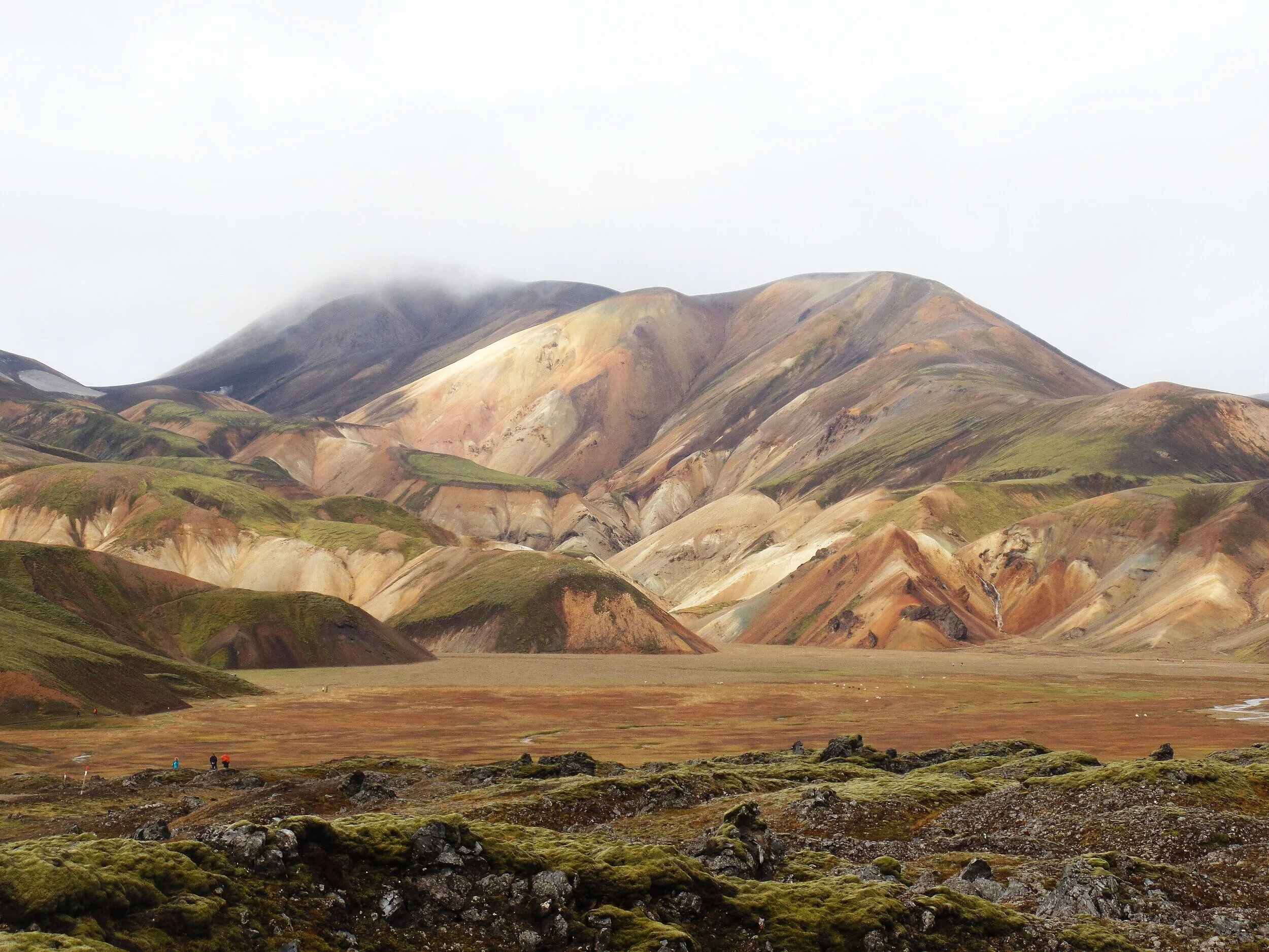
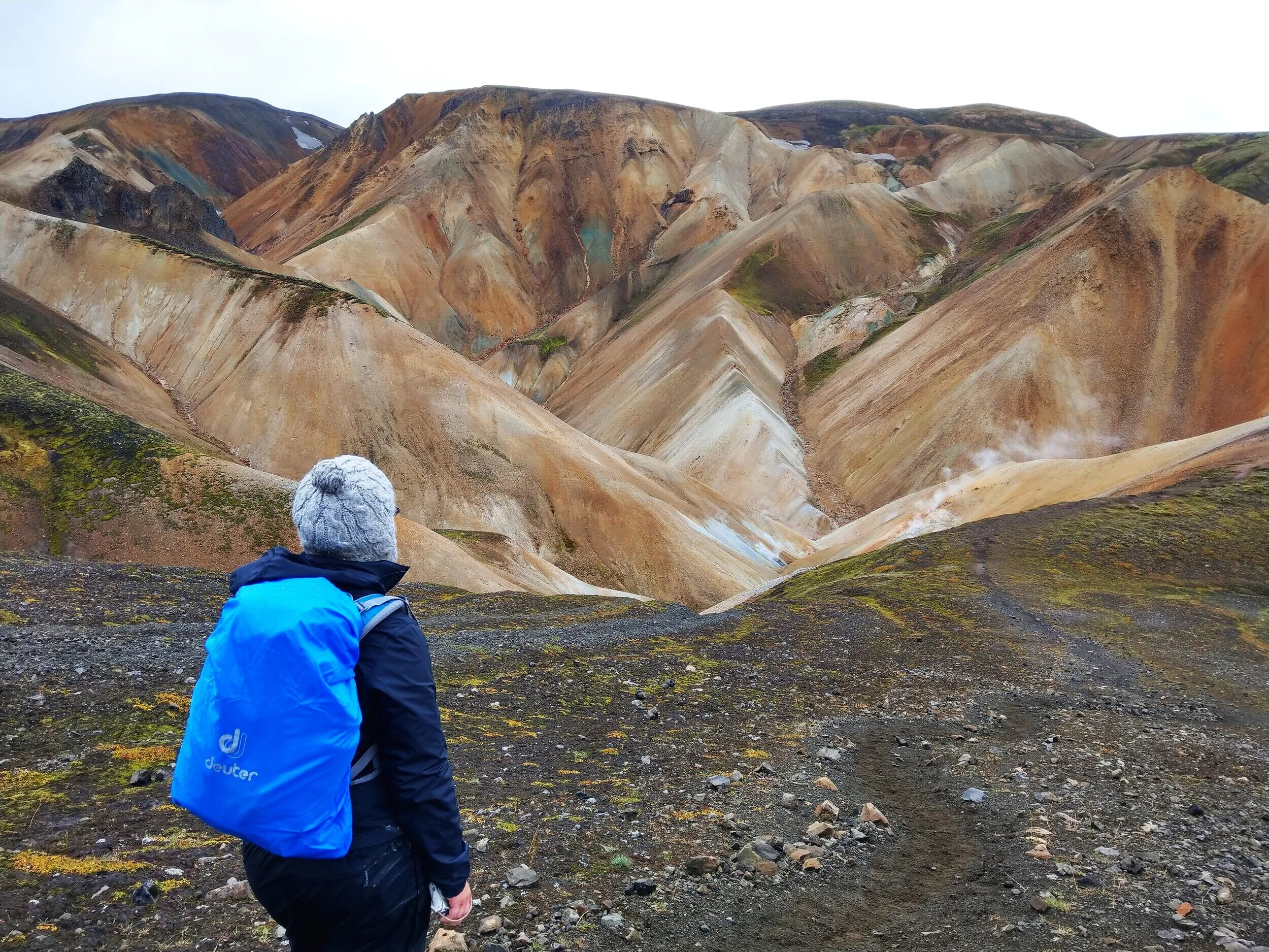
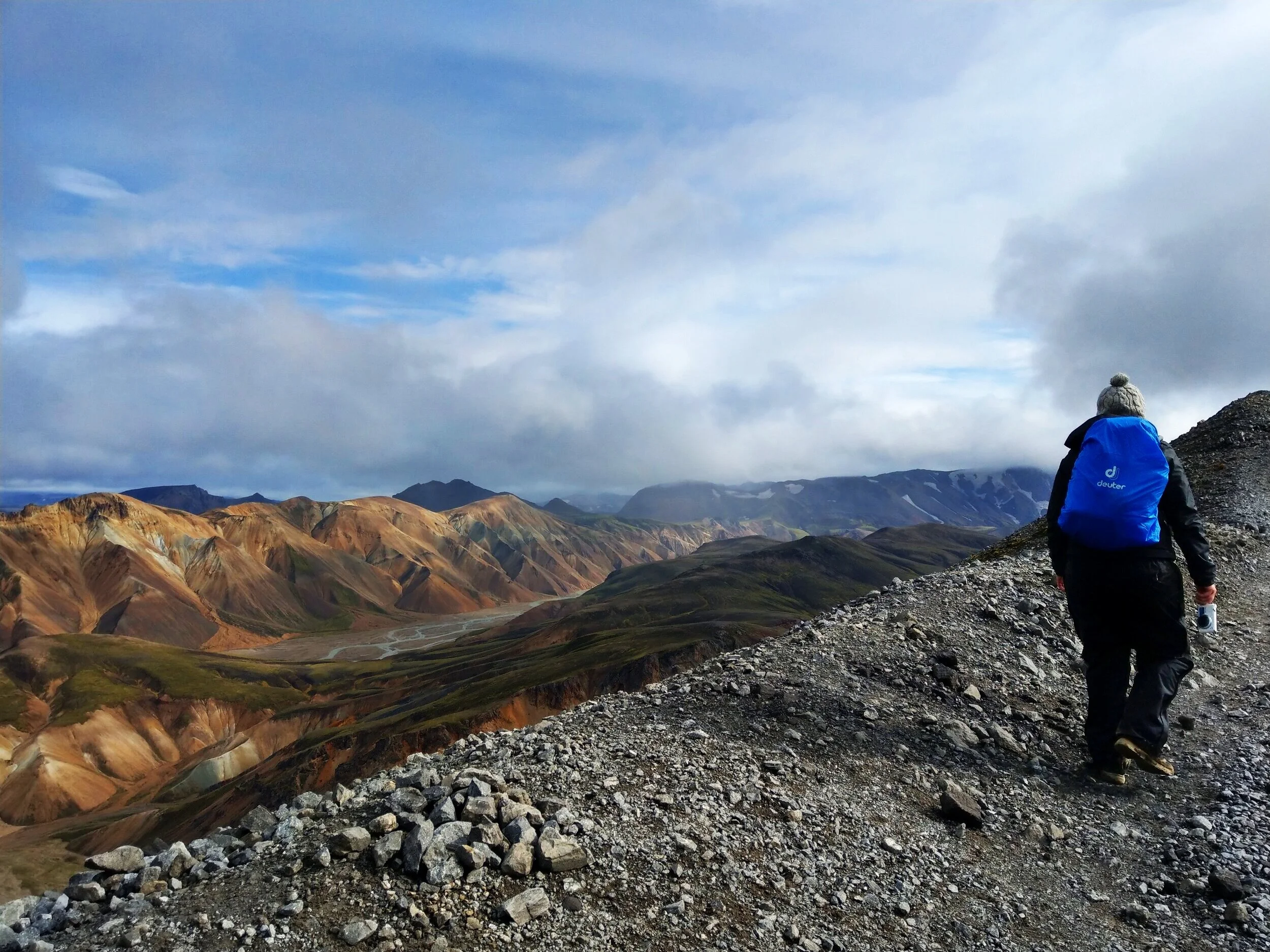
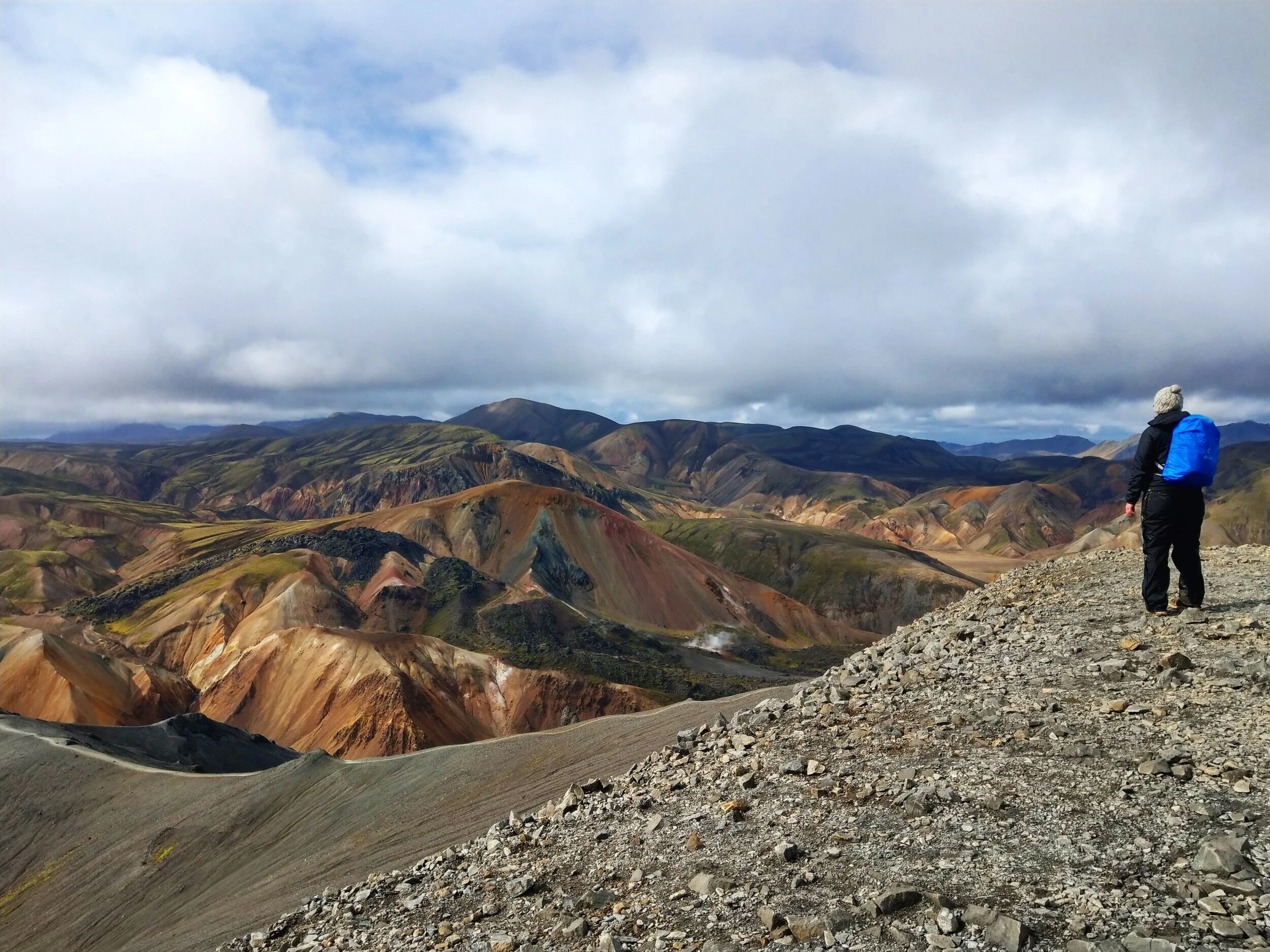
At the summit of Blahnúkúr, you’ll get a birds-eye view back towards basecamp and over the lava field, and over the collection of colorful rhyolite mountains. Just look at that view! When we were at the summit, it was a little hazy and drizzly, but it was still absolutely jaw-dropping.
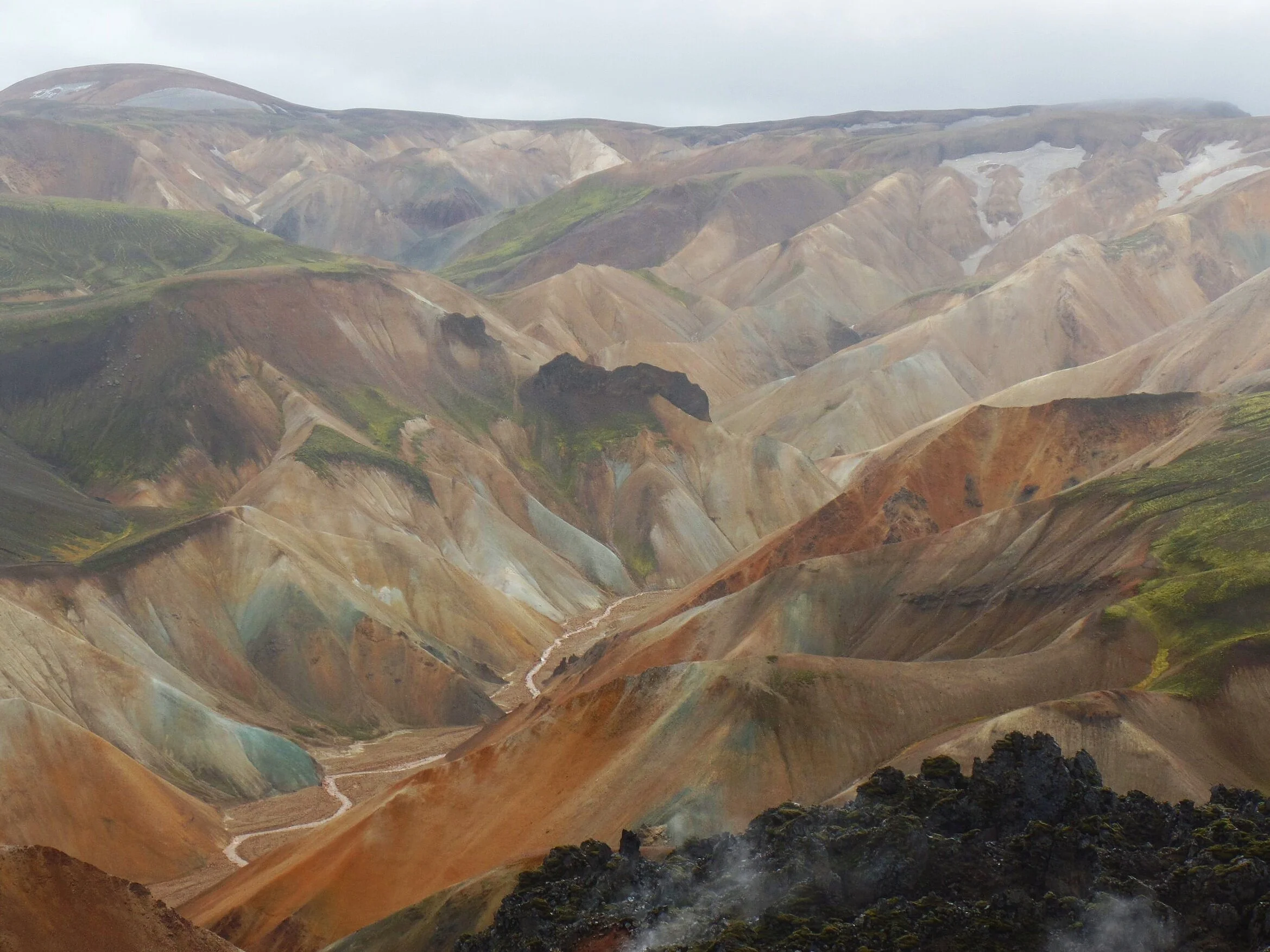
Up here, you also get a great view of the Laugevegur trail. If you look closely at the picture above, you can see the trail weave its way through the green moss along the hillside and the people that look like tiny ants climbing their way towards the top.
After you’ve enjoyed the summit views, you’ll go back down this same route. Retrace your steps down the green marked trail and take a left back along the red Laugevegur trail.
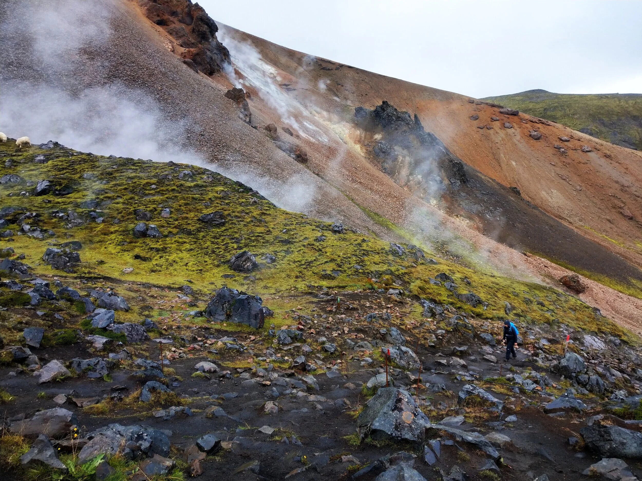
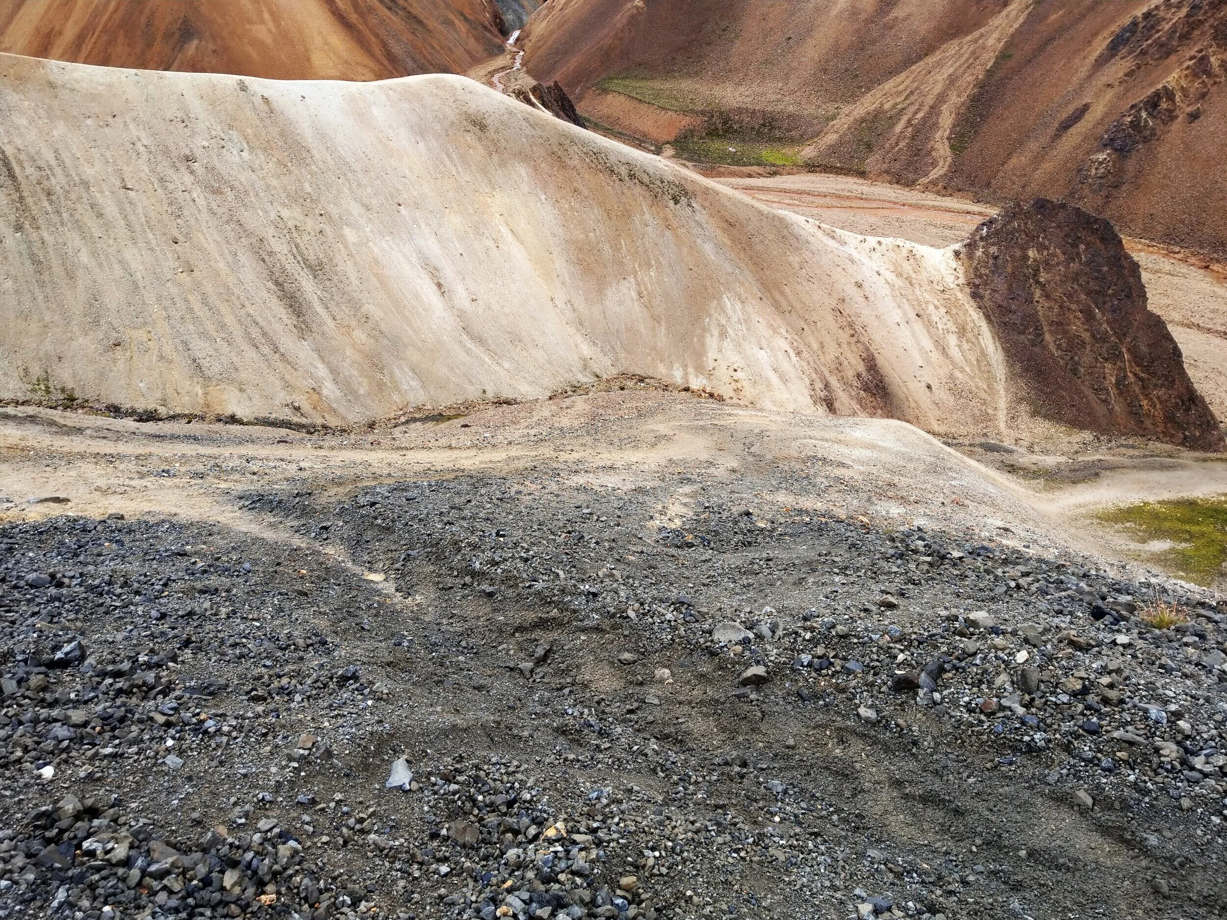
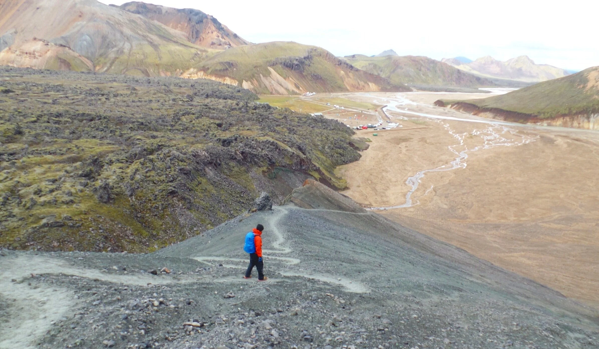
Part 3: Graenagil Canyon
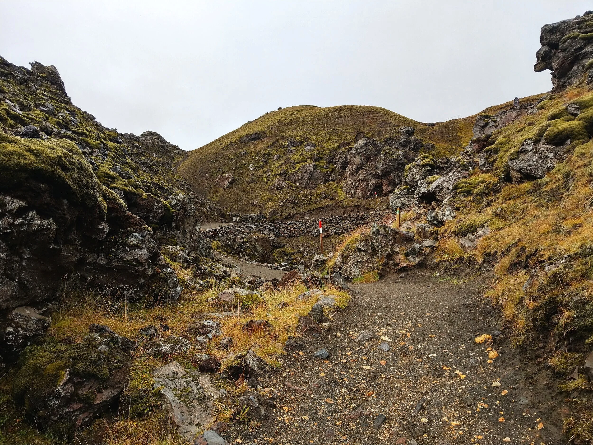
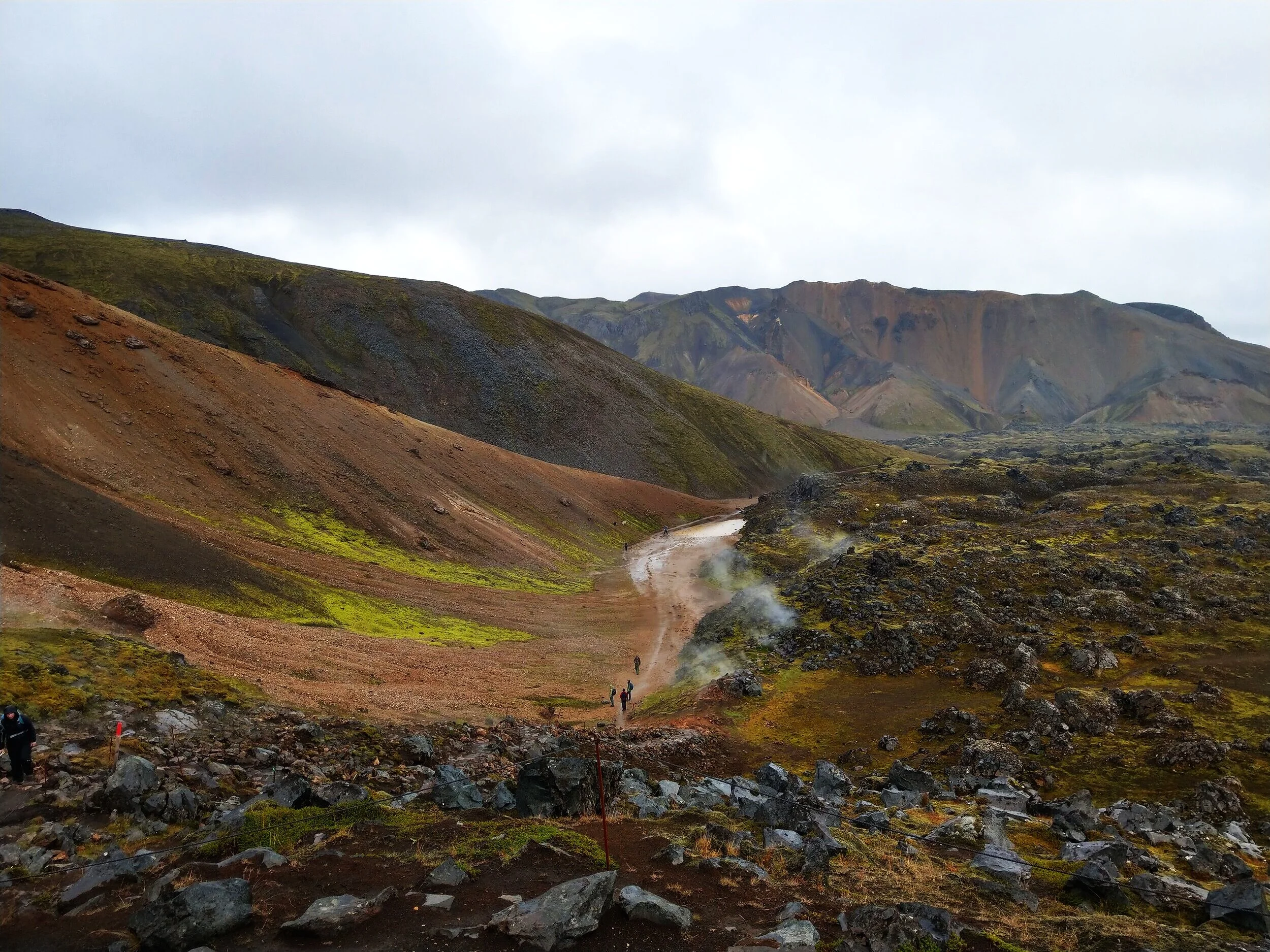
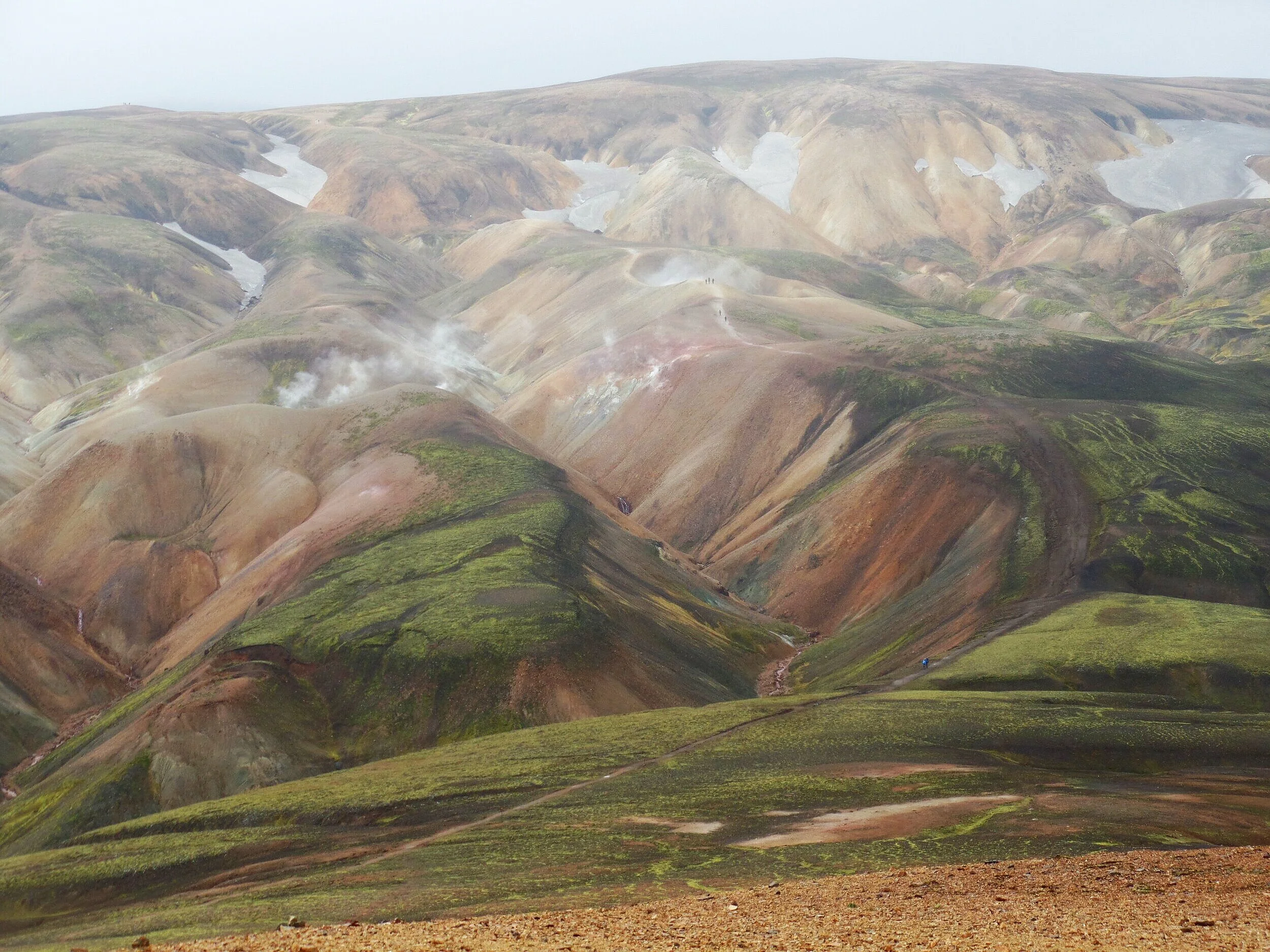
Once you’re back down to about the area shown in the picture below, you should run into a sign that will point you towards Graenagil Canyon (you might be able to see the sign in this picture - it’s in the thick geothermal smoke). It’s a bit tricky here to know where to go, but there will be a break in the lava rocks (you can clearly see this in the picture) that you’ll walk through and then you’ll start to see white-marked posts that will you lead you back into the lava field towards the canyon.
Follow this trail until you reach the next signed intersection in the middle of the lava field. Take a right here to follow a yellow-marked trail towards Blahnúkúr.
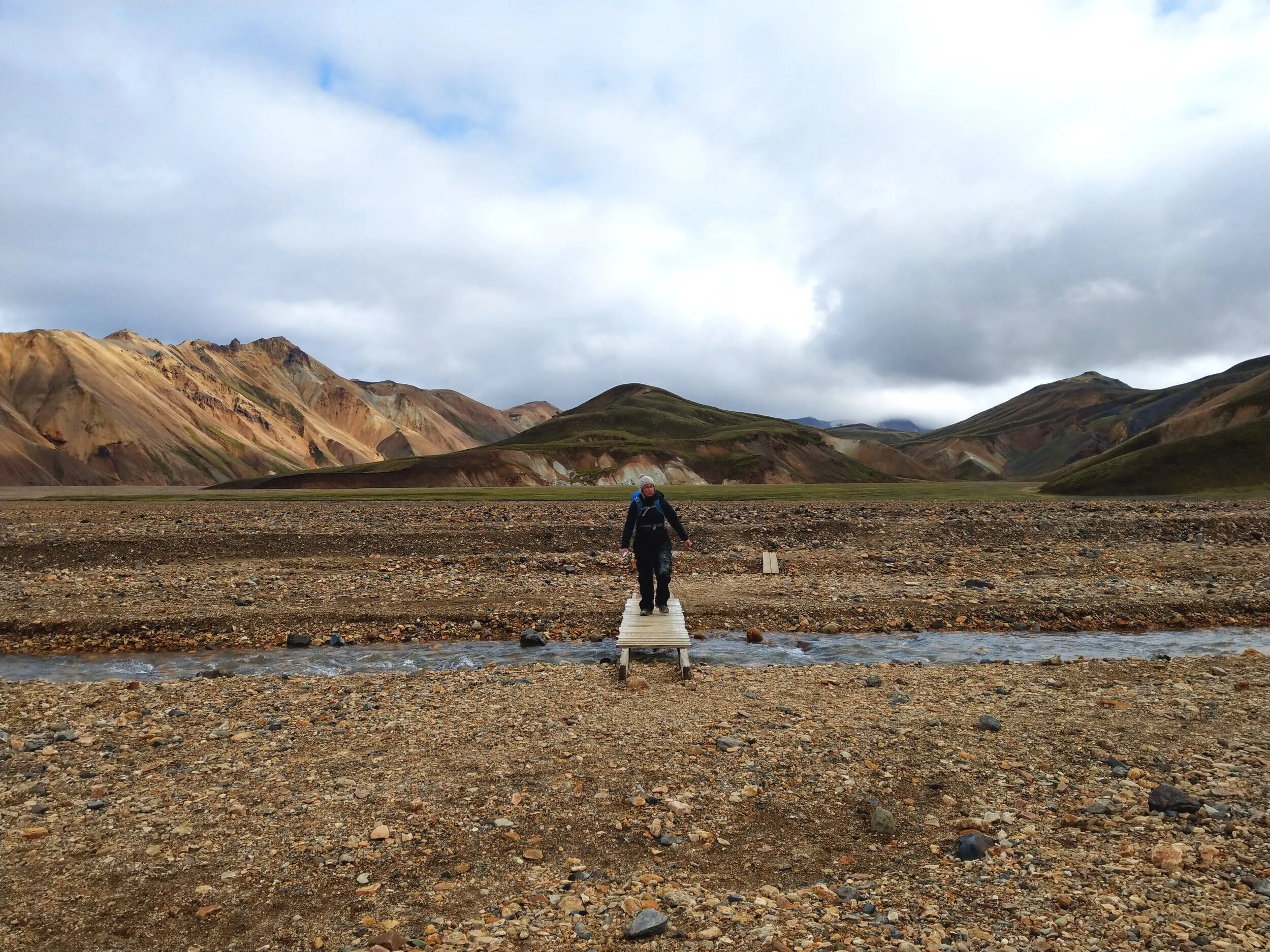
While up to this point, the trails through the lava fields have been clear smooth dirt paths, this part of the trail is a bit rougher, and will require some hopping through the lava rocks. But, in just a short time, it comes out to a smooth path that leads to a flat valley, with Blahnúkúr looming in the background.
You’ll cross the valley, which will require a little rock hopping over a small stream.
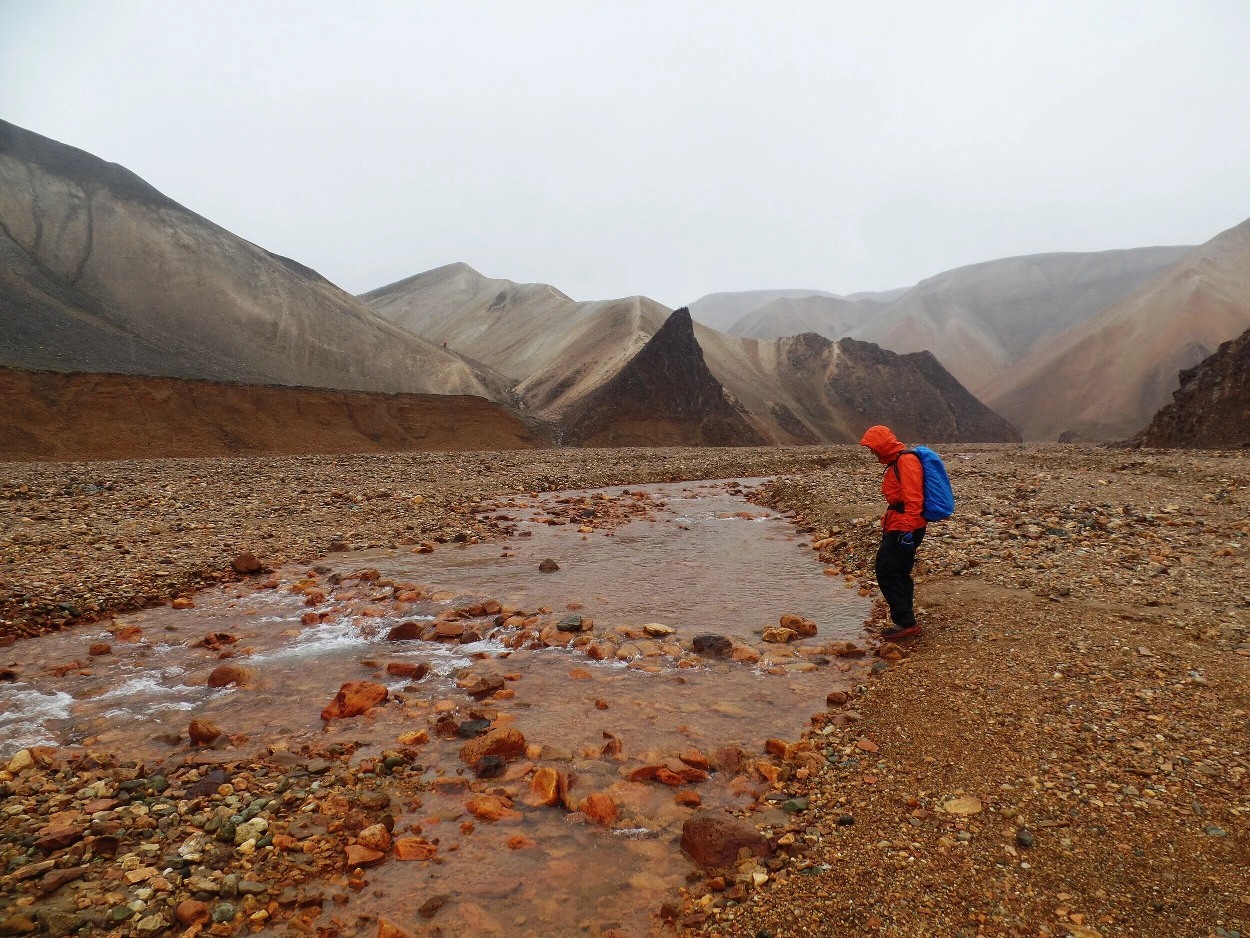
Climb up the bank on the other side and continue on the trail for just a bit more.
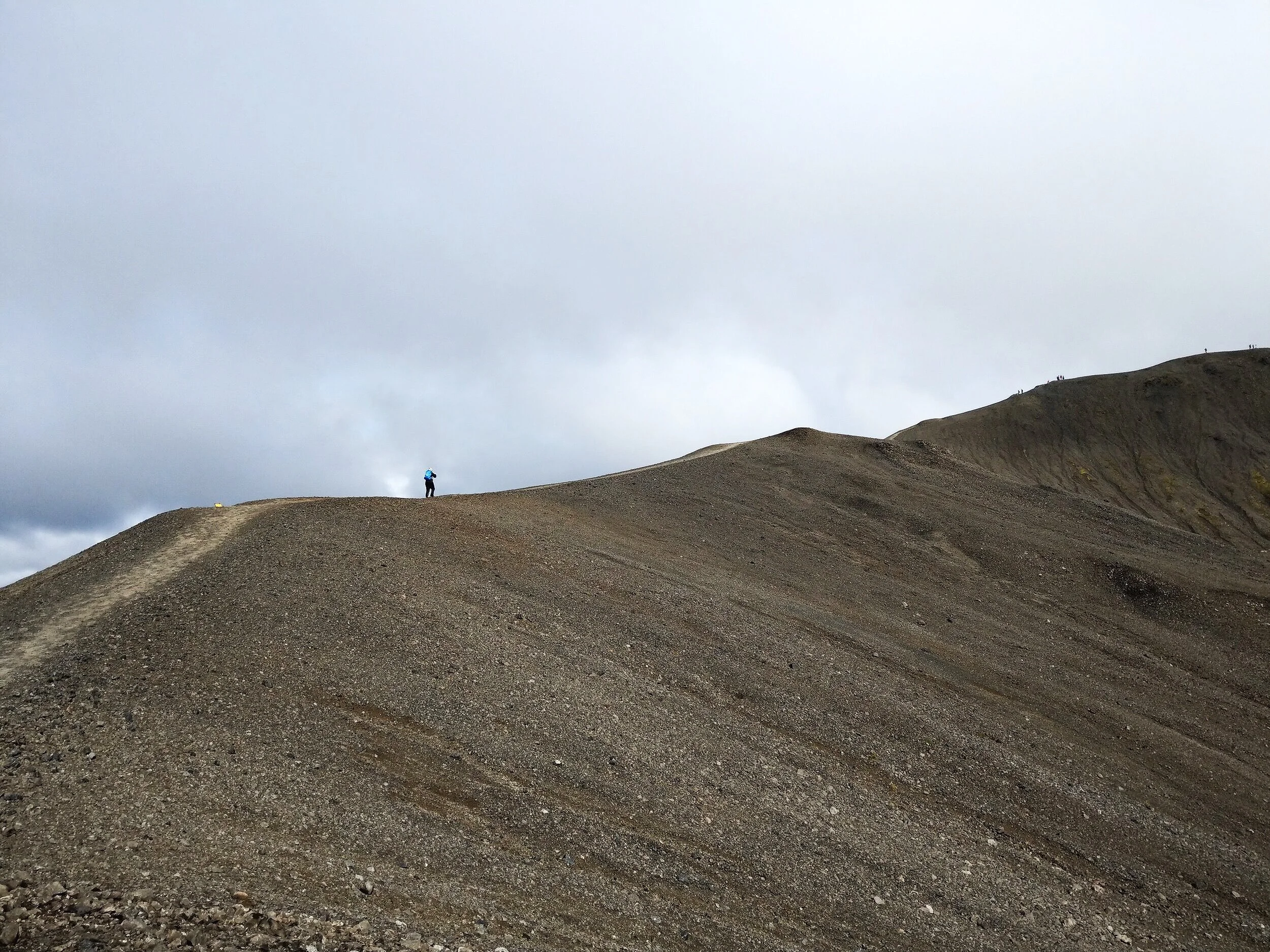
Next up is the trickiest part of the entire trail. You’ll come to the edge of Blahnúkúr, and it’s hard to tell there’s even a path up it, as there are no trail markers. It’s a very steep slippery slope, and we honestly wouldn’t even be sure that the trail was up in this direction were it not for the fact that we saw someone else going up this way as well, and then someone coming down.
Take a look at the path going up in the picture below (don’t mind the blurred splotches where rain hit the camera - that happened a lot on our trip!)
Part 4: The Hike up Blahnúkúr
As we started hiking up the side of Blahnúkúr, the path was super steep and super slippery (probably moreso than usual because it had rained the night before), and you really had to have firm footing here. It’s easy to slip and fall along this section. Don’t be afraid to climb your way up on all fours. 😊
This is the one section of the trail that I mentioned above where going up this way (i.e. doing the loop counterclockwise from basecamp) might be better than going down. This part of the trail, like I said, is super slippery, and I would not have wanted to go down it. If you do go down, it would be infinitely better with trekking poles, or expect to do a little butt sliding down…at least that would be my strategy!
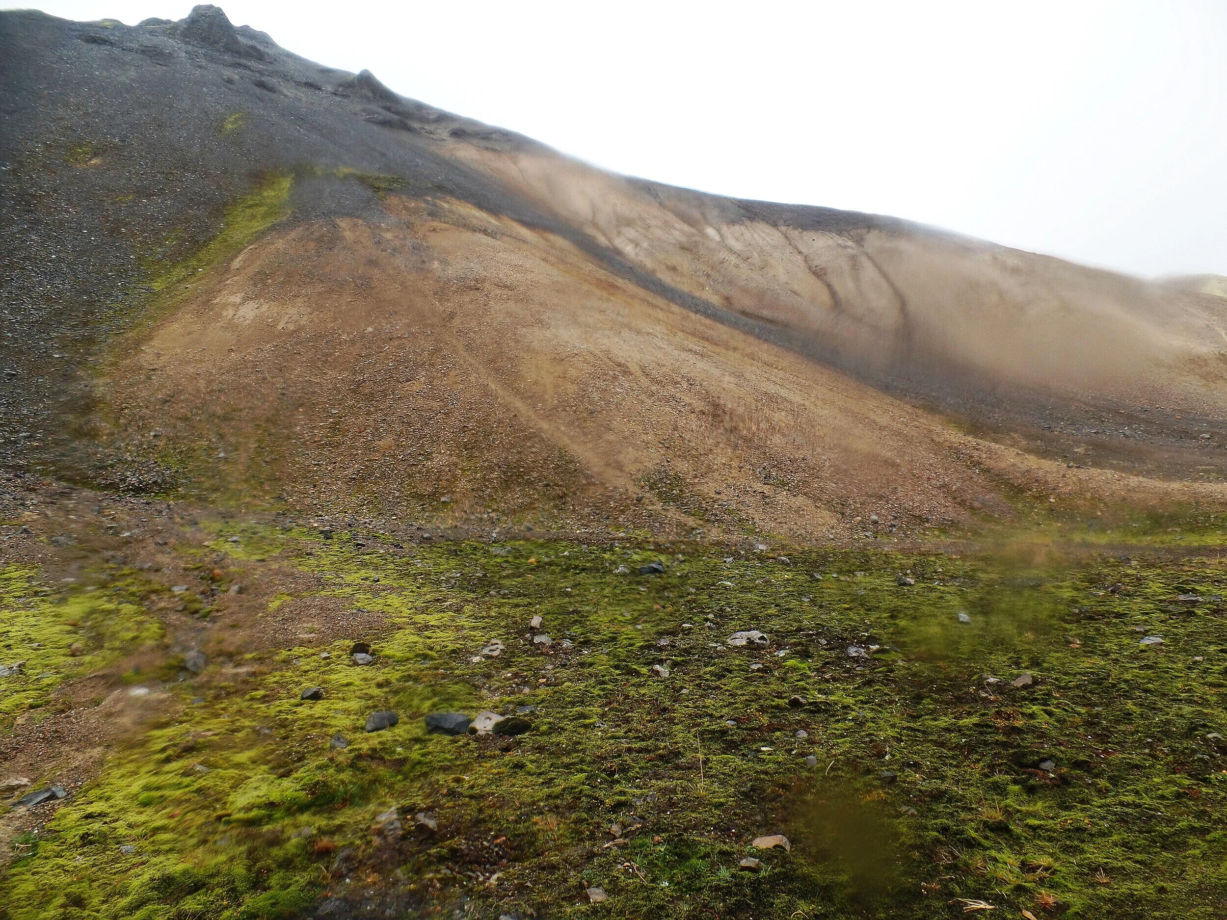
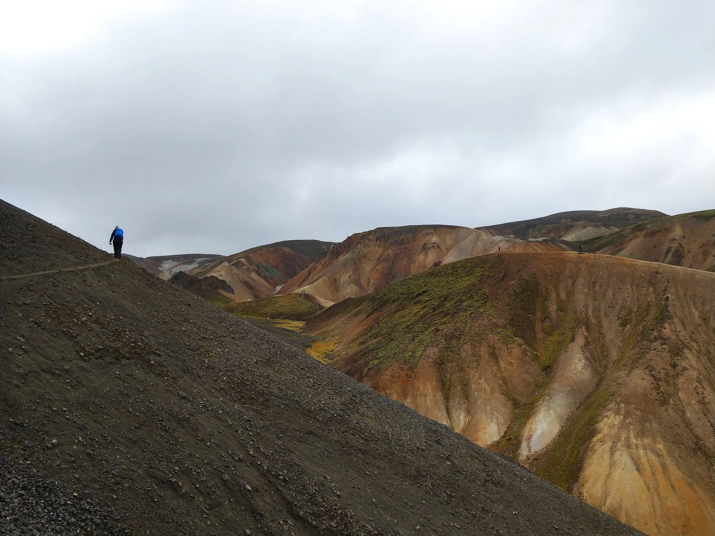
Luckily, this steep slippery section is short. The trail takes a turn and follows a narrow dirt path along the edge of the mountain. And to your right are beautiful views of the colorful rhyolite mountains (and trust us, these views will keep getting better and better with every step).
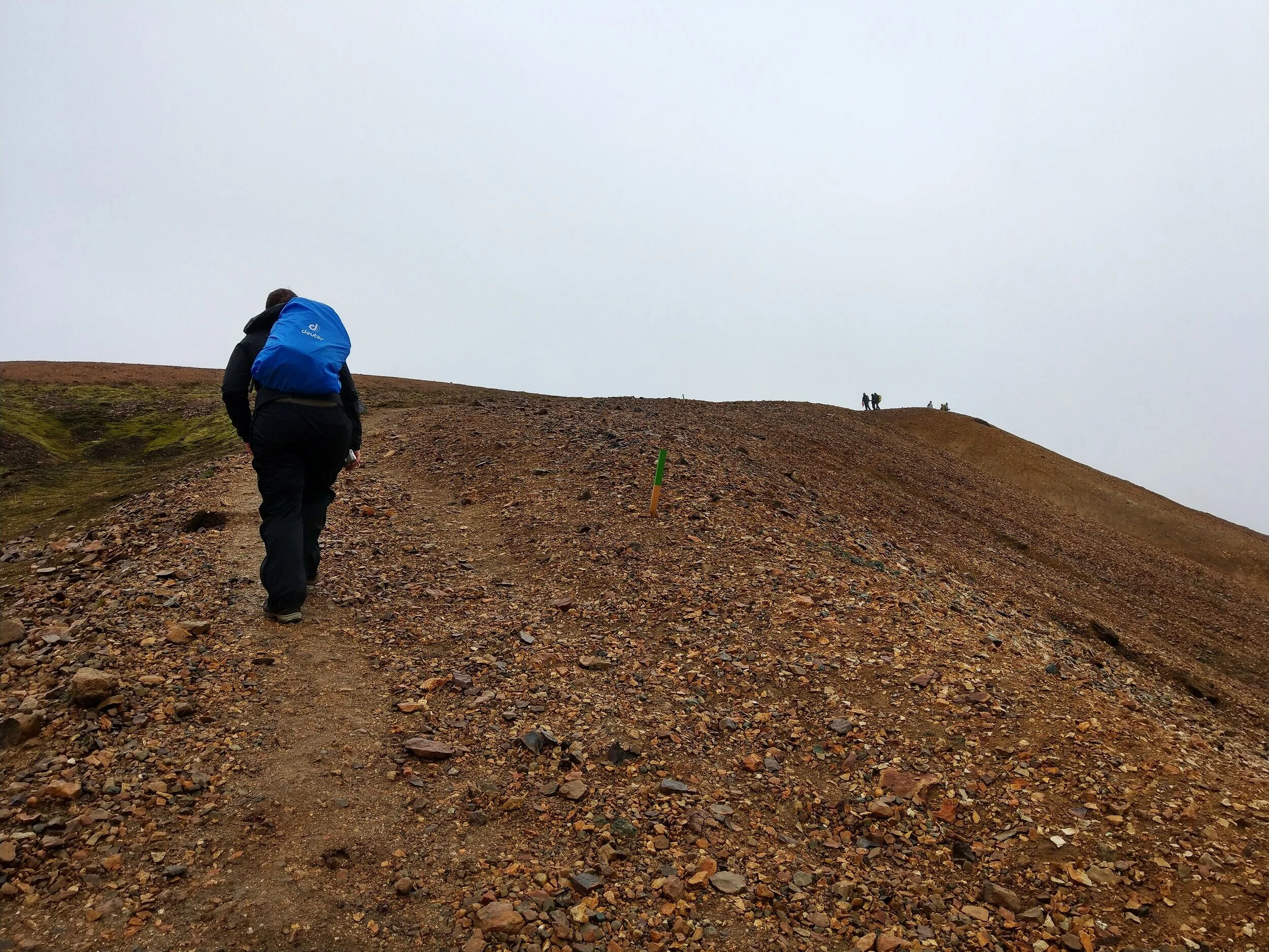
After traversing the side of Blahnúkúr, you’ll start a short climb up to the ridge. This is also where the alternate trail that we mentioned above meets up with the main trail.
From here, it’s a pretty easy and gradual but steady climb up to the summit along the mountain’s ridge. From this ridge, you can enjoy views along the way in every direction. We just couldn’t believe the landscape around us and were in total awe. We’ll try to let the pictures speak for themselves here, although these still don’t do this place justice!
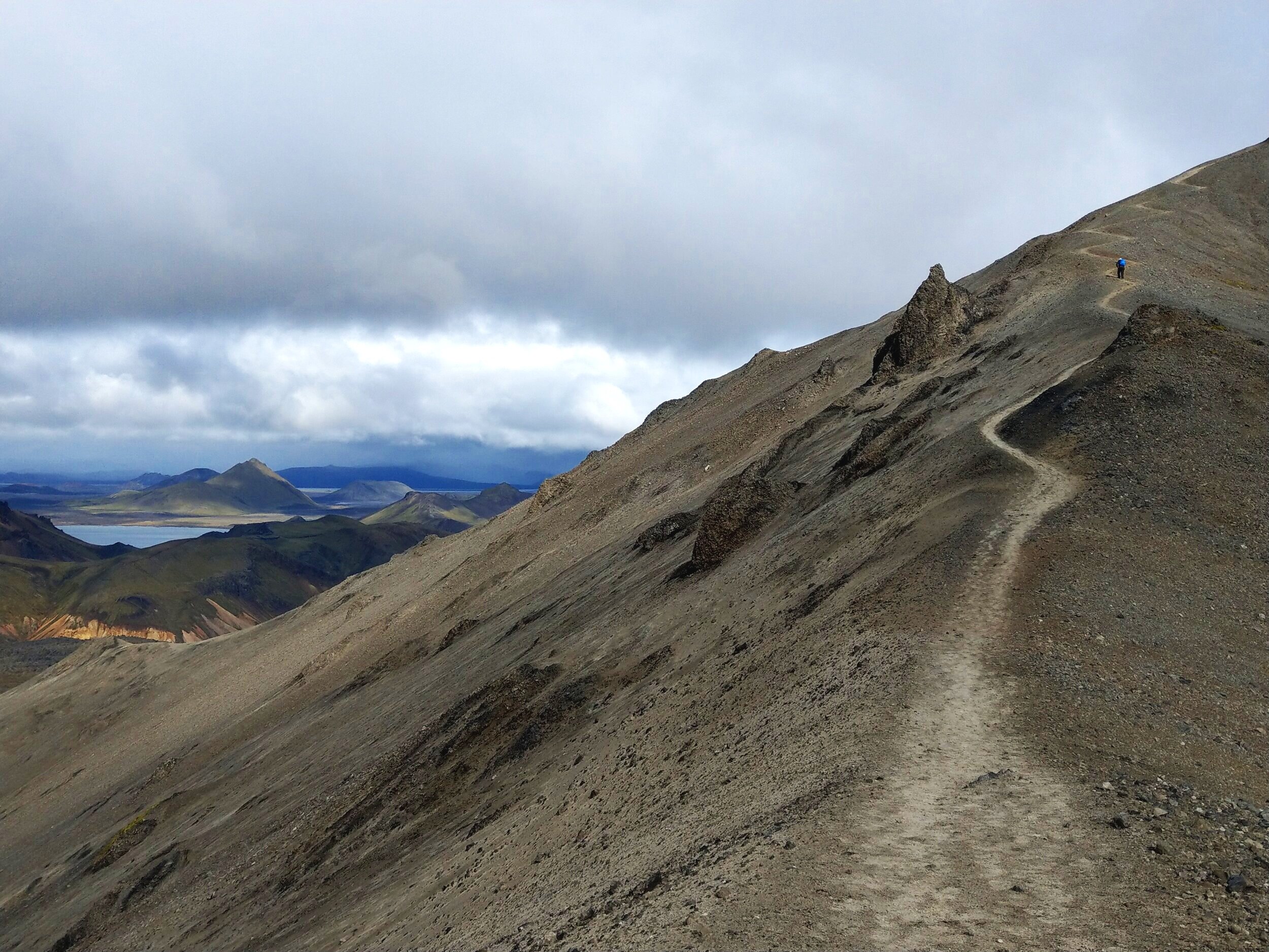
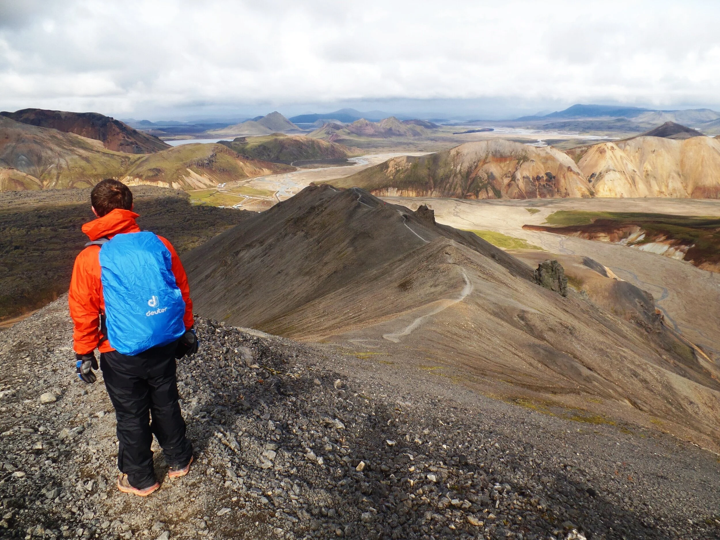
After climbing some picturesque zig-zags up the ridge and making the final climb, you’ll arrive at the summit…yay!
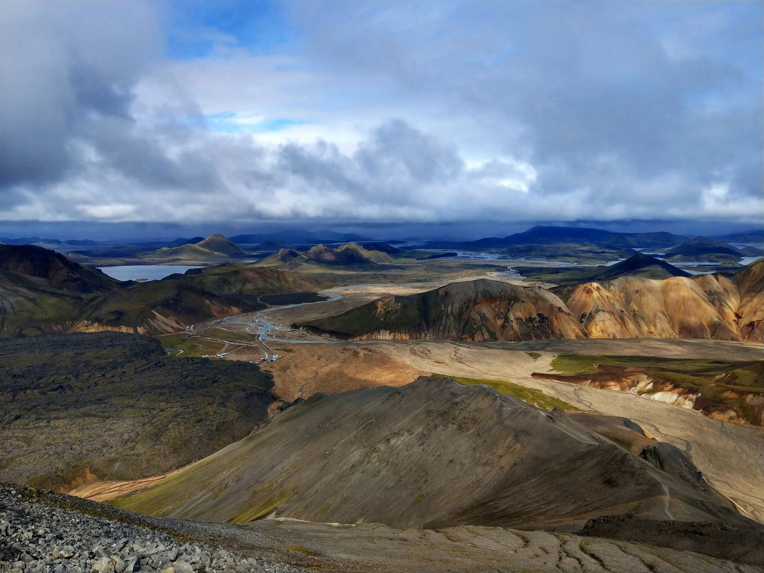
From the summit, you get incredible 360 degree views of Landmannalaugar… down over basecamp, the lava field, and back towards Brennisteinsalda.
We hung out here for a while, having the summit completely to ourselves for most of it, which was happy surprise, considering the crowds of people on the trails below.
We had trouble motivating ourselves to leave (trust us, you won’t want to leave either), but alas, we had to eventually start making our way back down.
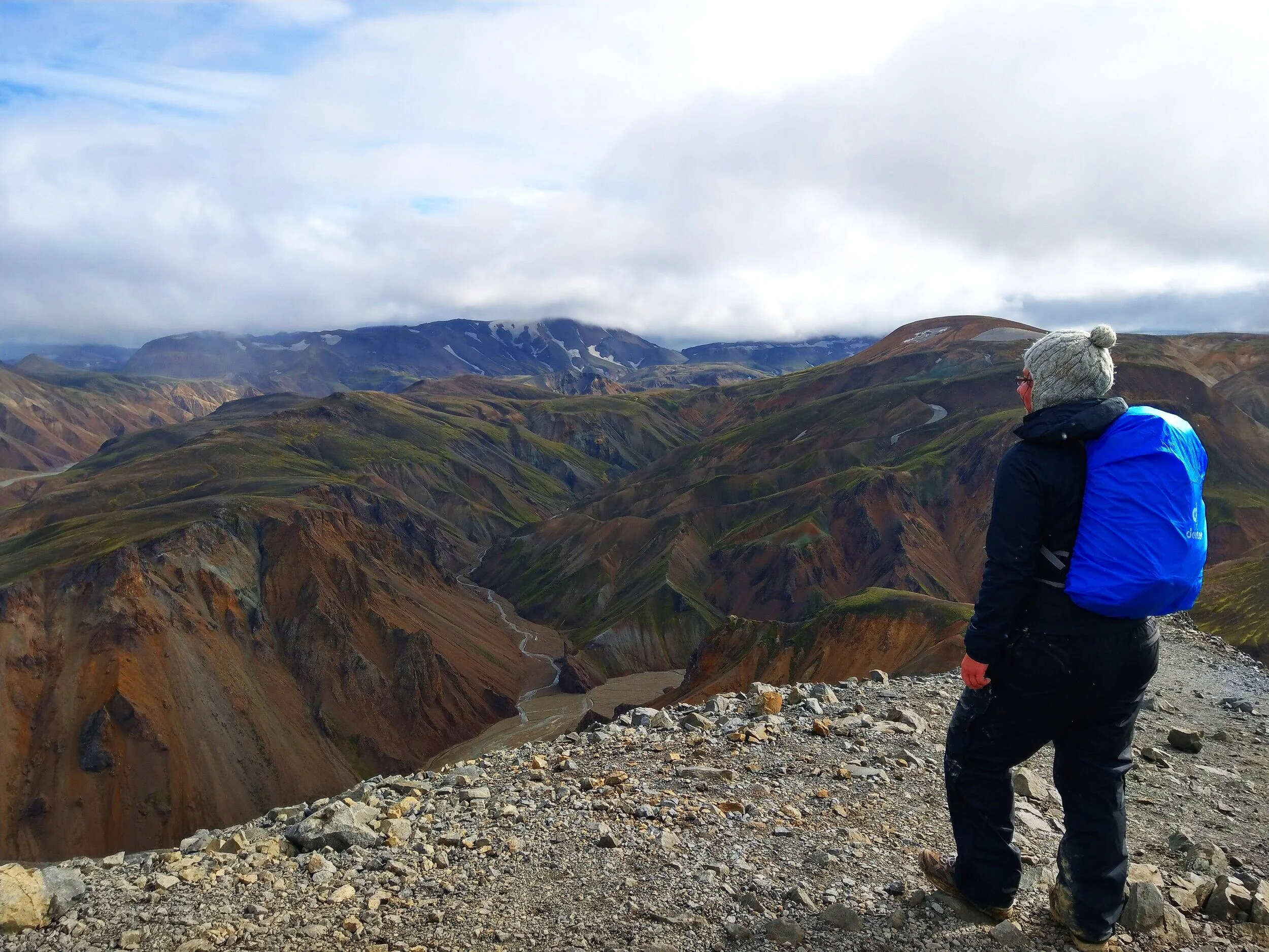
The way down, though, on the other side of Blahnúkúr was just as scenic and incredible. The Blahnúkúr hike is seriously nonstop views.
You’ll zigzag your way down small switchbacks from the summit, and follow the ridge on the other side of the mountain all the way down to the valley below. You’re completely exposed the whole time, with views all around you. The view back towards Blahnúkúr is quite dramatic from here, and you’ll be surprised how surprisingly easy it was to climb such a prominent looking peak.

The climb down is steady and constant, and you’ll find yourself at the bottom in no time at all. In the very last portion, the greenish blue hint that gives this mountain its name really shines through in the soil. There’s just one steep section along a small cliffside at the bottom to traverse along.

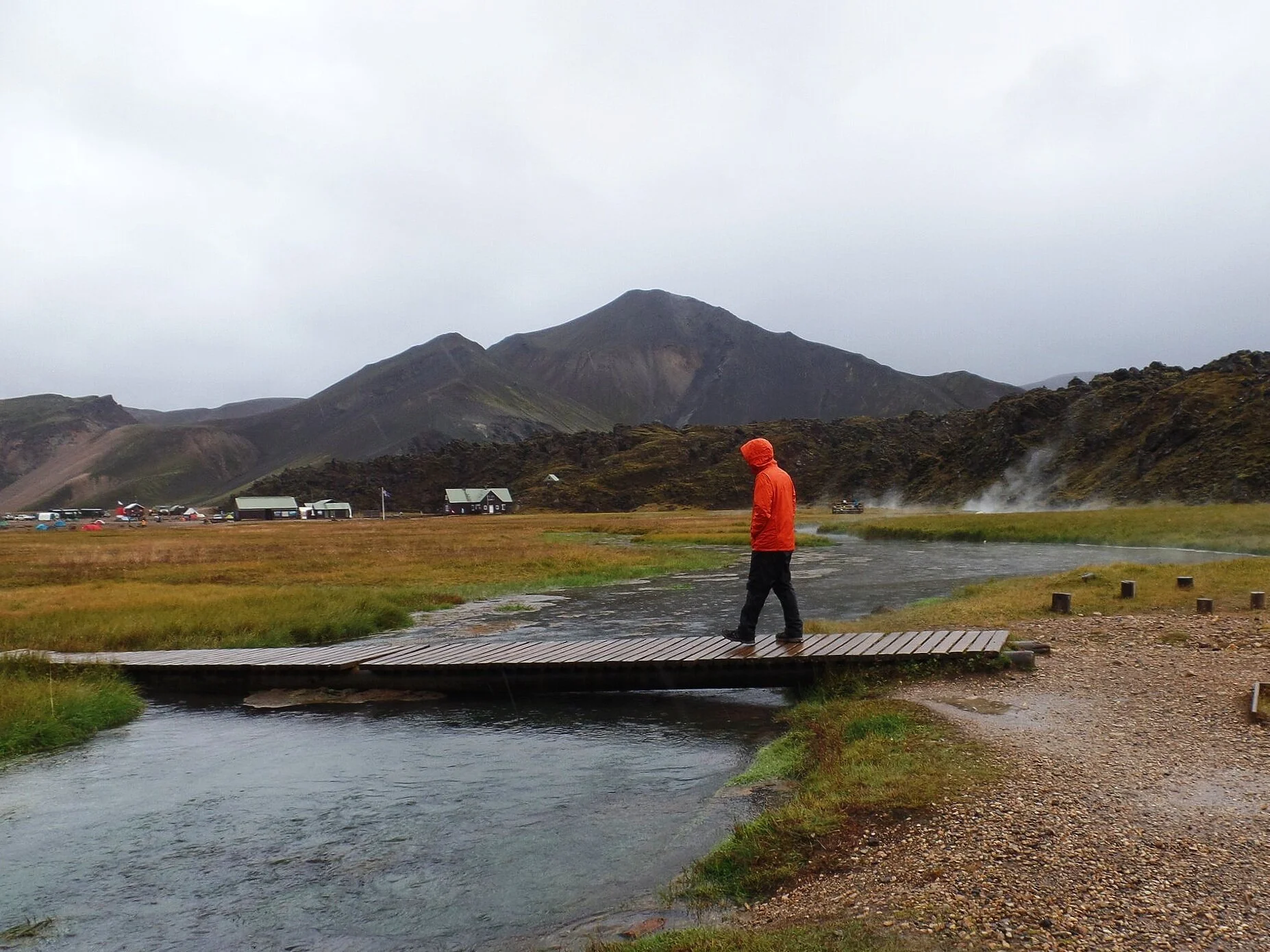
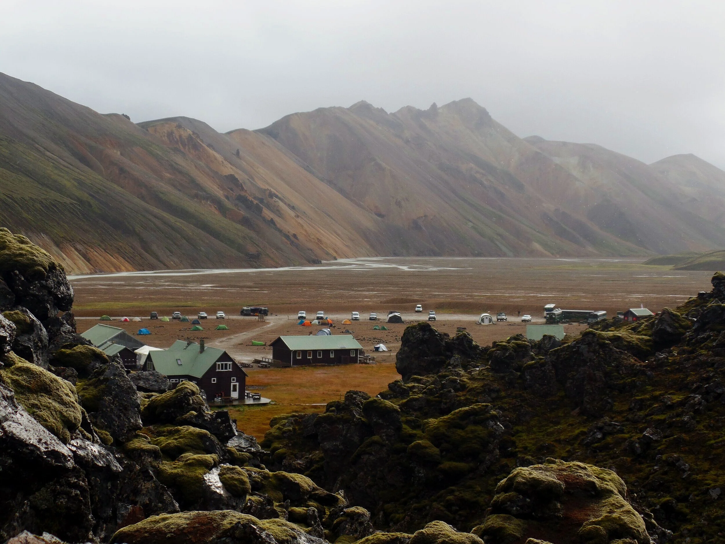
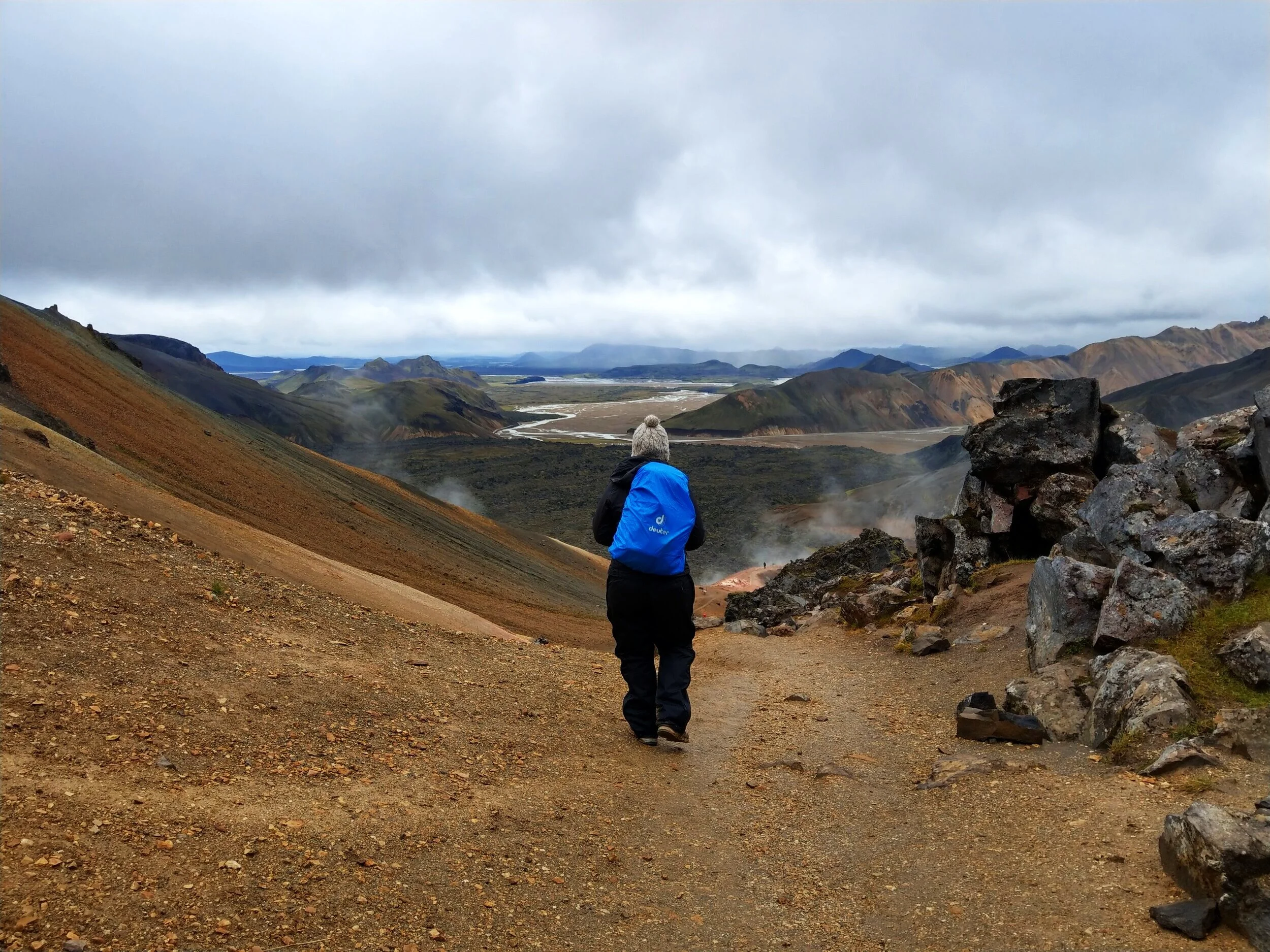
You’ll come out at the valley a short way from basecamp. It’s a quick flat walk back.
Note for those who want to start this hike with Blahnúkúr: If you are starting with Blahnúkúr for this hike in the reverse direction, you’ll simply walk through the valley from basecamp towards Blahnúkúr and you’ll come across this sign marking the trailhead.

Overview of the hike to Brennisteinsalda and Blahnúkúr
Here is the series of trails summarized from our counterclockwise loop route along the Brennisteinsalda - Blahnúkúr trail:
Take the white/red marked trail through Laugahraun lava field - follow the red marked trail along the side of Brennisteinsalda - up the green marked trail to the summit of Brennisteinsalda - back down the green marked trail - meet back up with the red trail at the base of the mountain and retrace your steps back towards the lava field - at the next intersection, follow the signs toward Graenagil Canyon along the white marked trail - take the yellow trail through the lava field and across the valley to the base of Blahnúkúr - climb the ridge to the summit of Blahnúkúr - continue along the trail to descend the other side of the mountain and arrive back in the valley - short walk back to basecamp
Just hiking Brennisteinsalda?
Take the white/red marked trail through the Laugahruan lava field - at the next intersection follow the white marked trail towards Landmannahellir - take the green marked trail up the back side of Brennisteinsalda to the summit - after the summit, continue along the green trail down the other side of the mountain - at the base, take a left on the red trail to head back toward the lava field - at the next intersection, follow the signs toward Graenagil Canyon and follow this white marked trail all the way through the canyon and back out to the valley - short walk through the valley back to basecamp
Just hiking Blahnúkúr?
Walk through the valley from basecamp towards Blahnúkúr until you reach the sign marking the trailhead - continue up the trail that follow the ridge all the way to the summit - continue down the other side of the summit ridge until you reach the valley below - now follow the yellow markers across the valley and into the lava field - at the intersection, take a right and follow the white marked trail back to the valley and basecamp
Which Hike Should You Choose in Landmannalauger...Brennisteinsalda or Blahnúkúr?
If you only want to do one hike in Landamnnalaugar and not the whole loop, which hike should you choose?
Difficulty considerations: Both of these trails are pretty similar difficulty-wise, as in neither is particularly challenging. With the exception of the initial slick portion of trail up the back of Blahnúkúr, the trails are pretty straightforward to follow and involve gradual steady climbs to the summits. The Blahnúkúr hike might be considered a touch harder because of its greater elevation gain in a shorter hiking distance.
An added bonus of hiking the Brennisteinsalda loop is that you get to hike through the Laugahraun lava field as well. However, this could be easily added on to the Blahnúkúr hike by simply taking the Laugahraun trail to or from basecamp rather than the Graenagil Canyon trail, and would only add a small amount of distance to the overall Blahnúkúr loop hike.
The Verdict:
Based on views alone, we would without a doubt recommend the hike to Blahnúkúr over Brennisteinsalda. It does have just a touch more climbing involved than Brennisteinsalda, but the views from this summit are truly out of this world. And the trail itself to the summit is way more scenic as well as you weave your way up the tiny switchbacks along the mountain’s ridges. I mean, you can’t argue with those views, right?!
Where to Stay for the Brennisteinsalda/Blahnúkúr Hike
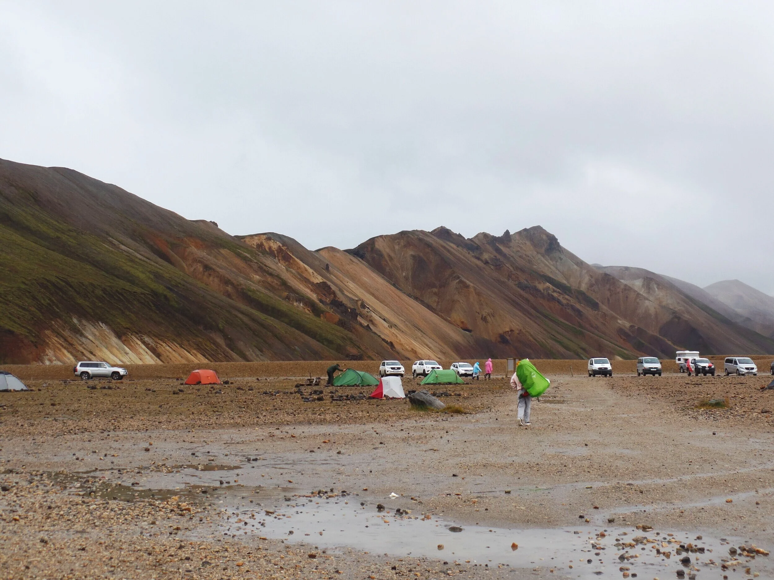
If you’re planning to spend the night in Landmannalaugar to hike the Brennisteinsalda - Blahnúkúr Loop, you can choose to stay at either a hut or the campground.
The hut costs 9000 ISK per person and includes bunk space in a dorm room (you’ll have to provide the bedding) and use of indoor kitchen facilities. Reservations should be made well in advance.
The campground is first come first served and costs 2000 ISK per person.
If just taking a day trip, Landmannalaugar is easily accessible from Reykjavik, the Golden Circle, or anywhere along the southern portion of the ring road, so spending the night anywhere in this area the night before is a good plan.
If planning on taking a bus to Landmannalaugar, staying in Reykjavik or any of the stops on the bus route between Reykjavik and Landmannalugar would be best.
General Tips for Hiking in Landmannalaugar
If you can, get an early start to your hike. Daily tour buses reach Landmannalaugar somewhere between 11 am to noon, and after this, the trails, especially the easier flat walks through the lava fields, can get crowded.
The good news is that if you plan to hike the Brennisteinsalda - Blahnukur Loop, you’ll have a fairy good chance of escaping most of these crowds.
Come prepared for all sorts of weather! Keep your eye on the forecast and monitor it for a few days before you’re Landmannalaugar visit, and if you can, try to be flexible about when you visit (much easier to do if you are driving yourself there and camping, since no reservations are needed for anything). Even if rain isn’t in the forecast, still come prepared for it. Rain pants are a life saver is Iceland, trust us!
Even if it does rain, try to make the most of it! The views will still be incredible. Take a short stroll through the lava fields and who knows…it’s Iceland! In another hour, you might get sunny skies and beautiful weather. That’s exactly what happened to us.
Check the road conditions and any advisories before driving to Landmannalaugar.
Most importantly, have fun! You’re in one of Iceland’s most unique and crazy out of this world places! ENJOY IT.
We want to hear from you!
Have any questions about the Brennisteinsalda Blahnúkúr hike in Landmannalaugar? Let us know below! We would love to help.
