How to Plan A Visit to Mount Assiniboine Provincial Park: The Ultimate Guide
Are you looking to plan a visit to Mount Assiniboine Provincial Park? The logistics can be complicated, but in this comprehensive guide, we’ll go over absolutely everything you need to know, including how to get to Mount Assiniboine, how to make all the Mount Assiniboine reservations you need, different hiking routes into Mount Assiniboine, costs, what to bring, best places to see in Mount Assiniboine once you’re there, and much more!
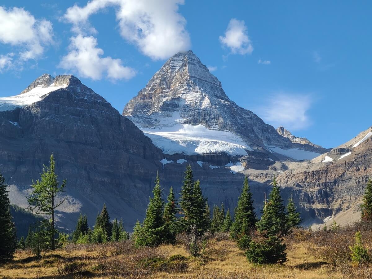
Nestled deep in the heart of the Canadian Rockies is one of the most incredible alpine environments we have ever been lucky enough to visit. Often called the Matterhorn of the Canadian Rockies for its striking resemblance to Switzerland’s iconic mountain, Mount Assiniboine rises above an epic landscape of jagged peaks, deep blue alpine lakes, and picturesque alpine meadows, all belonging to the incredible Mount Assiniboine Provincial Park.
Mount Assiniboine Provincial Park is located in eastern British Columbia, but borders the more famous Banff National Park found in Alberta. Despite its proximity to such a world-famous and stunning area, Mount Assiniboine is still a true standout (that’s really saying something!). And because it’s such a remote area, you’ll leave the crowds of its famous neighbors behind.
So, what’s the catch? There’s gotta be a catch, right?
Well, kind of…
Planning a visit to Mount Assiniboine National Park can be a challenging task. Because there are no roads in the park (yes, it’s that remote!), the only way to get to Mount Assiniboine is by hiking or taking a helicopter. Plus, you’ll need to secure all the proper reservations to get to and stay in the park. And with multiple options for flights into Mount Assiniboine, multiple hiking routes into Mount Assiniboine, and a few different places to stay in Mount Assiniboine, it can be overwhelming when trying to plan your visit!
But don’t worry…we got you covered! Our goal here was to bring in all the essential information for planning a trip to Mount Assiniboine Provincial Park into one convenient place. We’ll cover absolutely everything you need to know – how to get to Mount Assiniboine, including how to take the helicopter and how to hike to Mount Assiniboine, where to stay in Mount Assiniboine Provincial Park, how much everything costs, how to make all your Mount Assiniboine reservations, what to pack, and perhaps most importantly, all the best places to see in Mount Assiniboine. Along the way, we’ll share all the tips and tricks we’ve personally learned from our own visit to Mount Assiniboine.
Planning a trip to Mount Assiniboine takes some time and effort, and actually getting there will cost you quite a bit in either time, physical effort, or money (or all three!), but we are here to tell you that it’s all totally worth it in the end, we promise. Mount Assiniboine and the entire area surrounding it is some of the most epic and picturesque alpine scenery we’ve seen…the pictures don’t lie!
So, are you ready to plan your visit to Mount Assiniboine? Let’s get to it!
In this guide to visiting Mount Assiniboine Provincial Park:
Where to stay in Mount Assiniboine Provincial Park
How to get to Mount Assiniboine Provincial Park
Hiking to Mount Assiniboine Provincial Park
How to hike to Mount Assiniboine from Sunshine Village in Banff National Park
How to hike to Mount Assiniboine from Mount Shark via Wonder Pass
How to hike to Mount Assiniboine from Mount Shark via Assiniboine Pass
Through-hiking Mount Assiniboine Provincial Park: Hiking from Sunshine Village to Mount Shark
Combining hiking and the helicopter to get to Mount Assiniboine Provincial Park
How much time do I need in Mount Assiniboine Provincial Park?
Things to do near Mount Assiniboine and more Canadian Rockies guides
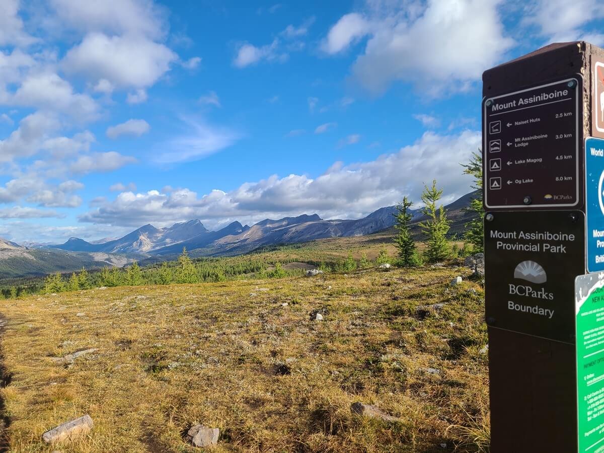
Where is Mount Assiniboine Provincial Park?

Mount Assiniboine on a cold misty morning
Mount Assiniboine Provincial Park is in British Columbia, but it lies right on the border with Alberta. In fact, to get into the park, whether by hiking or flying in, you will start in Alberta and cross the provincial border.
Mount Assiniboine Provincial Park is nestled between other famous parks of the Canadian Rockies, such as Banff National Park in Alberta and Kootenay National Park in British Columbia, as well as by the Kananaskis region found along the eastern border of the Rockies. To get into Mount Assiniboine, you’re starting point will be from one of these other parks. However, there are no roads into Mount Assiniboine, making this park pretty remote. You’ll have to either hike or fly in…but we’ll go more into all of this in just a little bit.
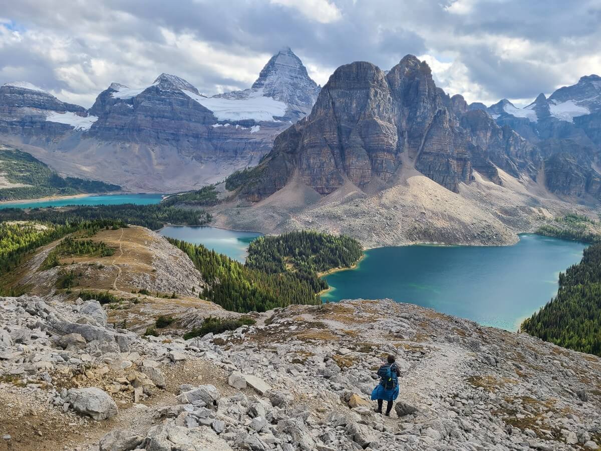
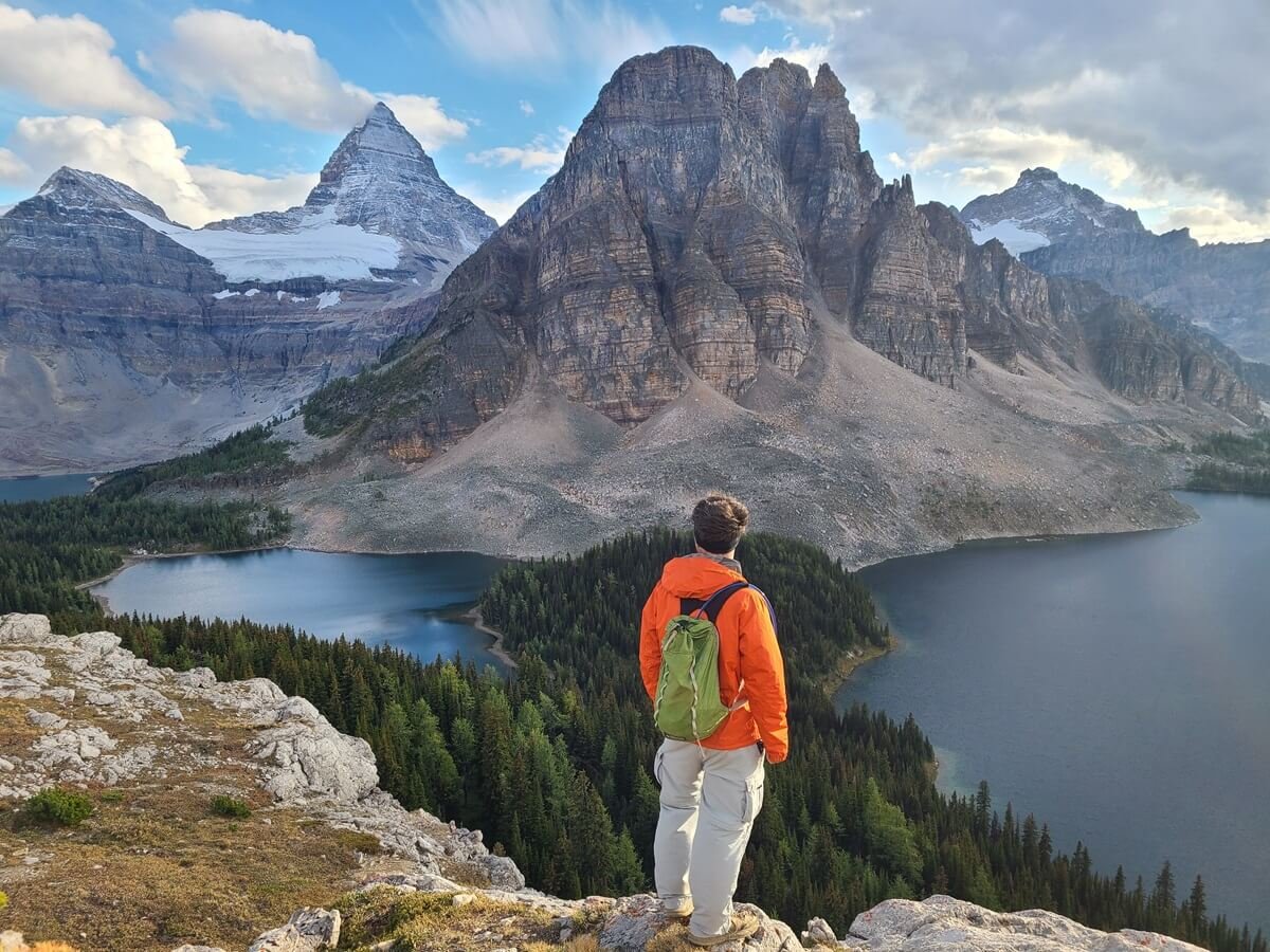
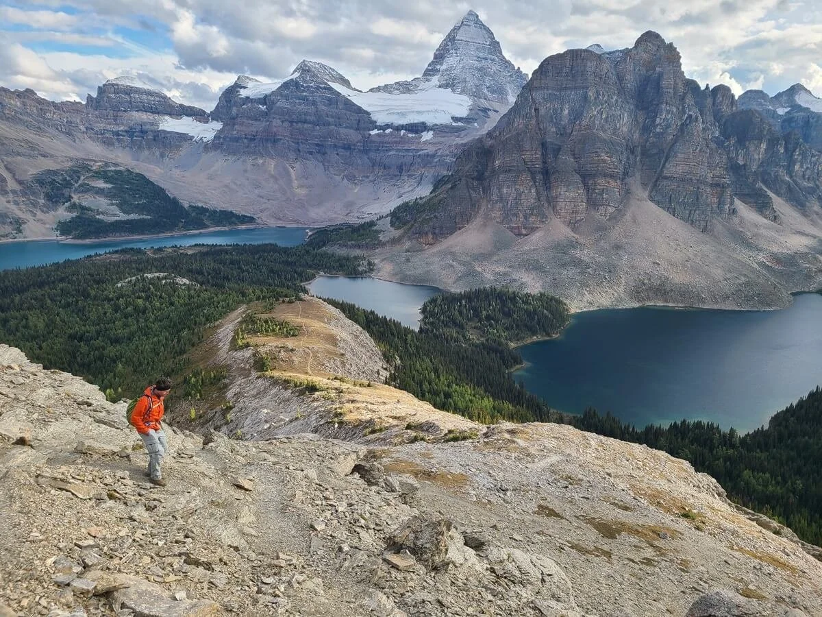
Though it’s just shy of 100,000 acres, the core area of the park centers around Lake Magog, a beautiful alpine lake that sits at the base of Mount Assiniboine itself. This is the most popular and coveted area of the park, and it’s where most visitors spend their time- and for good reason. Surrounding Lake Magog are a handful of amazing hiking trails that give postcard-worthy views of Mount Assiniboine and the surrounding mountains, including the famous and incredibly picturesque hike up to Nub Peak.
Overlooking the core region of Mount Assiniboine Provincial Park from the hike up the Nublet
Lake Magog and Mount Assiniboine hiding in the clouds
Mount Assiniboine Provincial Park map
This map shows where Mount Assiniboine Provincial Park is in relation to other parks in the Canadian Rockies.
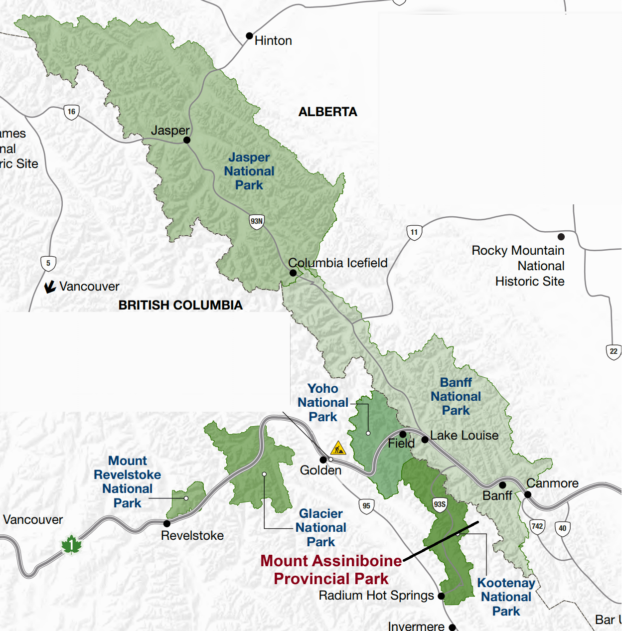
This map is taken from one of the Parks Canada brochures, with the location of Mount Assiniboine highlighted
Where to Stay in Mount Assiniboine Provincial Park
Before we talk about how to get there, it will be helpful to go over the different options of where to stay in Mount Assiniboine Provincial Park.
Like we said above, the core area surrounding Lake Magog is where the majority of people are looking to stay when they visit Mount Assiniboine, and there are a couple different options for where to stay near Lake Magog. These options range from a budget-friendly backpacker’s campground where you’ll have to be entirely self-sufficient, to an expensive luxury backcountry lodge where all meals, hot water, and even a sauna are provided for you. So, let’s go over each option!
The Assiniboine Lodge

The luxurious Assiniboine Lodge in Mount Assiniboine Provincial Park
Let’s start off with the most luxurious accommodations at Lake Magog. We find it a little hard to believe that you can find things like this out in the remote backcountry, but the Assiniboine Lodge lets you enjoy backcountry views without having to pitch a tent and brave the elements. The Lodge sits just near the foot of Lake Magog where you can get gorgeous views right from your window straight out to Mount Assiniboine.
Assiniboine Lodge is open in the summer from June 21st to September 30th. It provides all meals, guided hikes in the area, hot water, heat (a hot commodity out here!...get it?...but seriously, it gets cold out here…), electricity, an indoor toilet, a shower house, and even a sauna!
At Assiniboine Lodge, you can choose to stay either in a room in the lodge itself, or one of 5 private cabins (each holds up to five people) near the lodge. Amenities may vary slightly depending on which you choose so check out their site for more details on what’s provided in each.

The Assiniboine Lodge cabins come with an epic view! They are an amazing place to stay in Mount Assiniboine Provincial Park.

The epic view of Lake Magog from the Assiniboine Lodge!
How much does the Assiniboine Lodge cost?
Of course, you’ll have to expect to pay for this kind of luxury out in the backcountry!
Here are the current rates for the Assiniboine Lodge near Lake Magog. Note: We will do our best to keep this updated but please check their site for the most up-to-date-rates!
Each of these rates is in CAD and PER PERSON PER NIGHT (and does NOT include an extra 6.2% tax)
Lodge room for 2: $440 CAD
Lodge room for 1: $645 CAD
3-5 person private cabin: $440 CAD
2 person cabin: $545 CAD
Kids ages 2-12: $230 CAD
How to make reserverations at the Assiniboine Lodge
If the prices didn’t scare you away, you can make a reservation at the Assiniboine Lodge by going to their booking form here.
Some important information to make Assiniboine Lodge reservations:
WHEN TO BOOK: This is important! Bookings are accepted in August for the next summer season! So for example, summer 2024 bookings will be processed August 1st-31st of 2023…so you have to prepare well in advance for this one.
And as you might expect, with limited availability and a huge demand, these bookings sell out fast and they don’t keep a waitlist, so don’t have high hopes for getting a reservation. However, even though they stop taking bookings after August, you can check back on their site here…they might have a date where you can come back and see if there is availability (usually sometime around December).
MINIMUM STAY: Assiniboine Lodge does have a minimum stay of 2 or 3 nights, based on when you come. This is based around the days the helicopter, which is run by the Lodge, flies in and out. We’ll talk more about the helicopter later, but for now, just know that it flies in and out to Mount Assiniboine on Wednesdays, Fridays, and Sundays (or Mondays on holiday weekends). Your check in and out days for the lodge must match these days (even if you’re not using the helicopter and you’re hiking in, this still applies). So keep this in mind, because this means that those prices we listed above in reality will have to be doubled or tripled for your true cost to stay at the Assiniboine Lodge.
The Naiset Huts

One of the Naiset Huts in Mount Assiniboine Provincial Park
The Naiset Huts are a group of five dorm-style cabins near Lake Magog, just over a half kilometer away from the Assiniboine Lodge. They are a slight step up from camping, but not nearly as luxurious as the Lodge, but they’re also way cheaper than the Lodge, too!
These little huts range in sizes that can sleep 5-8 people. The huts really just have bunk style beds and a small woodstove (with wood available for purchase from the Lodge). There is a shared cooking lodge for all cabins. You’ll have to bring with you everything you’ll need…sleeping bags, all cooking utensils, and all meals. As we said, it’s just a slight step up from camping, but with four walls to keep you warm and dry instead of a tent, which is key out here where the weather can be rough and unpredictable.
How much does it cost to stay in the Naiset Huts?
To reserve a spot in a hut, you have to reserve the entire hut. For a cabin that sleeps 5, it costs $150 CAD per night, for one that sleeps 6 it’s $180 CAD per night, and for those that sleep 8, it’s $240 CAD per night. So, if you have enough people to fill the hut, it essentially breaks down to $30 CAD per person per night…not bad! (These rates do include taxes, too! Plus, children under 5 are free.)
How to make reservations for the Naiset Huts
The summer season for the Naiset Huts is June 21st- September 30th. There is one reservation day for the upcoming 2024 summer season, which is January 9th, 2024 starting at 8:30 am MST.
Reservations are by PHONE ONLY. Check this site for more details on how the reservation system works for the Naiset Huts, but basically spots sell out fast, as you could imagine (within a day or so), and basically, if you really want to score reservations, you need to prepare to spend a good chunk of your day on the phone trying to get through. It’s pretty much luck of the draw on who gets put in the phone queue.
As with the Lodge, your booking dates must line up with the helicopter flight schedule, even if you don’t plan on taking the helicopter, so the minimum stay is 2-3 nights.
Camping in Mount Assiniboine Provincial Park

An epic campground at Lake Magog in Mount Assiniboine Provincial Park
If you don’t want to shell out a ton of money, or you just want to preserve the special backcountry experience of Mount Assiniboine, then there is a budget-friendly place to stay near Lake Magog…the Lake Magog campground, which sits just adjacent to the picturesque lake.
About 5 km away from Lake Magog is another smaller campground, Og Lake campground, which sits at the base of another picturesque alpine lake. It’s further away, but it’s a nice alternative if you can’t get the coveted Lake Magog campsites.
Lake Magog campground
The Lake Magog campground is a popular campsite that sits on a hill above the west side of Lake Magog. It’s highly coveted for its location right in the core area of Mount Assiniboine. Luckily, it’s the largest campground in the park, with 40 sites, but it still fills up quickly.
Lake Magog campground is a well-maintained, mostly forested campground with 2 semi-enclosed cooking shelters that have picnic tables so you can hide from the elements, two open-air cooking areas, outhouses, grey water pits, bear boxes, and bear hangs located throughout. There are also water taps, however this water is untreated and must be filtered before you use it.

One of the cooking shelters at Lake Magog campground in Mount Assiniboine, along with bear boxes and the grey water pit nearby
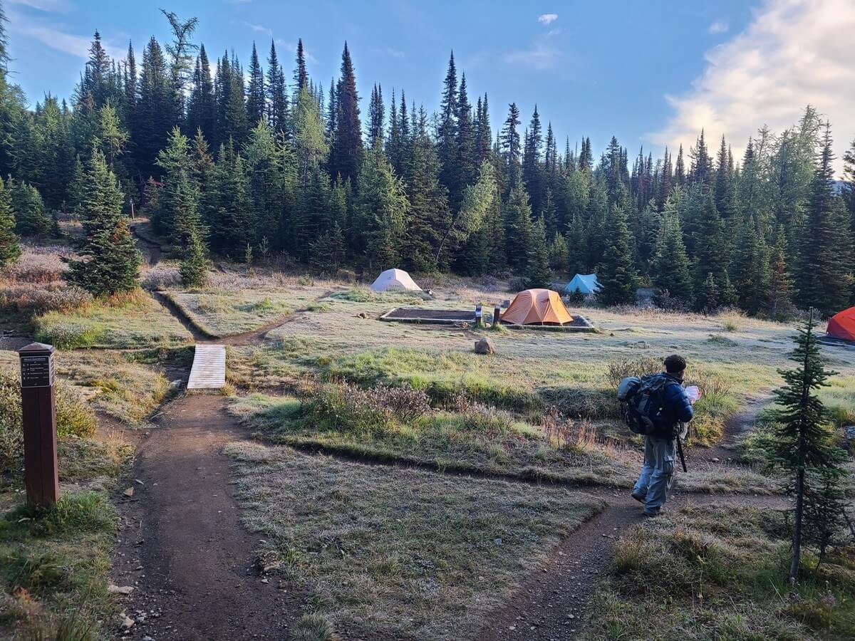
A frosty morning at the Lake Magog campground
A note on water at Lake Magog campground: When we visited Mount Assiniboine at the end of the summer season, water levels were low and the reservoir that supplies the Lake Magog campground with water was dried up, so be prepared for this. The Assiniboine Lodge has taps you can use, but this is 2 km from the campground (and this water must also be filtered). There’s also a small creek that runs through the backside of camp that you can filter from. Otherwise, you can walk down to the Lake Magog shoreline to filter water, which is a bit of a hike down from the campground.
What you should know about the Assiniboine Lodge for campers:
The Lake Magog campground is 2 km down the west side of Lake Magog from the Assiniboine Lodge, and use of the Lodge by campers- for general questions and purchases, or just to hang out on the porch area- is generally frowned upon. It’s something that honestly kind of struck us the wrong way at first, but we sort of get it…people are paying thousands of dollars for use of the Lodge and they don’t want smelly campers who haven’t paid their dues hanging around!
That said, they don’t want you loitering around on the porch, and you aren’t allowed inside, even to ask questions. The only service they provide for campers is afternoon tea. From 4 pm-5 pm on non-flying days (so, Monday, Tuesday, Thursday, and Saturday), you can go to the lodge for some warm tea (outside on the porch) and you can also buy things like beer, wine, and cakes (have Canadian cash on you!).
If you have any questions, you’re encouraged to ask the camp custodian who comes and does a round through camp every night to check permits, or during tea time at the Lodge.
In all fairness, the day we arrived at Lake Magog from our backpacking trip in, we and some other backpackers were taking shelter under their small porch from the non-stop hail and pouring rain. We were freezing and just trying to get dry and wait out the rain before setting up camp 2 km away (before we knew/realized there were semi-enclosed shelters at the campground itself) and they didn’t give us any problems. One friendly staff member did mention it’s not encouraged, but I think people were empathizing with us with the terrible weather! But it was difficult getting any questions answered until about 4 pm when the camp custodians were around.
Lake Magog campground map
Here is the map of the Lake Magog campground. It’s a pretty big campground, with 40 sites. This map is found right at the beginning of the campground, and we highly recommend snapping a picture of it when you’re there for reference. The campground has so many paths and is quite big, and without a map, you’re bound to get a little lost in it!

Map of the Lake Magog campground
If possible, it’s good to get there earlier in the day so you can scope out a good spot but also not have to wander around forever looking for empty sites.
We camped at site #5, which we thought was the best! Pretty much all of the campsites were in clumps, with other tent sites right next to them, except for site #5. It stood alone and was really quiet at night. It was also a good distance away from the cooking shelters, which can get rowdy at night. Plus, it had great views of the mountains and within just a few steps, an epic view of Mount Assiniboine itself. It’s also right past the entrance to the campground which is nice, because if you get a campsite towards the back of the campground, it adds a lot of extra walking every day to and from trails and the Lodge area, so it was easy access. It is right next to the hiking trail, but at night it was quiet so it wasn’t an issue.

Kevin admiring the view of Mount Assiniboine just steps from our tent in the Lake Magog campground

Typical tent sites at the Lake Magog campground in Mount Assiniboine
There are plenty of sites with great views, though, so when you see one, grab it!
Og Lake campground
Og Lake is 5 km away from Lake Magog. The campground sits above the North end of the lake. There are only 10 sites here in an open meadow, so there’s no privacy, but that just means there’s great views from every site. The Og Lake campground has one open-air designated cooking space (no enclosed or semi-enclosed shelters…so if there’s bad weather like we had, good luck!) with a bear box, bear hang, grey water pit, and one outhouse.

A tent pad at Og Lake campground in Mount Assiniboine Provincial Park

The cooking and eating area at Og Lake campground. We ate breakfast here while we listened to and watched the pikas scurrying around the rocks in the distance.
It’s a bit far from Lake Magog, but it’s a common place to camp for those hiking into Mount Assiniboine from Sunshine Village, or as an alternative for those who were unable to score a site at Lake Magog. The hike between the two is pretty easy and mostly flat through a view-filled meadow, so it’s easy to camp at Og Lake for the night, and then hike into the core area for the day to do a day hike before heading back.

The flat and scenic trail between Og Lake and Lake Magog
How much does it cost to camp at Lake Magog and Og Lake?
For such a coveted and popular area, camping in the core area of Mount Assiniboine is a bargain, at only $10 CAD per person per night (or $5 CAD for kids 6-15), plus a $6 CAD reservation fee…speaking of which…
How to make reservations for Lake Magog and Og Lake campgrounds
Reservations are required for both Lake Magog and Og Lake campgrounds from June 26th to September 30th (outside of this window you can self-register at the campground…bring cash!). Once you secure your Og Lake or Lake Magog reservation, be sure to print it out and bring it with you because they will check for it once you’re there!
You can make a reservation for Lake Magog or Og Lake on the BC Parks website.
Click on the “Backcountry” tab, make sure “Backcountry Reservation” is selected, and choose Mount Assiniboine from the drop down menu. Select the date you plan to arrive and your party size and hit Search. This will bring you to a map of the park showing the reservation status of both campgrounds. If they are green, which means available, click fast!

Here is what your selections should look like if you want to make backcountry reservations for Mount Assiniboine campgrounds

Once you hit the search button, a map of Mount Assiniboine and its two reservable campgrounds, Og Lake and Lake Magog, will appear. The color of the diamonds indicate availability, with green meaning there are sites available for the dates you selected.
You can book a site for Lake Magog or Og Lake starting four months in advance at 7 am PT, but sites go fast (within seconds)! I tried getting a reservation for a few days with no luck. I’d refreshed the page right at 7 am PT and would see the sites turn green as they became available, but as soon as I clicked, they were gone. When I returned back to the map, the status of both campgrounds turned red and that was that.
Our best tip for getting a Lake Magog reservation (or Og Lake) is to have an account made and ready and be signed on before reservations open for the day. Play around in the system a little bit beforehand to get used to how it works and which buttons you have to click to make a reservation, because it’s not the most intuitive interface we’ve ever dealt with.
Also, if you didn’t get a reservation right away, stay on the page for a bit and keep refreshing it. The status might turn green again as people contemplate whether they want the sites they got or not and return them. We saw this happen for Og Lake especially.
But, do you want to know our favorite tip for scoring Lake Magog reservations and how we managed to get ours?
Most people go immediately for Lake Magog sites, understandably. So chances are, you’ll click on it as soon as they become available, you won’t get them, and by the time you get back to the home page, everything has been taken. That’s what happened to us. Instead, go for Og Lake first. You have a better chance of getting it, whether it’s immediately or after you refresh the page a few times. Once you get a campsite in your cart, you can then begin building out your itinerary and book sites for each night that you plan on staying in the core region, which gives you a great chance of being able to stay at Lake Magog the next night!
For example, let’s say you plan on staying in the core area for three nights in July, so when you start your reservation, you put in your planned entry date of, for example, July 10th. Let’s say you are able to snag a campsite at Og Lake for the night of July 10th and it’s added to your cart. Now, the system let’s you add on consecutive days so that you can build out your entire Mount Assiniboine itinerary and book all your campsites in one go! The chance of having Magog Lake being available for July 11th and/or July 12th is now pretty much guaranteed.
This is exactly how we were able to reserve a spot at Lake Magog. We got Og Lake, and then were able to reserve the next two nights at Lake Magog.
Of course, this means you have to be willing to hike between the two. It was a no-brainer for us because we were going to be hiking in from Sunshine Village (more on this later) and Og Lake was on the way to Lake Magog. If you spend the first night at Og Lake and get an early start the next morning, you still can pretty much have the whole day in the Lake Magog area and then can spend the night there.
If all else fails, you can keep checking back on the site in the months and days leading up to your trip to the Rockies. If you’re lucky, sites may randomly open back up as people cancel…we did see that happen occasionally.
How to Get to Mount Assiniboine Provincial Park
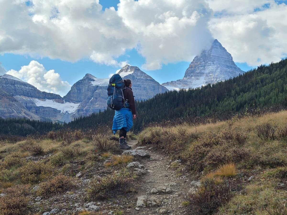
Hiking to Mount Assiniboine via Sunshine Meadows- one of the several ways to get to Mount Assiniboine Provincial Park
So, now you know where you can stay in the park, but here’s the big question: if there are no roads in, how do you get to Mount Assiniboine?
There are two main ways to get to Mount Assiniboine Provincial Park: a harder way, and a much much much easier way.
You can either hike to Mount Assiniboine or take a helicopter in. There are two main trailheads from which you can hike in, and each is about 28 km or so of hiking that will take 1-3 days depending on the route, how strong of a hiker you are, and how you decide to break up your days. Meanwhile, flying in takes a mere ten minutes.
So, you have some options. You can choose to hike in and out from Mount Assiniboine, you can fly in and out and avoid the hike altogether, or you can combine the two by flying in and hiking out or vice versa.
What did we do? We hiked! We’re all about preserving the backcountry experience and feeling the sense of accomplishment and reward from backpacking in somewhere.
But, we’ll be honest with you: The hike into Assiniboine was long and tough, the weather was pretty crazy, and we had heavy packs. Our biggest regret from our trip to Mount Assiniboine was probably not planning to take the helicopter one-way so that we would only have to make the one-way hike. To us, this would be the best of both worlds for visiting Mount Assiniboine.
With that said, let’s get into all your options now for how to get to Mount Assiniboine, along with our personal recommendations at the end, so you can make the best choice for your own trip!
Hiking to Mount Assiniboine Provincial Park

Hiking from Mount Assiniboine via Wonder Pass
There are two main trailheads and three main routes to hike into Mount Assiniboine:
Hike from Sunshine Village in Banff National Park to Mount Assiniboine
Hike from the Mount Shark Trailhead in Spray Valley Provincial Park to Mount Assiniboine via the Wonder Pass route
Hike from the Mount Shark Trailhead in Spray Valley Provincial Park to Mount Assiniboine via the Assiniboine Pass route
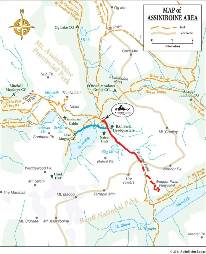
Mount Assiniboine hiking map
Here is a good overview map that shows the location of each trailhead and hiking route into Mount Assiniboine and the core area.
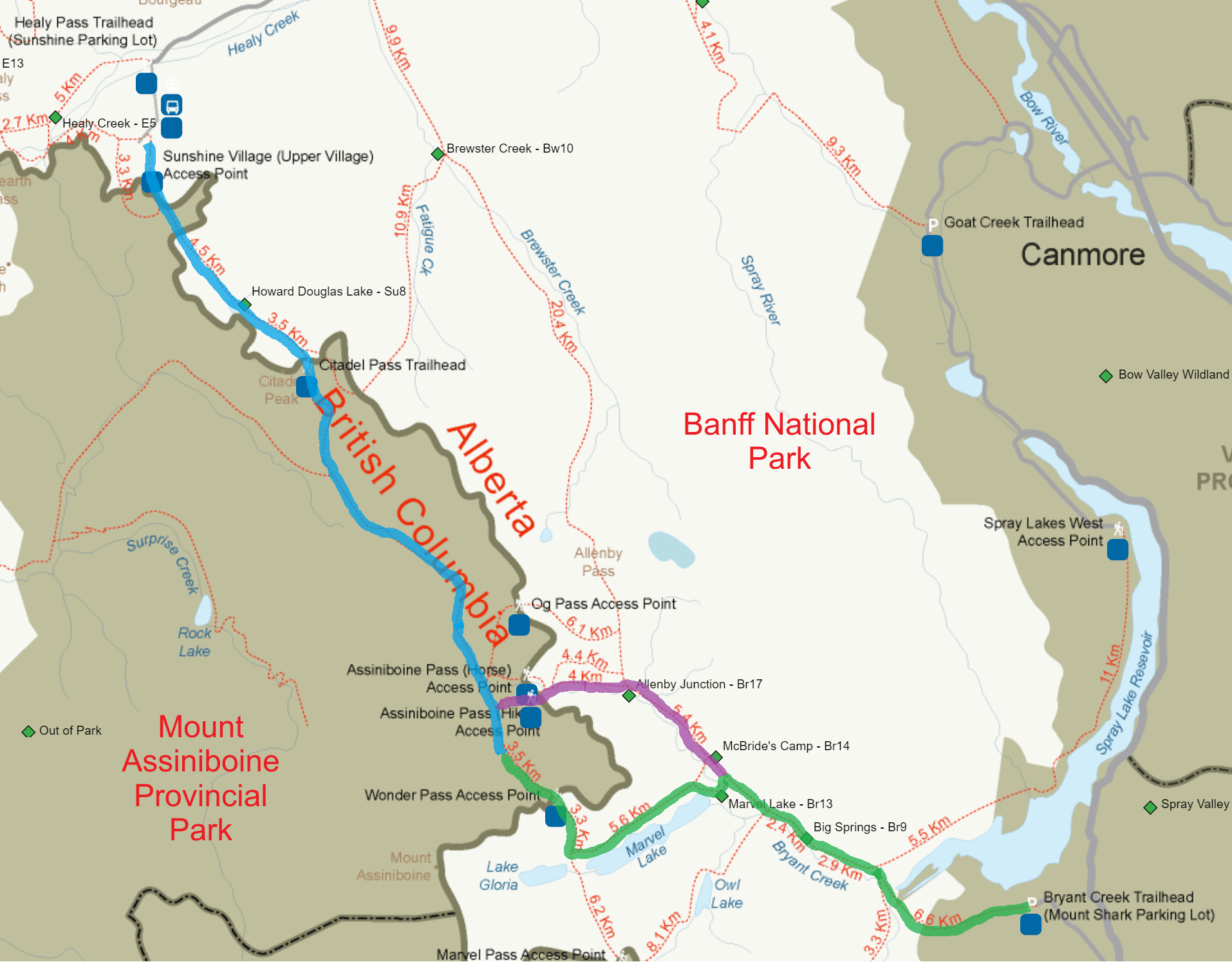
This image was taken from the Banff backcountry reservation system website, and gives a good overview of the hiking trails into Mount Assiniboine. We highlighted in blue the hike from Sunshine Village to Lake Magog. In green is the hike from the Mount Shark trailhead to Lake Magog via Wonder Pass, and purple shows the alternative hike via Assiniboine Pass.
Let’s go over each of the hiking routes into Mount Assiniboine.
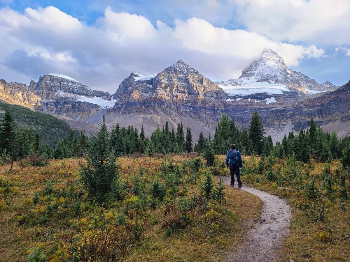
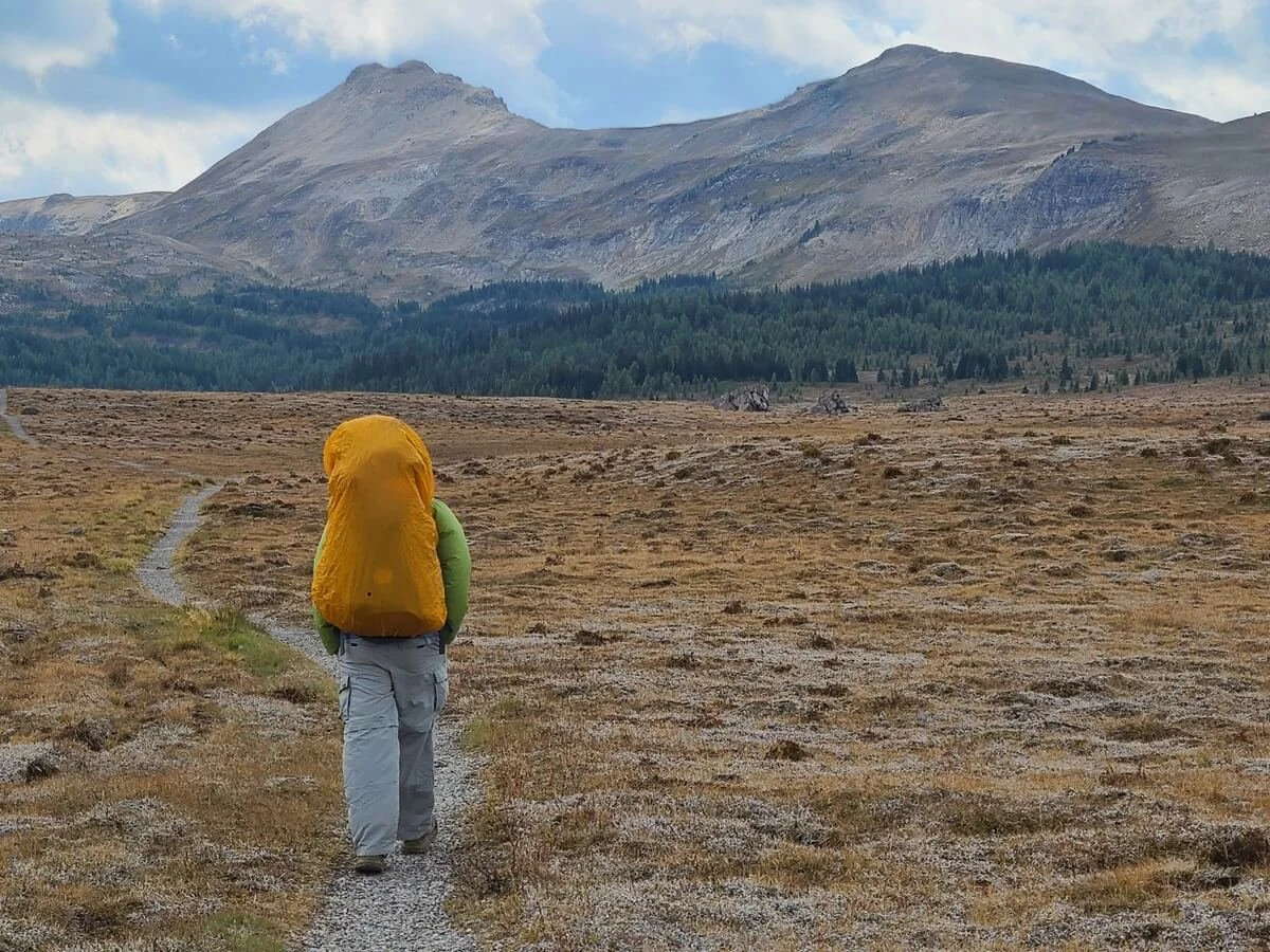
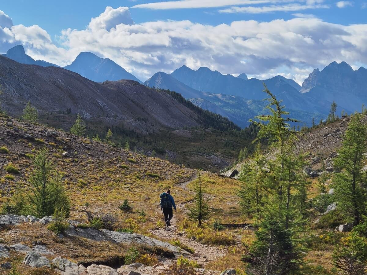
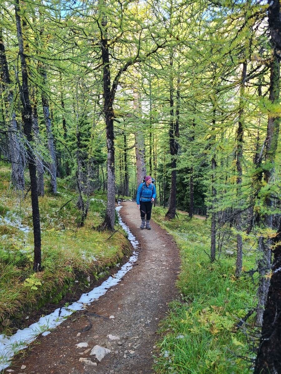
How to hike to Mount Assiniboine from Sunshine Village in Banff National Park

Looking out over Howard Douglas Lake on the trail from Sunshine Meadows to Mount Assiniboine
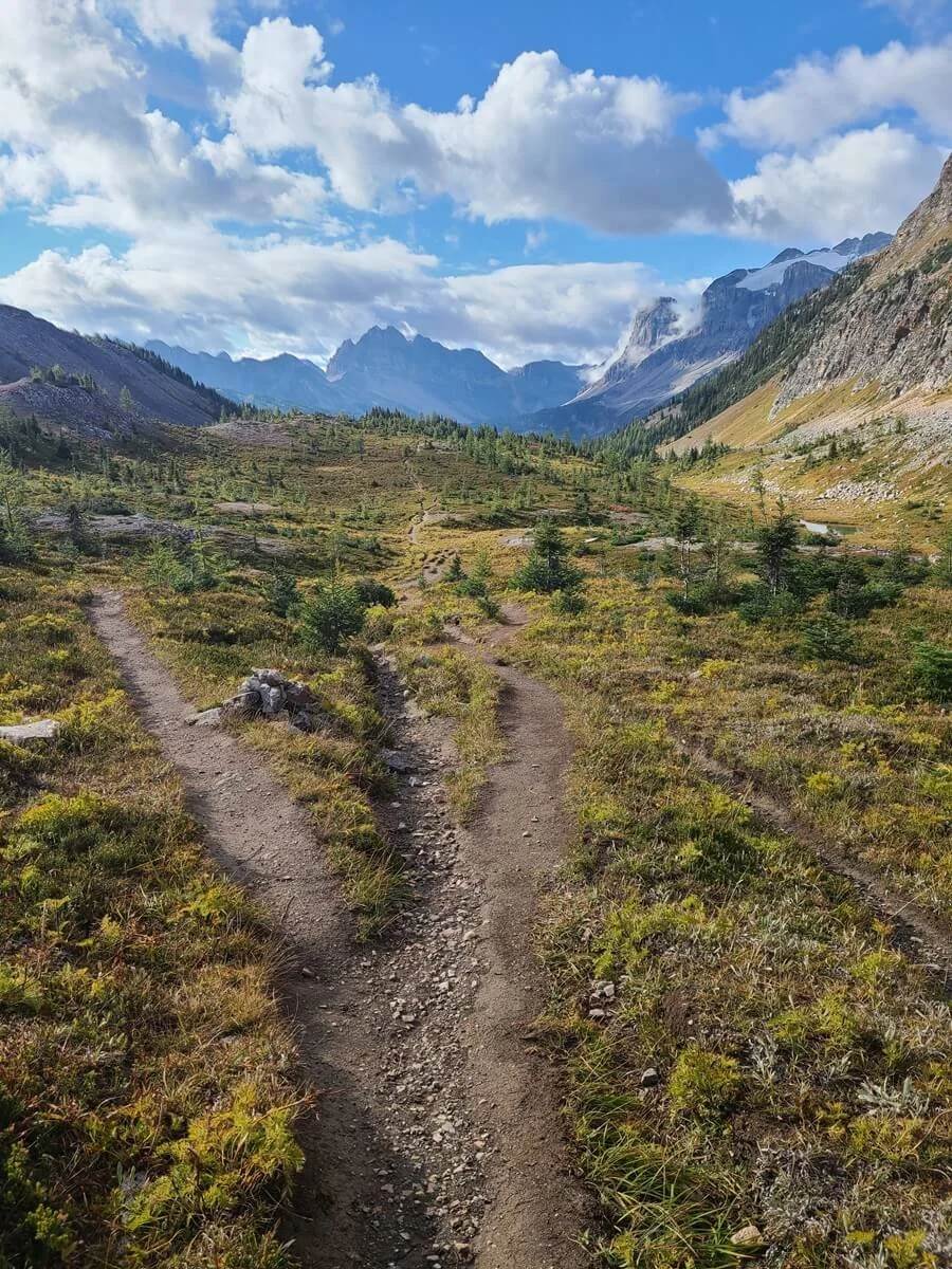
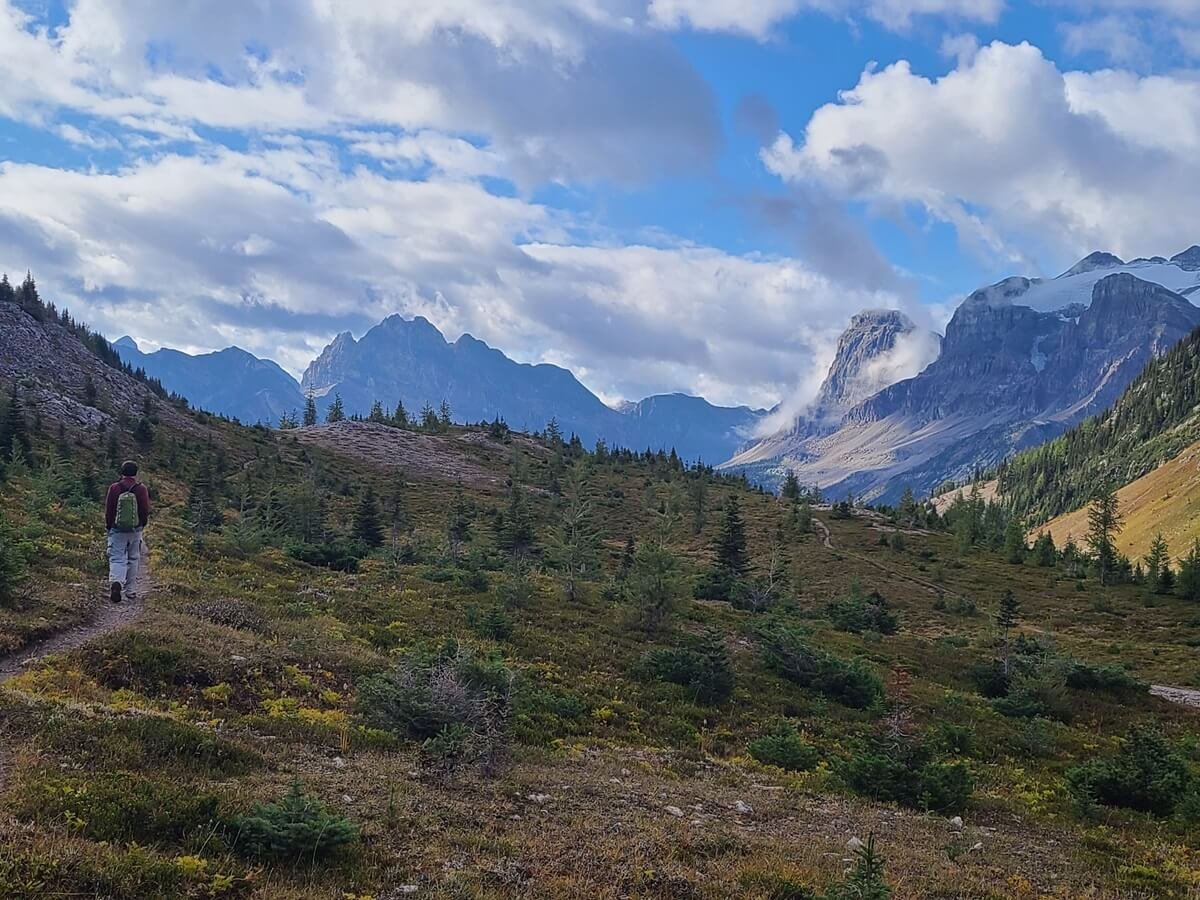
The hike from Sunshine Village to Mount Assiniboine is about 28.5 km (from the top of the Sunshine Gondola to the Lake Magog campground-if staying at the Lodge it will be about 2km less distance). It’s a beautiful hike that starts in a scenic area of Banff (Sunshine Meadows), traverses over Citadel Pass, and then drops down into the valley on the other side, taking you through the Valley of Rocks until you come to Og Lake, and then the Lake Magog core area.
One plus about the hike from Sunshine Village to Mount Assiniboine is that there are great views through much of the hike, and you can see Mount Assiniboine throughout many different parts of the trail. It is a tough hike, though, especially with a heavy pack.
How to get to the Sunshine Village trailhead
Sunshine Village is about 5 km (20 minutes) west of Banff on the TransCanada Highway. A large parking lot sits at the base of the village, where you can take a 20 minute scenic gondola ride to the top. This is where the popular and scenic Sunshine Meadows area is and it’s the start of the hike to Mount Assiniboine.
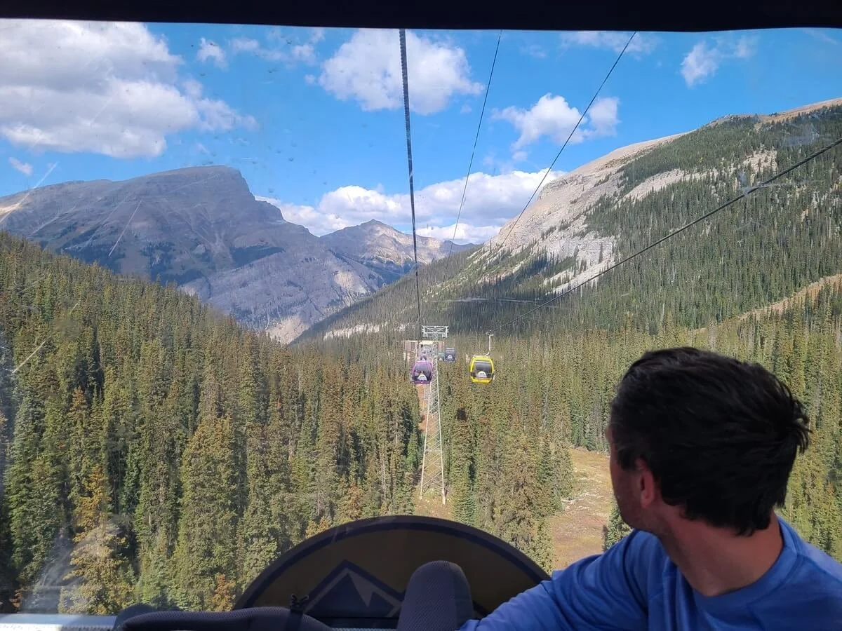
Gorgeous views from the Sunshine Village Gondola to get to the start of the Mount Assiniboine hike!
Alternatively, you can walk up to the Meadows area from the parking lot on a gravel service road, which will add an extra 6 km and 500m (1600 ft) elevation gain to your hike. Yikes. We almost opted for the walk up to reduce the cost of our trip, but I am so glad we didn’t! The road walk looked like an absolute slog, and boring with no views. This is one additional cost that’s worth it in our opinion! Learn more about the Sunshine Meadows Gondola and its costs, schedule, and hours on their site.
If you want to park at Sunshine Village, you will need a Banff National Park Pass. You can buy a day pass for each day you will be parked there, which can be bought online or at the park gates or visitor centers. This is $10.50 CAD per day per person. Or you can buy a Discovery Pass which is $72.25 per person but covers you for an entire year for tons of Canadian Parks. This is totally worth it if you plan on spending a long time on the trail or also plan to visit other nearby parks, like Yoho National Park or Jasper National Park.
If you don’t want to drive right to the Sunshine Village lot, there is also a free shuttle that runs from the town of Banff. Check the Sunshine Village Shuttle site for hours.
The Sunshine Village to Mount Assiniboine route overview
From the top of the Sunshine Gondola, you can spend some time wandering around the Sunshine Meadows area (we definitely recommend stopping at Rock Isle Lake for some nice views!).

The beautiful Rock Isle Lake- a short detour on the hike to Mount Assiniboine from Sunshine Meadows
On your way into Assiniboine, you’ll cross the meadows for a while, accompanied by the peeping sounds of nearby ground squirrels and mountain views surrounding you in every direction.
Crossing Sunshine Meadows on the way to Mount Assiniboine
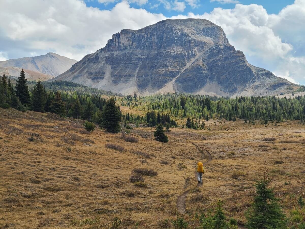
You’ll go up and down some smaller hills with sometimes steep climbs and descents, pass by Howard Douglas Lake, and the make a gradual climb up to the top of Citadel Pass at about 9 km in. At the pass, you cross over from Banff National Park into Mount Assiniboine Provincial Park and from Alberta into British Columbia.

The view over Howard Douglas Lake on the hike to Mount Assiniboine, with Citadel Pass in the background (to the left of the prominent trapezoidal-shaped peak in the distance)
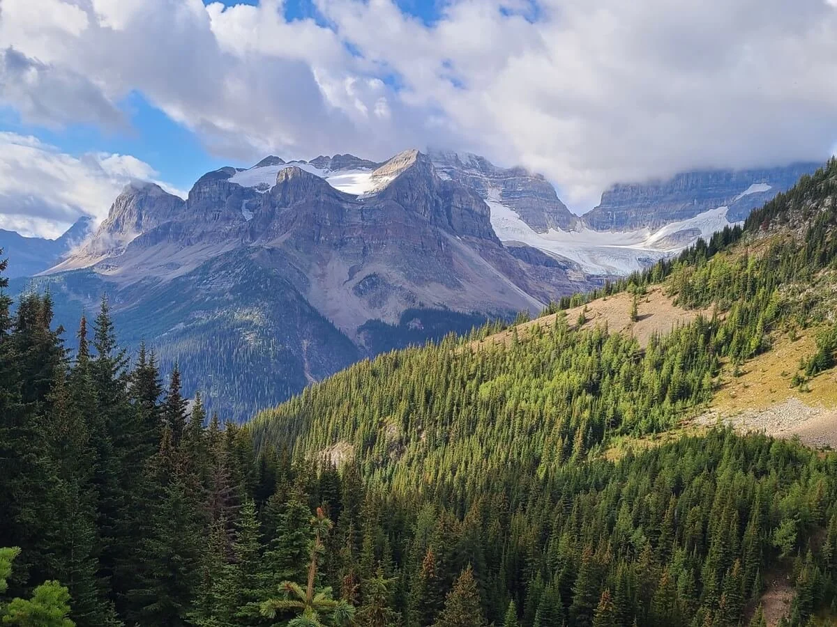
From here, you’ll drop down over 400 meters (1400 feet) along a steep grade down the other side of the pass into the valley. And from here, the rest of the hike is through a section called the Valley of Rocks. It’s a bit of a slog and feels never-ending to be honest, with lots of spurts of steep up and downs, though overall, you’ll be heading uphill to Og Lake.
Hiking through the Valley of Rocks near Og Lake, with Mount Assiniboine in clear view
On a clear day, you can enjoy the views of Og Lake with Mount Assiniboine towering above in the distance. From here, it’s a relatively easy walk across a meadow with amazing views of Mount Assiniboine ahead and the surrounding mountains before reaching the Assiniboine Lodge at the head of Lake Magog. If you’re staying the campground, it’s another 2 km along the side of the Lake Magog.
The final stretch of the hike to Mount Assiniboine from Sunshine Village
Mount Assiniboine to Sunshine Village: hiking out
Hiking out from Lake Magog to Sunshine Village is arguably a bit harder than hiking in. It’s the same distance, but with much more elevation gain as you have a much bigger climb to get to Citadel Pass from this direction.
Campgrounds on the hike from Sunshine Village to Mount Assiniboine

Our tent at Og Lake campground on a wet and gloomy day (Mount Assiniboine is hiding behind a veil of clouds)
Although some people attempt the hike from Sunshine Village to Mount Assiniboine in just a day, many opt for two to three days. It’s a long hike, and with the constant spurts of steep up and downs throughout the entire trail combined with the weight of a full pack, this Assiniboine trail is pretty exhausting, and trying to tackle it in one day is a lot.
So, where can you stay along the way?
There are three campgrounds along the trail from Sunshine Village to Mount Assiniboine.
Howard Douglas campground. This is a small campground of just five sites in Banff National Park along the shore of Howard Douglas Lake. It’s only about 4 km (2.5 miles) into the trail, so it’s a good place to camp if you know you’re going to get a late start on the way in, or you want a shorter last day on the way out (or if you didn’t take the Sunshine Gondola up and so have the added hiking distance). There are five tent pads, an outhouse, a cooking area with bear lockers, and a ready supply of water from the lake.
Porcupine campground. This is another small campground found in the forest at the base of Citadel Pass. There are a handful of platforms, bear bins, and an outhouse. There is a small stream that runs through the area but it can dry up in the summer, so it’s best to have enough water coming in (which you can fill up on back at Howard Douglas Lake). This campground is part of Mount Assiniboine, but is unmaintained and does not require any reservations or fees! The downside is that it’s found a significant ways off trail. It’s about 1.5 km off trail down a very steep, rough trail that many people describe as knee-busting. However, the junction for it is about 12 km from Sunshine Meadows, so just shy of half-way in, making it a convenient way to break up your hike to Mount Assiniboine.
Og Lake campground. This Mount Assiniboine Provincial Park campground is one we described above. It lies just above Og Lake with beautiful views on a clear day to Mount Assiniboine. This lies 20.5 km into the hike from Sunshine Meadows, so it’s still quite a big hike to do in one push from Sunshine Village, and really only cuts out the easiest part of the entire trail to Lake Magog.

Filtering water at Howard Douglas Lake right near the Howard Douglas campground
How to make backcountry reservations in Banff National Park
Since Porcupine Campground requires no reservations, and we’ve already discussed Og Lake reservations above, that leaves Howard Douglas, which is in Banff National Park.
You can make reservations starting in March of the year you plan on camping by going to the Parks Canada reservation site.
Once you’re here, select the Backcountry tab, and then make sure the Backcountry Zone button is selected. Then select Banff, Kootenay and Yoho Backcountry from the dropdown menu, and your arrival date and party number. Finally, the access zone will be “Sunshine Village Access Point”.

The selections you need to make to reserve the Howard Douglas Campground in Banff
Once you’ve selected all of this and hit Search, it will bring you to a map of the area where you can click on the Howard Douglas (SU8) campsite to check for availability.
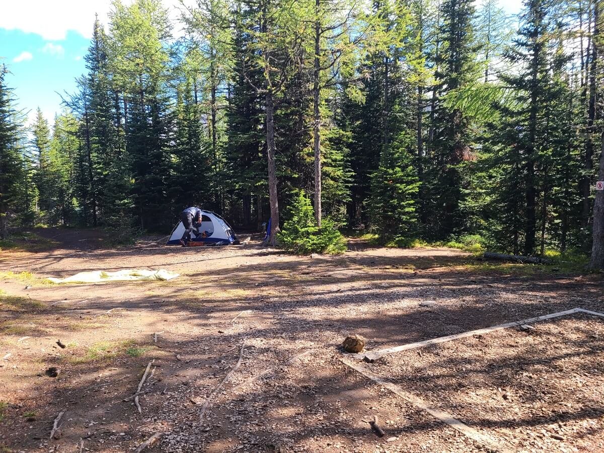
A cluster of tent pads at Howard Douglas Campground in Banff
The cost to make a backcountry reservation in Banff is $12.75 CAD per person per night, with an $11.50 reservation fee. Make sure to either print your confirmation or save a screenshot of it on your phone to show a ranger if they come by.
Even though Howard Douglas is popular, as it’s so accessible and not a far hike, we were able to snag one of the five sites just four nights ahead of time and for a Friday night.
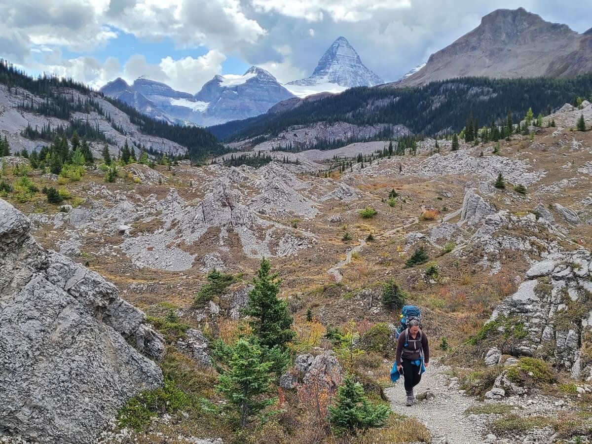
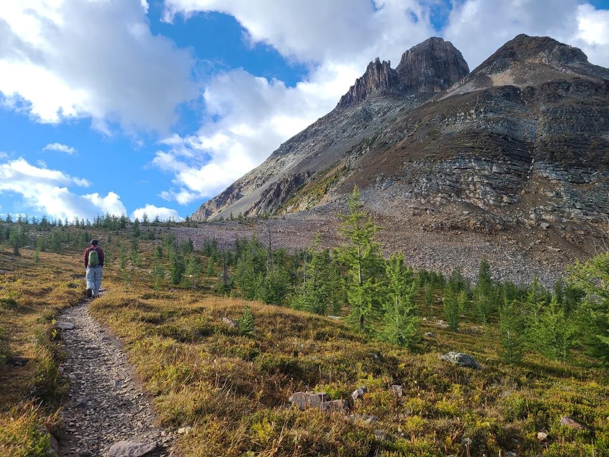
How to hike to Mount Assiniboine from Mount Shark via Wonder Pass
Views near Wonder Pass on the hike to Mount Assiniboine
This hiking route to Mount Assiniboine begins in Spray Valley Provincial Park in the Kananaskis area- an area just southeast of Banff. From the Mount Shark trailhead, you’ll walk through a long valley before traversing alongside the picturesque Marvel Lake up to Wonder Pass- the highlight of the hike. Then it’s an easy downhill hike to Lake Magog and the core Assiniboine area.
How to get to the Mount Shark trailhead
The Mount Shark trailhead (also called the Bryant Creek trailhead) is found in Spray Valley Provincial Park in Kananaskis. There are two ways to get to the trailhead depending on which direction you’re coming from. If you set your GPS to “Mount Shark Trailhead” it should get you there just fine. Just remember to have Google Maps for the area downloaded onto your phone, as you may lose service driving in this way.
From Calgary, it will take about 2 hours to get to the Mount Shark trailhead. From the Trans-Canada Highway, you’ll hop off onto the Kananaskis Trail (route 40), which is a paved road into Kananaskis Country with beautiful mountain scenery along the entire way. After about 50 km, you’ll turn right onto the Smith-Dorrien/Spray Trail (route 742). This is a dirt road but it’s pretty smooth on this end of it and doable in any car. After about 28 km on this road, take a left onto Mount Shark Road and drive to the end to reach the large parking lot. You’ll pass by the Mount Shark helipad about 1.5 km beforehand so make sure you don’t confuse the two.
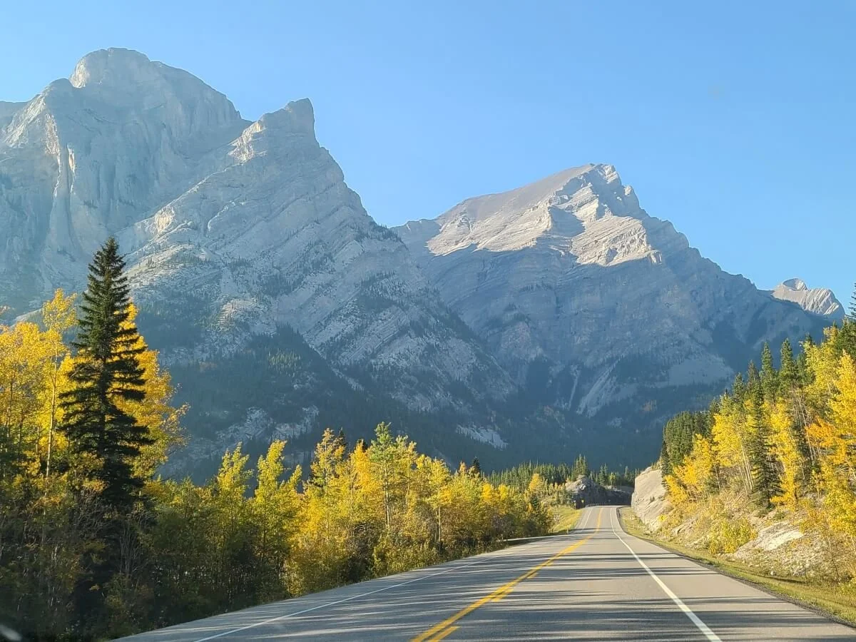
Views of Kananaskis on the way to the Mount Shark trailhead
From Canmore, it will take about one hour to get to the Mount Shark trailhead, and about an hour and a half from Banff.
From Canmore, hop onto the Smith-Dorrien/Spray Trail for about 40 km until you make the right turn onto Mount Shark Road. The Smith-Dorrien/Spray Trail is a dirt road and the first part out of Canmore is really washboarded and bumpy. However, once you get passed Whiteman’s Pond and the Ha Ling Peak trailhead, which seems to be the busiest part of the road, it becomes smooth and you can go quite fast. We were able to knock off a bunch of time from our ETA on Google Maps. The drive in from this direction is really beautiful as all the mountains and lakes of Kananaskis surround you.
Kananaskis Conservation Pass: In order to park in any area in Kananaskis, including the Mount Shark trailhead or helipad, you need to purchase a Kananaskis Conservation Pass. This pass is $15 CAD daily per car (not per person) or $90 CAD for a yearly pass, so if you plan on being in the backcountry for a while and/or will be spending more time in Kananaskis, this yearly pass is worth it. You can buy the pass online and your license plate will become registered in their system.
Overview of the route from Mount Shark to Mount Assiniboine via Wonder Pass
The route to Mount Assiniboine via Wonder Pass is about 27 km (16.7 miles) (this is from Mount Shark to Lake Magog campground) with about 640 m (2100 feet) of climbing.
The first half of this Mount Assiniboine hike is through a forested valley that is for the most part flat and with limited views, so you can really make some good time on this part of the trail. You’ll cross into Banff National Park pretty early on.

This is a birds-eye view of the valley you’ll hike through at the beginning of the trail from Mount Shark to Mount Assiniboine (taken from the Tent Ridge hike in Kananaskis which is right next to the Mount Shark trailhead). About halfway in, you’ll veer left out of the valley and towards Marvel Lake and Wonder Pass.
About 13 km (8 mi) into the hike, so almost the halfway point, you make a turn into the valley containing Marvel Lake, and the hike starts to get good. You’ll start gradually gaining some elevation as you walk a trail that parallels the lake, and you’ll have wide open views down to Marvel Lake and surrounding mountains.
Then, at about 19 km (12 miles) into the hike, you’re significant climbing on the trail will finally start. The trail turns away from Marvel Lake and begins to climb a series of steep switchbacks up out of the valley to a beautiful meadow and eventually up to Wonder Pass. During this part of the Assiniboine hike, you’ll be climbing about 430 m (1400 ft) in about 3.2 km (2 mi).
The trail to Wonder Pass and Mount Assiniboine (this is looking back towards the Marvel Lake side of the pass)
Wonder Pass is often thought of the highlight of the hike into Mount Assiniboine, and we would agree that the views from here are pretty great, with mountains on all sides. This is the border between Banff National Park and Mount Assiniboine, and also the provincial border between Alberta and B.C.

Hiking over the other side of Wonder Pass to Mount Assiniboine Provincial Park
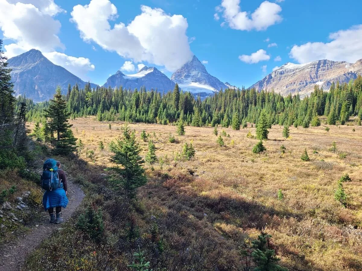
From the pass, it’s a pretty easy and scenic 213 meters (700 feet) back down through a larch forest to Assiniboine Lodge and Lake Magog campground. Mount Assiniboine comes into view towards the very end, once you get passed the Naiset Huts on the way to the Lodge.

Heading into Mount Assiniboine from Wonder Pass
Hiking from Lake Magog to Mount Shark: The hike out
Hiking out from Lake Magog to Mount Shark is easier than hiking in. The climb up to Wonder Pass is much gentler from the Lake Magog side, but the downclimb off the other side with a heavy pack on your back could be rough on the knees.
Campgrounds on the hike from Mount Shark to Mount Assiniboine
Even though it’s a long hike in to Mount Assiniboine from Mount Shark, many people choose to hike it entirely in one day. For strong hikers and backpackers, it’s doable, as the first half of the hike is flat and fast, and the latter half has one significant climb up to Wonder Pass from Marvel Lake.
However, many people do decide to break it up into two days, and there are three campgrounds en route that are conveniently all located about halfway on the trail.
Big Springs (Br9): 9.5 km (6 miles) in from the Mount Shark trailhead
Marvel Lake (Br 13): About 13 km (8.2 mi) from Mount Shark
McBride’s Camp (Br14): About 13 km (8.2 mi) from Mount Shark
Each of these sits at or near the junction that splits towards Marvel Lake and Wonder Pass, making them an ideal halfway point to set up camp and break up the hike.
All three sites are in Banff National Park, so you’ll have to make reservations for any one of these in advance here starting in March of the year you plan on visiting.
How to reserve these Banff campsites: Once on the site, select the Backcountry tab, and then make sure the Backcountry Zone button is selected. Then select Banff, Kootenay and Yoho Backcountry from the dropdown menu, and your arrival date and party number. Finally, the access zone will be “Bryant Creek Trailhead”.
Once you’ve selected all of this and hit Search, it will bring you to a map of the area where you can click on the each campsite to check for availability.
The cost to make a backcountry reservation in Banff is $12.75 CAD per person per night, with an $11.50 reservation fee. Make sure to either print your confirmation or save a screenshot of it on your phone to show a ranger if they come by.
How to hike to Mount Assiniboine from Mount Shark via Assiniboine Pass
From Mount Shark, you can also hike into Mount Assiniboine via Assiniboine Pass. You’ll hike from Mount Shark through the same forested valley as you would for Wonder Pass. However, at the 13 km (8 mile) part of the hike, the trail splits and you can either go towards Marvel Lake and Wonder Pass, or continue ahead up to Assiniboine Pass. We have the least knowledge of this Mount Assiniboine hiking route, but have read that it’s less scenic than Wonder Pass while being slightly easier (more gradual climbing). AllTrails pegs this hike at 25 km (15.5 mi) with 850 m (2800 ft) of elevation gain to the Lake Magog campground.
One thing to note is that there are two paths- a high route, and a lower horse trail around the pass. The high route over the pass is closed each year in August and September for Grizzly activity, but you can still take the lower horse trail.
Just as with the hike to Wonder Pass, you can break it up by staying at one of the three campgrounds near the halfway point, and will require reservations through Banff’s backcountry reservation website.
Through-hiking Mount Assiniboine Provincial Park: Hiking from Sunshine Village to Mount Shark

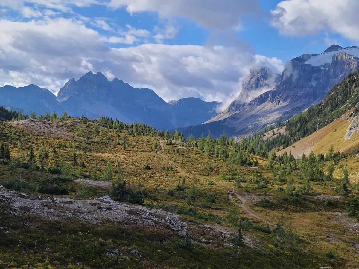
Hiking near Lake Magog in Mount Assiniboine Provincial Park
Can’t decide which hiking route to Mount Assiniboine you want to take? Then combine them into one big through-hike through Mount Assiniboine as a point-to-point hike! You can hike in from Sunshine Village, visit the core area, and hike out to Mount Shark, or vice versa. This is the most ideal way to hike to Mount Assiniboine as you never hike the same thing twice, but unfortunately, it’s a little bit logistically complicated. While there used to be a public shuttle that transported hikers between trailheads, that no longer exists, so it’s up to hikers to arrange their own transportation logistics between trailheads. The trailheads are about 80 km (or 1.5 hours) apart, so it takes some coordinating.
Here are your options for arranging transportation for a Mount Assiniboine through-hike:
Have two cars. Stage one at your ending trailhead and drive everyone to the start. That way you can all hike together to the car you staged and drive back to grab your second car when done.
Find someone along the trail who might be able to give you a ride. This is actually easier than it sounds. If you talk to enough people, you’re bound to find someone who is hiking out the same direction and same day as you and may be able to give you a ride. This is easier to do if you are hiking out via Mount Shark. It’s far less likely that someone hiking out to Sunshine Village is driving to Mount Shark or the Kananaskis area right after their hike and would be able to give you a ride back to your car. But if you are hiking out via Mount Shark, someone might at least be able to give you a ride back to Canmore. From Canmore, you can take the public bus back to Banff.
Helpful tip: If you plan to do this, we would suggest parking your car right in Banff and taking the free shuttle up to Sunshine Village to start your hike. You might not be able to find a ride back to Canmore, and ultimately, back to Banff until later in the day when people are coming off the trail, and if you parked up at the Village, you’ll have to worry about getting back to Banff in time to get the last shuttle up to Sunshine when you’re done hiking. If instead you park in downtown Banff, you can just take the bus from Canmore to Banff and get right to your car without having a huge time constraint to worry about.
Hitchhike. This is a risky option, but we have personally met people who were able to do this. I’d recommend parking at your finishing lot and trying to hitchhike to your starting trailhead. That way, you know your car will be waiting for you when you finish and you won’t have to risk being stranded at the end of the hike.
Try arranging transportation with other hikers before you hit the trail. We’ve tried to find some sort of online forum or Facebook group where Assiniboine hikers could discuss logistics and make plans to arrange transportation (we’ve seen sites like this for other hikes, like those in New Zealand), but we didn’t have any luck (if you know of any, please let us know in the comments below!). If you can find someone beforehand who is hiking the trail at the same time as you, you can arrange a car shuttle with them in advance. Or, you can arrange for a key swap. If you’re hiking in opposite directions, you can swap keys in the core area and then meet with your cars at the end.
Private taxi service. Finally, the last option is to arrange a private ride. There’s a cab service in Canmore that might do this if you inquire, but expect to pay hundreds of dollars for the service.
Our recommended route for hiking to Mount Assiniboine Provincial Park
The hike from Sunshine Village to Mount Shark is the best way to hike to Mount Assiniboine!
Through-hiking is definitely ideal for hiking to Mount Assiniboine, and if you can swing the logistics, we would recommend hiking in from Sunshine Village and hiking out via Wonder Pass to Mount Shark. Hiking in via Sunshine Meadows is much easier than out, and the hike out via Wonder Pass is easier than the hike in, so you get to hike the best direction both ways and avoid the huge climbs over both Citadel and Wonder Passes. Plus, the views are better in these directions, too! Hiking in via Sunshine Meadows will give you great views of Mount Assiniboine along the way, and hiking out via Wonder Pass will have you looking out over Marvel Lake on your way down the pass. It’s a win-win!
Hiking down from Wonder Pass towards Marvel Lake
Another option for combining hiking routes to Mount Assiniboine is to hike in via Wonder Pass and hike out via Assiniboine Pass. This way, you hike a loop but you don’t have to deal with the transportation logistics.
How hard is the hike to Mount Assiniboine? And is it worth it?
On paper, the hikes to Mount Assiniboine via either Mount Shark or Sunshine Village don’t seem too hard. They are pretty low elevation gain relative to the distance hiked. But remember, they are long hikes that have steep climbs, and with heavy packs on while carrying days worth of stuff, these hikes can be pretty exhausting, so we would rate them as moderate to hard.
Also, because of how long these hikes are, their elevation profiles usually get crammed into a small space that doesn’t distinguish all the smaller climbs and descents, making the hike look less daunting than it really is. We learned this the hard way on the trail from Sunshine Village, where we realized these zoomed out elevation profiles don’t show all the smaller but steep ups and downs along the trail that all really add up! Add to that any bad weather (we had two straight days of rain hiking in!) and you’ll be testing your limits for sure.
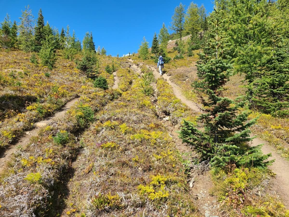
Short steep climbs are frequent on the hike from Sunshine Village to Mount Assiniboine
While there are people who do these hikes to Mount Assiniboine in one push, we would really recommend breaking up the hike into two days if you can, especially if you’re coming in from Sunshine Village. This will make the hike more manageable, and will also leave you with enough energy to explore the core area…after all, that’s the whole reason you’re making this journey! We’ll go over different Mount Assiniboine itineraries in a bit to help give you an idea of how to plan your time and break up your days.
Which hike to Mount Assiniboine is the easiest?
We had read in some places that the hike to Mount Assiniboine from Sunshine Village is easier and less strenuous than the one from Mount Shark, but after doing it ourselves, we would have to respectfully disagree. In all fairness, we didn’t hike in or out via Mount Shark, but just based on our personal experience on the trail and on what we learned about the Mount Shark trail from talking with (more like commiserating with) other fellow hikers, the hike to Mount Assiniboine via Wonder Pass seems to be the easier way. We also think that the fact that more people seem to be able to hike in or out from Mount Shark in just a day despite it being the same distance as the way from Sunshine Village attests to it being a little less difficult.
The route from Mount Shark starts off on a relatively flat path that remains pretty easy and fast for the first half of the entire hike. The big steep climb comes as you head away from Marvel Lake and up to Marvel Pass (and we have heard the switchbacks are pretty brutal). But once you get to the pass, it’s smooth sailing down to Lake Magog.
The trail from Sunshine Village is a bit rougher, in our opinion. The overall route has a lot of smaller steep ups and downs that wear on you, especially through the Valley of Rocks which seems to never end!
Both are equally long hikes, though, and really, it all comes down to the distance you are comfortable hiking with (while carrying a full pack!).
With that said, is hiking to Mount Assiniboine worth it? I mean, there’s a helicopter you can take to be there in 10 minutes or less! Why would you even entertain the entire of spending several days hiking?!
We hear ya. Trust me. We had these thoughts after being utterly exhausted from the hike in while simultaneously looking up to see the helicopter simply shuttling people in and out.
But, we think it is totally worth it. Hiking into Mount Assiniboine allows you to experience a lot more of the park, get more amazing views, and gives you a sense of accomplishment that you just can’t quite get from a ten minute helicopter ride.
With that said, we don’t wish we hiked both in and out from Mount Assiniboine, especially via the Sunshine Village route. We wish we could have done a through-hike from Sunshine Village to Mount Shark as we described above, or taken the helicopter one way to get the best of both worlds and to avoid killing ourselves too much on the trail.
So, let’s get into how to take the helicopter to Mount Assiniboine and what we think would be the best way to get to and from Mount Assiniboine…
How to take the helicopter to Mount Assiniboine Provincial Park

The helicopter to Mount Assiniboine
Does hiking to Mount Assiniboine sound a bit much? Taking the helicopter is a much easier option, and you’ll get amazing views over both Spray Lake and Marvel Lake on the ride, but it does come with a much higher price tag…
The helicopter leaves from both Canmore and the Mount Shark helipad (near the Mount Shark trailhead) in Kananaskis and brings you right to the Assiniboine Lodge (the helipad is just a few hundred meters away from the lodge). Flight days are Wednesdays, Fridays, and Sundays (or Mondays if a holiday weekend).
The helicopter is run by the Assiniboine Lodge, and all information regarding reservations, schedules, and updated costs can be found here.
Let’s go over all the options for using the helicopter to get to the core region of Mount Assiniboine.
The helicopter from Canmore to Mount Assiniboine
The first option for flying to Mount Assiniboine is to fly right from Canmore. This is the most popular option because of how convenient it is, but there are limited spots and can be tough to get. If you plan to take the helicopter both ways, flying from Canmore is the most ideal.
Cost of the flying between Canmore and Mount Assiniboine: $215 CAD + tax one way per person. There’s a 40 pound bag limit, with a $10 per pound excess baggage fee.
The helicopter from Mount Shark to Mount Assiniboine
The other option for flying to Mount Assiniboine is to fly from the Mount Shark helipad. This is located on Mount Shark Road, about 1.5 km before the Mount Shark trailhead. The Mount Shark flight is slightly shorter and cheaper, but it requires you to drive all the way into Kananaskis. Flying in/out from Mount Shark would be ideal for those who plan on hiking one way and flying the other way. You can park at the Mount Shark trailhead, walk to the helipad and fly in, and then hike out via Wonder Pass right back to your car at the trailhead, or vice versa. Do keep in mind that there is about 1.5km between the helipad and trailhead parking lot, so you might want to save that bit of walking for your flying day, and not the day you’ll already be hiking double digit miles!
Cost of flying between Mount Shark and Mount Assiniboine: $205 CAD + tax one way per person. There’s a 40 pound bag limit, with a $10 per pound excess baggage fee.
Combining the helicopter and hiking to Mount Assiniboine
Admittedly, our biggest regret from our trip to Mount Assiniboine was not planning to take the helicopter one way. We wanted to preserve the backcountry experience by only hiking, and get the sense of accomplishment from doing it that way. But in the end, we achieved both of those with our one way hike, and looked up in envy as the helicopter shuttled people out as we began our long hike back out to Sunshine Village at the end of our time exploring the core region.
Our recommendation for getting to Mount Assiniboine would be this:
Take the helicopter in from Mount Shark and hike out via Wonder Pass back to your car. The main reason to take the helicopter in is because it will save your energy and strength to do all the amazing hikes in the core area of Assiniboine (the whole point of going!). Speaking from our own experience, by the time we got to the core area after two days of hiking, we were feeling exhausted already and hiked a little less in the core region than what we were hoping to do. Taking the helicopter in would have gotten us to the core region on a fresh pair of legs ready to go! And then we could still enjoy the hike out later back to our car.
The second reason to take the helicopter in is because the hike out via Wonder Pass would be much easier than the hike in, as you would be going down and not up the steep side of the pass, plus with a slightly lighter pack as you would have gone through most of your food by then.
The Assiniboine Park boundary at the top of Wonder Pass
If you want to take the helicopter but also hike in via Sunshine Village, this is possible, too, but will require a little bit more logistics. Here’s how you can do it:
Most ideal: Plan to take the Canmore helicopter. To do this, park in Canmore on the morning of your hike. Then take the public bus to the town of Banff, where you can hop on the free shuttle up to Sunshine Village to start your hike. Then when you take the helicopter out you’ll fly right back to Canmore where you’ve left your car.
Less ideal: Taking the Mount Shark helicopter. In this case, do the same steps above, but plan either in advance or somewhere along the trail for someone to give you a ride from Mount Shark back to Canmore where your car is waiting. We found this to be pretty easy, as so many hikers along the trail will be hiking back out via Mount Shark and heading back in the direction of Canmore, but it’s still a little risky.
Hiking in from Sunshine Village and taking the helicopter out is a great way to do this hike because it gets you views from each side of the park, whether it be by foot or air.
Can I book a helicopter at the Assiniboine Lodge?
Let’s say you’re overambitious like us, decide to scrap the helicopter all together and hike both ways…but once you get to the core region already pretty exhausted, you start cursing your past self for not booking the flight out.
At this point, you might be asking yourself, is it possible to book the helicopter at the Assiniboine Lodge last minute and avoid the long hike out? Yes! But there are some caveats…primarily if you hiked in from Sunshine Village.
First, it is highly likely that the only flights available will be the ones going to Mount Shark, not to Canmore, as those are limited and very popular. This was the case for us (yes, we really tried to get a flight out!). If there was a flight available to Canmore, it would have been easy…just hop on that and take the public bus from Canmore back to Banff/Sunshine Village.
But because only the flight to Mount Shark was available and we didn’t plan to take the helicopter in advance, the logistics were complicated. The ranger advised us to try to find someone who can drive us from the helipad to Canmore, and then from Canmore we could take the public bus to Banff. Thinking this was a lost cause, we were pretty psyched to find that the very first group we asked just minutes later offered to give us the ride back to Canmore on the day we needed it. Score!
But…the issue was that our car was parked up at Sunshine Village, not in downtown Banff. The group would not be hiking out until about 3 pm that day, which would be fine for us getting to Canmore and catching a bus back to Banff. But we would still need to get the shuttle from Banff up to Sunshine Village, which stops running much earlier, and the time frame in which we would be getting back to Banff to catch the Sunshine shuttle was really cutting it close (we also didn’t know any of the bus and shuttle schedules because we weren’t expecting to do this, so it was hard to figure things out! There is no wifi or service out here, so learn from us be prepared with any and all information that might be helpful to you BEFORE coming to the park!). Because of the early shuttle times, we would have to rely on someone else at the helipad or trailhead offering us a ride earlier, and we really didn’t want to risk being stranded somewhere and not able to get back to our car. If we had parked in the town of Banff to begin with and taken the shuttle up to the Village to start our hike, we would have been fine! So moral of the story, park in Banff and not up at Sunshine VIllage if you think you may bail on your hike out!
If you hiked in from Mount Shark to begin with, it is likely there will be a flight back to the Mount Shark helipad available at the Lodge and it’s easy enough to get back to your car that way.
How to book the helicopter at Assiniboine Lodge
The only time the Lodge staff is available to help campers and answer questions is during the evening when one of the staff does their rounds through the campground, or at the Lodge tea time from 4-5pm on non-flying days, and they will only know flight availability for sure and be able to book your flight during tea time, so you’ll have to plan your time around being at the Lodge then.
They did say they would accept a credit card for booking the helicopter, but I think it would come with a pretty steep fee for using the card. So you might want to have enough CAD cash on you just in case.
Using the helicopter to fly gear into Mount Assiniboine
One last way you can use the helicopter to Mount Assiniboine to your advantage is to use it for flying in gear only. At $5 CAD per pound, it can still be an expensive option depending on how heavy you pack. But it will allow you to hike in to Mount Assiniboine with just a day pack and can significantly increase your speed on the trail, and may make a day hike into Mount Assiniboine from either direction way more doable. You’ll have more time and energy to spend on hikes in the core region, which is always a good thing!
Speaking of which…
Things to Do in Mount Assiniboine Provincial Park
Okay, now that we’ve gone over all the complicated logistics of how to get to Mount Assiniboine and where to stay, it’s time to go over the fun stuff…all the things to do in Mount Assiniboine once you’re there!
Here’s the list of our favorite places in Mount Assiniboine Provincial Park.
The Niblet/Nublet/Nub hike
The view from the Niblet- one of the best things to do in Mount Assiniboine
This hike has to be the number one thing to do in Mount Assiniboine Provincial Park. From this hike, you’ll get those iconic views that you see any time you google Mount Assiniboine, and believe us when we say that these views are just as good in real life, actually…even better. If there’s one thing you do in Mount Assiniboine, it’s this hike, and it made our journey to get to Mount Assiniboine completely worth it.
The Niblet/Nublet/Nub hike is a series of three successively higher peaks, all with gorgeous views of the surrounding area, but with particularly amazing views over Sunburst, Cerulean, and Magog Lakes, Sunburst Peak, and Mount Assiniboine.
The Niblet is the first peak/viewpoint at 7,840 feet (2,390 m) tall, then the Nublet at 8,300 feet (2,530 m), and finally the Nub at 9,000 ft (2,743 m). Each peak gets successively more challenging to climb, but the views from all three are absolutely incredible. So the good news is that you can go as far as you like before turning around, and choosing to stop early won’t make you feel like you’ve missed out on anything. In fact, many people say the views from the Niblet are even better than those from the Nub, so if you want to stop there, it’s perfectly fine!
The trail between the Niblet and Nublet in Mount Assiniboine
There are a few trails to get up to the Niblet (and then from there, up to the Nublet and Nub if you want to continue on). One starts from the Assiniboine Lodge and is a gradual climb through the forest up to the viewpoint. The other starts from the Lake Magog Campground and is a steeper climb up to the Niblet but passes by the picturesque Sunburst and Cerulean Lakes (we talk more about these below). You can do either one as an out and back, or combine them to make a nice loop.

This map is taken from the Assiniboine Lodge site. Here we have highlighted the loop trail up to the Niblet and Nublet from both the Lodge and the campground.
Depending on how far you go, this Mount Assiniboine hike can take anywhere from a couple hours to a half day. We’ve written an article about our experience hiking up to both the Niblet and the Nublet and share everything you need to know about this incredible Mount Assiniboine hike, so be sure to check that out if you want to learn more!
Sunburst and Cerulean Lakes

Nice evening reflections off Sunburst Lake- an amazing place to visit in Mount Assiniboine
Another short but amazing hike in Mount Assiniboine is the one to both Sunburst and Cerulean Lakes. These picturesque lakes are close to the Lake Magog Campground via a relatively flat and quick walk, so they are easy to get to and a great thing to do in Mount Assiniboine at any time of day for relaxing and enjoying the views. On a sunny day, these lakes are a beautiful bright blue.
Sunburst and Cerulean Lakes from the Lake Magog Campground:
Shortly after the entrance to the campground, there is a signed trail to the right that leads to Sunburst and Cerulean Lakes. From here, it’s a quick .4 mi (.6 km) flat walk to the edge of Sunburst Lake. From here, the path continues along the right side of the lake, and there are lots of herd paths that go down to the shore and run along the lake as well. We recommend continuing along to the other side of the lake for the absolute best views. Over here, there’s a scenic cabin and amazing views back over the lake toward Mount Assiniboine and the dominating Sunburst Peak. As you continue to walk along the lake, you’ll find lots of little nooks to enjoy the views from.
Sitting on the shore of Sunburst Lake in Mount Assiniboine
After about a mile on the trail (1.6 km), and very shortly after Sunburst Lake, you’ll reach Cerulean Lake, again with minimal elevation gain. From this lake, you can look back and get a great view of Sunburst Peak towering over the lake.

Walking along the shore of Cerulean Lake in Mount Assiniboine, with Sunburst Peak towering above the lake
From here, the trail turns away from the lake and begins its ascent up to the Niblet. You can also head to Elizabeth Lake, another alpine lake sitting at the base of Nub Peak.
Sunburst and Cerulean Lakes from Assiniboine Lodge:
The lakes are a bit further from the Lodge, but not by much. From the Lodge, you’ll hike the trail towards the campground for about 1 mile (1.6 km) or so until you reach a junction on the right that leads to the lakes. This additional mile along the lake is easy, flat, and quite scenic, with frequent views over Lake Magog and Mount Assiniboine. From the junction, it’s the same path to the lakes as described above.
Lake Magog
Standing at the shore of Lake Magog in Mount Assiniboine Provincial Park
Lake Magog, sitting at the base of Mount Assiniboine, is at the heart of the core region of Mount Assiniboine Provincial Park, and it’s totally worth it to explore and enjoy the views around the lake while you’re out here!
From Assiniboine Lodge, you get great head on views of Lake Magog and Mount Assiniboine, but the lake was surprisingly quite a bit further down from the lodge than I thought! A little herd path leads down through the brush to get to the rocky Lake Magog shoreline, and from here you can walk along the water’s edge and get every view imaginable of the beautifully blue lake, Mount Assiniboine, and the surrounding peaks. It’s a great place to hang out and relax after a full day of hiking the trails.

Lake Magog becomes a beautiful turquoise color in the sun
You can also access the Lake Magog shore from the campground. All the way at the back of the campground is the stream from which you can filter water, and from here there’s a steep path down to the lake’s shore.

The view of Lake Magog and Mount Assiniboine from the back of the campground. Here, you can access the lake with a steep downhill hike.
The trails between Assiniboine Lodge and Lake Magog Campground (both a higher one, and a lower one closer to the lake) are also very scenic, with lots of great views out towards the lake and mountain. It seemed that there used to be a few herd paths from here down to the lake, but many are closed off for restoration. So if you want to access the lake shore directly, it’s best to do it from the Lodge. But we’d still recommend walking along the trails around the lake towards the campground for more amazing views.

The scenic trail between the Assiniboine Lodge and the Lake Magog campground
View over Lake Magog from the trail that runs along Lake Magog to the campground
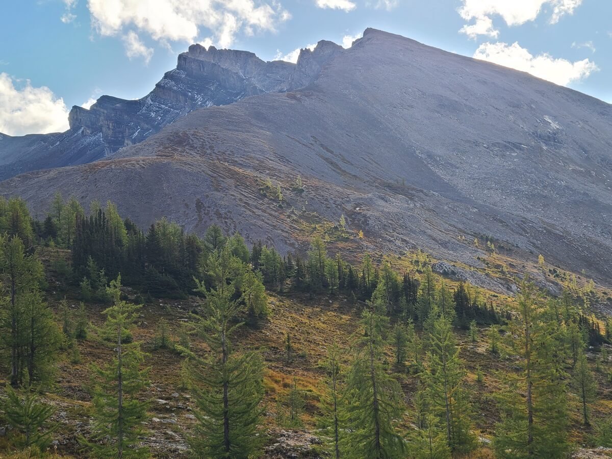
Wonder Pass
Wonder Pass is the gateway into Mount Assiniboine Provincial Park from the eastern boundary, and is another must-see place in Mount Assiniboine. If you’re hiking either in or out from Mount Shark, you’ll likely hike over Wonder Pass on your way, but if you flew in or hiked in from Sunshine Village, then it’s worth the short hike (about 3 hours round trip) to Wonder Pass.
This map is taken from the Assiniboine Lodge website and highlights the hike to Wonder Pass. The solid red trail is from the Assiniboine Lodge, while the blue trail is the additional path from the Lake Magog campground. The dash red line is the detour to the Wonder Pass Viewpoint.
From the Lodge, it’s about 1.9 miles (3 km) to Wonder Pass, and about 200 meters (700 feet) up. If you’re coming from the Lake Magog campground, it will be about an extra 1.2 km (0.8 miles) or so more. As you hike the trail from the campground back towards the Lodge, there will be a junction where you can take a trail to the right. This trail hugs Lake Magog, giving great views of the lake and mountains, and meets up with the trail from the Lodge at the Naiset Huts.
The trail that runs along Lake Magog from the Lake Magog Campground
Views of Mount Assiniboine dominate the early part of the hike to Wonder Pass
From the cabins, you’ll walk along a boardwalk across a meadow with nice mountain views and eventually make it to Gog Lake.
Heading towards Wonder Pass

Passing by Gog Lake on the way to Wonder Pass

From here, the climbing begins as you hike through a quiet larch forest, somewhat steeply at times, but it’s nothing too strenuous. Through the forest, you get occasional views back towards the Lodge and the Nub, and you’ll even pass a cool waterfall.
Hiking through the larch forest beneath Wonder Pass
Waterfall views on the way to Wonder Pass

Beautiful views are around every turn on the Wonder Pass hike in Mount Assiniboine
Once you emerge out of the forest, it’s a gentle climb up to Wonder Pass. Be sure to look behind you, because the views as you hike this last part are amazing.
Nearing Wonder Pass (the ridge up ahead!)

The view back over Mount Assiniboine from Wonder Pass!
Atop Wonder Pass, you straddle the border of not only Banff and Mount Assiniboine Parks, but also of Alberta and B.C.! There are amazing views in all directions. You can look back from where you came to see the Nub and its surrounding peaks in the distance, and on the other side of the pass lies the peaks that surround Marvel Lake below (not in sight here).

The view off the other side of Wonder Pass, towards Marvel Lake
Looking up at Wonder Peak from the Pass
Wonder Pass Viewpoint
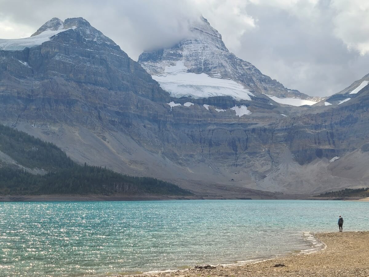
The views from Wonder Pass are amazing, but we would recommend hiking a little bit further down the other side of the pass if you want slightly better views of the peaks that surround Marvel Lake below. A large sprawling meadow lies just below this side of Wonder Pass, and it becomes more and more scenic the further you hike through it. We found that the further we walked, the better the views got and the more the jagged peaks on this side of the pass came into view.
Surprisingly, you have to hike quite a bit down to actually see the beautifully turquoise Marvel Lake that sits just beneath Wonder Pass, which we didn’t realize! As we continued hiking, we kept looking out and thinking that if we got out to a certain point where it looked like the meadow ended and the views opened up that we would be able to look out and see the lake, but each time, that wasn’t the case…the meadow just seemed to keep going and going!
We did vaguely know that there was a side trail off the pass to Wonder Pass Viewpoint, an overlook where we would be able to see both Marvel Lake and Gloria Lake and their epic mountain backdrop, but we admittedly didn’t know many details about this trail, how long it was, or what it entailed.
Not too long after dropping off Wonder Pass on the Marvel Lake side, we saw an obvious split in the trail marked with a small cairn pile. We veered left to head to the Wonder Pass Viewpoint.
The junction found just a short way down from Wonder Pass. The right path continues down to Marvel Lake while the left path goes to the Wonder Pass Viewpoint.
Hiking through the meadow beneath Wonder Pass toward the Wonder Pass Viewpoint
Like we said above, we kept thinking that the viewpoint was close, and if we just got to a point in the distance that looked as if the meadow ends, we would see the view of the lakes, but it was never the case. The meadow kept going on, and the trail kept dropping further from the pass behind us. We admittedly got quite frustrated not knowing where this trail was taking us, but the lure of eventually reaching the viewpoint and seeing Marvel Lake kept us going.
After almost 2 km (about 1.1 miles) from the pass, and after dropping nearly 120 meters (400 feet), we decided to call it quits. We didn’t want to hike too far off the pass on this side, as we were planning on hiking the Nublet later in the day (less than ideal weather the day before forced us to squeeze all of our hikes in the core region into one day). We did end up getting a fleeting glance of the brilliant turquoise color of Gloria Lake from one point along the trail, though, but weren’t not sure how close we ended up being to the actual viewpoint. It was still worth hiking further along this side of the pass though, because even though we didn’t see Marvel Lake or Gloria Lake in its entirety, the views of the surrounding peaks and glaciers opened up and it was really beautiful!
A view of Gloria Lake and the surrounding peaks from the Wonder Pass Viewpoint trail
The epic mountain views you get on the Marvel Lake side of Wonder Pass
Looking back up at Wonder Pass from the Wonder Pass Viewpoint trail
If you have more time and energy to hike to the Wonder Pass Viewpoint, we recommend doing it (and letting us know all about it!).
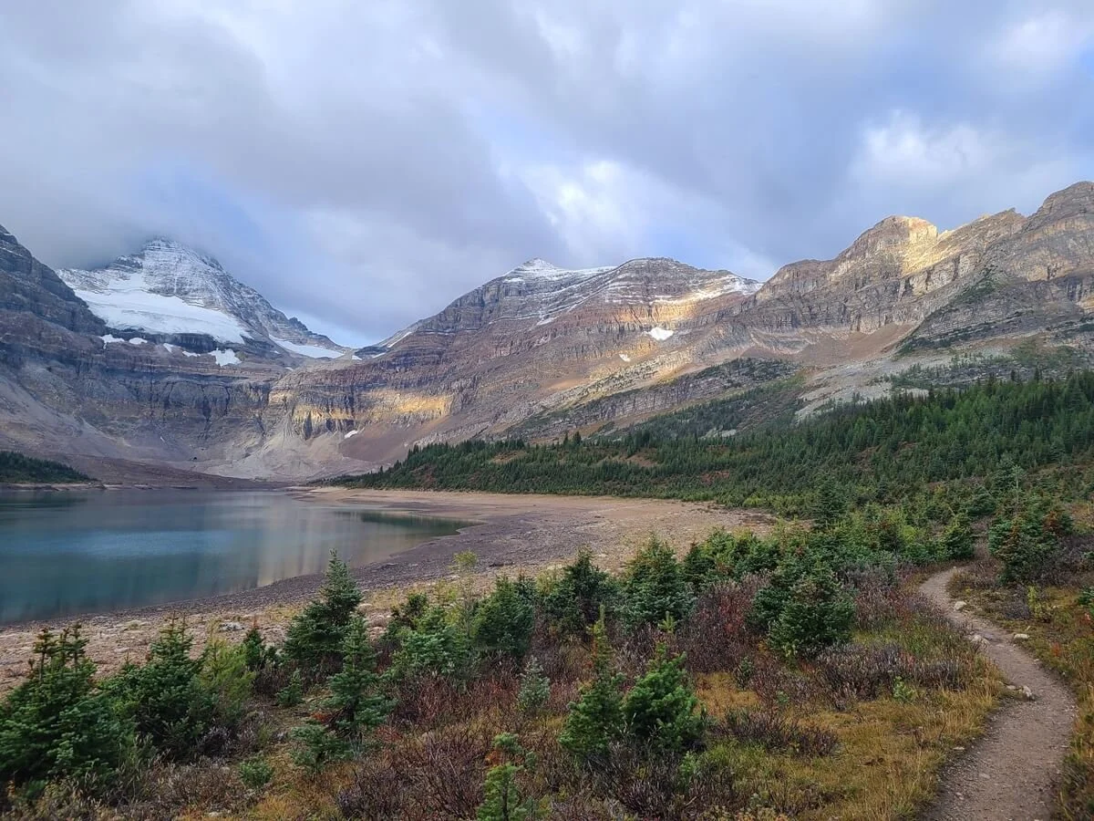
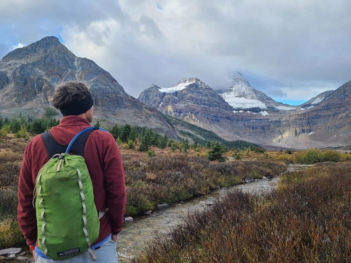
Og Lake

The view of Mount Assiniboine from the trail near Og Lake (just out of view on the left)
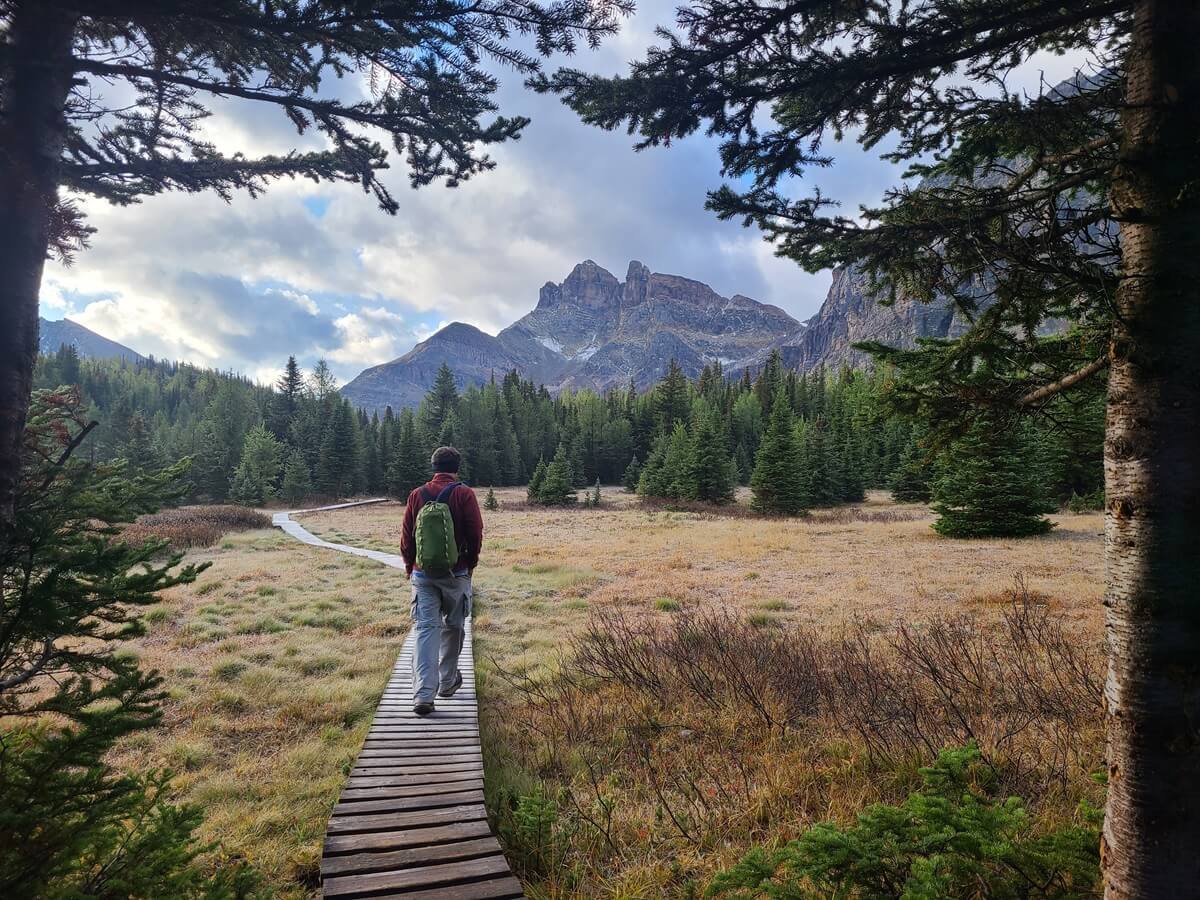
Og Lake is another picturesque lake near the core area of Mount Assiniboine. If you’ve hiked in from Sunshine Village, you’ve already passed through here, but if you flew in or hiked in via Mount Shark, then hiking to Og Lake is a good half day hike in to do in Mount Assiniboine.
From Assiniboine Lodge, the hike to Og Lake is about 6.4 miles (10.3 km) roundtrip and with only about 500 (152 m) feet or so of elevation gain. As you leave the Lodge behind, the trail traverses a wide open meadow with amazing views back to Mount Assiniboine on a clear day.

This map taken from the Assiniboine Lodge highlights the trail from the Assiniboine Lodge to Og Lake

The trail to Og Lake (on the right) runs through an open, flat, and very scenic meadow with awesome views back to Mount Assiniboine
From the far side of Og Lake (at the Og Lake Campground), Mount Assiniboine towers above it. When we were there, though, water levels were low and Og Lake was pretty dried up, so the view wasn’t as picturesque as we were anticipating. But we still thought it was a nice spot. If you walk a little bit further past Og Lake, we think the view gets a little bit cooler, with Mount Assiniboine peaking prominently up over the Valley of the Rocks.

If you hike a bit further past Og Lake, you can get this view over the Valley of Rocks, Og Lake, and Mount Assiniboine
How Much Time Do I need in Mount Assiniboine Provincial Park?
With all the incredible things to see in Mount Assiniboine and the effort it takes to get there, how long should you stay in Mount Assiniboine?
We would recommend dedicating two days for the core region of Mount Assiniboine Provincial Park. This will give you enough time to do a couple of half day hikes, hang out by the lakes, and account for a little bit of bad weather. Three days would be ideal to really enjoy your time there and work around bad weather (which is likely).
If hiking in and/or out of Mount Assiniboine, we would suggest dedicating 1-2 days per way, depending on your route and how strong of a hiker you are.
So, overall, if you are hiking in and out of Assiniboine, we would recommend reserving 5-7 days for your trip. A lot of people don’t have that kind of time and many choose to hike in faster, use the helicopter, or just spend less time in the core region, which is all possible. We think any time you get to spend out here is totally worth it.
Mount Assiniboine on a clear day
For us personally, we planned 5 days for our visit to Mount Assiniboine…a day and a half to hike in from Sunshine Village, a day and a half or so in the core (one day for the Nub, one day for Wonder Pass/Wonder Peak), and then a day and a half to hike out. Weather made it so we only had only one full day in the core to do everything we wanted, so we had to shorten our hikes- not do the entire hike to the Nub, for example, and just go to the Nublet, and then cut out Wonder Peak…but let’s face it, we were too exhausted to climb that anyway after the hike in!…so we were still able to fit everything we wanted to do into that one day.
If you’re flying in and out, two to three full days would be good to spend in the core, but remember, your schedule will be dictated by the helicopter schedule.
Mount Assiniboine itineraries

The Assiniboine Lodge cabins on a moody day in Mount Assiniboine. We’d recommend any Mount Assiniboine itinerary have some wiggle room for bad weather!
With so much information thrown at you in terms of how to get to Mount Assiniboine, where to stay, and what to do, there are tons of different ways to make a Mount Assiniboine itinerary, and it can all get pretty confusing pretty fast…trust us, we feel your pain. So to help you out, here are some suggested itineraries for Mount Assiniboine Provincial Park based on how you choose to get there. These Assiniboine itineraries range from 3-6 days long, with alternatives to shorten or lengthen them accordingly.
Mount Assiniboine itinerary 1: Hiking to Mount Assiniboine via Sunshine Meadows
Day 1: Hike to Howard Douglas, Porcupine Campground, or Og Lake Campground depending how late you start in the day and how strong/fast of a hiker you are.
Day 2: Hike to Lake Magog Campground. Relax on the shore of Lake Magog and soak in the views.
Day 3: Hike the Niblet/Nublet/Nub. End the day relaxing at Sunburst and Cerulean Lakes.
Day 4: Hike to Wonder Pass and Wonder Pass Viewpoint. Head to the Assiniboine Lodge for 4 pm tea time (only on non-flight days…if that’s not today, you can do this on Day 3).
Day 5: Hike back out to Og Lake, Porcupine, or Howard Douglas Campground.
Day 6: Hike back to Sunshine Village.
How to shorten this Mount Assiniboine itinerary:
Hiking all the way to Og Lake on Day 1 means on Day 2 you will have a short easy hike to Lake Magog and most of the day can be used to explore the core region. So, you can shorten the itinerary by doing one of the hikes (the Nublet or Wonder Pass on Day 2), the other on Day 3, and then removing day 4 from the itinerary, making it a total of 5 days instead of 6 (this is what we did!).
Hike all the way to Lake Magog from Sunshine Village in one day. We wouldn’t recommend this, but we did cross paths with a few people who did this.
The shortest Sunshine Village to Mount Assiniboine itinerary we saw someone doing was:
Day 1: Hike to Og Lake
Day 2: Hike to Lake Magog and do the Nublet
Day 3: Hike from Lake Magog all the way back to Sunshine Village
This is an incredibly aggressive itinerary, but if you really want to see the core region and have little time, it can be done.
We have a post on our hike from Sunshine Village to Mount Assiniboine, so check that out if you want to learn more and plan out your own Mount Assiniboine itinerary!
Mount Assiniboine itinerary 2: Hiking to Mount Assiniboine via Mount Shark
Day 1: Hike to Marvel Lake or McBride’s Campground
Day 2: Hike over Wonder Pass to Lake Magog. Relax and hangout at the Lake Magog shore or grab afternoon tea at the Lodge if it’s a non-flight day.
Day 3: Hike the Niblet/Nublet/Nub. Hang out at Sunburst and Cerulean Lakes in the evening.
Day 4: Hike out via Assiniboine or Wonder Pass to Marvel Lake or McBride’s Campground
Day 5: Hike back to the Mount Shark trailhead
To shorten this Mount Assiniboine itinerary, you can hike to and from Mount Shark to Lake Magog in one day (we met many people doing this, so it is totally possible if you’re a strong hiker). This can shorten your trip to just three days, though we would suggest having one more day in the core in case of bad weather, or to do another day hike, such as to Og Lake.
Mount Assiniboine itinerary 3: Through-hiking Mount Assiniboine
Day 1: Hike from Sunshine Village to Howard Douglas Lake, Porcupine, or Og Lake Campground
Day 2: Hike to Lake Magog and spend time at Lake Magog, Sunburst and Cerulean Lakes
Day 3: Hike the Niblet/Nublet/Nub
Day 4: Hike out via Wonder Pass to Marvel Lake or McBride’s Campground
Day 5: Hike out to the Mount Shark trailhead
You can choose to spend one extra day in the core to make the itinerary longer, or still keep it five days long by hiking out to Mount Shark in one day instead of 2.
Mount Assiniboine itinerary 4: Hike plus helicopter
Day 1: Park at the Mount Shark trailhead and hike the road back to the Mount Shark helipad for your ride into Mount Assiniboine. Spend the afternoon hanging out at Magog Lake, hiking the trails around the lake, and visiting Sunburst and Cerulean Lakes.
Day 2: Hike the Niblet/Nublet/Nub.
Day 3: Hike out via Wonder Pass to Mount Shark
You can extend this by a day by either taking two days to hike out, or spending an extra day in the core region and day hiking to Og Lake and back.
Mount Assiniboine itinerary 5: Hike plus helicopter
Day 1: Park in Canmore and take the public bus to Banff and the shuttle to Sunshine Village. Hike into Porcupine Campground (this will be more realistic as you might be getting a later start today).
Day 2: Hike to Lake Magog. Spend the day relaxing by Lake Magog or Sunburst and Cerulean Lakes.
Day 3: Hike Wonder Pass in the morning. Hike to the Nublet in the afternoon.
Day 4: Fly out to Canmore.
You can make this a five day trip by adding one extra day in the core area and splitting up the hikes to Wonder Pass and the Nublet/Nub into two days.
Mount Assiniboine itinerary 6: Helicopter to Mount Assiniboine
Day 1: Helicopter in from Canmore or Mount Shark. Hike to Wonder Pass in the afternoon,
Day 2: Hike the Niblet/Nublet/Nub. Hang out at Sunburst and Cerulean Lakes.
Day 3: Helicopter back out to Canmore or Mount Shark.
If you have one more day due to the helicopter schedule (for example you flew in on a Sunday, and the next flight out isn’t until Wednesday), do a day hike out to Og Lake and back.
Of course, there a ton of different ways to organize a Mount Assiniboine itinerary based on how much hiking you think you can do each day, how much you just want to relax and enjoy the views, and how much time you have. We hope the Assiniboine itinerary suggestions above help guide you as you create your own perfect itinerary!
What to Pack for Mount Assiniboine Provincial Park
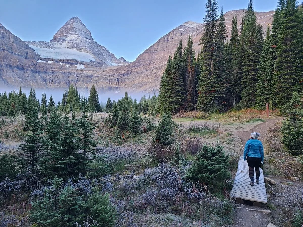
A frosty morning in Mount Assiniboine. Cold weather gear and clothes should be on your Mount Assiniboine packing list no matter what time of year you visit!
Despite there being a whole cozy lodge out here with helicopter service, you are still out in the backcountry and you need to come prepared. Other than some of the obvious essentials, here are some things we would recommend packing for Mount Assiniboine. Keep in mind that if you’re taking the helicopter in, you only get 40 pounds of free gear transfer (and then you’ll be charged for any excess weight).
Cold weather gear and clothing. In Mount Assiniboine, summers are short, but even then, the evenings and nights can be chilly, with temps in the 50s, and passes and summits can be windy and cold. If planning a trip to Mount Assiniboine in the spring or fall, it gets even colder, with May and September bringing daytime temps between the 50s and 60s, and nighttime temperatures in the 40s or even the 30s. Have warm layers, a jacket, hat and gloves, and if you’re camping, be sure to bring an appropriately rated sleeping bag, pad and liner to stay warm at night.
Rain gear. The weather can be unpredictable and crazy at times in Mount Assiniboine. When we visited, we had two days straight of rain, sleet, hail, and thunder. Have a raincoat, waterproof boots, and a pack cover at the very least. Something we are so happy to have purchased (before our trip to Iceland, whose weather is equally as unpredictable) that have been absolute lifesavers are rain pants! They slip on easily over our boots and normal hiking pants and keep us super dry while hiking.
Water bladder and Nalgene bottle. We each carry a 3 L water bladder for hiking, but also an empty Nalgene on the trail for use back at camp. It was also nice to have so that we could fill it with hot water at night and throw in our sleeping bags to help stay warm (a nice little trick for cold weather camping!).
Good hiking shoes/boots. This goes without saying for those backpacking in, but even for those helicoptering in, make sure to bring good hiking shoes (preferably waterproof) if you plan to hit any of the trails, especially the Niblet/Nublet/Nub. These trails get rocky and steep.
Bear spray. This is another hugely important thing to bring on a visit to Mount Assiniboine. Mount Assiniboine is home to Grizzlies, so always have protection on you and keep it easily accessible (i.e. not tucked away in your hiking pack).
You can rent bear spray from a few places in Banff for about $10 CAD per day (we checked out Ultimate Sports and Bear Street Outfitters). If you plan on being in Banff and the area for a long time (more than a week), it might be more cost effective to simply buy bear spray. We had found it on sale at a Cabella’s in Calgary so it was cheaper than renting for the two weeks we were there. When we were done with it, we gave it to our Airbnb host to use since you can’t fly with it. We had also later read that you can give unused cans to staff at a visitor center so that they can use it for bear safety demonstrations.
Navigation/map. As you get near the core region and in the core region itself, there are many intersecting trails. They are well signed at all the junctions but it’s nice to be prepared, know which trails you need to take, be able to track your progress, and have a guide in case you get lost.
First aid and an emergency device. Make sure you have a first aid kit that will allow you to treat minor injuries such as scrapes and blisters. Having an emergency device such as a Garmin InReach is also useful when in the backcountry in case of an emergency. There is zero cell service out here.
Reservations and any pertinent information. Have all reservations saved to your phone and printed out to show the park rangers. Have any pertinent information that you think you may want to reference, such as maps, transportation schedules, and trail descriptions, downloaded and saved to your phone before visiting Mount Assiniboine, because you won’t be able to access it otherwise once you’re there! There’s no cell service throughout Mount Assiniboine Provincial Park and the Assiniboine Lodge does not have wifi or service. Even though we weren’t even thinking about taking the helicopter out before visiting, we sure wished we had all the information we needed about transportation schedules to help us make a better decision regarding flying versus hiking out once we were in the core region.
Cash. If you want to make any purchases at the Lodge during tea time as a hiker, make sure to bring CAD.
Bug spray. The bugs were gone by September when we visited Mount Assiniboine, but we hear the summer months can get pretty buggy.
Sun protection. Bring a hat and sunscreen at the very least. Much of the hike into the core region and the trails in the core region up to the passes and peaks are very exposed to the sun.
Best Time to Visit Mount Assiniboine Provincial Park
We would say that the best time to visit Mount Assiniboine is early July to mid-September. This is likely when there will be no or minimal snow on the trails (although depending on the season, keep in mind that the snow can linger into July or start earlier in September).
Mid-July to mid-August has the warmest weather and is also when the wildflowers are in bloom, but it’s also the buggiest. During these months, daytime temps are in the 70s, but the nights are still cool and in the 50s. By September, the bugs and wildflowers are gone, but the temperatures start to really get cold (into freezing temps at night). We visited Mount Assiniboine in early September, and it was very cold at night (many fellow campers including myself struggled to get warm and sleep) and we woke up a few mornings to frost on our tent.

Freezing nights and chilly mornings are the norm in Mount Assiniboine, particularly starting in September
Mid-to late September means larch season, so it’s a popular time to come. There are tons of larches in the core area of Mount Assiniboine, particularly on the way up to Wonder Pass from Lake Magog, but it will be cold, and you might risk the possibility of snow. If you’re staying in the warm cozy lodge, it won’t be a huge deal, but if you’re camping, it could be a challenge.
Can you visit Mount Assiniboine in the winter? Absolutely. The Assiniboine Lodge is open from mid-February to the end of March for ski touring trips. We have no experience visiting then but check out more on the Assiniboine Lodge site.
Tips for Visiting Mount Assiniboine Provincial Park
Here are a few extra things to keep in mind when planning your visit to Mount Assiniboine.
What is the weather at Mount Assiniboine?
Mount Assiniboine follows typical mountain weather in that it has short summers and unpredictable weather.
In the summer of months of July and August, the temperatures are at their warmest (around the 70s during the day but still dropping into the 50s at night). By September, nights are dipping into freezing territory.
But even in the summer, keep in mind that these are the mountains, and weather out here can be quite unpredictable and unstable. No matter what the forecast says, be prepared for anything- wind, rain, hail, sun- even all in one day. Below is a series of pictures taken in just the span of a few hours after we had arrived at Lake Magog, and you can see how quickly the weather changes!

Rainy and gloomy at Mount Assiniboine
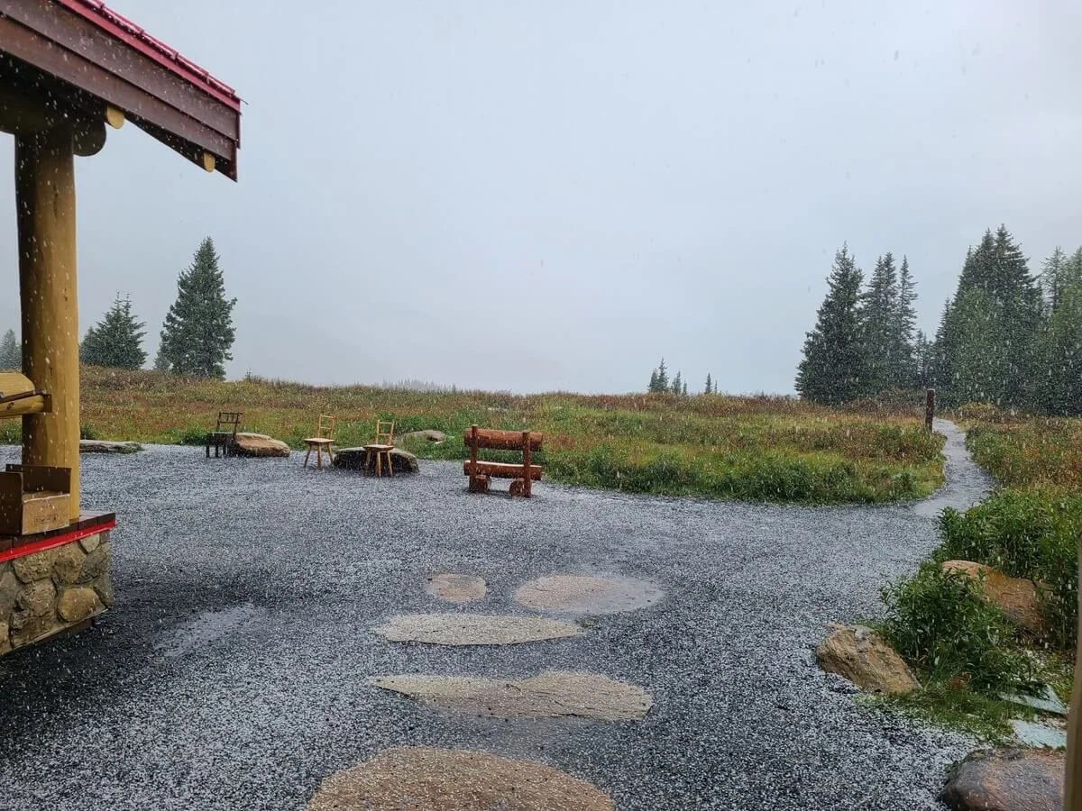
Some good size hail completely shrouding Lake Magog and Mount Assiniboine!

Rain at Lake Magog meant snow on the mountains

After rain comes rainbows!

And finally Mount Assiniboine came out!
In the entire month before our trip to Mount Assiniboine, I found myself checking the forecast obsessively (seriously…like five different sites ten times a day…), and I found that it was kind of was pointless. The weather forecast never remained stable and would say something different every time I checked it. I’d say that it wasn’t until it got with two days of trip did the weather finally remain stable and could be somewhat trustworthy. But clouds and rain can still always sneak their way in.
The forecasts I found most helpful for predicting Mount Assiniboine weather were Mountain Forecast and YR. With the latter, I did make the mistake of just looking at weather specifically for Lake Magog. We quickly learned that the weather in one place can be pretty different than somewhere very nearby. While Lake Magog had an okay forecast, we spent 1.5 days hiking in from Sunshine Village in heavy rain and sleet. Meanwhile, those hiking in from Mount Shark had clear skies. So make sure to check the forecasts for exactly where you’ll be on any given day (i.e. Lake Magog vs. Sunshine Meadows), not just for the core region.
I also liked to check the Mount Assiniboine webcam to see how the forecast matched what was actually happening.
Another thing to mention- just to temper your expectations- is that Mount Assiniboine, as a giant mountain, tends to make its own weather and its often shrouded in a cloud. Many people might not get the chance to see the whole thing, but if you stay there long enough, you’ll probably get lucky, even if it’s only for a few fleeting moments.
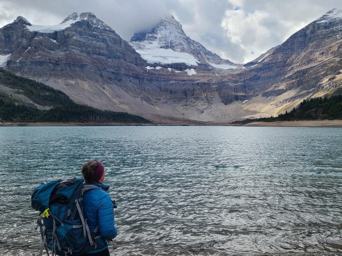
A typical view of Mount Assiniboine with its summit hiding in the clouds
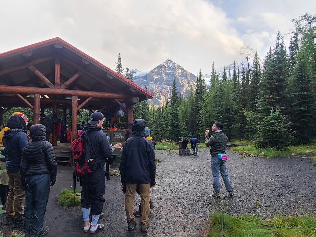
All the campers gathered as Mount Assiniboine made its first full appearance in days!
We visited in early September, and we basically saw Mount Assiniboine in every weather condition possible. We spent two days hiking in from Sunshine Village, and for most of that hike it was cold and miserable, with a mix of rain, sleet, hail, wind, and the occasional thunder. We arrived at Lake Magog with no views- it was like the mountain wasn’t even there! The next day, it began to clear, and while the top of the mountain was still hiding behind clouds, it was sunny and a bit warmer. By the evening, the mountain was showing itself, and we had nice weather the next two days for our hike out.
All this to say, come prepared for anything!
Check conditions in Mount Assiniboine Provincial Park
Make sure to check for any trail closures or alerts for bears, weather, or wildfires, or to learn of any challenging conditions on the trail. Wildfires are common in the Canadian Rockies, so be sure to check the smoke forecast and air quality as well. The Lodge also displays current trail conditions and weather on its site. You can also read about Banff’s trail conditions here.
Bears in Mount Assiniboine Provincial Park
Mount Assiniboine does have lots of bears, including Grizzlies, so be bear aware, only cook and dispose of gray water at designated areas, store all food and scented items in the bear lockers provided at all the campgrounds, and definitely carry readily accessible bear spray with you at all times.
Bears become particularly active in the fall months as they prepare for hibernation. During our time in the Canadian Rockies in September, there were several bear sightings and reports all over. In Mount Assiniboine in particular, there had been a grizzly sighting just near Wonder Pass the day before we were there (and we saw the scat to prove it the next day!). A bit more unsettling was when a group of fellow campers approached us in our campsite to tell us they saw a grizzly about a kilometer up the trail from our tent. Luckily we never had an encounter with one, and we heard of no issues during our time there.
Cost to visit Mount Assiniboine Provincial Park
There is no entry fee to get into Mount Assiniboine itself. All the cost to visit the park comes from getting there and staying there, and as you might guess, it can be as cheap or expensive as you make it.
If you take the helicopter both ways plus stay in the lodge, you’re looking at a minimum of about $1300 CAD per person for a two-night minimum stay.
If you hike in to Mount Assiniboine and camp only, it becomes much cheaper.
We visited Mount Assiniboine for just about as cheaply as you can do it, hiking in and camping each night. Our total cost per person for visiting Mount Assiniboine on a 4 night, five day trip was about $120 CAD. $70 CAD of this was the fee to take the gondola up to Sunshine Village (optional but highly recommended if hiking this way!), and the rest was in campsite fees.
While there is no entry fee into Mount Assiniboine itself, it is accessed by parks that do have fees. If you hike or fly out of Mount Shark, you will have to pay for a Kananaskis Conservation Pass to park your car there (at most, this will be $75 CAD per vehicle if you pay for the annual pass). And if you park at Sunshine Village and hike in this way, you will need a Banff National Park Pass, which is sold per person, not per vehicle.
Are dogs allowed in Mount Assiniboine?
Dogs are allowed in Mount Assiniboine Provincial Park, which is surprising to me given the high bear activity here. They must be kept on a leash at all times and are not allowed in any of the buildings, such as the Lodge. We saw quite a few of them on the trails here. The trails themselves are perfectly suitable for them, but because it is bear territory out here, use extra caution and be extra vigilant and watchful.
Is there cell service or Wi-Fi in Mount Assiniboine?
No! There’s no service throughout the park, nor is there Wi-Fi or service at the Lodge, so come prepared with everything you might possibly need downloaded to your phone. For people staying at the Lodge, it’s easier to get information as staff is around to help you, but for campers, it’s a bit harder. You really are only allowed to ask questions and get help form the park custodian who visits the campground once per evening to check reservations, and at the Lodge tea time from 4-5pm on non-flight days.
Do I need a bear cannister in Mount Assiniboine?
You don’t actually need to have a bear cannister in Mount Assiniboine, as all the campgrounds that you would be staying at have bear boxes and bear hangs for storing food, so just be sure to utilize those. Make sure to carry all your food, scented items, and trash in your pack in a secured way, though, such as in a double bagged ziplock. This will help keep everything contained so nothing spills in your pack or you don’t accidentally leave something in it overnight.
How crowded is Mount Assiniboine?
Something I was worried about before visiting Mount Assiniboine were the potential crowds. I know access to this area is a bit limited due to the limited lodging and camping, but still…the core region isn’t that huge and there are only a few key places people would likely be going to. I was a bit worried the trails and viewpoints would be crowded, especially on the first nice day we got after a few days of rain and sleet. But I couldn’t have been more wrong! We were out on the trails all day and somehow barely saw anyone else. We had most of Wonder Pass to ourselves, the Lake Magog shoreline to ourselves right in the middle of the day, and we had the entire Nublet to ourselves! Even the hike in and out from Sunshine Meadows was blissfully empty. Despite how much hype this place gets and how full the campgrounds and accommodations were, we were happy to still be able to experience true backcountry solitude.
Where to Stay Near Mount Assiniboine Provincial Park
If you plan on hiking to Mount Assiniboine from Sunshine Village, staying right at the Sunshine Mountain Lodge in Sunshine Village would be the most convenient and ideal, but also expensive. You can also stay right in Banff at either hotels or campgrounds and be about 20 minutes away from the Village.

Sunshine Mountain Resort at the top of the gondola
If planning on hiking to Mount Assiniboine from Mount Shark (or taking the helicopter), staying right in Canmore is a good option, but again, pricey. Canmore is ideal if helicoptering out of Canmore itself, or it’s about an hour from the Mount Shark trailhead and helipad. There are plenty of accommodation options here, or for a more budget friendly option, there are some campgrounds near Canmore or along the nearby Three Sisters Parkway. We stayed at the Bow River Campground along the Three Sisters Parkway one night during our time in Banff. It was pretty primitive (with vault toilets and non-potable water) but it was inexpensive and did the trick (and surprisingly easy to get a first come first served spot on a Saturday night).
If you want to be as close as you can to the Mount Shark trailhead, camping in Kananaskis is your best option. Some campgrounds require reservations and some don’t. Check out this list of campgrounds in the Kananaskis area for more details on each one. The closest would be Spray Lakes West (about a half hour away on the other end of Spray Lake from the Mount Shark trailhead). Just make sure to carefully check the dates of operation (some close by August).
Keep in mind that to camp in Kananaskis (which includes the campgrounds along the Three Sisters Parkway) requires that you purchase the Conservation Pass for each day your vehicle is there (so for one night of camping you’ll need to purchase a two day pass).
If you don’t want to camp, options for lodging in Kananaskis near the Mount Shark area are limited, with most being found in Kananaskis Village along the paved route 40, including a hostel and a lodge. Otherwise, there are plenty of options in Canmore (both in the main town and near the Bow Flats/Three Sisters Parkway area close by) and Banff, though they will be quite pricey. The closest accommodation right near the Mount Shark trailhead is the Mount Engadine Lodge.
We actually stayed in Calgary in the days before our trip to Mount Assiniboine. We took a few days to prepare, shop for last minute things (like bear spray and camping food), and pack our gear. And it was much cheaper than staying directly in Banff or Canmore. It’s about an hour and a half to two hours of driving to get to either Mount Assiniboine trailhead from Calgary, so if you don’t need an early morning start, it’s totally doable. Make sure to plan some padding in your drive time for traffic heading out of the city, though.
Things to Do Near Mount Assiniboine Provincial Park and More Canadian Rockies Guides

There are plenty of epic things to do near Mount Assiniboine Provincial Park!
For more information on your trip to Mount Assiniboine:
SUNSHINE VILLAGE TO LAKE MAGOG HIKING GUIDE: Learn everything you need to know about hiking into Mount Assiniboine from Sunshine Village, including how long it takes, how hard it is, where to camp, and more.
THE NIBLET/NUBLET HIKE: Learn more about the Nublet hike, the best day hike in Mount Assiniboine!
Are you in the area for a while and looking for more things to do after your trip to Mount Assiniboine? We spent a total of about one month in the Canadian Rockies, and are currently writing up tons of guides to help you plan your trip!
Check out what we have so far to spark your wanderlust:
THE TENT RIDGE HIKE IN KANANASKIS: Check out our complete guide to hiking Tent Ridge, one of the best hikes in the Canadian Rockies!
EASY CANADIAN ROCKIES HIKES: Check out the easy hike to Boom Lake in Banff National Park, or hike the short and easy trail to Wapta Falls in Yoho National Park.
GLACIER NATIONAL PARK OF CANADA: The Hermit Trail and the Glacier Crest Trail are two challenging and steep trails that lead to epic views over glaciers and jagged peaks and are just a few hours from Banff.
MOUNT REVELSTOKE: The Eva and Miller Lakes hike is the best hike in Mount Revelstoke National Park, showcasing alpine meadows and two beautiful alpine lakes.
Are you planning a visit to Mount Assiniboine in the Canadian Rockies? Let us know if you have any questions! We love to help, and hope this Mount Assiniboine guide helps you have an amazing trip.