The Glacier Crest Trail in Glacier National Park of Canada: The Ultimate Guide
Are you looking for an off-the-beaten-path hike near the Canadian Rockies? Then check out the Glacier Crest Trail in Glacier National Park of Canada. Not too far from more popular parks but with far less crowds, the Glacier Crest Trail is a challenging hike that rewards with stunning views of the Illecillewaet and Asulkan Glaciers and panoramic mountain views. This guide goes over everything you need to know to hike the Glacier Crest Trail in Canada!

Glacier National Park of Canada is a bit of a hidden gem in the Canadian National Parks system. Not to be confused with the popular and similarly named U.S. National Park in Montana, Glacier National Park of Canada lies in British Columbia, only about 2 hours west of the more famous Banff National Park along the TransCanada Highway.
While Glacier National Park of Canada lies in the shadow of its more famous neighbors, it hides an absolute treasure trove of hiking trails that lead to breathtaking panoramic views of glaciers, jagged mountains, and scenic alpine meadows. If you’re looking for some epic mountain scenery but without the crowds of Banff and Jasper, then Glacier National Park of Canada is your answer.
The Glacier Crest Trail is a particularly scenic hike in Glacier National Park of Canada. It’s steep and challenging, but the reward is an incredible and up-close view of both the Illecillewaet Glacier and Asulkan Glacier, as well as panoramic views out to Mount Sir Donald and the jagged mountains of Rogers Pass.
In this guide, we’ll go over everything you need to know to hike the Glacier Crest Trail in British Columbia, including how to get there, when to go, where to stay nearby, and what to expect on the Glacier Crest Trail.
In this Glacier Crest Trail hiking guide:
How long is the Glacier Crest Trail in Glacier National Park?
How hard is the Glacier Crest Trail in Glacier National Park?
The Glacier Crest Trail in Glacier National Park: Trail Description and our experience
Best time to hike the Glacier Crest Trail in Glacier National Park
Tips for hiking the Glacier Crest Trail in Glacier National Park
Where to stay near the Glacier Crest Trail in British Columbia
Things to do near the Glacier Crest Trail and more Canadian Rockies guides
Where is the Glacier Crest Trail?
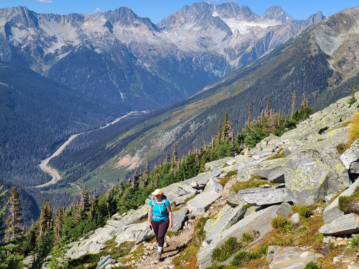
Views from the Glacier Crest Trail over Rogers Pass and the TransCanada Highway
The Glacier Crest Trail is found in Glacier National Park of Canada in British Columbia, just two hours west of Banff National Park on the TransCanada Highway. A collection of hiking trails here runs through the Columbia Mountain range that borders the Canadian Rockies to the east. Nestled among popular regions like Banff, Jasper, Yoho National Park and Revelstoke, Glacier National Park of Canda holds equally stunning scenery, but without the crowds of its more famous neighbors.
One road traverses Glacier National Park (the TransCanada Highway), and the highlight of this road is Rogers Pass. Here, views of jagged peaks and glaciers surround you simply from the seat of your car. You’ll also find here the Glacier National Park visitor center and frontcountry camping opportunities, and many of the best hikes in Glacier National Park of Canada are centered around Rogers Pass as well, including the Glacier Crest Trail.

Driving through Glacier National Park of Canada
Nearest towns to Glacier National Park of Canada:
Golden: 1 hour (83 km) east of Rogers Pass
Revelstoke: 45 minutes (65 km) west of Rogers Pass
Other driving distances to Glacier National Park of Canada:
Lake Louise: 1 hour 50 minutes (160 km)
Banff: 2.5 hours (225 km)
Jasper: 4.5 hours (387 km)
Calgary: 3.5 hours (343 km)
Vancouver: 6.5 hours (630 km)
Map of Glacier National Park of Canada

A map showing where Glacier National Park of Canada is located in relation to the other National Parks of the Canadian Rockies. It sits right along the TransCanada Highway in between Golden and Revelstoke.
Why hike the Glacier Crest Trail in Glacier National Park?
Glacier National Park of Canada is known not only for its stunning scenery, but also for its steep and rugged hikes. While you can find plenty of easier hikes through the peaceful forests at its base, the most epic scenery of mountains and glaciers awaits those who make the trek up challenging and super steep hikes to ridges and viewpoints over the park.

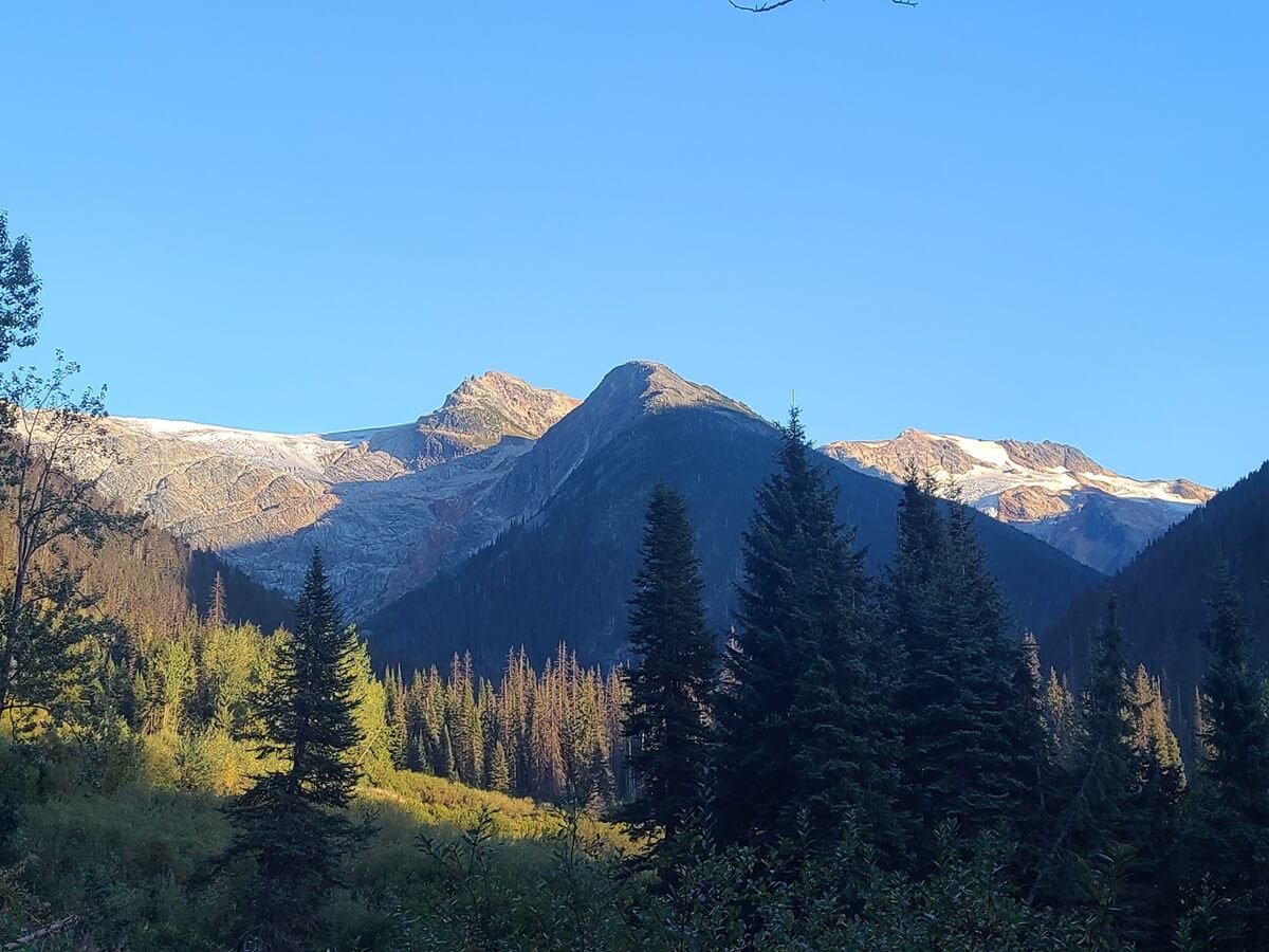
Typical views from hikes in Glacier National Park of Canada (this is near the top of the Glacier Crest Trail looking into Asulkan Valley)
Many hikes in Glacier National Park of Canada are found around Rogers Pass. In particular, the Illecillewaet Campground, found just 2 km west of the pass, is a major trailhead for many of Glacier National Park’s best hikes. Some of the best (and more challenging) hikes include Abbott Ridge, Asulkan Valley, Perley Rock, and of course, the Glacier Crest Trail.
So, with so many great options, how do you pick a hike in Glacier National Park? Luckily, they are all amazing in terms of views, so you can’t really go wrong here. At first, we had a handful of hikes in Glacier National Park on our to-do list, but we found that since many of these hikes are all right next to each other (many even share the same trailhead), the views from the top are quite similar. Hikes like Glacier Crest and Abbott Ridge are similarly steep with epic views back towards Rogers Pass. So, while the views are definitely stunning enough to warrant seeing them multiple times from different trails, it’s safe to say that if you only have time for one hike in Glacier National Park of Canada, you don’t have to worry too much about which one you pick.
Why we chose the Glacier Crest Trail

Stunning views of the Illecillewaet Glacier from the end of the Glacier Crest Trail
The Abbott Ridge Trail is one of the more popular trails in Glacier National Park of Canada, and views from its summit are often used in park brochures and advertisements.
The Glacier Crest Trail shares the same exact trailhead as Abbott Ridge, and both are equally steep and challenging up to similar and expansive viewpoints, but the two trails split early on to go to two separate ridges. Abbott Ridge gives a further out perspective over the Glacier Crest Trail, Mount Sir Donald, the Illecillewaet Glacier and the Asulkan Glacier, and then back towards Rogers Pass. You basically see the whole spread of mountains and valleys in one view.
The Glacier Crest Trail, on the other hand, climbs in between the two valleys of the Illecillewaet and Asulkan Glaciers, and the top gives more in-your-face views, but you can still look back towards Abbott Ridge and out to Rogers Pass.
This is a view of the Glacier Crest Trail from the entrance to the Illecillewaet Campground. On this trail, you’ll be climbing to the top of the bump right in the middle of the picture and in between the two glacial valleys. The Abbott Ridge Trail climbs the mountain that is starting to show on the right side of the picture (but is cut off).
We chose the Glacier Crest Trail to get those more up-close views of the Illecillewaet Glacier while also avoiding the crowds of the Abbott Ridge Trail. And we’re so glad we did! Despite there being a completely filled trailhead parking lot, we saw only a handful of other hikers the entire 6.5 hours we were on the Glacier Crest Trail. We had the entire top to ourselves and the entire hike out to ourselves, so we truly got to find some solitude near otherwise crowded places like Banff and Revelstoke. Oh, and the views were pretty epic, too.
Because we were happy with the views we got from the Glacier Crest Trail, we felt we didn’t need to do another hike, such as Abbott Ridge, from the same area/trailhead. We still did have time for one more hike in Glacier National Park, so we instead chose the Hermit Trail, which is on the opposite side of Roger Pass and would give different views. We thought that by hiking one trail on each side of the pass, we got a good taste of what Glacier National Park of Canada has to offer.
How to Get to the Glacier Crest Trailhead
The Glacier Crest trailhead is in the Illecillewaet Campground, which is about 2 km west of Rogers Pass on the TransCanada Highway.
The turnoff for the campground is marked by a small sign with a tent symbol, so it’s not totally obvious- so just keep your eye out.
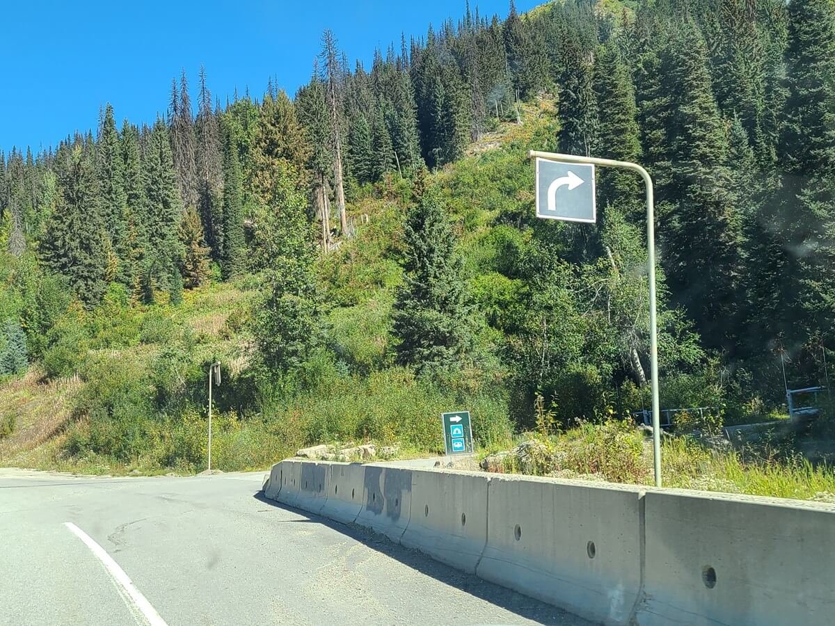
The turnoff for the Illecillewaet Campground and the Glacier Crest trailhead
If coming from the west to the Illecillewaet Campground: Simply look for the signed turnoff on the right. Important note: Just before the campground road is the Illecillewaet Valley trailhead and parking area, which is not the trailhead you are looking for. Although you can hike to the Glacier Crest Trail from here, it will add 2 km more to your roundtrip hike, so it’s best to just start from the campground trailhead.
If coming from the east to the Illecillewaet Campground: This is a little bit trickier. The campground will be on your left, but you can’t just turn into it from this side of the road, even though GoogleMaps might tell you that you can. Instead, drive about a kilometer further up the road until you see the Illecillewaet U-Turn. Here, you can make a U-turn and drive east on the TransCanada Highway back to the campground, which will be on your right.
Once in the campground, the entry road ends about one kilometer in at the trailhead for the Glacier Crest Trail, with a small parking area, before turning into the actual campground sites. If the parking area is full, you can park along the side of the road, just making sure not to block cars from driving through, as this is the main road into the campground.
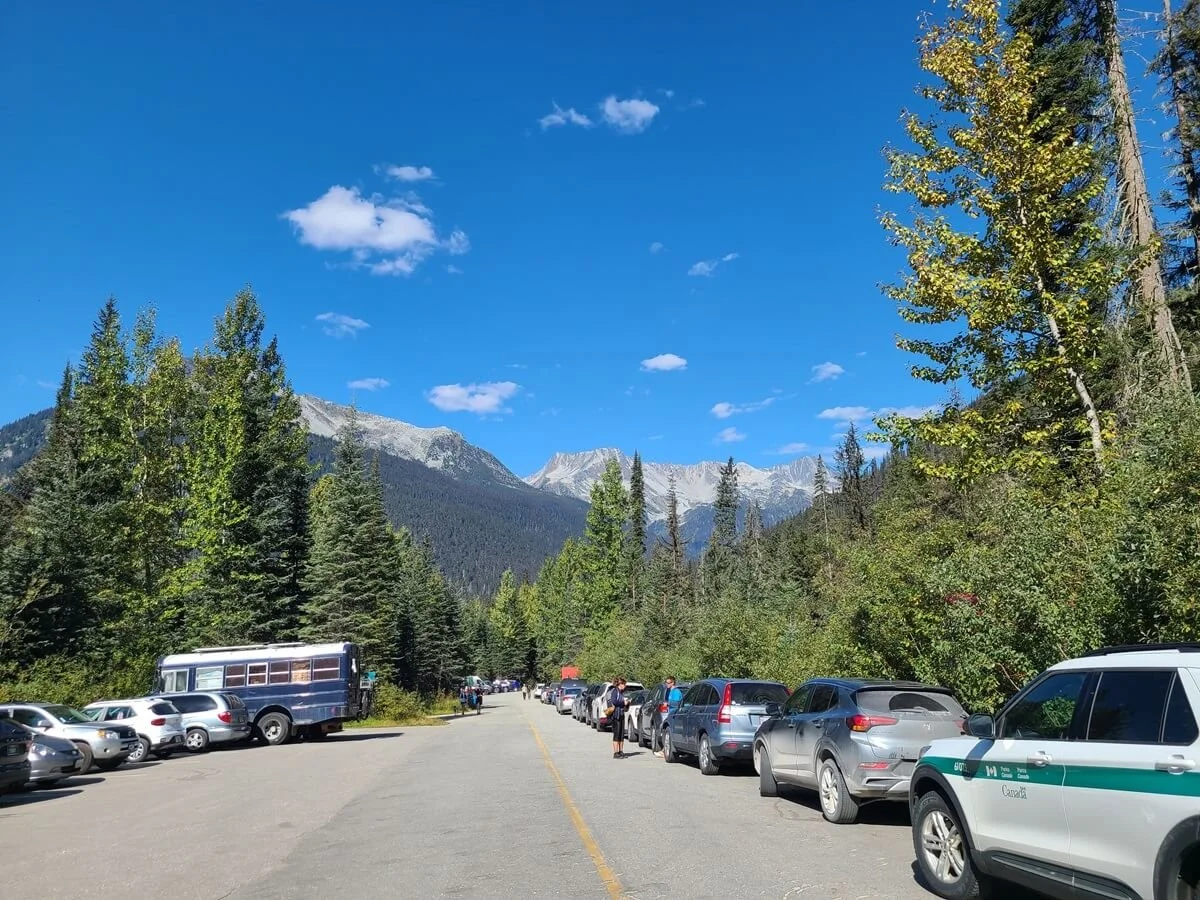
A busy weekend at the Illecillewaet Campground trailhead in Glacier National Park
We arrived around 11:30 am on a nice Sunday morning in September, and the trailhead was packed! But, the Illecillewaet Campground serves as a major trailhead for a number of hikes in Glacier National Park, so it makes sense that it would be pretty busy here. Luckily, everyone kind of spreads out among the different trails and at least for us, the Glacier Crest Trail itself was blissfully empty and quiet. So don’t get too intimidated if you see a crowded lot!
Near the Glacier Crest trailhead, there is a little kiosk with a campground attendant who can help you with any questions. You can also use the campground bathrooms, and we were able to fill up our water bladders before the hike (we were directed to site 59 for the closest water tap in the campground).
How Long is the Glacier Crest Trail in Glacier National Park?
Here are our hiking stats for the Glacier Crest Trail:
Length: 12 km (7.5 mi)
Elevation gain: 954 meters (3,130 ft)
Time: 6.5 hours. This includes one hour of resting at the top. It took us exactly 3 hours to hike up, and 2.5 hours to hike down.
Elevation profile:
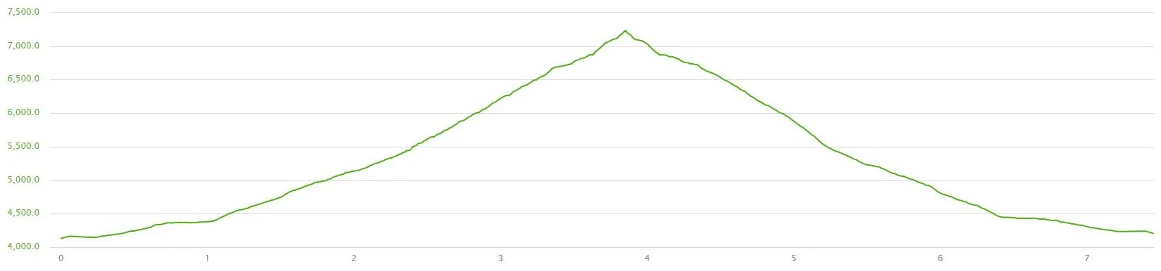
Our elevation profile of the Glacier Crest Trail from our Garmin watch
Satellite view of our Glacier Crest Trail hike:
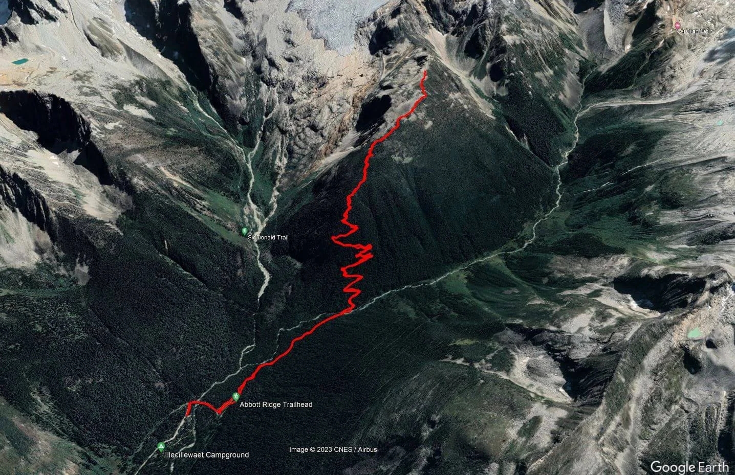
This is the view of our hike on the Glacier Crest Trail, which gives a good idea of what the hike entails
Glacier Crest trail map
Here is a Glacier National Park of Canada trail map taken from the park brochure. You can see all the trails that begin from the Illecillewaet area, including the Glacier Crest Trail.
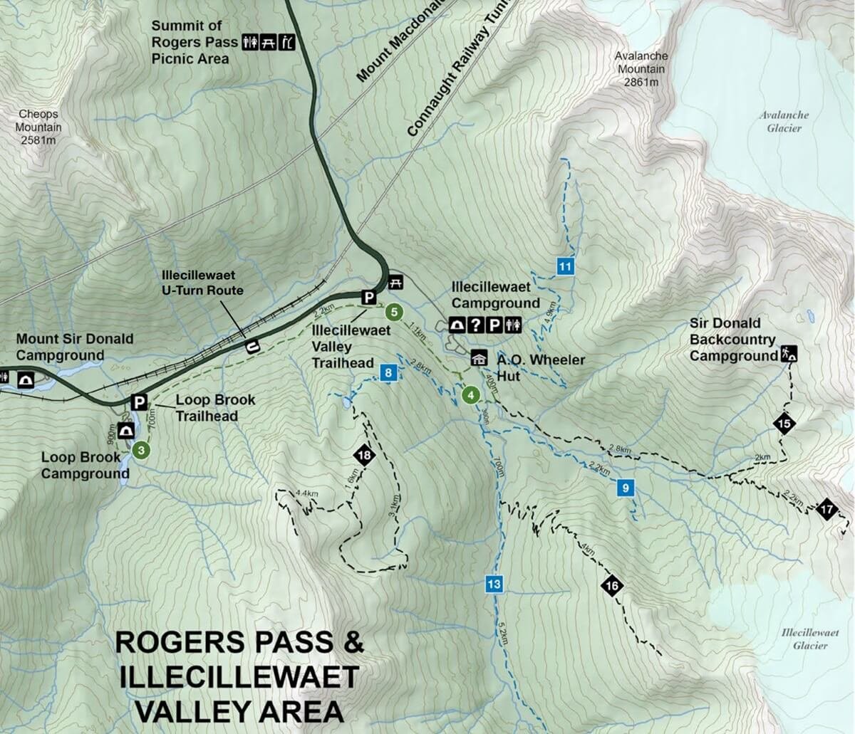
The Glacier Crest Trail is #16

This Glacier National Park trail map is at the Illecillewaet Campground trailhead and shows all the trails that start from here. The Glacier Crest Trail is number 16, so this gives you a good idea of what you’ll be climbing and where you will go in relation to other hikes in the area.
How Hard is the Glacier Crest Trail in Glacier National Park?

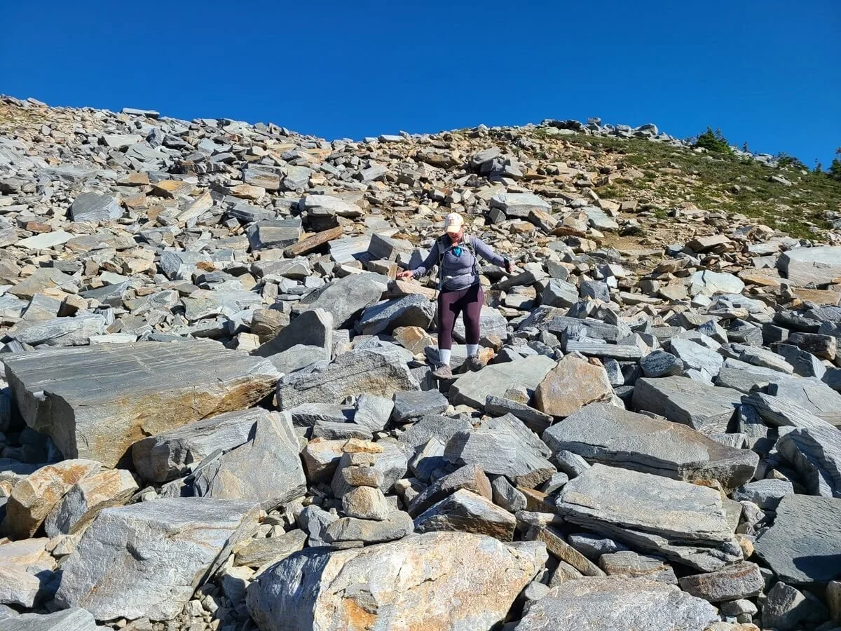
The rocky alpine terrain at the top of the Glacier Crest Trail
Glacier National Park has a trail rating system akin to ski trails, with green circles representing the easiest of trails that are short and have minimal elevation gain, blue squares representing moderate trails with medium distance and/or moderate elevation gain, and black diamonds representing hard trails that are more rugged, steep, long, and have big elevation gains.
The Glacier Crest Trail is rated as difficult (black diamond), and we’d have to agree with that rating. While there is nothing technical about the trail, once it starts climbing, it’s steep, and consistently steep, not really letting up until the top.
The bottom half of the Glacier Crest Trail is through forest on a nice cushy path, while the top half becomes more alpine, and you’ll be navigating through rock, shale, and sometimes slick dirt and scree to get to the final viewpoint. It’s nothing technical and easily navigable, you just have to be extra cautious as you step.

Nearing the top of the Glacier Crest Trail
Also, everything is extremely well-signed at each junction, so it’s very easy to find your way among all the intersecting trails that start at the campground trailhead.
Ultimately, it’s a just a steep slog to the top. But we promise, the views you’ll get from the Glacier Crest Trail as you hike will keep you going!
The Glacier Crest Trail in Glacier National Park: Trail Description and Our Experience
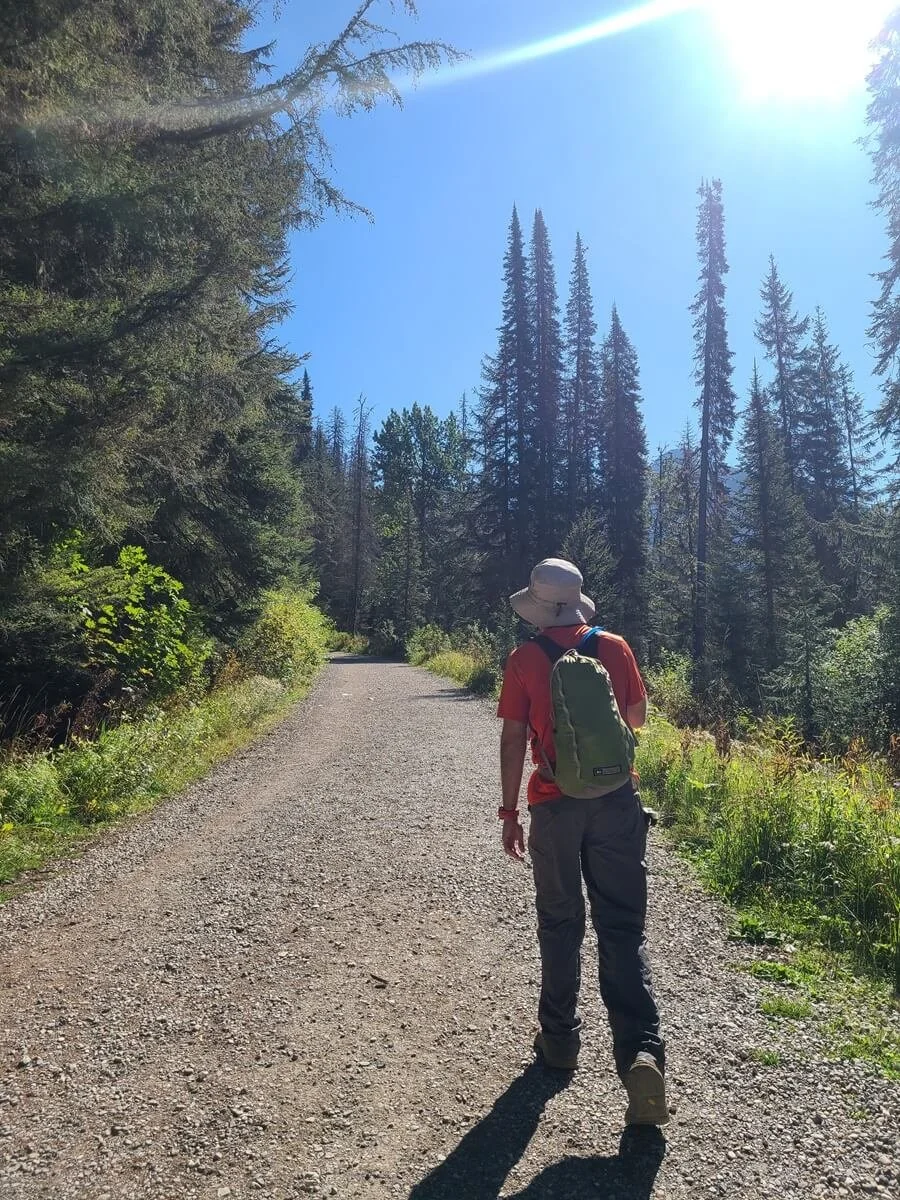
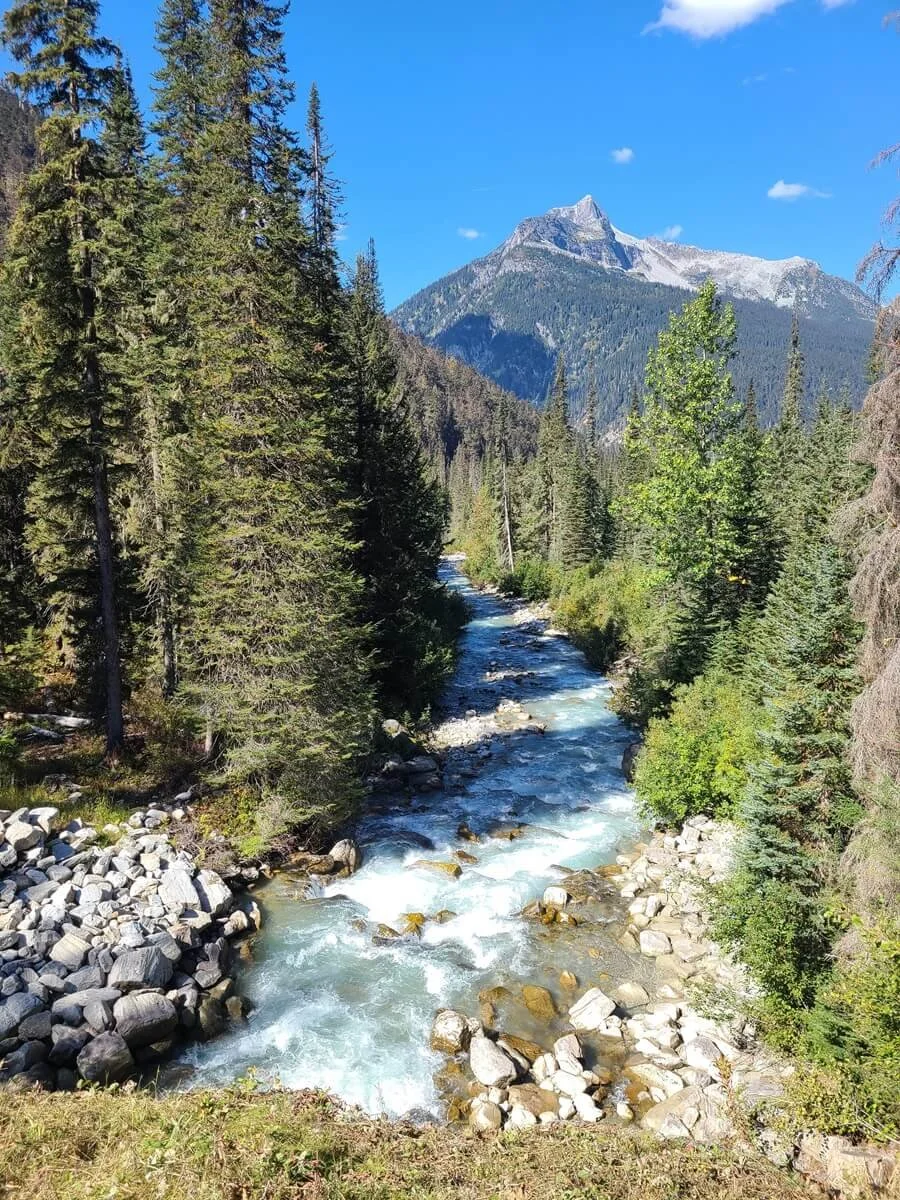
From the parking lot in the Illecillewaet Campground, a wide gravel path makes a short climb before it levels off to a nice flat walk. On your left, the trail for Perley Rock will branch off, but keep heading on the gravel path to a small bridge with beautiful views over a blue river and pretty mountain backdrop.
The start of the Glacier Crest Trail
Early views from the Glacier Crest Trail
Shortly after the bridge, turn left to walk through an historic interpretive loop about the Glacier House (it’s actually some pretty interesting history about the Glacier House and its role in the National Park and also in the general mountaineering community). If you started your hike to Glacier Crest from the Illecillewaet Valley trailhead off the TransCanada Highway, this is where you’d meet up with the trail.

Remnants of the Glacier House along the Glacier Crest Trail
You can take either the left or right fork of this interpretive loop- it’s equidistant around to the other end where the Glacier Crest Trail continues. If you take the right fork, the trail to Abbott Ridge branches off to the right, so just make sure to continue straight around the loop there.
Shortly past the historical loop, you’ll approach another junction. Here, head right (again, all these junctions are very well-signed so you’ll know exactly where to go).
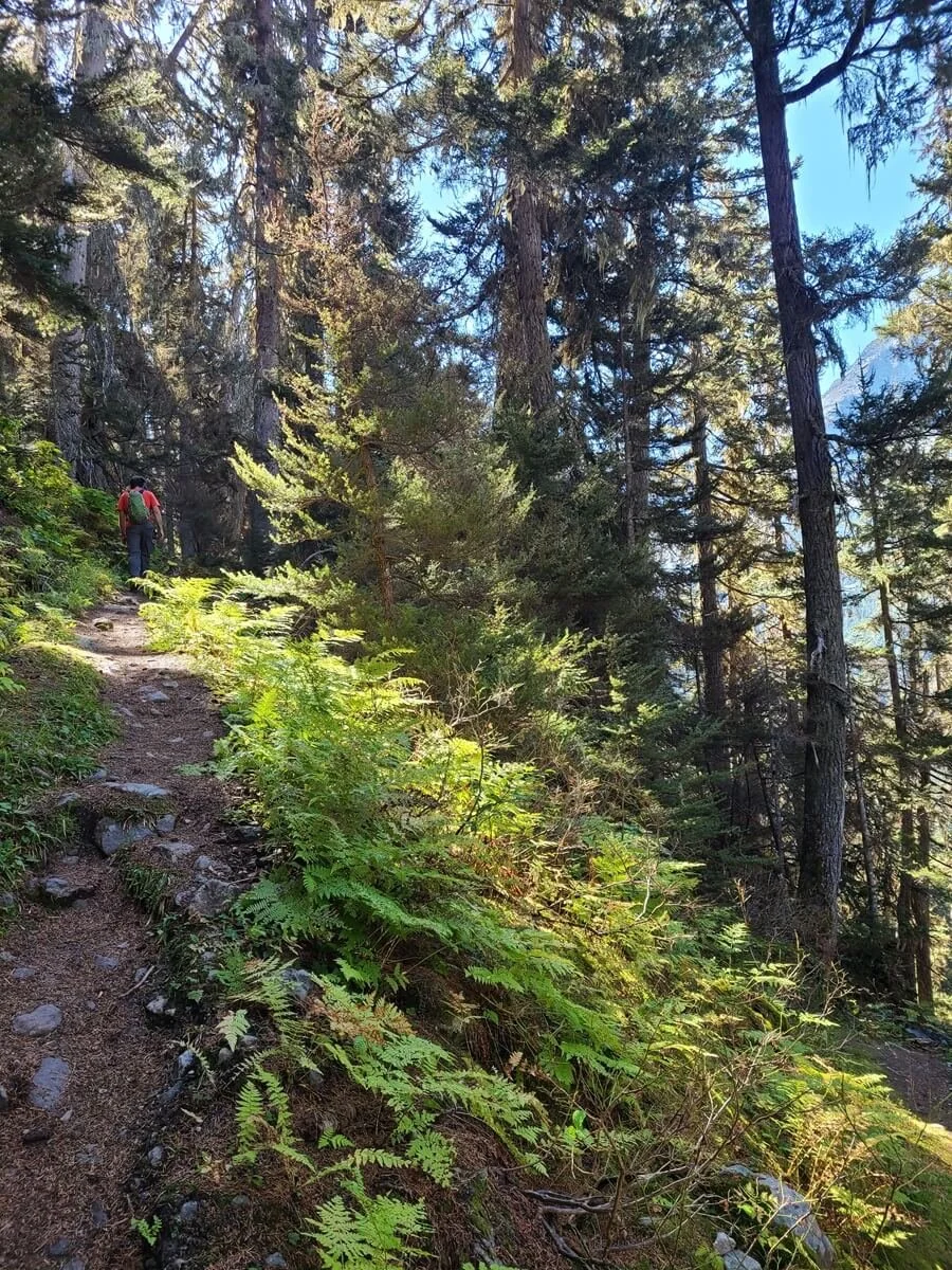
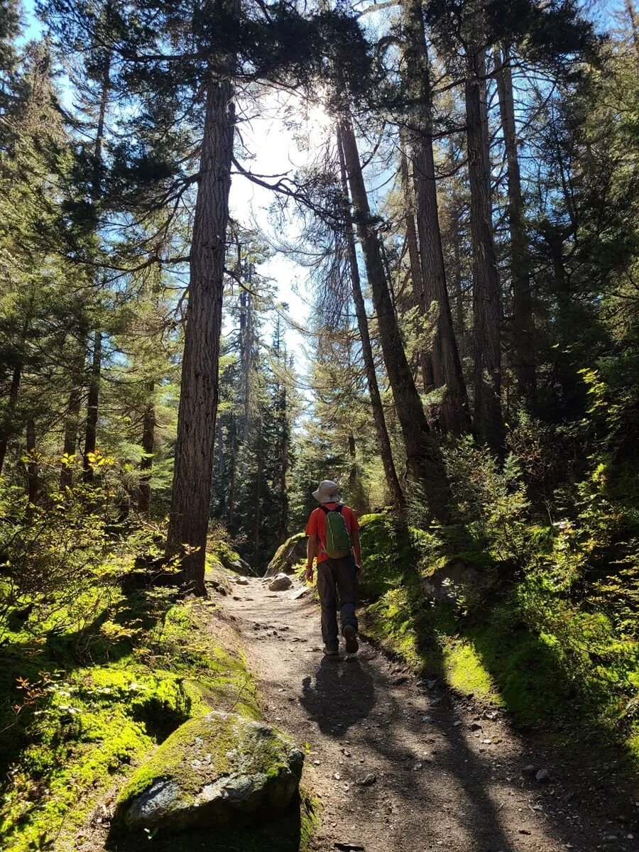
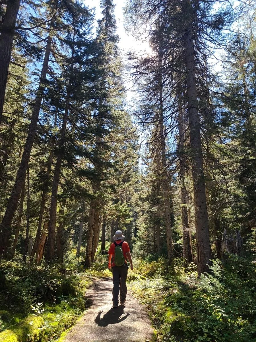
After this point, you’ll begin to lose any sort of crowds that were formed earlier on of people who are simply sightseeing and wandering the lower valley trails (though it still wasn’t nearly as busy down here as the number of cars in the parking lot suggested!). Here, the path becomes more trail-like as it climbs gently through the forest, often giving cool lighting as the sunlight pokes through the trees.

Up ahead, you’ll come to yet another junction- go right, following the signs to Glacier Crest. This section of the Glacier Crest Trail is flat and easy with occasional glimpses through the trees out to the mountains of the Illecillewaet Valley. Enjoy this last final part of easy hiking, because the trail is about to get tough!

There are lots of junctions at the beginning of the Glacier Crest Trail, but they are all well-signed
The last of the easy hiking on the Glacier Crest Trail!
Catching quick glimpses of mountains and glaciers on the Glacier Crest Trail
This easy part of the hike ends about 20-25 minutes in from the trailhead at another footbridge over a river before arriving at the final junction, and this is where the real climbing on the Glacier Crest Trail begins!
At this junction, the trail goes left and right away starts its aggressive climb to the top. Here, it’s pretty indicative of what the rest of the hike entails, so you can mentally prepare yourself now.

Crossing the Asulkan River right before the start of the climbing on the Glacier Crest Trail
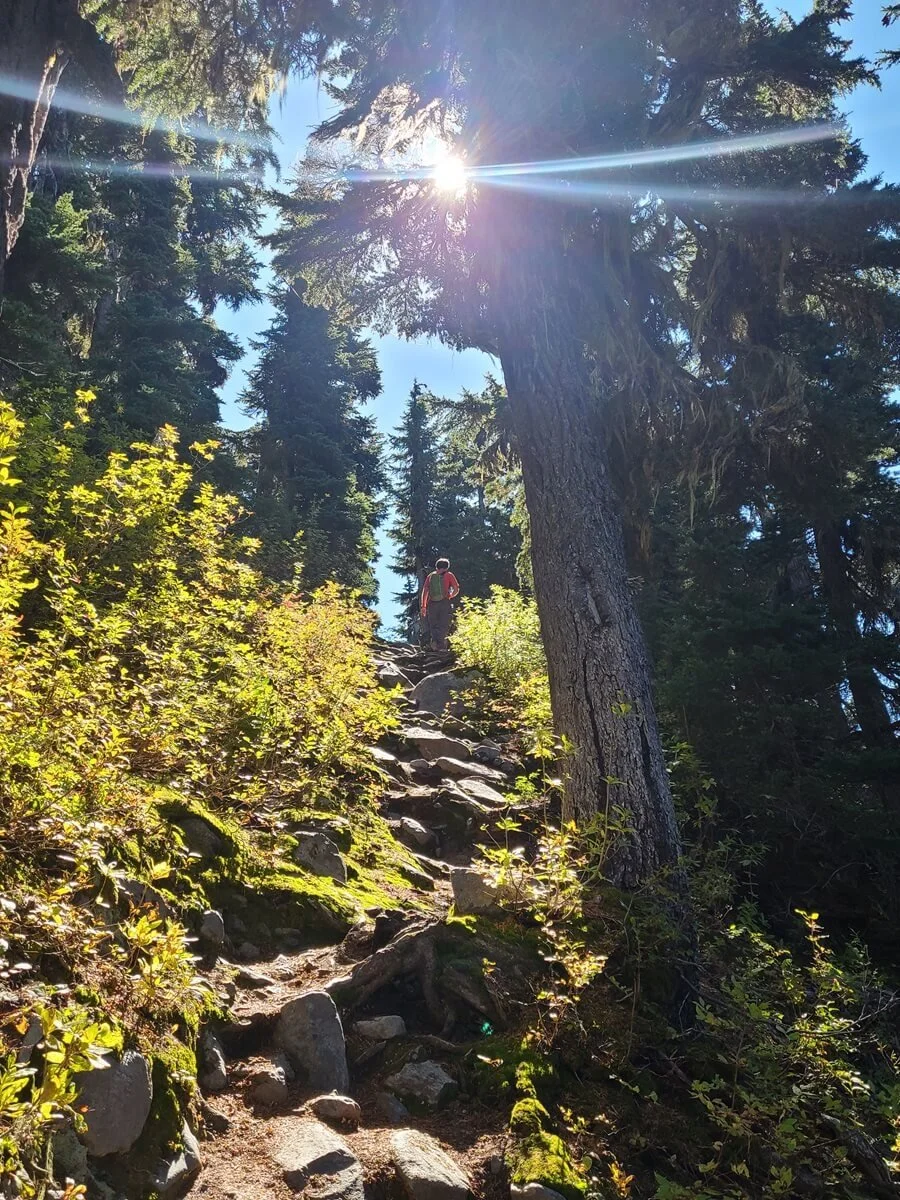
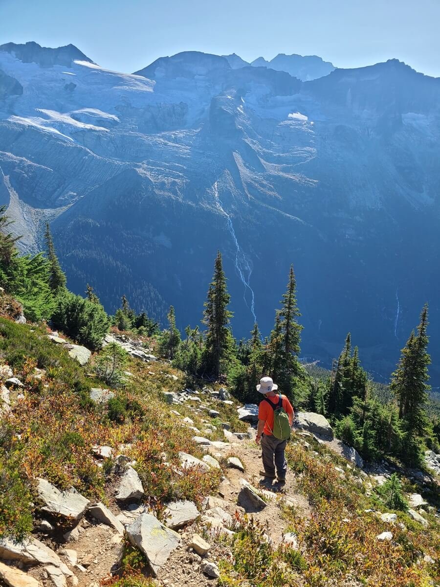
For this next portion of the Glacier Crest Trail, you’ll be climbing and switchbacking through the forest of the Illecillewaet Valley, with occasional glimpses of the mountains around you (little previews of what’s to come!). You start to leave the sounds of the TransCanada Highway behind as you climb higher, and instead replace them with the sounds of rushing water from the rivers below and the powerful waterfalls cascading down from the surrounding mountains (though you can’t quite see them just yet!).

The final junction of the Glacier Crest Trail, where the trail starts to climb
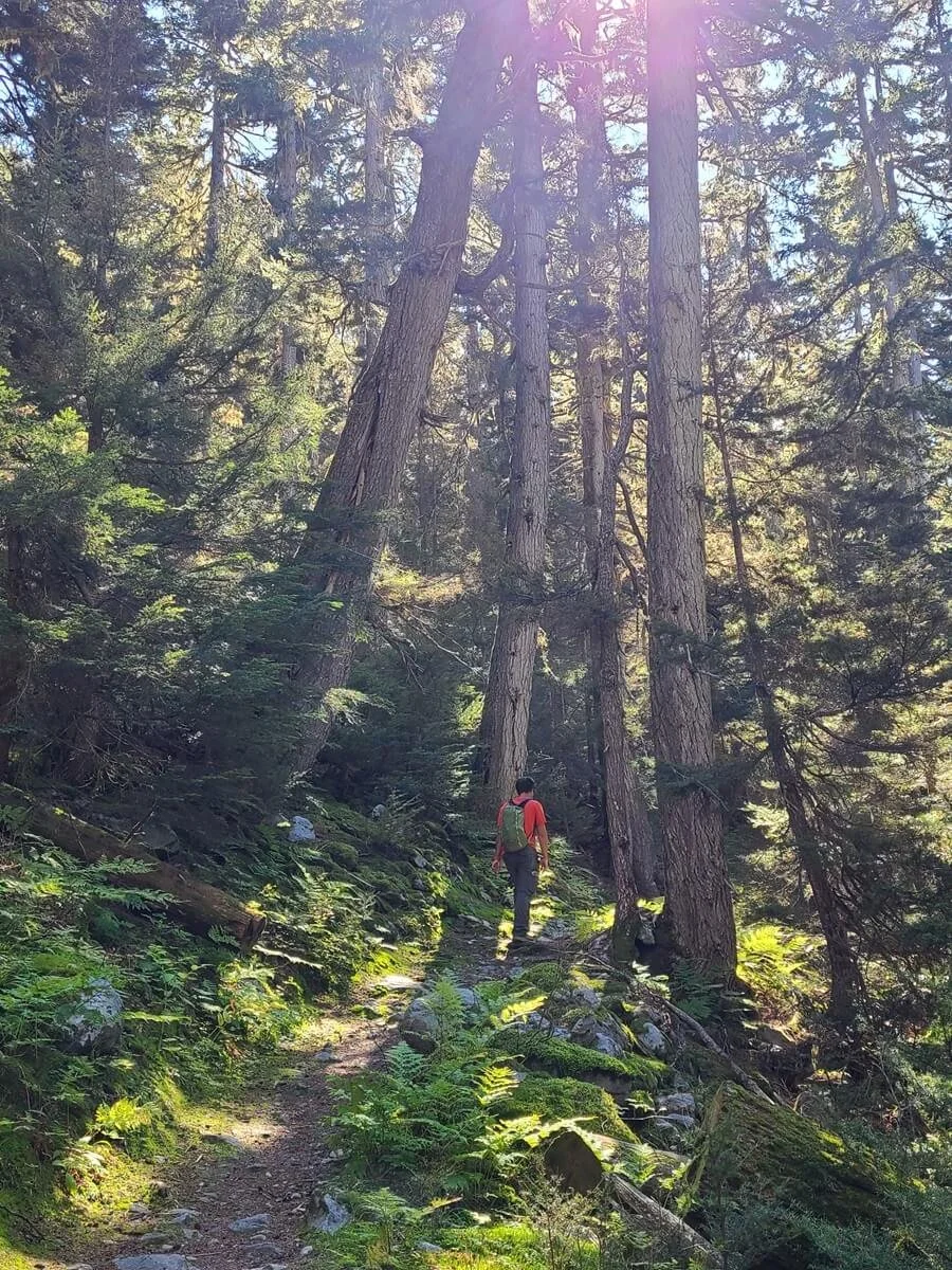
The first part of the Glacier Crest Trail is a climb through a lush green forest
Throughout this part of the hike, there are definitely a lot of steep parts, but you do actually get some relief here and there and it’s not all unforgivingly steep, so it still feels doable. Don’t get me wrong though…it’s still quite the workout!

Switchbacks on the Glacier Crest Trail

However, this first part of the climb does kind of lure you into a false sense of security…it’s steep but doable and you can keep a good pace. Even though we thought it was already steep here, the actual steepest parts of the Glacier Crest Trail start at about 2.4 miles into the hike, and the very steepest parts are reserved for the very top (of course!). Earlier, the rate of elevation gain was about 150 meters per kilometer (800 feet per mile), but around that 2.4 mile point, the trail starts to gain about 190 meters per kilometer (1000 feet per mile), and my place slowed right down…after some time it seemed like it would never end! It might be because we literally just came off of a five- day backpacking trip through Mount Assiniboine the day before, but I feel like we still would have felt like this was quite challenging.


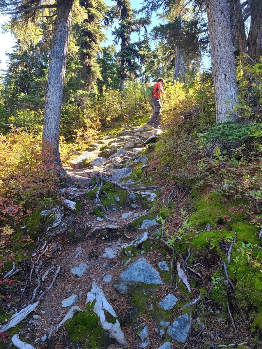
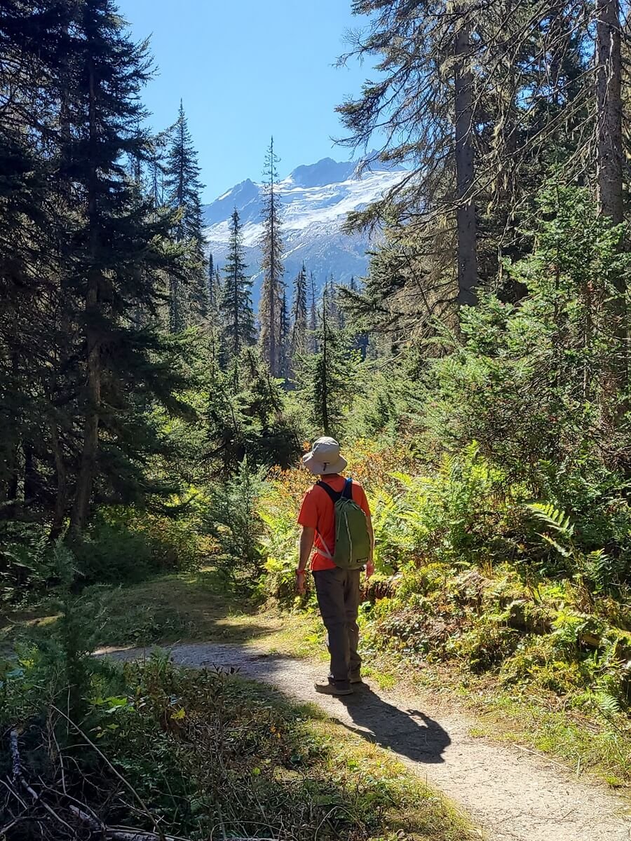
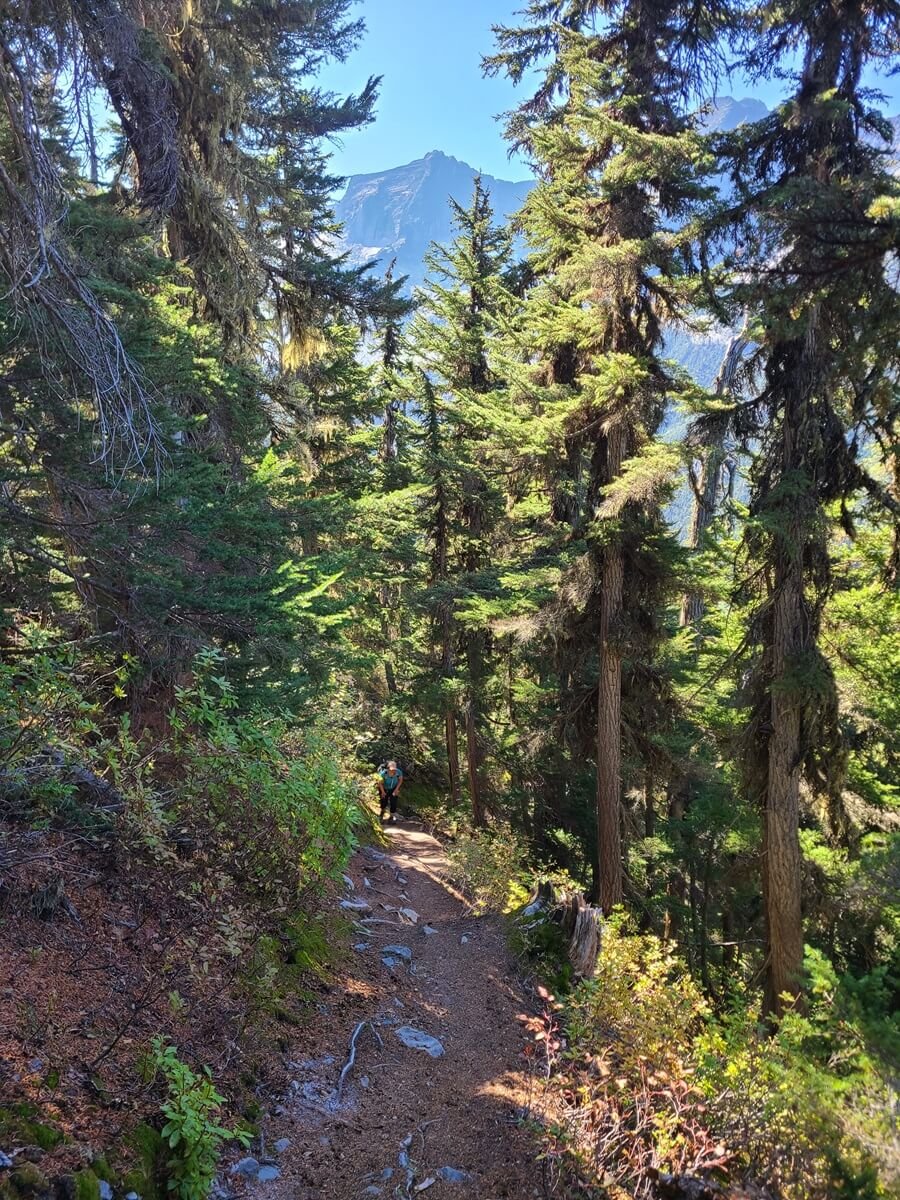
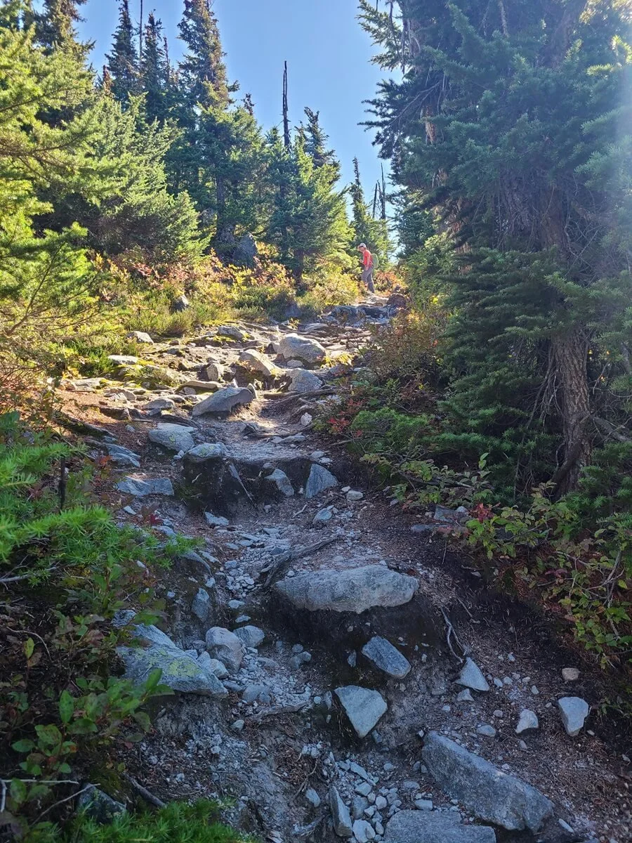
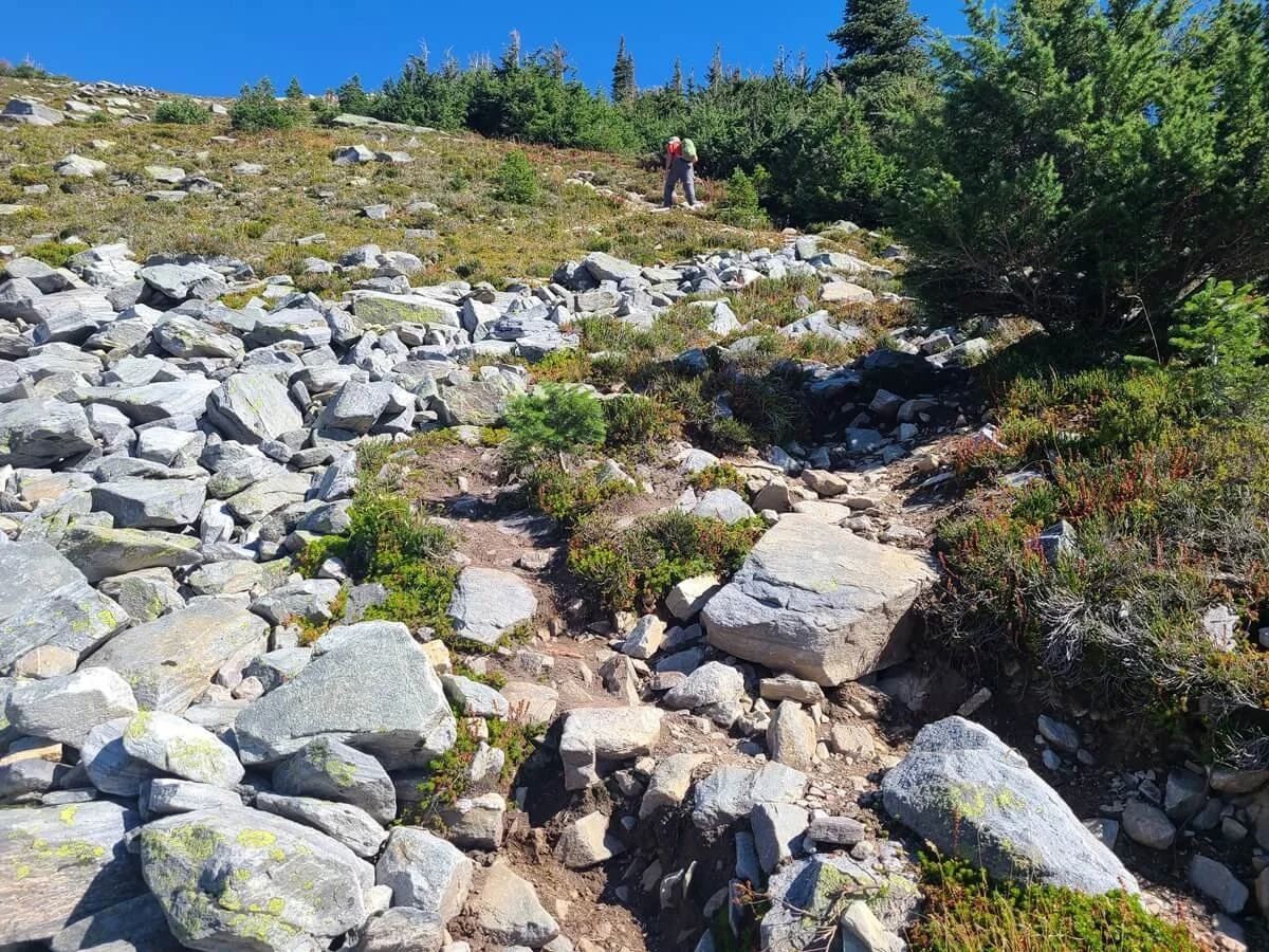
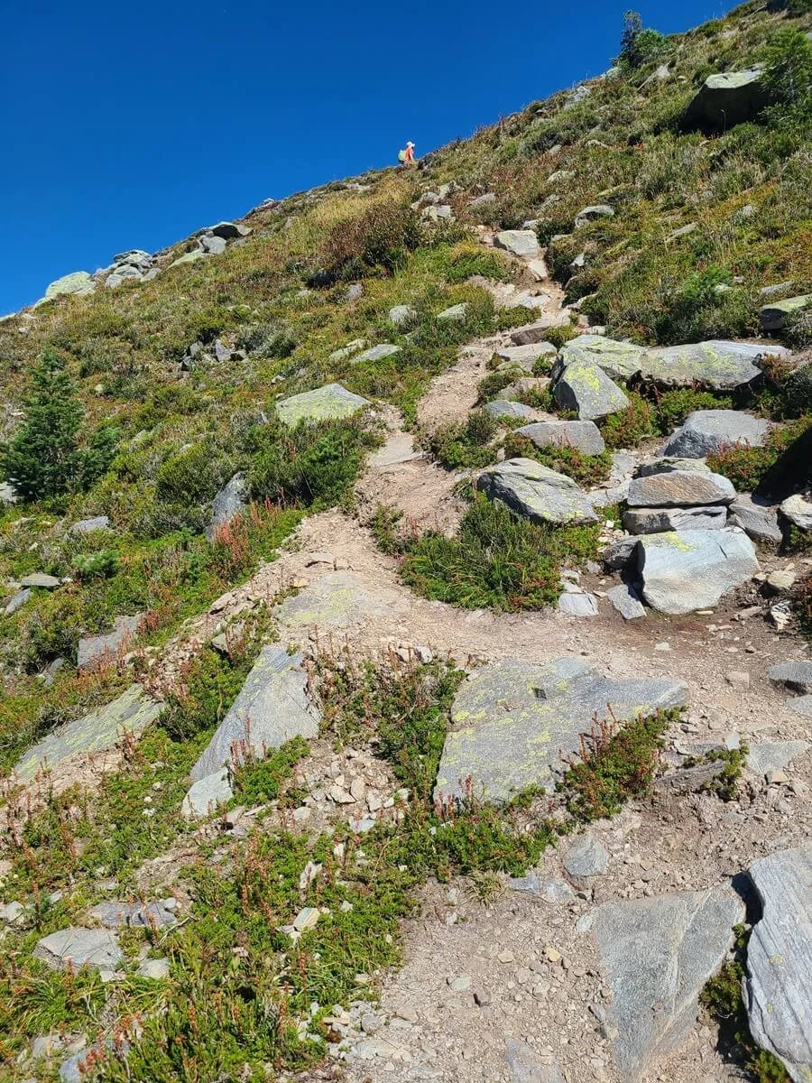
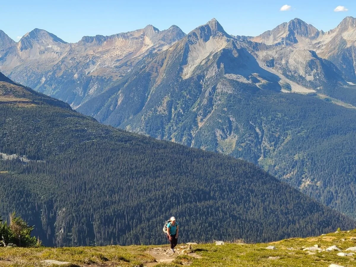
Eventually, though, the trees start thinning out and you become rewarded with more views. As you get higher, the path begins to get rockier underfoot as you emerge from the valley and into an alpine environment.

The views start getting good as you break treeline on the Glacier Crest Trail! This is back towards Rogers Pass.

Heading up the rocky Glacier Crest Trail
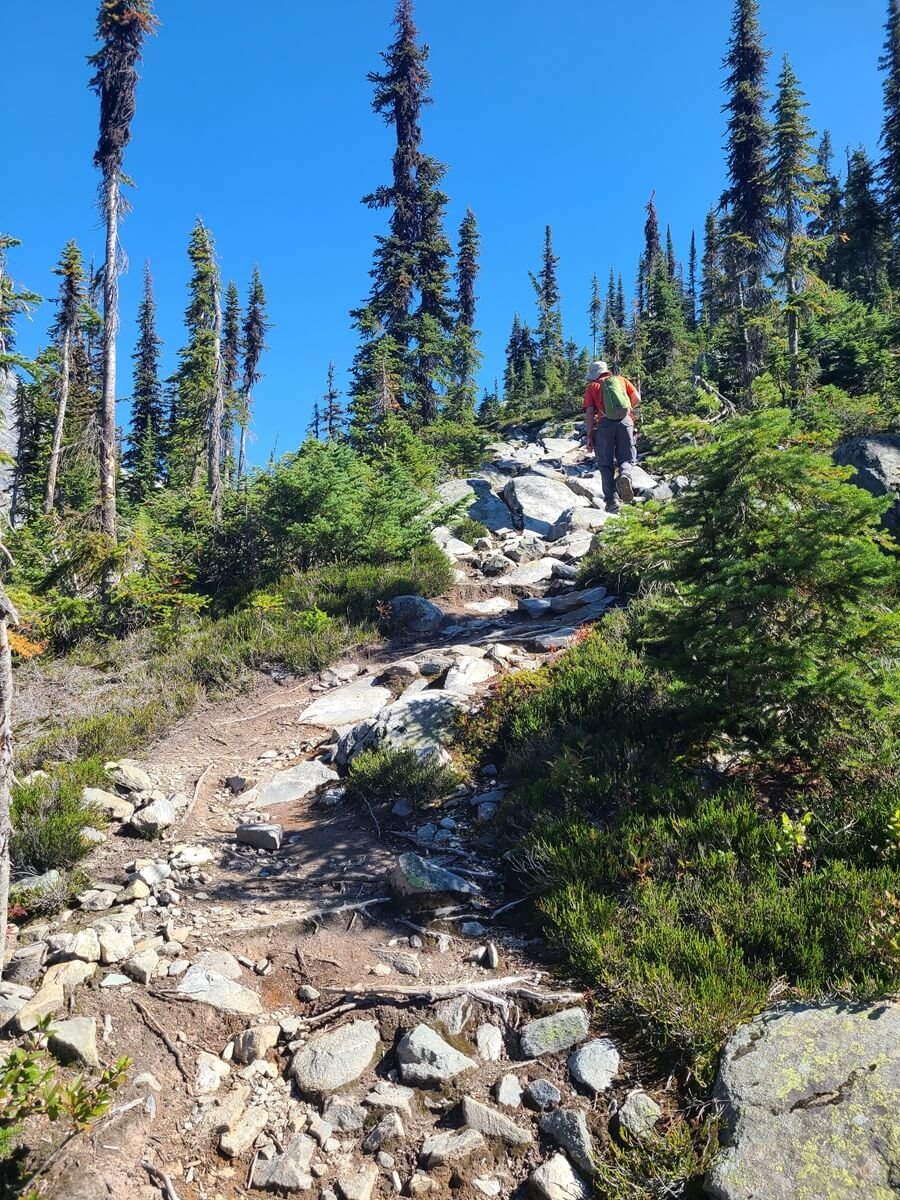

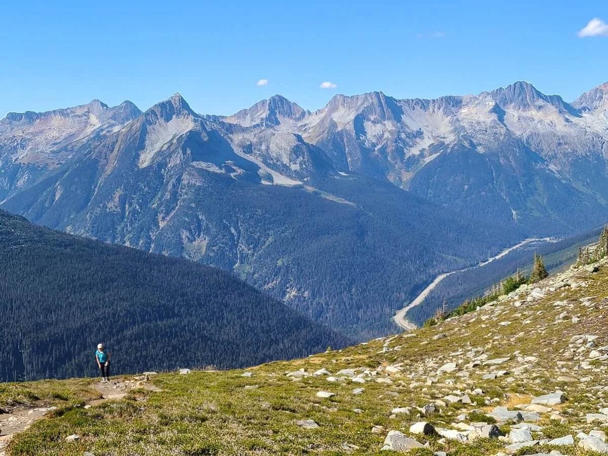
Finally, you’ll break out from treeline and this is where the Glacier Crest Trail gets good (and you’ll no longer be wondering if this trail choice was worth it!). The views from up here back towards Rogers Pass behind you and into the Asulkan Valley ahead are simply stunning. Glaciers and waterfalls dominate your view as you navigate the rocky landscape.

Views into Asulkan Valley open up as you get higher on the Glacier Crest Trail
Along your left, you can see the ridge that the Glacier Crest Trail eventually tops out on, but instead of climbing it from here, the trail kind of just parallels it along the bottom. You’re still gaining elevation (thankfully not as steeply as you have been!), but the trail continues to just keep following the base of the ridge deeper into the Asulkan Valley.
You can see the rocky ridge on the left where we eventually need to go, but for now, we’ll just be hiking along the bottom of it, deeper into the side of the Asulkan Valley
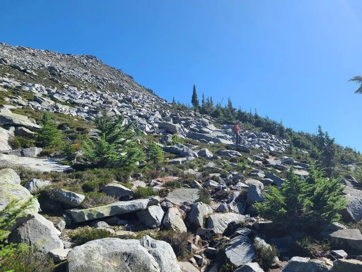
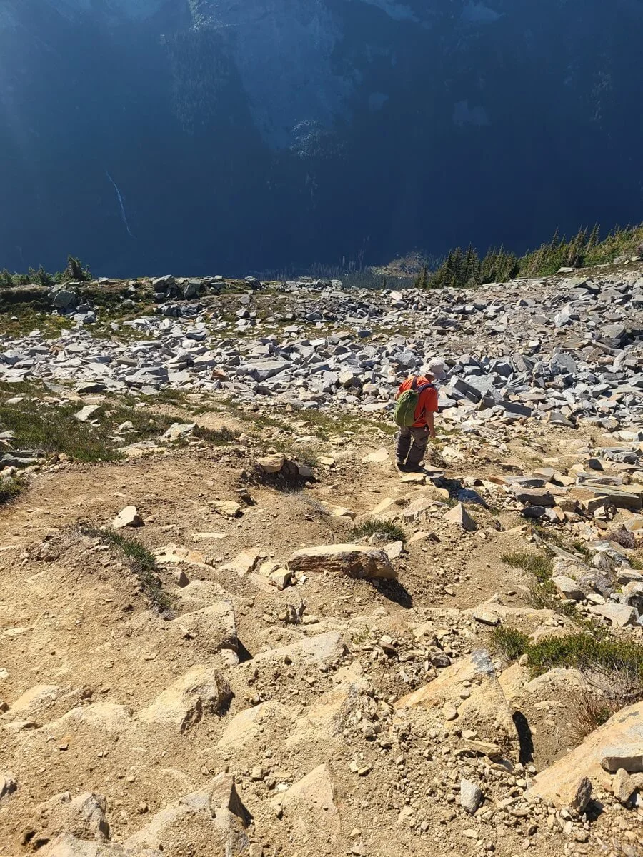
Up here, the Glacier Crest Trail has become a path through basically a giant rock field. The path is pretty easy to discern, but there are rock cairns here and there to help keep you on course. We took our time through here, continually gawking at the picture-perfect views around us, but also wondering when we were going to finally crest that ridge and see the main star of the show…the Illecillewaet Glacier.

Hiking the rocky Glacier Crest Trail with views into Asulkan Valley

Higher up on the Glacier Crest Trail with views out towards Rogers Pass

In-your-face views of the glaciers and waterfalls of Asulkan Valley from the Glacier Crest Trail

Eventually, the trail does take a turn to head up the rocky ridge. But instead of gradually climbing it on switchbacks, the trail takes one very steep shot up to the top. A lot of this part of the Glacier Crest Trail goes up slippery dirt and loose rock, so on already tired legs, this last part of the hike really feels difficult! You’ll top off on a false ridge before one final short rocky climb to the true top of the ridge.
Heading up the final steep climb to the top of the Glacier Crest Trail

Cresting over the false ridge before the final climb to the top of the Glacier Crest Trail

Looking up at the final rocky climb on the Glacier Crest Trail. The summit of the hike is at the top of that ridge!

An idea of how steep and rocky the final part of the Glacier Crest Trail is…Kevin is at the top!
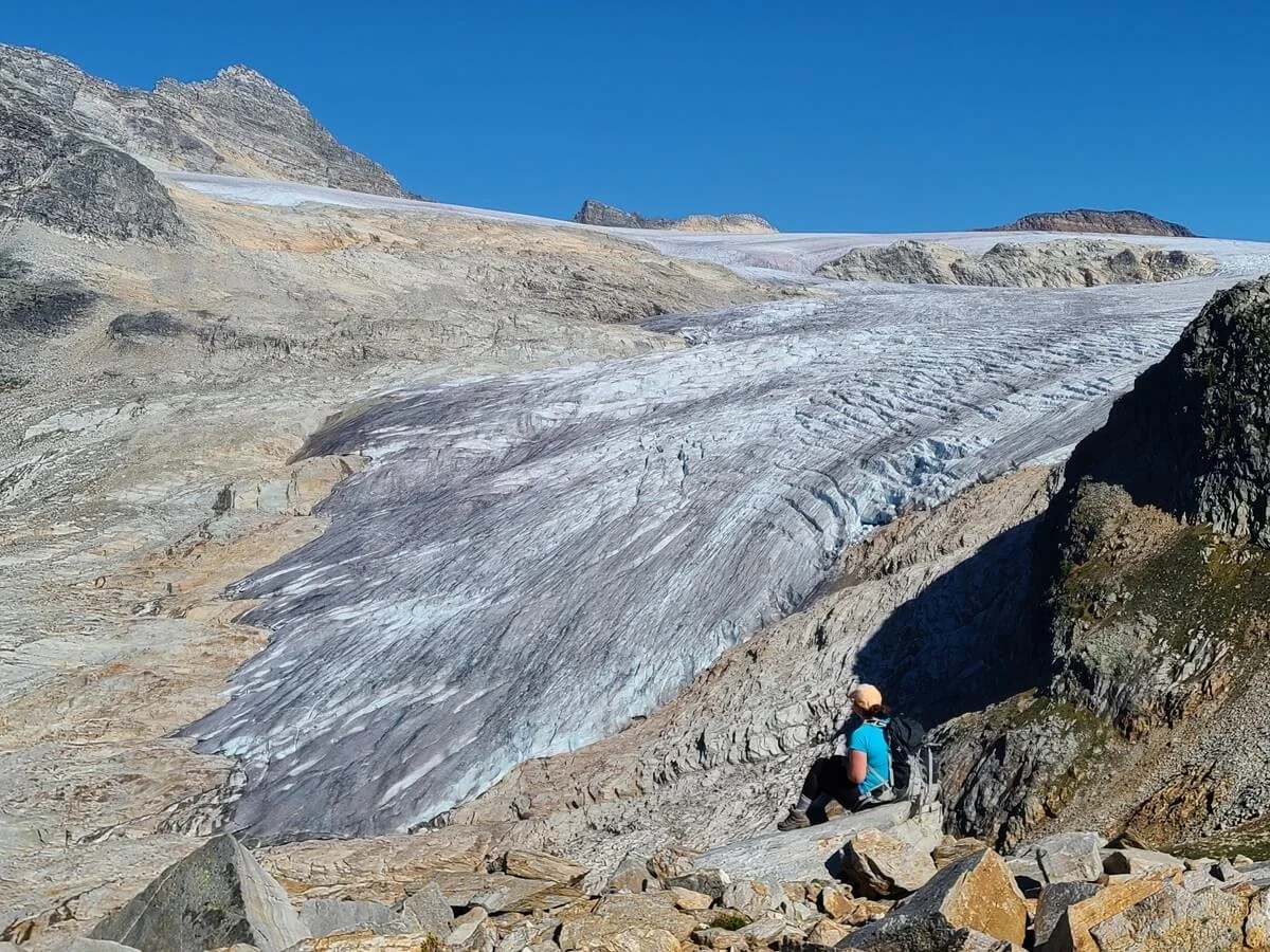
It was super cool to finally crest over the ridge and see the Illecillewaet Glacier and Valley and Mount Sir Donald so close and in your face. Up here, a pole marks the end of the trail, and although we’ve read of people exploring the ridge further, we didn’t feel the need. From this rocky ridge, we could see perfectly clear into both Illecillewaet and Asulkan Valleys and out over the mountains of Rogers Pass. We could also see back over to Abbotts Ridge.
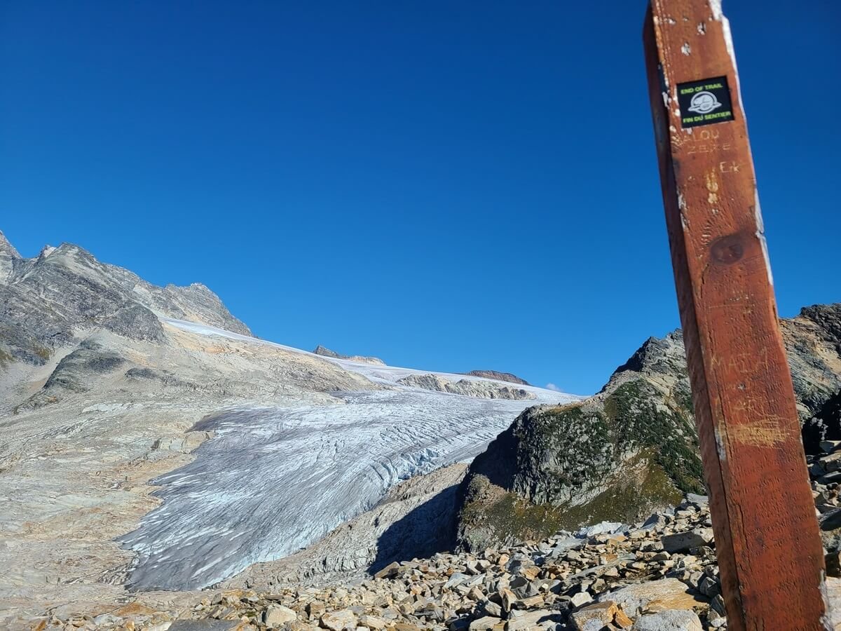
The view of the Illecillewaet Glacier from the end of the Glacier Crest Trail!

Crazy views of the Illecillewaet Glacier from the top of the Glacier Crest Trail
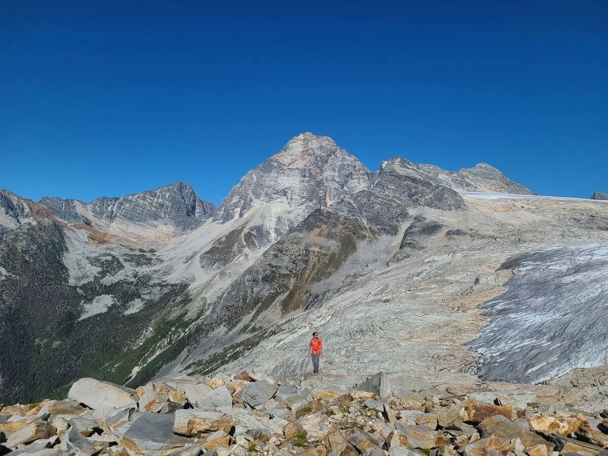
Views from the Glacier Crest Trail into the entire Illecillewaet Valley and of Mount Sir Donald
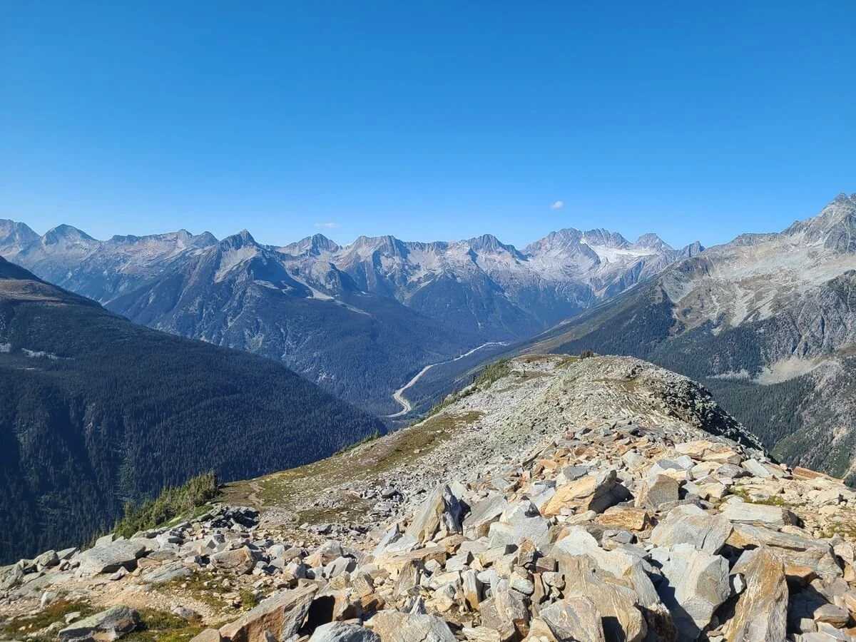
A view back down the ridge of the Glacier Crest Trail over to Rogers Pass. The Abbott Ridge Trail goes up the forested mountain on the left.

Enjoying views into Asulkan Valley from the top of the Glacier Crest Trail
We spent a lot of time up here (about an hour) enjoying the views in complete solitude, taking pictures, eating snacks, and just relaxing. We were hoping to see some fun wildlife up here, like mountain goats which are known to be in the park, but instead we saw one cute little chipmunk trying to sneak some of our food.
Once we were done, the descent back off the ridge was a bit annoying and slow. That last steep section that we had climbed up was full of loose dirt and rock, so we really had to go slow and watch our footing as we descended back down it, and it was a bit tiring. But after that, the rest of the hike was pretty much smooth-sailing, and just steep. However, this time, while we were still above treeline, we could enjoy more of the views towards Rogers Pass now that it was in front of us instead of behind us.

Heading back down off the ridge from the top of the Glacier Crest Trail
The slippery dirt path down the Glacier Crest Trail
Careful footing is needed on the way down!
Navigating the rocky path at the top of the Glacier Crest Trail

Heading back down into the forest to finish the Glacier Crest Trail
We made it down pretty quickly, in just 2.5 hours, and caught some nice evening light on the mountains at the end of our hike.
Best Time to Hike the Glacier Crest Trail in Glacier National Park

The best time to hike the Glacier Crest Trail is July to mid-September. This brings the warmest weather and the highest likelihood of the trails in Glacier National Park being snow-free, though snow can linger late into July or start in early September on high trails like the Glacier Crest Trail depending on the year, so be sure to check trail conditions if planning to hike the Glacier Crest Trail in late spring or fall.
In winter, many of the trails in Glacier National Park have avalanche conditions, and trail bridges are removed. The visitor center is open year round but visitor facilities are generally closed between October and May.
Weekends can get busy in Glacier National Park, especially around the Illecillewaet Valley and trails, however, even on a beautiful September Sunday, we never saw completely full trailhead parking lots. We started on the Glacier Crest Trail midday, which is kind of late, but we were still able to find parking, and the benefit was that the small handful of people on the trail were already coming down, so we had the top and the entire hike down to ourselves, which was so surprising considering it was a nice weekend day, but also a refreshing change of pace from the nearby trails in places like Banff and Jasper National Parks.
What to Bring on the Glacier Crest Trail in Glacier National Park
Aside from usual hiking necessities, here are some things we would specifically highlight for the Glacier Crest Trail.
Hiking boots/shoes: This probably goes without saying, but make sure to have the appropriate footwear with good ankle support and grip, as the Glacier Crest Trail gets rocky, rugged, and slick at the top.
Trekking poles: The Glacier Crest Trail is steep for most of it and trekking poles could save your knees on the way down.
Bear spray: Glacier National Park of Canada is home to Grizzlies, so be sure to always hike with easily accessible bear spray and know how to use it in case of an emergency. There are outdoor stores in Revelstoke and Golden where you can rent or buy a can.
First aid kit: Steep, rocky, slick trails make for high chances of slips, falls, and twisted ankles so make sure you have a kit on you that can treat minor cuts and scrapes.
Sun protection: Once above treeline, you are exposed to the sun for the rest of the Glacier Crest Trail, so make sure to have sunscreen, a hat, and sunglasses.
Tips for Hiking the Glacier Crest Trail in Glacier National Park of Canada
Is there a fee for Glacier National Park of Canada?
Entry into Glacier National Park of Canada, and thus hiking on the Glacier Crest Trail, does require a park pass. You can get a Glacier National Park day pass at the Rogers Pass Visitor Center or at the small kiosk near the Illecillewaet Campground trailhead. A day pass costs $10.50 CAD per person. An annual pass that combines both Glacier and Revelstoke National Parks can also be purchased for $52.25 CAD.
A great alternative to a Glacier National Park day pass is to purchase a Parks Canada Discovery Pass, which gives access for an entire year to all of Canada’s National Parks. This includes Banff, Jasper, Yoho, Kootenay, and Revelstoke National Parks, so if you know you’ll be visiting other parks during your visit or throughout the year, this is totally worth it. You can purchase it in person or online for $75.25 CAD per person (but there are family rates as well).
Bears in Glacier National Park of Canada

A warning sign at the start of the Glacier Crest Trail
Glacier National Park of Canada is home to Grizzlies and black bears so it’s super important to be bear aware and know how to stay safe in bear country. Make sure to be extra aware on trails, keep your bear spray accessible and know how to use it in case of an emergency, and practice strict Leave No Trace Principles wherever you go.
What time zone is Glacier National Park of Canada in?
Glacier National Park of Canada is on Pacific Time. If coming from Golden/Banff/Calgary, you’ll be crossing time zones, so keep that in mind when planning out your day.
Check Glacier National Park trail conditions
Wildfires are unfortunately a common occurrence in the Canadian Rockies and Wilderness, so make sure to monitor for any wildfires in the area, any resulting closures, and keep an eye on the smoke forecasts and air quality to make sure its safe to hike. The first time we visit the area, Glacier National Park was completely closed off due to the abundance of fires and smoke. The second time, we were able to visit but just planned our hikes around days with good air quality forecasts.
Trail conditions: Make sure to check for any updates on trail conditions, closures or warnings before hiking, particularly if planning on hiking in the spring and fall shoulder seasons when weather and conditions can be unpredictable and variable year to year.
Are dogs allowed in Glacier National Park of Canada?
Dogs are allowed on trails in Glacier National Park as long as they are leashed. It’s not particularly recommended to bring them as this is bear country, so if you do decide to have your furry friend on the trail with you, use extra caution.
Where to Stay Near the Glacier Crest Trail in British Columbia
The two closest towns to Glacier National Park of Canada with plenty of accommodation options are Golden and Revelstoke.
Revelstoke is about 45 minutes (65 km) from the Rogers Pass area of Glacier National Park and, as a tourist hub, has a bit more going on than Golden. Here, you can also visit Mount Revelstoke National Park, which also has some great hiking and sightseeing.
Golden is a smaller, quainter town a little bit further from Glacier National Park, about an hour’s drive (82 km) from Rogers Pass. However, it’s a good central place to stay if you want a base from which to explore Glacier National Park and perhaps Mount Revelstoke on one side, and Banff, Yoho, and/or Kootenay National Parks on the other side. Golden is just an hour and half from the town of Banff and one hour from the Lake Louise area of Banff National Park, so it really does make a good central location to explore a few of the National Parks in the area.
Glacier National Park lies just about halfway between Revelstoke and Golden, and there’s not much else in between the two towns, with the exception of the Heather Mountain Lodge, a luxury lodge located about 20 minutes (26 km) east of Rogers Pass on the TransCanada Highway and marketed as the only accommodation option within a 150 km stretch of highway between Revelstoke and Golden.
Staying further afield in Banff, Lake Louise, or in Yoho National Park is possible, but will require a long day trip into the park.
Camping in Glacier National Park of Canada
There are three frontcountry campgrounds in Glacier National Park, all located within the Rogers Pass area. They are generally open from end of June to mid-October but check the Glacier National Park site for exact dates each year.
The Illecillewaet Campground is the most convenient, as it is right at the trailhead for the Glacier Crest Trail and a handful of other Glacier National Park hikes. It provides flush toilets, potable water, and cooking shelters and costs $23 CAD per night. This is a first come first served campground but there are 60 sites and when we were there on a Sunday, it didn’t look full at all, but, especially on a weekend night, it’s always best to get there early.
Loop Brook Campground is just two miles west of Illecillewaet Campground. It’s smaller, with only 20 sites, but requires reservations on the Parks Canada reservation system starting sometime in mid-January for the following summer season (again, check the website for an exact opening date each year). This is also $23 CAD per night with an additional reservation fee.
Mount Sir Donald Campground is a small campground near the others, but more primitive, and is indefinitely closed for hazards.
An ACC Alpine Hut, the Arthur Wheeler Hut, is found within the Illecillewaet Campground as well and is the only ACC hut with vehicle access. Non-ACC members can reserve this up to three months in advance. See more information here.
An option for camping near Glacier National Park is the Kinbasket Lake Resort, about a half hour east of Rogers Pass along the Highway. Alternative, campgrounds in and near Mount Revelstoke are also an option.
Can you camp on the Glacier Crest Trail?
There are only two official backcountry campgrounds in Glacier National Park, and neither is found on the Glacier Crest Trail. There are random camping zones, but they are further afield and don’t encompass any part of the Glacier Crest Trail, so this is one hike you’ll have to enjoy as a day hike only.
If you are looking for an amazing backcountry camping experience in Glacier National Park, then check out the Hermit Meadows Campground on the Hermit Trail!
Things to Do Near the Glacier Crest Trail and More Canadian Rockies Guides
Looking for more things to do near the Glacier Crest Trail in B.C.? Then check out some of our other guides for amazing hiking nearby!
THE HERMIT TRAIL: This incredible Glacier National Park hiking trail lies on the opposite side of Rogers Pass, leading hikers up a brutally steep trail to a beautiful alpine meadow.
EVA AND MILLER LAKE IN REVELSTOKE: The Eva and Miller Lakes trail is the best hike in Mount Revelstoke National Park. Learn everything you need to know to hike this trail in our guide!
Other Canadian Rockies guides
HOW TO VISIT MOUNT ASSINIBOINE PROVINCIAL PARK: Mount Assiniboine is a gem of the Canadian Rockies, but can be challenging to plan a visit because of its remote location. Learn everything you need to know to plan a visit to Mount Assiniboine!
HOW TO HIKE THE NUBLET AND NUBLET: This is the absolute best hike in Mount Assiniboine!
TENT RIDGE IN KANANASKIS: The Tent Ridge hike has some of the best views in Kananaskis near Banff National Park.
EASY HIKES IN THE CANADIAN ROCKIES: The Boom Lake hike in Banff is an easy half day hike to a beautiful blue lake at the base of Boom Mountain. Head to Yoho National Park to do the easy and short hike to Wapta Falls for a view of an epic waterfall along the Kicking Horse River.
Do you plan on hiking the Glacier Crest Trail in British Columbia and have more questions? Let us know in the comments! We’d love to help you plan your hikes in Glacier National Park of Canada.