The Reinanuten Hike in Norway: A Hidden Gem in the Southern Fjords
Are you looking for an off-the-beaten path hike in Norway without the crowds? Then the Reinanuten hike might be for you. Located near the popular town of Odda, the Reinanuten hike in Norway brings you up close and personal to Norway’s third largest glacier with stunning views along the way…but you’ll certainly have to work for it. The Reinanuten hike is short but very steep and quite challenging. In this guide, we’ll share everything you need to know about the Reinanuten hike in Norway so you can decide if it’s right for you!
Odda is a well-known town in the southern fjords of Norway, located along the scenic Hardangerfjord and put on the map by its Instagram-famous hike, Trolltunga. Pictures of tourists posing on the famous overhanging rock bring thousands of people to the area to experience the hike for themselves. And we can attest that this hike is totally worth it (and you can read about our Trolltunga hike here!). But you certainly won’t be alone on this trail- you’ll be sharing it with hundreds of others hoping to see that same epic view.
But did you know that Odda has tons of other lesser known, less traveled hiking trails? If you’re looking to escape the crowds for a bit more peace and solitude on a Norway hiking trail, there are some great hidden gems around Odda.
In particular, Odda is a gateway to Folgefonna National Park, named after its crown jewel and Norway’s third largest glacier. It took some digging before we learned about this place, as most things in this area get overshadowed by Trolltunga, but this park has tons of great hiking trails with equally, if not more, stunning views as its famous neighbor (but without the crowds).
One of these hidden gem hikes is Reinanuten. The Reinanuten hike is a very steep, very rugged trail that climbs straight up out of the Buerdalen Valley to a viewpoint overlooking the expanse of the massive Folgefonna ice cap and its cascading glacial tongues that fall into the valley below. It’s an absolutely breathtaking view, and provides a unique vantage looking over an ice cap instead of viewing its glaciers from below.
The catch? Well, when we say it’s steep, we really mean it. The Reinanuten hike in Norway is probably the single steepest trail we’ve ever hiked. It’s relatively short, but it’s a relentless and exhausting climb all the way to the top. There’s nothing technical to it- it’s just a grind.
We hiked Reinanuten the day after we hiked 17 miles on the Trollunga trail. A bit overambitious? Maybe. But we had great weather and a limited amount of time, and we had to take advantage of it! And we’re so glad we did- the Reinanuten hike provided such a stark contrast to the crowded Trolltunga trails. It was like a breath of fresh air, and such a cool experience to get to enjoy peaceful solitude in the mountains of a popular Norwegian hiking town.
Interested in hiking the Reinanuten trail in Norway? Then stick around, because we’re about the share everything you need to know about the Reinanuten hike in Norway, including how to get there, when to go, and what the trail is like, and we’ll share all our best tips to help you decide if this off-the-beaten path hike in Norway is one you want to add to your Norway itinerary!
So, without further ado, let’s get right to it!
In this Reinanuten hiking guide:
Where is the Reinanuten Hike in Norway?
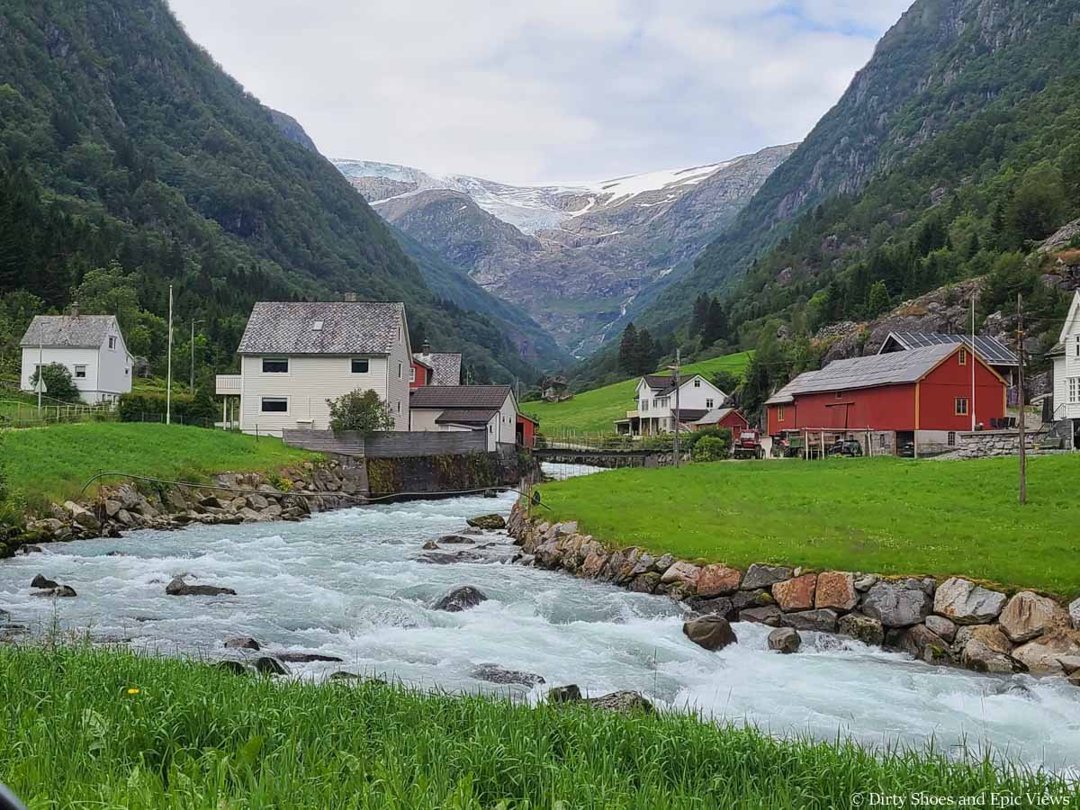
The Reinanuten hike begins in the beautiful Buerdalen Valley along the edge of Folgefonna National Park. This valley is a quick 20-minute drive from Odda in Norway’s Southern Fjords.
Buerdalen Valley in Norway
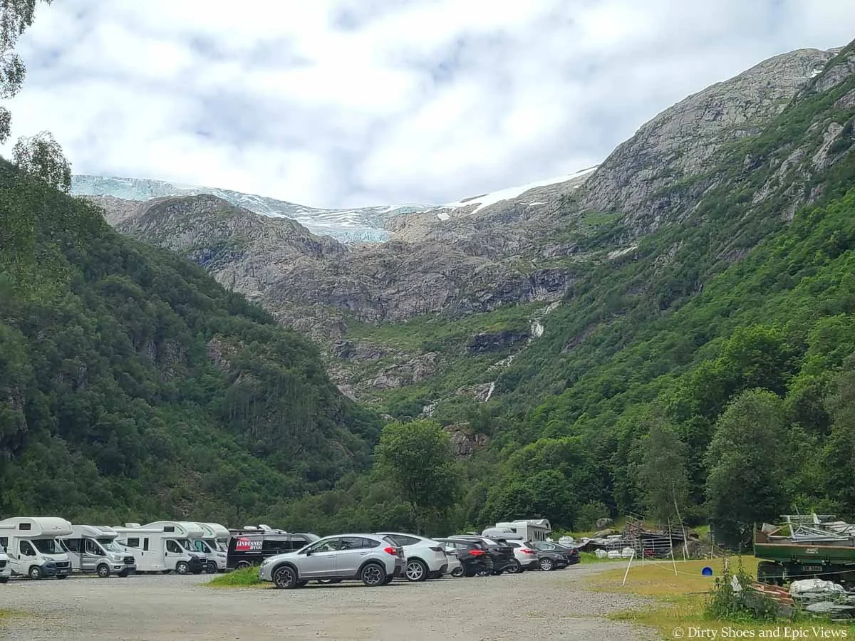
The focal point of the Buerdalen Valley is the Buerbreen Glacier, a cascading glacial tongue of the massive Folgenfonna ice cap, Norway’s third largest glacier. You can see the Buerbreen Glacier right from the incredibly scenic parking lot.
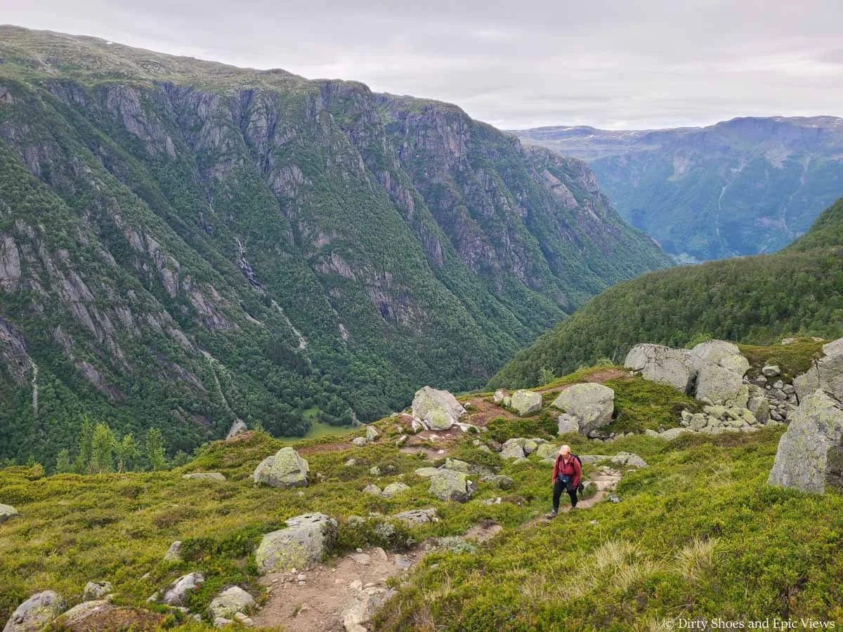
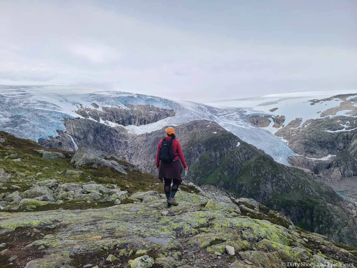
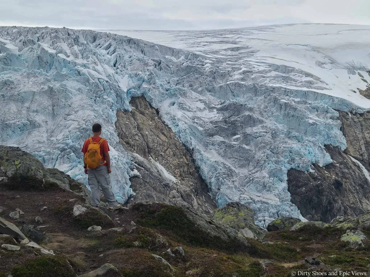
The Reinanuten hike climbs steeply up the side of this valley, up to the rocky cliffs that sit just in front of the glacier. The trail brings you to a unique vantage point where, instead of looking up at a glacier tongue from its base like many hikes do, you’ll be at a viewpoint overlooking the top of the glacier’s expansive icecap. It’s an incredible overlook that brings you up close to the jagged ice and deep crevasses of the glacier and gives stunning panoramic views of the Buerbreen valley, its cliffs, the dozens of cascading waterfalls, and the distant mountain ranges.
Epic views of the Folgefonna ice cap and Buerbreen Glacier from the Reinanuten viewpoint
How to get to the Reinanuten trailhead
The Reinanuten trailhead is about 20 minutes (7.5 km) from downtown Odda in the Southern Fjords. Set your GPS to the Buarbreen car park.
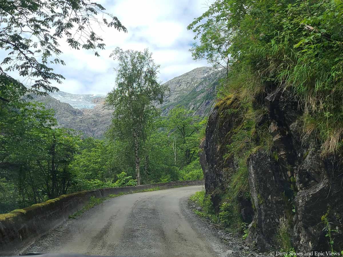
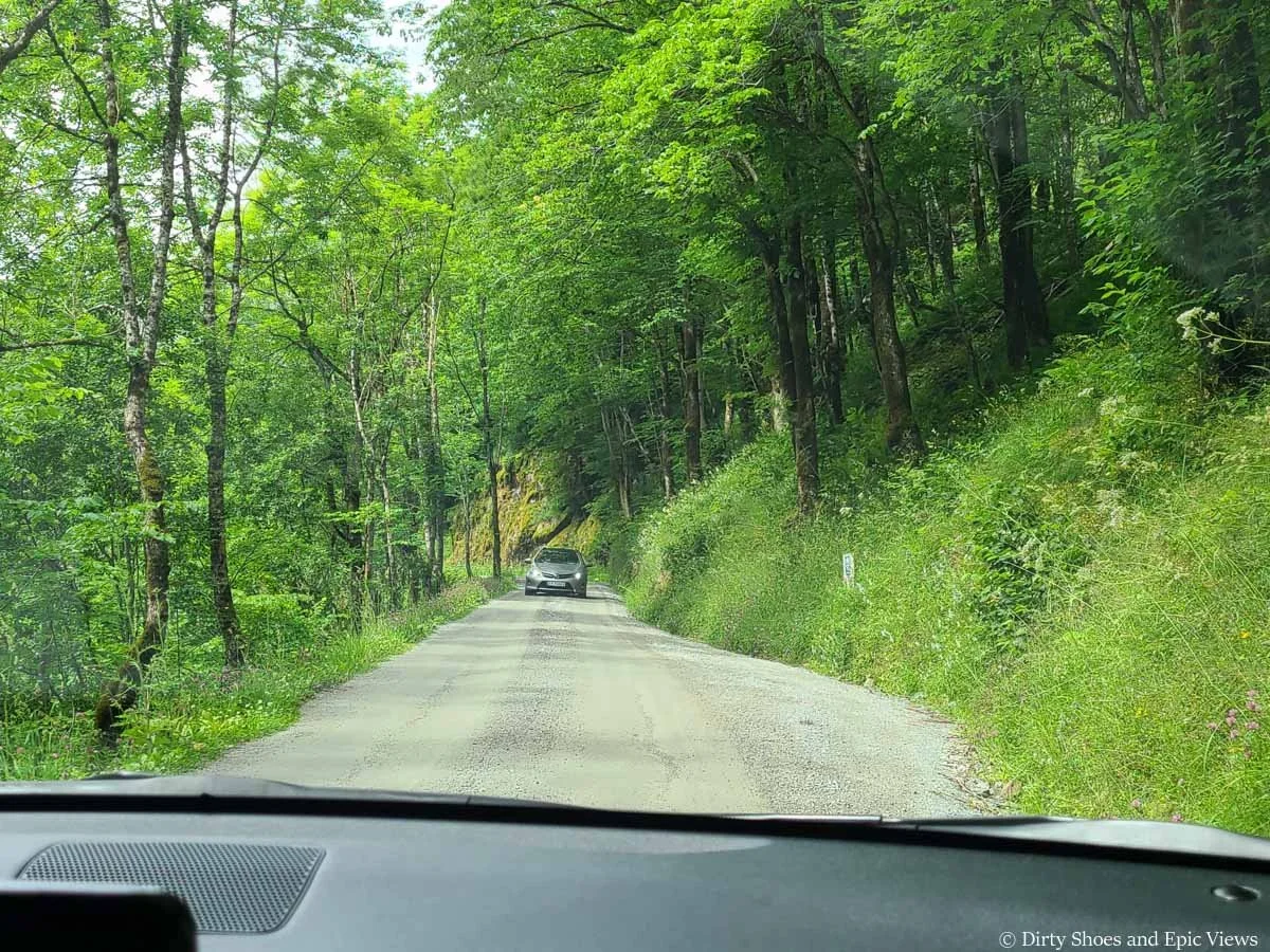
From Odda, you’ll drive around the west side of Sadvevatnet (a pretty lake) and then turn away from the lake and start driving into the scenic glacier valley, Buerdalen.
The road into the valley is long with well-maintained gravel, but it is quite narrow with quite a few blind turns. Luckily, it wasn’t very busy. But we do recommend you drive slowly and cautiously with a careful eye for oncoming traffic, and be prepared to stop and pullover. If you’ve read our Norway itinerary, you’ll know that this is quite common on Norway’s roads!
A typical view of the road into Buerdalen Valley
Be on the lookout for pullover spots in case of oncoming traffic
With that said, the road into Buerdalen Valley is quite scenic. You’ll be following a rushing blue river through the valley, and you’ll catch frequent glimpses of the Buerbreen Glacier ahead.
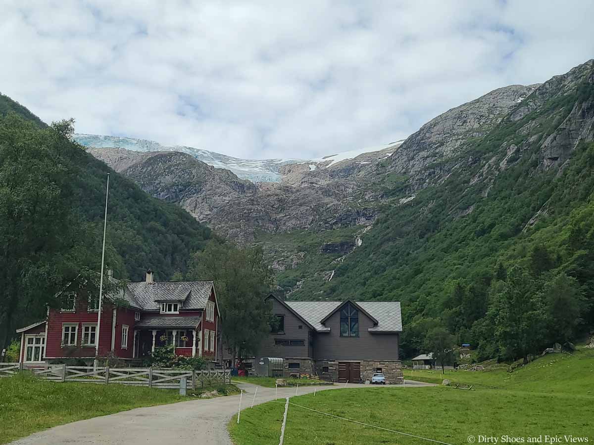
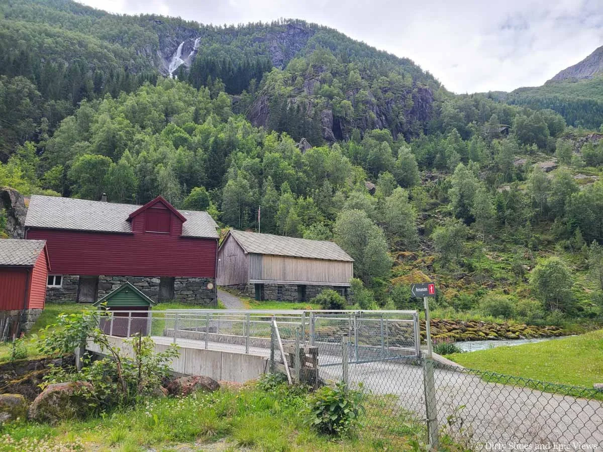
The road ends in a parking lot for the trailhead and a restaurant. It’s pretty pricey to park here for the day, but the funds go for supporting upkeep of the park and trails. We’ve read some accounts of people saying that they park further away (at a small lot near the Trolltunga Campground) just to avoid playing the pricey cost, but that would be a long walk in and not worth it in our opinion. When we hiked Reinanuten, the cost to park here for the day was 230 NOK. You’ll drive through a gate to get into the lot, and then you’ll pay at the gate on the way out by credit card.
The parking area has two long narrow lots separated by a small stretch of road. For the Reinanuten hike, it doesn’t really matter which one you park in because the trailhead is pretty much halfway between the two.
When we arrived at the lot close to 1 pm, the first lot was basically full, which surprised us because we didn’t think we would find a big crowd here! So we followed the signs for more parking. We drove through the lot and down another narrow stretch of road past the Buer Restaurant (good for a post-hike meal!). The second lot is just behind the restaurant and, to our surprise, it was also pretty full! But we were still able to find parking.
The road as it passes by the restaurant at the Reinanuten parking lot
The second parking lot for Reinanuten
The good news? Everyone must have all been doing the Buerbreen hike (another more popular hike in the area) because they certainly weren’t on the Reinanuten trail! More on that in just a bit…
Right from the parking lot for Reinanuten you get a great view up to the Buerbreen Glacier and the surrounding cliffs, mountains, and waterfalls.
We didn’t really know where exactly the Reinanuten hike would be going at this point, and little did we know we would be going pretty much straight up the valley’s side to the left of the glacier up to the rocky ridge high above. At this point for me, ignorance was bliss…
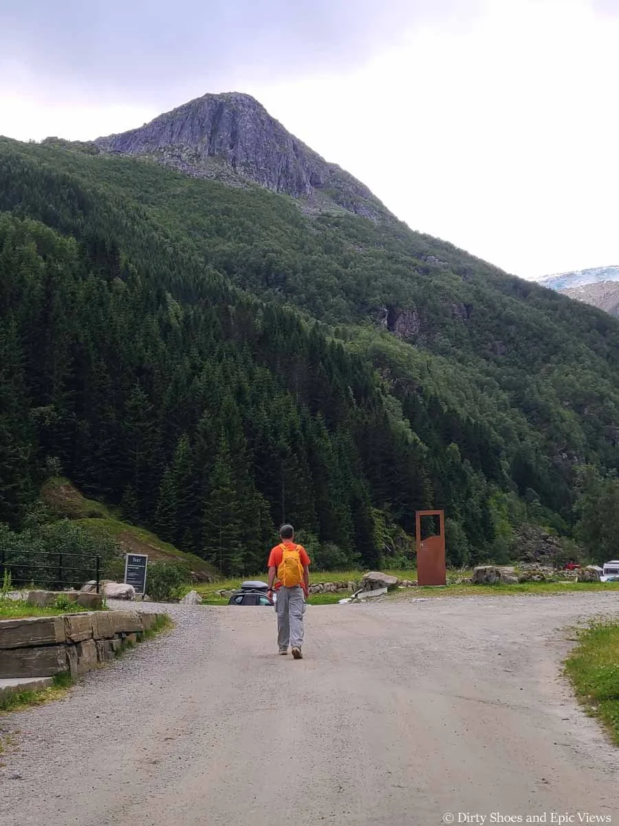
The Reinanuten hike will take you up to the top of the cliffs above the parking lot
To get to the Reinanuten trailhead, walk back down the road towards the first parking lot until you reach a small footbridge that crosses the river. You should see a sign for Reinanuten pointing across the bridge- this is where you start the Reinanuten hike!
The start of the Reinanuten trail
How Long is the Reinanuten Hike in Norway?
Here are our personal roundtrip stats for the Reinanuten hike near Odda:
Distance: 6.2 miles / 10 km round trip
Elevation gain: 3,547 feet / 1081 m
Time: 7 hours. It took 3.5 hours to go up, and 2.5 hours to hike down, with about an hour hanging out at the summit.
Reinanuten is a short trail- but don’t let that fool you. Take a look at that elevation gain and you’ll quickly realize that this won’t exactly be a quick walk in the park!
Elevation profile:
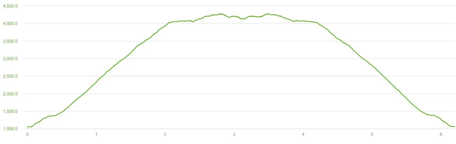
Out-and-back elevation profile of the Reinanuten hike
Map of the Reinanuten hike in Norway
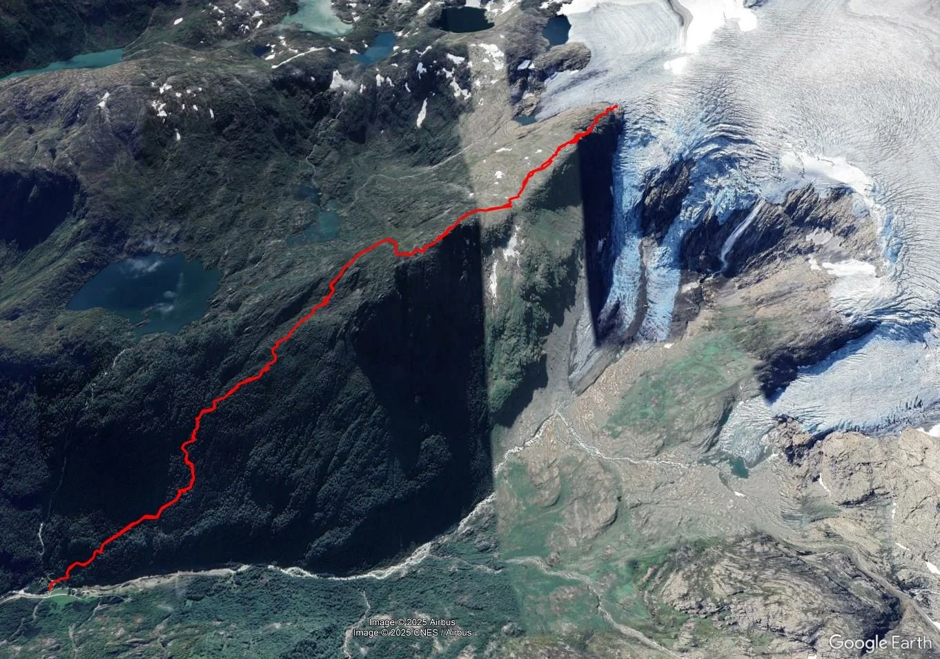
A satellite shot of our Reinanuten hike
How Hard is the Reinanuten Hike in Norway?
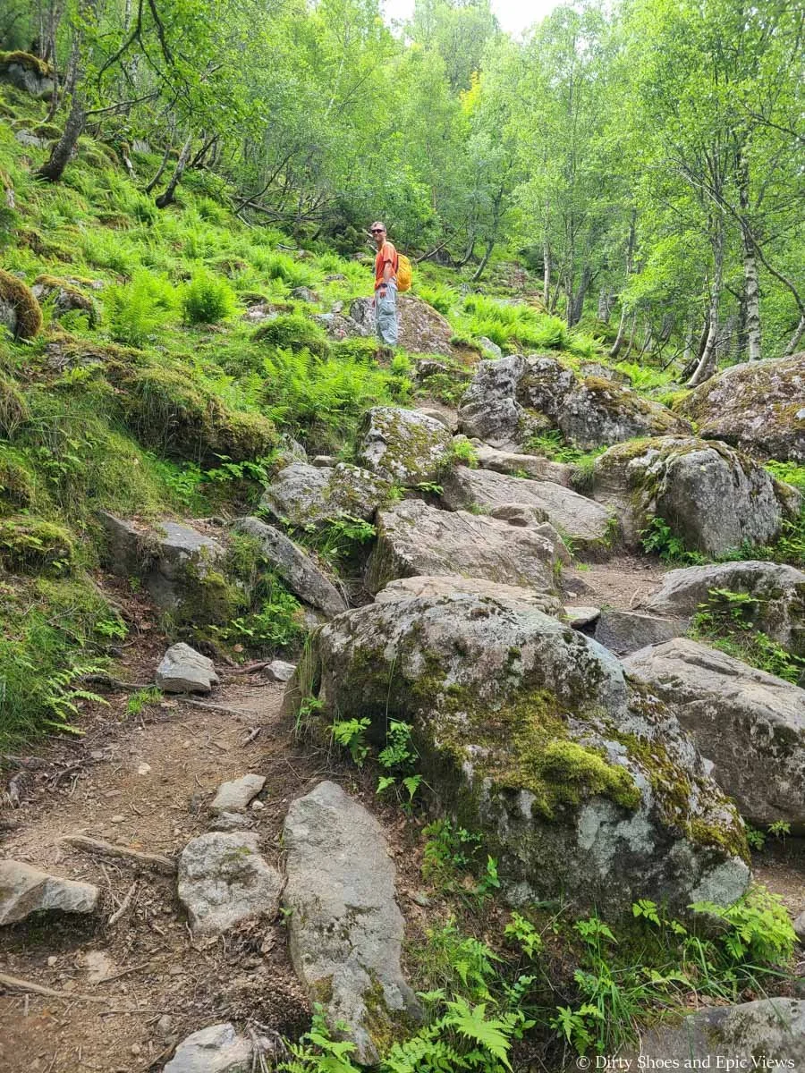
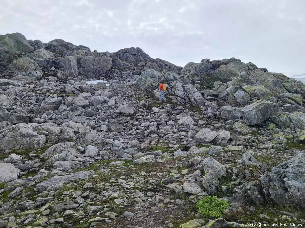
The Reinanuten hike is just plain exhausting. It’s very steep- basically one continuous climb with no real break. It’s also pretty rocky and rugged throughout with some bits of loose rock or mud here and there. It’s nothing technical, it’s just a grind, both mentally and physically.
The Reinanuten trail is steep…
…and also quite rugged!
In fact, Reinanuten is probably the steepest trail we’ve ever hiked. During one of our microbreaks, Kevin checked the stats, and we had climbed 1800 feet in just 1.3 miles- that’s pretty steep! And we noted that we had averaged roughly 1500 feet per mile over the first two miles. So get ready to feel those legs burning!
And just a head’s up, because it’s so steep, the descent is arguably just as hard as the ascent on this hike. You’ll be on tired feet and the steep downhill can really be brutal on the legs and knees. If you are used to having them, bring your trekking poles for this one.
Looking down the trail- it’s often steep with loose dirt and rock
Trekking poles are definitely helpful on this type of terrain!
The saving grace is that it is a short trail, and despite being a bit more off-the-beaten path and rugged, Reinanuten is a very well-marked trail. Keep your eye out for the red T’s to keep you on track- sometimes it seemed like every other rock was marked, so it’s pretty easy to follow the trail.
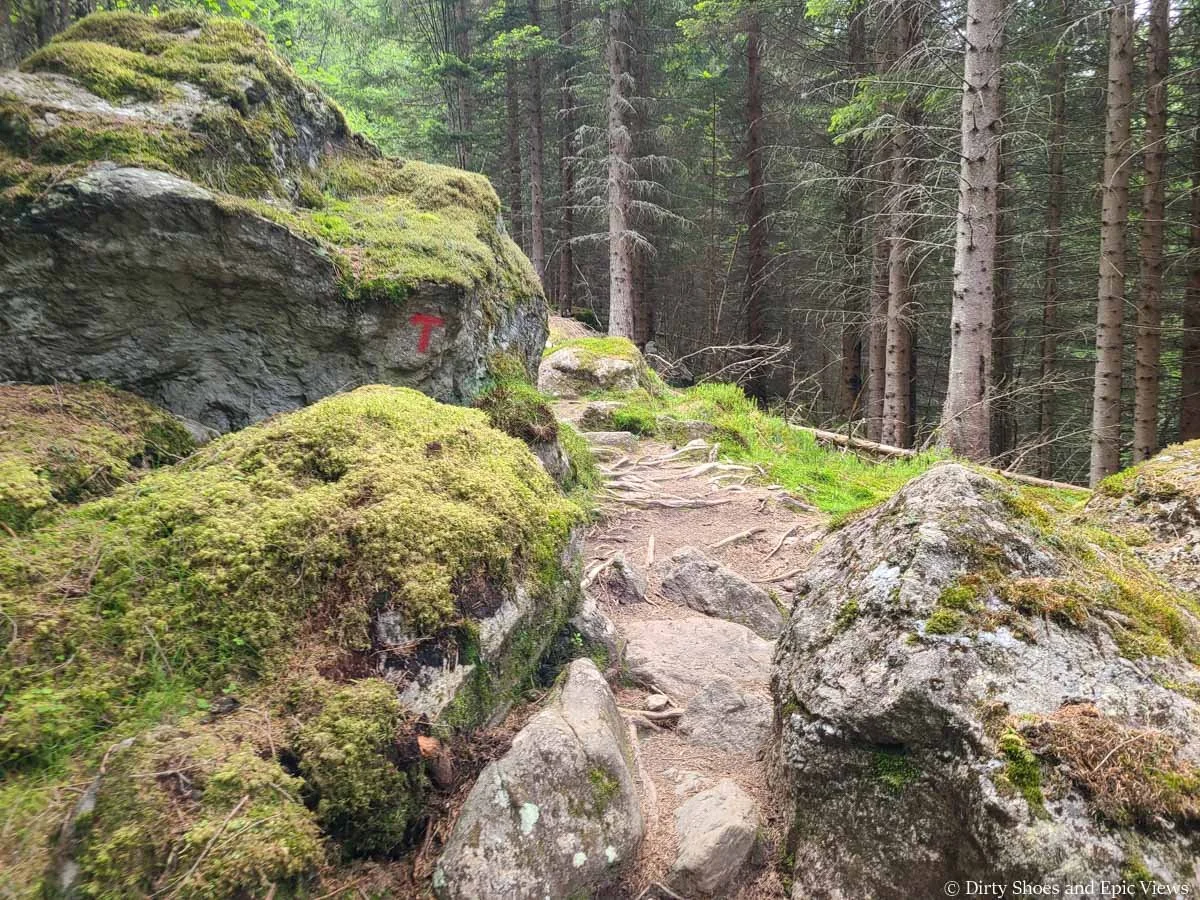
Red Ts mark the Reinanuten trail
Despite there being an easier alternative, we ultimately still decided to hike Reinanuten. We knew we would be getting similar glacial views like the ones from the Buarbreen hike once we headed over to Jostalbreen National Park (check out our time on the Austerdalsbreen hike!), so we wanted to take advantage of this opportunity to see an ice cap from above.
We were also super happy with our decision to hike Reinanuten instead once we saw how busy and popular the Buarbreen hike was just based on the parking lot alone. The solitude and views we got on Reinanuten were definitely worth the extra effort.
The Reinanuten Hike in Norway: Trail Description and Our Experience
Now that we got all the important details out of the way, we want to get to the good stuff! Here, we’ll share with you our detailed experience on the Reinanuten hike so you can see if it’s something you want to tackle.
To start the Reinanuten hike, you’ll open the gate and cross the small footbridge over the river near the Buer Restaurant. Right after the bridge, there will be a sign for Reinanuten that points you on the path to the right, following the river upstream.
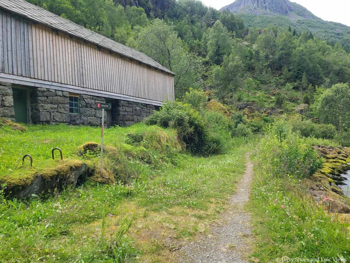
The start of the Reinanuten trail on the other side of the river
Enjoy this part of the hike, because it’s pretty much the only flat section of the entire trail!
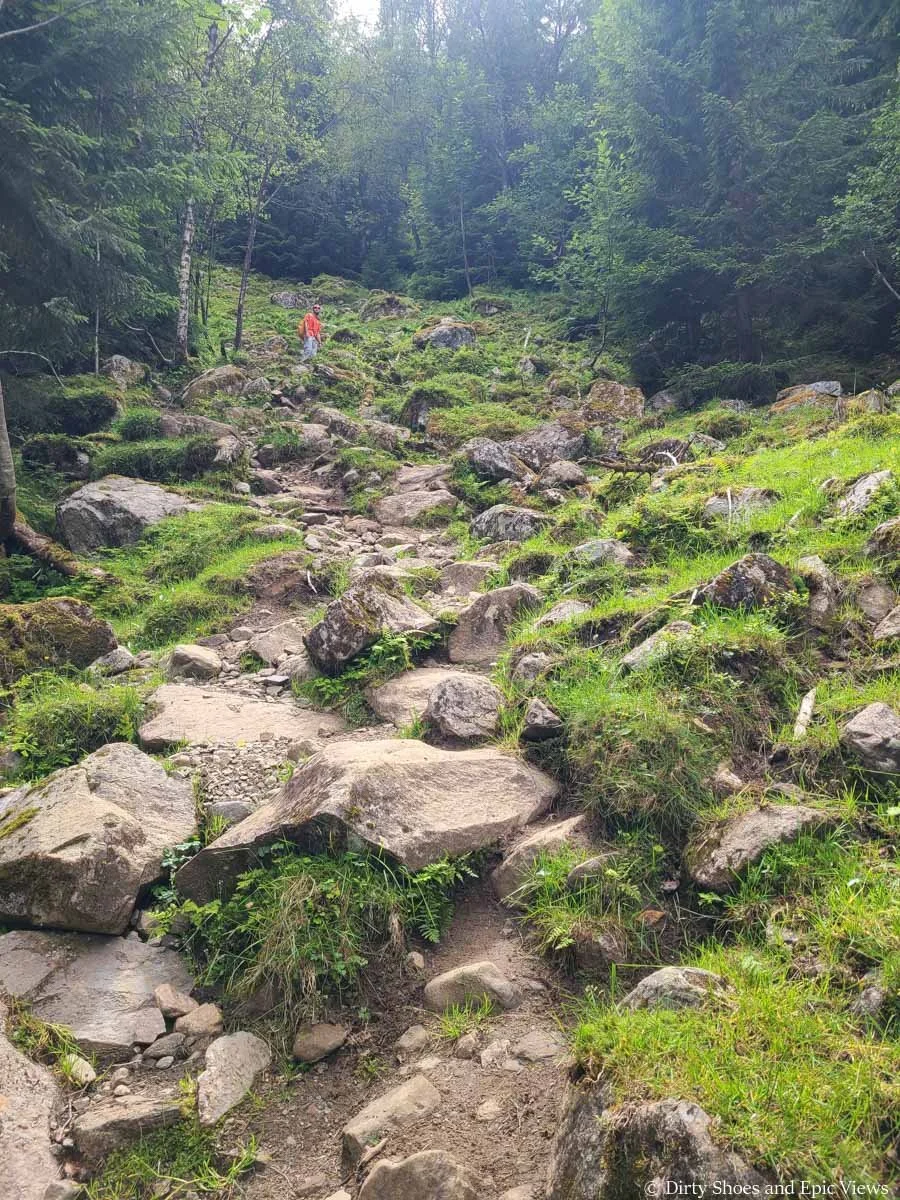
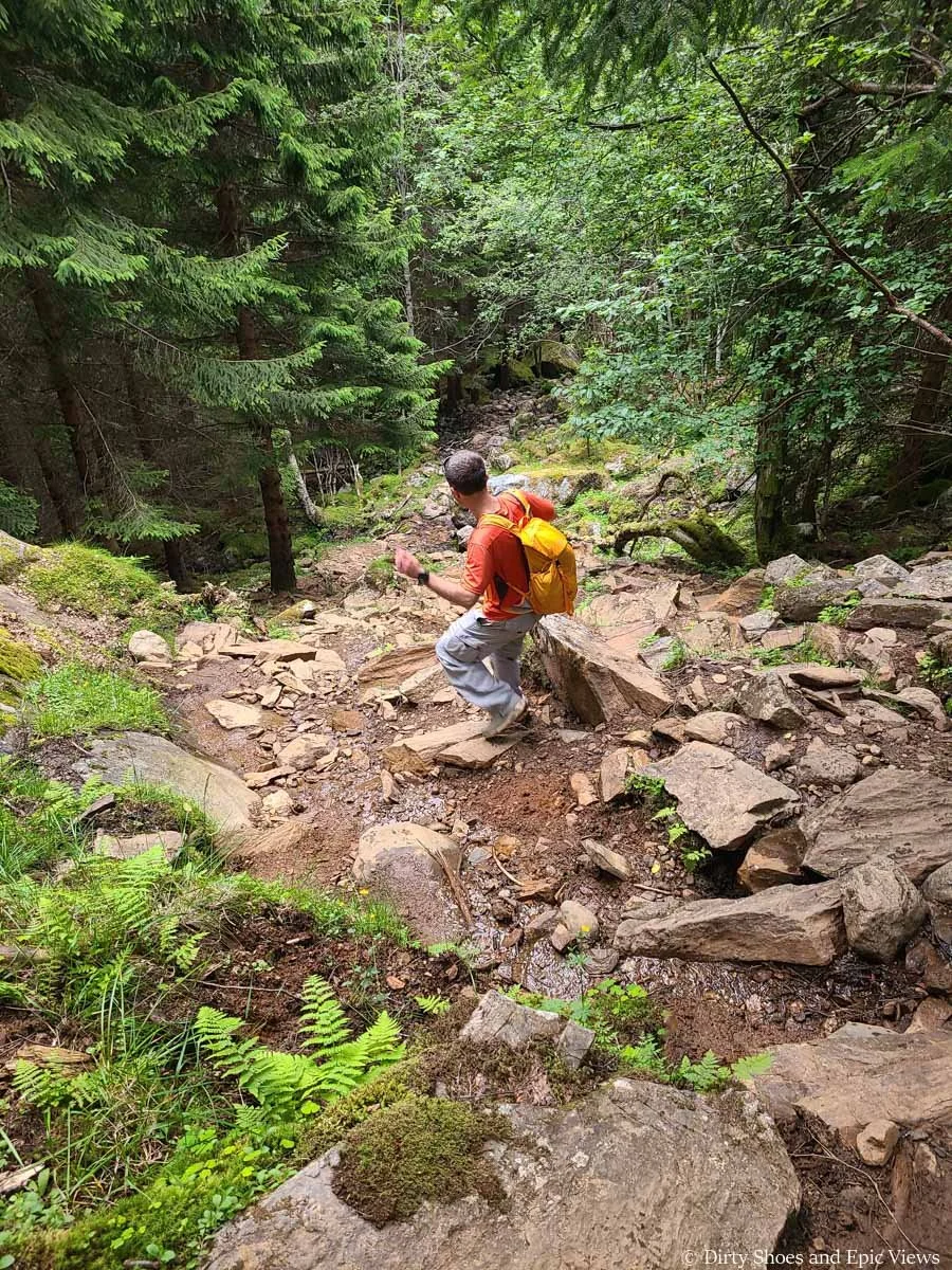
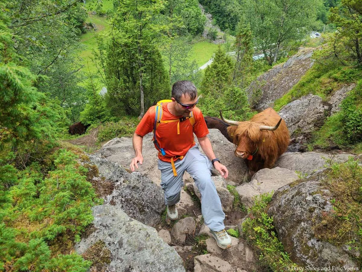
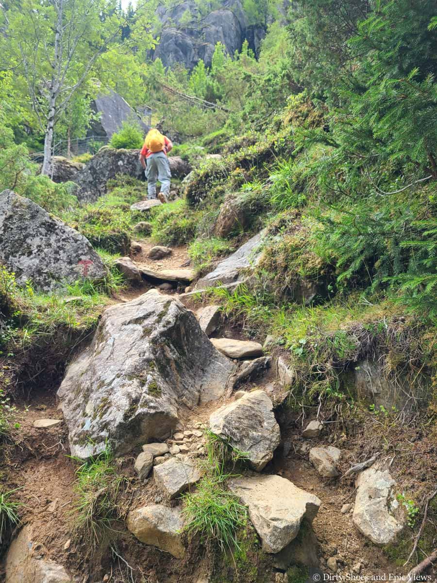
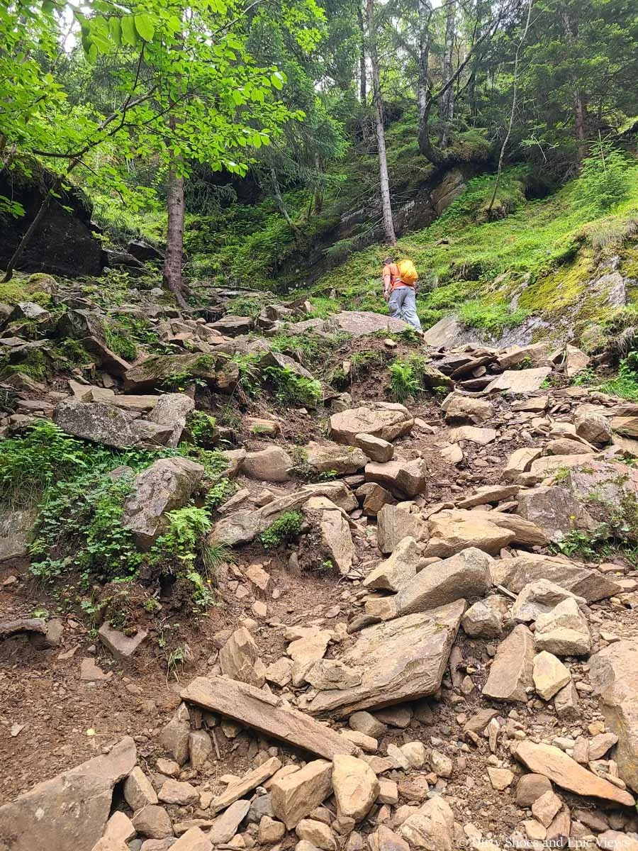
You’ll quickly come to another gate that you have to go through, and from here, the trail turns and begins its never-ending steep and relentless climb up out of the valley. The trail through here is steep and quite rocky, with sometimes larger boulders you’ll have to maneuver around and up.
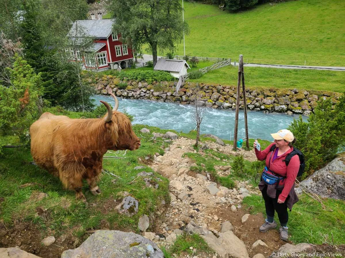
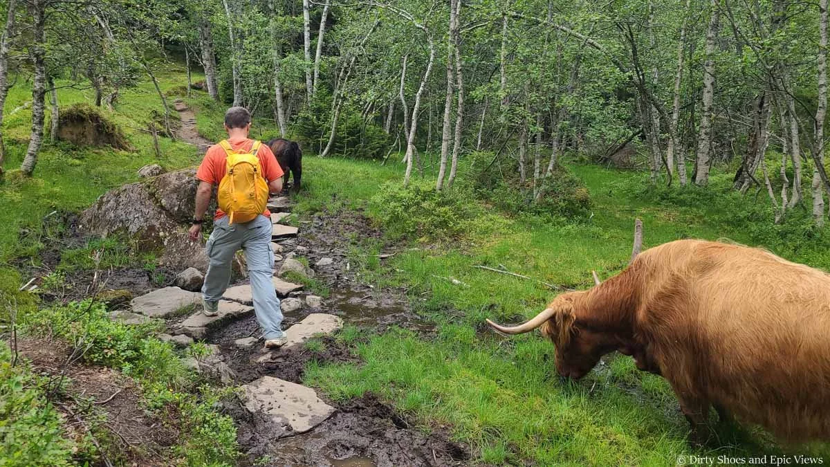
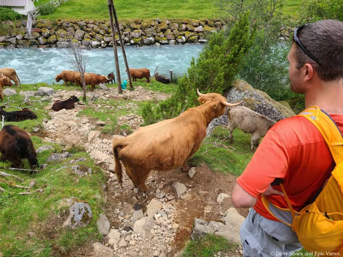
However, as we started up this section we were, to our surprise, greeted by a friendly-looking Highland cow! He was right by the trail and seemed rather curious, just watching us pass by. The Buer Farm, which sits right by the Buer Restaurant, has lots of these cows that roam the valley freely and often are seen by hikers on these lower parts of the trail. While they seemed friendly and curious, I was a bit way of their massive horns and didn’t know their temperament, so we tried to admire from a distance and stay out of their way, which was actually kind of hard to do!
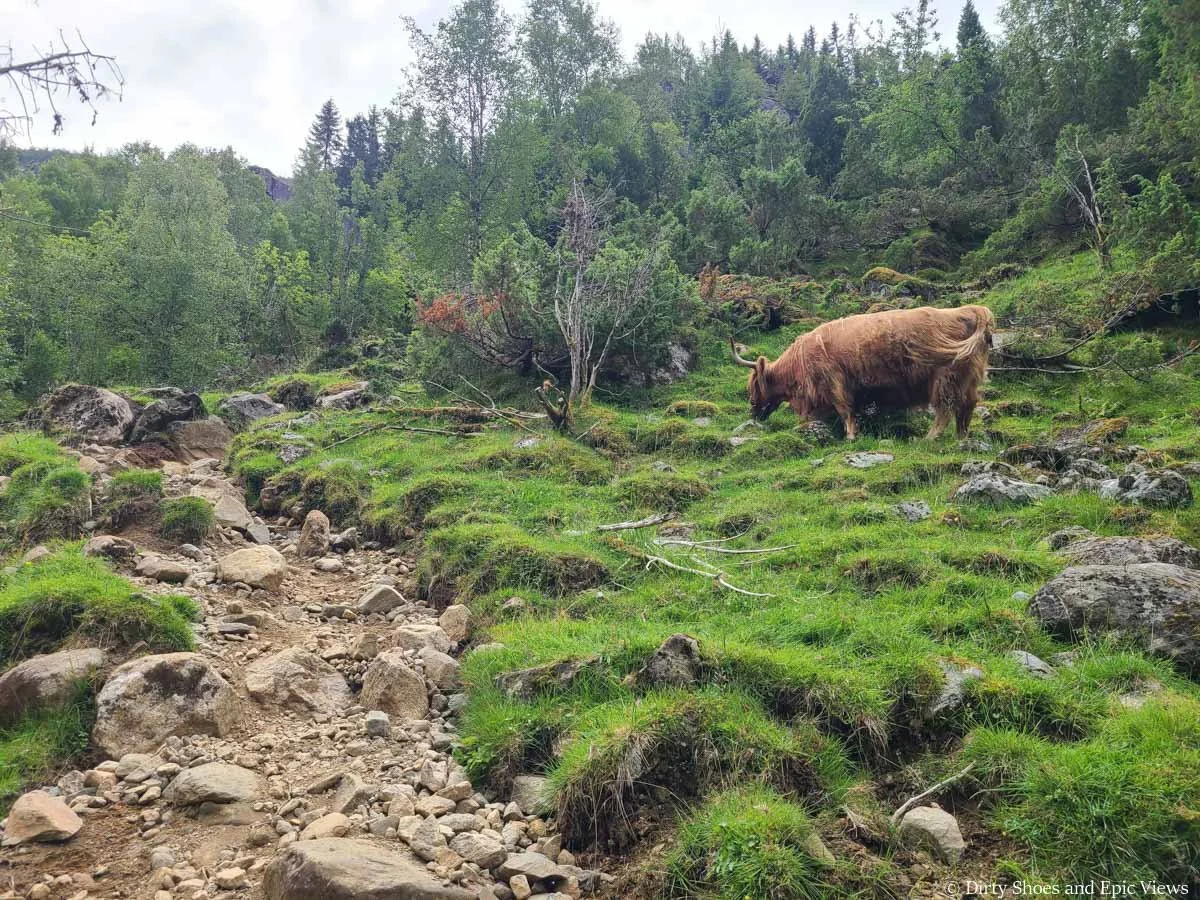
We were greeted by cows at the start of the Reinanuten trail!
They happily posed for our pictures
As we continued to climb up the rocky path straight up out of the valley, we started seeing more cows! These ones were cute little baby cows that were just walking along the trail ahead of us. And then, a few more Highland cows appeared! They all kind of just lingered right on the trail and watched curiously as we headed up, sometimes requiring us to skirt off the trail a bit to give them their space.
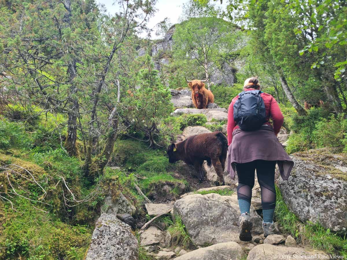
Baby cow leading the way!
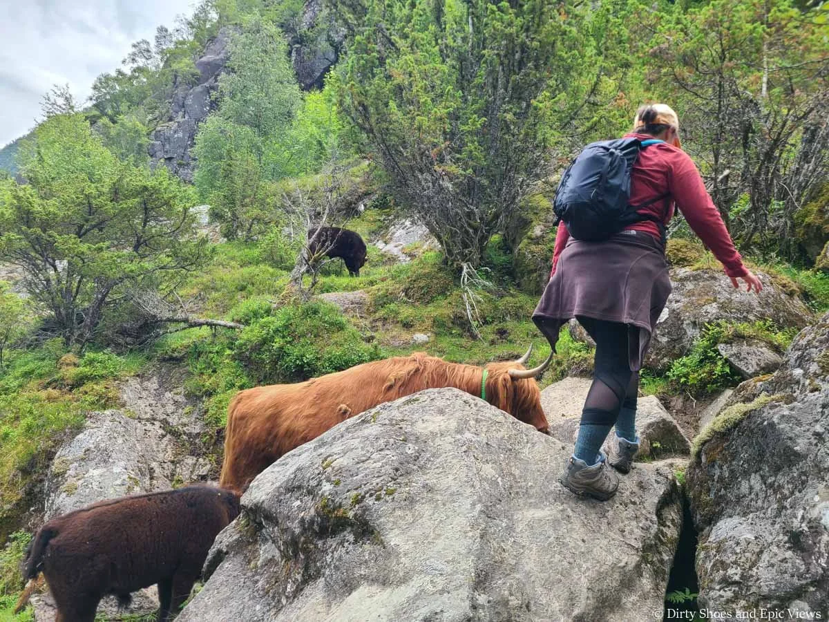
The cows took up the trail, so we would sometimes have to climb around!
And just a head’s up, as you might guess, there was a lot of cow poop throughout this part of the climb, so watch your step! It sometimes made an already challenging trail a bit more tiring when trying to avoid certain spots along the way. Also, it was pretty buggy through here, and we couldn’t stop for too long without getting swarmed.
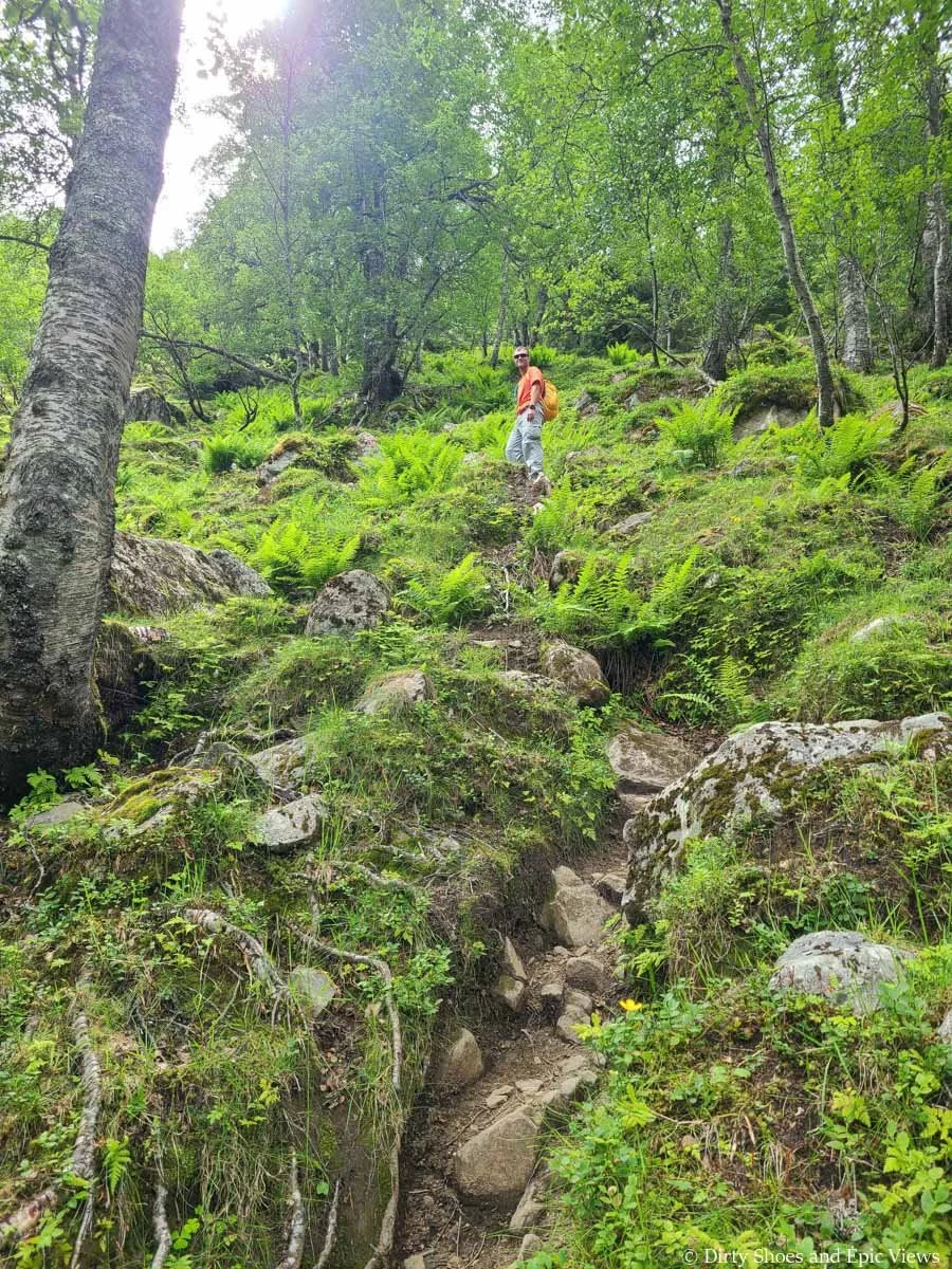
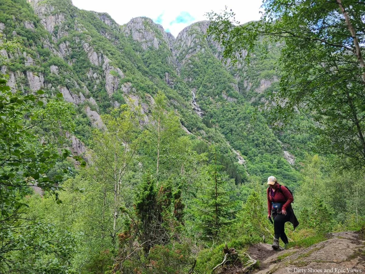
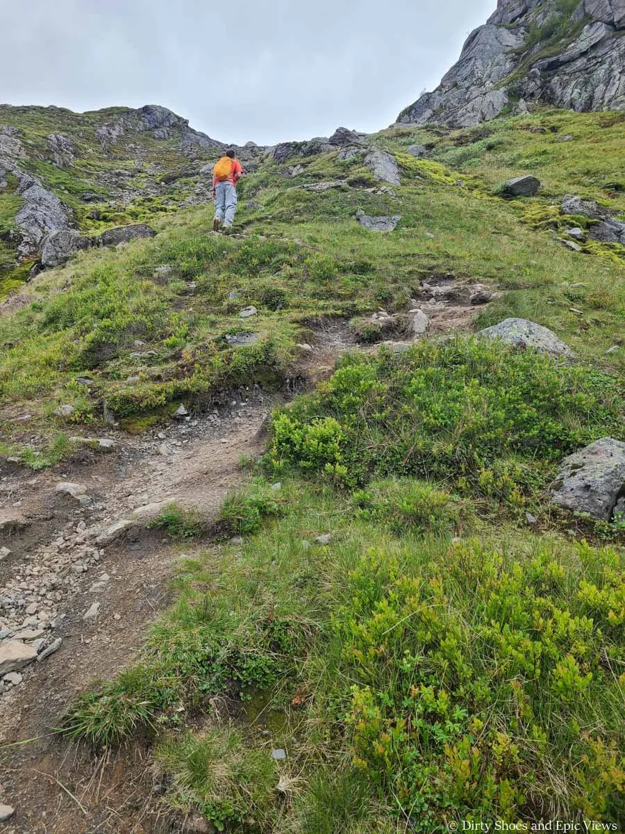
The trail continues up a steep rocky path, but our legs were still fresh, and the cows happily distracted me from the challenging terrain, so this part wasn’t bad. As we climbed up through the sparse forest, there were occasional views behind us out to the mountains across the valley, but these are nothing compared to what’s to come.
The Reinanuten trail climbs steeply right from the start!
After about 15 minutes of steep climbing, we came to a very brief flat section through a grassy meadow where there were a lot more Highland cows grazing and watching us pass through. We loved seeing them, though I was still a bit uneasy with how close their giant horns were to us and the trail!
This part of the Reinanuten trail can be a bit muddy, but there were some nice rocky stepping stones to help navigate through.
Navigating the muddy terrain
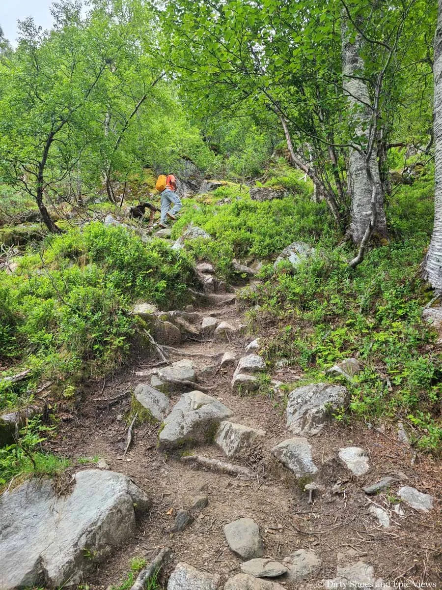
After this all too brief respite, the steep climb of the Reinanuten hike continues. Now it heads up through a dense lush forest for quite a while with only occasional fleeting views across the valley, and the trail becomes quite rugged, full of rocks, roots, and bits of loose rock and mud.
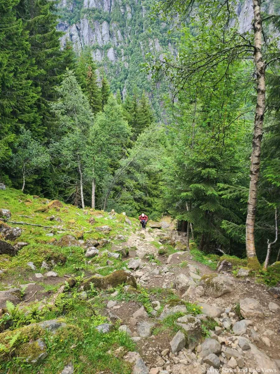
Oh, and did I say it’s steep? Don’t worry- I’ll probably say it a hundred more times. And honestly, the pictures don’t quite do it justice, though we tried to capture just how steep the Reinanuten hike actually was.
However, it sometimes wasn’t as bad as it looks. Often, I’d look up at the pile of rocks and roots and think I’d be climbing straight up, but there would often be little herd paths that make tiny switchbacks to guide you up the trail. Don’t get me wrong- it’s still steep, but it made the hiking a little easier.
You’ll eventually come to a point of really steep switchbacks through a lush green part of the forest right before you hit a trail junction. For us, we got here after exactly one hour of hiking, and at this point we had climbed about 1,000 feet already.
The Reinanuten trail is steep!
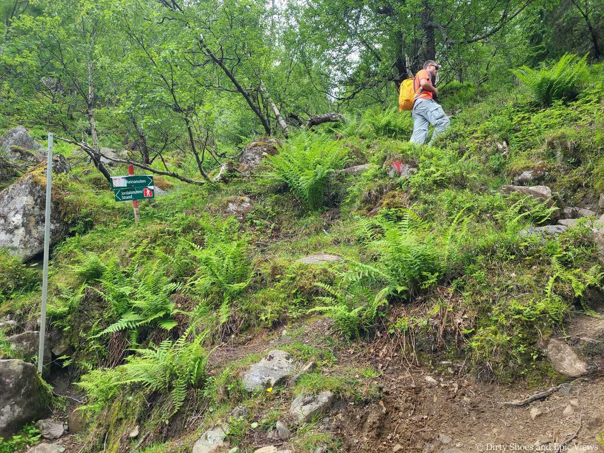
Bear right at this junction to continue to Reinanuten
You’ll bear right at this junction and…well, I bet you can guess… Yep- more steep climbing!
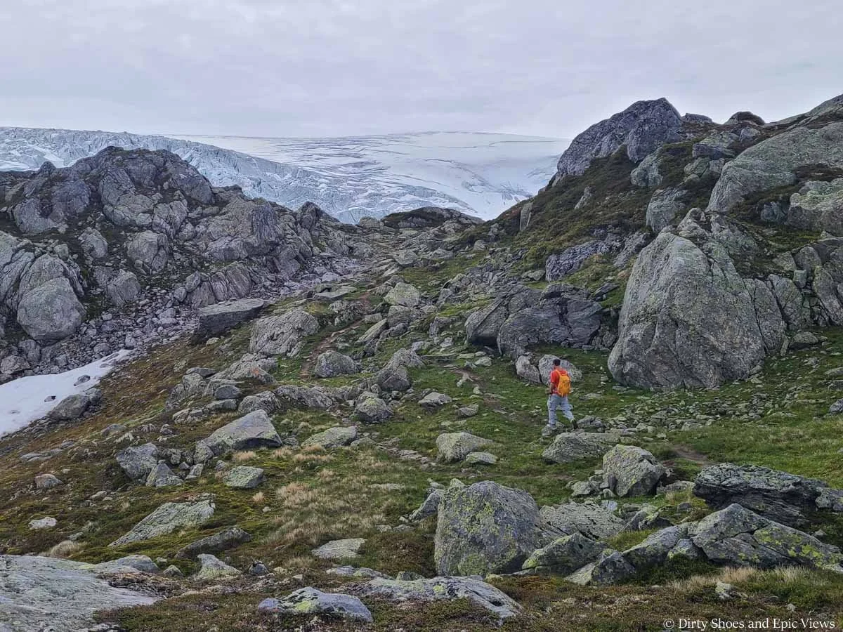
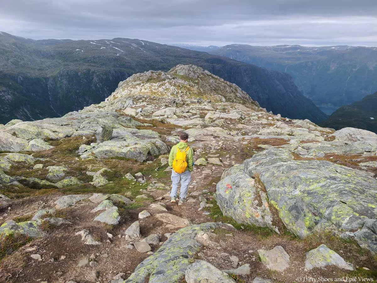
But after just about 20 minutes past this junction, the Reinanuten hike starts to become a lot more interesting, because here is where you start hiking out of the treeline and into the alpine brush, and the views really start opening up around you. The ice cap comes back into view as well as all the waterfalls cascading down the cliffs across the valley. The views are already epic here, but it’s about to get even better.
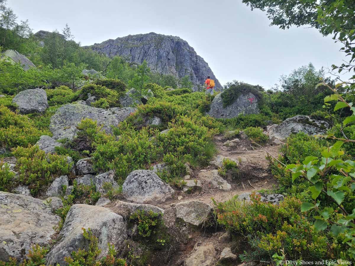
Hiking out of the forest and to the views!
The views start to open up at this point in the Reinanuten hike!
Snowy mountain views and waterfalls!
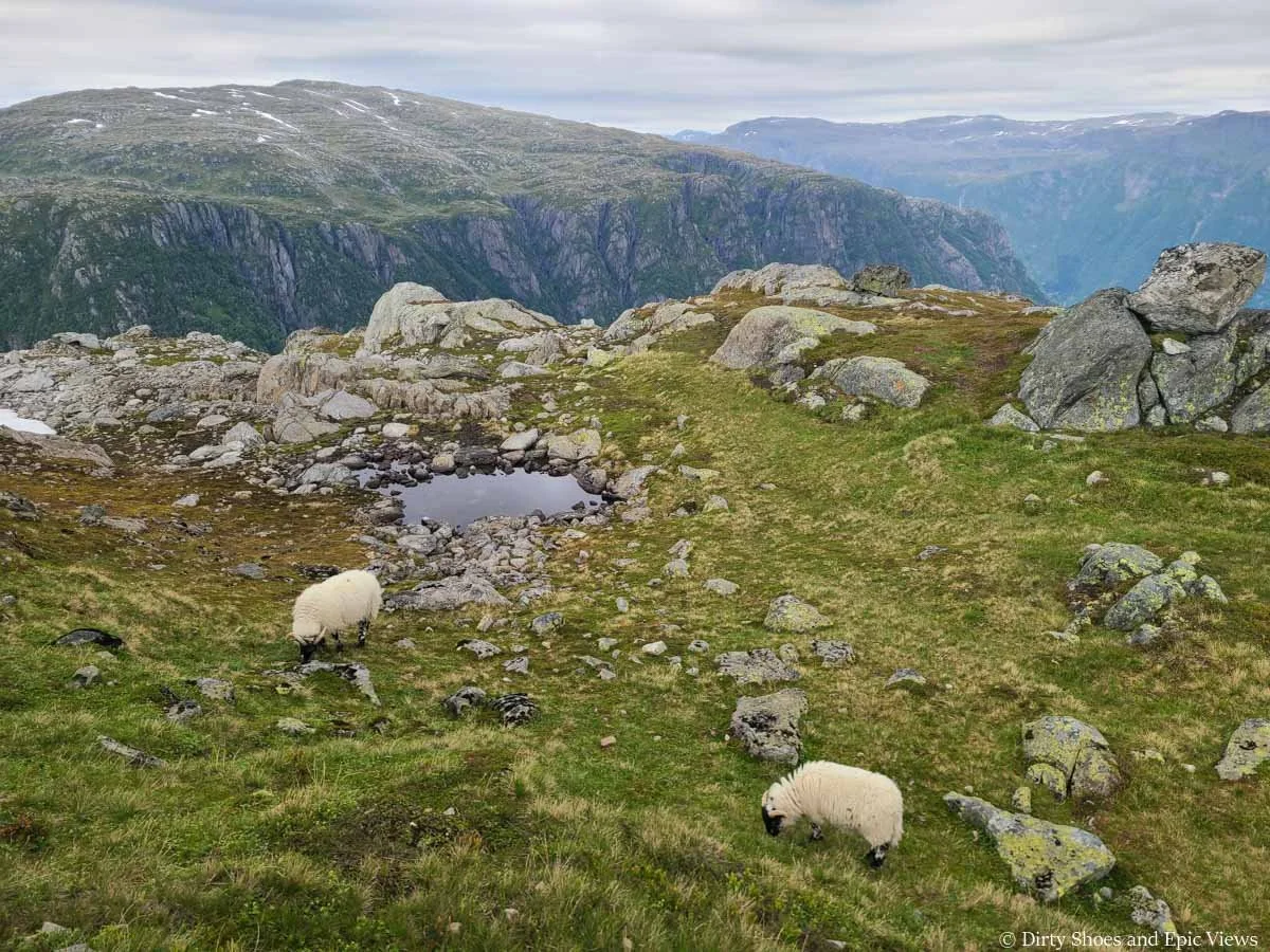
As the trail continues steeply up, it becomes less rocky as it heads up a grassy meadow towards a headwall, and through here we were greeted by lots of fluffy sheep scattered throughout the mountainside! Meanwhile, the views continued to open up around us.
Climbing through the meadow towards the headwall
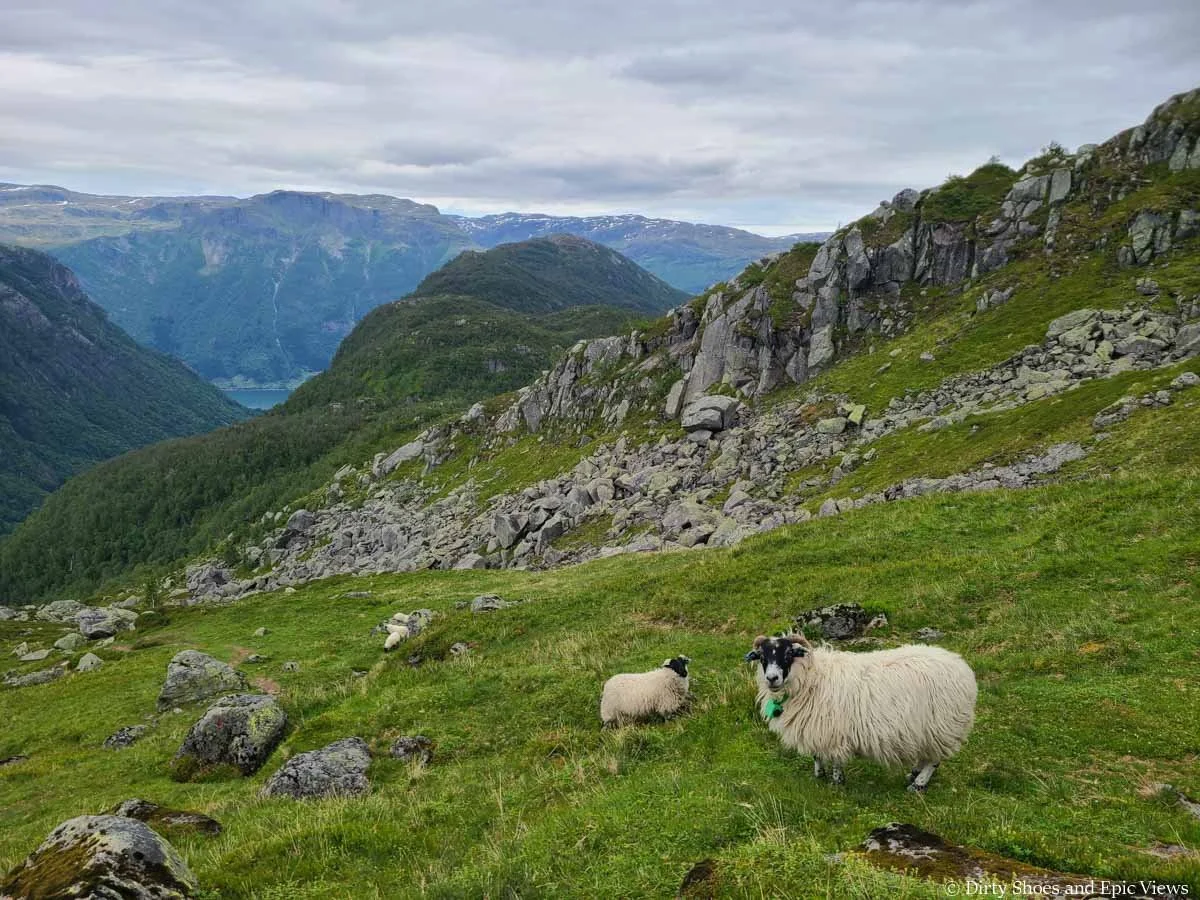
Hello, sheep!
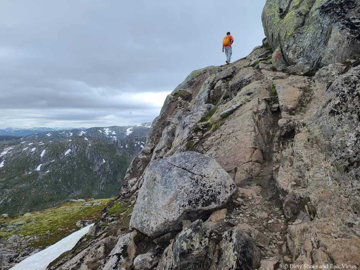
Towards the top of the headwall, the trail seemed to get even steeper (which we didn’t think was possible). It gets a bit rocky up here, and there was one small tricky spot, particularly on the way down, that was a bit slick and required slight scrambling, but it was brief.
The Reinanuten trail continues steeply towards the headwall
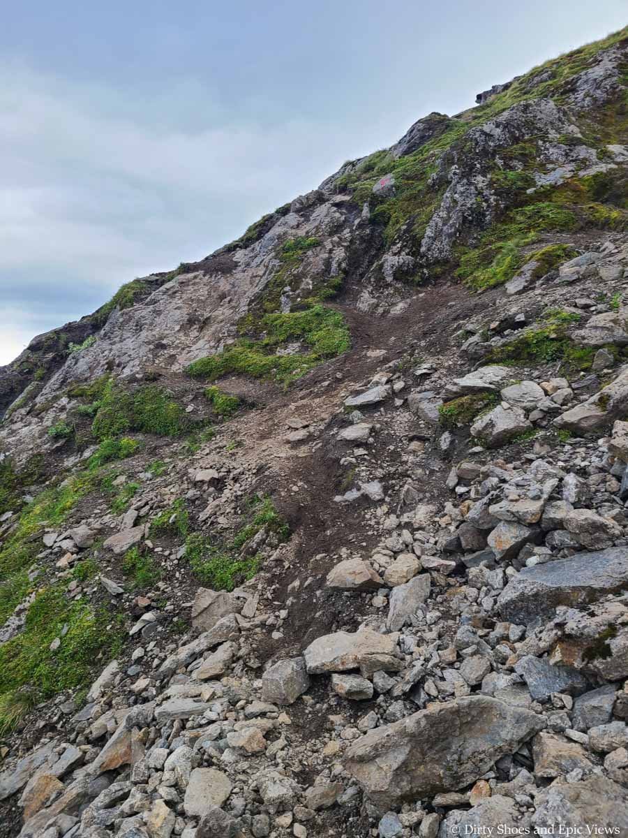
A small tricky part going up the headwall
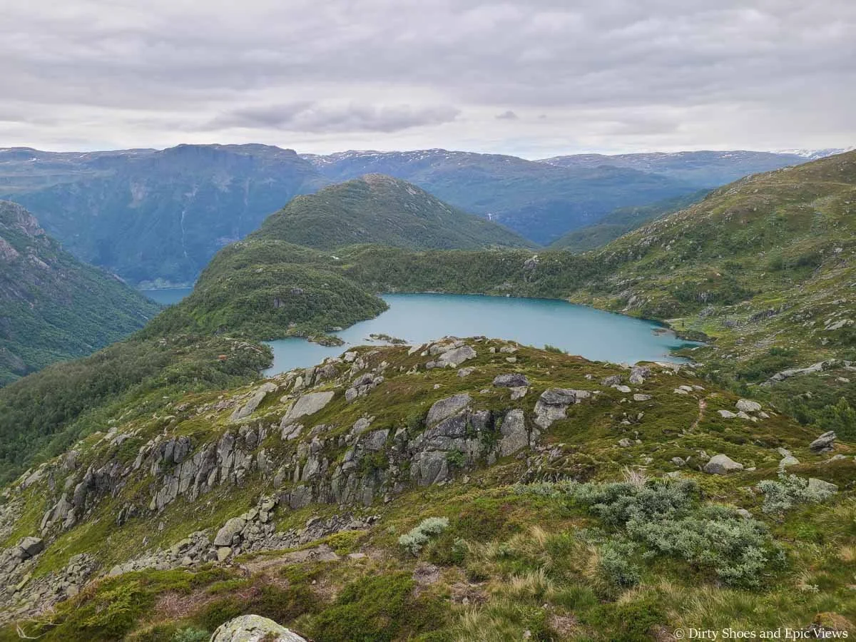
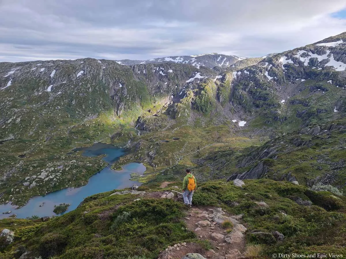
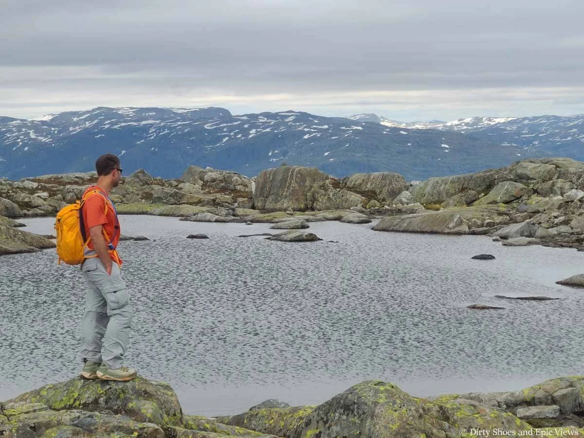
Eventually, a nearby lake comes into view, with the distant mountains near Hardangerfjord setting the backdrop.
Beautiful views from the Reinanuten trail in Norway
Even though from the meadows below it looked like the trail might level off up over the headwall, it just keeps on climbing. It’s one of those trails where you keep looking up and see what looks to be the “top” of the climb, but when you get there, you realize it just keeps on climbing! By this point, it was getting quite tiring. But the incredible views kept me going.
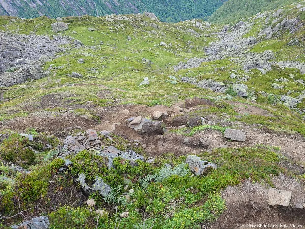
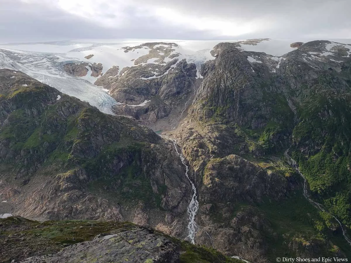
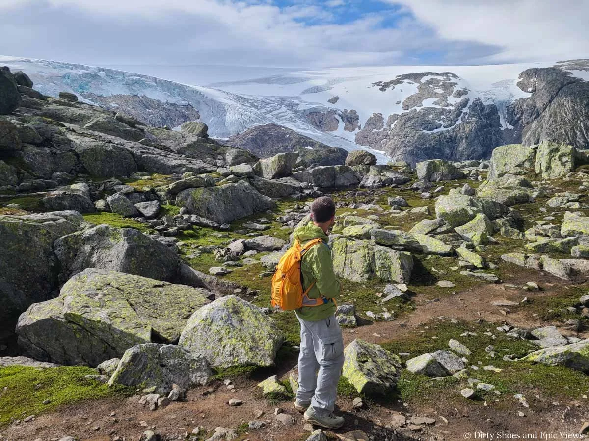
Before you know it, you’ll round a corner and views of a gorgeous alpine basin open up. Beautiful blue lakes and waterfalls come into view, and you can also see some of the ice cap above the basin.
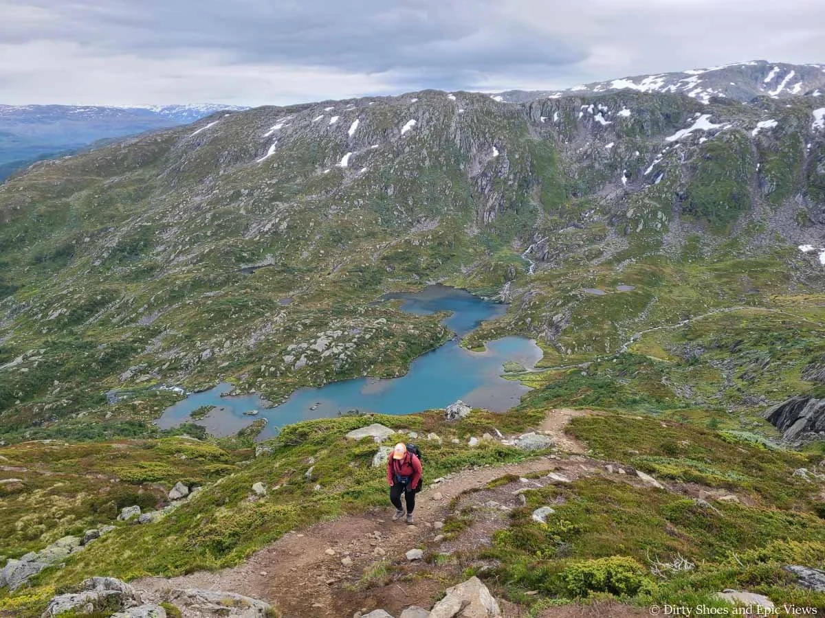
Hiking above a beautiful basin on the Reinanuten trail
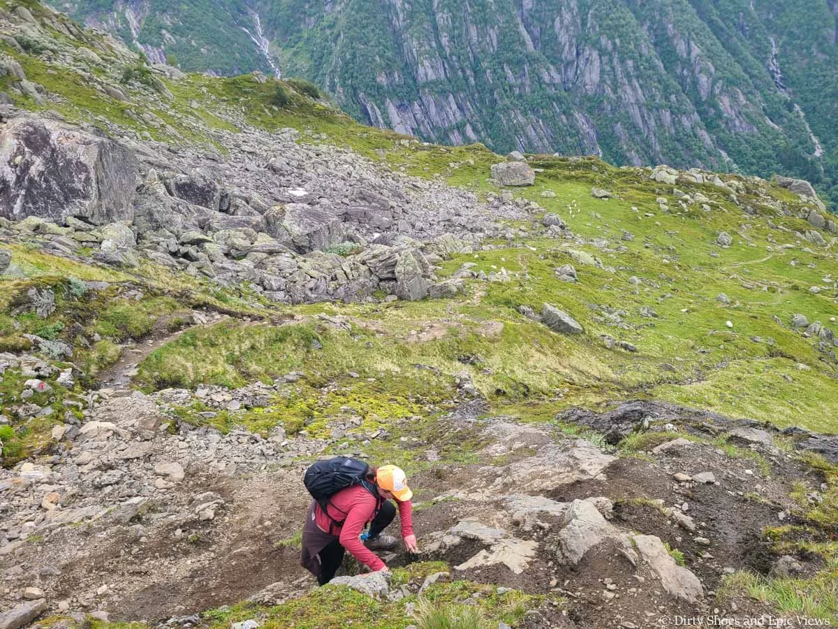
From here, the Reinanuten trail turns quite rocky again and continues climbing steeply as the views of the basin behind you get better and better. Stopping every ten feet to turn around and take pictures was a great excuse to take lots of mini breaks throughout this part of the climb.
Looking back down toward the basin below the Reinanuten trail
After a bit of climbing, we hit the first and only small patch of snow still lingering on the trail. It was on a slight incline and quite slick so it was a bit tricky to cross, especially on the way down, and having trekking poles for this would definitely be helpful. However, it was a very small patch so luckily it wasn’t an issue- just take it slow and carefully.
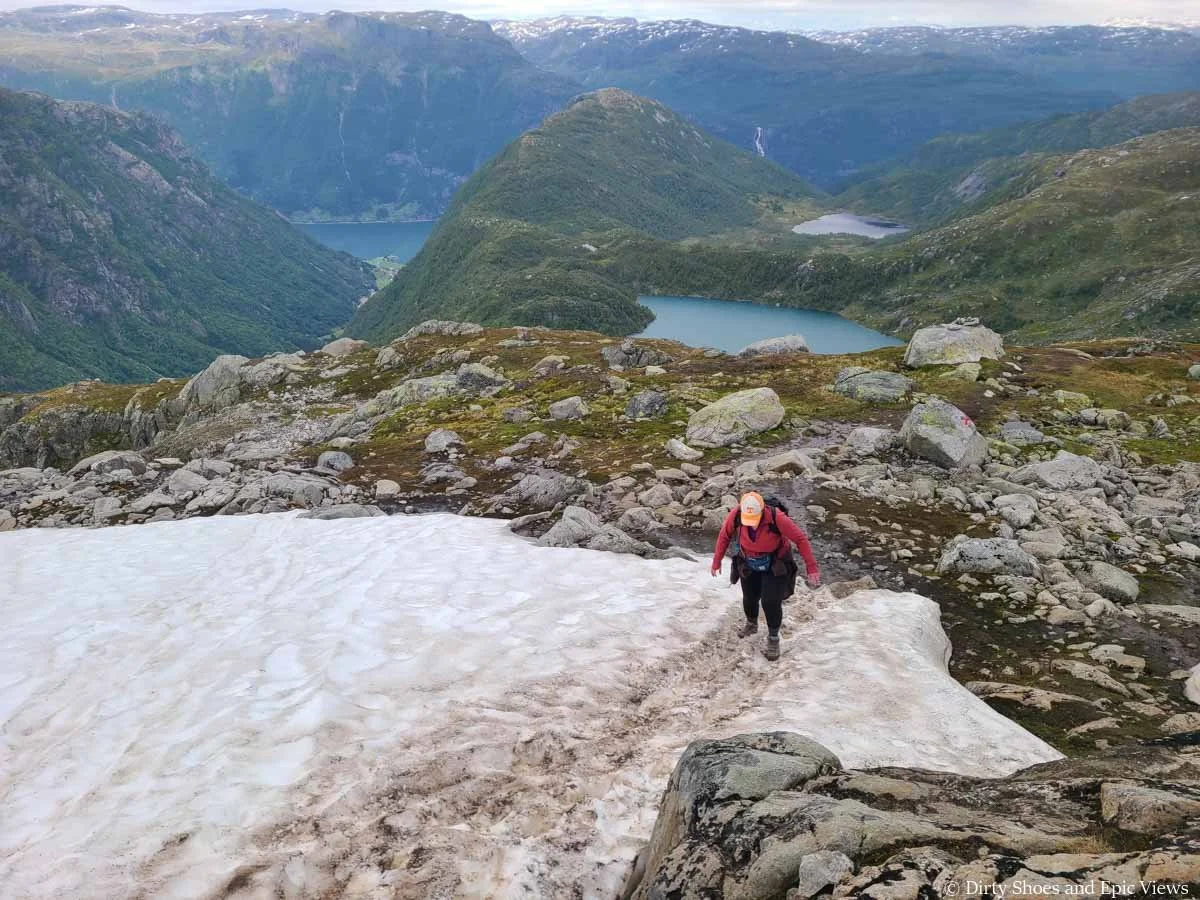
A lingering snow patch on the Reinanuten trail in July
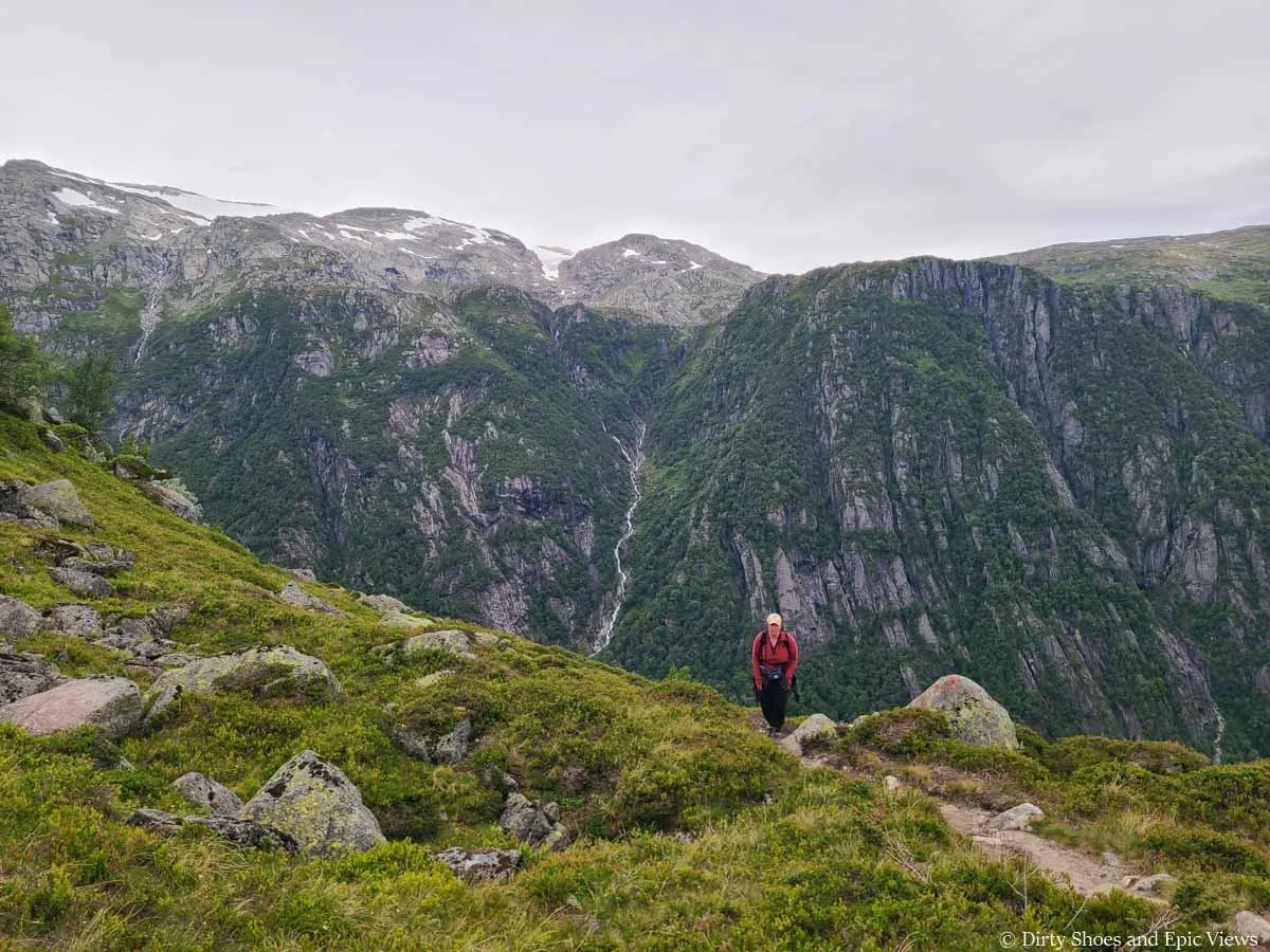
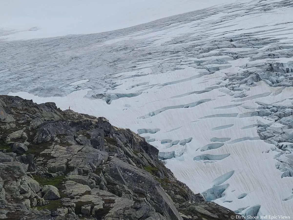
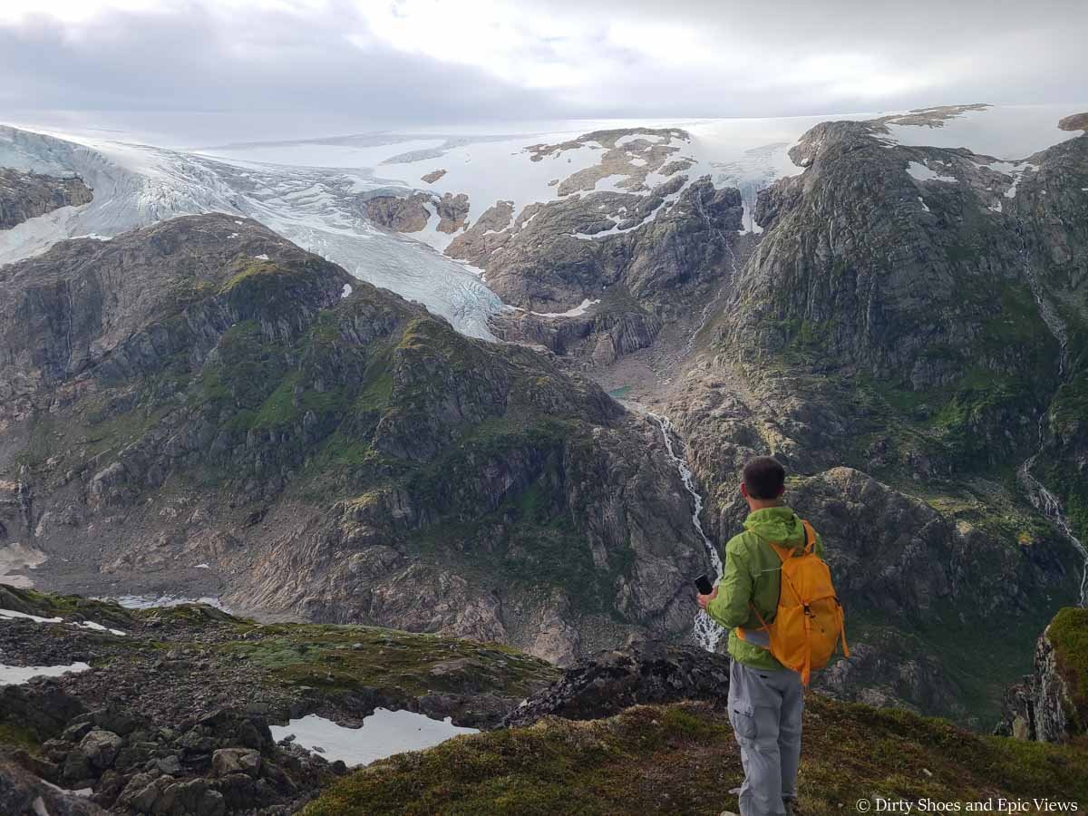
Once we crossed this snow patch, we climbed up onto the rocky ridge that leads to the final viewpoint of the hike- we were on the home stretch! Up here, we were welcomed with our first great close-up views of the ice cap, lots of cascading waterfalls, the cascading Buerbreen Glacier, Buardalen Valley below, and panoramic mountain views all around.
The final small push up to the Reinanuten ridge
Our first views of the Folgefonna ice cap from the Reinanuten trail!
Up on this ridge, you’ll be greeted by epic mountain and waterfall views
It was definitely a wow moment, and it did give me some renewed energy to get through the last push, if only for a moment…
The problem was that I thought we were close. Looking down the ridge towards the glacier, it didn’t seem like the final viewpoint would be much further and that it would be more of an easier, flatter walk from here. But I was wrong. I mean, in the grand scheme of things, sure, we were close. But it didn’t feel that way.
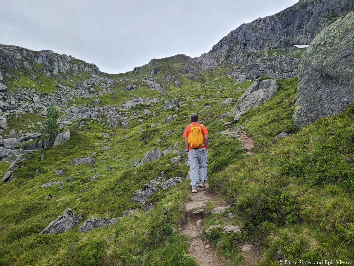
The final push of the Reinanuten hike still has a bit of climbing left as you have to navigate a series of small “bumps” along the ridge as you head towards the ice cap. Every time I thought I saw what might be the end, the ridge just kept on going and there would be another bump to climb. The trail was easy to navigate though, as it was basically a herd path through the rocky terrain.
Hiking along the ridge towards the final Reinanuten viewpoint
Climbing the bumps of the ridge towards the final Reinanuten viewpoint
Another caveat is that our GPS was showing that we should have been to the end by now based on distances we had read before we started our hike, so the Reinanuten hike ended up being a little longer than what we were expecting, making it more of a mental game at this point, and it made this last part of the hike feel like forever. In reality, this final ridge walk didn’t even take a half hour.
All along the way, I took my time and enjoyed the ever-better panoramic mountain views and the sight of the massive glacier ahead.
Enjoying the views along this final part of the Reinanuten hike!
Getting closer to the ice cap!
Loving these views from Reinanuten!
And finally, we saw the giant summit cairn in the distance- relief! We reached it almost exactly 3.5 hours after we started from the Buer Valley car park thousands of feet below.
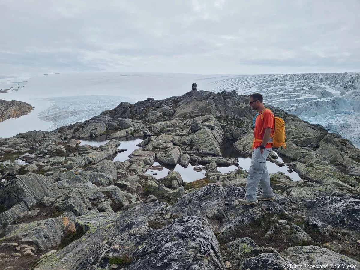
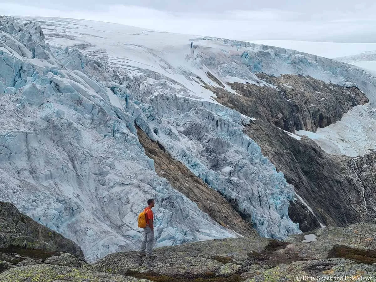
The Reinanuten summit cairn is just ahead, sitting in front of the massive Folgefonna ice cap
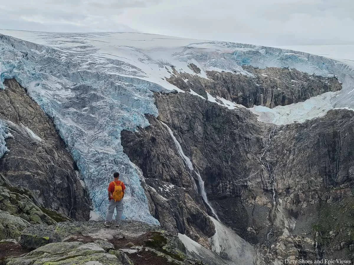
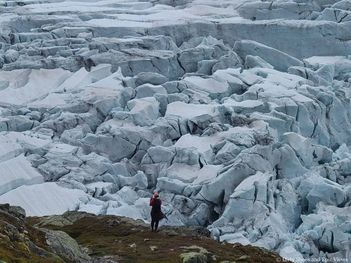
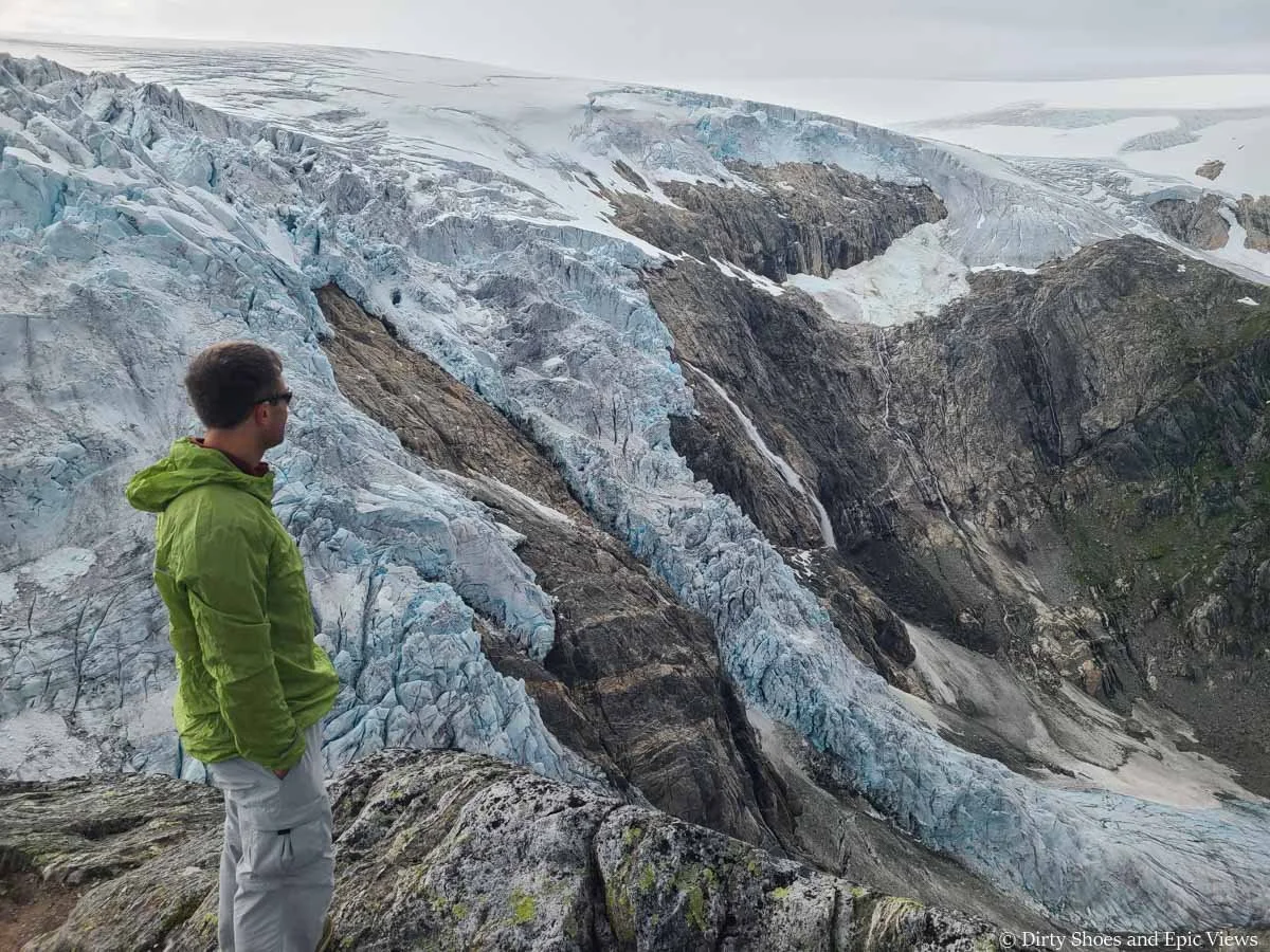
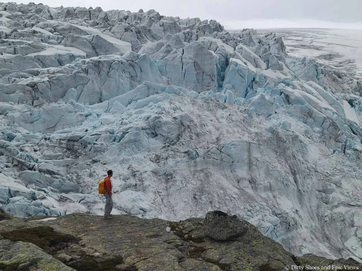
From the Reinanuten viewpoint, we had absolutely stunning up-close views of the Folgefonna ice cap and the Buerbreen Glacier cascading into the valley below. It was such a unique perspective to see over the top of an icecap from such a high vantage point. It was massive, and we were so close we could see all the details and features of the glacier so clearly, like the jagged peaks of ice and deep crevasses. We felt so small standing next to this giant.
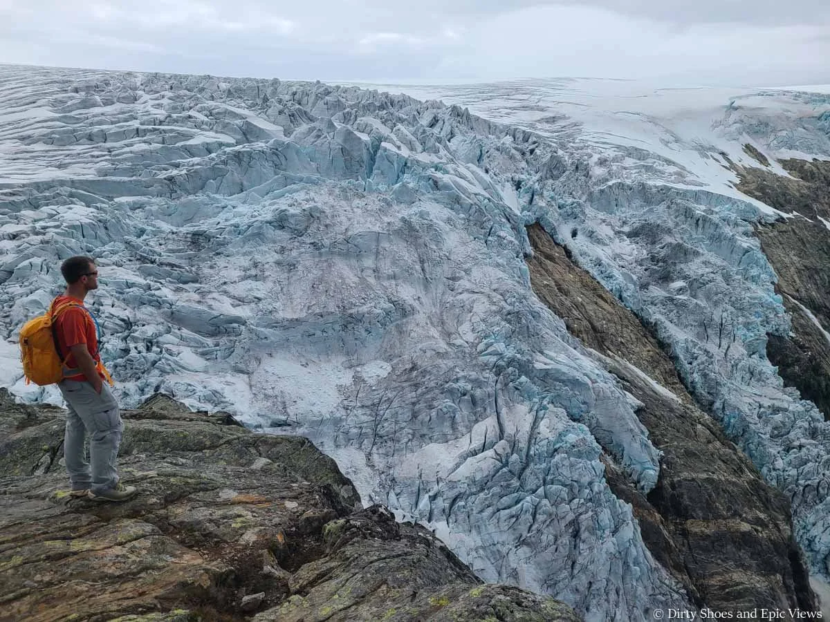
Epic views of the Folgefonna ice cap from the Reinanuten viewpoint in Norway!
Getting close-up view of all the glacier’s features
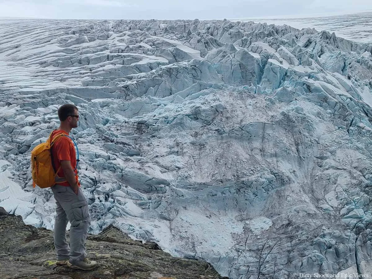
But as much as I wanted to, we couldn’t sit and rest just yet! There was a huge space to explore at the end of the ridge, so we ran around getting different views and angles of the scenery and soaking it all in. Kevin even walked out to the furthest point of the ridge where the glacier comes down and touches the rock. (Just a friendly reminder- we don’t advocate for walking out on the glacier itself! Kevin just walked to the edge of the ridge and touched the snow with his hand, because how many times can you say you’ve touched an actual icecap?)
The huge area to explore at the Reinanuten viewpoint in Norway
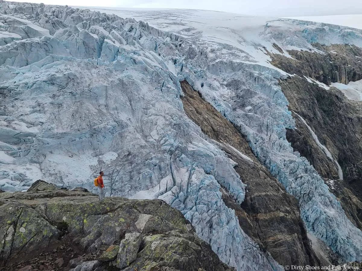
Can you see Kevin standing in front of the massive ice cap? It really puts the size of the glacier into perspective!
Feeling small while standing at the Reinanuten viewpoint!
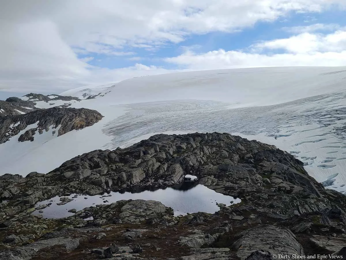
Aside from the stunning glacier view, the whole landscape up here was super pretty. The rocky landscape was dotted with glacial tarns, and the views back down into the valley and over the steep cliffs, waterfalls, and distant mountains were gorgeous.
Admiring the mountain views from the Reinanuten viewpoint
Watching the Buerbreen Glacier spill into the valley below
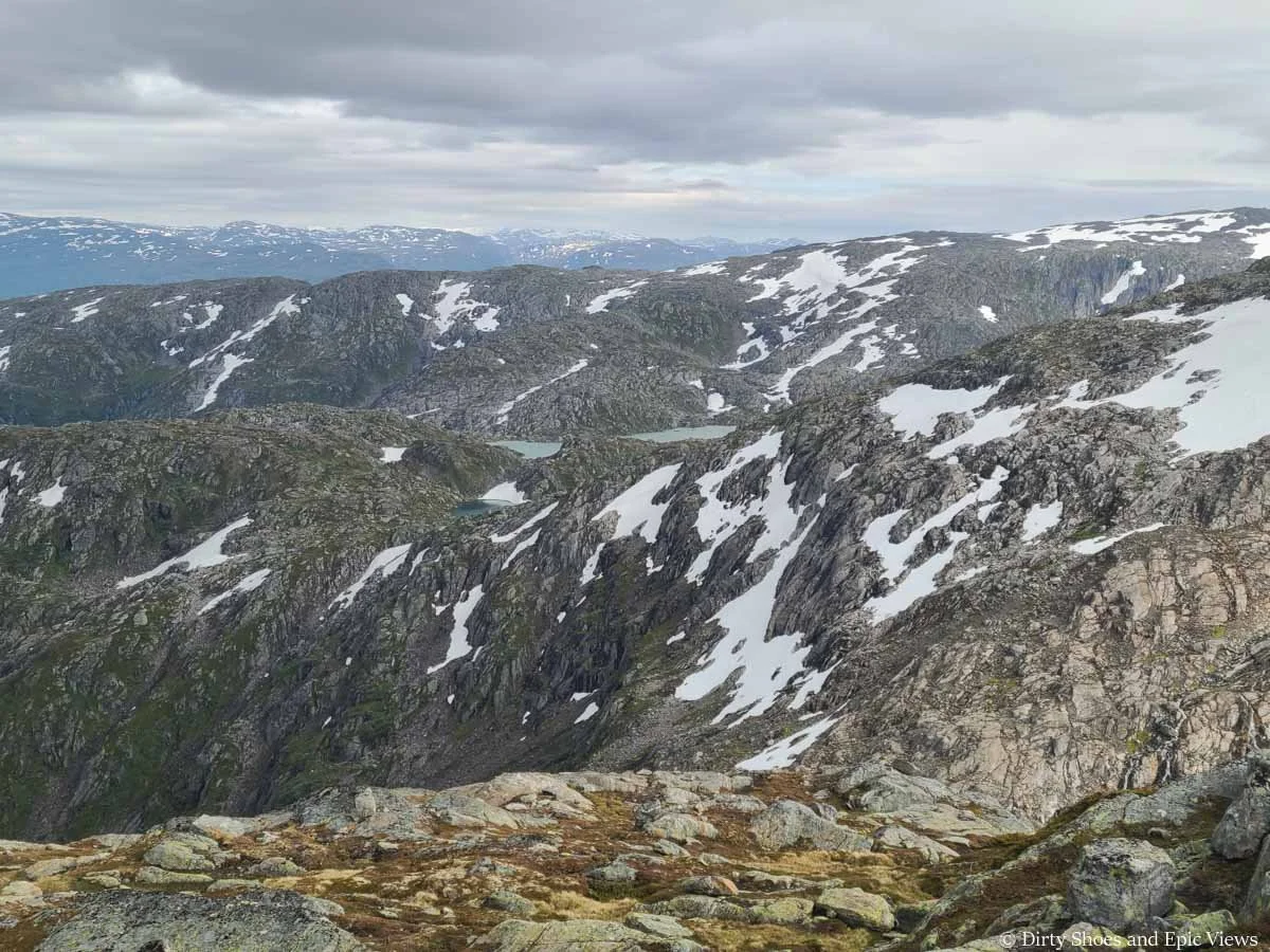
Panoramic mountain views from Reinanuten
After exhausting ourselves, we headed back to the summit to refuel with snacks. It was pretty windy and chilly up here on the summit, but it was easy to find some sheltered spots behind larger rocks that could block out the wind while we rested and ate.
After about an hour or so, we started our hike back to the car by retracing our steps. It was steep on the way up, which meant it was just as steep on the down, and we were on very tired feet.
Going down was pretty straightforward and we could move a little faster, but there were some brief tricky spots, such as the small snow patch, and some areas of steep or loose rock to watch out for. Trekking poles would definitely be good to have for this descent because of how steep and rugged it is and how hard on the knees it can be.
Walking back down the ridge
Right before the trailhead, we ran into the friendly cows again, and this time there were a lot of them and they were blocking the trail and the gate! We waited for them to move out from the gate for about ten minutes before we could finally finish, but we didn’t mind! It was a fun way to end a great day on the trails.
Cows blocking the trail at the end of the Reinanuten hike!
So our overall take on the Reinanuten hike in Norway? We loved it! It was definitely a challenge, but worth it for those views. It’s overall just a steep, tiring climb, and a grind both up and back down.
We also really loved that it was a super quiet trail. I think we saw a total of a dozen other people, mostly single or in pairs, that would just quickly pass by, and we had the summit completely to ourselves for almost the complete hour we were up there. It was a very cool experience to have in the Norwegian mountains, and a nice change of pace from the Trolltunga experience we had just the day before! Reinanuten is truly a hidden gem of Norway.
Best Time to Hike Reinanuten Hike in Norway
Summer is the best time to hike Reinanuten, specifically between June and September when the trail should be mostly clear of snow. Depending on the year, though, snow and thick mud can linger at higher elevations well into June, so be sure to check recent trail reviews to see what the conditions are like.
Norway’s fjords are notoriously known for their unpredictable and often wet weather. The driest months are typically May and June, though like we said above, you may experience snow on the trail then, so these months aren’t super ideal for hiking at higher elevations. Instead, July and August are ideal times to hike in Norway for the chance at more stable and clear trails.
We hiked around Norway’s southern fjords in early to mid-July and we were pleasantly surprised that the weather was actually pretty perfect. We had mostly sunny dry days, with just a few small and infrequent spurts of rain moving through the mountains. We were told by a few locals that this type of amazing weather has been the norm for Norway’s summers recently. Of course, this can vary year to year, but we’d say your best shot for stable weather when it comes to hiking in Norway will fall between late June through August.
Another benefit of hiking in Norway during the peak summer months is the long daylight hours. The midnight sun phenomenon occurs from mid-June to early July, and while the southern fjords where the Reinanuten hike is located lies just below the Arctic Circle (and so doesn’t experience the true midnight sun), there is still essentially some light 24/7 during this time. The night hours are more of a twilight glow than pure daylight or pure night. This means that you can be a little more flexible for when you start or end a hike in case you have a tight schedule or you have to work around any weather. We got a late start on the Reinanuten hike and were on the trail until after 8pm with no issue.
By September, the weather can start to get a bit more unstable and stormy, and you’ll have less daylight to work with. Crowds will be smaller, but you’ll have a bit more of a gamble in terms of nice days for hiking, so it’s a trade off! We hear it’s still a great time to visit Norway, just be willing to be a bit more flexible with your plans, and check the weather often!
Where to Stay Near the Reinanuten Hike in Norway
Odda is the closest town to the Reinanuten trailhead (about 15-20 minutes away), so we highly recommend staying here. There are lots of accommodation options spanning across most budgets, from popular campgrounds like Trolltunga Camping up to more luxury hotels. Be sure to start looking early to find something that’s within your budget! We waited until about a month out and had trouble finding cheaper places to stay. It’s a popular place to be in the summer because of the famous Trolltunga hike.
You can technically find places to stay for a little less if you look outside of Odda, but your drive in will likely be at least 45 minutes from other nearby towns around the fjord. To increase your flexibility in the area, and if you plan on doing other hikes besides Reinanuten, we suggest just making Odda your base for a few days. Be sure to check out our Norway itinerary for ideas on how to fit Odda and the Reinanuten hike into your own itinerary!
Tips For the Reinanuten Hike in Norway
Before we wrap up, here are just a few more last-minute tips for your Reinanuten hike:
What to pack for the Reinanuten hike
Aside from all the usual day hiking gear, we’d specifically recommend bringing the following for the Reinanuten hike:
Good hiking boots: Wear hiking shoes or boots with good ankle support, traction, and waterproofing. Reinanuten is a very rocky and rugged trail with some mud and running water along the way.
Layers: It can be much cooler and windier on the ridge and summit so be sure to pack appropriate layers.
Rain gear: Just in case! You never know when rain or showers might move through the mountains of the southern fjords.
Sun protection: More than half of the Reinanuten hike is above treeline, so have sunscreen and any other sun protection you like (hat, sunglasses, etc).
Trekking poles: We usually don’t use them, but this hike is steep, and the constant steep descent on the way down can be rough on the knees. This is one hike where trekking poles can be super useful!
Credit card: Make sure you have a card with you to pay for the parking at the gate on the way out! Also, while there are no bathrooms along the trail, there is a bathroom you can use at the Buer restaurant at the trailhead, though I do remember seeing that you’d have to pay a small fee to use it, so just be prepared for that.
Snacks and water: Bring plenty of food and water for a full day on the trail, and make sure to pack out everything with you!
Check the weather the day before your hike
Weather in the mountains and fjords of Norway can be quite unpredictable. We found that it wasn’t very helpful to check the weather too far in advance. To get the most accurate forecast, be sure to check the day before and even the morning of your Reinanuten hike.
We certainly wouldn’t recommend hiking Reinanuten in bad or wet weather. The trail can become quite slick and unmanageable in the rain, and being at the ridge on the top can be dangerous. It’s a wide ridge with no need to go the edge to see the views, but even so, all the rocks can become slick and slippery and just increase your chances of injury in the mountains- never a good thing!
We found the most reliable forecast for our Norway hikes to be YR.
More Norway Guides
Looking for more things to do in Norway after your Reinanuten hike? Check out all our Norway guides to help you plan your perfect Norway trip!
The Reinanuten hike is one of Norway’s best hidden gems. It’s tough, but worth it! Have you hiked Reinanuten or have it on your bucketlist? Let us know in the comments below! Happy hiking!