15 Best Things To Do in Death Valley National Park
Looking for the best things to do in Death Valley National Park? Well, we’ve got 15 of them! Read on to learn about all the best places and top sights in Death Valley to help you plan your visit. We’ve also got tips on when to go, what to pack, how long you’ll need, and more!
You might know Death Valley for its unforgiving temperatures, harsh desert landscapes, and its big claim to fame, Badwater Basin, home to the lowest, driest point in the United States (actually, in the entire Western Hemisphere!).
But we’re here to tell you that there is so much more to Death Valley National Park than that! This place is a treasure trove of varied and unique landscapes that will definitely surprise you.
There are so many incredible places to see in Death Valley. Would you believe it if we said that during our visit, we hung out by a waterfall in a desert oasis, drove over what seemed liked dozens of mountain passes (okay, maybe it was more like 3…), ran down sand dunes, slithered through canyons, hiked through snow, and even walked the rim of a volcanic crater? See, we told you it was diverse!
Intrigued? In this article, we want to share with you all of the amazing things to do in Death Valley so that you can plan an epic time in the park and not miss any of the top Death Valley sights. We’ll also share all of our best tips on what to bring, when to go, and more so you’ll be ready to pack your bags and hit the road. So, let’s dive right in!
In this Best Things to Do in Death Valley Guide:
Joshua Tree National Park One Day Itinerary
How to Get Permits for Half Dome in Yosemite National Park
Want to save this article for later? Pin this post and come back when you need it!
Is Death Valley Worth Visiting?
So many amazing sights in Death Valley absolutely make it worth visiting!
This is a great question, and one we are happy to answer! Because we know, when you think of a desert, visions of long flat stretches of nothingness come to mind. At least that’s kind of what we thought of. But trust us, Death Valley is not that!
Death Valley was so unexpected for us, in a great way. In fact, it ended up being one of our favorite National Parks! You may have seen some pictures of the famous highlights of Death Valley – Badwater Basin, maybe the sand dunes – but it doesn’t quite prepare you for the sheer beauty, vastness, and especially, diversity, of the desert. Outside of these famous attractions is a whole park (the largest National Park in the continental U.S.!), that’s as diverse as it is big. It’s not just barren desert. It’s mountains, and canyons, and volcanoes, and sand dunes, and waterfalls, and…. well, what more can you ask for! And we are going to cover all of these epic Death Valley sights in this list!
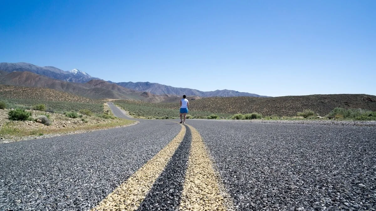
But as much as we love our list of best places in Death Valley, we have to be honest and say that half the fun of this park was actually the in-betweens, just getting from place to place. The long drives were full of sweeping vistas, long desert roads that disappear into the horizon and that twist up and over mountain ranges, and just all around scenic overload! You’ll be constantly surrounded by beautiful landscapes, each part with its own unique features and formations and even colors, so that even on a long drive, you will never be bored. Half the pictures we took are probably just from the car window!
If you can’t quite tell, we loved this park, and we absolutely recommend putting it high up on your bucket list. But we’ll let our list of best things to do in Death Valley do most of the talking, so without further ado…
Best Things to Do in Death Valley
Let’s get into all the best places to visit in Death Valley that can’t be missed. Get ready to be blown away by how much there actually is do!
Hike the Golden Canyon Trail
Walking through Golden Canyon is one of the best things to do in Death Valley!
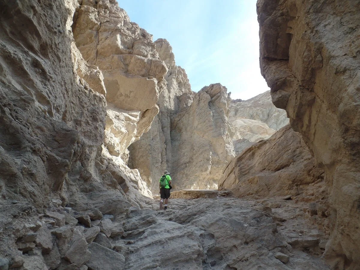
While there are several canyons in the park that you can hike through, The Golden Canyon hike is definitely the most popular, and is one of the best things to do in Death Valley. Depending how far you want to hike, it has the potential to take you through several of the park’s best landscapes, including jagged badlands, colorful washes, and of course, as the name implies, towering golden canyon walls.
And what’s even better is that you get all of this for not too much effort! A short, very gradual uphill hike takes you through the glowing walls of the Golden Canyon for about a mile. Once the canyon ends, you can stop here and return to the trailhead, making for a pretty easy and quick trip. However, the trail continues past the canyon, forming a loop that connects with the Gower Gulch Trail, a beautiful trail through a colorful desert wash with walls of blue and green. Or, you can opt for an even longer hike by adding on an additional loop trail, the Badlands Loop Trail, that goes deeper into the Badlands and up to Zabriskie Point. In total, this makes for a moderate 8-mile hike that takes you through the best sights that Death Valley has to offer. For us, the entire loop took about three and a half hours, but this was a pretty slow place with lots of exploring and lots of picture-taking. You can certainly do it faster if needed, but it’s nice to take your time and enjoy it.
The colors of Gower Gulch are an incredible sight in Death Valley
We absolutely recommend completing the entire loop – the Golden Canyon – Badlands – Gower Gulch Loop - if you have the time. It doesn’t add too much more difficulty than just hiking the Golden Canyon, just quite a bit more distance. But, it’s super scenic at every turn, and gives you a chance to explore and climb through tiny slot canyons and play around on the hills of the badlands. And despite the Golden Canyon hike being one of the most popular hikes in Death Valley, once you get passed the canyon part, the crowds thin out and you don’t pass too many people out on the trail. In fact, the entire second part of the loop (in Gower Gulch) we never saw another person!
One important piece of advice for this Death Valley activity is to be sure to do this hike in the morning, before the heat of the day really sets in. There’s no shade on this hike, so bring a hat, sunscreen, sunglasses, and plenty of water. We also suggest avoiding this trail in the hot summer months.
Fun fact: Star Wars Episode IV was filmed in Death Valley! They shot scenes at several different parts of the park, and one of them was here in Golden Canyon. I’m not a fan of Star Wars (*cue gasps*), so I didn’t recognize any scenes out of the movie which I never saw (*cue more gasps*) but they’re there!
Visit Badwater Basin
Badwater Basin is one of the most famous places in Death Valley!
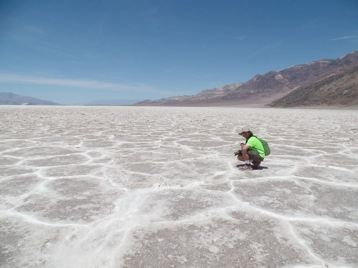
Badwater Basin is a must-see in Death Valley. At 282 feet below sea level, Badwater Basin is an expansive salt flat that will make you feel tiny and on a different planet all together. Plus, how cool is it to say that you’ve stood at the lowest point in the entire Western Hemisphere?!
This Death Valley highlight is just down the road from the Golden Canyon trailhead and consists of a small parking lot that sits right at the edge of the salt flats, with a small viewing platform and the famous Badwater Basin sign that is now an obligatory photo op.
During the hot summer months, this sign may be as far as you go. Remember, it will be very hot here in the summer at such a low elevation (think three digit temperatures with no shade).
During the more temperate months, you can take a short walk out to the middle of the flats to check out the unique and intricate polygon-shaped salt crystal formations and experience just how truly flat and vast this landscape is.
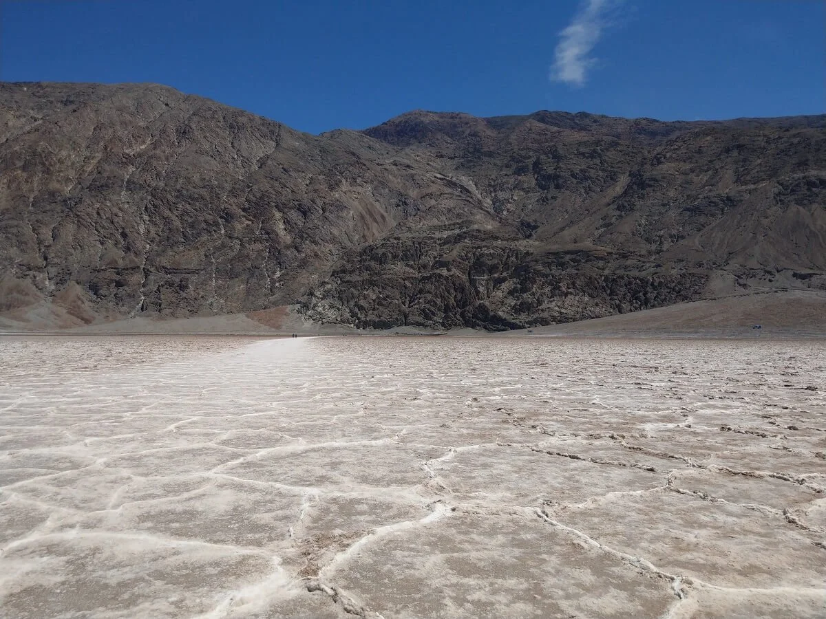
The path out to the middle of the salt flats at Badwater Basin
Even in the “cooler” months, though, we would still advise you to try to get here early in the day or later in the evening to avoid the worst heat of the day. When we were there in April, which is just before the desert summer starts, we got here a little after noon, and in the midday heat this short half mile round trip walk was a little painful, and the air a little suffocating. The walk back to the parking lot felt a bit like a death march and we were craving our air-conditioned car. Trust us…don’t underestimate the walk just because it’s short! Still remember to bring a hat, sunscreen and water with you.
At Badwater Basin, not only can you marvel at the super cool salt patterns, but in the distance on the opposite edge of the flats, the Panamint mountains tower above, with the 11,000 foot Telescope Peak, Death Valley’s tallest point, dominating the view. It’s so cool that you can be standing at the hottest, driest, flattest location in the park while standing right at the base of this giant (which may even be snow-capped depending on the time of year!).
Take a Scenic Tour on Artist's Drive
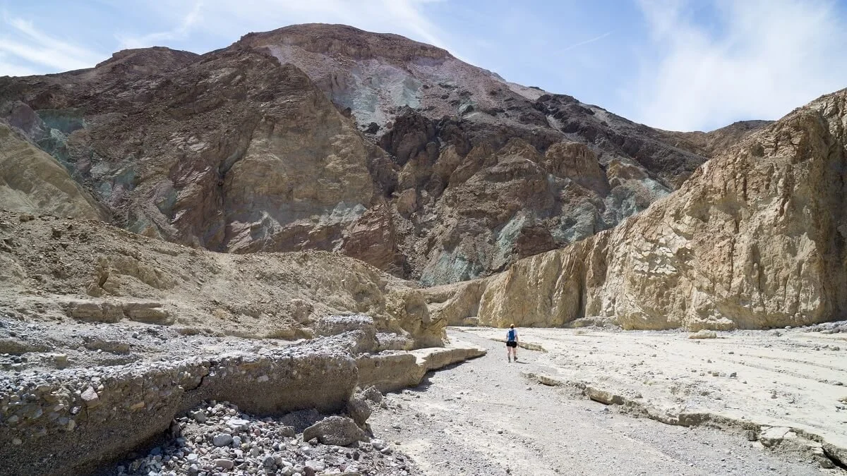
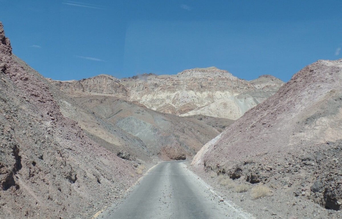
Artist’s Drive is a great thing to do in Death Valley at any time of year because it allows you to enjoy some of the best Death Valley scenery from the comfort of your (air-conditioned) car. Artist’s Drive is a 9 mile one- way paved road that’s found just off of Badwater Road between Badwater Basin and Furnace Creek. It’s a fun drive that weaves in and out of Death’s Valley’s Black Mountains, which seems like a misnomer, as what you’ll really be driving by are surprisingly colorful hills filled with shades of blues, reds, and greens.
Off the main road, you’ll begin with an initial ascent up into the hills and quickly come to an early pit stop where you can get out of your car and walk around, admiring the views of the mountains and the valley behind you.
Weaving through the colorful hills of Artist’s Drive is one of the best things to do in Death Valley!
As you continue along, the road weaves and dips between short canyon walls and hills with splashes of greens and blues formed from the oxidation of mineral deposits. The main highlight of this Death Valley drive, though, is the Artist’s Palette, the most famous and colorful section of the entire road (and maybe the entire park!). Located about halfway through the drive, there’s a small parking lot from which you can see these hills, and if you’re up to it (you will be once you see them!), you can get around and wander around for a more close up look of the colors. And guys, these colors do not disappoint. I didn’t expect how actually vibrant they would be in real life!
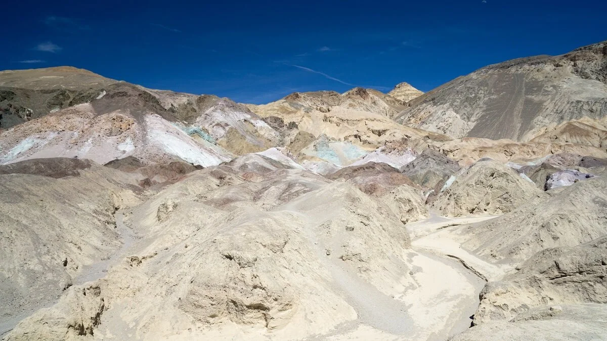
The colorful hills of Artist’s Palette are one of our favorite sights in Death Valley!
As you continue your drive away from Artist’s Palette, the colors don’t stop, and it’s fun to try to spot other blues and greens throughout the rest of the journey. You also continue to get sweeping views of the valley below.
In total, it took us about 30 minutes to complete Artist’s Drive, including pitstops, so it’s an easy and quick must-do in Death Valley!
Visit the Devil's Golfcourse
No, this is not an actual golf course… it’s better! This is a quick stop in Death Valley where you can wander around a large salt pan that has been sculpted and eroded by wind and rain into rough and jagged structures that are unlike anything we’ve ever seen before.
To get here, there is a dirt road off of the main Badwater Road that cuts straight through the salt flat, but is definitely passable to sedans and non-four wheel drive vehicles. As you’re driving, you feel like you’re driving into the middle of nowhere, which, essentially, you are. You’ll end up in a small parking lot adjacent to the golf course and are free to roam around the mineralized salt deposits and take in the views.
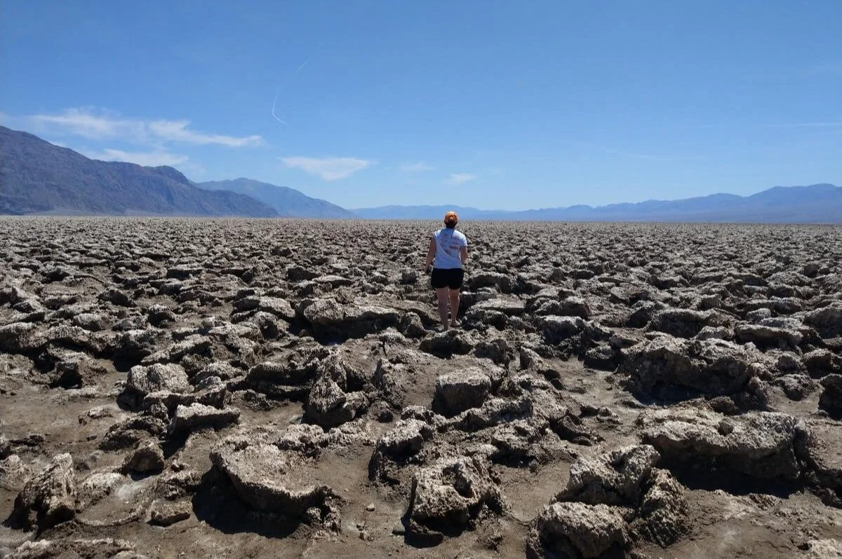
The Devil’s Golfcourse is a unique place in Death Valley
A cool feature of this Death Valley attraction is that, apparently, if you walk around long enough and search hard enough, there are some salt pools hidden throughout the golf course. And, if you listen closely enough, you can hear tiny popping noises coming from the ground below, which is the sound of tiny salt crystals bursting in the heat.
We neither saw hidden salt pools nor heard salt crystals bursting, but we did enjoy our quick 5 minute detour. As with everywhere else in the park, the mountain scenery is fantastic, with different displays of colors and shapes all along the range, and we got to check off another unique Death Valley landscape.
Check out Zabriskie Viewpoint
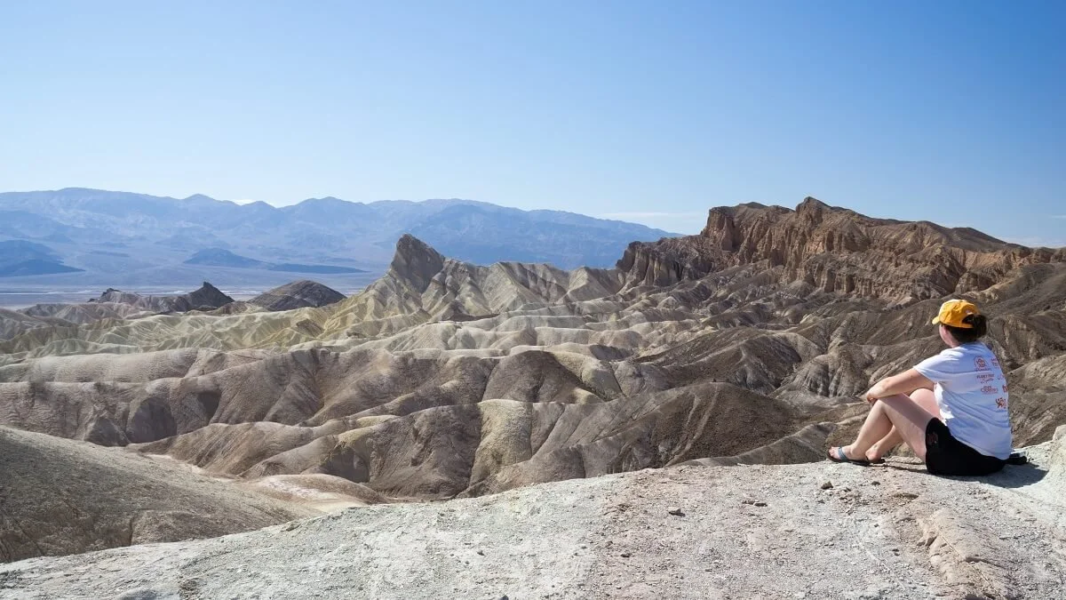
Zabriskie Point is one of the most photographed places in Death Valley, and for good reason. Here, you’ll have an amazing view over the badlands and the valley beyond, as well as the mountain backdrop centered around Telescope Peak. It’s definitely something you should not miss in Death Valley.
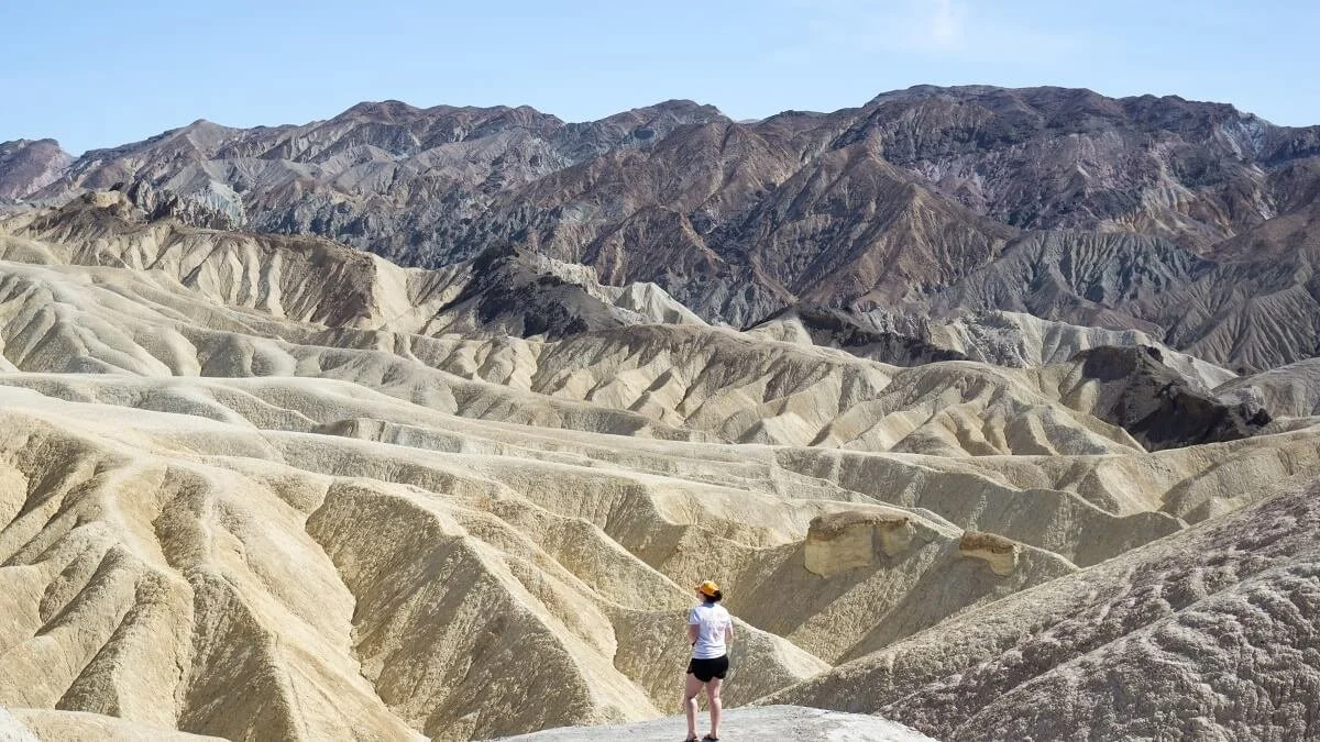
The views from Zabriskie Point make this one of the best stops in Death Valley!
A visit to Zabriskie point is easy…from the parking lot, you walk up a short incline to the viewpoint area and simply take in the views. Not a bad deal to get one of the best views in Death Valley! It’s an incredibly unique place where everything kind of looks fake and you’re left wondering what even is real and all these other existential far out thoughts…or maybe that was just us. And while the large parking lot was definitely the most crowded we came across in the park, compared to all the other parks we have been to the crowds were nothing here.
There are also trails from Zabriskie Point that venture into the Badlands and meet up with the Golden Canyon and Gower Gulch trails, making that Golden Canyon – Badlands – Gower Gulch loop that we mentioned up above. So, you can start and finish that loop here, or at the Golden Canyon trailhead. If you haven’t already or don’t plan on hiking into the badlands from the Golden Canyon trailhead, it’s worth taking some time here to hike in just a little bit and explore the badlands if you can.
Check out Dante's View
Dante’s View has (supposedly) one of the best views in Death Valley…but we wouldn’t know! Unfortunately, when we were in Death Valley, this viewpoint was closed because the parking lot was under construction. But we needed to include it on this list of best things to do in Death Valley because of just how popular a place it is! Dante’s View provides that iconic picture over the valley and Badwater Basin that you’ve probably seen at some point or another in your Death Valley research. There is also a hike (Dante’s Ridge) that starts here.
To get here, drive south past Zabriskie Point on Furnace Creek Wash Rd, and you’ll see Dante’s View Road on your right. Follow this up to the viewpoint.
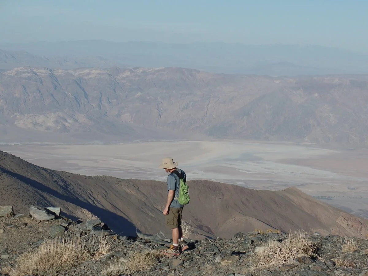
Get Epic Views from Aguereberry Point
If you want to get away from the crowds of some of the more popular sights in Death Valley but still get an amazing bird’s-eye view of the basin below, Aguereberry Point is for you. It gives you a similar view as Dante’s viewpoint, but from the other side of the basin.
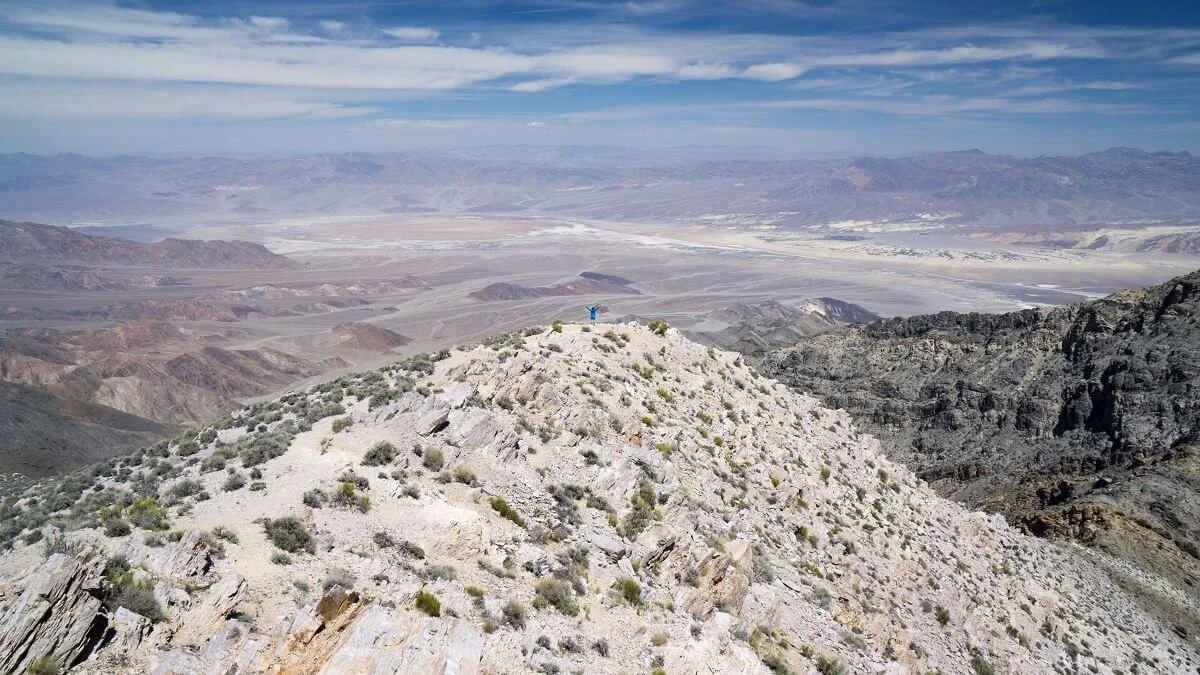
Aguereberry Point is a great place in Death Valley to escape the crowds! Can you see me?
The catch? Of course there’s a catch! To reach Aguereberry Point, you need a high-clearance 4x4 vehicle. Is it worth getting one just to visit this viewpoint? Probably not, as there are several other great viewpoints in the park, but if you do happen to have a 4x4, then be sure to take it here! (And when we mention some other Death Valley tips later on, we’ll try to convince you why having a 4x4 in general for visiting Death Valley is probably worth it!)
How to get to Aguereberry Point in Death Valley
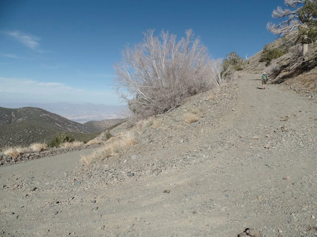
Honestly, half the fun of Aguereberry Point is just getting there. To get here, turn onto Emigrant Pass Road off of Hwy 190, right across from the Emigrant campground. You’ll be heading straight into the mountains…and, we can’t say this enough, the scenery here is stunningly gorgeous. If you are coming from spending time in the salt flats and sand dunes, driving through here will feel like a completely different world, and was a complete surprise to us. The colors of all the mountains and the way the vegetation dotted the landscape were especially pretty and unexpected based on our preconceived notions of the desert.
About 11 miles down Emigrant Road, you’ll see a dirt road on the left. This will take you to Aguereberry Point and is the part that requires a high clearance vehicle. The initial portion of the road is extremely washboarded, and trust us, this gets old pretty quickly. You have to drive very slowly and carefully, as there are definitely some road features and rocky obstacles that make having a high clearance vehicle a must. Not too far in, you’ll pass an abandoned mine that we didn’t stop to explore, but there was one group there, which would be the last people we saw along the entire road until we reached the top. You’ll spend roughly 30 minutes driving this bumpy road all the way out to the viewpoint. For the most part, the views are expansive, except for one short section that cuts between some high rock walls.
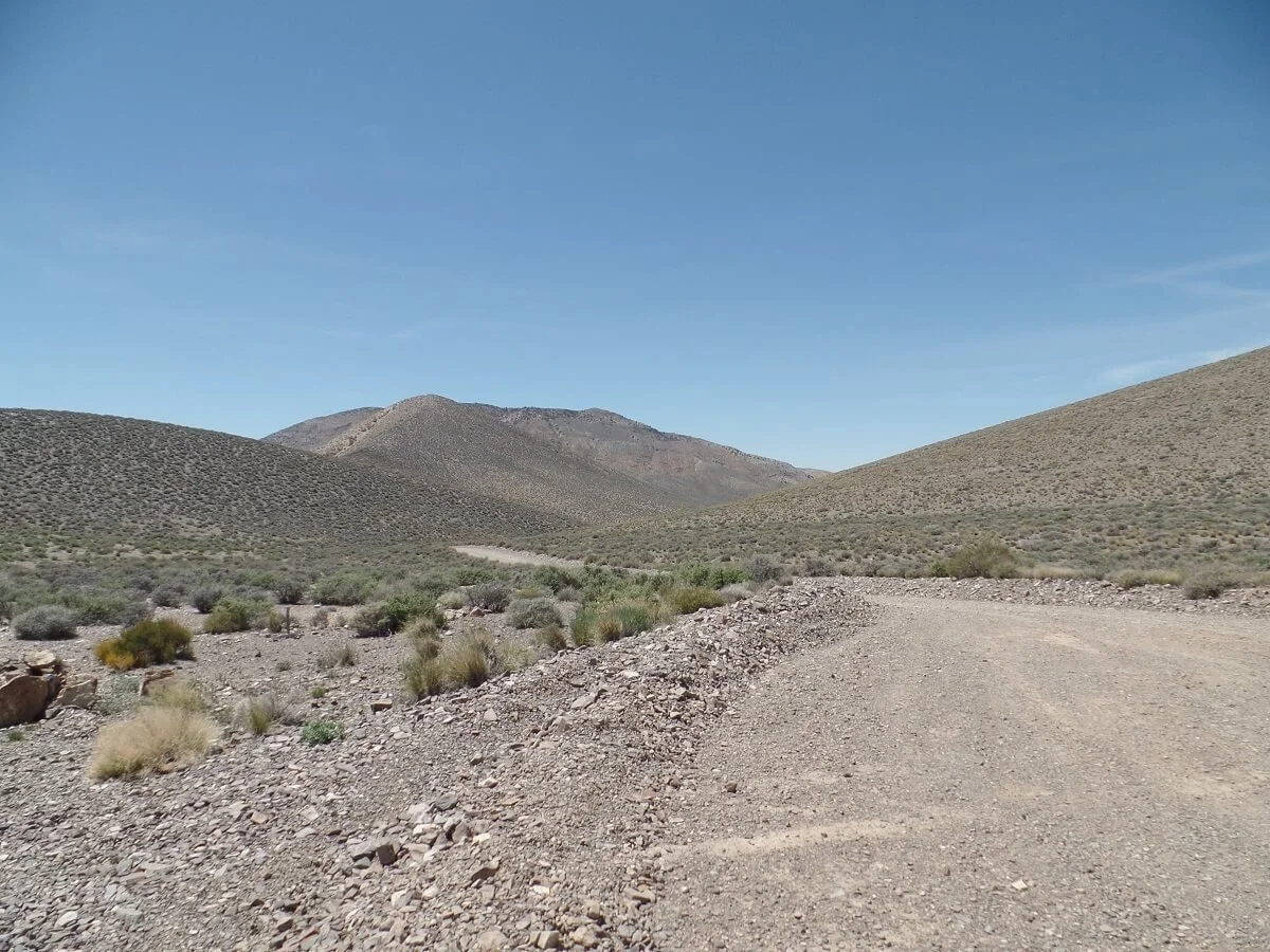
A high clearance vehicle is definitely needed to drive to Aguereberry Point in Death Valley
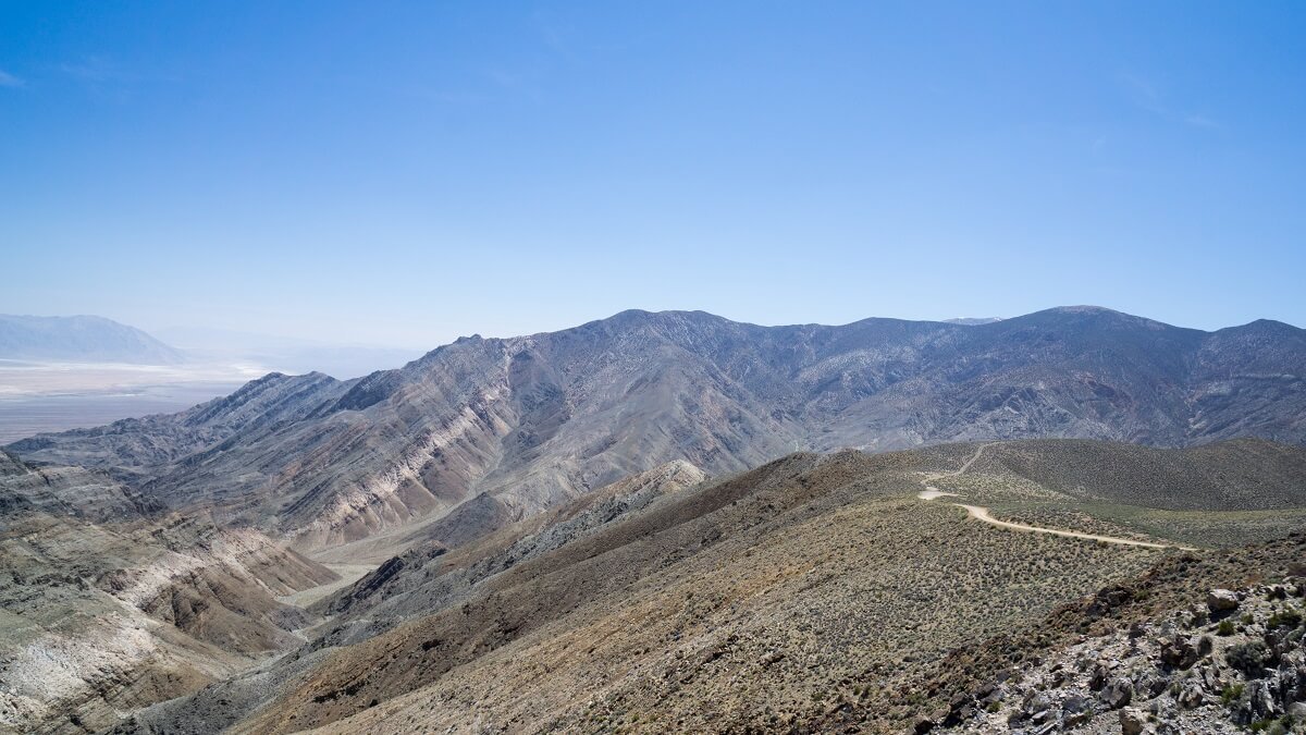
The view from Aguereberry Point back toward the road that weaves its way across the desert
Towards the end, you crest a hill and find yourself gazing out at an amazing view of Badwater Basin and the entire valley below. This isn’t the viewpoint just yet, though. Just ahead is the scariest part of the whole drive, particularly if you don’t like heights and narrow roads (and speaking as one of those people, coming back down is worse!). A very short section of road runs right along a cliff side, but as soon as you round the turn, you’re there!
A small parking lot with a sign marks your destination. And although you might be a little rattled from the long drive out here, I promise you that the 360 degree views from up here are well worth the bumpy drive. Towards the west, you can actually see the Sierras off in the distance, including the tallest mountain in the lower 48, Mt. Whitney. And to the east, Badwater Basin. In one place, you can look at both the highest point and the lowest point in the continental United States at the same time! How cool is that?
A short walk down a rocky outcropping takes you to the true viewpoint with a more expansive view over the basin. There’s a rock formation out in front that does block some of the valley from you, but it does add a fun element to the scenery. There was only one other person who left shortly after we arrived, and we had the entire viewpoint to ourselves for the rest of the time. Doesn’t get any better than that!
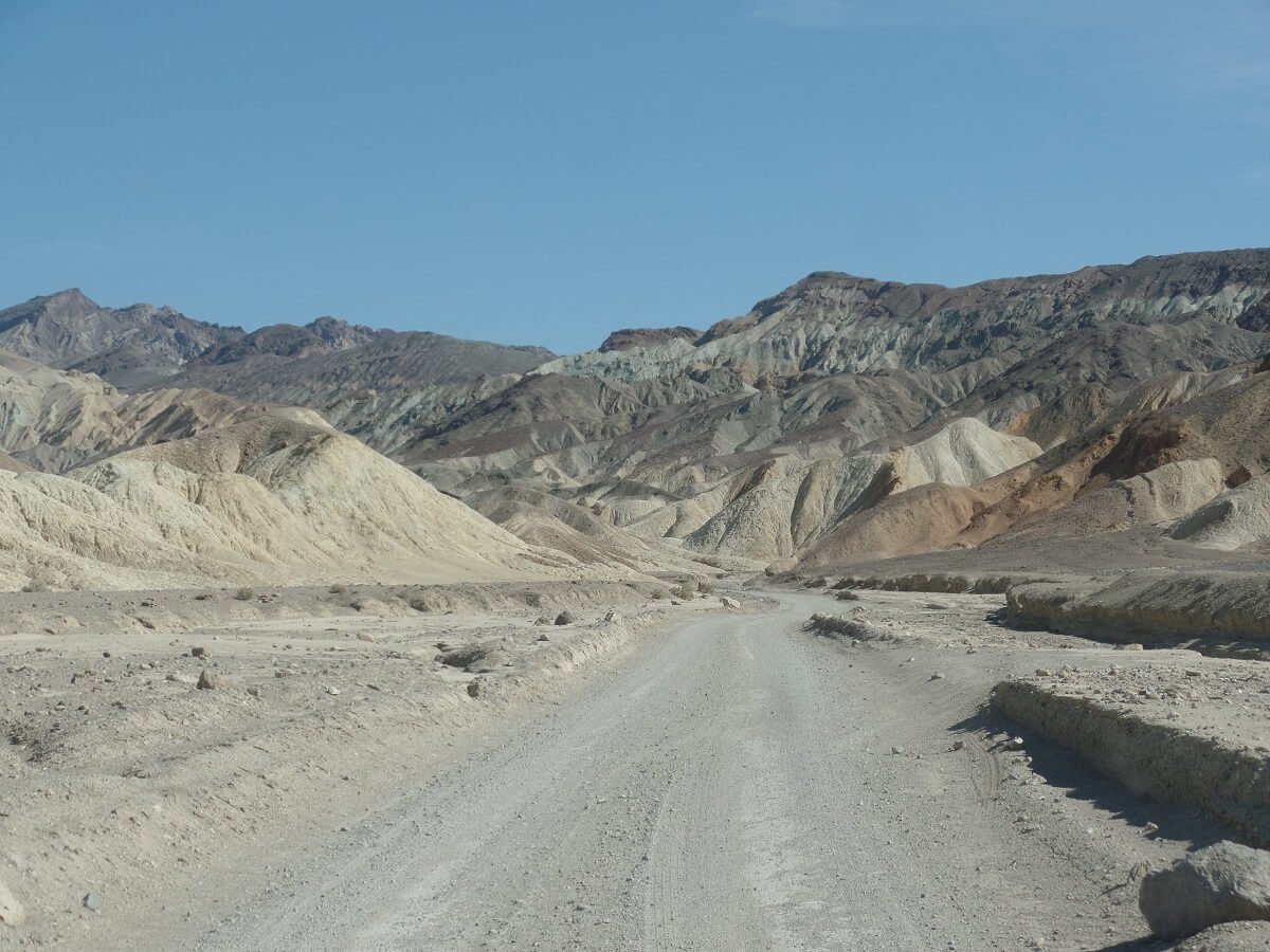
Drive the Twenty Mule Team Canyon Road

Walking around the badlands of Twenty Mule Team Canyon Road…a unique thing to do in Death Valley
Just down the road from Zabriskie Point is the Twenty Mule Team Canyon Road. This is another great thing to do in Death Valley any time of year because you can explore the badlands of Death Valley from the comfort of your car, so it’s good for those summer days when it’s just too hot to hike. But in the cooler months, we would absolutely recommend pulling over along this road and getting out to explore on foot!
Twenty Mule Team Canyon Road is a quick 2.7 mile one way drive on a dirt road, but passable to regular sedans. There were a few bumpy sections towards the end but with careful driving it is certainly doable.

The road cutting through the badlands of the Twenty Mule Team Canyon Road in Death Valley
What we really loved about this drive is that we did not see anybody else the entire time…not one other person. So even though it’s not too far away from other popular Death Valley attractions, it seems to remain a bit off the beaten path, probably from being overshadowed by the nearby and much more famous Zabriskie Point. But this made us love it even more!
If you loved Zabriskie Point and can’t get enough of this sort of awesome badland landscape (like us!) then this quick drive is a must-do in Death Valley.
Climb Up the Mesquite Sand Dunes
Hiking sand dunes is one of the best things to do in Death Valley!
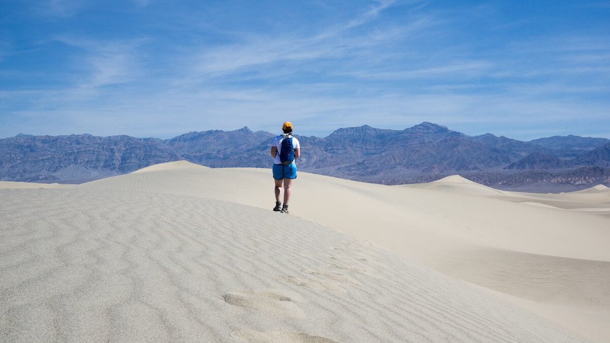
The Mesquite Sand Dunes are something you should not miss in Death Valley National Park! As you drive towards them on Highway 190, they look so small and very randomly placed. But they are actually the most expansive dunes in the park, and trust us, once you’re actually out walking on them, they definitely won’t seem so small anymore!
A parking lot is located right at the edge of the sand dunes, so they are super easy to get to… just hop out of the car and you’re right there! You can spend as much or as little time as you’d like here. You can view the dunes from the parking lot or roam free to your heart’s content. We noticed that most people would simply hop out of the car, walk just ever so slightly into the sand, snap some pictures and leave. Of course, you know what we would suggest already, don’t you? If you really want to experience the dunes, you need to venture out a bit further!
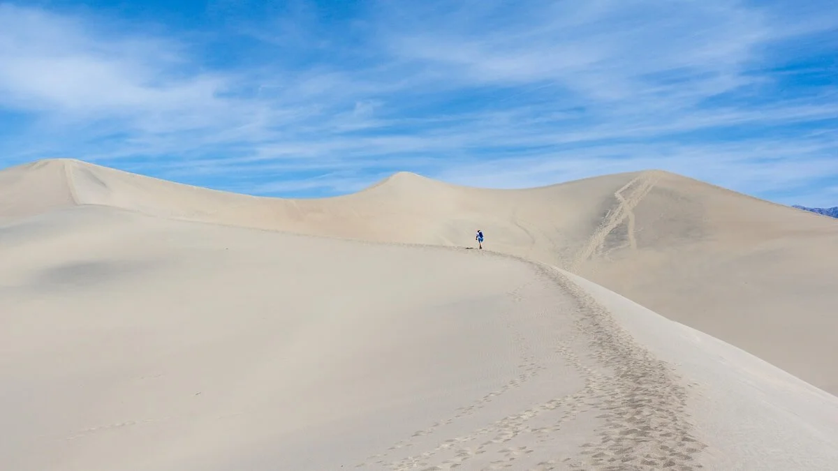
A popular option for those who want to explore this popular Death Valley highlight is to hike out to the top of the highest dune, which is about 100 feet tall. It’s pretty easy to spot from the parking lot, so just start heading in that general direction.
According to the brochures, it’s about a 2 mile round trip hike to climb the tallest dune. However, there is no designated trail…the dunes are pretty much a free for all, so distances might vary between everyone. Also, don’t take this 2 mile estimation too lightly, because remember, you’re walking up piles of sand, which, as you may know, can be a bit difficult to walk on! For every step up, you slide a little bit back down, making what sounds like a short 2 miles a bit more of a challenge.
Hiking up to the tallest dune in the Mesquite Sand Dunes of Death Valley!
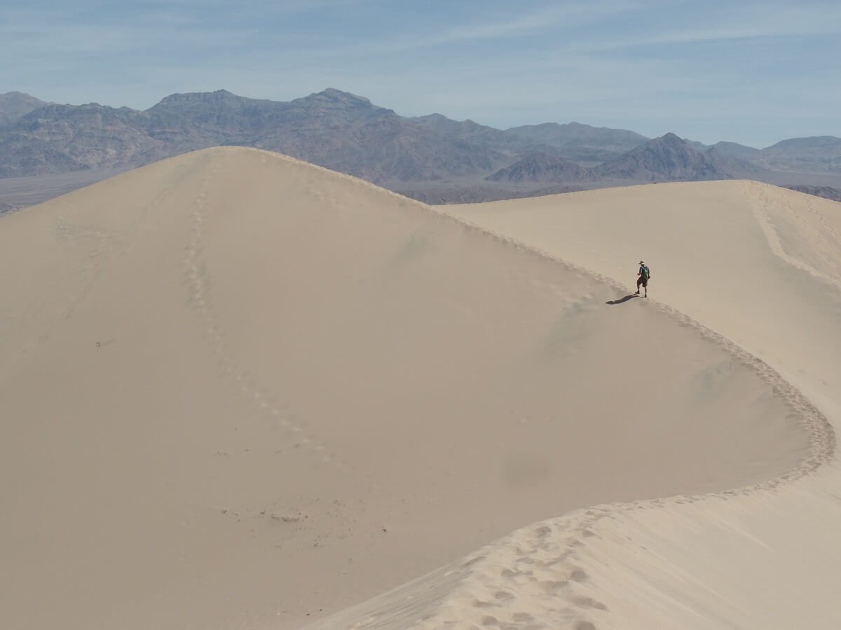
As we trekked out to the tallest dune, we took our time and did a lot of exploring, trying to find some of that gorgeous untracked sand to get some good shots. If you’re looking to do the same, here’s just a bit of a head’s up: this does require a bit of time, patience and a bunch of searching. Most of the sand that lies in a straight shot between the parking lot and the tall dunes have footsteps in them, which isn’t surprising. So, we had to go a bit out of the way to find the good stuff, and it was worth it to see those beautiful untouched ripples. There’s just something so satisfying about making those first tracks in the sand dunes…
Loving the sand ripples across the dunes…
We finally wandered over to the base of the tallest dunes and climbed our way up, enjoying the vast views of sand stretching for what seemed like miles.
What comes up must come down, and this is the fun part! While climbing up and across the tallest dunes took about 15 minutes from the base, running down took about 15 seconds! Looking back up to the top from this perspective right at the bottom really showed just how tall they really are!
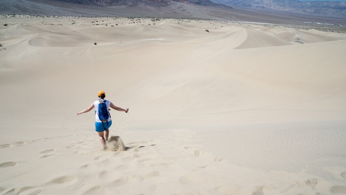
Running down the Mesquite Sand Dunes is super fun!
When we got back to the parking lot, we each emptied about a cup of sand from each one of our boots.
So, what was the verdict for our final distance and time spent hiking the Mesquite Sand Dunes? After all was said and done, we probably did a bit more than the two miles that the brochure said, and spent about 2 and a half hours playing around in the sand. To our surprise, no one else seemed to be going out to the tall dunes after us, and most didn’t venture too far beyond the parking lot. So, even though it’s a popular spot in Death Valley, you can still get that sense of isolation if you’re willing to trek just a little bit further.
Other Death Valley Sand Dunes
While the Mesquite Sand Dunes may be the most accessible dunes of the park, they certainly aren’t the only ones. In fact, there are 7 areas of dunes in Death Valley! Here are two others that are a bit more accessible than others but still off the beaten path:
The Eureka Sand Dunes, while not as expansive as Mesquite Flat Sand Dunes, are the tallest dunes in California, reaching almost 700 feet high! They are, however, quite remote. From the Ubehebe Crater, you have to drive 44 miles down a dirt road (this doesn’t require a four-wheel drive vehicle, though), which takes about 2 and a half hours one way. So, to get here is an all-day affair for sure. There are no services or water available along the way either, so make sure you come prepared with necessary supplies and have a plan ready in case of a breakdown.
If you do have the time and manage to make it out to these dunes, way to go! You’ll be rewarded with some epic sand dunes and you’ll possibly have them all to yourself. It is possible to climb to the top of the dunes. Apparently, if you go at the right time when the sand is completely dry, the sand “sings” as it’s blown down off the tallest dune, making a noise like that of a small drone.
Are these dunes worth the journey? That’s for you to decide! If your time is short in the park, Mesquite Flats is a great sand dune experience that eliminates the 5 hour round trip journey down a bumpy slow-going dirt road, and will give you more time in your schedule to see all of the other awesome places in Death Valley! With more time, though, it can be a fun extra add on if you are well-prepared for the long haul.
The Panamint Sand Dunes are found in the Panamint Valley and can be see far off in the distance as you drive down Highway 190 through the valley. They look like tiny specks lying on the bottom slopes of the mountain range. To get to these is quite an off the beaten path journey that requires driving 5 miles down an unmarked dirt road and then hiking about 3 miles in.
Visit the Charcoal Kilns
Tucked away in the Panamint mountain range of Death Valley is a neat piece of history, a set of 10 kilns that were built in the late 19th century to provide a source of fuel for nearby mining operations. Presumably last used in 1879, they are a well preserved but lesser visited Death Valley attraction, probably because of their location away from most of the main sites.
The kilns are located in the western side of Death Valley, down Emigrant Canyon Road and on the way to the Telescope Peak trailhead (see below). We recommend carving out some time to explore this area of the park. By driving into the mountains, you’ll see a whole other side of the park that many visitors of Death Valley miss, and will make you rethink your idea of what a desert really is. You’ll get stunning views of Telescope Peak, the highest mountain in Death Valley. (Like we said earlier, simply the drives through this park can often be more stunning than the Death Valley attractions themselves!)
After you pass the road to Aguereberry Point (or maybe you’ll be coming from there!), continue on until eventually you hit Wildrose Canyon Road. Bear left to visit the Kilns. The road becomes dirt just a few miles before the Kilns and had some particularly rocky sections. We were in a 4x4 high clearance vehicle so had no problem here, but we did see sedans parked in the Kilns parking lot, so it is doable with some careful driving.
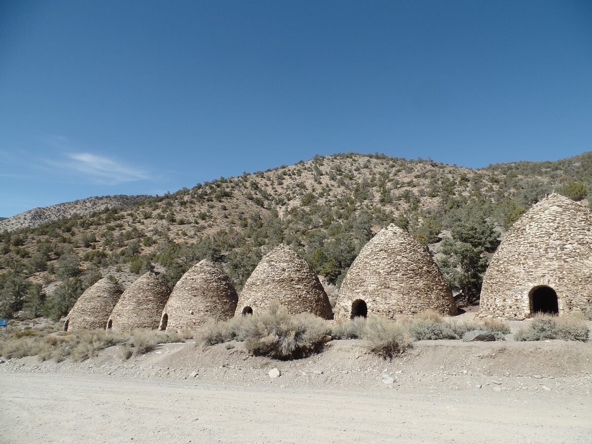
The Charcoal Kilns along the road in Death Valley
A small parking lot with an informational sign and a pit toilet indicate you’ve made it. The kilns are right alongside the road, and you are free to explore them inside and out. What makes this unique Death Valley highlight so interesting is that even though they were last operational well over 100 years ago, you can still smell the fresh scent of charcoal as if they were just used yesterday. And when you walk in them, the echos are pretty neat (we may have weirdly shouted random things and made up chants with deep voices in the Kilns…totally normal).
While we wouldn’t necessarily advise you to come all this way just to see these, the Kilns are a great stop on the way to Telescope and Rogers peaks, which we talk more about next. The rest of the journey to this trailhead will require a high clearance vehicle, however, so if you have a sedan, you’re journey ends at the kilns and you’ll have to retrace your path back down Emigrant Pass Road.
Hike Rogers Peak or Telescope Peak
Not only can you stand at the lowest elevation in the western hemisphere in Death Valley, but you can hike up mountains over 11,000 feet tall! There are several different options, but Telescope Peak, Death Valley’s tallest mountain at 11,049 feet, has the most popular and well-trodden path to a summit. However, a lesser traveled but equally beautiful summit is the nearby Roger’s Peak, which makes a good alternative for someone looking for a shorter hike in Death Valley and on a tighter schedule. No matter what you do, summiting a mountain is certainly a must-do in Death Valley for any avid hiker or for anyone looking for some amazing views.
Hiking to Telescope Peak in Death Valley National Park
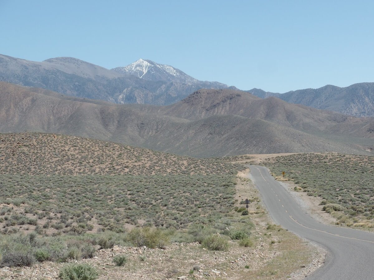
Telescope Peak is the snow-capped peak in the distance!
To get to the summit of Telescope Peak requires a 14 mile round trip hike with a 3300 foot elevation gain, so it’s not something to take lightly! It will require the better part of a day, but in return for your time and effort, you’ll be rewarded with views from the highest point in the park. You’ll be able to look out towards the east down to Badwater Basin, the lowest point in the country, and to the west on a clear day you’ll see the Sierras, and if you have a sharp eye you can point out Mt. Whitney, the highest point in the contiguous U.S.!
The trailhead is found at the very end of Wildrose Canyon Road, several miles past the Charcoal Kilns. The road between the Kilns and the trailhead requires a high clearance vehicle, and we can say this from experience! There were huge rocks and rough patches of road that a car simply could not make it across. The ride is wide enough for only one car but there are a few pull offs here and there which you need to hope to be by if a car is coming from the opposite direction, or else there will be some tricky side skirting or driving in reverse until you can pull off safely. We only had one car come from the other direction when we were on the road, and fortunately, it was right by one of the pull offs.
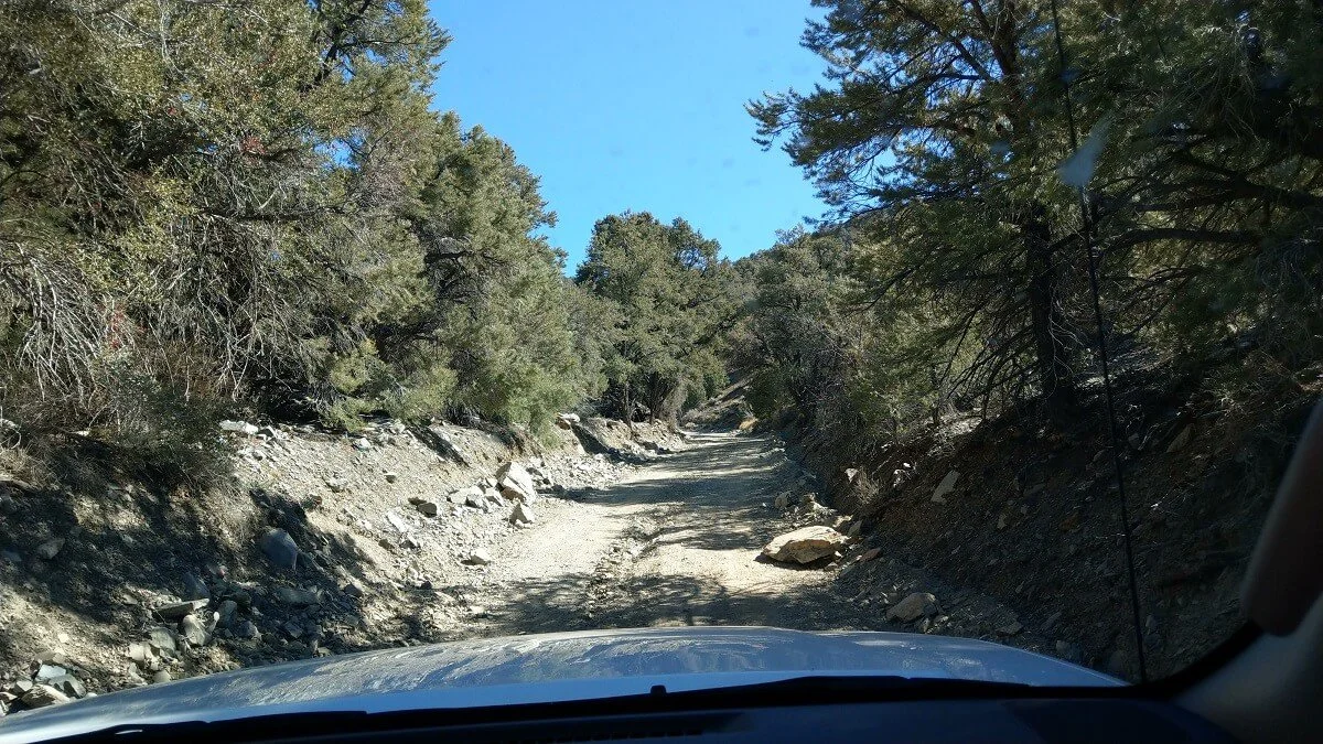
The rough road to Telescope Peak and Rogers Peak in Death Valley
The road ends in a small parking area for both the Mahogany Flat campground and the Telescope Peak trailhead, where you’ll find signs about the hike. If coming from the valley, when you get out of your car up here, the cool air will be a surprise and a relief! While it was in the 100s when we were in the valley just the day before, it was in the low 70s at the trailhead at 8,000 feet! Speaking of which…
Here’s an important note on altitude. We recommend not doing Telescope Peak in the same day that you visit the other main attractions in Death Valley, such as Badwater Basin. The trailhead for this peak is at about 8100 feet. Quickly ascending from sea level to 8,000 feet in a car, and then hiking up 3,000 more feet is risky and can likely lead to altitude sickness. It’s super important to acclimate! Spend the night before your hike up one of these mountains at a nearby campground, such as Mahogany Flat, Wildrose, or Thorndike campgrounds and give your body some time to get used to the altitude.
Roger’s Peak
The views from Rogers Peak are a must-see in Death Valley!
If you don’t want to devote an entire day to a single Death Valley hike, Roger’s Peak is a perfect alternative to Telescope Peak. It starts at the same trailhead, and provides similar views of both the valley and the Sierras, but with less mileage and elevation gain. The summit sits at about 10,000 feet.
Roger’s Peak can actually be done in a loop. You can start on the trail to Telescope Peak, which will lead to a side path that goes up to Roger’s Peak. Alternatively, a separate service road that begins at the trailhead also leads straight to the summit. By connecting these two routes, you can hike a loop of about 6 miles. We discovered the spur trail off the Telescope Peak trail after the fact, and only knew about the service road at the time, so we did an out and back trip on just the road, which is about 5.3 miles of hiking roundtrip. The map on the sign at the trailhead didn’t show this spur trail, but hey, now you know.
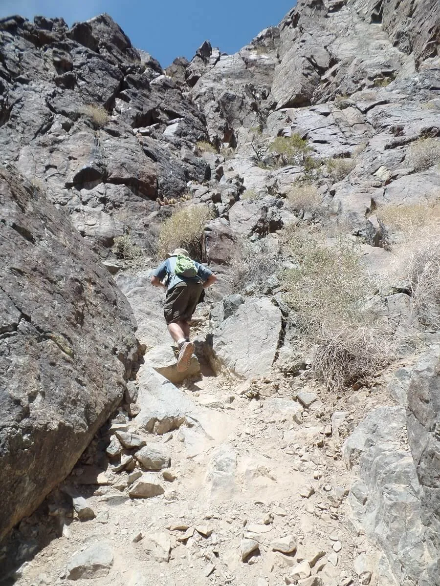
Hiking up to Roger’s Peak in Death Valley on the service road…it can get pretty steep!
The service road was an easy walk...it’s simply a road…but it’s not trivial! We were making pretty good time up the trail without taking any rests, but we were definitely huffing and puffing. The service road basically has three major (and steadily steep) switchbacks that climb up the side of the mountain, eventually opening up to great views of the valley below. As we climbed higher, it got cooler, and we even encountered snow along the trail… pretty cool! (No pun intended. Ok, who are we kidding, yes it was.) Towards the end of the hike on the final switchback, Telescope Peak comes into view as you make the final turn to the summit.
Your reward at the summit is a 360 degree view.

Catching views from Rogers Peak is one of the best things to do in Death Valley!
On the way back down the service road, I found it easier to use my momentum and jog down. We had barreled up in about an hour and 40 minutes, and got back to the car in about 45 minutes.
While Telescope Peak gets much of the attention in this area, Roger’s Peak was a nice alternative, with similar views and the added bonus of being able to see Telescope Peak up close instead of standing directly on it. We would recommend doing the loop, though, so that you get some actual trail hiking in instead of using the service road both ways, just to keep things interesting!
Visit Darwin Falls
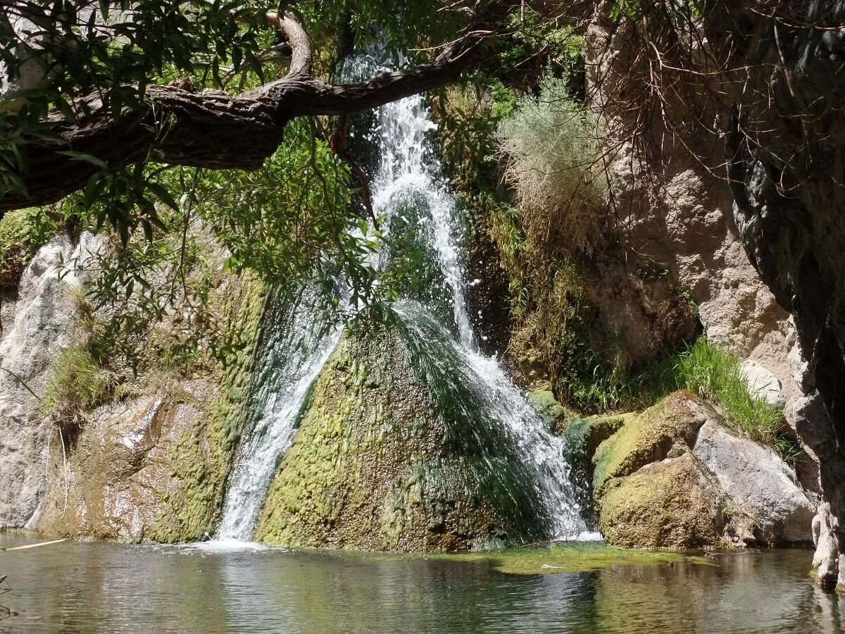
Darwin Falls is one of the coolest places to see in Death Valley!
Yes, there is a waterfall in the middle of the desert! Darwin Falls is certainly one of the more unique places in Death Valley to visit. This neat little oasis is located just past the small village of Panamint Springs on the western edge of the park and will transport you to an entirely different world.
To get here, you’ll take the long road to Panamint City, which is quite a sight as you watch the road weave up into the Panamint range and then disappear into the mountains.
Just over a mile passed the town on CA-190, you’ll take a dirt road on your left. There’s no sign at the turn off so it’s easy to miss. Along this road, we were happy at some spots to have a high clearance vehicle because of large rocks in some places, but at the trailhead we did see sedans, so it is doable with a car – just be prepared for a bumpy ride.
The road ends after 2 and a half miles at a parking area and trailhead sign. There are no restrooms or facilities here so make sure you come with everything you need. A couple of parties were ending their hike when we got there and only one other pair was starting ahead of us… we were loving the thin crowds at this park, even on the popular trails!
This Death Valley hike starts off by following a wide wash surrounded by high canyon walls. There’s no designated or marked trail here, so you’re free to wander around a bit. Staying in some of the herd paths through the center of the wash will allow you to see some cool desert flowers. If you stay to the right side of the wash, a trail does branch off a little ways in that gives you a straight shot to the upcoming canyon.
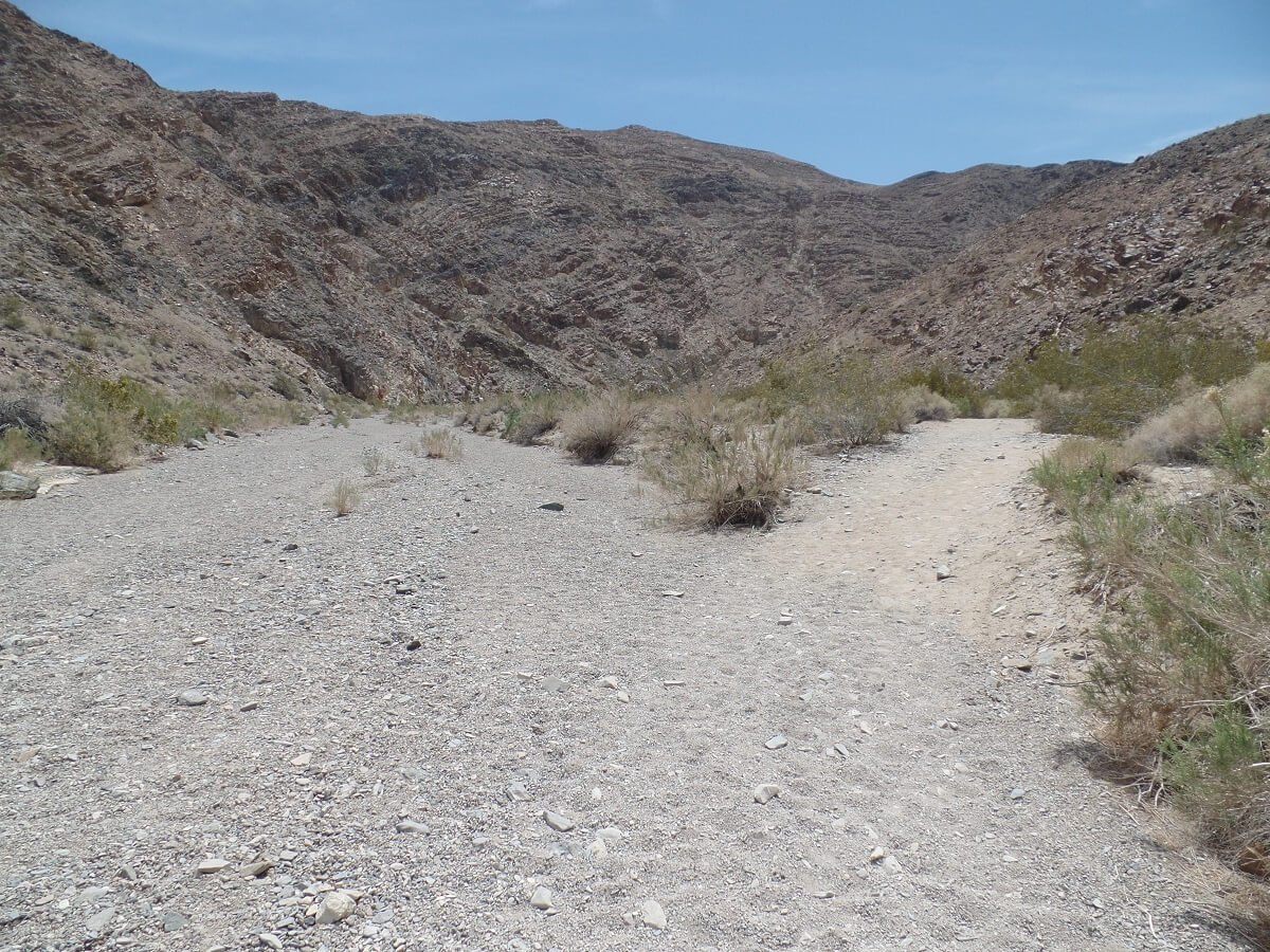
The trail through the wash to Darwin Falls. If you take the right split here, you’ll have a direct shot to the canyon.
Eventually, the canyon suddenly narrows and you are transported to a completely different world. After being in the desert for a few days, it really did feel like we had found an oasis! There are suddenly trees and vegetation and so much wildlife. At times, it seemed almost like were in a jungle! Dragonflies, hummingbirds, toads, and tons of lizards were along the trail. We saw at least a dozen lizards, both small and very very large, scampering across the path or sunbathing on nearby rocks. We also came across two snakes on the trail, which we later looked up and discovered to be Red Racers…not dangerous, but fast. One was a few feet in length and crossed the path right in front of us and we watched him slither up the side of the rocks. The other was yellow and hiding in the bushes next to the trail.

There were lots of these giant lizards on the Darwin Falls trail!
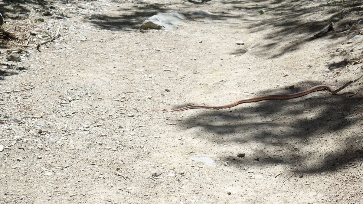
…and plenty of snakes, too!
The trail weaves in and out through the trees and sometimes involves some minor scrambling up and around the rocks which can be wet and slippery, or crossing through some muddy puddles or narrow streams.
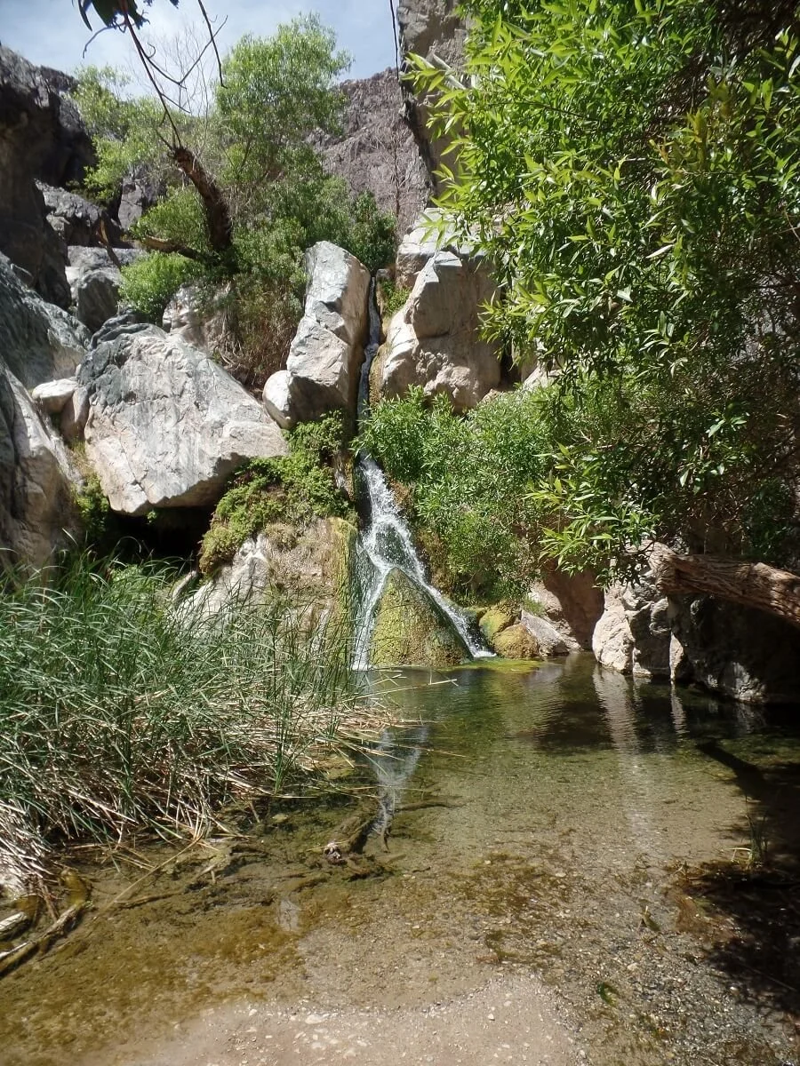
The trail ends at the falls. As tempting as it is…no swimming is allowed here, so just relax, take in the view, and enjoy this beautiful oasis in the middle of Death Valley before heading back out the way you came.
In total, we were out on the trail for about an hour and 45 minutes, with several stops for picture taking and with about 15 minutes at the falls.
Though it’s a bit far out from some of the other main Death Valley attractions on this list, Darwin Falls is definitely worth the detour!
Drive the Scenic Titus Canyon Road
If you’re looking for the best scenic drive in Death Valley, put Titus Canyon Road on your radar. Seriously.
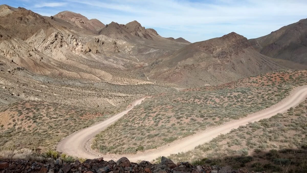
Driving Titus Canyon Road was definitely one of our favorite things to do in Death Valley…I mean, look at those views!
Titus Canyon Road is a one-way scenic drive in Death Valley that will set you back about three hours, but it is so worth it! You’ll see hands-down some of the most beautiful areas of the entire park, climb up mountains passes in the Amargosa mountains, drive through an old ghost town, and cruise through the narrow walls of Titus Canyon.
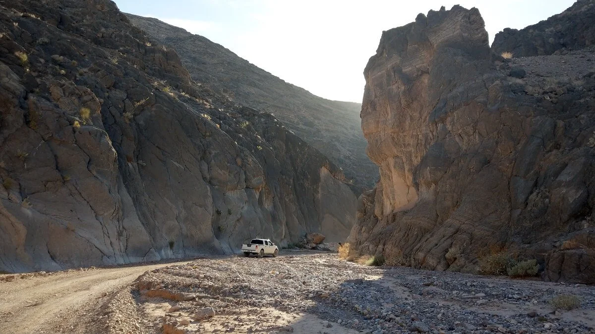
Driving through Titus Canyon in Death Valley…the grand finale of the road!
The catch? There must be a catch, right? Okay, yes, a tiny one. You need a high clearance vehicle. Is it worth renting a high clearance vehicle just for this drive? Our answer is a resounding “yes”! That’s how much we loved the Titus Canyon drive.
The other thing to note is that you’ll want a pretty confident driver behind the wheel, and one who doesn’t get terrified while driving along exposed cliff roads (*sinks down in seat*). The road has some, what I considered to be kind of scary, switchbacks as it weaves up to the main pass. Be prepared for an often times washboarded bumpy ride, but also for non-stop incredible scenery.
As you exit the canyon at the other end of the road, you enter a two way dirt road that will bring you back down to Scotty’s Castle Road. If you don’t have the proper vehicle to do the entire drive, a sedan can easily drive up this two-way road to the mouth of Titus Canyon where you can park and explore the narrowest part of the canyon on foot.
Visit Ubehebe Crater
So far in this list of amazing things to do in Death Valley, we’ve mentioned canyons, sand dunes, mountains, even a waterfall. So, what can possibly be left to explore? Volcanos of course!
Ubehebe (pronounced Ooh-Bee-He-Bee) Crater is different from anywhere else in Death Valley. As you drive towards it from the Furnace Creek area, the landscape slowly transitions from desert flats with brown and green hues to blackened volcanic terrain.

The road to Ubehebe Crater in Death Valley is so different than anywhere else in the park!
The crater is about 8 miles west of Scotty’s Castle, attracting slightly less crowds because of its distance from the popular Furnace Creek area. The road ends right at the crater parking lot, which lies directly adjacent to the crater itself, so there’s no hiking needed to see it. Just note that there are no restrooms or facilities at the parking lot.
As you walk up to the edge of the crater, you realize that pictures don’t do it justice…it’s so big and quite dramatic in person. It’s an astonishing half a mile wide, and 600 feet deep, and was only formed just 300 years ago by rising magma underground that created steam pressure when it encountered ground water, causing a giant explosion.

Ubehebe Crater is huge! And certainly one of the more unique places to see in Death Valley.
A trail does traverse the rim of the crater if you are up for a quick hike. The trail is a mile and a half, gaining about 500 feet along the way. Keep in mind it does walk directly around the rim so might be a little nerve wracking for those afraid of heights or edges.
An even shorter hiking option is visiting the crater’s smaller cousin, Little Hebe Crater. If starting in a counter clockwise direction along the rim trail, it is about a half mile in.
Regardless of if whether you hike or just admire the crater from the parking lot, this is definitely one of the most unique places in Death Valley that you could visit!
Camp in Death Valley National Park

Camping in Death Valley allows you to wake up to incredible desert views!
If you’re looking for a truly epic thing to do in Death Valley, then grab your tent! Camping in Death Valley is a great way to experience the park and to base yourself right near all of the amazing sights in Death Valley. There’s nothing like pitching a tent in the middle of nowhere where you can gaze up at the night sky and see millions of stars and a full milky way staring back down at you. In fact, Death Valley is considered one of the best Dark Sky Parks, meaning you’ll want to stay here after dark!
Do you need a reservation to camp in Death Valley?
Luckily, there are 9 campgrounds to choose from in Death Valley. Only one of them (Furnace Creek) requires a reservation and only in the peak season from October to April.
All the other Death Valley campgrounds are first come first served. Unlike a lot of the more popular parks, though, you’re almost guaranteed to find a campsite somewhere in the park, no matter what time you arrive. It’s pretty nice not having to worry about arriving at a campground before 7 am to get a spot like in so many of the other national parks! There are some sites that have very little spaces (10 or less), so it might be more prudent to get to those sites a little earlier if you are dead set on these specific campgrounds, but there’s no need to stress about worrying if you’ll be able to find a spot for the night in at least one of the campgrounds in the park. The exception is holiday weekends during the summer months (think fourth of July or Memorial Day weekends) because only a few select campgrounds remain open during the hot summer months.
Tent sites range from $14-16 on the honor system, but there a some that are free! There are a few sites that are primitive, with pit toilets and no water, so make sure you know ahead of time what the campsite offers and come prepared.
Here is a list of campgrounds in the park and some basic information on each. We elaborated a little bit on our experience at the ones we personally stayed at. Be sure to check the park service for more details and updated info!
Furnace Creek
Elevation: -196 feet
$16, water, toilet
We stayed here on our first night. It’s a huge and popular campground, so you won’t be alone or in solitude here. Furnace Creek is centrally located right in the heart of some of the best places in Death Valley, so it’s a great location for getting a head start in the morning.
Sunset
Elevation: -196 feet
$14, water, toilet
Texas Springs
Elevation: sea level
$16, water, toilet
Sunset and Texas Springs are both located near Furnace Creek, giving you a good chance of finding a campsite in this area at any given time.
Stovepipe Wells
sea level
$14, water, toilets
We passed by this campground during our trip, and we thought it looked like a parking lot off the side of the road and did not seem very ideal to get a true camping experience. However, it’s close to some main Death Valley attractions, especially the Mesquite Sand Dunes, and is an option if other campgrounds in the area are full.
Emigrant
Elevation: 2100 feet
free, water, toilets
We stayed at this Death Valley campground for one night. It’s located on Hwy 190, about 16 miles west of the junction with Scotty’s Castle Road, right at the junction with Emigrant Pass Road. It’s pretty much in the middle of nowhere. That in combination with the fact that are only ten tent sites in the entire campground gave us that isolated wilderness feel that we love when we’re camping.
We got to this campground around 6 pm on a Saturday and there were still 5 sites left at that time, but they quickly filled up in the following hour.
A plus to this campground: there were flush toilets and running water…pretty nice accommodations for a free campground! Also, can’t beat this view back down into the valley.
Mesquite Springs
Elevation: 1800 feet
$14, water, toilet
We stayed at this Death Valley campground for a night and loved it. This is another one of the “in the middle of nowhere” campgrounds along Scotty’s Castle Road and on the way out to Ubehebe Crater. It has about 40 sites, but when we were there, only about five were taken and we had a section of the campground all to ourselves.
There were lots of little critters here, too, which I loved…lots of rabbits and lizards, and a mouse hanging out at our site when we were making dinner. We also had some bats flying around us in the early evening.
During the night, I woke up with a pounding headache and had to go out of the tent to the car to grab some medicine. Kudos to my pounding head, I was able to look up and see one of the most fantastic night skies I had ever seen! There was a phenomenal Milky Way that traversed the entire night sky, and a very clear Andromeda Galaxy. The next morning, we read a sign posted near the bathrooms that proclaimed this campground as one of the best in the entire country for stargazing! (So that should give you a sense of how remote this campground actually is.)
Wildrose
Elevation: 4100 feet
free, water, pit toilet
Both Wildrose and Thorndike are small, secluded, quaint campgrounds up in the mountain ranges. Camp here to get away from the masses.
Thorndike
Elevation: 7400 feet
free, no water, pit toilets
Mahogany Flat
Elevation: 8200 feet
free, no water, pit toilets
This is a small campground at the trailhead to Telescope Peak. It seemed like a great little campground and perfect for acclimating if you’re looking to climb up to the 11,000 foot summit of Telescope Peak the next day.
More Things to Do in Death Valley
Phew, that was a long list! But believe it or not, there are still plenty more things to do in Death Valley. Like we said, it’s a huge park!
Here are a few more unique places in Death Valley that we personally didn’t have time to check out, but wanted to include in case they spark your interest!
The Racetrack
This is a very famous place in Death Valley. I’m sure you’ve seen or heard of the rocks that mysteriously move across the barren salt flats, evidenced by the tracks they leave behind.
We toyed and struggled with the idea of visiting the Racetrack, and ultimately chose not to. We read a few accounts of people advising that the destination was not quite worth the journey and is a bit underwhelming. Visiting this involves a 2 and a half hour one way drive from Ubehebe Crater (which is already quite off the beaten path) down an extremely rough and wash-boarded road, and we had spent a lot of time on those already. In fact, on two separate occasions, we had two different rangers tell us that they didn’t think the Racetrack was worth the time. One specifically said, “If you were happy before going there, you won’t be happy coming back.”. That’s quite a statement coming from a park ranger! He told us it would be a very long, very bumpy five hour round trip drive with a high chance of vehicle breakdown and damage and that most rentals won’t insure for damages incurred on this road. We would have to call a tow (provided we had cell service), the nearest of which would come from Lone Pine and charge $1500-2000! At a sign posted in Mesquite Campground, recent accidents along the Racetrack Road were listed and included shredded tires (eight in one day!), transmission damage, and a rollover. Yikes.
If you do decide to go to the Racetrack, the park service recommends topping up on fuel before you go, driving slow (15-20mph), and starting very early.
Despite all this, we just wanted to let you know that if you have the time, the proper vehicle, and are well prepared for the long journey, the Racetrack is always an option for a place to visit in Death Valley visit, and certainly would be a both a unique journey and destination!
Lee Flat Joshua Tree and Father Crowley Viewpoint
Both of these are west of Panamint, past Darwin Falls, and require you to climb up and over an additional mountain pass. They are a bit out of the way from all the other Death Valley attractions, but if you find yourself passing through on your way out of Death Valley and into Lone Pine, they look like they’d be worth a stop.
Natural Bridge Trail
This is an easy, flat, one mile roundtrip hike to a natural rock arch, which probably isn’t worth is on a tight schedule but can be a nice add-on for a longer trip.
Map of the Best Things to Do in Death Valley
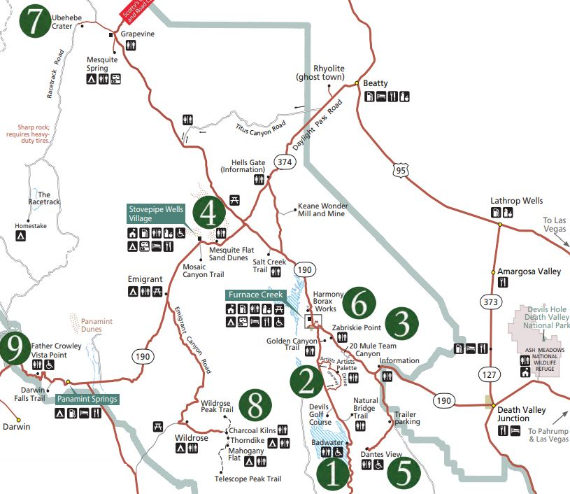
This Death Valley map is taken from the park brochure. On here, you can find all of the things to do in Death Valley that we talked about in this post to help you plan out your road trip!
I know, we hit you with a lot of amazing things to see in Death Valley, and we want to help you visualize where everything is! Check out this Death Valley map that highlights all the Death Valley attractions we talked about!
Death Valley Itinerary
With all of these unique places to visit in Death Valley, you might be wondering how much time you need to see everything. While it sounds like it would take a lot of time to cover it all, it might not take as long as you think. We were able to see and do everything on this Death Valley bucketlist in just three days in the park!
We get that not everyone has that kind of time, though. So, is one day enough time in Death Valley? We think so! You might not get to see every Death Valley attraction, but one day is certainly enough time to squeeze in a lot of the highlights.
When is the Best Time to Visit Death Valley?
As you’ve read through our list of things to do in Death Valley, you might have started to see a pattern…Death Valley is hot, and it makes certain times of the year better to visit Death Valley than others. To have the best experience and depending on what you want to do, timing is important, and it’s best to be mindful of the temperatures in Death Valley throughout the different seasons.
So, let’s start with when you should not go to Death Valley...and that’s the summer. Summer is probably a time you’ll want to try and avoid as it gets uncomfortably, and dangerously, hot as early as May and until as late as mid-October. And when we say hot, we really mean it. Death Valley actually holds the world record for hottest air temperature ever…a whopping 134 degrees! Yikes. It doesn’t always get this hot, though. Temperatures in the summer usually hover around 120 degrees, and at night, it’s, you know, just a balmy 90 degrees or so. So yea, it’s hot. This makes it difficult to do really any sort of physical activity outside, including hiking, in the lower elevation portions of the park. However, if you don’t mind staying mostly confined to your air-conditioned car, taking scenic drives, and popping out every now and then to admire some viewpoints, summer in Death Valley can be doable.
tips for visiting Death Valley in the summer
Make sure to camp in the higher elevation campgrounds and limit hiking to the higher elevations as well (i.e. Telescope Peak area).
Avoid drives down 4x4 high clearance roads during this time. If your car breaks down on one of these, you might not have cell service to call for help, and you don’t want to be stuck walking for hours in this dangerous heat.
Make sure to always have an adequate amount of water with you in the car, and of course sun proper sun protection.
So, when is the best time to go to Death Valley?
Late fall, winter, and early spring are all good times to go to Death Valley. The best time to do any sort of hiking and camping in Death Valley is November to March. The weather is a bit more tolerable, especially in the fall and spring, and Ranger Programs open up.
Spring is definitely the most crowded because of wildflower season. The stark contrast of bright yellows and oranges against the browns and grays of the desert attracts tons of visitors every year. However, it can be a hit or miss, depending on the season’s particular conditions. Some years, it’s a super bloom. Sometimes it’s a dud. There are places you can track the status of the wildflower blooms. Because it’s such a popular phenomenon to witness, you’ll probably want to book lodging accommodations well in advance.
Winter in Death Valley has cooler temperatures, and sometimes nights can reach freezing temperatures (the desert is a weird place). The winter is a great time to do lower elevation hikes, but the mountains, such as Telescope Peak, do get a good amount of snow and you might need to be prepared for conditions requiring ice axe and crampons!
Here’s an idea of what the temperatures look like for each season in Death Valley:
Winter (Dec-Feb): Mid 60s to low 70s in the day, high 30s to mid 40s at night
Spring (Mar-Apr): low 80s to 90 in the day, mid 50s to low 60s at night
Summer (May-Sep): 100 to 120 in the day, mid 70s to high 80s at night
Fall (Oct-Nov): 80s in the day, 50s at night
Our experience: We visited Death Valley at the very end of April. We were a little nervous about going so late in the spring, as this is outside the recommended hiking window due to rising temperatures. While we were there, temperatures reached 106° F at the lowest parts of the park (at Furnace Creek there’s a real-time thermometer displaying the temperature).
Surprisingly, we tolerated the heat pretty well. We’re used to the humidity of the East coast, so to us, the dry heat of the desert felt a bit more bearable. Importantly, we made sure to do all of our more strenuous hikes and activities before noon and felt fine, as the temperatures remained in the high 70s to low 80s throughout the morning.
How to Get to Death Valley
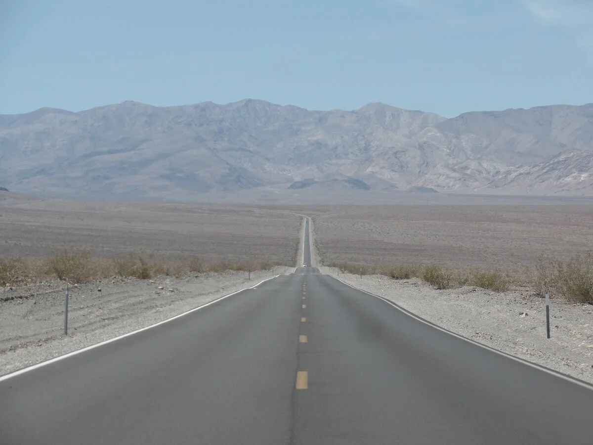
One of the many long desert roads you’ll encounter driving through Death Valley National Park.
Ready to hit the road and see all the amazing sights in Death Valley? Luckily, it’s not too far from a few major cities! Death Valley lies on the eastern edge of California, at the border of Nevada. Some popular ways to get there include:
From Las Vegas: Death Valley is only just under two hours from Las Vegas, a popular fly-in destination for this park. Even though it’s famed for its casinos and crazy night life, Vegas is a great jumping point to a few awesome outdoor areas, like the Grand Canyon, Valley of Fire, and Red Rocks, all of which can be combined with Death Valley for one epic road trip!
From Los Angeles: It’s about a 3 and a half hour drive from Los Angeles to Death Valley. Joshua Tree, which lies only two hours east of L.A., can be combined with Death Valley to make for a great trip from the city.
From San Francisco: Death Valley is a long 7 hours from San Francisco. However, on your way, you can make a trip out of it and visit the entire Sierra range. You can drive across Yosemite National Park and down the western Sierras before hitting Death Valley, and then drive back up the Eastern Sierras to San Francisco, hitting Sequoia and Kings Canyon National Parks on the way.
Do You Need a High Clearance Vehicle in Death Valley?
It’s not essential, but having a high clearance vehicle in Death Valley is highly recommended, at least by us, for whatever that’s worth! There are so many awesome places in Death Valley that are only accessible via a high clearance, like Titus Canyon, or Aguereberry Point, that we think it’s totally worth it, especially if you are looking to get more off the beaten path.
If you do plan on driving these high clearance roads in Death Valley, here are some of our tips:
Always check road conditions with a ranger before going
If possible, travel in groups so that if you break down, another vehicle is there to bring you back to help
Keep in mind that getting a tow will take a long time, and will be super expensive. Make sure you are well stocked with plenty of extra food and water in case of a breakdown and in case you have to wait for several hours to get help.
Make sure you top off your gas before heading out
Make sure you have the proper tools and equipment to fix or replace a flat tire, which, as you can imagine, is a common problem on the rough backcountry roads. Know how to use it all!
Check your rental agreement for what you are and are not allowed to do. Many don’t allow backcountry travel. Make sure the vehicle you get is outfitted for a backcountry trip.
Tips for Visiting Death Valley
Expect a lot of driving. Death Valley is big. And also quite mountainous! Badwater Basin is sandwiched between two mountain ranges, and to get to many of the Death Valley attractions, such as Titis Canyon Road, Darwin Falls, and Telescope Peak, you’ll be driving up and over these mountain ranges. We don’t think you’ll ever get bored on these drives, though. All the scenery is spectacular.
Budget for gas. Speaking of long drives, you’ll want to try to fill up before arriving at Death Valley, as there is gas in the park, but it was very expensive. You’ll most likely have to fill up again at least once while you’re there, but we are here to try and quell any sticker shock you might get at the pump.
There’s an entrance fee to visit Death Valley. The park pass will cost $30 per vehicle but lasts 7 consecutive days. If you’re planning on visiting other California National Parks on your trip, consider buying the America the Beautiful Pass which is $80 and gives you unlimited entry to all the National Parks for a year!
Be aware of elevation changes. Death Valley is so unique in that in the morning you can be hundreds of feet below sea level, and in that very same day you can find yourself as high as 11,000 feet. But of course, we don’t advise this. Make sure you take some time to acclimate if you plan on doing any high elevation hikes by camping in one of the higher elevation campgrounds. Also, be aware of the signs of altitude sickness.
Cell service. There’s little to no cell service in the park. Download any road and trail maps and important information to your phone before arriving.
Drink tons of water. Even if you don’t feel thirsty, and even in the winter. Always have a supply with you! There’s drinking water at most campgrounds and visitors centers in the park, so always use them as an opportunity to fill up. The park serve recommends a gallon per person per day. We loved having our collapsible 10 gallon water jug in the car with us so we could fill up often and have a good supply on hand in case of an emergency.
Have sun protection. Hats, sunglasses, sunscreen – there is very little shade out in the desert.
More Things to Do in Death Valley and Beyond
If you’re looking for more information to help you plan a visit to Death Valley, make sure to check out these articles!
One to Three Day Itinerary for Death Valley: How to Plan the Perfect Trip!
A Complete Guide to Driving Titus Canyon Road in Death Valley National Park
How to Hike the Golden Canyon – Gower Gulch Loop in Death Valley National Park
And if you’re planning on making Death Valley part of a larger road trip, check out our other articles on California parks!
Best Things to Do in Joshua Tree National Park in One Day
How to Hike Ryan Mountain in Joshua Tree National Park
How to Get a Permit for Half Dome in Yosemite National Park
How to Get a Permit for Mt. Whitney – California’s Highest Peak!
We hope this list of best things to do in Death Valley National Park helps you plan your trip! If you have any questions, let us know! Are there any other Death Valley must-sees that you would add to this list?